Iran Antique Map

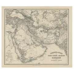
Old German Antique Map of Iran and Arabia, 1866
Located in Langweer, NL
Antique map titled 'Vorder-Asien oder Iran, Turan, Arabien, Kleinasien und die Kaukasus Länder
Category

19th Century Iran Antique Map

Materials

Paper

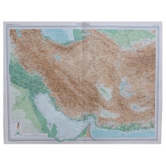
Large Original Vintage Map of Persia / Iran, circa 1920
Located in St Annes, Lancashire
Great maps of Persia. Unframed. Original color. By John Bartholomew and Co. Edinburgh
Category

1920s British Iran Antique Map

Materials

Paper

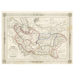
Persia Unveiled: Antique Map of Iran, Afghanistan, and Beyond, 1852
Located in Langweer, NL
The antique map titled 'Royaumes de Perse Herat & Kaboul' is an attractive map of Persia. Here are
Category

Mid-19th Century Iran Antique Map

Materials

Paper

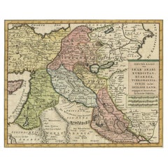
Original Map of The Northern Arabian Peninsula, Palestine, Iraq & Iran, 1732
Located in Langweer, NL
Antique map titled 'Nieuwe kaart van Irak Arabi, Kurdistan, Diarbek (..).' Detailed map including
Category

1730s Iran Antique Map

Materials

Paper

Exploring Ancient Persia: Ptolemaic Map of Iran and Iraq by Ptolemy and Mercator
Located in Langweer, NL
Ptolemaic map depicting much of modern-day Iran, Iraq and part of Armenia. The map stretches from the
Category

1610s Iran Antique Map

Materials

Paper

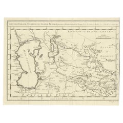
Antique Map Centered on Turkestan
Located in Langweer, NL
Antique map titled 'Carte de Karazm, Turkestan et Grande Bukarie'. Engraved map centered on
Category

Mid-18th Century Iran Antique Map

Materials

Paper

Antique Map Centered on Turkestan
H 9.53 in W 12.52 in D 0.02 in
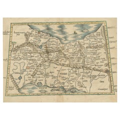
Original Antique Woodcut Map of Persia
Located in Langweer, NL
Antique map titled 'Tabula V Asiae'. Important early woodcut map of Persia, depicting the area of
Category

16th Century Iran Antique Map

Materials

Paper

Original Antique Woodcut Map of Persia
H 14.97 in W 19.02 in D 0.02 in
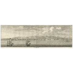
Panoramic Antique View of Bandar-Abbas 'Formerly Gamron, Persia' in Iran, 1714
Located in Langweer, NL
Antique print titled 'Gamron'. Panoramic view of the city of Bandar-Abbas (formerly Gamron) in Iran
Category

1710s Iran Antique Map

Materials

Paper

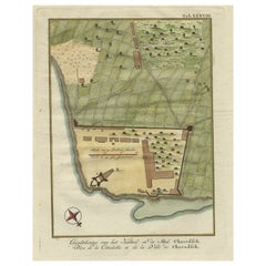
Original Antique Plan of the Fortress of Charedsch in Persia or Iran, ca.1780
Located in Langweer, NL
Antique map, titled: 'Plan de la Citadelle de la Ville de Charedsch.' Plan of the fortress of
Category

1780s Iran Antique Map

Materials

Paper

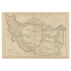
Antique Map of Persia, Afghanistan and Balochistan, 1859
Located in Langweer, NL
antique map encompasses the regions of Persia (modern-day Iran), Afghanistan, and Balochistan (spanning
Category

Mid-19th Century Iran Antique Map

Materials

Paper

Antique Map of the Empire of the Great Mogul
Located in Langweer, NL
Antique map titled 'Magni Mogolis Imperium'. This map depicts the Empire of the Great Mogul in
Category

Late 17th Century Iran Antique Map

Materials

Paper

Antique Map of the Empire of the Great Mogul
H 22.17 in W 25.79 in D 0.2 in
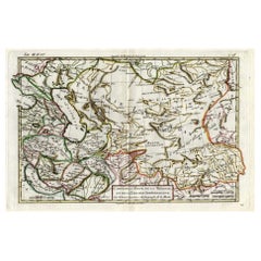
Antique Map of Persia, Georgia and Kazakhstan, ca.1780
Located in Langweer, NL
Persia, Georgia and Kazakhstan. This map shows current days Georgia, Iran, Irak, Kazakhstan, Armenia
Category

1780s Iran Antique Map

Materials

Paper

Antique Map of Russia and Surroundings by Stieler, 1874
Located in Langweer, NL
Antique map titled 'Nord- & Mittal-Asien, Ubersicht des Russischen Reiches.' A map of Russia in
Category

19th Century Iran Antique Map

Materials

Paper

Authentic Old Map of Persia with Original Border Coloring, 1745
Located in Langweer, NL
Title: "Kaartje van Persien na de stelling van den Heer Guillaume de L'Isle" Translates to "Map
Category

1740s Iran Antique Map

Materials

Paper

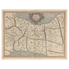
Historical Map of the Black Sea and Surrounding Regions, 1705
Located in Langweer, NL
Title: "Map of Turcomania, Georgia, and Comania" This print presents an intricately detailed map
Category

Early 1700s Iran Antique Map

Materials

Paper

Antique Map of the Arabian Peninsula by Bonne 'c.1780'
Located in Langweer, NL
antique map of the Arabian Peninsula, including the horn of Africa and part of Southwest Iran. Pictorial
Category

Late 18th Century Iran Antique Map

Materials

Paper

Antique Map of the Arabian Peninsula by Bonne 'c.1780'
Located in Langweer, NL
antique map of the Arabian Peninsula, including the horn of Africa and part of Southwest Iran. Pictorial
Category

Late 18th Century Iran Antique Map

Materials

Paper

Oriental Realms: A Detailed Map of Persia, Afghanistan, and Beloochistan, 1882
Located in Langweer, NL
This historical map from the 1882 atlas published by Blackie & Son is a comprehensive depiction of
Category

1880s Iran Antique Map

Materials

Paper

Antique Map of Persia, Georgia and Kazakhstan by Bonne, c.1780
Located in Langweer, NL
Persia, Georgia and Kazakhstan. This map shows current days Georgia, Iran, Irak, Kazakhstan, Armenia
Category

18th Century Iran Antique Map

Materials

Paper

Antique Map Centered on Turkestan, Including the Black and Caspian Seas, 1749
Located in Langweer, NL
, and the northern reaches of Iran and Afghanistan. This map originates from 'Histoire générale des
Category

18th Century Iran Antique Map

Materials

Paper

Imperial Frontiers: A 19th Century Map of Southern Russia and the Caucasus, 1882
Located in Langweer, NL
This map, sourced from the comprehensive 1882 atlas by Blackie & Son, delineates the southern part
Category

1880s Iran Antique Map

Materials

Paper

Old Ptolemaic Map of the Region Between the Persian Gulf and Caspian Sea, 1598
Located in Langweer, NL
"Tabula Asiae V", Ptolemy/Ruscelli Subject: Persia - Iran Period: 1598 (published) Publication
Category

16th Century Iran Antique Map

Materials

Paper

Ancient Crossroads: Albania to Assyria in Antiquity, Published in 1880
Located in Langweer, NL
, Iran, Iraq, and Syria. Some interesting facts of this original antique map: 1. **Ancient
Category

1880s Iran Antique Map

Materials

Paper

Map Tabula Asiae IX Pakistan Afghanistan Iran Indian Ocean
Located in Florham Park, NJ
“Tabula Asiae IX Pakistan, Afghanistan, E. Iran” Girolamo Ruscelli (1504 – 1566) Venice, 1561 V
Category

16th Century Realist Iran Antique Map

Materials

Copper

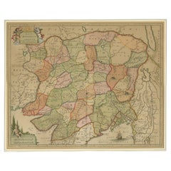
Persia, Armenia & Adjacent Regions: A Hand-colored 17th Century Map by De Wit
By Frederick de Wit
Located in Alamo, CA
This colorful and detailed 17th century copperplate map by Frederick De Wit was published in
Category

Late 17th Century Old Masters Iran Antique Map

Materials

Engraving

Collection of 18th and 19th Century Arabic Astrolabes and Quadrant
Located in London, GB
-held map of the universe. Instruments such as these are keenly associated with the Islamic Golden age
Category

Early 19th Century Persian Islamic Iran Antique Map

Materials

Brass

19th Century N.W. Persian Bakhshaiesh Carpet ( 11'10" x 19'10" - 360 x 604 )
Located in New York, NY
attribution as to origin is impossible. There is a town with this name on 20th Century maps, but not on
Category

1870s Persian Bakshaish Iran Antique Map

Materials

Wool

Wonderful and extremely rare Dutch pocketglobe
By Dementz Family DEUR Art Company
Located in ZWIJNDRECHT, NL
Persia covers much of today’s Pakistan, Afghanistan, Iran, Iraq, etc. Tartary Magna covers Russian
Category

Early 18th Century Dutch Dutch Colonial Iran Antique Map

Materials

Hardwood, Paper

Wonderful and extremely rare Dutch pocketglobe
Free Shipping
H 2.5 in Dm 2.5 in
Mid-19th Century Persian Tribal Bidjar Rug
Located in Los Angeles, US
after by designers. Bidjar rugs, produced in Northwest Iran are among the finest of Persian rugs by
Category

19th Century Tribal Iran Antique Map

Materials

Wool, Cotton

Mid-19th Century Persian Tribal Bidjar Rug
Free Shipping
W 50 in L 78 in
Antique Bidjar Rug with Floral Design 17'8''x11'7''
Located in Los Angeles, US
after by designers. Bidjar rugs, produced in Northwest Iran are among the finest of Persian rugs by
Category

Early 1900s Asian Other Iran Antique Map

Materials

Wool, Cotton

People Also Browsed

Stabled Horses
By John Ferneley Junior
Located in Stoke, Hampshire
John Ferneley Jnr Stabled horses Oil on canvas Canvas Size - 20 x 24 in Framed Size - 27 x 31 in Born in about 1815 at Melton Mowbray, he was the eldest son of the important sportin...
Category

19th Century Old Masters Iran Antique Map

Materials

Oil

Ghisolfi Portrait Old master Oil on canvas17th Century Architecture Italy Art
By Giovani Ghisolfi (Milan 1623-1683)
Located in Riva del Garda, IT
Giovani Ghisolfi (Milan 1623-1683), attributed / workshop View of classical architectural ruins with Pythagoras pretending to return from Hades Oil on canvas, cm. 70 x 84 In frame c...
Category

17th Century Old Masters Iran Antique Map

Materials

Oil

Large 18th Century French Old Master Oil Painting The Penitent Magdalene
Located in Cirencester, Gloucestershire
The Penitent Magdalene French School, 18th century oil painting on canvas, framed canvas: 30.5 x 25 inches framed: 39 x 33 inches condition: excellent provenance: private collection,...
Category

18th Century Old Masters Iran Antique Map

Materials

Oil, Canvas

Early 20th Century Small Liberty & Co Syrian Table
Located in London, GB
Early 20th century small Liberty & Co Syrian table We are proud to offer a beautiful early 20th century small Liberty & Co Syrian table with hexagonal form. This highly decorative...
Category

1920s Syrian Victorian Iran Antique Map

Materials

Mother-of-Pearl, Ebony, Teak

Holy Family Poussin Paint Oil on canvas Old master 17th Century Religious Art
Located in Riva del Garda, IT
Nicolas Poussin (Les Andelys 1594 - Rome 1665), Circle of Holy Family with Saint Elizabeth and Saint John the Baptist in a landscape Oil painting on canvas 56 x 68 cm. in frame 72 x...
Category

17th Century Old Masters Iran Antique Map

Materials

Oil

Ancient Antique 16th Century Islamic Calligraphy Mamluk Glass Mosque Lamp 1500
Located in Portland, OR
A rare and ancient Mamluk period Islamic handblown glass mosque lamp, Egypt or Syria, early 1500's. The lamp of diminutive form & having a flared neck with Islamic calligraphy, the g...
Category

16th Century Egyptian Islamic Iran Antique Map

Materials

Glass

Antique Damascus Syrian Inlaid Card, Chess, Backgammon, Games table C1900
Located in London, GB
This profusely inlaid Syrian Damascus games table dates from Circa 1900, and has multiple geometric and asymmetric inlays of various specimen woods The hinged lid opens to reveal a...
Category

Early 1900s Iran Antique Map

Materials

Wood

Early 20th Century Marble Top Moorish Side Table     
Located in London, GB
Early 20th Century Marble Top Moorish Side Table      A highly decorative and unusual marble top example of an early 20th Century Moorish Syrian side table. Covering in intricate typ...
Category

Early 20th Century Syrian Early Victorian Iran Antique Map

Materials

Wood

18th/19th Century French Old Master Oil Christ entering Jerusalem
Located in Cirencester, Gloucestershire
18th/19th Century School 'A scene of Christ entering Jerusalem' Medium: oil on canvas, framed Size of painting: 21.5" x 18.25" inches condition: overall very good and presentable, a ...
Category

18th Century Old Masters Iran Antique Map

Materials

Oil

Greek slingshot with bee
Located in EL CAMPELLO, ES
ITEM: Slingshot with bee MATERIAL: Lead CULTURE: Greek PERIOD: 4th Century B.C DIMENSIONS: 15 mm x 28 mm CONDITION: Good condition PROVENANCE: Ex English private collection, acquired...
Category

15th Century and Earlier Greek Classical Greek Iran Antique Map

Materials

Lead

Greek slingshot with bee
H 0.6 in W 1.11 in D 0.6 in
Upper Fountain of Siloam. Jerusalem.Tinted lithograph after David Roberts, 1855.
By David Roberts
Located in Melbourne, Victoria
'Upper Fountain of Siloam', tinted lithograph after David Roberts RA. Signed in stone lower right. Printed title below the image. Roberts travelled throughout Egypt and the Holy Lan...
Category

Mid-19th Century Victorian Iran Antique Map

Materials

Lithograph

Rare Map of Rama or Ramma 'Ramallah?' in Palestine or the Holy Land, ca.1730
Located in Langweer, NL
Antique map titled 'Rama'. This maps shows a view of Ramma (Ramallah?) in Palestine or the Holy Land. With Dutch legend. Source unknown, to be determined. Artists and Engraver...
Category

1730s Iran Antique Map

Materials

Paper

19th century Landscape, country horses, dog ploughing George Wright
By George Wright
Located in York, GB
GEORGE WRIGHT Plough Team horses and a Dog in a Landscape, oil on canvas A fine painting from the renowned equine artist George Wright. This oil on canvas depicts the 2 horse plough ...
Category

19th Century Old Masters Iran Antique Map

Materials

Oil

Portrait Lady Pulzone Paint Oil on canvas Old master 16th Century Italian Roma
Located in Riva del Garda, IT
Scipione Pulzone, called Il Gaetano (Gaeta 1544 - Rome 1598) - workshop of Portrait of Bianca Cappello (Venice, 1548 - 1587) Grand Duchess of Tuscany, second wife of Francesco I de '...
Category

16th Century Old Masters Iran Antique Map

Materials

Oil

16th Century Map of Saudi Arabia, the Persian Gulf and Red Sea, ca. 1574
Located in Langweer, NL
Ptolemaic map of the Arabian Peninsula based on the 1548 map of Giacomo Gastaldi. It covers nearly all of the peninsula, but does not include the head of the Red Sea. The coastlines ...
Category

16th Century Iran Antique Map

Materials

Paper

Original Antique Map of Canaan, Armenia, Syria, Mesopotamia and Arabia, 1709
Located in Langweer, NL
Antique map titled 'Descriptio Paradisi et Terrae Canaan'. Original antique map of Canaan, Armenia, Syria, Mesopotamia and Arabia. It displays the Middle East from the eastern Medi...
Category

Early 1700s Iran Antique Map

Materials

Paper

Recent Sales

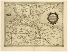
Old map of Georgia, Armenia and Azerbaijan by Mercator - Engraving - 17th c.
By Gerard Mercator
Located in Zeeland, Noord-Brabant
. (…).' - A beautiful Ptolemaic map of the Caucasus region and what is now Georgia, Armenia, Azerbaijan
Category

1690s Old Masters Iran Antique Map

Materials

Engraving

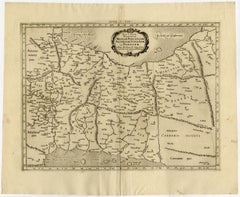
Ptolemaic map - Persian Gulf to the Caspian Sea by Mercator - Engraving - 17th c
By Gerard Mercator
Located in Zeeland, Noord-Brabant
, ac Persidem. (…).' - A beautiful Ptolemaic map of much of modern-day Iran, Iraq and part of Armenia
Category

1690s Old Masters Iran Antique Map

Materials

Engraving

Antique Kerman Persian Rug
Located in New York, NY
exceptional contribution of weaver without a map to be directed. It is charming, challenging, strong, and
Category

19th Century Persian Iran Antique Map

Antique Brass Art Deco Étagères or Night Tables with Marble Tops, 1900, Set of 2
Located in Warsaw, PL
Deco design map. They were creating the highest quality, simple and functional furniture from precious
Category

Early 20th Century Polish Art Deco Iran Antique Map

Materials

Marble, Brass

Antique Map of the Environment of Busschir, Also Called Abu Schahhr, Iran, 1776
Located in Langweer, NL
Antique map, titled: 'Plan des Environs d'Abu Schahhr.' Detailed hand colored antique map of
Category

1770s Iran Antique Map

Materials

Paper

Antique Ziegler Mahal
Located in San Francisco, CA
's which put Zieglers on the map. From there it went to Dildarian who then sold it.
Category

19th Century Persian Iran Antique Map

Antique Ziegler Mahal
W 188 in L 156 in
Antique Persian Sultanabad Oriental Rug
Located in New York, NY
Visions of ancient maps and spirited adventures come to mind when gazing upon the gorgeous patterns
Category

Early 20th Century Persian Sultanabad Iran Antique Map

Materials

Wool

Antique Persian Sultanabad Oriental Rug
Free Shipping
W 120 in L 152 in
Antique Tribal Bidjar Persian Rug
Located in New York, NY
after by designers. Bidjar rugs, produced in Northwest Iran are among the finest of Persian rugs by
Category

Late 19th Century Persian Tribal Iran Antique Map

Materials

Wool

Early 20th Century Silver Mezuzah by Avraham Moshe Sokolka, Jerusalem
Located in New York, NY
map of Tel Aviv made of silver and gold that the municipality of Tel Aviv presented to Governor
Category

Early 20th Century Israeli Art Deco Iran Antique Map

Materials

Silver

Original Antique Map of Persia / Iran, Arrowsmith, 1820
Located in St Annes, Lancashire
Great map of Iran Drawn under the direction of Arrowsmith Copper-plate engraving Published
Category

1820s English Iran Antique Map

Materials

Paper

Original Antique Map of Persia / Iran, Arrowsmith, 1820
1 bid
No Reserve
H 10.5 in W 16 in D 0.07 in
Original Antique Map of Persia 'Iran', circa 1890
Located in St Annes, Lancashire
Great map of Persia Original color. Published, circa 1890 A couple of minor edge tears
Category

1890s English Other Iran Antique Map

Materials

Paper

Original Antique Map of Persia 'Iran', circa 1890
Free Shipping
H 16.5 in W 11.75 in D 0.07 in
Large Original Vintage Map of Persia / Iran, circa 1920
Located in St Annes, Lancashire
Great maps of Persia Unframed Original color By John Bartholomew and Co. Edinburgh
Category

1920s British Iran Antique Map

Materials

Paper

Large Original Vintage Map of Persia / Iran, circa 1920
Free Shipping
H 18 in W 23 in D 0.07 in
Large Original Vintage Map of Persia / Iran, circa 1920
Located in St Annes, Lancashire
Great maps of Persia. Unframed. Original color. By John Bartholomew and Co. Edinburgh
Category

1920s British Iran Antique Map

Materials

Paper

Large Original Vintage Map of Persia / Iran, circa 1920
1 bid
No Reserve
H 18 in W 23 in D 0.07 in
Large Original Vintage Map of Persia / Iran, circa 1920
Located in St Annes, Lancashire
Great maps of Persia Unframed Original color By John Bartholomew and Co. Edinburgh
Category

1920s British Iran Antique Map

Materials

Paper

Large Original Vintage Map of Persia / Iran, circa 1920
1 bid
No Reserve
H 18 in W 23 in D 0.07 in
Original Antique Map of Persia / Iran. Sherwood, Neely & Jones. 1809.
Located in St Annes, Lancashire
Great map of Persia Copper-plate engraving by Cooper Published by Sherwood, Neely & Jones. Dated
Category

Early 1800s English Iran Antique Map

Materials

Paper

Decoritive Antique Map of Eastern Iran or The Persian Empire, 1734
Located in Langweer, NL
, dividing the region into its various early ethnic and tribal groups. This 18e century map of eastern Iran
Category

1730s Iran Antique Map

Materials

Paper

Large Original Antique Map of Persia 'Iran' by Sidney Hall, 1847
Located in St Annes, Lancashire
Great map of Persia Drawn and engraved by Sidney Hall Steel engraving Original colour
Category

1840s Scottish Iran Antique Map

Materials

Paper

Antique Map of Modern-Day Armenia, Iran, Iraq, Syria, Israel and Surroundings
Located in Langweer, NL
'. Detailed regional map of modern day Armenia, Iran, Iraq, Syria, Israel, Jordan, Turkmenistan, Afghanistan
Category

Late 17th Century Iran Antique Map

Materials

Paper

Antique Ptolemaic Map of Modern-Day Iran, Iraq and Part of Armenia
By Gerard Mercator
Located in Langweer, NL
'. Ptolemaic map of much of modern-day Iran, Iraq and part of Armenia. The map stretches from the Persian Gulf
Category

Late 17th Century Iran Antique Map

Materials

Paper

Antique Map of the Persian Empire 'Persia/Iran' by H. Moll, circa 1745
By Herman Moll
Located in Langweer, NL
Antique map titled 'Persia, agreable to Modern History'. Map of the Persian Empire extending from
Category

Mid-18th Century English Iran Antique Map

Materials

Paper

Antique Map of the Region East from Cyprus to Iran ‘Asia’ by F. De Wit, 1680
Located in Langweer, NL
This fine map shows the area East from Cyprus to Iran, including The Saudi Peninsula, Red Sea, Nile
Category

Late 17th Century Iran Antique Map

Materials

Paper

Original Antique Map of Turkey in Asia, 1880
Located in Langweer, NL
Antique map titled 'Turquie d'Asie et les Provinces du Caucase'. This map covers from the
Category

1880s Iran Antique Map

Materials

Paper

Antique Map of Persia, Georgia and Tartary, Ca.1780
Located in Langweer, NL
'. This map shows current days Georgia, Iran, Irak, Kazakhstan, Armenia, Azerbaijan, Afghanistan
Category

1780s Iran Antique Map

Materials

Paper

Antique Map Covering the Mid-19th Century Claims of The Ottoman Empire, 1884
Located in Langweer, NL
Antique map of Turkey titled 'Turquie d'Asie et les Provinces du Caucase'. This map covers from
Category

1880s Iran Antique Map

Materials

Paper

Empires of the East: The Indo-Scythian and Parthian Kingdoms, Published in 1880
Located in Langweer, NL
Tigris, and the Iranian plateau. 7. **Strategic Locations**: Given the historical context, the map may
Category

1880s Iran Antique Map

Materials

Paper

Art Deco Nightstands with Marble Tops by Konrad, Jarnuszkiewicz i S-Ka, 1900s
Located in Warszawa, Mazowieckie
Konrad and Stanislaw Jarnuszkiewicz. This factory is a historic place on the Art Dèco design map. They
Category

Early 1900s Polish Art Deco Iran Antique Map

Materials

Marble, Brass

Get Updated with New Arrivals
Save "Iran Antique Map", and we’ll notify you when there are new listings in this category.

Iran Antique Map For Sale on 1stDibs

Choose from an assortment of styles, material and more with respect to the iran antique map you’re looking for at 1stDibs. A iran antique map — often made from paper — can elevate any home. You’ve searched high and low for the perfect iran antique map — we have versions that date back to the 18th Century alongside those produced as recently as the 19th Century are available. Herman Moll each produced at least one beautiful iran antique map that is worth considering.

How Much is a Iran Antique Map?

A iran antique map can differ in price owing to various characteristics — the average selling price 1stDibs is $333, while the lowest priced sells for $67 and the highest can go for as much as $879.

Read More

Pamela Shamshiri Shares the Secrets behind Her First-Ever Book and Its Effortlessly Cool Interiors

The sought-after designer worked with the team at Hoffman Creative to produce a monograph that beautifully showcases some of Studio Shamshiri's most inspiring projects.

Moroccan Artworks and Objects Take Center Stage in an Extraordinary Villa in Tangier

Italian writer and collector Umberto Pasti opens the doors to his remarkable cave of wonders in North Africa.

Montecito Has Drawn Royalty and Celebrities, and These Homes Are Proof of Its Allure

Hollywood A-listers, ex-pat aristocrats and art collectors and style setters of all stripes appreciate the allure of the coastal California hamlet — much on our minds after recent winter floods.

Whaam! Blam! Pow! — a New Book on Pop Art Packs a Punch

Publishing house Assouline and writer Julie Belcove have teamed up to trace the history of the genre, from Roy Lichtenstein, Andy Warhol and Yayoi Kusama to Mickalene Thomas and Jeff Koons.

The Sparkling Legacy of Tiffany & Co. Explained, One Jewel at a Time

A gorgeous new book celebrates — and memorializes — the iconic jeweler’s rich heritage.

What Makes a Gem-Encrusted Chess Set Worth $4 Million?

The world’s most opulent chess set, weighing in at 513 carats, is literally fit for a king and queen.

Tauba Auerbach’s Geometric Pop-Up Book Is Mighty Rare, Thanks to a Hurricane

This sculptural art book has an epic backstory of its own.

Step inside the Storied Mansions of Palm Beach’s Most Effervescent Architect

From Spanish-style courtyards to fanciful fountains, these acclaimed structures abound in surprising and elegant details.