Items Similar to Original Antique Plan of the Fortress of Charedsch in Persia or Iran, ca.1780


Want more images or videos?
Request additional images or videos from the seller
1 of 5
Original Antique Plan of the Fortress of Charedsch in Persia or Iran, ca.1780
About the Item
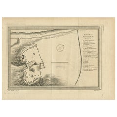
Antique map, titled: 'Plan de la Citadelle de la Ville de Charedsch.'
Plan of the fortress of Charedsch, Iran / Persia. This original antique print originates from 'Reize naar Arabie en andere omliggende landen, van Carsten Niebuhr uit het Hoogduitsch vertaald.', published in Amsterdam by S.J. Baalde and Utrecht by J. van Schoonhoven & comp., 1776. (Translation: Voyage to Arabia and surrounding countries by Carsten Niebuhr, translated from German.) This is the Dutch ed. translated and enlarged from 'Reisebeschreibung von Arabien und anderen umliegenden Landern (1774-1778). Carsten Niebuhr (1733-1815) travelled extensively in Arabia, Persia, Palestine and Asia Minor, and became by his descriptions and maps and the richness of his observations the pioneer of a more profound knowledge of the Orient.
Artists and Engravers: Made by 'Carsten Niebuhr' after an anonymous artist.
Condition: Good, given age. Some crinkles. General age-related toning and/or occasional minor defects from handling. Please study scan carefully.
- Dimensions:Height: 10.63 in (27 cm)Width: 8.59 in (21.8 cm)Depth: 0 in (0.02 mm)
- Materials and Techniques:
- Period:1780-1789
- Date of Manufacture:circa 1780
- Condition:Some crinkles. General age-related toning and/or occasional minor defects from handling.
- Seller Location:Langweer, NL
- Reference Number:
About the Seller
5.0
Platinum Seller
These expertly vetted sellers are 1stDibs' most experienced sellers and are rated highest by our customers.
Established in 2009
1stDibs seller since 2017
1,922 sales on 1stDibs
Typical response time: <1 hour
- ShippingRetrieving quote...Ships From: Langweer, Netherlands
- Return PolicyA return for this item may be initiated within 14 days of delivery.
More From This SellerView All
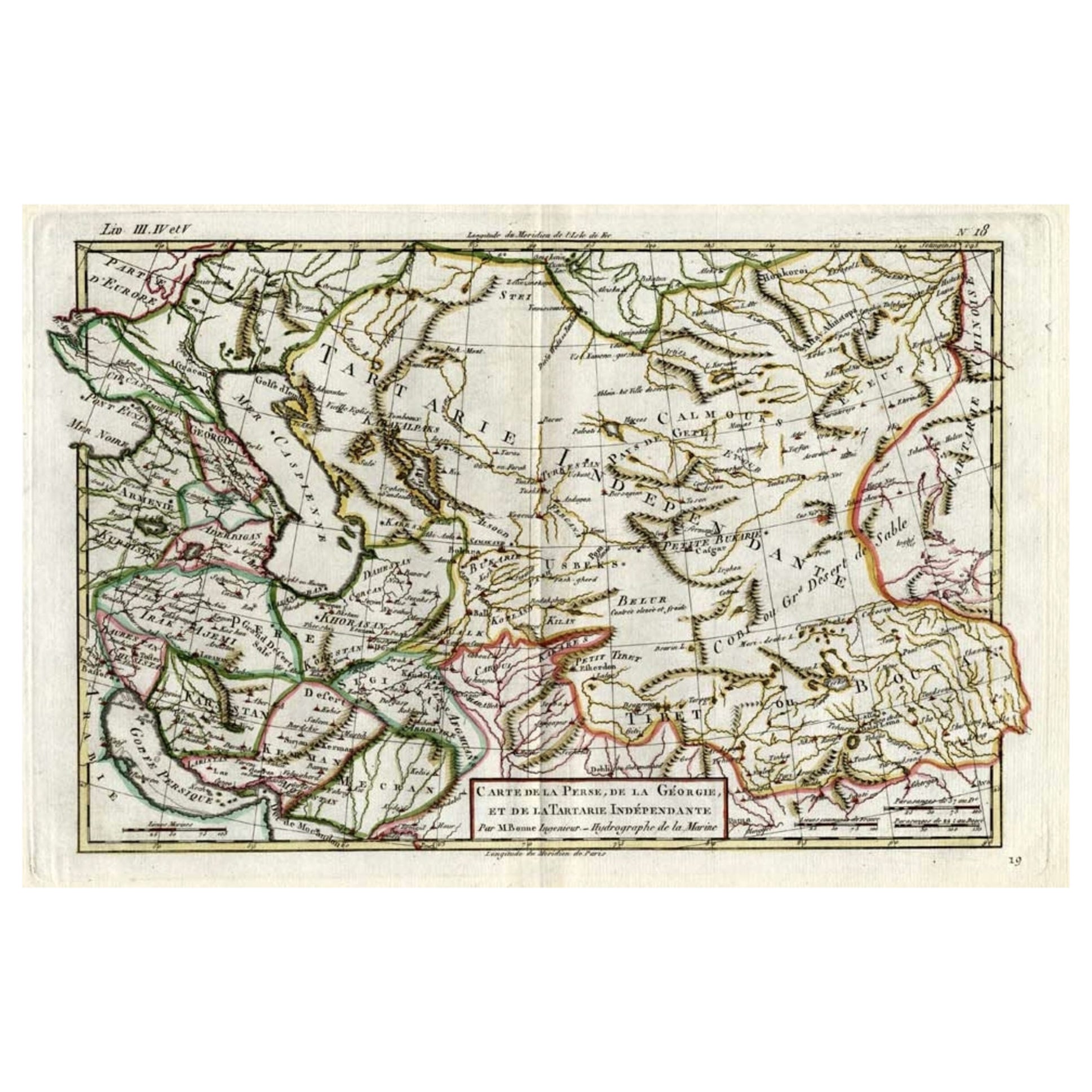
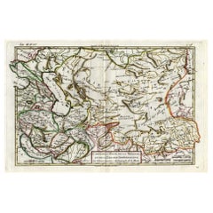
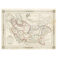
- Antique Map of Persia, Georgia and Kazakhstan, ca.1780Located in Langweer, NLAntique map titled 'Carte de la Perse, de la Georgie, et de la Tartarie Independante'. Map of Persia, Georgia and Kazakhstan. This map shows current days Georgia, Iran, Irak, Kaz...Category
Antique 1780s Maps
MaterialsPaper
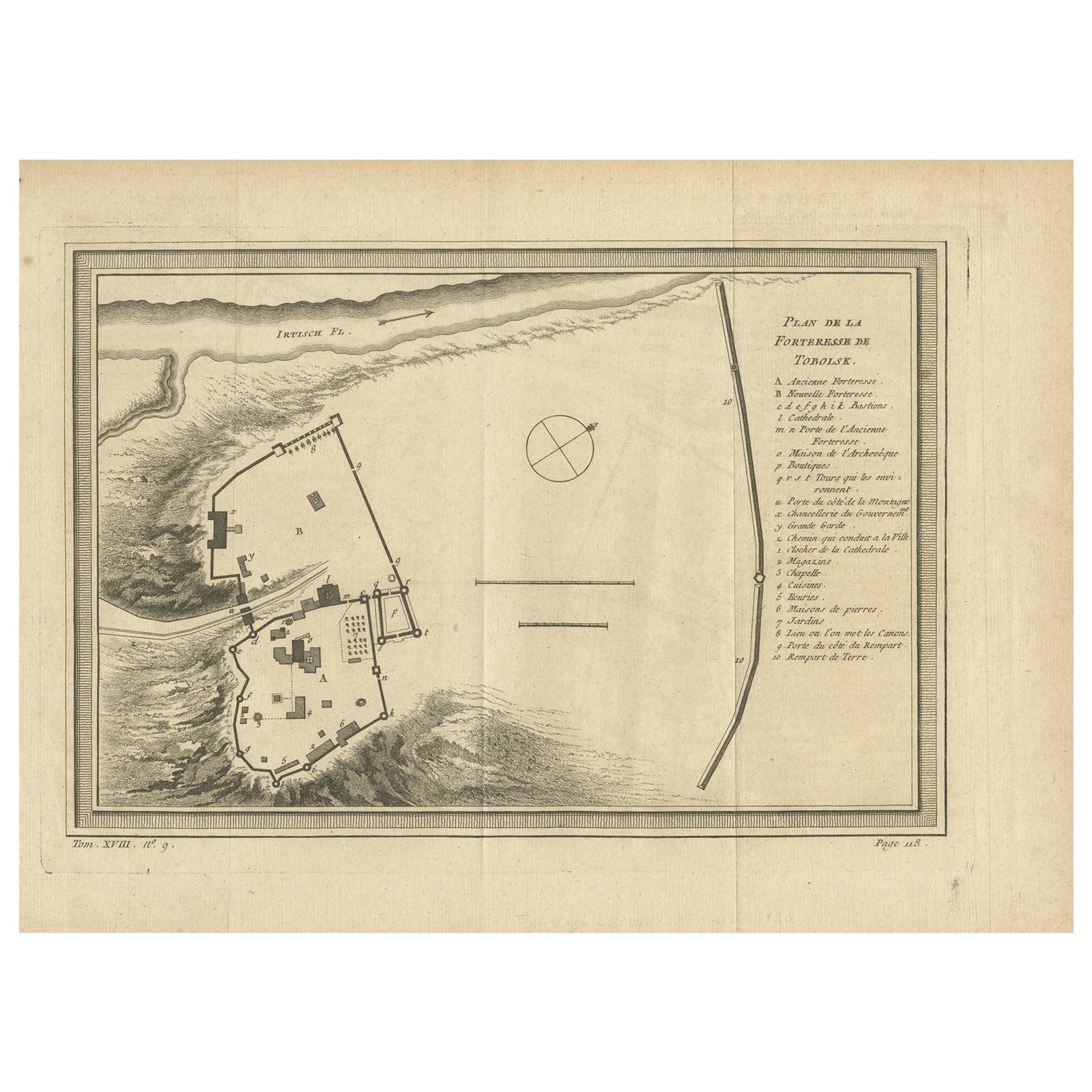
- Antique Plan of the Fortress of Tobolsk by Bellin '1768'Located in Langweer, NLAntique map titled 'Plan de la Forteresse de Tobolsk'. Original plan of the Fortress of Tobolsk, a town in Tyumen Oblast, Russia. Engraved by J.N. Bellin ...Category
Antique Mid-18th Century Maps
MaterialsPaper
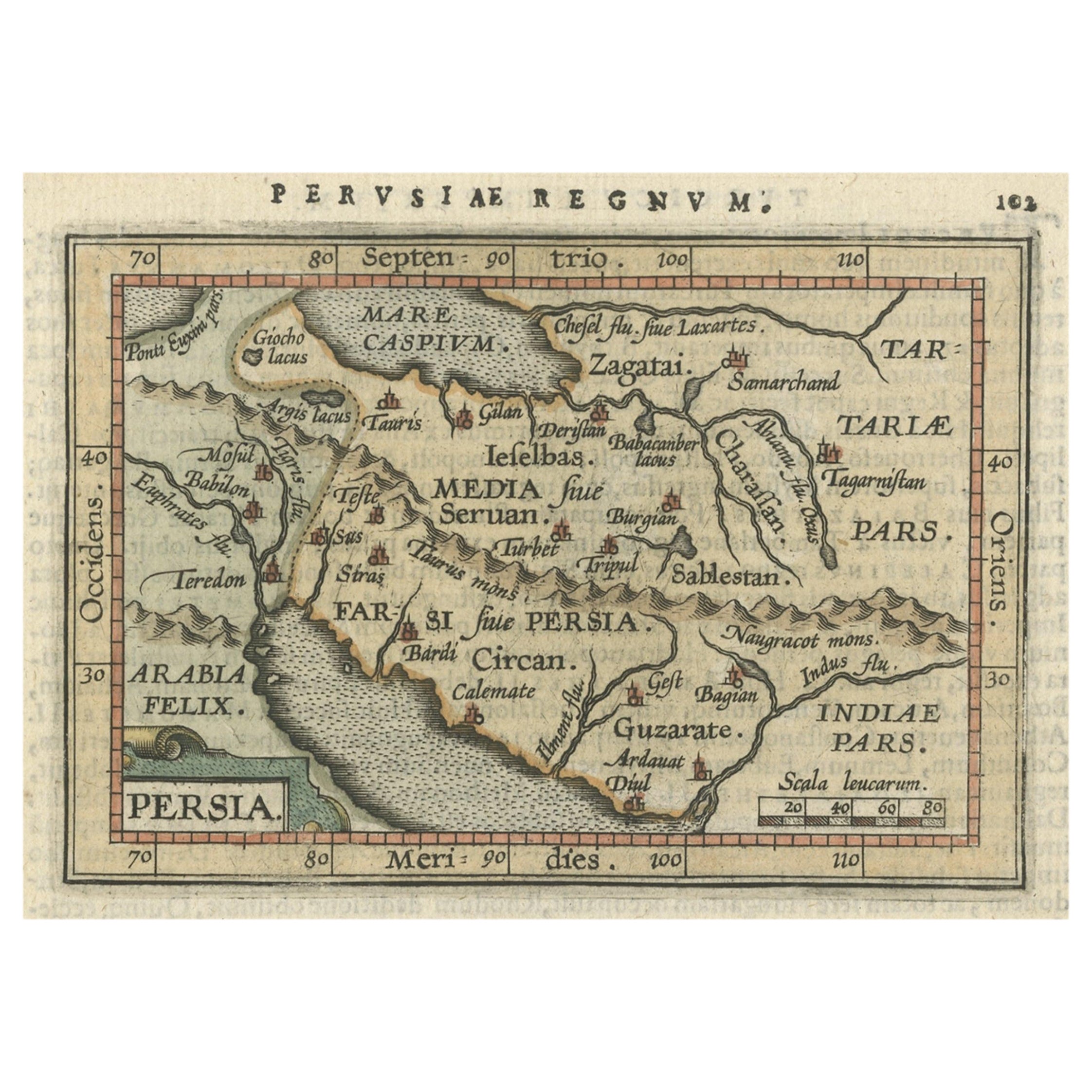
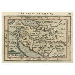
- Original Antique Miniature Map of Persia, Published, ca.1601Located in Langweer, NLAntique miniature map titled 'Persia'. Small map of Persia published in the Epitome, or pocket-edition of the "Theatrum Orbis Terrarum". Artists and e...Category
Antique Early 1600s Maps
MaterialsPaper
- Antique Map of the Russian Empire in Europe, ca.1780Located in Langweer, NLDescription: Antique map titled 'Bowles's New Pocket Map of the Russian Empire in Europe, Comprehending the West Part of the Empire in Asia' Large and detai...Category
Antique 1780s Maps
MaterialsPaper
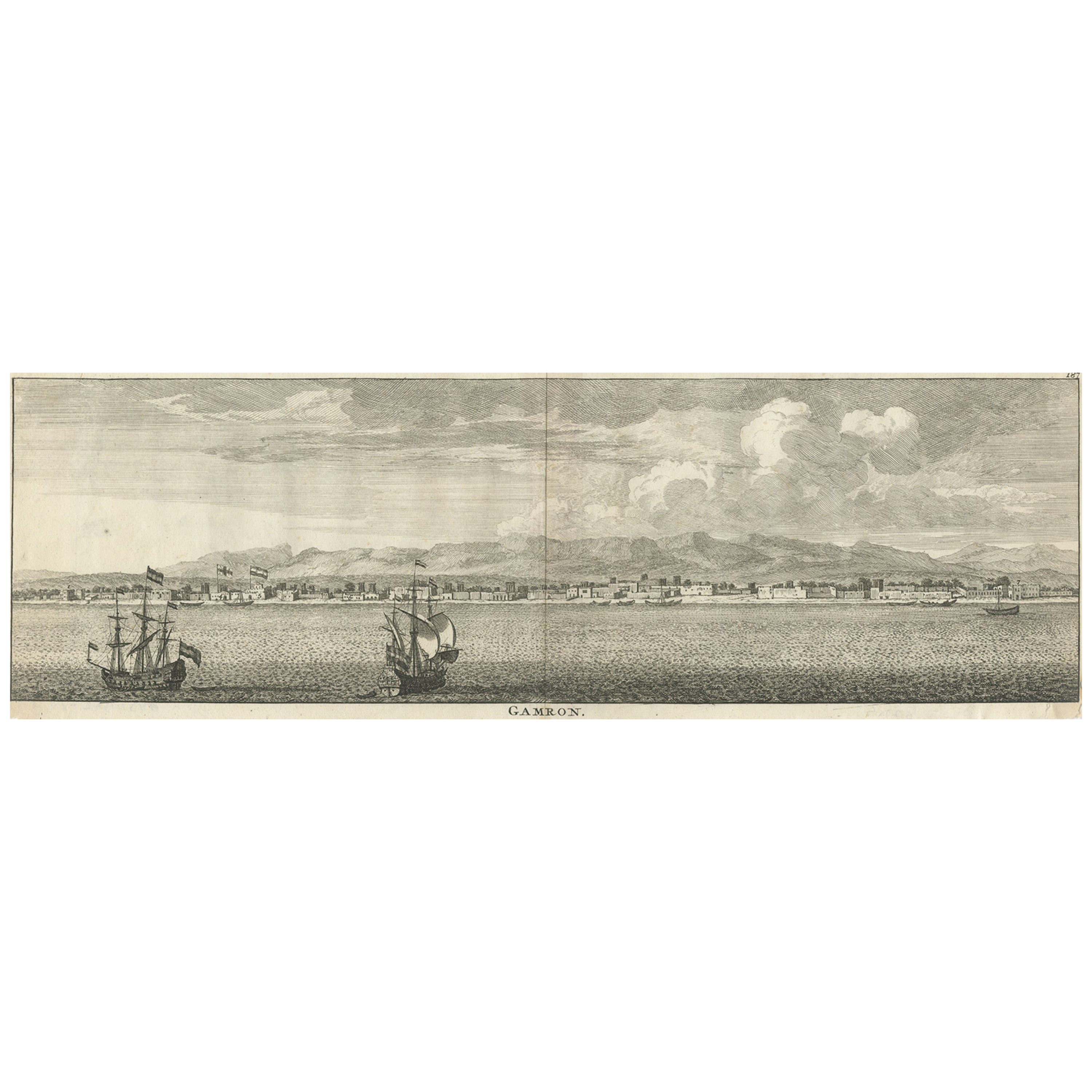
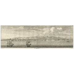
- Panoramic Antique View of Bandar-Abbas 'Formerly Gamron, Persia' in Iran, 1714Located in Langweer, NLAntique print titled 'Gamron'. Panoramic view of the city of Bandar-Abbas (formerly Gamron) in Iran / Persia. This print originates from 'Reizen over Moskovie, door Persie en Indie' ...Category
Antique 1710s Maps
MaterialsPaper
- Persia Unveiled: Antique Map of Iran, Afghanistan, and Beyond, 1852Located in Langweer, NLThe antique map titled 'Royaumes de Perse Herat & Kaboul' is an attractive map of Persia. Here are the key details and features of the map: 1. **Geographic Coverage**: - The map ...Category
Antique Mid-19th Century Maps
MaterialsPaper

You May Also Like
- Original Antique Map of Italy. C.1780Located in St Annes, LancashireGreat map of Italy Copper-plate engraving Published C.1780 Unframed.Category
Antique Early 1800s English Georgian Maps
MaterialsPaper

- Original Antique Map of Asia. C.1780Located in St Annes, LancashireGreat map of Asia Copper-plate engraving Published C.1780 Two small worm holes to right side of map Unframed.Category
Antique Early 1800s English Georgian Maps
MaterialsPaper

- Original Antique Map of India. C.1780Located in St Annes, LancashireGreat map of India Copper-plate engraving Published C.1780 Three small worm holes to right side of map and one bottom left corner Unframed.Category
Antique Early 1800s English Georgian Maps
MaterialsPaper

- Original Antique Map of South America. C.1780Located in St Annes, LancashireGreat map of South America Copper-plate engraving Published C.1780 Two small worm holes to left side of map Unframed.Category
Antique Early 1800s English Georgian Maps
MaterialsPaper
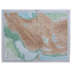
- Large Original Vintage Map of Persia / Iran, circa 1920Located in St Annes, LancashireGreat maps of Persia. Unframed. Original color. By John Bartholomew and Co. Edinburgh Geographical Institute. Published, circa 1920. Free shipping.Category
Vintage 1920s British Maps
MaterialsPaper
- Original Antique Map of The World by Thomas Clerk, 1817Located in St Annes, LancashireGreat map of The Eastern and Western Hemispheres On 2 sheets Copper-plate engraving Drawn and engraved by Thomas Clerk, Edinburgh. Published by Mackenzie And Dent, 1817 ...Category
Antique 1810s English Maps
MaterialsPaper