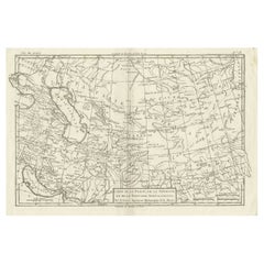
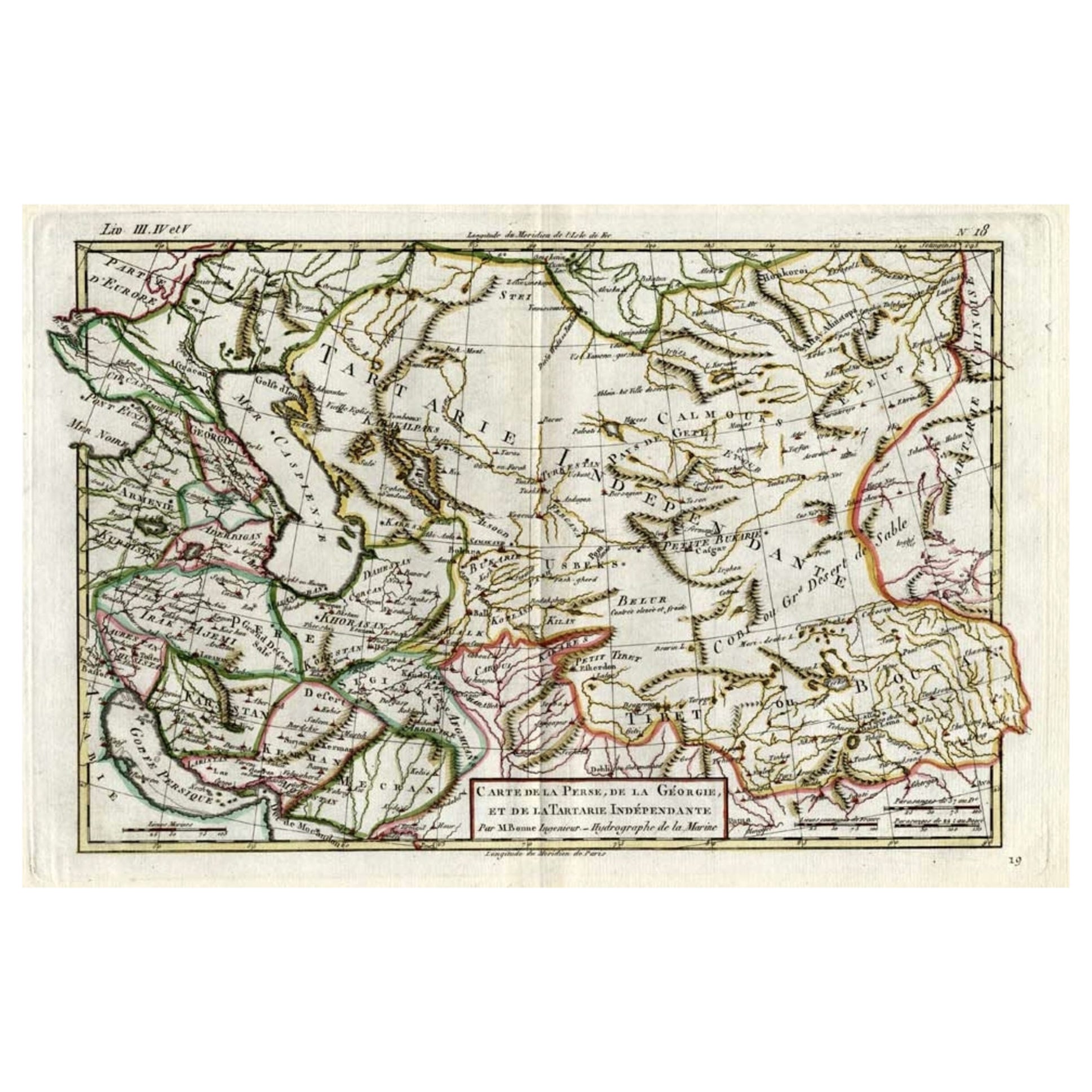
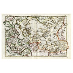
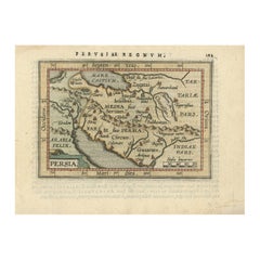
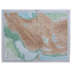
Antique Map of Persia, Georgia and Tartary, Ca.1780
View Similar Items


Want more images or videos?
Request additional images or videos from the seller
1 of 5
Antique Map of Persia, Georgia and Tartary, Ca.1780
About the Item
- Dimensions:Height: 10.63 in (27 cm)Width: 14.65 in (37.2 cm)Depth: 0 in (0.02 mm)
- Materials and Techniques:
- Period:1780-1789
- Date of Manufacture:circa 1780
- Condition:Wear consistent with age and use.
- Seller Location:Langweer, NL
- Reference Number:Seller: BG-07118 1stDibs: LU3054326530062
About the Seller
5.0
Platinum Seller
These expertly vetted sellers are 1stDibs' most experienced sellers and are rated highest by our customers.
Established in 2009
1stDibs seller since 2017
1,932 sales on 1stDibs
More From This SellerView All
- Antique Map of Persia, Georgia and Kazakhstan, ca.1780Located in Langweer, NLAntique map titled 'Carte de la Perse, de la Georgie, et de la Tartarie Independante'. Map of Persia, Georgia and Kazakhstan. This map shows current days Georgia, Iran, Irak, Kaz...Category
Antique 1780s Maps
MaterialsPaper
 $455 Sale Price20% Off
 - Antique Map of Persia and Tartary by Lowry, '1852'Located in Langweer, NLAntique map titled 'Persia and Tartary'. Original map of Persia and Tartary. This map originates from 'Lowry's Table Atlas constructed and engraved from the most recent Authorities' ...Category
Antique Mid-19th Century Maps
MaterialsPaper
- Antique Map of Persia, Georgia and Kazakhstan by Bonne, c.1780Located in Langweer, NLAntique map titled 'Carte de la Perse, de la Georgie, et de la Tartarie Independante'. Map of Persia, Georgia and Kazakhstan. This map shows current days Georgia, Iran, Irak, Kazak...Category
Antique 18th Century Maps
MaterialsPaper
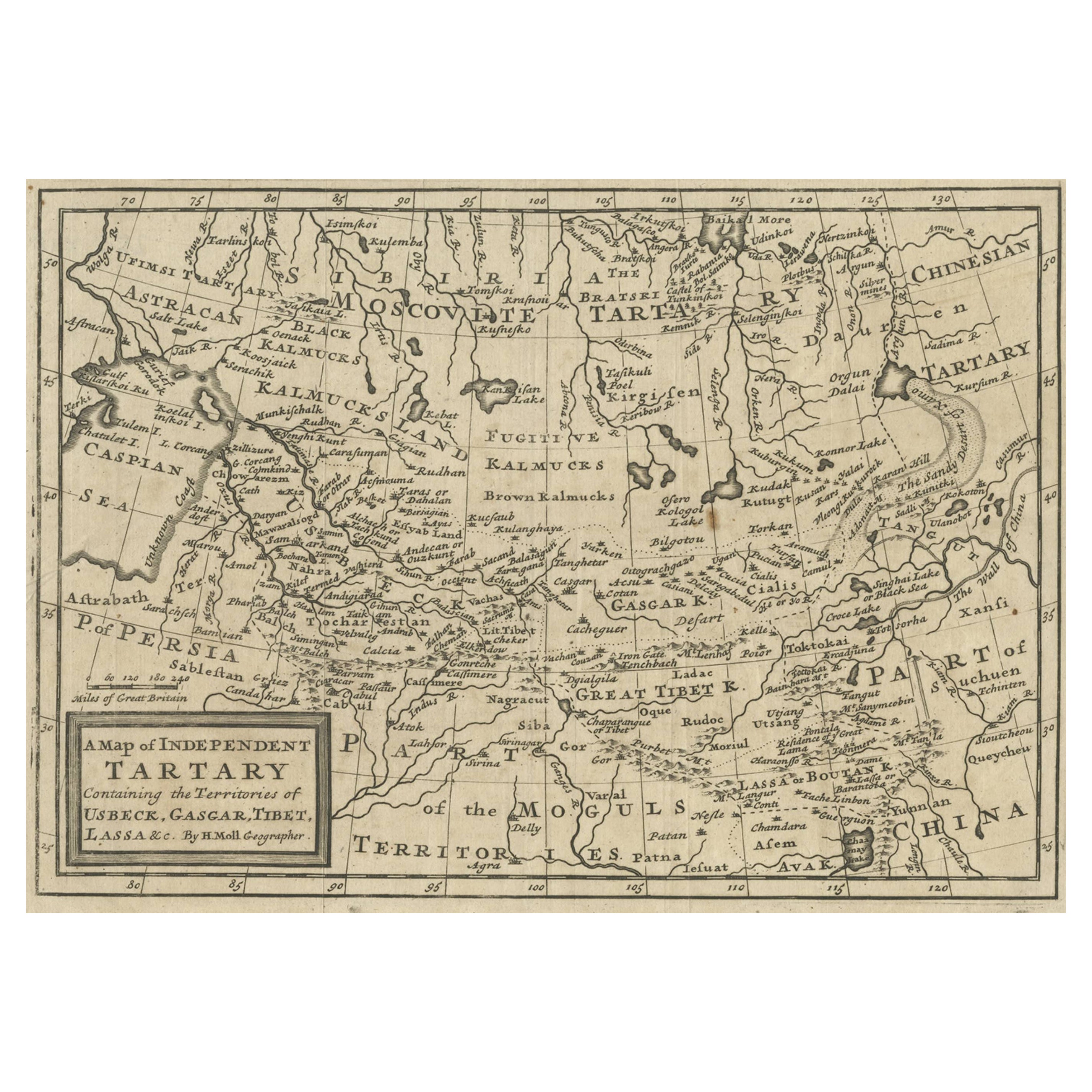
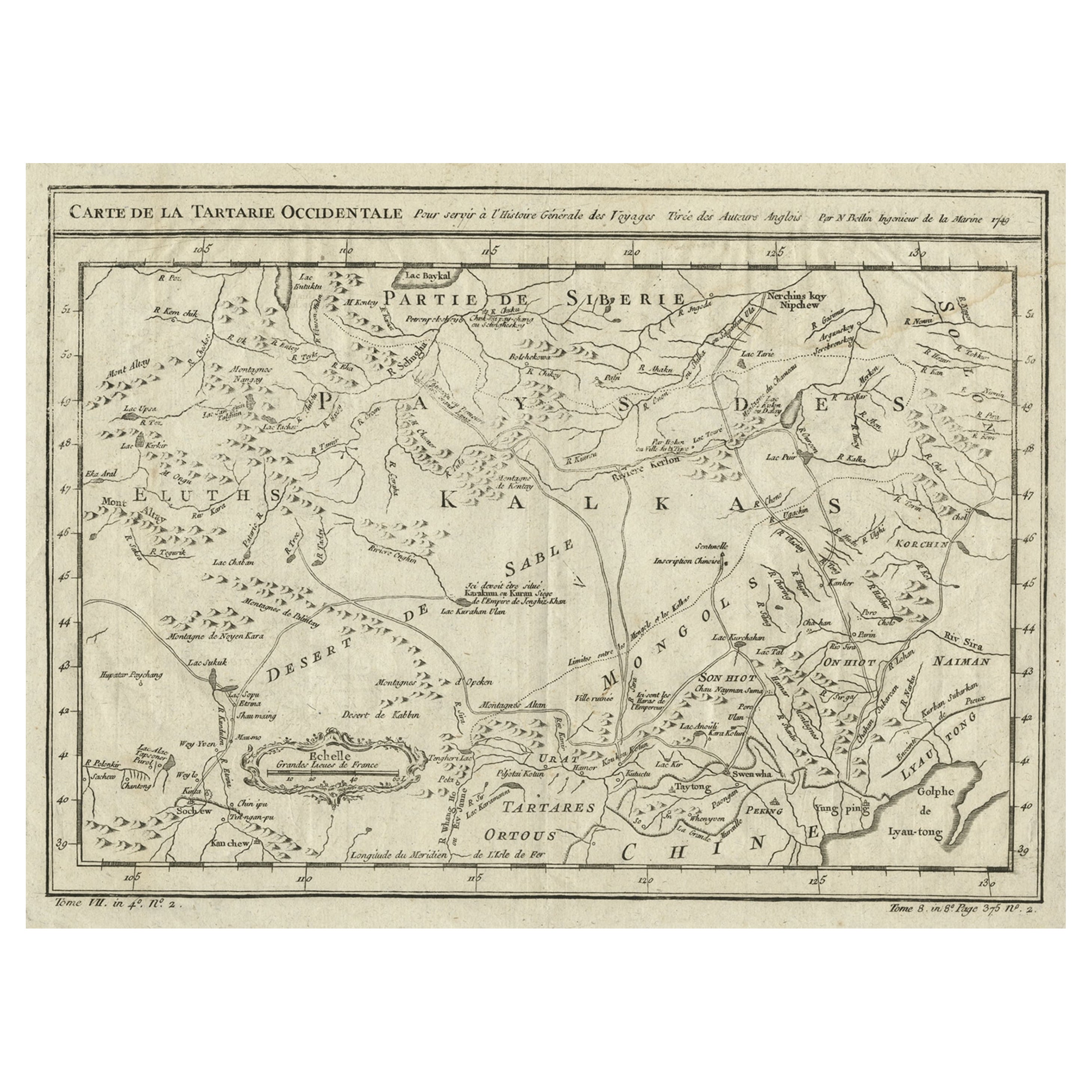
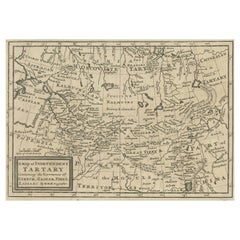
- Old Map of Tartary with Persia, Siberia, the Mogul Territories & China, ca.1717Located in Langweer, NLAntique map titled 'A Map of Independent Tartary, containing the territories of Usbeck, Gasgar, Tibet, Lassa & c'. Old map depicting east of the Caspian Sea with parts of Persia, Siberia, the Mogul territories and on to western China...Category
Antique 1710s Maps
MaterialsPaper
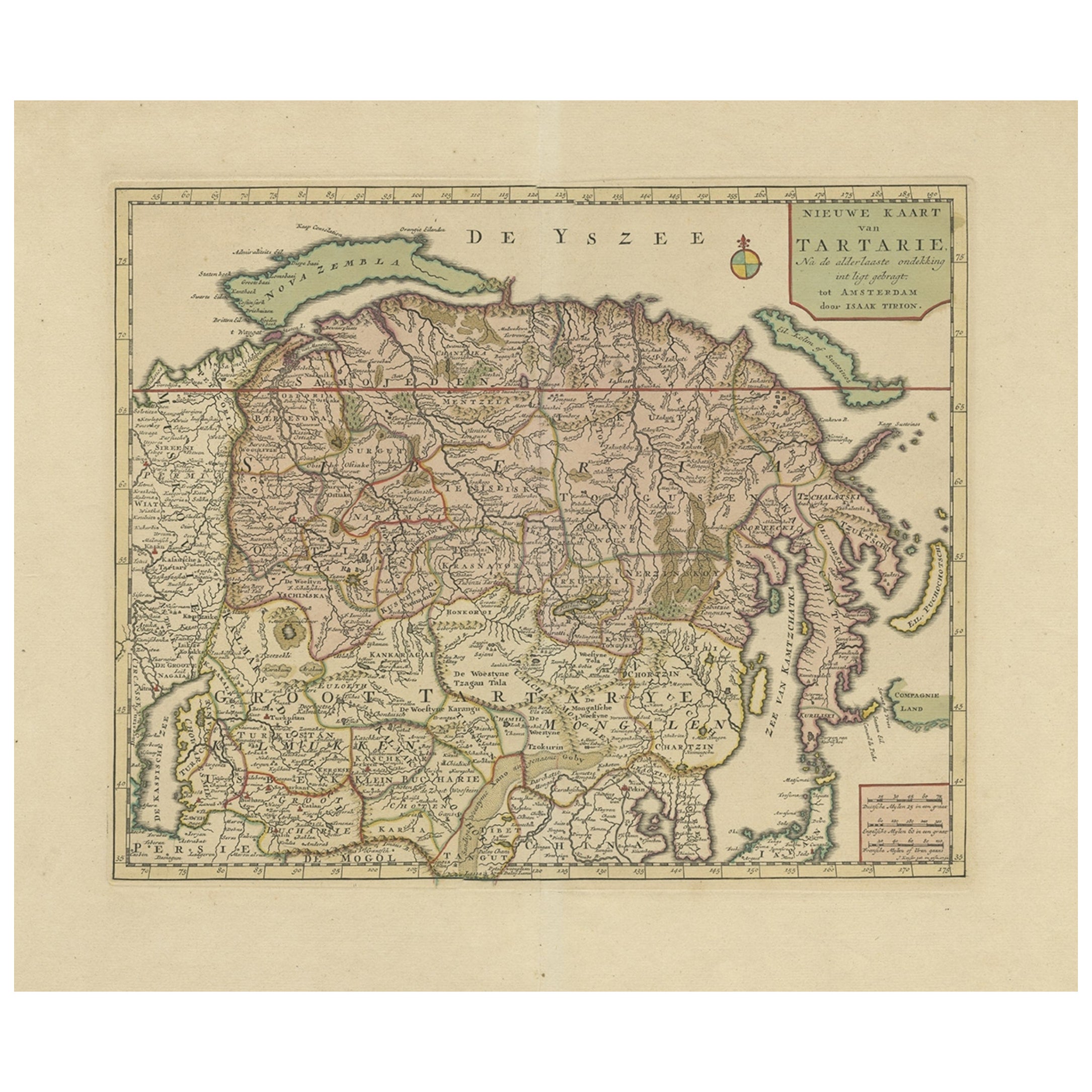
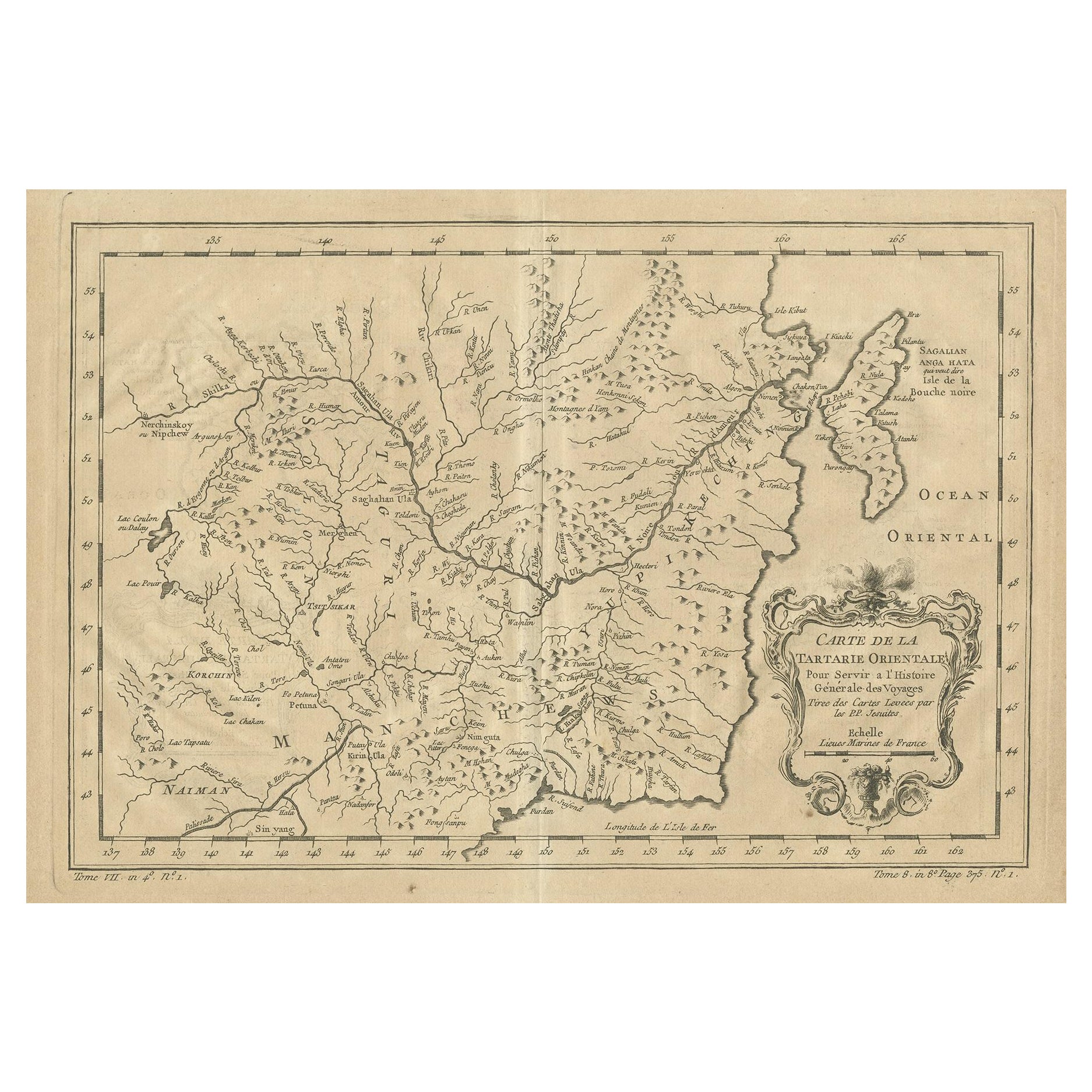
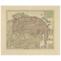
- Antique Map of Siberia and Chinese Tartary, Incl Nova Zembla, ca.1732Located in Langweer, NLAntique map of Tartary titled 'Nieuwe Kaart van Tartarie na de alderlaatste ondekking int ligt gebracht tot Amsterdam door Isaak Tirion'. Map op Siberia and Chinese tartary. In t...Category
Antique 1730s Maps
MaterialsPaper
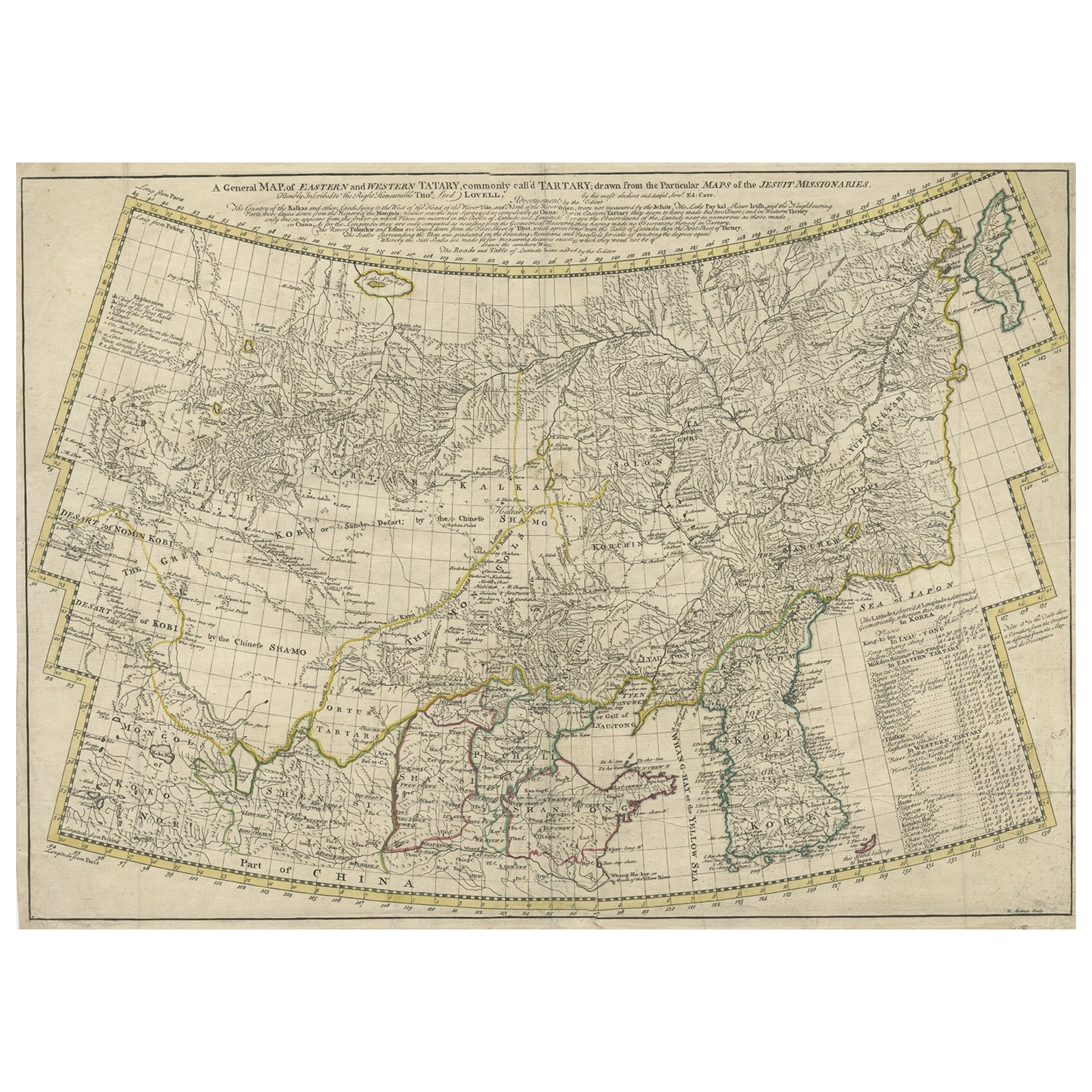
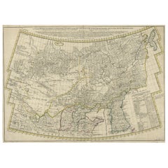
- Rare Hand-Colored Antique Map of Tartary, China and Korea, ca.1741Located in Langweer, NLAntique map titled 'A General Map of Eastern and Western Tatary, commonly call'd Tartary; drawn from the Particular Maps of the Jesuit Missionaries'. Rare antique map of Tartary, C...Category
Antique 1740s Maps
MaterialsPaper
You May Also Like
- 1851 Map of "Independent Tartary", Ric. R018Located in Norton, MA1851 Map of Independent Tartary "Russia" Ric.r018 A highly decorative 1851 map of Independent Tartary by John Tallis and John Rapkin. Covers the regions between the Caspian Sea and Lake Bakquash and between Russia and Afghanistan. These include the ancient Silk Route kingdoms of Khiva, Tartaria, Kokand, and Bokhara. Today this region roughly includes Kazakhstan, Uzbekistan, Turkmenistan, Kyrgyzstan, and Tajikistan. This wonderful map offers a wealth of detail for anyone with an interest in the Central Asian portion of the ancient Silk Road. Identifies various caravan routes, deserts, wells, and stopping points, including the cities of Bokhara and Samarkand. Three vignettes by W. Bragg decorate the map, these including an image of Tartars on a Journey, a horseback Bride Chase, and a tartar camp site. Surrounded by a vine motif border. Engraved by J. Rapkin for John Tallis's 1851 Illustrated Atlas . Tartary Antique Map...Category
Antique 19th Century Unknown Maps
MaterialsPaper
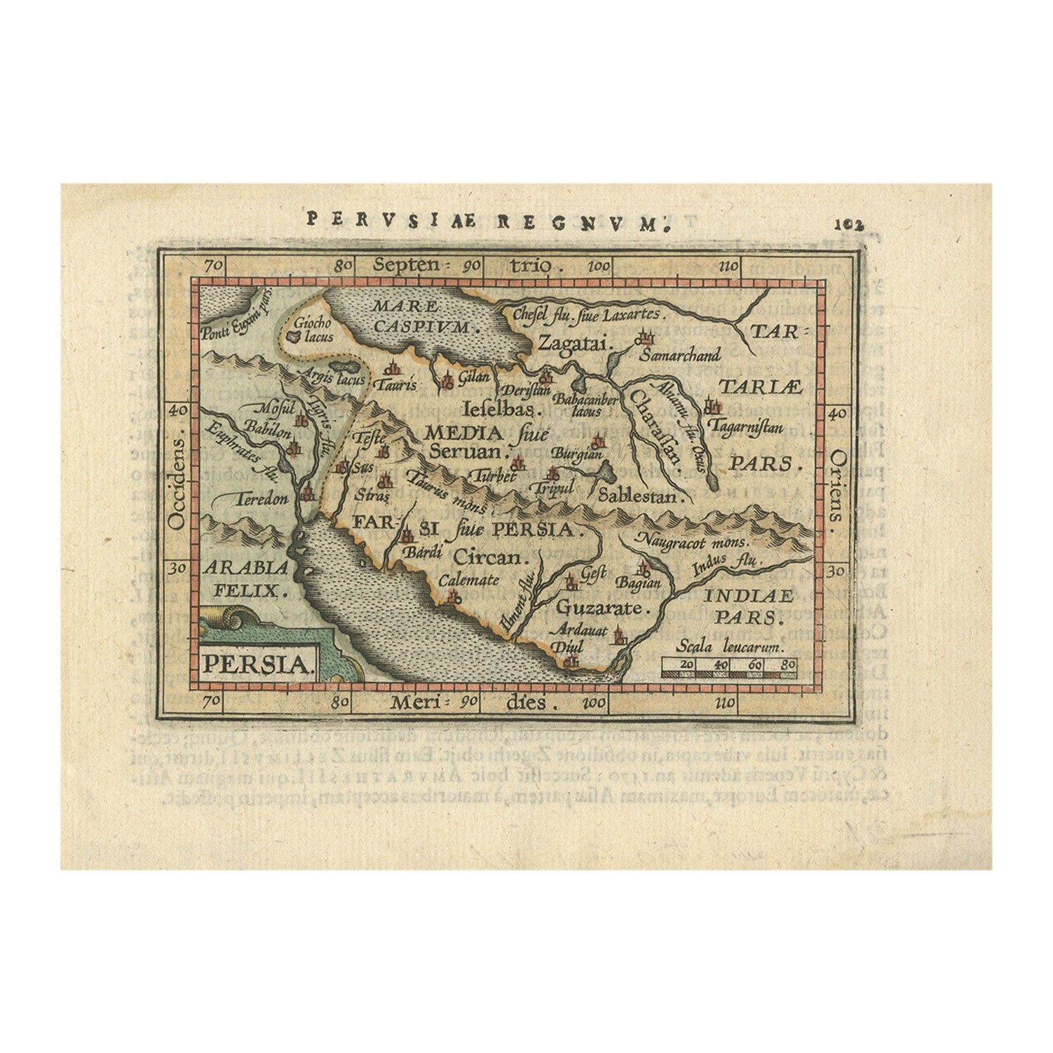
- Super Rare Antique French Map of Chine and the Chinese Empire, 1780Located in Amsterdam, Noord HollandSuper Rare Antique French Map of Chine and the Chinese Empire, 1780 Very nice map of Asia. 1780 Made by Bonne. Additional information: Type: Map ...Category
Antique 18th Century European Maps
MaterialsPaper
- Large Original Vintage Map of Persia / Iran, circa 1920Located in St Annes, LancashireGreat maps of Persia. Unframed. Original color. By John Bartholomew and Co. Edinburgh Geographical Institute. Published, circa 1920. Free shipping.Category
Vintage 1920s British Maps
MaterialsPaper
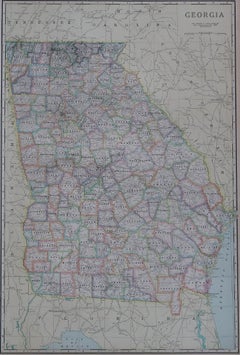
- Large Original Antique Map of Georgia, USA, circa 1900Located in St Annes, LancashireFabulous map of Georgia Original color Engraved and printed by the George F. Cram Company, Indianapolis. Published, circa 1900 UnframedCategory
Antique 1890s American Maps
MaterialsPaper
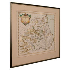
- Antique Lithography Map, Durham, English, Framed, Cartography, Early GeorgianLocated in Hele, Devon, GBThis is an antique lithography map of Durham. An English, framed engraving of cartographic interest, dating to the early 18th century and later, circa 1720. Superb lithography of Du...Category
Antique Early 18th Century British Georgian Maps
MaterialsWood
- Antique Lithography Map, Cumbria, English, Framed Cartography Interest, GeorgianLocated in Hele, Devon, GBThis is an antique lithography map of Cumbria. An English, framed engraving of cartographic interest, dating to the early 18th century and later. ...Category
Antique Early 18th Century British Georgian Maps
MaterialsWood


Recently Viewed
View AllMore Ways To Browse
Antique Persia
Unknown Circa 1780
Antique Marine Furniture
Marine Collectibles
Tibet Antiques
Antique French Globe
Antique Globes And Maps
Antique Maps And Globes
Persia 18th Century
Antique Paper Globe
La Marine Antique
Used Furniture Depot
Antique Map Globe
Atlas Globe
Antique Depot
Carte Paris
Antique Furniture Depot
Antique Marine Maps