Items Similar to Old German Antique Map of Iran and Arabia, 1866


Want more images or videos?
Request additional images or videos from the seller
1 of 5
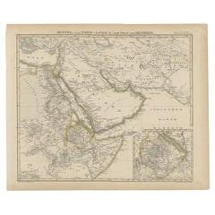
Old German Antique Map of Iran and Arabia, 1866
About the Item
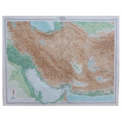
Antique map titled 'Vorder-Asien oder Iran, Turan, Arabien, Kleinasien und die Kaukasus Länder'. Large map centered on Iran. It shows the area from Turkey to Mumbai in India. Includes Arabia, the Caspian Sea and the Aral Lake. Artists and Engravers: Published by Weimar Geographisches Institut.
Artist: Published by Weimar Geographisches Institut.
Condition: Good, age-related toning. Please study image carefully.
Date: 1866
Overall size: 69.5 x 58 cm.
Image size: 57 x 50 cm.
We sell original antique maps to collectors, historians, educators and interior decorators all over the world. Our collection includes a wide range of authentic antique maps from the 16th to the 20th centuries. Buying and collecting antique maps is a tradition that goes back hundreds of years. Antique maps have proved a richly rewarding investment over the past decade, thanks to a growing appreciation of their unique historical appeal. Today the decorative qualities of antique maps are widely recognized by interior designers who appreciate their beauty and design flexibility. Depending on the individual map, presentation, and context, a rare or antique map can be modern, traditional, abstract, figurative, serious or whimsical. We offer a wide range of authentic antique maps for any budget.
- Dimensions:Height: 27.37 in (69.5 cm)Width: 22.84 in (58 cm)Depth: 0 in (0.01 mm)
- Materials and Techniques:
- Period:
- Date of Manufacture:1866
- Condition:
- Seller Location:Langweer, NL
- Reference Number:
About the Seller
5.0
Platinum Seller
These expertly vetted sellers are 1stDibs' most experienced sellers and are rated highest by our customers.
Established in 2009
1stDibs seller since 2017
1,929 sales on 1stDibs
Typical response time: <1 hour
- ShippingRetrieving quote...Ships From: Langweer, Netherlands
- Return PolicyA return for this item may be initiated within 14 days of delivery.
More From This SellerView All
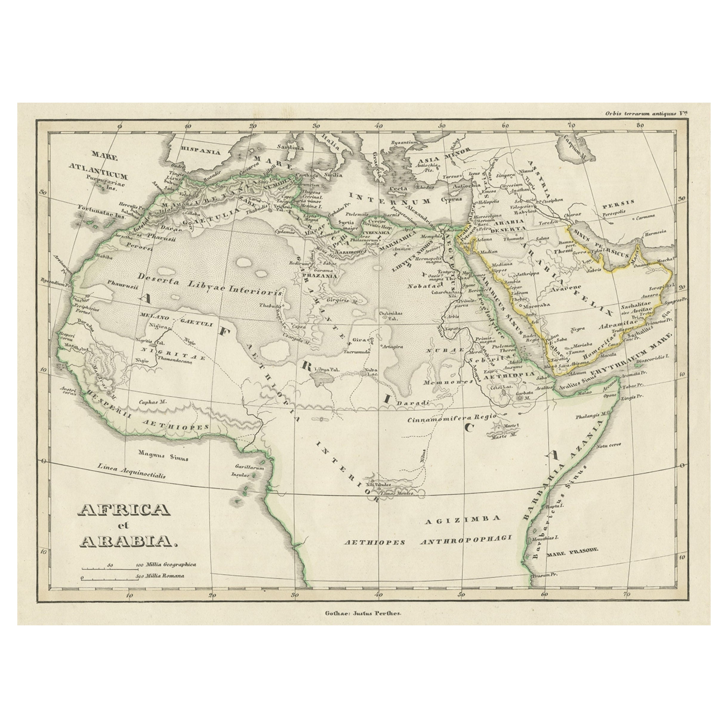
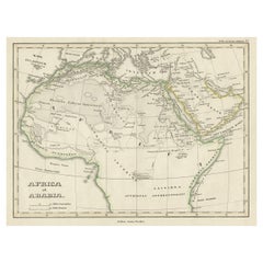
- Old Original Map of Africa and Arabia, 1848Located in Langweer, NLAntique map titled 'Africa et Arabia'. Old map of Africa and Arabia originating from 'Orbis Terrarum Antiquus in usum Scholarum'. Artists and Engravers: Published by Justus P...Category
Antique 1840s Maps
MaterialsPaper
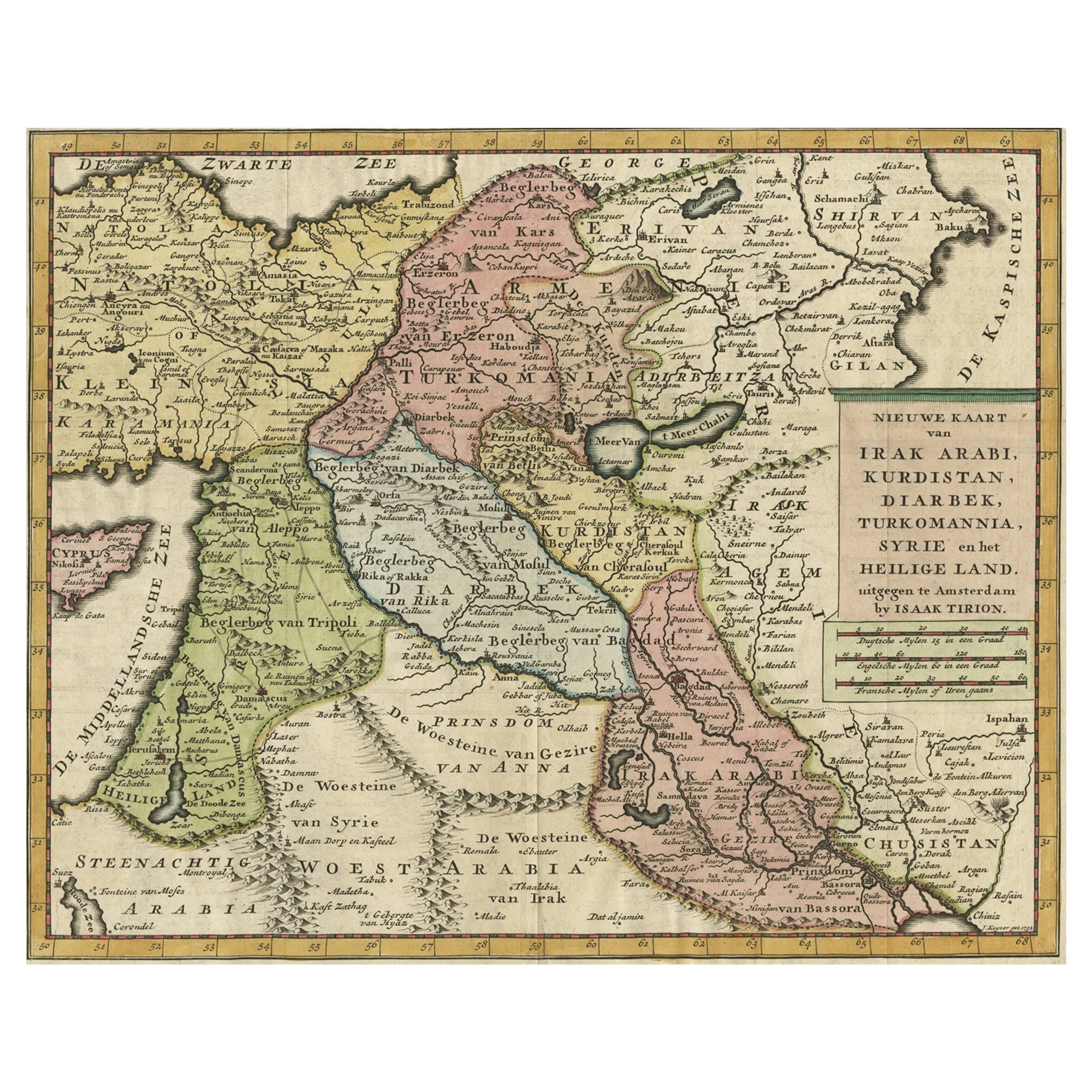
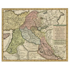
- Original Map of The Northern Arabian Peninsula, Palestine, Iraq & Iran, 1732Located in Langweer, NLAntique map titled 'Nieuwe kaart van Irak Arabi, Kurdistan, Diarbek (..).' Detailed map including the northern part of the Arabian peninsula, Pales...Category
Antique 1730s Maps
MaterialsPaper
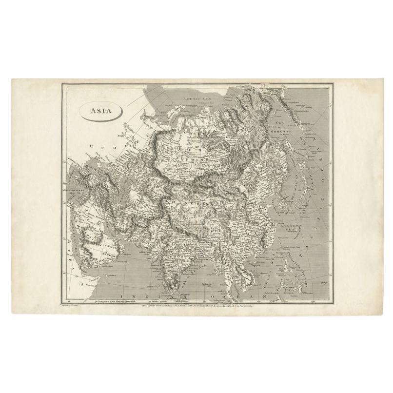
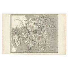
- Antique Map of Asia including Arabia, 1806Located in Langweer, NLAntique map titled 'Asia'. Original antique map of the Asian continent engraved by E. Jones. Artists and Engravers: Drawn under the direction of Mr. Arrowsmith. Published in 1806...Category
Antique 19th Century Maps
MaterialsPaper
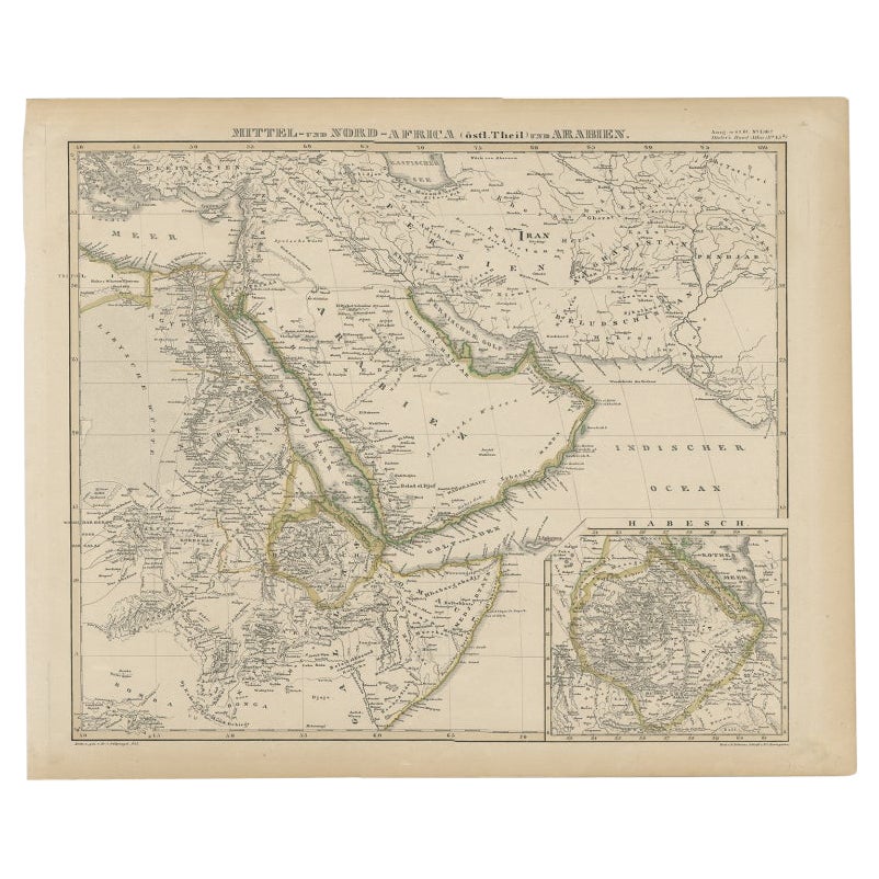
- Antique Map of Africa and Arabia with Inset Map of Ethiopia and Eritrea, 1845Located in Langweer, NLAntique map titled 'Mittel- und Nord-Africa (östl. Theil) und Arabien'. This map depicts North and Central Africa and Arabia with an inset map of Habesch (Ethiopia and Eritrea). Ar...Category
Antique 19th Century Maps
MaterialsPaper
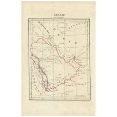
- Antique Map of Arabia by Tardieu '1843'Located in Langweer, NLAntique map titled 'Arabie'. Attractive small map of Arabia. This map originates from 'Dictionnaire Universel de Geographie Moderne' 4th Edition, by A.Pe...Category
Antique Mid-19th Century Maps
MaterialsPaper
- Original Antique Map of Arabia and the Red SeaLocated in Langweer, NLAntique map titled 'Carte de la Coste d'Arabie (..) - Kaart van de Kust van Arabië (..)'. This is a Dutch version, engraved by J. van Schley, of Bellin's map of Arabia and the Red Se...Category
Antique Mid-18th Century Maps
MaterialsPaper

You May Also Like
- Large Original Vintage Map of Persia / Iran, circa 1920Located in St Annes, LancashireGreat maps of Persia. Unframed. Original color. By John Bartholomew and Co. Edinburgh Geographical Institute. Published, circa 1920. Free shipping.Category
Vintage 1920s British Maps
MaterialsPaper
- 1866 Ensign & Bridgman's Rail Road Map of the United StatesLocated in Colorado Springs, COPresented is an 1866 issue of “Ensign & Bridgeman’s Rail Road Map of the United States, showing Depots & Stations.” First published in 1856, this is the third edition, following anot...Category
Antique 1860s American Late Victorian Maps
MaterialsPaper
- Old Nautical Map of CorsicaLocated in Alessandria, PiemonteST/556/1 - Old map of Corsica isle, surveyed by Captain Hell, of the French Royal Navy in 1824, engraved and published on 1874, with additions and corre...Category
Antique Early 19th Century English Other Prints
MaterialsPaper
- Old Horizontal Map of EnglandBy TassoLocated in Alessandria, PiemonteST/520 - Old rare Italian map of England, dated 1826-1827 - by Girolamo Tasso, editor in Venise, for the atlas of M.r Le-Sage.Category
Antique Early 19th Century Italian Other Prints
MaterialsPaper
- East German MapBy VEB Hermann HaackLocated in Baltimore, MDA brilliantly colourful map of the Leipzig, Karl Marx Stadt and Dresden area in the former German Democratic Republic by VEB Hermann Haack of Gotha.Category
Vintage 1970s German Maps
- Set of 4 Antique Geographical Maps French-German War 1870-71Located in Casale Monferrato, ITElegant late 19th century set of four antique geographical maps relating to the positioning of the armies in the Franco-German War 1870-71. A...Category
Antique 1890s Italian Maps
MaterialsPaper