Map Of Hungary

2
50
to
11
42
7
50
50
50
2
1
1
23
16
11
6
3
1
1
2
2
1
1
42
4
3
1
1
18
6
4
2
2
2
1
1
1
1
Sort By
Original Antique Map of Hungary, Arrowsmith, 1820
Located in St Annes, Lancashire
Great map of Hungary Drawn under the direction of Arrowsmith. Copper-plate engraving. Published
Category

Antique 1820s English Maps

Materials

Paper

Original Antique Map of Hungary, Arrowsmith, 1820
No Reserve
H 10.5 in W 16 in D 0.07 in
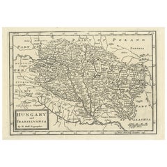
Original Antique Map of Hungary and Transylvania 'Modern Day Romania', C.1710
Located in Langweer, NL
Antique map titled 'Hungary and Transilvania'. Original antique map of Hungary and Transylvania
Category

Antique 1710s Maps

Materials

Paper

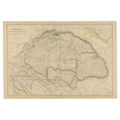
Antique Map of Hungary, Transylvania and Dalmatia by W. G. Blackie, 1859
Located in Langweer, NL
Antique map titled 'Hungary, Transylvania, Dalmatia'. Original antique map of Hungary, Transylvania
Category

Antique Mid-19th Century Maps

Materials

Paper

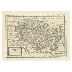
Antique Engraved Map of Hungary and Transylvania or Romania, c.1710
Located in Langweer, NL
Antique map titled 'Hungary and Transilvania'. Original antique map of Hungary and Transylvania
Category

Antique 18th Century Maps

Materials

Paper

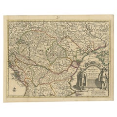
Antique French Map of Hungary with Decorative Title Cartouche, c.1730
Located in Langweer, NL
Antique map titled 'La Hongrie suivant les Nouvelles Observations (..)'. Antique map of Hungary
Category

Antique 18th Century Maps

Materials

Paper

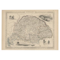
Old Engraved Map of Hungary with Decorative Vignettes, 1851
Located in Langweer, NL
Antique map titled Hungary. Includes decorative vignettes titled Hungarian Peasants, Pesth and the
Category

Antique 19th Century Maps

Materials

Paper

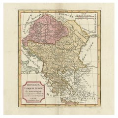
Old Engraved Map of Hungary, European Balkan Countries, Greece and Crete, 1806
Located in Langweer, NL
Antique map titled 'Hongrie, Turquie Europe'. Decorative map of Hungary, southeast European
Category

Antique 19th Century Maps

Materials

Paper

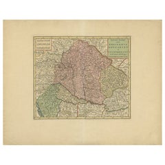
Antique Map of Hungary Incl Surroundings like Croatia, Bosnia, Servia, 1730
Located in Langweer, NL
ontdekkingen'. This map depicts Hungary including surroundings like Croatia, Bosnia, Servia, Bulgaria and
Category

Antique 18th Century Maps

Materials

Paper

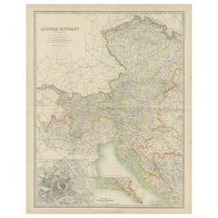
Antique Map of Austria- Hungary by Johnston '1909'
Located in Langweer, NL
Antique map titled 'Austria- Hungary'. Original antique map of Austria- Hungary. With inset maps of
Category

Early 20th Century Maps

Materials

Paper

Antique Map of Austria- Hungary by Johnston, '1909'
Located in Langweer, NL
Antique map titled 'Austria- Hungary'. Original antique map of Austria- Hungary. This map
Category

Early 20th Century Maps

Materials

Paper

Antique Map of Austria-Hungary by Levasseur, '1875'
Located in Langweer, NL
-Hungary. This map originates from 'Atlas de Géographie Moderne Physique et Politique' by A. Levasseur
Category

Antique Late 19th Century Maps

Materials

Paper

Antique Map of the Kingdom of Hungary by Keizer & de Lat, 1788
Located in Langweer, NL
Hungary. This map originates from 'Nieuwe Natuur- Geschied- en Handelkundige Zak- en Reisatlas' by Gerrit
Category

Antique Late 18th Century Maps

Materials

Paper

Antique Map of the Region of Elbogen & Eger, Czech Republic & Hungary, 1742
Located in Langweer, NL
Antique map titled 'Repraesentatio Geographica Circuli Egerani, nec non Elnbogensis : in quo simul
Category

Antique 1740s Maps

Materials

Paper

Map Turkey in Europe & Hungary Thomas Kitchin, 1783
Located in BUNGAY, SUFFOLK
Thomas Kitchen (1718 - 1784) : Map of Turkey in Europe & Hungary 1783 Visible sheet within the
Category

Antique 18th Century English Georgian Maps

Materials

Paper

Antique Map of Germany, Bohemia, Hungary and Part of Poland by R. Bonne ‘1780’
Located in Langweer, NL
Antique map titled "L'Allemagne, La Bohême, et la Hongrie avec une partie de la Pologne" by
Category

Antique Late 18th Century Maps

Materials

Paper

Antique Map of Eastern Europe, Incl Montenegro & Serbia & a Budapest Map, 1890
Located in Langweer, NL
Antique map titled 'Osterreich-Ungarn in 4 Blattern, Blatt 4.' Map of Eastern Europe, with
Category

Antique 1890s Maps

Materials

Paper

Antique Map of Eastern Europe by Stieler, 1890
Located in Langweer, NL
Antique map titled 'Osterreich-Ungarn in 4 Blattern, Blatt 4.' Map of Eastern Europe, with
Category

Antique 19th Century Maps

Materials

Paper

17th Century Nicolas Visscher Map of Southeastern Europe
Located in Hamilton, Ontario
A beautiful, highly detailed map of southeastern Europe by Nicolas Visscher. Includes regions of
Category

Antique 17th Century Dutch Maps

Materials

Paper

Antique Map of Turkey in Europe by Russell, circa 1795
Located in Langweer, NL
Antique map titled 'Turkey in Europe and Hungary'. Original map of Turkey in Europe. Covers present
Category

Antique Late 18th Century Maps

Materials

Paper

Antique Map of the War Situation in Europe and Asia, 1944
Located in Langweer, NL
Antique map titled 'Newsmap for the Armed Forces'. This "newsmap" was issued on Monday, December 18
Category

20th Century Maps

Materials

Paper

Antique Map of Germany During the Mid-18th Century, Published in 1747
Located in Langweer, NL
Antique map Germany titled 'A New & Accurate Map of Germany'. It covers Germany during the mid-18th
Category

Antique 18th Century Maps

Materials

Paper

Hand Colored 18th Century Homann Map of Austria Including Vienna and the Danube
By Johann Baptist Homann
Located in Alamo, CA
"Archiducatus Austriae inferioris" is a hand colored map of Austria created by Johann Baptist
Category

Antique Early 18th Century German Maps

Materials

Paper

Southern & Eastern Europe: A Large 17th C. Hand-colored Map by Sanson & Jaillot
By Nicolas Sanson
Located in Alamo, CA
This large hand-colored map entitled "Estats de L'Empire des Turqs en Europe, ou sont les
Category

Antique 1690s French Maps

Materials

Paper

Original Copper Engraving of Koroni 'or Corone', Greece, 1688
Located in Langweer, NL
contemporary eyewitness accounts of the Balkans (Hungary, Dalmatia, Greece) during 1683-88. Artists and
Category

Antique 1680s Maps

Materials

Paper

View of the Island Onrust Near Batavia 'Jakarta', Indonesia, 1739
Located in Langweer, NL
Netherlands were attacked by Germany. In the Dutch East Indies thousands of Germans, Hungarians, Czechs
Category

Antique 1730s Maps

Materials

Paper

Old Engraving of the Trarbach Battle in Rhineland-Palatinate, Germany, c.1710
Located in Langweer, NL
French armies and those of its Bavarian allies, together with a revolt in Austrian-controlled Hungary
Category

Antique 1710s Maps

Materials

Paper

Original Vintage Travel Poster Visit Hungary Pictorial Map Budapest Lake Balaton
Located in London, GB
Original vintage travel poster - Visit Hungary! - featuring a pictorial map of the country
Category

Vintage 1960s Hungarian Posters

Materials

Paper

Antique Portrait of Matthias I of Hungary by Janszoon, 1615
Located in Langweer, NL
Antique portrait titled 'Matthias I (..)'. Portrait of Matthias I of Hungary. This print originates
Category

Antique 17th Century Prints

Materials

Paper

Antique Portrait of Ferdinand II by Goltzius, 1645
Located in Langweer, NL
, King of Bohemia and King of Hungary. This print originates from 'Icones Imperatorvm Romanorvm (..)' by
Category

Antique 17th Century Prints

Materials

Paper

Original Antique World War One Poster Hark The Dogs Do Bark WWI Dogs Of War
Located in London, GB
- featuring a serio-comic map of Europe at war with military soldier caricature portraits and some countries
Category

Vintage 1910s British Posters

Materials

Paper

Antique Brass Czech Orrery Astronomical Instruments Made by Jan Felkl in 1870
By Jan Felkl
Located in Milan, IT
the nineteenth century. Cast iron base, papier mâché´ globe, with detailed territorial map and oceanic
Category

Antique 1860s Czech Scientific Instruments

Materials

Iron

1970s Framed Antique Map of Hungaria Hungary 1629 Original
Located in Nuernberg, DE
Hungary. Map is dated 1629 and approx. 7 ¼" wide and 6 ?" high in viewable size. Framed in a handmade
Category

Vintage 1970s Decorative Art

Materials

Glass, Wood

Rare 1710 Hand-Colored Map of Europe
By Frederick de Wit
Located in La Jolla, CA
this state of the map is similar to an example in a 150 map De Wit Atlas in the Hungarian State Library
Category

Antique 1710s Dutch Northern Renaissance Prints

Materials

Paper

Old Map of the Austro-Hungarian Empire with an Inset Map Dalmatia, 1882
Located in Langweer, NL
Antique map titled 'Austro-Hungarian Monarchy'. Old map of the Austro-Hungarian Empire with an
Category

Antique 1880s Maps

Materials

Paper

Antique Map of Austria and Hungary by Ortelius, c.1590
Located in Langweer, NL
map of Austria and Hungary, following the Danube from Lintz to Bratislava and extending north to the
Category

Antique 16th Century Maps

Materials

Paper

Old Map of the Austro-Hungarian Monarchy with an Inset of Vienna, 1882
Located in Langweer, NL
Antique map titled 'Austro-Hungarian Monarchy'. Old map of the Austro-Hungarian Monarchy with
Category

Antique 1880s Maps

Materials

Paper

Antique Map of Poland and Lithuania, c.1744
Located in Langweer, NL
Antique map titled 'A New and Accurate Map of Poland, Lithuania & c'. Old map of Poland and
Category

Antique 18th Century Maps

Materials

Paper

Antique Map of the Austrian Empire by A.K. Johnston, 1865
Located in Langweer, NL
Antique map titled 'Austrian Empire (Eastern Sheet)'. Depicting Hungary, Servia, Transylvania and
Category

Antique Mid-19th Century Maps

Materials

Paper

Six Framed Maps of Europe
Located in Essex, MA
, Hungary by Guillaume De Lisle , Spain By De Lisle.
Category

Antique 1680s European Decorative Art

Six Framed Maps of Europe
H 30 in W 34 in D 1 in
Imperial Map Desk of the Habsburg Empire
Located in New Orleans, LA
This monumental, one-of-a-kind map desk hails from the Imperial Palace of the Habsburg Emperor
Category

Antique 19th Century Austrian Other Desks

Materials

Wood, Satinwood, Walnut

Original Vintage Imperial Airways Poster - Map Of Empire And European Air Routes
By László Moholy-Nagy
Located in London, GB
Beck; 1902-1974) recent 1931 London Underground tube map design. Artwork by the Hungarian artist and
Category

Vintage 1930s British Posters

Materials

Paper

A Desk Top Terrestrial Globe by Geographica Ltd
Located in London, GB
Deansgate, Manchester. Literature: Geographia Ltd was a prolific London-based publisher of globes, maps
Category

Early 20th Century English Globes

Materials

Wood, Paper

Important Art Deco Mural by Pierre Van Parys Bourdelle Imagination Arienne 1939
Located in St. Louis, MO
fronts in the dome-buffet and lounge-observation cars, a wall map of the CZ's route in the buffet's
Category

Vintage 1930s Unknown Art Deco Paintings

Materials

Canvas

Antique Map of Hungary and Transylvania by Lowry, 1852
Located in Langweer, NL
Antique map titled 'Hungary and Transylvania'. Two individual sheets of Hungary and Transylvania
Category

Antique Mid-19th Century Maps

Materials

Paper

Set of 2 Old Maps of the Austro-Hungarian Empire , 1882
Located in Langweer, NL
Antique map titled 'Austro-Hungarian Monarchy'. Old map of the Austro-Hungarian Empire with an
Category

Antique 1880s Maps

Materials

Paper

Set of 2 Old Maps of the Austro-Hungarian Empire , 1882
Free Shipping
H 24.1 in W 19.49 in D 0 in
19th Century Map Imperial Court of Austria Habsburgs
Located in London, GB
This is an antique map of the State of the Imperial Court and the hereditary states of the House of
Category

Antique 1820s Spanish Maps

A Set of Two Late 18th-Century Wall Maps in Original Wood Mounts
Located in Kinderhook, NY
A wonderful set of two 18th century European wall maps in original wood mounts having cove-mold
Category

Antique Late 18th Century European Maps

Antique Rare Mechanical Orrery, Astronomical Instrument by Jan Felkl Praga 1870
By Jan Felkl
Located in Milan, IT
biggest maker of globes in market Austro-Hungarian, making terrestrial and celestial globes in 17
Category

Antique 1860s Czech Globes

Materials

Brass

Early 20th Century 8” Terrestrial Table Globe ‘Geographia’, circa 1920-1925
By Geographia, Ltd.
Located in Bedford, Bedfordshire
truculent Hungarian immigrant." The firm produced street maps and atlases of all the major cities in the
Category

Vintage 1920s English High Victorian Globes

Materials

Wood, Paper

Hungarian Globe on Bronze Atlas Figurine and Black Marble Footbase, circa 1920
Located in Unteriberg, Schwyz
world around 1920, the most famous map maker, Lajos Kókai, the cartouche of the globe: "Dr. Janos Takács
Category

Vintage 1920s Hungarian Art Deco Globes

Materials

Marble, Bronze

Get Updated with New Arrivals
Save "Map Of Hungary", and we’ll notify you when there are new listings in this category.

Map Of Hungary For Sale on 1stDibs

Choose from an assortment of styles, material and more with respect to the map of hungary you’re looking for at 1stDibs. A map of hungary — often made from paper, glass and wood — can elevate any home. Your living room may not be complete without a map of hungary — find older editions for sale from the 18th Century and newer versions made as recently as the 20th Century.

How Much is a Map Of Hungary?

A map of hungary can differ in price owing to various characteristics — the average selling price 1stDibs is $303, while the lowest priced sells for $50 and the highest can go for as much as $595.

Read More

Pamela Shamshiri Shares the Secrets behind Her First-Ever Book and Its Effortlessly Cool Interiors

The sought-after designer worked with the team at Hoffman Creative to produce a monograph that beautifully showcases some of Studio Shamshiri's most inspiring projects.

Moroccan Artworks and Objects Take Center Stage in an Extraordinary Villa in Tangier

Italian writer and collector Umberto Pasti opens the doors to his remarkable cave of wonders in North Africa.

Montecito Has Drawn Royalty and Celebrities, and These Homes Are Proof of Its Allure

Hollywood A-listers, ex-pat aristocrats and art collectors and style setters of all stripes appreciate the allure of the coastal California hamlet — much on our minds after recent winter floods.

Whaam! Blam! Pow! — a New Book on Pop Art Packs a Punch

Publishing house Assouline and writer Julie Belcove have teamed up to trace the history of the genre, from Roy Lichtenstein, Andy Warhol and Yayoi Kusama to Mickalene Thomas and Jeff Koons.

The Sparkling Legacy of Tiffany & Co. Explained, One Jewel at a Time

A gorgeous new book celebrates — and memorializes — the iconic jeweler’s rich heritage.

What Makes a Gem-Encrusted Chess Set Worth $4 Million?

The world’s most opulent chess set, weighing in at 513 carats, is literally fit for a king and queen.

Tauba Auerbach’s Geometric Pop-Up Book Is Mighty Rare, Thanks to a Hurricane

This sculptural art book has an epic backstory of its own.

Step inside the Storied Mansions of Palm Beach’s Most Effervescent Architect

From Spanish-style courtyards to fanciful fountains, these acclaimed structures abound in surprising and elegant details.