Bohemia Map
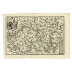
Antique Uncommon Map of Bohemia, Moravia and Silesia, 1699
Located in Langweer, NL
Antique map titled 'B. V. Boleslaviensis in Bohemia, Moravia et Silesia (..).' Detailed uncommon
Category
Antique 17th Century Maps
Materials
Paper
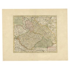
Antique Map of Bohemia in the Present-Day Chech Repubic, 1730
Located in Langweer, NL
Moravien (Moravia) en Lusatien' (Lusatia). Map of Bohemia (Czech Republic) with the surrounding regions
Category
Antique 18th Century Maps
Materials
Paper
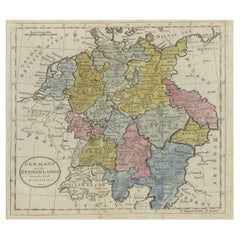
Antique Map of Germany, the Netherlands, Bohemia, Bavaria and Switzerland, 1785
Located in Langweer, NL
Antique map titled 'Germany and the Netherlands from the latest authorities'. Depicts Germany, the
Category
Antique 18th Century Maps
Materials
Paper
H 8.27 in W 10.24 in D 0 in
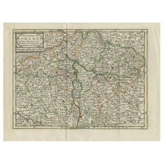
Antique Map of the Kingdom of Bohemia by Keizer & de Lat, 1788
Located in Langweer, NL
Bohemia. This map originates from 'Nieuwe Natuur- Geschied- en Handelkundige Zak- en Reisatlas' by Gerrit
Category
Antique Late 18th Century Maps
Materials
Paper
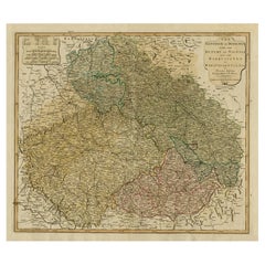
Original Map of the Kingdom of Bohemia, with Silesia, Moravia and Lusatia, 1804
Located in Langweer, NL
Antique map titled 'The Kingdom of Bohemia with the Duchy of Silesia and the Marquisates of Moravia
Category
Antique Early 1800s Maps
Materials
Paper
H 21.38 in W 27.37 in D 0 in
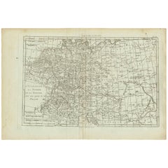
Antique Map of Germany, Bohemia, Hungary and Part of Poland by R. Bonne ‘1780’
Located in Langweer, NL
Antique map titled "L'Allemagne, La Bohême, et la Hongrie avec une partie de la Pologne" by
Category
Antique Late 18th Century Maps
Materials
Paper
H 10.24 in W 15.04 in D 0.02 in
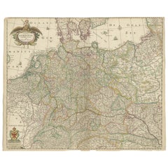
Antique Map of Germany including surrounding countries
Located in Langweer, NL
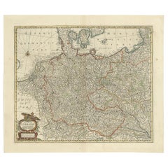
Antique map titled 'Tabula Germaniae'. Orginal antique map of Germany by Claes Jansz. Visscher
Category
Antique Mid-17th Century Maps
Materials
Paper
17th Century Nicolas Visscher Map of Southeastern Europe
Located in Hamilton, Ontario
A beautiful, highly detailed map of southeastern Europe by Nicolas Visscher. Includes regions of
Category
Antique 17th Century Dutch Maps
Materials
Paper
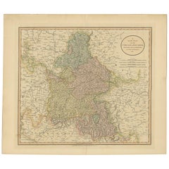
Antique Map of Bavaria and Salzburg by Cary, 1811
By John Cary
Located in Langweer, NL
Antique map titled 'A New Map of the Circle of Bavaria'. Antique map of Bavaria and Salzburg
Category
Antique Early 19th Century Maps
Materials
Paper
Antique Map of Germany by J.B. Elwe, 1792
Located in Langweer, NL
Antique map titled 'Germanie vulgo Duitschland (..)'. Decorative map of Germany with Silesia
Category
Antique Late 18th Century Maps
Materials
Paper
Antique Map of the German Empire, Johannes Janssonius van Waesbergen, circa 1670
Located in Langweer, NL
Antique map titled 'Nova Totius Germaniae Descriptio'. Uncommon map of the German Empire including
Category
Antique Late 17th Century Maps
Materials
Paper
H 20.48 in W 23.43 in D 0.02 in
Hand-Colored 18th Century Homann Map of the Danube, Italy, Greece, Croatia
By Johann Baptist Homann
Located in Alamo, CA
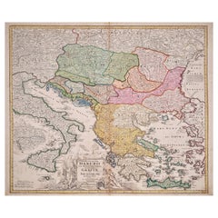
"Fluviorum in Europa principis Danubii" is a hand colored map of the region about the Danube river
Category
Antique Early 18th Century German Maps
Materials
Paper
H 20 in W 23.88 in D 0.07 in
Antique Map of the Danube River and Surroundings by Homann Heirs, c.1730
By Homann Heirs
Located in Langweer, NL
Bavaria and Bohemia, to Provence in the west, and modern day Albania in the east. This highly detailed map
Category
Antique 18th Century Maps
Materials
Paper
H 21.15 in W 25.01 in D 0 in
Hand Colored 18th Century Homann Map of Austria Including Vienna and the Danube
By Johann Baptist Homann
Located in Alamo, CA
"Archiducatus Austriae inferioris" is a hand colored map of Austria created by Johann Baptist
Category
Antique Early 18th Century German Maps
Materials
Paper
H 20.25 in W 23.63 in D 0.07 in
Original Vintage Travel Poster Eastern Bohemia Vychodni Cechy Map Czechoslovakia
Located in London, GB
Original vintage travel map for Eastern Bohemia / Vychodni Cechy featuring route lines through the
Category
Vintage 1960s Czech Posters
Materials
Paper
H 25.6 in W 37.41 in D 0.04 in
Hand Colored 18th Century Homann Map of Austria Including Vienna & the Danube
By Johann Baptist Homann
Located in Alamo, CA
"Archiducatus Austriae inferioris" is a hand colored map of Austria created by Johann Baptist
Category
Early 18th Century Old Masters Landscape Prints
Materials
Engraving
Charte von Sud-America (Map of South America) - Etching with Hand-Drawn Outlines
Located in Soquel, CA
Map of south America, engraved by Franz Pluth (Czech, 1800-1871), from the book "Neueste Länder
Category
1820s Other Art Style More Prints
Materials
Paper, Printer's Ink, Etching
H 23 in W 19 in D 0.75 in
Danube River, Italy, Greece and Croatia: A Hand-colored 18th C. Homann Map
By Johann Baptist Homann
Located in Alamo, CA
"Fluviorum in Europa principis Danubii" is a hand colored map of the region about the Danube river
Category
Early 18th Century Old Masters Landscape Prints
Materials
Engraving
H 20 in W 23.88 in D 0.07 in
Antique Portrait of Ferdinand II by Goltzius, 1645
Located in Langweer, NL
, King of Bohemia and King of Hungary. This print originates from 'Icones Imperatorvm Romanorvm (..)' by
Category
Antique 17th Century Prints
Materials
Paper
Rare Classic Biedermeier Gilded Count Buquoy Hyalith (True black) Scent Bottle
By Harrach Glassworks
Located in Worcester Park, GB
in Southern Bohemia, Stribrny Vrch (Silberberg) -Black glass was one of the first innovate techniques
Category
Antique 1820s Czech Biedermeier Glass
Materials
Art Glass
H 3 in W 3.5 in D 3.5 in
Antique Brass Czech Orrery Astronomical Instruments Made by Jan Felkl in 1870
By Jan Felkl
Located in Milan, IT
the nineteenth century. Cast iron base, papier mâché´ globe, with detailed territorial map and oceanic
Category
Antique 1860s Czech Scientific Instruments
Materials
Iron
H 18.9 in W 29.53 in D 11.03 in
"Under the Apple Tree", Figurative Chromolithograph after George Niles, 188/250
By Louis Prang
Located in Soquel, CA
fled via Bohemia and Switzerland to get to America.
In 1850, Prang went to Boston, having stopped
Category
Late 19th Century American Impressionist Figurative Prints
Materials
Lithograph, Cardboard
H 12.75 in W 10.75 in D 1.25 in
Original Vintage Travel Poster Eastern Bohemia Vychodni Cechy Map Czechoslovakia
Located in London, GB
Original vintage travel map for Eastern Bohemia / Vychodni Cechy featuring route lines through the
Category
1960s More Prints
Materials
Paper
People Also Browsed
Swiss Splendor: Antique Map of Switzerland and Its Cantons, 1852
Located in Langweer, NL
The antique map titled 'Carte de la Suisse' is an attractive map of Switzerland. Here are the key details and features of the map:
1. **Geographic Coverage**:
- The map provides ...
Category
Antique Mid-19th Century Maps
Materials
Paper
Antique Map of Switzerland by N. Visscher, circa 1690
Located in Langweer, NL
Beautifully detailed map of Switzerland and surrounding regions in present-day France, Germany, and Italy. This map features two decorative cartouches: the larger is flanked by two p...
Category
Antique Late 17th Century Maps
Materials
Paper
Italian Parchment Map of the City of Pisa Dated, 1640
By Matthäus Merian the Elder
Located in Roma, IT
An antique map of the Tuscan city of Pisa engraved for The 'Itinerarium Italiæ Nov-antiquæ' by Matthäus Merian the Elder and printed in 1640. The original paper from 1640 is well pre...
Category
Antique 1640s Italian Maps
Materials
Paper
Italian Parchment Map of the City of Lucca Dated 1640
By Matthäus Merian the Elder
Located in Roma, IT
An antique map of the Tuscan city of Lucca engraved for The 'Itinerarium Italiæ Nov-antiquæ' by Matthäus Merian the Elder and printed in 1640. The original paper from 1640 is well pr...
Category
Antique 1640s Italian Maps
Materials
Parchment Paper, Paper
Antique Map of Switzerland by J. Tallis, circa 1851
Located in Langweer, NL
A decorative and detailed mid-19th century map of Switzerland which was drawn and engraved by J. Rapkin (vignettes by A. H. Wray & J. B. Allen) and published in John Tallis's Illustr...
Category
Antique Mid-19th Century Maps
Materials
Paper
Southern & Eastern Europe: A Large 17th C. Hand-colored Map by Sanson & Jaillot
By Nicolas Sanson
Located in Alamo, CA
This large hand-colored map entitled "Estats de L'Empire des Turqs en Europe, ou sont les Beglerbeglicz our Gouvernements" was originally created by Nicholas Sanson d'Abbeville and t...
Category
Antique 1690s French Maps
Materials
Paper
H 24.88 in W 38 in D 0.13 in
Original Antique Hand-Colored Map of Friesland by C. Merian, 1659
Located in Langweer, NL
This is a hand-colored engraving of the province of Friesland in the Netherlands, created by the Swiss-born engraver and artist Matthäus Merian (1593–1650) and included in "Topograph...
Category
Antique Mid-17th Century Maps
Materials
Paper
Free Shipping
H 11.74 in W 14.3 in D 0.02 in
Antique Map of Switzerland by N. Visscher, circa 1690
Located in Langweer, NL
Antique map titled 'Tabula Geogaphica qua Pars Meridionalis sive Superior Rheni, Mosae, et Mosellae (..)'. Published by N. Visscher, Amsterdam, circa 1690. Contemporary coloring.
Category
Antique Late 17th Century Maps
Materials
Paper
Antique Map of Switzerland by J. van Waesbergen, circa 1680
Located in Langweer, NL
Antique map titled 'Vera totius marchionatus Badensis, et Hochbergensis ; ceterorumque ducatuum ladngravionatuum et comitatuum ad principes huius nominis spectantium geometr: astro: ...
Category
Antique Late 17th Century Maps
Materials
Paper
Antique Map of the Kanton Luzerne 'Switzerland' by Homann Heirs, 1763
Located in Langweer, NL
Antique map titled 'Canton Lucern (..)'. Fine decorative copper plate engraved antique map of the Canton of Lucerne in Central Switzerland with pictorial cartouche in top right corne...
Category
Antique Mid-18th Century Maps
Materials
Paper
Beautiful Original Copper Engraved Map of Lake Geneva in Switzerland, 1613
Located in Langweer, NL
Description: Antique map titled 'Lacus Lemanus'.
Old map of Lake Geneva with good detail of surrounding towns and villages. Decorated with a large compass rose with two sailing b...
Category
Antique 1610s Maps
Materials
Paper
Original Antique Map of Switzerland, 1882
Located in Langweer, NL
Embark on a historical journey with an original Antique Map of Switzerland from the renowned 'Comprehensive Atlas and Geography of the World,' meticulously crafted in 1882. This exqu...
Category
Antique 1880s Maps
Materials
Paper
Antique Map of Switzerland by J.B. Homann, 1751
By Johann Baptist Homann
Located in Langweer, NL
Decorative example of Homann's map of Switzerland, with decorative cartouche and the coat of arms of each of the 13 Cantons.
Category
Antique Mid-18th Century Maps
Materials
Paper
Antique Map of Switzerland by Johnston, 1882
Located in Langweer, NL
Antique map titled 'Switzerland and the Alps of Savoy and Piedmont'. Old map of Switzerland and the Alps of Savoy and Piedmont. This map originates from 'The Royal Atlas of Modern Ge...
Category
Antique 19th Century Maps
Materials
Paper
Antique Map of Switzerland by Homann, 1753
Located in Langweer, NL
Antique map Switzerland titled 'Territorium Reipublicae liberae Helveticae Scaphusiensis (..)'. Regional map of Switzerland. Artists and Engravers: Homann Heirs was a German publishi...
Category
Antique 18th Century Maps
Materials
Paper
Colourful Antique Map of Switzerland, 1846
Located in Langweer, NL
Antique map titled 'Switzerland'. Old map of Switzerland.
This map originates from 'A New Universal Atlas Containing Maps of the various Empires, Kingdoms, States and Republics O...
Category
Antique 1840s Maps
Materials
Paper
Recent Sales
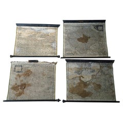
Group of Four 18thC German Maps by Johann Baptist Homann Dated from 1720-1757
By Johann Baptist Homann
Located in Bedford, Bedfordshire
. B. Homann/Homann Erben Nuremberg Map of Bohemia
1730 J. B. Homann/ Homann Erben, Nuremberg Map of
Category
Antique Mid-18th Century German Rococo Maps
Materials
Parchment Paper
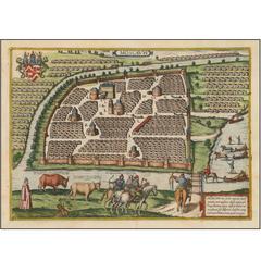
One of the Earliest Views of Moscow
By Georg Braun and Frans Hogenberg
Located in La Jolla, CA
is depicted with its many churches. The map shows illustrations of people riding horse-drawn sleighs
Category
Antique 16th Century German Northern Renaissance Prints
Materials
Paper
Antique Map of the Leitmeritzer Kreis by Schreiber, 1749
Located in Langweer, NL
, Bohemia. This map originates from 'Atlas Selectus von allen Konigreichen und Landern der Welt' by Johann
Category
Antique 18th Century Maps
Materials
Paper
Antique Map of the Austrian Empire ‘West’ by A.K. Johnston, 1865
Located in Langweer, NL
Antique map titled 'Austrian Empire (Western Sheet)'. Depicting Dalmatia, Istria, Croatia, Bohemia
Category
Antique Mid-19th Century Maps
Materials
Paper
Hand Colored 18th Century Homann Map "Bohemiae" of the Modern Day Czech Republic
By Johann Baptist Homann
Located in Alamo, CA
This is a hand colored 18th century map of the modern day Czech Republic and the southern portions
Category
Early 18th Century Other Art Style Landscape Prints
Materials
Engraving
H 27.75 in W 31.13 in D 0.88 in
19th Century Map Imperial Court of Austria Habsburgs
Located in London, GB
This is an antique map of the State of the Imperial Court and the hereditary states of the House of
Category
Antique 1820s Spanish Maps
Antique Map of Austria by J. Tallis, circa 1851
Located in Langweer, NL
A highly decorative and finely engraved mid-19th century map of Austria (including Bohemia) that
Category
Antique Mid-19th Century Maps
Antique Rare Mechanical Orrery, Astronomical Instrument by Jan Felkl Praga 1870
By Jan Felkl
Located in Milan, IT
. Very good condition and perfectly working.
Jan Felkl (1817-1878) was born in Bohemia and already in
Category
Antique 1860s Czech Globes
Materials
Brass
H 18.51 in W 23.63 in D 7.09 in
Get Updated with New Arrivals
Save "Bohemia Map", and we’ll notify you when there are new listings in this category.
Bohemia Map For Sale on 1stDibs
With a vast inventory of beautiful furniture at 1stDibs, we’ve got just the bohemia map you’re looking for. Frequently made of paper, metal and brass, every bohemia map was constructed with great care. Whether you’re looking for an older or newer bohemia map, there are earlier versions available from the 18th Century and newer variations made as recently as the 19th Century. Johann Baptist Homann, Jan Felkl and Homann Heirs each produced at least one beautiful bohemia map that is worth considering.
How Much is a Bohemia Map?
A bohemia map can differ in price owing to various characteristics — the average selling price 1stDibs is $675, while the lowest priced sells for $99 and the highest can go for as much as $12,984.
