1785 Maps
5
to
17
63
10
44
42
30
27
15
9
5
2
2
2
1
1
1
1
1
1
1
2
1
1
1
1
Sort By
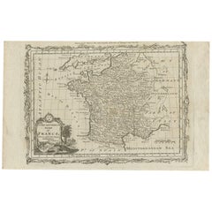
Antique Map of France by T. Bowen, 1785
Located in Langweer, NL
Decorative antique map of France titled 'A new and accurate map of France, Drawn from the latest
Category
Antique Late 18th Century Maps
Materials
Paper
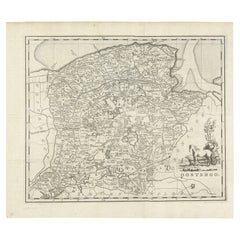
Antique Map of Oostergo, Friesland by Tirion, 1785
Located in Langweer, NL
Antique map Friesland titled 'Oostergo'. Antique map of part of Friesland depicting the 'Oostergo
Category
Antique 18th Century Maps
Materials
Paper
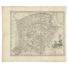
Antique Map of Oostergo, Friesland by Tirion, 1785
Located in Langweer, NL
Antique map Friesland titled 'Oostergo'. Antique map of part of Friesland depicting the 'Oostergo
Category
Antique 18th Century Maps
Materials
Paper
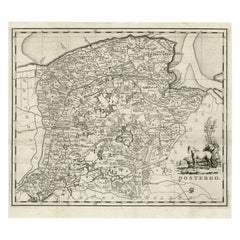
Antique Map of Oostergo, Friesland by Tirion, 1785
Located in Langweer, NL
Antique map Friesland titled 'Oostergo'. Antique map of part of Friesland depicting the 'Oostergo
Category
Antique 18th Century Maps
Materials
Paper
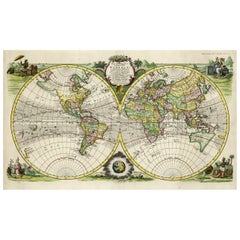
Rare Original Double Hemisphere World Map with Allegorical Figures, 1785
Located in Langweer, NL
the maps of Bachiene were published in 1785 by the Amsterdamse publisher Schalekamp under the title
Category
Antique 1780s Maps
Materials
Paper
H 17.05 in W 23.23 in D 0 in
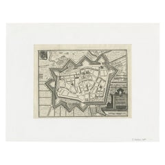
Antique Map of the City of Leeuwarden by Christyn, 1785
Located in Langweer, NL
Antique map titled 'La Ville de Lewarde'. Old map of the city of Leeuwarden, Friesland. Originates
Category
Antique 18th Century Maps
Materials
Paper
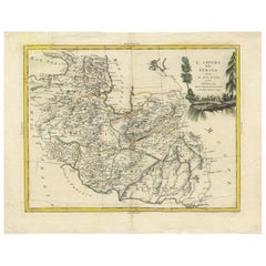
Antique Map of Persia by A. Zatta, circa 1785
Located in Langweer, NL
Antique map titled 'L'Impero della Persia diviso ne suoi Stati'. The Empire of Persia divided into
Category
Antique Late 18th Century Maps
Materials
Paper
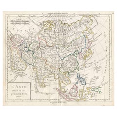
Antique French Map of Asia with Original Border Colouring, c.1785
Located in Langweer, NL
Antique map titled 'L'Asie divisee en ses principaux Etats.' (Map of Asia and its principal states
Category
Antique 18th Century Maps
Materials
Paper
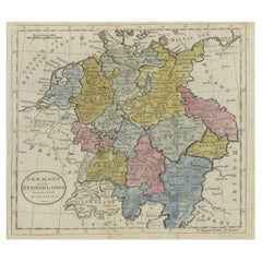
Antique Map of Germany, the Netherlands, Bohemia, Bavaria and Switzerland, 1785
Located in Langweer, NL
Antique map titled 'Germany and the Netherlands from the latest authorities'. Depicts Germany, the
Category
Antique 18th Century Maps
Materials
Paper
H 8.27 in W 10.24 in D 0 in
Antique Engraved Map of the Friendly Islands or Tonga, ca.1785
Located in Langweer, NL
Antique map titled 'Carte des Isles des Amis'.
Map of the Friendly Islands / Tonga. The Tongan
Category
Antique 1780s Maps
Materials
Paper
Antique Map of the Northern Coast of Tongatapu by Benard, c.1785
Located in Langweer, NL
.
Date: c.1785
Overall size: 43 x 25 cm.
Image size: 39.7 x 22.3 cm.
We sell original antique maps
Category
Antique 18th Century Maps
Materials
Paper
Uncommon Old Map of Lapland to Russia and Denmark to Kazan in the South, 1785
Located in Langweer, NL
Description: Antique map titled 'Kaart van het Noorderdeel van Europa, Bevattende Deenmarken
Category
Antique 1780s Maps
Materials
Paper
H 10.04 in W 14.73 in D 0 in
Old Map of the East Coast of Honshu with an Inset, Japan, c.1785
Located in Langweer, NL
Antique map titled ‘Part of Japan or Nippon'.
View of the Coast of Japan when we first saw it
Category
Antique 1780s Maps
Materials
Paper
Decorative Antique Map of Central Asia
Located in Langweer, NL
Antique map titled 'Carte de la Tartarie Indépendante (..)'. Decorative map of Central Asia
Category
Antique Late 18th Century Maps
Materials
Paper
Antique Map of India and Ceylon, along with the Maldives
Located in Langweer, NL
Antique map titled 'Stato del Mogol con l'Isole di Ceilan e Maldive'. Beautiful map of India and
Category
Antique Late 18th Century Maps
Materials
Paper
Antique Map of the City of Leeuwarden by Harrewijn, 1743
Located in Langweer, NL
Antique map titled 'La Ville de Lewarde'. Old map of the city of Leeuwarden, Friesland. Originates
Category
Antique 18th Century Maps
Materials
Paper
Antique Map of the Islands of Iwo Jima and Sulfur
Located in Langweer, NL
Untitled Antique Map of the islands of Iwo Jima and Sulfur, with a view of Sulphur with the hill
Category
Antique Late 18th Century Maps
Materials
Paper
Antique Map of the Eastern United States with Inset Map of Texas
Located in Langweer, NL
Antique map titled 'Verein-Staaten von Nord-America mit Ausnahme Florida's und der Westlichen
Category
Antique Mid-19th Century Maps
Materials
Paper
Antique Map of the Region of Georgia with Inset Maps of Florida and Texas
Located in Langweer, NL
Antique map of part of the United States showing Alabama, Georgia, North Carolina, South Carolina
Category
Antique Late 19th Century Maps
Materials
Paper
H 15.04 in W 18.63 in D 0.02 in
Antique Map of the United States with inset map of the region of Mexico City
Located in Langweer, NL
Antique map titled 'Verein-Staaten von Nord-America, Mexico, Yucatan u.a.'. Very detailed map of
Category
Antique Mid-19th Century Maps
Materials
Paper
H 14.69 in W 17.92 in D 0.02 in
Set of Two Antique Maps of South America with Inset Maps of Rio de Janeiro
Located in Langweer, NL
Set of two antique maps titled 'Süd-America in zwei Blättern'. Two individual sheets of South
Category
Antique Mid-19th Century Maps
Materials
Paper
Free Shipping
H 14.57 in W 17.88 in D 0.02 in
Original Antique Map of Ancient Greece- Boeotia, Thebes, 1787
Located in St Annes, Lancashire
Great map of Ancient Greece. Showing the region of Boeotia, including Thebes
Drawn by J.D
Category
Antique 1780s French Other Maps
Materials
Paper
Antique Map of the Queen Charlotte Islands, Haida Gwaii
Located in Langweer, NL
Antique map titled 'Isles de la Reine Charlotte (..)'. Original old map of the Queen Charlotte
Category
Antique Late 18th Century Maps
Materials
Paper
Antique Map of North America Including the West Indies
Located in Langweer, NL
Original antique map titled 'Nord-America'. Old map of North America and the West Indies. Also
Category
Antique Mid-19th Century Maps
Materials
Paper
Antique Map of Tennessee, Kentucky, Virginia, Alabama, Georgia and Surroundings
Located in Langweer, NL
Antique map of part of the United States showing Alabama, Georgia, North Carolina, South Carolina
Category
Antique Mid-19th Century Maps
Materials
Paper
Free Shipping
H 15.16 in W 18.71 in D 0.02 in
Antique Map of South America with Many Details, ca.1859
Located in Langweer, NL
Original antique map titled 'Süd-America'. Beautiful old map of South America, with many details
Category
Antique Mid-19th Century Maps
Materials
Paper
Original Antique Map of Ancient Greece, Phocis, Gulf of Corinth, 1787
Located in St Annes, Lancashire
Great map of Ancient Greece. Showing the region of Phocis, including the Gulf of Corinth
Drawn
Category
Antique 1780s French Other Maps
Materials
Paper
No Reserve
H 10 in W 14 in D 0.07 in
Antique Map with Hand Coloring of the United States and the Caribbean
Located in Langweer, NL
Antique map titled 'Verein-Staaten von Nord-America, Mexico, Yucatan u.a.'. Very detailed map of
Category
Antique Late 19th Century Maps
Materials
Paper
H 15.08 in W 18.71 in D 0.02 in
Antique Map of the United States of America, also showing the Caribbean
Located in Langweer, NL
Antique map titled 'Verein-Staaten von Nord-America, Mexico, Yucatan u.a.'. Very detailed map of
Category
Antique Mid-19th Century Maps
Materials
Paper
H 14.38 in W 17.88 in D 0.02 in
Antique Map with Hand Coloring of North America and the West Indies
Located in Langweer, NL
Original antique map titled 'Nord-America'. Old map of North America and the West Indies.
This
Category
Antique Late 19th Century Maps
Materials
Paper
Free Shipping
H 15.08 in W 18.78 in D 0.02 in
Antique Map of Part of the United States Including Lower California & Arizona
Located in Langweer, NL
Antique map of part of the United States of America including Lower California, Arizona and part of
Category
Antique Late 19th Century Maps
Materials
Paper
H 15.08 in W 18.75 in D 0.02 in
Set of 4 Antique Maps of part of the United States of America
Located in Langweer, NL
Set of four individual antique maps of part of the United States. Published as part of a set of six
Category
Antique Mid-19th Century Maps
Materials
Paper
Set of two Antique Maps of the region of Oregon, Idaho, Wyoming, Nebraska & Iowa
Located in Langweer, NL
Set of two individual antique maps of part of the United States. It shows the region and
Category
Antique Late 19th Century Maps
Materials
Paper
H 15.12 in W 18.82 in D 0.02 in
Antique Map of the Eastern United States with Only the Northern Part of Florida
Located in Langweer, NL
Antique map titled 'Verein-Staaten von Nord-America mit Ausnahme Florida's und der Westlichen
Category
Antique Mid-19th Century Maps
Materials
Paper
H 14.45 in W 17.92 in D 0.02 in
Original Old China Map, From Korea and the Sea of Japan to Teypin Island, 1803
Located in Langweer, NL
Antique map titled 'China, Contains 15 Subject Provinces Including the 2 Islands of Hainan, Formosa
Category
Antique Early 1800s Maps
Materials
Paper
H 10.63 in W 12.01 in D 0 in
Antique Map of The Bay of D'Estaing located on the Russian island Sakhalin, 1798
Located in Langweer, NL
Antique map titled 'Plan of La Baie d'Estaing'.
This map shows the bay of D'Estaing located on
Category
Antique 1790s Maps
Materials
Paper
H 16.34 in W 14.38 in D 0 in
Map of Ancient Greece - Original Etching by Antonio Zatta - 1785
Located in Roma, IT
This Map of ancient Greek is an etching realized by Antonio Zatta in Venice in 1785.
The state of
Category
1770s Landscape Prints
Materials
Etching
H 16.54 in W 12.8 in D 0.04 in
Antique Map of Kerguelens Island Coast in the Indian Ocean by Cook, 1785
By James Cook
Located in Langweer, NL
Antique print titled 'Kerguelen's Land (..)'. Antique map of Kerguelens island coast, known today
Category
Antique 18th Century Prints
Materials
Paper
Topographical Map of Pompeii, 1785, by Francesco Piranesi, Reprint
By Francesco Piranesi
Located in Larchmont, NY
Francesco Piranesi (Italian, 1758-1810)
Topographical Map of Pompeii
Originally executed 1785
Category
1780s Realist More Art
Materials
Engraving
H 48.25 in W 26.325 in D 1.5 in
Antique Plan of Dunkirk by Basire 'c.1785'
Located in Langweer, NL
Antique map titled 'Plan of the city and citadel of Dunkirk (..)'. Original antique plan of Dunkirk
Category
Antique Early 18th Century Prints
Materials
Paper
Antique Chart of the Friendly Islands or Tonga in the Pacific Ocean, 1785
By James Cook
Located in Langweer, NL
Antique print titled 'Chart of the Friendly Islands'. Antique map of the Friendly Islands depicting
Category
Antique 18th Century Prints
Materials
Paper
H 12.21 in W 19.3 in D 0 in
Cemetery on Amsterdam Island, French Territory in the Indian Ocean, ca.1785
Located in Langweer, NL
a British explorer, navigator, cartographer, and captain in the Royal Navy. Cook made detailed maps
Category
Antique 1780s Prints
Materials
Paper
H 9.85 in W 15.36 in D 0 in
Map of Lymosin-Perigord-Quercye - Original Etching by Antonio Zatta - 1776
Located in Roma, IT
This Map of Lymosin-Perigord-Quercy is an etching realized by Antonio Zatta in Venice in 1776.
The
Category
1770s Figurative Prints
Materials
Etching
H 16.54 in W 12.6 in D 0.04 in
Voyage to the Cape of Good Hope, First Edition, c1785
Located in valatie, NY
, Cash and Byrne, 1785, first edition leather bound hardcover. Complete with ten plates and large fold
Category
Antique 18th Century Irish Books
Materials
Leather, Paper
Antique Print of a Druze Woman in Libanon, 1843
Located in Langweer, NL
.
Artists and Engravers: Auguste Wahlen (1785-1849) was a Belgian publisher and bookseller.
Condition
Category
Antique 19th Century Prints
Materials
Paper
Antique Print of a Hindu Soldier with Riffle, 1843
Located in Langweer, NL
.
Artists and Engravers: Auguste Wahlen (1785-1849) was a Belgian publisher and bookseller.
Condition
Category
Antique 19th Century Prints
Materials
Paper
Antique Print of a Bayadèrea or Bayadère, a Hindu Dancer
Located in Langweer, NL
Wahlen.
Artists and Engravers: Auguste Wahlen (1785-1849) was a Belgian publisher and bookseller
Category
Antique 19th Century Prints
Materials
Paper
Antique Print of a Carian, an ancient inhabitant of Caria in Southwest Anatolia
Located in Langweer, NL
Engravers: Auguste Wahlen (1785-1849) was a Belgian publisher and bookseller.
Condition: Fair/good
Category
Antique 19th Century Prints
Materials
Paper
H 10.44 in W 6.7 in D 0 in
Antique Print of an Ainu Man, circa 1843
Located in Langweer, NL
Engravers: Auguste Wahlen (1785-1849) was a Belgian publisher and bookseller.
Condition: Fair/good, general
Category
Antique 19th Century Prints
Materials
Paper
Antique Hand-Colored Print of a Chinese Man, 1843
Located in Langweer, NL
Engravers: Auguste Wahlen (1785-1849) was a Belgian publisher and bookseller.
Condition: Fair/good
Category
Antique 19th Century Prints
Materials
Paper
Antique Print of a Chukchi Family, 1843
Located in Langweer, NL
Wahlen.
Artists and Engravers: Auguste Wahlen (1785-1849) was a Belgian publisher and bookseller
Category
Antique 19th Century Prints
Materials
Paper
Antique Print of a Man from Bukhara, 1843
Located in Langweer, NL
' by Auguste Wahlen.
Artists and Engravers: Auguste Wahlen (1785-1849) was a Belgian publisher and
Category
Antique 19th Century Prints
Materials
Paper
The Atlantic Ocean - Original Etching by A. Stieler - 1857
Located in Roma, IT
title "Der Atlantische Ocean".
Stieler’s Hand-Atlas n. 41 printed on higher right corner.
This map
Category
1950s Figurative Prints
Materials
Etching
H 14.3 in W 17.33 in D 0.08 in
Carte d'une Partie de l'Amerique Septentrionale
By Francois Soules
Located in Florham Park, NJ
).
________________________________________
DATE OF PUBLICATION : R1787 (1781MS)
PLACE OF PUBLICATION : PARIS
DESCRIPTION : THIS MAP SHOWING
Category
18th Century and Earlier Academic Prints and Multiples
Materials
Engraving
Picturesque Tour of the Seine, from Paris to the Sea / Ackermann, First Edition
Located in Middletown, NY
), pp. x, 177, title vignette and 24 hand colored aquatints, map. Later three-quarter yellow levant
Category
Antique Early 19th Century English Books
Materials
Leather, Paper
H 13.5 in W 11 in D 1 in
Portrait of William Pitt, Earl of Chatham: Rare Framed Mezzotint after Brompton
By Edward Fisher
Located in Alamo, CA
Magna Carta, a map of the colonies, including Long Island and Staten Island, and papers entitled "A Plan
Category
Late 18th Century Old Masters Portrait Prints
Materials
Mezzotint
H 31.63 in W 26.63 in D 0.75 in
Plan of the City of New York
By George Hayward
Located in New York, NY
1782 survey and map drawn in 1785 by John Hills. Richly detailed map of New York City including Fort
Category
1780s Realist More Prints
Materials
Lithograph
Antique Engraving of the Cemetery of Tongatapu, Friendly Islands, 1785
Located in Langweer, NL
Tongatapu, Friendly Islands. This map originates from volume 1 of 'Troisième voyage de Cook, ou, Voyage à
Category
Antique 1780s Prints
Materials
Paper
18th Century Map of Italy by Antonio Zatta 1782 Original Hand-Colored Etching
By Antonio Zatta
Located in Milan, IT
from 1775 and 1785 incisaed in Venice in 1782. The map was drawn by Giovanni Pitteri and engraved by
Category
Antique Late 18th Century Italian Neoclassical Prints
Materials
Walnut, Paper
H 24.02 in W 20.08 in D 0.79 in
Antique Print of a Waterfall in Wales by Appleton, c.1875
Located in Langweer, NL
, 1785 – March 27, 1849), who opened a general store which included books. He published his first book in
Category
Antique 19th Century Prints
Materials
Paper
- 1
Get Updated with New Arrivals
Save "1785 Maps", and we’ll notify you when there are new listings in this category.
1785 Maps For Sale on 1stDibs
There is a range of 1785 maps for sale on 1stDibs. Each of these unique 1785 maps was constructed with extraordinary care, often using paper. 1785 maps have been produced for many years, with earlier versions available from the 18th Century and newer variations made as recently as the 18th Century.
How Much are 1785 Maps?
Prices for 1785 maps start at $134 and top out at $2,644 with the average selling for $200.
More Ways To Browse
Antique Map South Carolina
Antique South Carolina Map
Map Of Normandy
R Havell
Antique Maps South Carolina
Antique South Carolina Maps
Bohemia Map
Missouri Sellers
Antique Maps Of South Carolina
Duchess Of Sutherland
Antique Brampton
Ithaca Antique
Wooden Discs On Stands
Old Antique Plough
Arkansas Map
Bien U
Map Of Arkansas
North Carolina Map
