Items Similar to Antique Chart of the Friendly Islands or Tonga in the Pacific Ocean, 1785
Want more images or videos?
Request additional images or videos from the seller
1 of 6
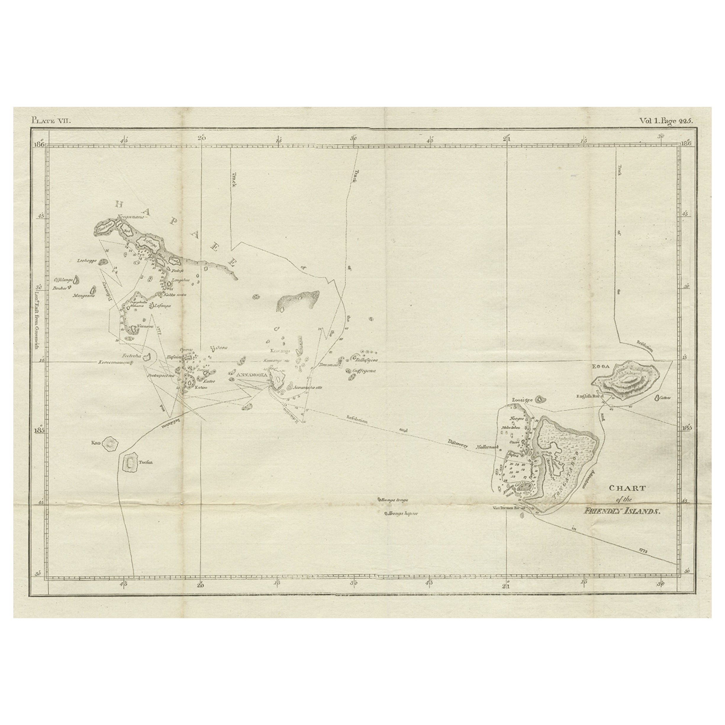
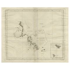
Antique Chart of the Friendly Islands or Tonga in the Pacific Ocean, 1785
About the Item
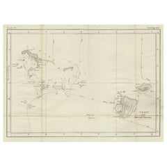
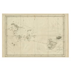
Antique print titled 'Chart of the Friendly Islands'. Antique map of the Friendly Islands depicting Rotterdam or Anamocka, Middelburg or Eaoowe and Amsterdam or Tongatabu. Originates from 'Voyage to the Pacific Ocean, undertaken by the Command of His Majesty, for making discoveries in the Northern Hemisphere. Performed under the direction of Captains Cook'.
Artists and Engravers: James Cook (Author, 1728-1779) was a British captain, explorer and cartographer.
Condition: Good, general age-related toning. Some creasing. Please study image carefully.
Date: 1785
Overall size: 49 x 31 cm.
Image size: 35 x 24 cm.
Antique prints have long been appreciated for both their aesthetic and investment value. They were the product of engraved, etched or lithographed plates. These plates were handmade out of wood or metal, which required an incredible level of skill, patience and craftsmanship. Whether you have a house with Victorian furniture or more contemporary decor an old engraving can enhance your living space. We offer a wide range of authentic antique prints for any budget.
- Creator:James Cook (Author)
- Dimensions:Height: 12.21 in (31 cm)Width: 19.3 in (49 cm)Depth: 0 in (0.01 mm)
- Materials and Techniques:
- Period:
- Date of Manufacture:1785
- Condition:Condition: Good, general age-related toning. Some creasing. Please study image carefully.
- Seller Location:Langweer, NL
- Reference Number:
About the Seller
5.0
Platinum Seller
These expertly vetted sellers are 1stDibs' most experienced sellers and are rated highest by our customers.
Established in 2009
1stDibs seller since 2017
1,916 sales on 1stDibs
Typical response time: <1 hour
- ShippingRetrieving quote...Ships From: Langweer, Netherlands
- Return PolicyA return for this item may be initiated within 14 days of delivery.
More From This SellerView All
- Antique Chart of the Friendly Islands or Nowadays Tonga, by Cook, 1784By James CookLocated in Langweer, NLAntique print titled 'Chart of the Friendly Islands'. Antique map of the Friendly Islands depicting Rotterdam or Anamocka, Middelburg or Eaoowe and Amsterdam or Tongatabu. Originates...Category
Antique 18th Century Prints
MaterialsPaper
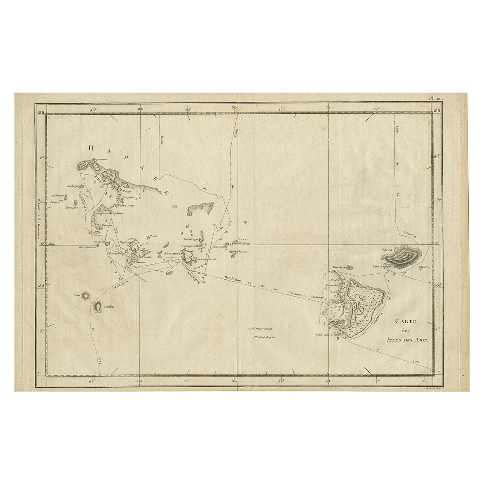
- Antique Engraved Map of the Friendly Islands or Tonga, ca.1785Located in Langweer, NLAntique map titled 'Carte des Isles des Amis'. Map of the Friendly Islands / Tonga. The Tongan people first encountered Europeans in 1616 when the Dutch vessel Eendracht, captain...Category
Antique 1780s Maps
MaterialsPaper
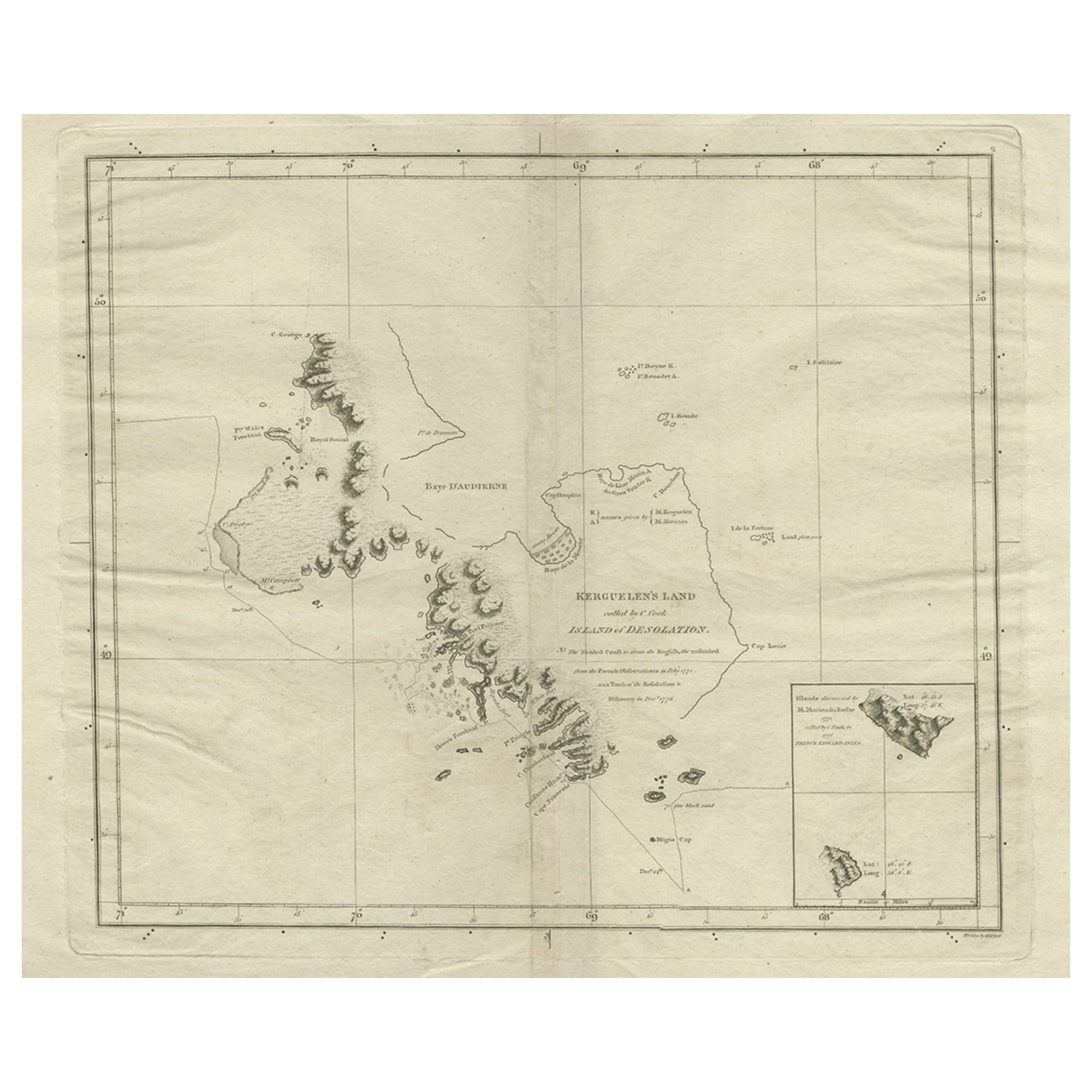
- Antique Map of Kerguelens Island Coast in the Indian Ocean by Cook, 1785By James CookLocated in Langweer, NLAntique print titled 'Kerguelen's Land (..)'. Antique map of Kerguelens island coast, known today as the Desolation islands. Originates from 'Voyage to the Pacific Ocean, undertaken ...Category
Antique 18th Century Prints
MaterialsPaper
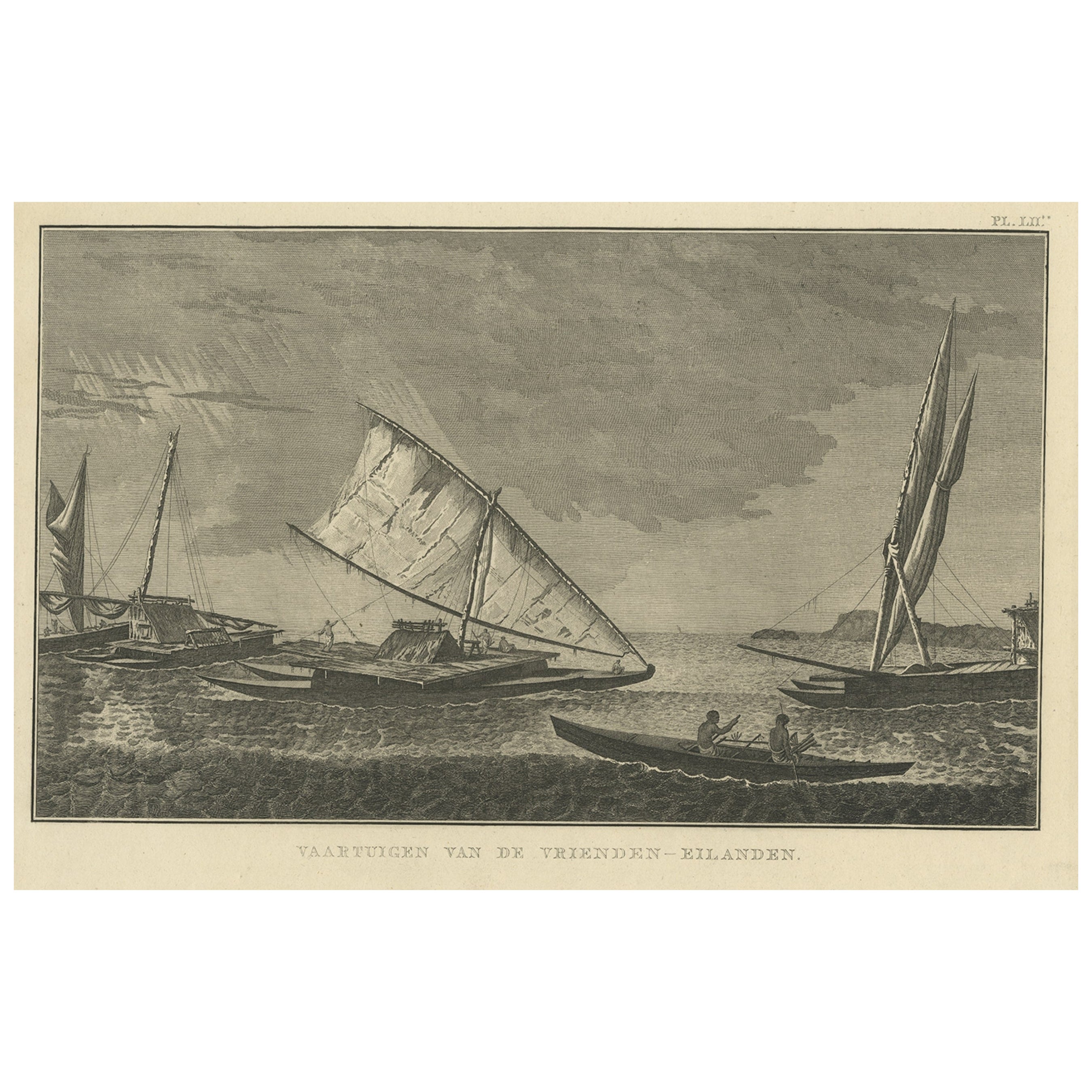
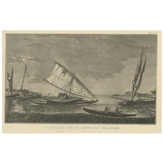
- Antique Print of Boats of the Friendly Islands or Tonga, by Cook, c.1801Located in Langweer, NLAntique print titled 'Vaartuigen van de Vrienden-Eilanden'. This print depicts various boats. Originates from 'Reizen rondom de Waereld' by J. Cook. Artists and Engravers: Author:...Category
Antique 19th Century Prints
MaterialsPaper
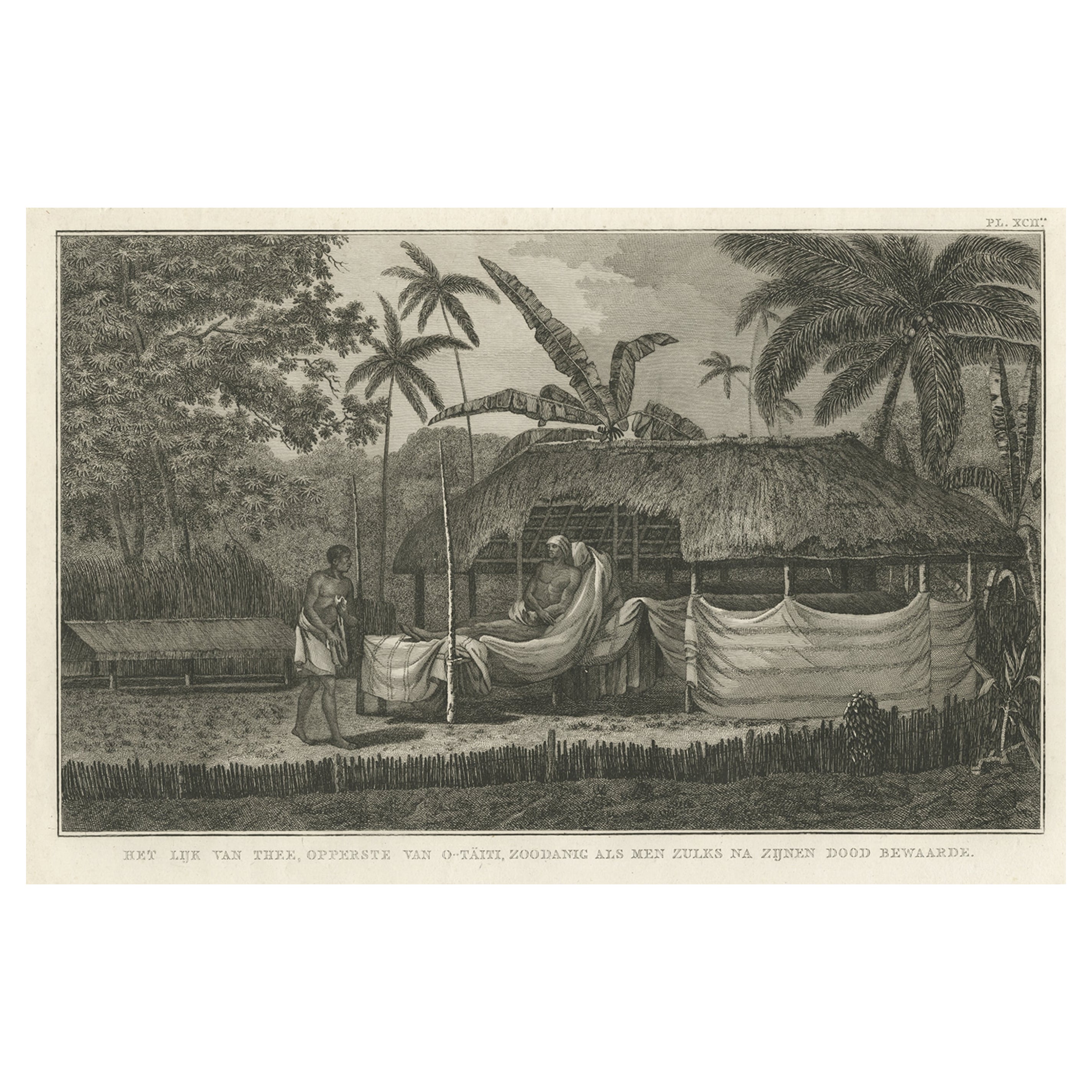
- Antique Engraving of the Dead Chief of Tahiti Island in the Pacific, 1803By James CookLocated in Langweer, NLAntique print titled 'Het Lijk van Thee, Opperste van O-Tahiti, zoodanig als men zulks na zijnen dood bewaarde'. Antique print depicting the remnents of Thee, Chief of Tahiti. Origin...Category
Antique 19th Century Prints
MaterialsPaper
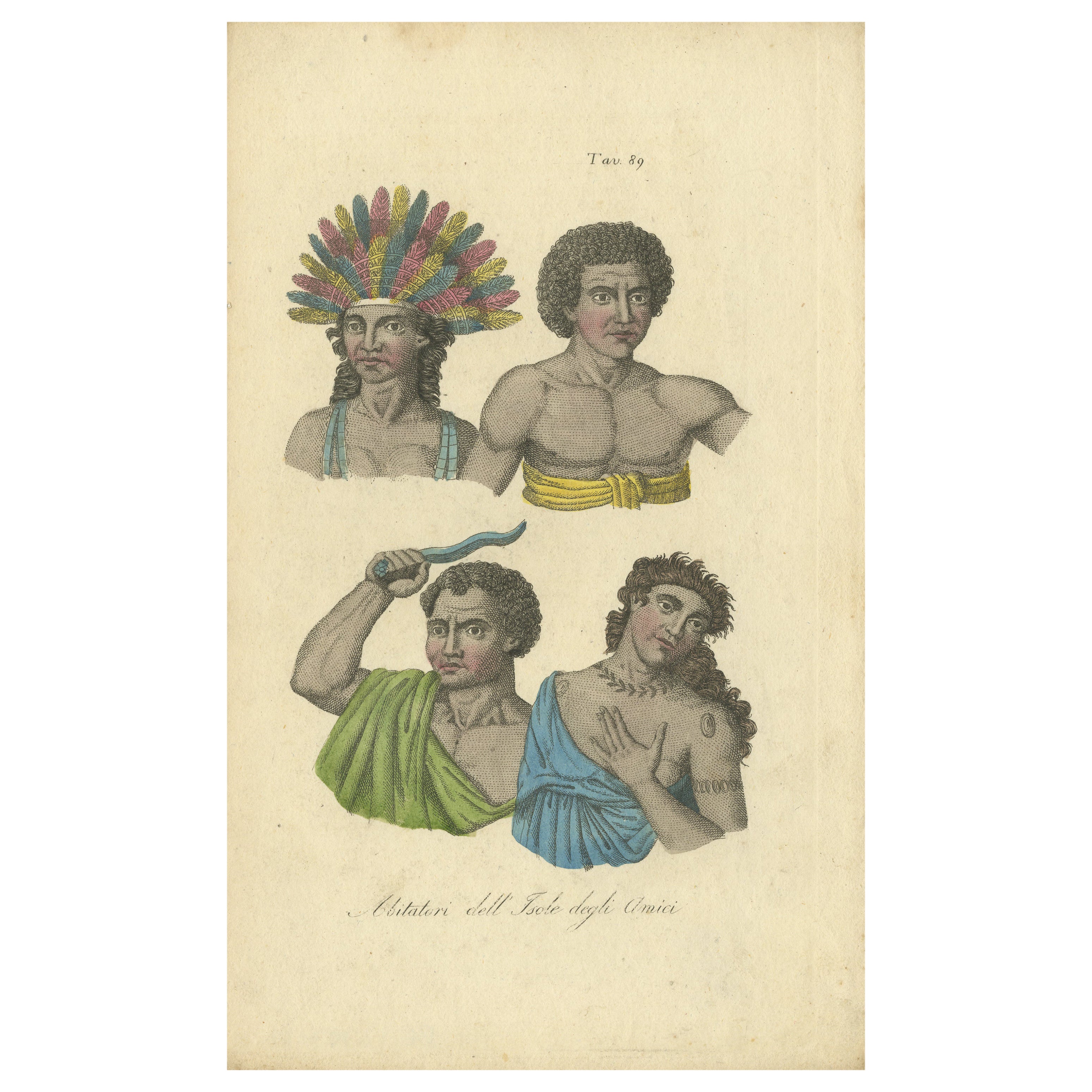
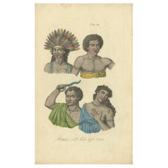
- Hand Colored Antique Print of Natives of Tonga, Friendly IslandsLocated in Langweer, NLAntique print titled 'Abitatori dell' Isole degli Amici'. Hand colored original antique print of natives of Tonga (Friendly Islands). King Poulaho in feather headdress, man in gnatoo...Category
Antique Mid-19th Century Prints
MaterialsPaper
You May Also Like
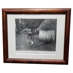
- Victorian Pacific Island Beauty "A Samoan Belle" Lithograph in Koa FrameLocated in Van Nuys, CAMuseum Quality Photographic Lithograph Artwork print titled "A Samoan Belle" depicting a beautiful Victorian-era Samoan woman in traditional dress with her village in the background....Category
1990s American Prints
MaterialsPaper
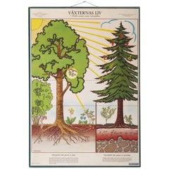
- Antique Swedish School, Teaching Chart, Poster "the Life of the Plants"Located in Vienna, ATAntique wall chart depicting "The life of the plants." The chart is signer M. Richter. This is a reprint probably from the 1950s. Colorful print o...Category
Vintage 1950s Swedish Prints
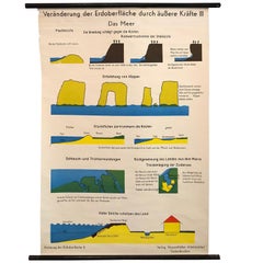
- German Scientific Ocean Tidal Erosion Geology ChartLocated in Brooklyn, NYGerman, scientific, geological, educational, roll-up chart depicting ocean tidal erosion is printed on canvas backed paper with .75 inch diameter, painted wooden dowels with steel ve...Category
Mid-20th Century German Industrial Prints
MaterialsCanvas, Wood
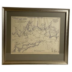
- Mariners charts of Massachusett Long Island by George Eldridge 1901Located in Norwell, MANautical Chart showing the harbor and local waters of the Little Neck Bay, Manhasset and Hempstead Harbors. The chart displays depths, buoys, lighthouses, etc., Shown is Manhasset Ne...Category
Antique Early 1900s North American Prints
MaterialsPaper
- Mariners Chart of Fishers Island Sound by George Eldridge 1901Located in Norwell, MANautical Chart showing the harbor and local waters of fishers island sound. The chart displays depths, buoys, lighthouses, etc., Shown is Watch Hill Point, Stonington, Mason Island, ...Category
Antique Early 1900s North American Prints
MaterialsPaper
- Chart of the East Coast of EnglandLocated in Norwell, MAChart of the East Coast of England, from Dungeness to Flamborough, including the entrances to the Thames River. Drawn by hydrographer J.W. Norie in 1841. Includes Kent, Essex and Suf...Category
Antique 1840s English Nautical Objects
MaterialsPaper


Recently Viewed
View AllMore Ways To Browse
Explorer Date
Mid Century Glass Ceiling Fixture
Dining Room Chairs Danish Wood
Belgium Antique Furniture Chair
Hans Agne Jakobsson Lighting
Black Painted Door
Vintage Mid Century Modern Furniture Canada
20 Century Vases
Brass Globe Light
Glass Floral Arrangements
Pair Of Midcentury Storage Cabinet
Vintage Red Dining Set
Vintage Miller Sign
French Walnut Furniture Louis Xv
Man On Chair
Used Foldable Chairs
Plinth Modern
Mid Century Glass Leaves