Items Similar to Hand Colored 18th Century Homann Map of Austria Including Vienna & the Danube


Want more images or videos?
Request additional images or videos from the seller
1 of 9
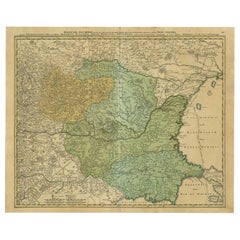
Johann Baptist HomannHand Colored 18th Century Homann Map of Austria Including Vienna & the Danube1728
1728
$675
£504.19
€584.53
CA$937.22
A$1,050.50
CHF 546.97
MX$12,827.10
NOK 6,944.49
SEK 6,582.75
DKK 4,361.23
Shipping
Retrieving quote...The 1stDibs Promise:
Authenticity Guarantee,
Money-Back Guarantee,
24-Hour Cancellation
About the Item
"Archiducatus Austriae inferioris" is a hand colored map of Austria created by Johann Baptist Homann (1663-1724) and published in Nuremberg, Germany in 1728 shortly after his death. It depicts the Archduchy of Lower Austria surrounded by Moravia, Bohemia, Styria and the Kingdom of Hungary. It includes Vienna and the course of the Danube River. The beautiful cartouche in the lower right depicts multiple figures, including putti and baskets of harvested crops and a cornucopia, representing the wealth and commerce of the region, as well as the coat of arms of Lower Austria.
There is mild discoloration along the vertical fold and some mild focal discoloration in the margins. It is otherwise in very good condition.
Johann Baptist Homann (1663-1724) was a mapmaker who founded the famous Homann Heirs publishing company. He lived his entire life in Bavaria, particularly in Nuremberg. Initially, Johann trained to become a priest before converting to Protestantism and working as a notary. In 1702, Johann founded a publishing house that specialized in engravings. The firm flourished, becoming the leading map publisher in Germany and an important entity in the European map market. In 1715, Johann was named Imperial Geographer to the Holy Roman Empire by Charles VI and made a member of the Prussian Academy of Sciences. Most importantly for his business, his reputation and contacts gained him imperial printing privileges which protected his publications and recommended him to customers. Johann is best known for this Grosser Atlas ueber die ganze Welt, or the Grand Atlas of the World, published in 1716.
- Creator:Johann Baptist Homann (1664 - 1724, German)
- Creation Year:1728
- Dimensions:Height: 20.25 in (51.44 cm)Width: 23.63 in (60.03 cm)
- Medium:
- Movement & Style:
- Period:
- Condition:
- Gallery Location:Alamo, CA
- Reference Number:Seller: #12951stDibs: LU117325890132

Johann Baptist Homann
Johann Baptist Homann (1663-1724) was a mapmaker who founded a respected and prolific publishing company, which continued long after his death as Homann Heirs. Homann lived his entire life in Bavaria, particularly in Nuremberg. Initially, Johann trained to become a priest before converting to Protestantism and working as a notary. In 1702, Johann founded a publishing house that specialized in engravings. The firm flourished, becoming the leading map publisher in Germany and an important entity in the European map market. In 1715, Johann was named Imperial Geographer to the Holy Roman Empire by Charles VI and made a member of the Prussian Academy of Sciences. Most importantly for his business, his reputation and contacts gained him imperial printing privileges which protected his publications and recommended him to customers.
About the Seller
5.0
Platinum Seller
Premium sellers with a 4.7+ rating and 24-hour response times
Established in 2011
1stDibs seller since 2019
285 sales on 1stDibs
Typical response time: 2 hours
- ShippingRetrieving quote...Shipping from: Alamo, CA
- Return Policy
Authenticity Guarantee
In the unlikely event there’s an issue with an item’s authenticity, contact us within 1 year for a full refund. DetailsMoney-Back Guarantee
If your item is not as described, is damaged in transit, or does not arrive, contact us within 7 days for a full refund. Details24-Hour Cancellation
You have a 24-hour grace period in which to reconsider your purchase, with no questions asked.Vetted Professional Sellers
Our world-class sellers must adhere to strict standards for service and quality, maintaining the integrity of our listings.Price-Match Guarantee
If you find that a seller listed the same item for a lower price elsewhere, we’ll match it.Trusted Global Delivery
Our best-in-class carrier network provides specialized shipping options worldwide, including custom delivery.More From This Seller
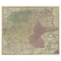
View AllDanube River, Italy, Greece and Croatia: A Hand-colored 18th C. Homann Map
By Johann Baptist Homann
Located in Alamo, CA
"Fluviorum in Europa principis Danubii" is a hand-colored map of the region about the Danube river created by Johann Baptist Homann (1663-1724) in his 'Atlas Novus Terrarum', publish...
Category
Early 18th Century Old Masters Landscape Prints
Materials
Engraving

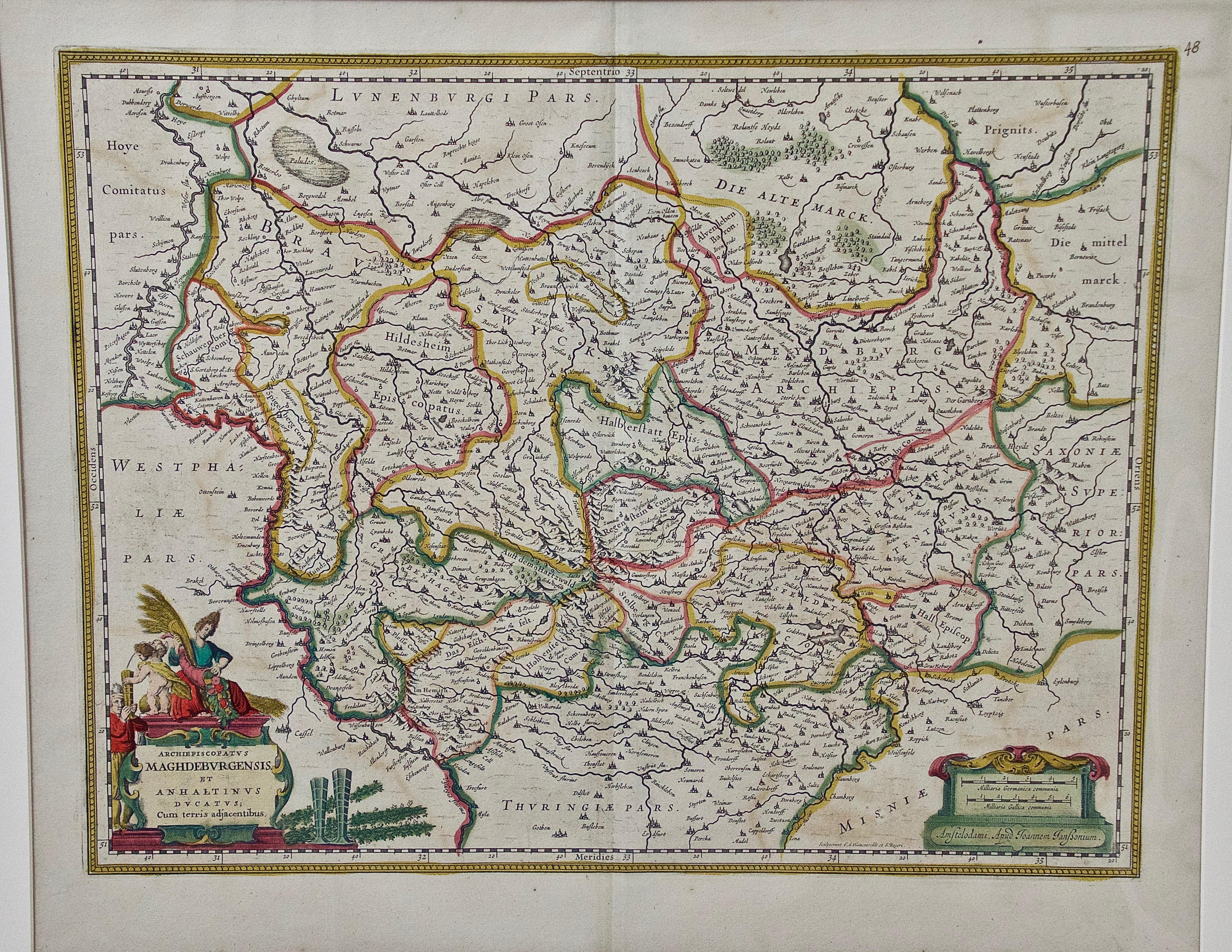
West Germany: Original Hand Colored 17th Century Map by Johannes Janssonius
By Johannes Janssonius
Located in Alamo, CA
An original hand colored copperplate engraved map entitled in Latin "Archiepiscopatus Maghdeburgensis et Anhaltinus Ducatus cum terris adjacentibus", published in Amsterdam in 1640 i...
Category
Mid-17th Century Old Masters More Prints
Materials
Engraving

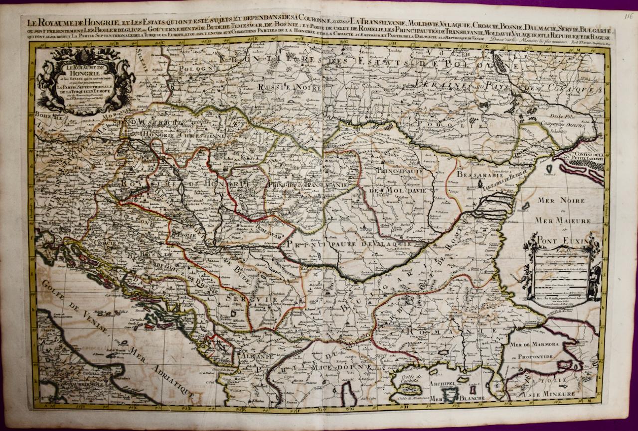
Hungary & Eastern Europe: A Large 17th C. Hand-colored Map by Sanson & Jaillot
By Nicholas Sanson d'Abbeville
Located in Alamo, CA
This large hand-colored map entitled "Le Royaume De Hongrie et les Estats qui en ont este sujets et qui font presentement La Partie Septentrionale de la Turquie en Europe" was origin...
Category
1690s Landscape Prints
Materials
Engraving

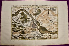
Vienna, Austria: A Large 17th Century Hand-colored Map by Sanson and Jaillot
By Nicholas Sanson d'Abbeville
Located in Alamo, CA
This large 17th century hand-colored map of Vienna, Austria and the surrounding countryside and villages entitled "Plan de la Ville de Vienne en Austrich...
Category
1690s Landscape Prints
Materials
Engraving
A Hand Colored 17th Century Janssonius Map of Prussia: Poland, N. Germany, etc.
By Johannes Janssonius
Located in Alamo, CA
An attractive hand-colored copperplate engraved 17th century map of Prussia entitled "Prussia Accurate Descripta a Gasparo Henneberg Erlichensi", published in Amsterdam by Joannes Janssonius in 1664. This very detailed map from the golden age of Dutch cartography includes present-day Poland, Latvia, Lithuania, Estonia and portions of Germany. This highly detailed map is embellished by three ornate pink, red, mint green and gold...
Category
Mid-17th Century Old Masters Landscape Prints
Materials
Engraving

Sweden and Adjacent Portions of Scandinavia: A Hand-colored 18th C. Homann Map
By Johann Baptist Homann
Located in Alamo, CA
This hand-colored copper-plate map of Sweden and adjacent portions of Scandinavia entitled "Regni Sueciae in Omnes suas Subjacentes Provincias accurate divisi Tabula Generalis" was c...
Category
Early 18th Century Old Masters Landscape Prints
Materials
Engraving

You May Also Like
Hand Colored 18th Century Homann Map of Austria Including Vienna and the Danube
By Johann Baptist Homann
Located in Alamo, CA
"Archiducatus Austriae inferioris" is a hand colored map of Austria created by Johann Baptist Homann (1663-1724) and published in Nuremberg, Germany in 1728 shortly after his death. ...
Category
Antique Early 18th Century German Maps
Materials
Paper

18th Century Hand-Colored Homann Map of Germany, Including Frankfurt and Berlin
By Johann Baptist Homann
Located in Alamo, CA
An 18th century hand-colored map entitled "Tabula Marchionatus Brandenburgici et Ducatus Pomeraniae quae sunt Pars Septentrionalis Circuli Saxoniae Superioris" by Johann Baptist Homa...
Category
Antique Early 18th Century German Maps
Materials
Paper

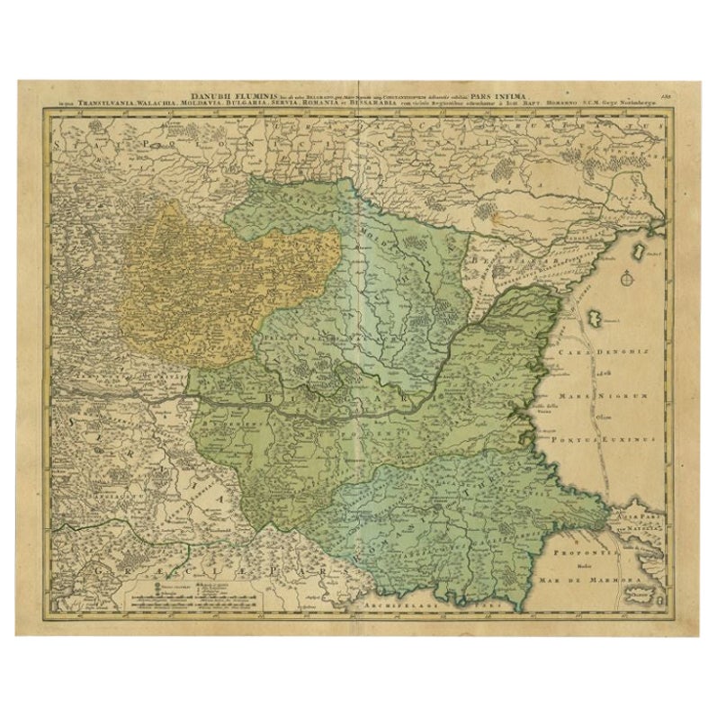
Antique Map of the Danube River by Homann, c.1720
By Homann Heirs
Located in Langweer, NL
Antique map titled 'Danubii Fluminis (..)'. Regional map of the Donau river, Shows the Danube river from Belgrade in Serbia, along the border between Roma...
Category
Antique 18th Century Maps
Materials
Paper
$889 Sale Price
20% Off
Old Decorative Map of Austria, Centered on the Danube River and Vienna, Ca.1720
Located in Langweer, NL
Antique map titled 'Archiducatus Austriae inferioris (..).' Decorative map of Austria, centered on the course of the Danube River and Vienna. Shows the region from Enss and Steyr to ...
Category
Antique 1720s Maps
Materials
Paper
$269 Sale Price
20% Off
Hand-Colored 18th Century Homann Map of the Danube, Italy, Greece, Croatia
By Johann Baptist Homann
Located in Alamo, CA
"Fluviorum in Europa principis Danubii" is a hand colored map of the region about the Danube river created by Johann Baptist Homann (1663-1724) in his 'Atlas Novus Terrarum', publish...
Category
Antique Early 18th Century German Maps
Materials
Paper

Antique Map of Northern Italy by Homann Heirs, c.1730
Located in Langweer, NL
Antique map titled 'Domini Veneti cum vicinis Parmae Mutinae, Matuae et Mirandol (..).' Detailed map of northern Italy by J. B. Homann. This map shows Venice and its adjacent states ...
Category
Antique 18th Century Maps
Materials
Paper
$499 Sale Price
20% Off