By Treadway Russell Nash
Located in Saint Augustine, FL
Artist: Treadway Russell Nash (English, 1724-1811)
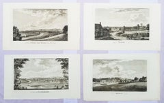
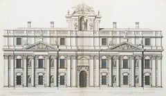
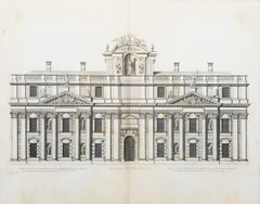
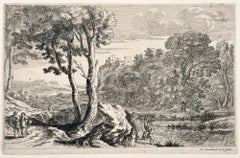
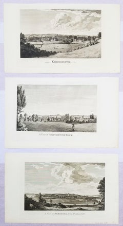
Title: "A View of Pershore, from Pensham hill", "A View of Shipston upon Stour", and "Kidderminster"
Portfolio: Collections for the History of Worcestershire
Year: 1781-1782 (First edition)
Medium: Set of Three Original Engravings on watermarked laid paper
Limited edition: Unknown
Printer: John Nichols, London, UK
Publisher: T. Payne and Son, J. Robson, B. White, Leigh and Sotheby, London, UK; Fletcher, Oxford, UK; and Lewis, Worcester, UK
Sheet size (each): approx. 10.13" x 16.75"
Image size (each): approx. 7" x 11.88"
Reference: Upcott III, page 1330
Condition: A few light handling creases. Have been professionally stored away for decades. They are all strong impressions in excellent condition
Notes:
Provenance: private collection - Aspen, CO. All three works were engraved by English artist Thomas Sanders (Active: Mid-Late 18th Century) after drawings by himself. Comes from Nash's two volume "Collections for the History of Worcestershire", (1781-1782) (First edition), which consists of 75 engravings. Each work is printed from one copper plate in one color: black. There was a (Second edition) "with Additions" bound in with Volume II of this portfolio published by John White in (1799). And both the First and Second editions of "Collections for the History of Worcestershire" are based off Thomas Sanders' 1779-1781 "Perspective Views of the Market Towns within the County of Worcester". All three, "A View of Pershore, from Pensham hill", "A View of Shipston upon Stour", and "Kidderminster" have an unidentified watermark in the center of their sheets resembling "XV".
Biography:
Treadway Russell Nash (24 June 1724 – 26 January 1811) was an English clergyman, now known as an early historian of Worcestershire and the author of Collections for the History of Worcestershire, an important source document for Worcestershire county histories. He was a fellow of the Society of Antiquaries of London.
Treadway Russell Nash was born on 24 June 1724 born at Clerkenleap, in Kempsey, Worcestershire. His family were from Ombersley. They had lands there and at Claines, and had later bought lands in the Reformation around St Peter's, Droitwich. He was related to James Nash and John Nash, both MPs for Worcester. His father Richard, a grandson of Sir Rowland Berkeley, died in 1740, and Richard's eldest son in 1757. As a result, Treadway Russell Nash inherited the Russells' Strensham estates from his brother, as well as the Nash estates, and took both names.
He was educated from the age of twelve at King's School, Worcester, and became a scholar at Worcester College, Oxford aged fifteen. In March 1749, he accompanied his brother on a trip to the continent, to aid Richard's health. They visited Paris for about six weeks, before spending the summer "on the banks of the Loire". They then visited "Bourdeaux, Thoulouse, Montpelier, Marseilles, Leghorn, Florence, Rome, Naples, Bologna, Venice, Padua, Verona, Milan, Lyons, and again Paris"; such expeditions are often known as the Grand Tour.
On his return in late summer 1751, Nash took up a post as Vicar of Eynsham through his friend and future brother-in-law, John Martin. He also had an income as a tutor at Oxford. He took his Doctor of Divinity degree and left Oxford, having "gone out grand compounder", following the death of his brother. He also left his benefice at Eynsham in 1757. While at Oxford he had proposed a road from there to Witney (now the A40 and B4022), and also stood for Parliament. Nash married Margaret Martin...
Category
1780s Old Masters Johann Baptist Homann Art
MaterialsEngraving, Laid Paper