Items Similar to View of the Island Onrust Near Batavia 'Jakarta', Indonesia, 1739

Want more images or videos?
Request additional images or videos from the seller
1 of 6
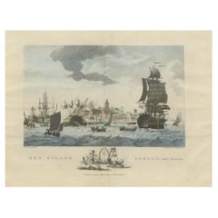
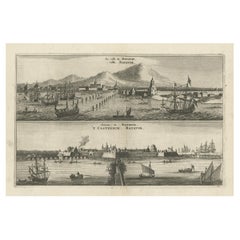
View of the Island Onrust Near Batavia 'Jakarta', Indonesia, 1739
About the Item
Antique print titled 'Ein Prospect der Insul Onrust oder Unruhe 2 Meilen von Batavia gelegen.' (View of the island ' Onrust' near Batavia.)
Onrust Island also known as Pulau Onrust or Pulau Kapal (ship island) is an Indonesian island off the coast of Jakarta. It measures about 3.5 km2 (1.4 sq mi) and is part of the Thousand Islands. The town on the island had houses and warehouses, but it also had a gunpowder magazine, a storage for water transported from Batavia, general warehouses, and a lot of warehouses specifically meant to store pepper. Specific to the shipyard were the reservoirs for trees. Sawing windmills processed these trees to make planks for the shipyards. There was also a smithy that served the shipyard. Near the waterfront there were special installations to easily pull ships on their side. Sometimes ships for local use were built at the island. The VOC employees were only allowed to leave the island two times a year.
In 1911 Onrust Island was turned into a quarantine station for pilgrims returning from the Hajj. The island had the advantage of being completely isolated. Furthermore, it was so small that it was possible to make it malaria free by the only method known at the time. This was done by filling up all the small ponds and other fresh water instances on the island and by removing most vegetation. Later a sanatorium for lung diseases was established on the island, because of the very much improved health situation. From 1933 it was used to lock up the mutineers of the 1933 mutiny on the HNLMS De Zeven Provinciën (1909).
In 1940 German nationals were interned on Onrust. In May 1940 the Netherlands were attacked by Germany. In the Dutch East Indies thousands of Germans, Hungarians, Czechs, Italians, Dutchmen with a German family name, and members of the National Socialist Movement in the Netherlands were arrested and locked up at Onrust and in Ngawai. After war with Japan broke out on 8 December 1941 a small part of these prisoners was evacuated to Suriname. The Japanese also used Onrust as a prison.
On 23 January 1950 Raymond Westerling attempted the APRA coup d'état. It failed, and most of the APRA military were seized by the Dutch troops that were still on Java. The Dutch military authorities decided to judge these as deserters. They ended up on Onrust. The Indonesian authorities prolonged this tradition when they interned Chris Soumokil president of the Republic of South Maluku. On 12 April 1966 he was shot at Onrust by order of General Suharto.
This plate shows the Dutch flag, windmills, church, workshop etc.
This print is taken from 'Allerneuester Geographische- und Topographischer Schau-platz, von Africa und Ost-Indien', published in Germany 1739.
Artists and Engravers: Johann Wolfgang Heydt (1705 - ?), a German artist who worked for the Dutch East India company.
- Dimensions:Height: 10.08 in (25.6 cm)Width: 12.84 in (32.6 cm)Depth: 0 in (0.02 mm)
- Materials and Techniques:
- Period:1730-1739
- Date of Manufacture:1739
- Condition:Wear consistent with age and use. Condition: Good, general age related toning; some light staining from handling. Please study image carefully.
- Seller Location:Langweer, NL
- Reference Number:
About the Seller
5.0
Platinum Seller
These expertly vetted sellers are 1stDibs' most experienced sellers and are rated highest by our customers.
Established in 2009
1stDibs seller since 2017
1,928 sales on 1stDibs
Typical response time: <1 hour
- ShippingRetrieving quote...Ships From: Langweer, Netherlands
- Return PolicyA return for this item may be initiated within 14 days of delivery.
More From This SellerView All
- Beautiful View of Pulau 'Island' Onrust, Batavia 'Jakarta, Indonesia', ca.1805Located in Langweer, NLAntique print titled 'Het Eiland Onrust'. Beautiful view of the sea near Onrust Island, also known as Pulau Onrust or Pulau Kapal (ship island), Indonesia. Published by E. Maaskamp, ...Category
Antique Early 1800s Maps
MaterialsPaper
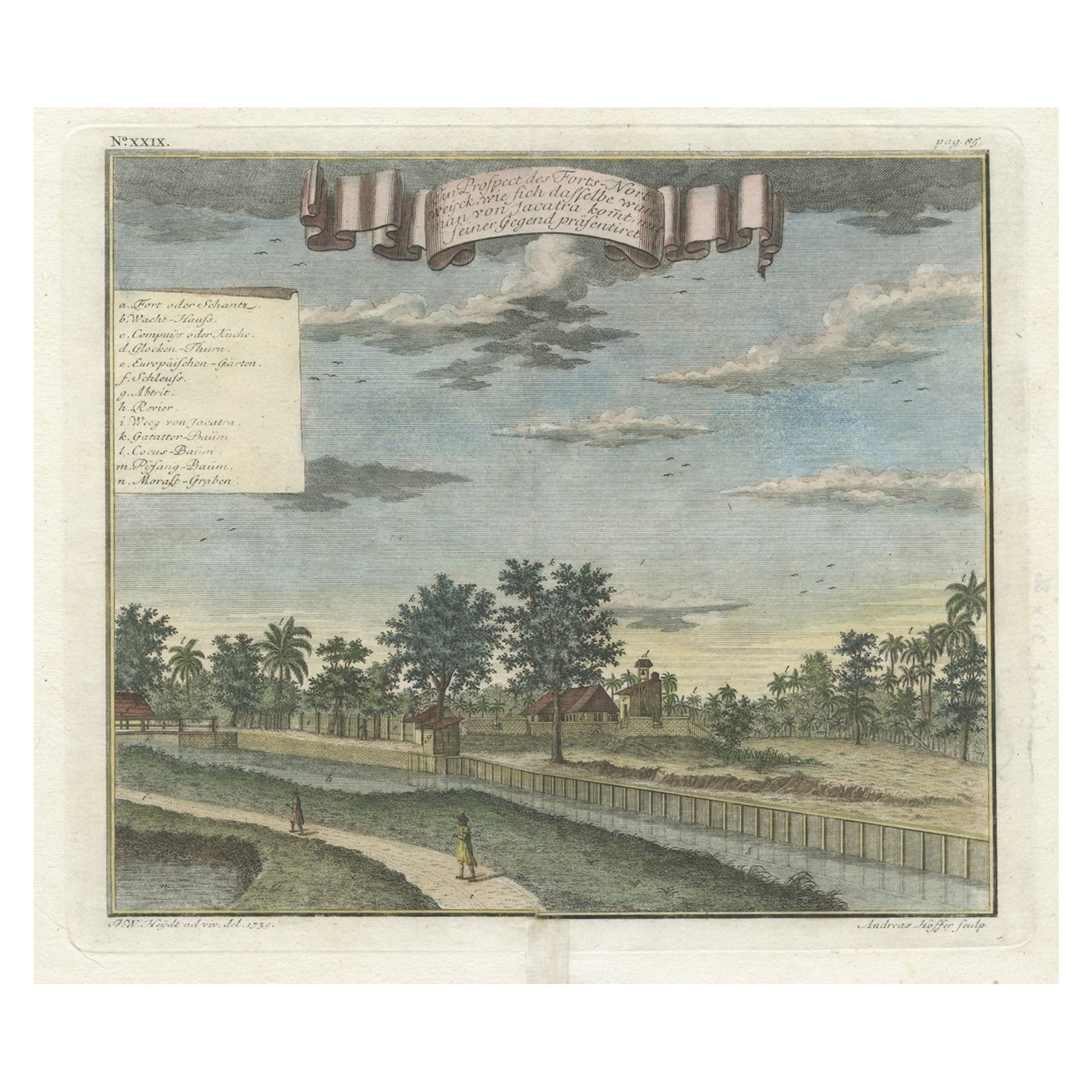
- Old Antique Print of Fort Noordwijk, Batavia 'Jakarta, Indonesia', 1739Located in Langweer, NLAntique print titled 'Ein Prospect des Forts Nortweijck, wie sich dasselbe wan man von Jacatra komt, mit seiner Gegend präsentiret'. Old print of Fort Noordwijk, Batavia (Jakarta)....Category
Antique 1730s Prints
MaterialsPaper
- Antique Print of Ships Near Onrust Island Near Jakarta, Indonesia, 1779Located in Langweer, NLAntique print titled 'Het Eiland Onrust'. Beautiful view of the sea near Onrust Island, also known as Pulau Onrust or Pulau Kapal (ship island), Indonesia. Artists and Engravers: ...Category
Antique 18th Century Prints
MaterialsPaper
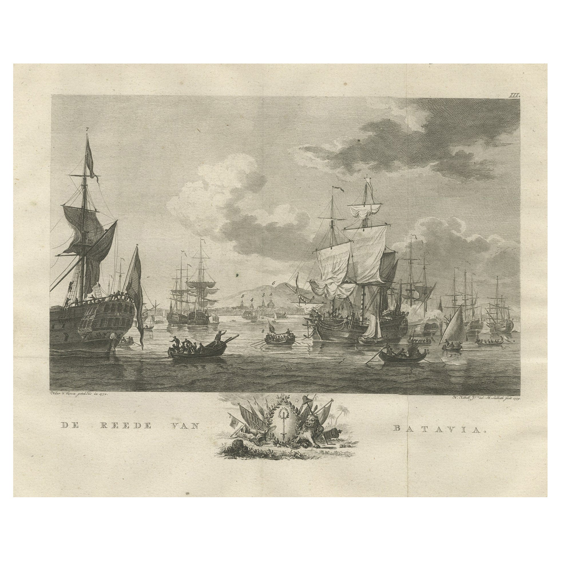
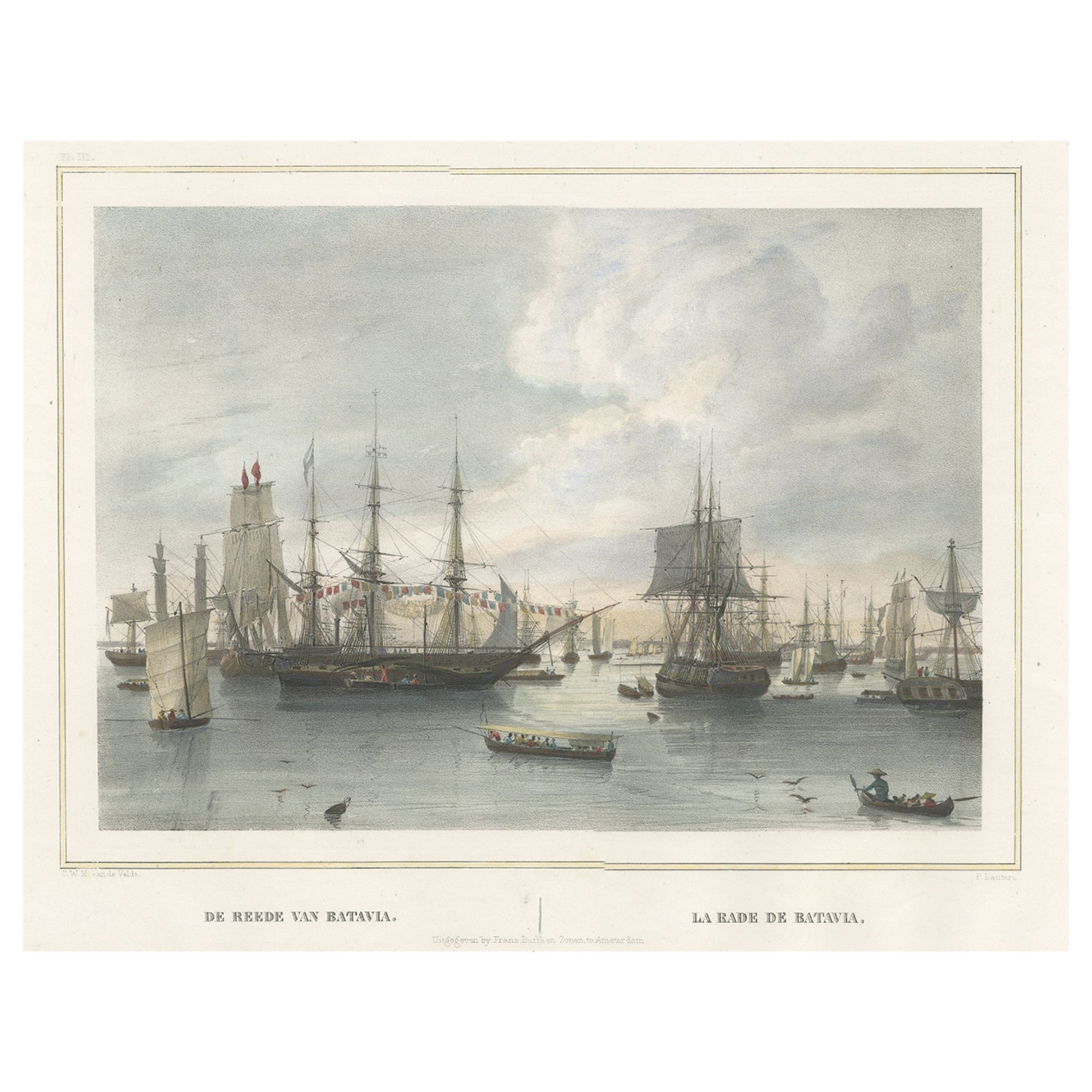
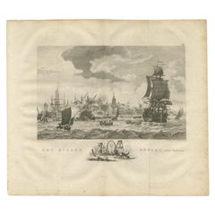
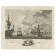
- Old Print of VOC Ships in the Sea Near Batavia (Jakarta, Indonesia), 1779Located in Langweer, NLAntique print Batavia titled 'De Reede van Batavia'. Beautiful view of the sea near Batavia (Jakarta, Indonesia), with several ships lying at anchor. Artists and Engravers: Ma...Category
Antique 1770s Maps
MaterialsPaper
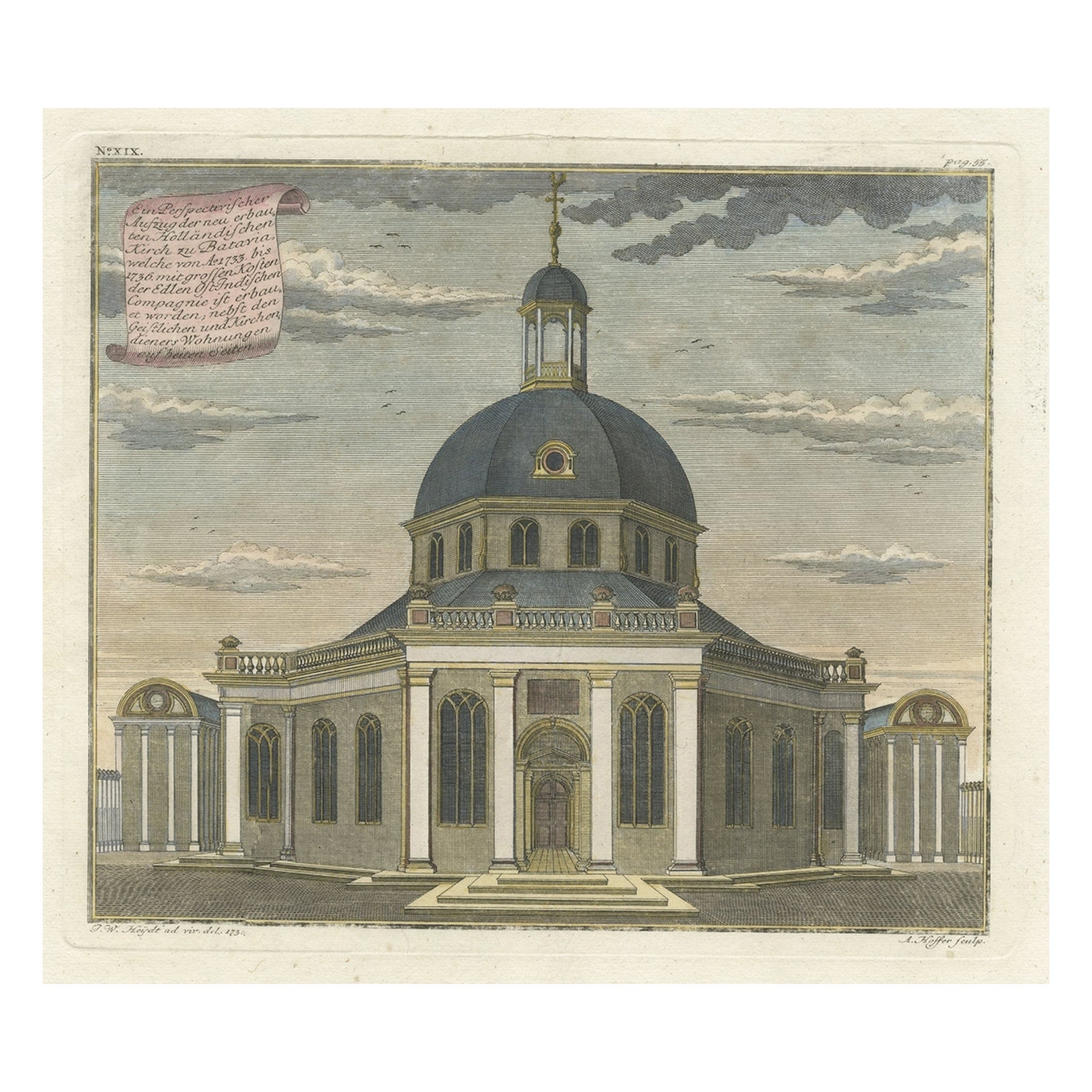
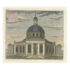
- Old Print with a View of the Dutch Church in Batavia 'Jakarta, Indonesia', 1738Located in Langweer, NLAntique print titled 'Ein Perspectivischer Aufzug der neu erbauten Holländischen Kirch zu Batavia, welche von Ao. 1733. bis 1736. mit grossen Kosten der Ed;en Ost-Indischen Compagnie...Category
Antique 1730s Maps
MaterialsPaper
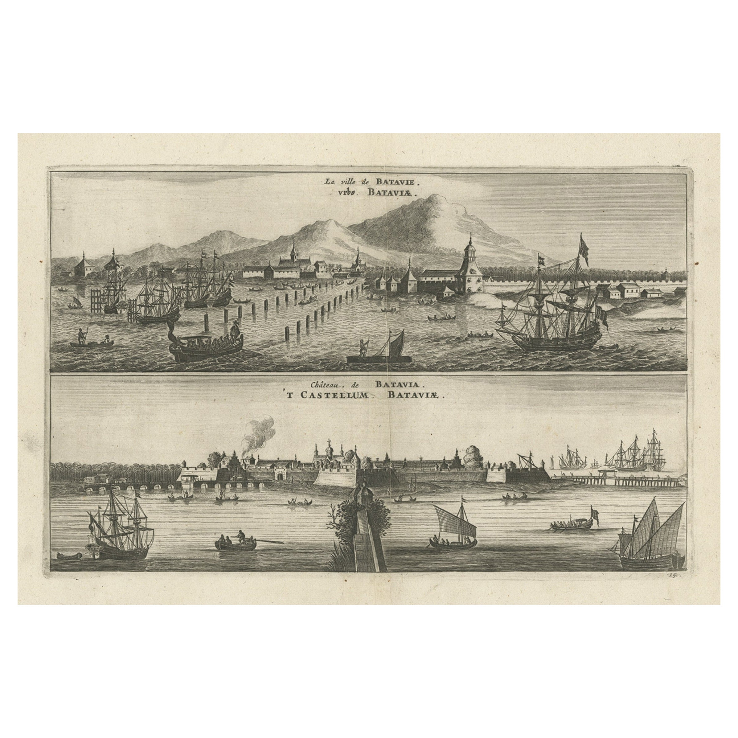
- Old Print with a View on the City & Castle of Batavia 'Jakarta', Indonesia, 1668Located in Langweer, NLAntique print Indonesia titled ‘La ville de Batavie. De Stadt Batavia. Chateau de Batavia. ‘t Casteel van Batavia’. Antique print with a view on the city of Djakarta, Indonesia. ...Category
Antique 1660s Prints
MaterialsPaper
You May Also Like
- Vintage "View of the Center of Paris Taken from the Air" Lithograph MapLocated in San Diego, CAA very stylish "View of the Center of Paris Taken from the Air" lithograph map published by the Paris Ministry of Tourism, circa early 1950s. The piece measures 27" x 43" and shows...Category
20th Century French Mid-Century Modern Prints
MaterialsPaper
- N.E. View of the United States Capitol, Washington, DC Antique Proof Print 1858Located in Colorado Springs, COThis engraved print shows a view of the United States Capitol Building, in Washington, D.C. The print depicts the neoclassical building from the northeast orientation, with a bustling street scene in front. The steel engraving is a proof printing, drawn and engraved by Henry Sartain and published in 1858. Plans began in May 1854 to build a new cast-iron dome for the United States Capitol. The then-architect of the Capitol Thomas Walter and his team were sold on the aesthetics of a new dome, as well as the utility of a fire-proof one. A year later, on March 3, 1855, President Franklin Pierce...Category
Antique 1850s American Prints
MaterialsPaper
- Hand-Colored 18th Century Homann Map of Denmark and Islands in the Baltic SeaBy Johann Baptist HomannLocated in Alamo, CAAn 18th century copper plate hand-colored map entitled "Insulae Danicae in Mari Balthico Sitae utpote Zeelandia, Fionia, Langelandia, Lalandia, Falstria, Fembria Mona" created by Joh...Category
Antique Early 18th Century German Maps
MaterialsPaper
- Catalogue of Engraved Views, Plans, Etc., Of New York City, 1st EdLocated in valatie, NYA catalogue of engraved views, plans, etc., Of New York City, (The Collection of Percy R. Pyne II). Privately Printed by The De Vinne Press, New York, 1912. Limited to 100 copies. Gr...Category
Early 20th Century American Books
MaterialsPaper
- Set of Twelve Colored Engravings of the Defeat of the Spanish Armada by J. PineLocated in Essex, MABy John Pine considered the foremost heraldic and decorative engraver of his generation. Depicting the defeat of the Spanish by the English Fleet in 1588. These are after a set of tapestries that hung in the House of Commons...Category
Antique 1740s English Prints
MaterialsPaper
- Map of the Republic of GenoaLocated in New York, NYFramed antique hand-coloured map of the Republic of Genoa including the duchies of Mantua, Modena, and Parma. Europe, late 18th century. Dimension: 25...Category
Antique Late 18th Century European Maps


