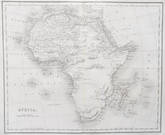
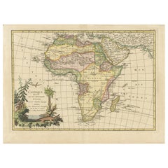
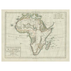
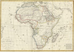
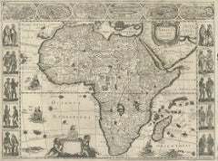
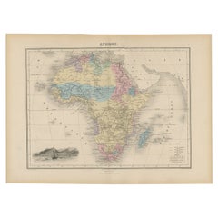
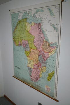
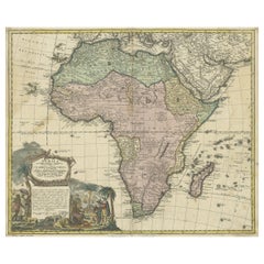
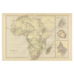
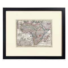
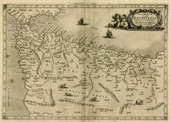
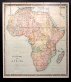
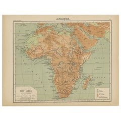
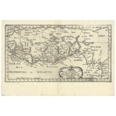
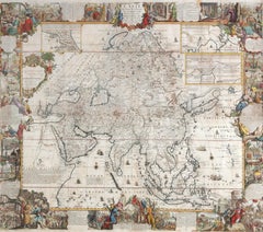
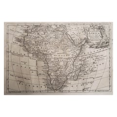
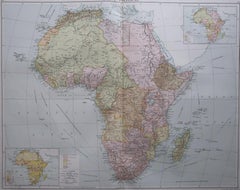
Original Antique Map of Africa
$317Sale Price|20% Off
Original Antique Map of Africa
Located in Langweer, NL
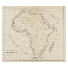
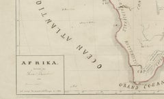
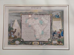
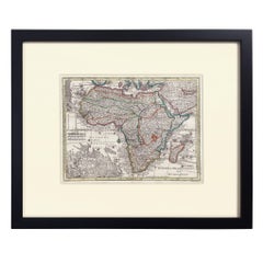
Antique map titled 'Afrika'. Original antique map of Africa, drawn by Van Beusekom.
Category
Antique Late 19th Century Maps
Materials
Paper
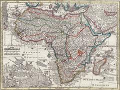
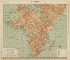
$317Sale Price|20% Off
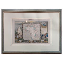
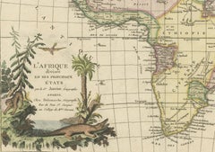
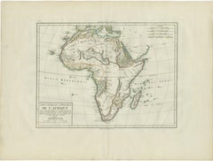
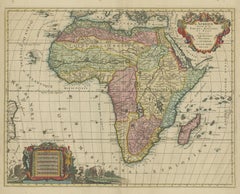
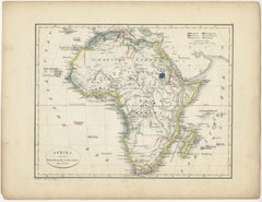
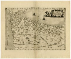
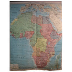
Original Antique Map of Africa
Located in Langweer, NL
Antique map titled 'Afrika'. Original antique map of Africa, drawn by Van Beusekom.
Paper

$233Sale Price|20% Off
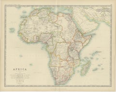
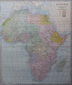
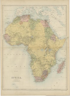
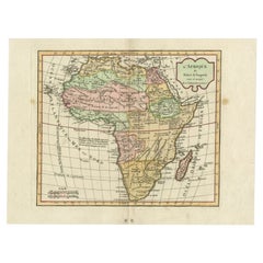
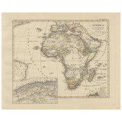
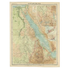
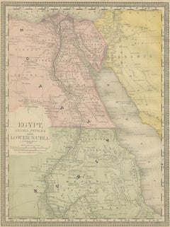
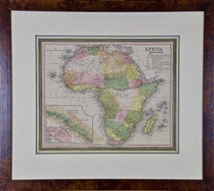
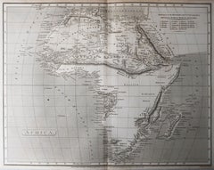
Antique Map of Africa by Johnston (1909)
Located in Langweer, NL
Antique map titled 'Africa'. Original antique map of Africa.
Paper

$1,401Sale Price|20% Off
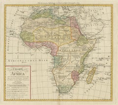
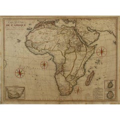
Antique Map of Africa by Homann Heirs, '1804'
Located in Langweer, NL
Antique map titled 'Charte von Africa'. Large, original antique map of Africa by Franz Ludwig Güssefeld.
Paper

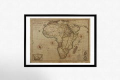
Large Original Antique Map of Africa. C.1900
Located in St Annes, Lancashire
Fabulous map of Africa Original color. Engraved and printed by the George F.
Paper

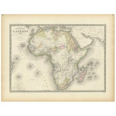
Antique Map of Africa by Dufour, circa 1834
Located in Langweer, NL
Antique map titled 'Afrique'. Uncommon map of Africa. Published by or after A.H.
Paper
$121Sale Price|20% Off
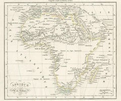
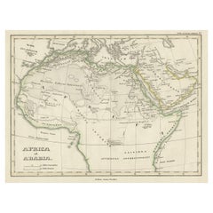
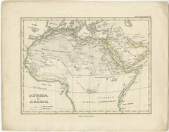
Old Original Map of Africa and Arabia, 1848
Located in Langweer, NL
Antique map titled 'Africa et Arabia'. Old map of Africa and Arabia originating from 'Orbis Terrarum Antiquus in usum Scholarum'.
Paper

Original Antique Map of Africa by Dower, circa 1835
Located in St Annes, Lancashire
Nice map of Africa Drawn and engraved by J.Dower Published by Orr & Smith.
Paper
Antique Map of Africa by Levasseur 'c.1840'
Located in Langweer, NL
Antique map titled 'Afrique'. Original antique map of Africa.
Paper

$256Sale Price|20% Off
Antique Map of Africa by A & C, Black, 1870
Located in Langweer, NL
Antique map titled 'Africa'. Original antique map of Africa.
Paper
$924Sale Price|20% Off
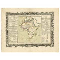
Original Antique Map of Africa with large decorative cartouche
Located in Langweer, NL
Attractive and precise map of Africa, with large decorative cartouche.
Paper

$373Sale Price|20% Off
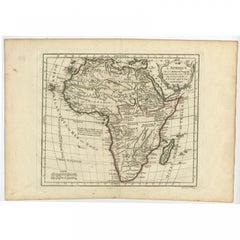
Antique Map of Africa by Keizer & de Lat, 1788
Located in Langweer, NL
Antique map titled 'Kaartje van Africa (..)'. Uncommon original antique map of Africa.
Paper

$1,138Sale Price|35% Off
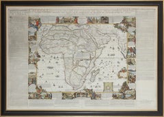
Original Antique Hand- Map of Africa by Allard '1697'
Located in Langweer, NL
Beautiful large map of Africa. This is the 3rd state of the map, with climate notation added in border (1697, Betz 162, Norwich 54).
Paper
$747Sale Price|20% Off
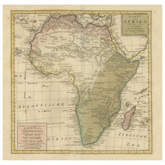
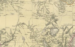
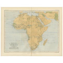
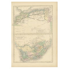
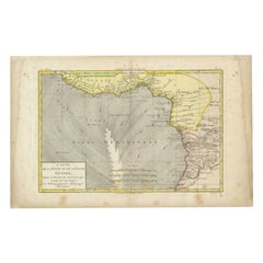
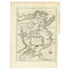
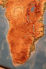
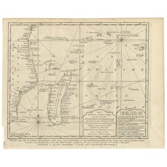
Antique Map of Africa with Mountain Ranges and other details
Located in Langweer, NL
Original antique map of Africa. Highlights numerous mountain ranges, lakes and rivers, regions, countries and places.
Paper

$467Sale Price|20% Off
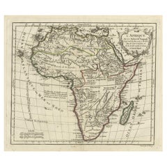
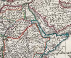
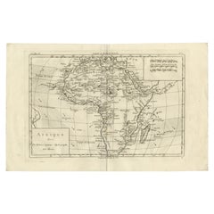
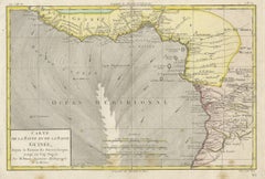
Antique Map of Africa by Claude Buy de Mornas '1761'
Located in Langweer, NL
Antique map titled 'Afrique'. Original antique map of Africa flanked with descriptions containing geographical information about the area.
Paper

$728Sale Price|20% Off
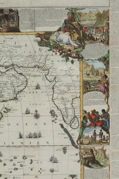
Antique Map of Africa with Original Hand Coloring
Located in Langweer, NL
Detailed original old map of Africa, with very small inset map titled 'Vlaamsche Eilanden', which shows the Azores.
Paper

$1,681Sale Price|20% Off
Antique Map of Africa by Bordiga Fratelli 'circa 1818'
Located in Langweer, NL
Antique map titled 'Carta dell Africa'. Large and quite scarce Italian map of Africa, reflecting the then-current knowledge of the continent's geography, with large areas left comple...
Paper
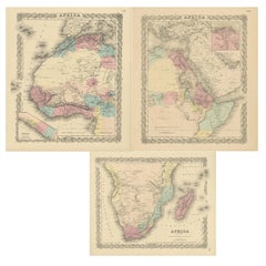
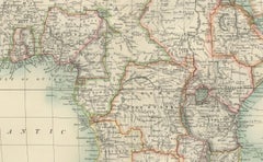
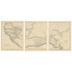
Set of Three Antique Maps of Africa by Colton (circa 1855)
Located in Langweer, NL
Set of three individual maps of Africa including 'North West Africa', 'North Eastern Africa' and 'Southern Africa'.
Paper
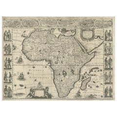
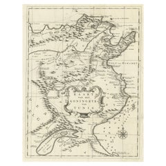
Antique Map of Africa by Janssonius, Rare Paneled Print, Circa 1655
Located in Langweer, NL
Antique map titled 'Africa Nova Tabula Auct Jud. Hondio'.
Paper

$934Sale Price|20% Off
Original Hand-Colored Antique Map of Africa by Elwe '1792'
Located in Langweer, NL
Decorative large map of Africa. The cartography is typical for the 17th century with the Nile originating in two large lakes below the equator.
Paper
$251Sale Price|20% Off
Antique Map of Africa by Delamarche, 1806
Located in Langweer, NL
Antique map titled 'L'Afrique'. Decorative map of Africa by Robert de Vaugondy, revised and published by Delamarche.
Paper

$224Sale Price|20% Off
Antique Map of Africa with Decorative Vignette of Saint Helena, 1880
Located in Langweer, NL
Antique map titled 'Afrique'. Old map of Africa, covering the African continent.
Paper

Antique Map of Africa with European Language Borders, 1852
Located in Langweer, NL
Antique map titled 'Afrika'. Map of Africa. This map originates from 'School-Atlas van alle deelen der Aarde' by Otto Petri.
Paper

Antique Map of Africa by Pierre M. Lapie, Mid-19th Century Print, 1842
Located in Langweer, NL
Antique map titled 'Carte d'Afrique'. Map of Africa. This map originates from 'Atlas universel de géographie ancienne et moderne (..)' by Pierre M.
Paper


French Map of Africa by Cortambert – Sahara, Egypt & Algeria, 1864
Located in Langweer, NL
French Map of Africa by Cortambert – Sahara, Egypt & Algeria, 1864 A finely engraved and historically fascinating map of Africa published in Paris in 1864 under the direction of the...
Paper
$135Sale Price|40% Off
Map of Africa, archival. Printed in Edinburgh, Scotland, 1916. Free Delivery
Located in Madison, WI
Map of Africa from the geography classroom, 1916 edition.
Wood, Paper

Colorfull Antique Map of Africa with Algeria Inset – Stieler Atlas 1858
Located in Langweer, NL
Antique Map of Africa with Algeria Inset – Stieler Atlas 1858 This antique map of Africa, engraved by F. von Stülpnagel and published by Justus Perthes in 1858, is a finely detailed...
Paper

Antique Map of Africa, Highlighting Colonial Divisions, Geographic Features 1903
Located in Langweer, NL
Title: Antique Map of Africa, 1903, Highlighting Colonial Divisions and Geographic Features Description: This antique map, titled "Africa," was engraved and published in 1903 by W. ...
Paper
Ancient Map of Africa - Etching - 19th century
Located in Roma, IT
This Map of Africa is an etching realized in the 19th century.
Etching
Antique Map of Africa, Cartouche with Elephant Tusks and Horned Serpent, 1737
Located in Langweer, NL
Antique map of Africa titled 'Africa Secundum Legitimas Projectionis Stereographicae regulas (..)'.
Paper
$326Sale Price|20% Off
Antique Map of Africa with French Cartouche and Scale, c.1780
Located in Langweer, NL
Antique map titled 'L'Afrique'. Original antique map of Africa.
Paper
Antique Old Map of Africa with Insets of Mauritius, Reunion and Natal, 1882
Located in Langweer, NL
The uploaded image is a historical map of Africa from the 1882 atlas by Blackie & Son.
Paper

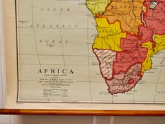
Large University Chart “Physical Map of Africa” by Bacon
Located in Godshill, Isle of Wight
Large university chart “Physical Map of Africa” by Bacon W&A K Johnston’s Charts of Physical Maps By G W Bacon, This is colorful Physical map of North America, it is large lith...
Linen

Antique Map of Africa with Ocean Currents and Other Details, C.1780
Located in Langweer, NL
Antique map titled 'Afrique.' Detailed map of Africa, showing towns, rivers, some topographical features, ocean currents, ports and political boundaries.
Paper

$205Sale Price|20% Off
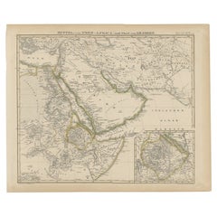
Antique Map of Africa and Arabia with Inset Map of Ethiopia and Eritrea, 1845
Located in Langweer, NL
Antique map titled 'Mittel- und Nord-Africa (östl. Theil) und Arabien'.
Paper
Hand-Colored Map of Africa, circa 1744
By Matthew Seutter
Located in New York, NY
Seutter, Matthew. Africa. From Atlas minor praecipua Terrarum Imperia... Augsburg, circa 1744. Original engraving with old hand-coloring. Image size: 7 5/8 x 10 1/8 inches.
Paper

Geological Map of Africa by A.K. Johnston – Mountains and Valleys 1852
Located in Langweer, NL
Geological Map of Africa by A.K. Johnston – Mountains and Valleys 1852 This antique map titled "The Mountains, Table Lands, Plains & Valleys of Africa" was produced by the distingui...
Paper
Antique Map of North Africa and South Africa by Black, 1854
Located in Langweer, NL
Antique map titled 'Africa north part - Africa south part'.
Paper
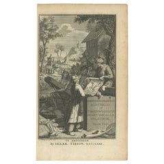

Antique Frontispiece by Tirion, Showing a Map of Africa, an Elephant Etc, 1731
Located in Langweer, NL
Antique frontispiece of the 3rd volume of 'Hedendaagsche historie of tegenwoordige staat van allen volkeren (..)' by Thomas Salmon. This volume describes Pegu, Arrakan, India, Ceylon...
Paper
Large University Chart “Africa Physical ” by Bacon
Located in Godshill, Isle of Wight
Large University chart “Africa Physical ” by Bacon W&A K Johnston’s charts of physical maps by G W Bacon, This is a Physical map of Africa, it is lithograph set on Linen mounte...
Linen

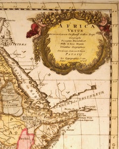
"Africa Vetus": a 17th Century Hand-Colored Map by Sanson
By Nicolas Sanson
Located in Alamo, CA
This original hand-colored copperplate engraved map of Africa entitled "Africa Vetus, Nicolai Sanson Christianiss Galliar Regis Geographi" was originally created by Nicholas Sanson d...
Paper

Africa Map by Rigobert Bonne – Pre-Colonial Geography c.1780
Located in Langweer, NL
Africa Map by Rigobert Bonne – Pre-Colonial Geography c.1780 DESCRIPTION This map of Africa captures European geographic knowledge prior to large-scale colonial penetration.
Paper
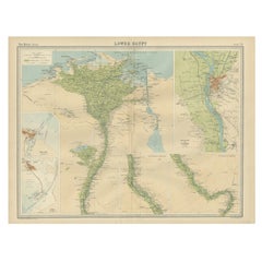

Antique Map of Lower Egypt, Showing Port Said, Suez and Surroundings, 1922
Located in Langweer, NL
Antique map of Africa titled 'Lower Egypt '. Old map of Africa depicting Egypt, Port Said, Suez and surroundings.
Paper

Antique Map of the Region of the Nile River by Bartholomew, 1922
Located in Langweer, NL
Antique map of Africa titled 'Egypt and the Nile'. Old map of Africa depicting Egypt, the Nile river and surroundings.
Paper

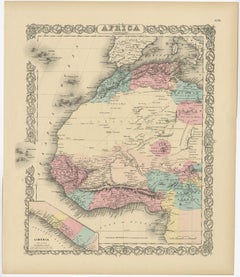
Antique Map of Northwest Africa by Bartholomew, 1922
Located in Langweer, NL
Antique map of Africa titled 'North-West Africa'. Old map of north-west Africa depicting Morocco, Algeria, Tunis and surroundings.
Paper

Africa: A Large 17th Century Hand-Colored Map by Sanson and Jaillot
By Nicolas Sanson
Located in Alamo, CA
This large original hand-colored copperplate engraved map of Africa consists of two sheets joined as one along a vertical joint.
Paper

$1,354Sale Price|20% Off
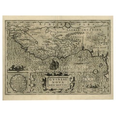
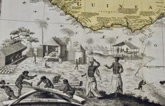
Old Decorative Map of the West African Coast & St. Thomae Island, c.1600
Located in Langweer, NL
Antique map titled 'Guineae Nova Descriptio.' This very decorative map shows the West African coast from Senegal (the 'Rio Senega' is the Senegal River) to Cape Lopez on the Gulf...
Paper

West Africa Entitled "Guinea Propria": An 18th Century Hand Colored Homann Map
By Johann Baptist Homann
Located in Alamo, CA
This is a scarce richly hand colored copper plate engraved map of Africa entitled "Guinea Propria, nec non Nigritiae vel Terrae Nigrorum Maxima Pars" by Johann Baptist Homann (1664-1...
Paper
$336Sale Price|20% Off
Antique Map of Senegal, West Africa
Located in Langweer, NL
Original antique map titled 'Carta del Senegal'. Antique map of Senegal, West Africa.
Paper
$411Sale Price|20% Off
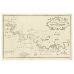
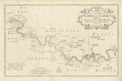
Antique Map of Gambia, West Africa
Located in Langweer, NL
Detailed map of Gambia, West Africa, surrounded by Senegal with decorative title based on information supplied by Captain John Leach.
Paper
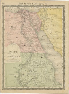
Egypt & Lower Nubia – Elegant Antique Atlas Map of the Nile, ca.1888
Located in Langweer, NL
A particularly appealing feature of this sheet is that the reverse side displays a decorative map of Africa, making it a versatile double-sided atlas leaf.
Paper

$233Sale Price|20% Off
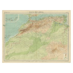
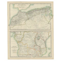
Antique Map of N.W. Africa & Central Africa by Johnston (1909)
Located in Langweer, NL
Antique map titled 'N.W. Africa & Central Africa'. Original antique map of N.W.
Paper
Antique Map of the Coast of Guinea, Africa, 1820
Located in Langweer, NL
Antique map Africa titled 'Carte de la Haute et de la Basse Guinée'.
Paper

Antique Map of the West Coast of Africa, 1771
By Rigobert Bonne
Located in Langweer, NL
Map of the West Coast of Africa. Covers from the Cape Verde Islands eastward to the coasts of Africa and the western mouth of the Niger River.
Paper


$186Sale Price|20% Off
Antique Map of South Africa by Wyld '1845'
Located in Langweer, NL
Antique map titled 'South Africa'. Original antique map of South Africa.
Paper


$373Sale Price|20% Off
Uncoulored Original Antique Map of Western Africa, 1749
Located in Langweer, NL
Interesting detailed German antique map titled 'Neue Vorstellung der Abendlaendischen Küsten von Africa (..)'.
Paper
Antique Map of the Kingdom of Tunisia, Africa, 1773
Located in Langweer, NL
Old map of the Kingdom of Tunisia. Originates from the first Dutch editon of an interesting travel account of Northern Africa titled 'Reizen en Aanmerkingen door en over Barbaryen en...
Paper
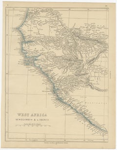
Antique Map of West Africa by Lowry, 1852
Located in Langweer, NL
Antique map titled 'West Africa'. Three individual sheets of West Africa.
Paper
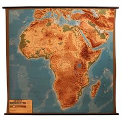
Vintage Relief Map of Africa, 1970s
Located in Antwerp, BE
Vintage relief map of Africa, 1970s. Good original condition with great relief.
Hand-Colored Map of Africa, circa 1744
By Matthew Seutter
Located in New York, NY
Seutter, Matthew. Africa. From Atlas minor praecipua Terrarum Imperia... Augsburg, circa 1744. Original engraving with old hand-coloring. Image size: 7 5/8 x 10 1/8 inches.
Paper
Interesting Large Victorian Relief Map of Africa
Located in Stamford, CT
Good relief map with a great patina and original oak frame
Wood
Unavailable
H 19.69 in W 29.53 in
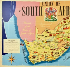
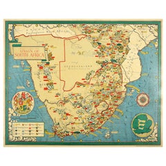
Original Vintage Poster Union Of South Africa Map Natural & Industrial Resources
Located in London, GB
Original vintage illustrated map poster for the Union of South Africa Her Natural and Industrial Resources featuring colourful images of the main cities including Cape Town, Pretoria...
Paper
Unavailable
H 24.02 in W 18.12 in
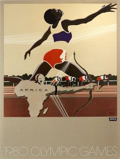
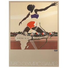
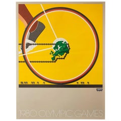
Original Vintage Sport Poster Levi's Moscow 1980 Olympic Games Africa Runner
Located in London, GB
Original vintage sport poster published by the Levi Strauss clothing brand (founded 1853) for the 1980 Moscow Olympic Games featuring a great graphic design depicting an athlete stre...
Paper
Unavailable
H 33.08 in W 42.52 in
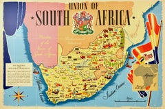
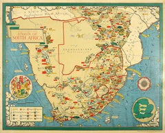
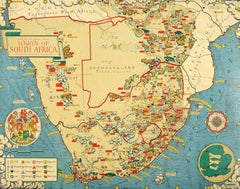
Original Vintage Illustrated Map Poster Union Of South Africa MacDonald Gill
By "Leslie MacDonald ""Max"" Gill"
Located in London, GB
The map is also decorated with a compass, coat of arms of South Africa, small map of England used to show scale, ships, waves and clouds.
Paper
Unavailable
H 17.33 in W 20.87 in
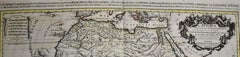
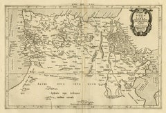
Ptolemaic map of North Africa, Libya, Egypt by Mercator - Engraving - 17th c
By Gerard Mercator
Located in Zeeland, Noord-Brabant
.' - A beautiful Ptolemaic map covering ancient North Africa, specifically Libya and part of Ethiopia but also including a mapping of the Nile in Egypt and the Canary Islands.
Engraving
Unavailable
H 16.93 in W 20.87 in
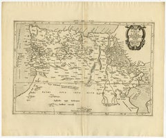
Ptolemaic map of NW Africa, Morocco and Algeria by Mercator - Engraving - 17th c
By Gerard Mercator
Located in Zeeland, Noord-Brabant
.' - A beautiful Ptolemaic map covering ancient northwestern Africa, including present day Morocco and Algeria.
Engraving
Unavailable
H 33.08 in W 30.71 in
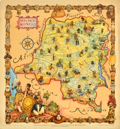
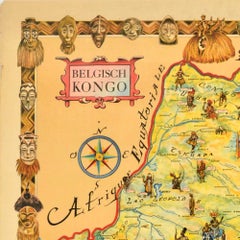
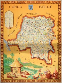
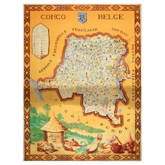
Original Vintage Travel Map Poster Belgian Congo Africa Thiriar Margraff Belgium
Located in London, GB
Original vintage travel map poster for the Belgian Congo / Belgisch Kongo featuring a pictorial map of the area bordering Equatorial Africa, French Sudan, Angola, Rhodesia, Tanganyik...
Paper

Unavailable
H 44.1 in W 33.08 in
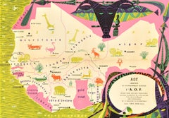
Original Vintage Africa Travel Poster Belgian Congo Congo Belge Illustrated Map
Located in London, GB
Original vintage Africa travel poster for the Belgian Congo / Congo Belge including a pictorial map of French Equatorial Africa, Sudan, Uganda, Tanganyika, Rhodesia and Angola.
Paper
Unavailable
H 80 in W 120 in
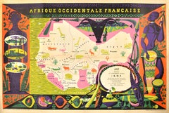
Original Vintage Poster French West Africa Map Afrique Occidentale Francaise Art
By Alain Cornic 1
Located in London, GB
Original vintage poster featuring an illustrated map of French West Africa / Afrique Occidentale Francaise marking the capital cities, towns, ports, Sahara Desert and rivers in Mauri...
Paper

Unavailable
H 23.63 in W 15.75 in
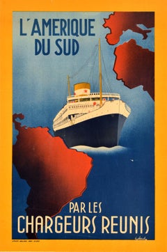
Original Vintage Travel Poster Amerique Du Sud Par Les Chargeurs Reunis Cruise
Located in London, GB
Original vintage cruise travel poster for South America by Chargeurs Reunis / L'Amerique Du Sud par les Chargeurs Reunis featuring a ship sailing on the Atlantic Ocean between map sh...
Paper
Unavailable
H 41.34 in W 29.53 in
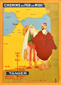
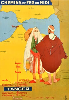
Original Vintage Train Travel Poster Tanger Morocco Chemins De Fer Du Midi
Located in London, GB
Original vintage train travel poster advertising the Chemins de Fer du Midi railway company to Tanger / Tangier in Morocco featuring a colourful illustration of a lady and man in tra...
Paper
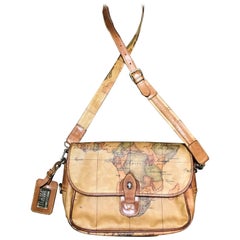
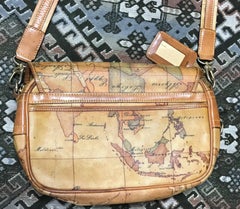
Alviero Martini Prima Classe Vintage messenger type classic shoulder bag.
By Alviero Martini
Located in Kashiwa, Chiba
Vintage Alviero Martini Prima Classe messenger type classic shoulder bag with a map print of Africa and Southeast Asia. Unisex use.

Lagos Vision Series
By Cyrus Kabiru
Located in London, GB
The series of dozens of eyewear made from bits and pieces found in the slum, constructed with consumate craftsmanship, eachof them alluding to a personal or Kenyan history-related na...
C Print

Lagos Vision Series
By Cyrus Kabiru
Located in London, GB
The series of dozens of eyewear made from bits and pieces found in the slum, constructed with consumate craftsmanship, eachof them alluding to a personal or Kenyan history-related na...
C Print

Lagos Vision Series
By Cyrus Kabiru
Located in London, GB
The series of dozens of eyewear made from bits and pieces found in the slum, constructed with consumate craftsmanship, eachof them alluding to a personal or Kenyan history-related na...
C Print

Lagos Vision Series
By Cyrus Kabiru
Located in London, GB
The series of dozens of eyewear made from bits and pieces found in the slum, constructed with consumate craftsmanship, eachof them alluding to a personal or Kenyan history-related na...
C Print
Philips’ New Map of Africa
Located in London, London
[PHILIP, George] Philips’ New Map of Africa London & Liverpool George Philip & Son [1899] Attractive large map of Africa by the firm founded by the Scottish cartographer George Ph...
Watercolor, Engraving
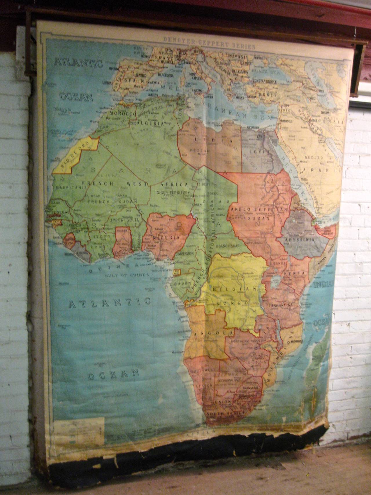
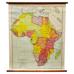
1923 Denoyer-Geppert School House Map of Africa
Located in New Windsor, NY
Amazing size and quality Denoyer-Geppert Map of Africa. Africa's strong colonial influences and exploiters are still fully evident and give a great history lesson.
Oak, Paper

Map of Africa by Tanner
Located in Alamo, CA
At the time this map was published, Africa was largely unexplored.
Engraving
Sold
H 10.12 in W 12.84 in D 0.01 in
Relief Atlas Map of Africa by Hachette – Antique c.1883 French Map
Located in Langweer, NL
Antique Map of Africa – Relief Atlas Map by Hachette, circa 1880 Description: This is an attractive antique map titled “Afrique,” published by Hachette in Paris around 1880.
Paper
Framed Map of Africa by Hubert Jaillot
Located in Essex, MA
Black and white engraving. Framed and matted under plexiglass.
Paper
Sold
H 43.12 in W 64.18 in D 1.58 in
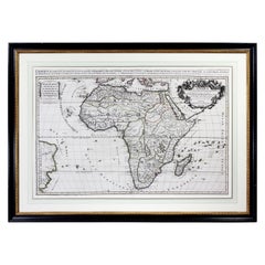
Important giant Map of Africa, for the King of France, 1698
By Nicolas de Fer
Located in Amsterdam, NL
Engraved by Hendrik van Loon after design by Nicolaas de Fer Printed on four copperplates and surrounded by (often cut-off) texts in relief printing on separate copperplates, later ...
Watercolor, Engraving

Sold
H 23.23 in W 17.92 in D 0 in
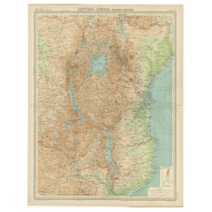
Antique Map of Central Africa 'East' Depicting Belgian Congo, Kenya etc, 1922
Located in Langweer, NL
Antique map of Africa titled 'Central Africa - Eastern Section'.
Paper


Antique Map of South Africa by Lowry, 1852
Located in Langweer, NL
Antique map titled 'South Africa'. Two individual sheets of South Africa.
Paper


Antique Map of Northern Africa by Tallis, 1851
Located in Langweer, NL
Antique map titled ?Northern Africa?. Includes decorative vignettes titled Mogador, Marocco, Constantine, Algiers and Tunis.
Paper

Sold
H 15.56 in W 20.48 in D 0.08 in
Attractive Antique Map of East and Central Africa with Inset Map of Congo, 1609
Located in Langweer, NL
Antique print titled 'Abissinorum sive Pretiosi Ioannis Imperiu'. Attractive map of East and Central Africa with inset map of Congo, focusing on the legendary kingdom of prester ...
Paper

Antique Map of West Africa by N. Sanson, 1656
Located in Langweer, NL
This 17th century map displays the southern coast of West Africa from the coast of Sierra Leone around to Gabon, including São Thome (St.
Paper
Hammond's Map of the Mediterranean, Europe, and Africa, circa 1941
Located in Colorado Springs, CO
This is an original WWII folding folio map of the Mediterranean, Europe, and Africa. The map was one of six foldout maps in a color lithographic folio titled "Battle Maps: Covering A...

Sold
H 20.08 in W 12.21 in D 0 in
Antique Map of Eastern Africa, Engraved by a German Missionary, 1858
Located in Langweer, NL
Original antique map of Eastern Africa. This map originates from 'Reisen in Ost-Afrika, ausgeführt in dem Jahren 1837-55' by J.L.
Paper

Sold
H 10.24 in W 12.8 in D 0.02 in
Antique Map of the Coast of Zanguebar and Madagascar 'Africa' by J. van Schley
Located in Langweer, NL
Decorative map of the area between the east coast of South Africa, the Seychelles, Mauritius and Madagascar.
Paper

Sold
H 46.86 in W 31.5 in D 0.04 in
Original Vintage Poster French Equatorial Africa Map Afrique Chad Congo Francais
Located in London, GB
Original vintage pictorial map poster of French Equatorial Africa / Afrique Equatoriale Francaise featuring and illustrated design by J.
Paper
Antique Map of the Turkish Empire by Tirion, 1763
Located in Langweer, NL
Antique map titled 'Nieuwe Kaart van het Turksche Ryk gelegen in Europa, Asia en Africa'.
Paper
Sold
H 36.42 in W 24.02 in D 0.04 in
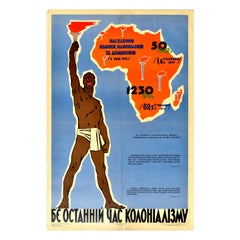
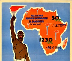
Original Vintage Poster The Last Hour Of Colonialism Africa Independence USSR
Located in London, GB
Original vintage Soviet Ukrainian propaganda poster - The Last Hour of Colonialism Is Coming - featuring dynamic artwork depicting a man holding up a flaming torch with information o...
Paper
Sold
H 39.77 in W 25.4 in D 0.04 in
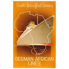
Original Art Deco German African Lines Cruise Poster for South Africa - Pretoria
By Ottomar Anton
Located in London, GB
Fantastic Art Deco illustration by the German painter and graphic artist Ottomar Anton (1895-1976) featuring the Pretoria liner against an orange shaded background with a white outli...
Paper
Sold
H 39.97 in W 25.01 in D 0.04 in
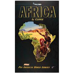
Original Vintage Travel Advertising Poster: Africa By Clipper - Pan American PAA
Located in London, GB
Great design featuring people standing in tall grass wearing traditional jewelry and clothing and holding shields pointing towards a town in the distance in front of hills on the hor...
Paper
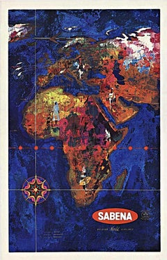
Sabena Belgian World Airlines original vintage travel poster to Africa
Located in Spokane, WA
Archival linen-backed so that is ready to frame. The image is a map of Africa and the Middle East created in beautiful color patterns with the oceans surrounding it in blue tones.
Lithograph

Sold
H 24.02 in W 18.12 in D 0.04 in
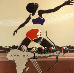
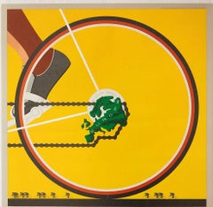
Original Vintage Sport Poster Levi's Moscow 1980 Olympic Games Africa Athletics
Located in London, GB
Original vintage sport poster published by the Levi Strauss clothing brand (founded 1853) for the 1980 Moscow Olympic Games featuring a great graphic design depicting an athlete stre...
Paper
Sold
H 43.12 in W 64.18 in
Important giant Map of Asia, for the King of France, 1696
By Nicolas de Fer
Located in Amsterdam, NL
Avec le Privilege du Roy, 1696 (See also his Giant Map of Africa from our Collection) Description de l’Asie par N. de Fer (in relief printing) Engraved by Hendrik van Loon after d...
Watercolor, Engraving
Sold
H 37.01 in W 49.22 in
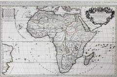
1825 original map "Carte générale de l'Afrique divisée en plusieurs royaumes"
Located in PARIS, FR
During this period, European maps of Africa often combined geographical information with elements of political propaganda.
Linen, Paper, Lithograph

Sold
H 33.08 in W 42.52 in D 0.04 in
Original Vintage Illustrated Map Poster Union Of South Africa MacDonald Gill
By "Leslie MacDonald ""Max"" Gill"
Located in London, GB
The map is also decorated with a compass, coat of arms of South Africa, small map of England used to show scale, ships, waves and clouds.
Paper
Sold
H 38.19 in W 28.35 in D 0.04 in
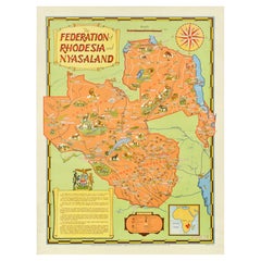
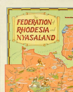
Original Vintage Poster The Federation Of Rhodesia And Nyasaland Africa Map
Located in London, GB
Original vintage poster - The Federation of Rhodesia and Nyasaland - featuring a pictorial map of the region depicting the tribes and wild animals, cattle, industrial manufacturing, ...
Paper
Sold
H 40.16 in W 59.85 in D 0.04 in
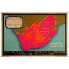
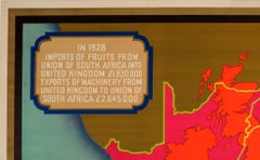
Original Vintage Empire Marketing Board Poster Ft Union of South Africa & UK Map
Located in London, GB
Original vintage historic Empire Marketing Board poster - Every Time You Buy Empire Produce You Help The Empire To Buy The Goods You Make At Home - issued by the Empire Marketing Boa...
Paper

Sold
H 44.1 in W 33.08 in D 0.04 in
Original Vintage Africa Travel Poster Belgian Congo Congo Belge Illustrated Map
Located in London, GB
Original vintage Africa travel poster for the Belgian Congo / Congo Belge including a pictorial map of French Equatorial Africa, Sudan, Uganda, Tanganyika, Rhodesia and Angola.
Paper
Sold
H 24.02 in W 18.12 in D 0.04 in
Set of 6 Original Vintage Posters 1980 Moscow Olympic Games Levi's Sport Design
Located in London, GB
Artist: Michael Manwaring. [4] Africa Athletics Track Archery poster features a great graphic design depicting an athlete stretching over an archer formed from the shape of the ma...
Paper
Sold
H 26.78 in W 18.9 in D 0.04 in
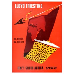
Original Vintage Cruise Travel Poster Lloyd Triestino Europa Italy South Africa
Located in London, GB
Original vintage cruise travel poster - Lloyd Triestino MV. Africa MV. Europa Italy South Africa Express - featuring a dynamic design against a red background showing a map of Europe...
Paper
Sold
H 27.6 in W 19.7 in D 0.1 in
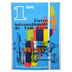
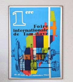
1st International Tamatave Fair 1963 - Madagascar Original Vintage Poster
Located in Winchester, GB
Held from 31st August to 22nd September 1963 in the coastal port city of Tamatave, the event featured many pavilions including machinery and engineering as featured in the brilliant ...
Linen, Paper
Sold
H 63 in W 46.46 in D 0.4 in
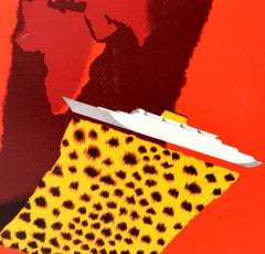
Original Vintage Poster-Jean Piaubert-E Olive Oil from Tunisia, c.1925
Located in SAINT-OUEN-SUR-SEINE, FR
He is wearing a traditional Tunisian hat: Fez - Chechia.The background is a map of North Africa and Tunisia, with the cities of Bizerte, Tunis, Sousse, Sfax, Mahares.
Paper

Sold
H 40.56 in W 60.24 in D 0.04 in
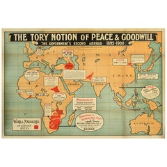
Original Antique Political Propaganda Poster The Tory Notion Peace Goodwill UK
Located in London, GB
Original antique political propaganda poster - The Tory Notion of Peace & Goodwill The Government's Record Abroad 1895-1900 - featuring a map of the world marked Europe Africa Arabia...
Paper

Original Antique Map of Africa. C.1780
Located in St Annes, Lancashire
Great map of Africa Copper-plate engraving Published C.1780 Unframed.
Paper


Original Antique Map of Africa, circa 1800
Located in St Annes, Lancashire
Great map of Africa Copper plate engraving Published in The Barclays Dictionary, circa 1800.
Paper


Antique Map of Africa by Balbi '1847'
Located in Langweer, NL
Antique map titled 'Afrique'. Original antique map of Africa.
Paper

Original Antique Map of Africa, Arrowsmith, 1820
Located in St Annes, Lancashire
Great map of Africa. Drawn under the direction of Arrowsmith.
Paper

Antique Map of Africa by Levasseur '1875'
Located in Langweer, NL
Antique map titled 'Carte générale du l'Afrique'. Large map of Africa.
Paper

Large Original Vintage Map of Africa, circa 1920
Located in St Annes, Lancashire
Great map of Africa Original color. Good condition Published by Alexander Gross Unframed.
Paper


Antique Map of Africa by Wyld '1845'
Located in Langweer, NL
Antique map titled 'Africa'. Original antique map of Africa.
Paper
It's hard to resist the allure of a beautiful pool. So, go ahead and daydream about whiling away your summer in paradise.
It’s never too early for good design. These interiors combine elevated furnishings and a youthful spirit, resulting in spaces that are at once elegant and whimsical.
Produced in 1843, the well-preserved volume is evidence of the author's exacting specifications.
New or old, the coverlets add old-time charm to any space.
Get into the games! These items celebrate the events, athletes, host countries and sporting spirit.
French trendsetter and serial collector Daniel Rozensztroch tells us about his obsession with objects related to seafaring men.
The sought-after designer worked with the team at Hoffman Creative to produce a monograph that beautifully showcases some of Studio Shamshiri's most inspiring projects.
Italian writer and collector Umberto Pasti opens the doors to his remarkable cave of wonders in North Africa.