Items Similar to Antique Map of the West Coast of Africa, 1771

Want more images or videos?
Request additional images or videos from the seller
1 of 6
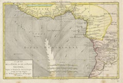
Antique Map of the West Coast of Africa, 1771
About the Item
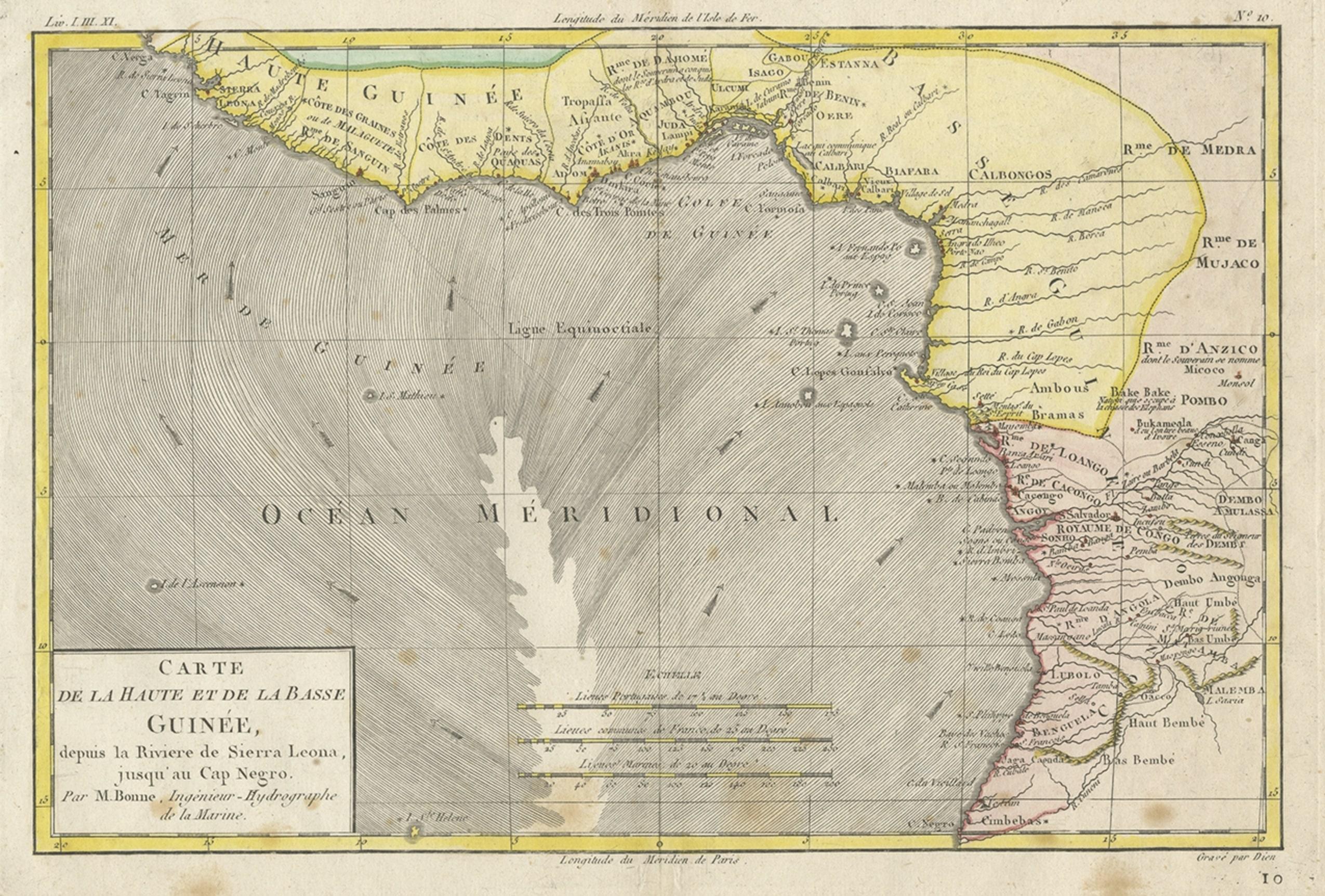
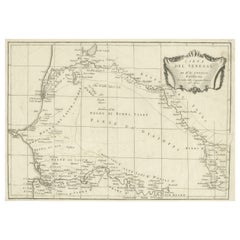
Antique map titled 'Carte de la Guinee contenant les Isles du Cap Verd, le Senegal, la Cote de Guinee proprement dite, les Royaumes de Loango, Congo, Angola, et Benguela avec les Pays voisins autant qu'ils sont connus'. Map of the West Coast of Africa. Covers from the Cape Verde Islands eastward to the coasts of Africa and the western mouth of the Niger River. Includes the modern day nations of Mauritania, Senegal, Gambia, Guinea-Bissau, Guinea, Sierra Leone, Liberia and Cote d'Ivoire.
Artists and Engravers: Rigobert Bonne (1727 - 1794) was one of the most important French cartographers of the late 18th century.
Condition: Good, age-related toning. Some stains, please study image carefully.
Date: 1771
Overall size: 38 x 54 cm.
Image size: 31 x 42 cm.
We sell original antique maps to collectors, historians, educators and interior decorators all over the world. Our collection includes a wide range of authentic antique maps from the 16th to the 20th centuries. Buying and collecting antique maps is a tradition that goes back hundreds of years. Antique maps have proved a richly rewarding investment over the past decade, thanks to a growing appreciation of their unique historical appeal. Today the decorative qualities of antique maps are widely recognized by interior designers who appreciate their beauty and design flexibility. Depending on the individual map, presentation, and context, a rare or antique map can be modern, traditional, abstract, figurative, serious or whimsical. We offer a wide range of authentic antique maps for any budget.
- Creator:Rigobert Bonne (Artist)
- Dimensions:Height: 21.26 in (54 cm)Width: 14.97 in (38 cm)Depth: 0 in (0.01 mm)
- Materials and Techniques:
- Period:
- Date of Manufacture:1771
- Condition:Condition: Good, age-related toning. Some stains, please study image carefully.
- Seller Location:Langweer, NL
- Reference Number:
About the Seller
5.0
Platinum Seller
These expertly vetted sellers are 1stDibs' most experienced sellers and are rated highest by our customers.
Established in 2009
1stDibs seller since 2017
1,922 sales on 1stDibs
Typical response time: <1 hour
- ShippingRetrieving quote...Ships From: Langweer, Netherlands
- Return PolicyA return for this item may be initiated within 14 days of delivery.
More From This SellerView All
- Antique Map of the West African Coast and the Cape Verde Islands, c.1680Located in Langweer, NLAntique map Africa titled 'Isles du Cap Verd Coste et Pays des Negres'. Antique map of the coast of Africa and the Cape Verde islands. Artists a...Category
Antique 17th Century Maps
MaterialsPaper
- Antique Map of the Coast of Guinea, Africa, 1820Located in Langweer, NLAntique map Africa titled 'Carte de la Haute et de la Basse Guinée'. Map of the Coast of Guinea, Africa. Represents modern day Liberia, Ivory Coast, Ghana, Nigeria, Cameroon, Gabon, Congo, and Equatorial Guinea...Category
Antique 19th Century Maps
MaterialsPaper
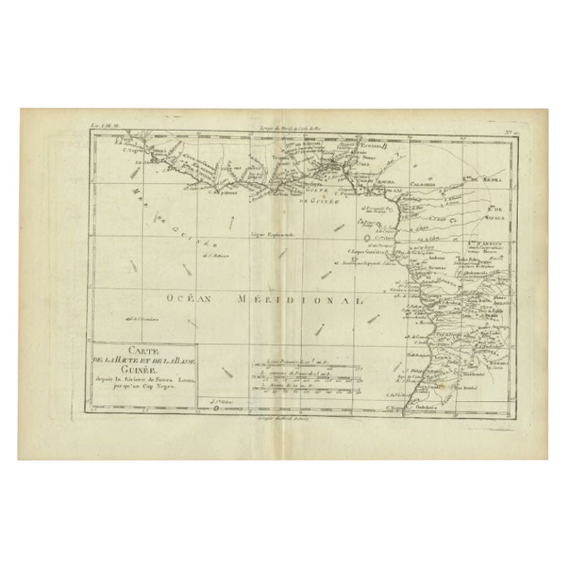
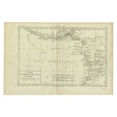
- Antique Map of the Coast of Guinea, Africa, c.1780Located in Langweer, NLAntique map Africa titled 'Carte de la Haute et de la Basse Guinée'. Map of the Coast of Guinea, Africa. Represents modern day Liberia, Ivory Coast, Ghana, Nigeria, Cameroon, Gabon, Congo, and Equatorial Guinea...Category
Antique 18th Century Maps
MaterialsPaper
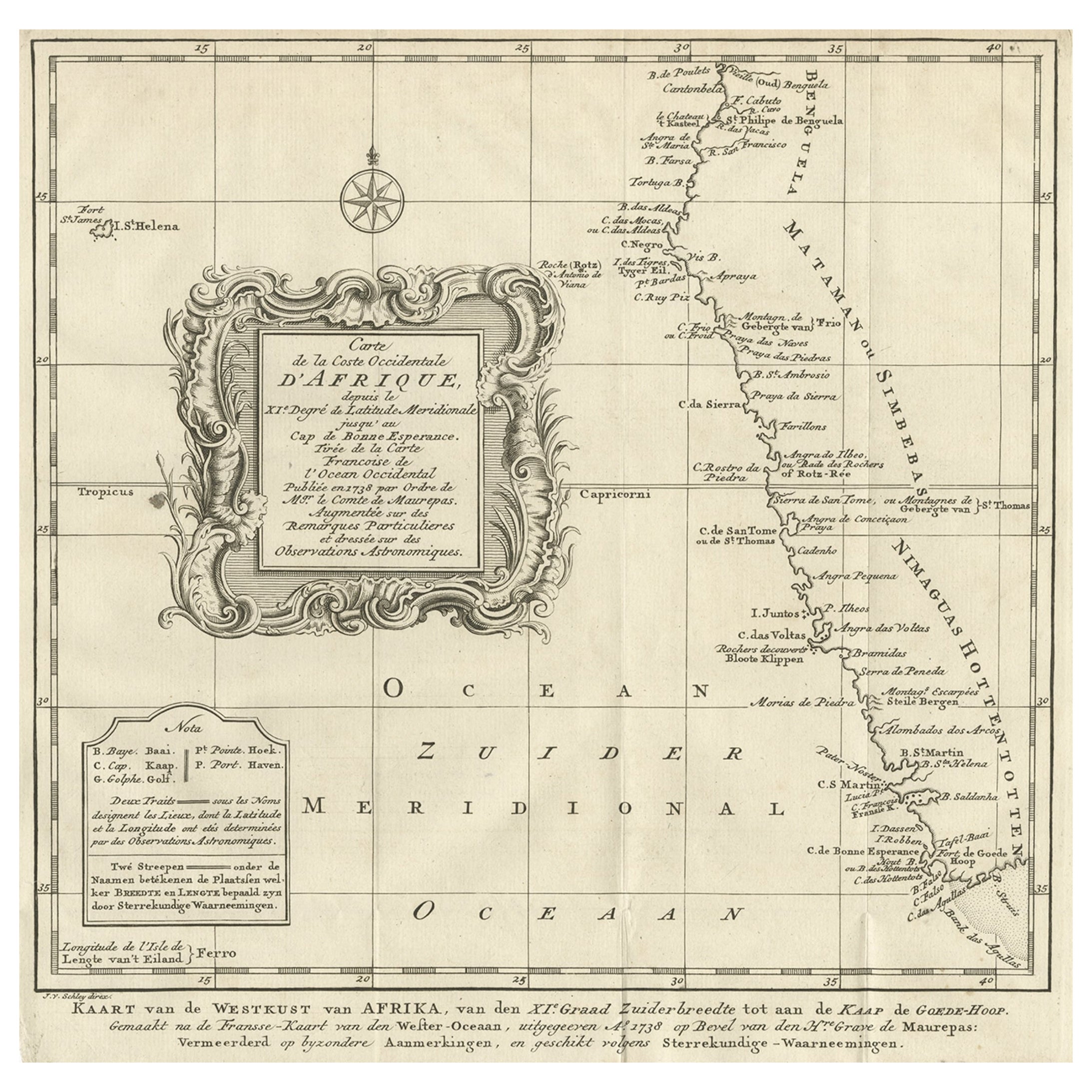
- Dutch Antique Map of the West Coast of Africa, to the Cape of Good Hope, 1747Located in Langweer, NLAntique map of the Coast of Africa titled 'Kaart van de West Kust van Afrika (..)'. Map of the west coast of Africa, from 11 degrees south latitude to the Cape of Good Hope. This...Category
Antique 1740s Maps
MaterialsPaper
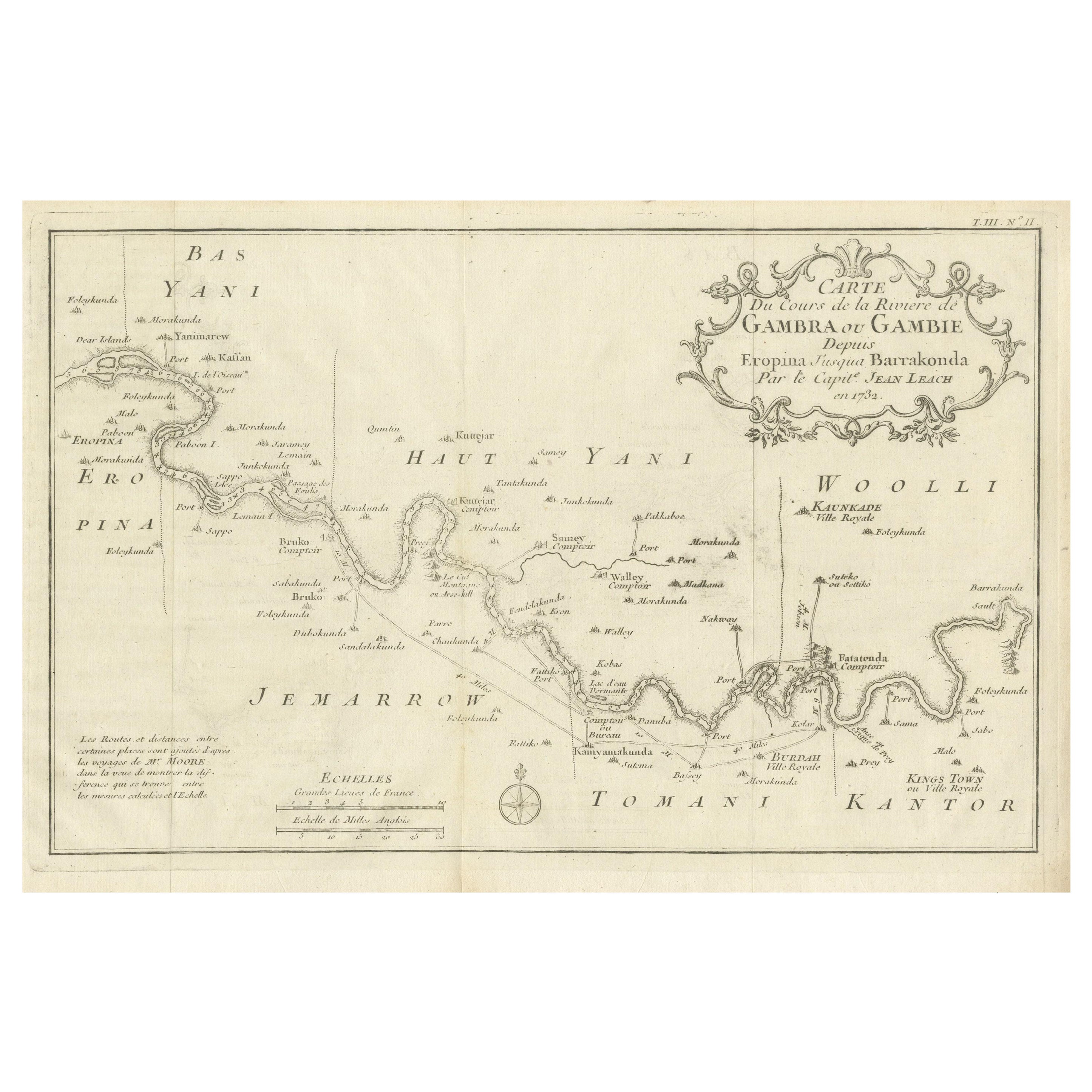
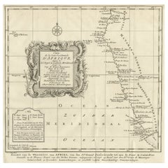
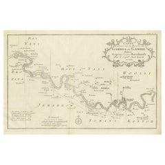
- Antique Map of Gambia, West AfricaLocated in Langweer, NLAntique map titled 'Carte du Cours de la Riviere de Gambra ou Gambie (..)'. Detailed map of Gambia, West Africa, surrounded by Senegal with decorative title based on information supp...Category
Antique Mid-18th Century Maps
MaterialsPaper
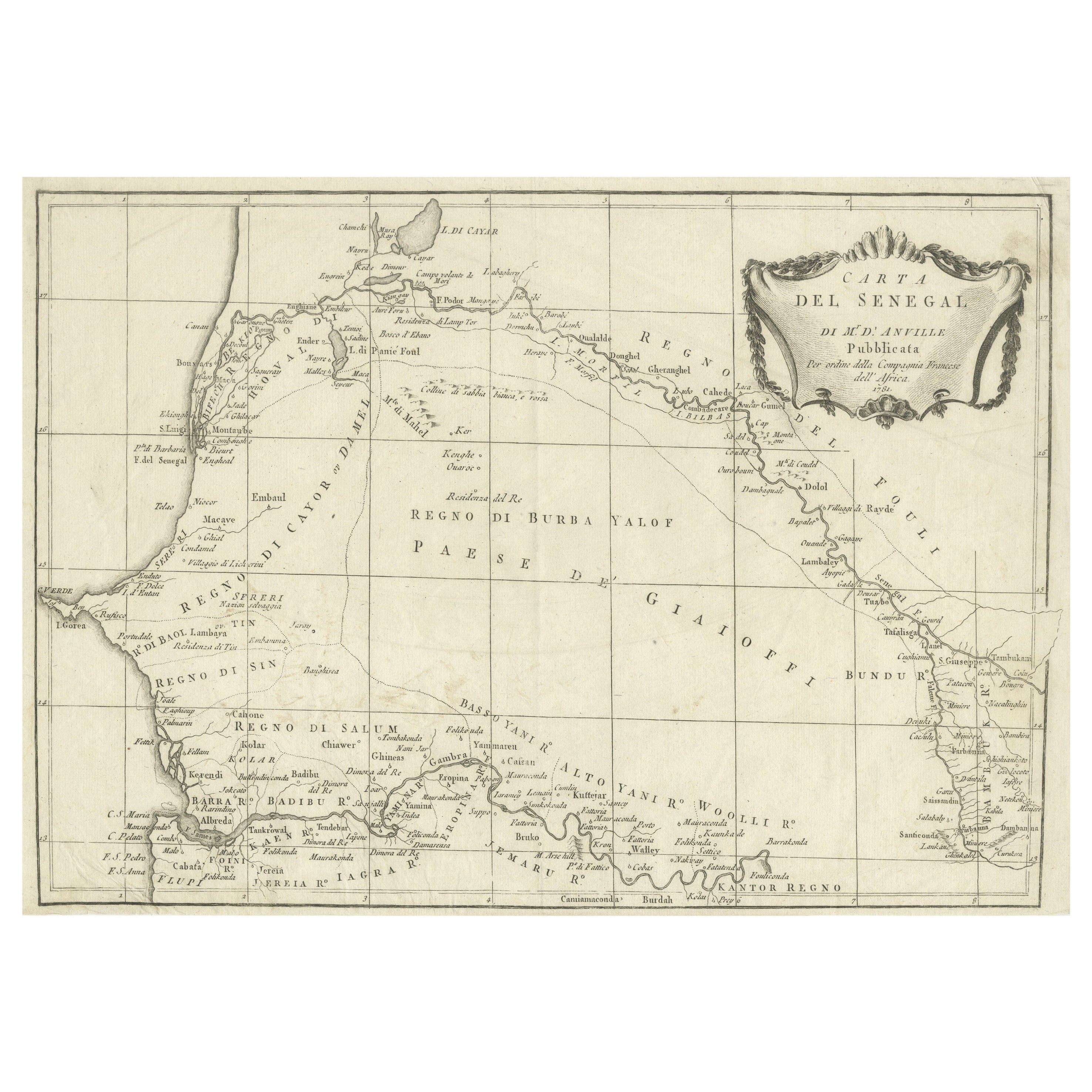
- Antique Map of Senegal, West AfricaLocated in Langweer, NLOriginal antique map titled 'Carta del Senegal'. Antique map of Senegal, West Africa. This map originates from 'Compendio della storia generale dei viaggi (..)'. Published by De la Harpe...Category
Antique Mid-18th Century Maps
MaterialsPaper

You May Also Like
- Original Antique Decorative Map of South America-West Coast, Fullarton, C.1870Located in St Annes, LancashireGreat map of Chili, Peru and part of Bolivia Wonderful figural border From the celebrated Royal Illustrated Atlas Lithograph. Original color. Published by Fullarton, Edi...Category
Antique 1870s Scottish Maps
MaterialsPaper
- West Coast of Africa, Guinea & Sierra Leone: An 18th Century Map by BellinBy Jacques-Nicolas BellinLocated in Alamo, CAJacques Bellin's copper-plate map entitled "Partie de la Coste de Guinee Dupuis la Riviere de Sierra Leona Jusquau Cap das Palmas", depicting the coast of Guinea and Sierra Leone in ...Category
Antique Mid-18th Century French Maps
MaterialsPaper
- Antique Lithography Map, West Africa, English, Framed, Cartography, VictorianLocated in Hele, Devon, GBThis is an antique lithography map of Western Africa. An English, framed atlas engraving of cartographic interest by John Rapkin, dating to the early Victorian period and later, circ...Category
Antique Mid-19th Century British Early Victorian Maps
MaterialsWood
- Large Original Antique Map of The West Indies by Sidney Hall, 1847Located in St Annes, LancashireGreat map of The West Indies Drawn and engraved by Sidney Hall Steel engraving Original colour outline Published by A & C Black. 1847 Unframed Free shipping.Category
Antique 1840s Scottish Maps
MaterialsPaper
- 17th Century Hand-Colored Map of West Africa by Mercator/HondiusLocated in Alamo, CAA 17th century hand-colored map entitled "Guineae Nova Descriptio" by Gerard Mercator and Jodocus Hondius, published in their 'Atlas Minor' in Amsterdam in 1635. It is focused on the...Category
Antique Mid-17th Century Dutch Maps
MaterialsPaper
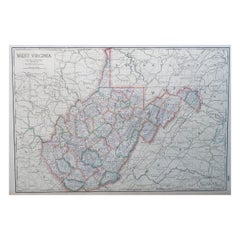
- Large Original Antique Map of West Virginia, USA, C.1900Located in St Annes, LancashireFabulous map of West Virginia Original color Engraved and printed by the George F. Cram Company, Indianapolis. Published, C.1900 Unframed Free shipping.Category
Antique 1890s American Maps
MaterialsPaper


Recently Viewed
View AllMore Ways To Browse
Sierra Leone Antique Map
Antique Colorado Map
Antique Maps Colorado
Vietnam Map
Antique Map Of Colorado
Congo Antique Map
World Map Relief
Antique Map Norfolk
Antique Maps Norfolk
Brooklyn Map
Gambia Antique Map
Vintage Bartholomew Maps
Vintage Bartholomews Maps
Antique Brooklyn Map
Antique South Carolina Map
Durham Antique Map
Map Made Of Silver Gold
Mozambique Antique Map