Items Similar to Antique Map of Africa with Mountain Ranges and other details

Want more images or videos?
Request additional images or videos from the seller
1 of 6
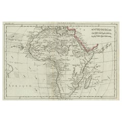
Antique Map of Africa with Mountain Ranges and other details
About the Item
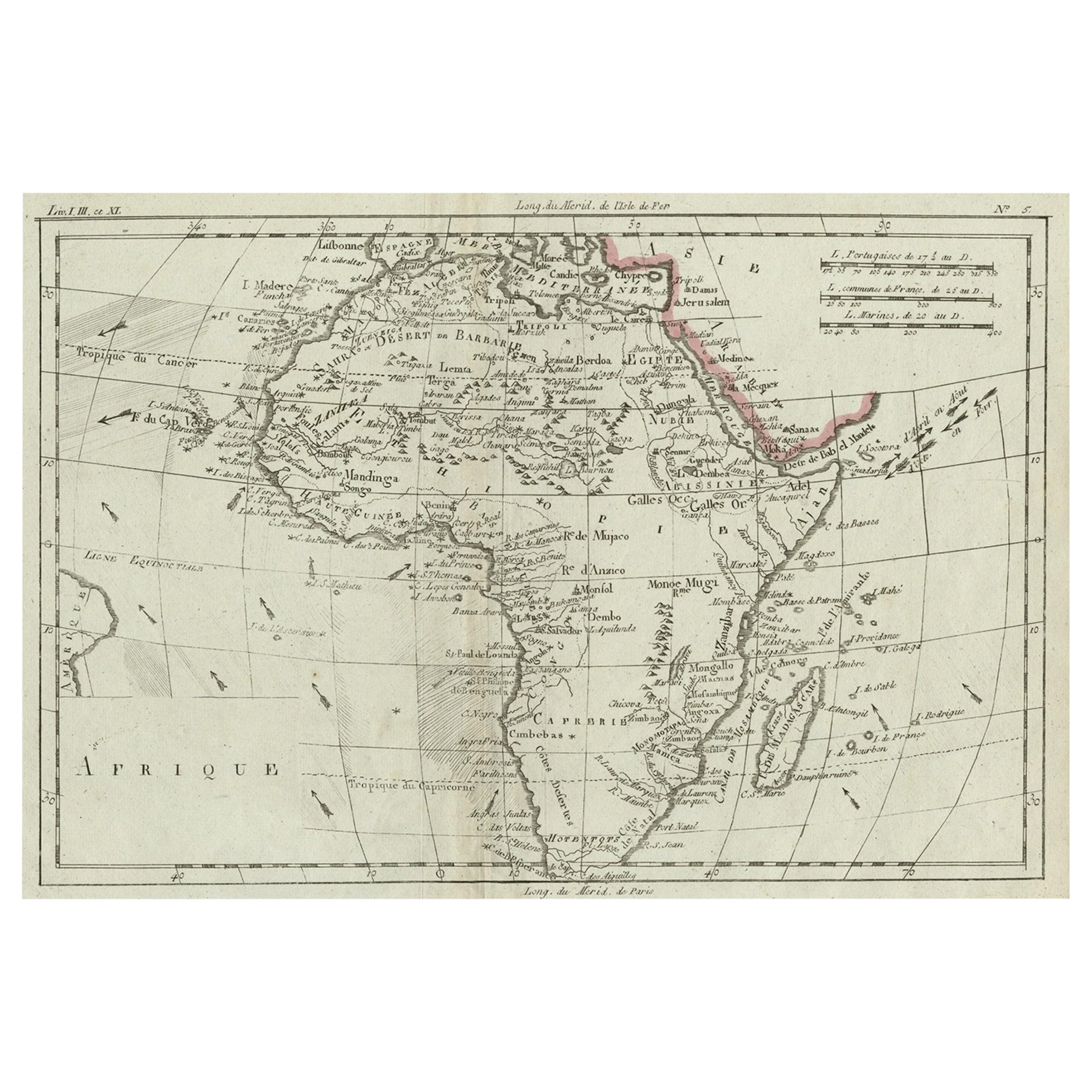
Antique map titled 'Carte générale et Politique de l'Afrique'. Original antique map of Africa. Highlights numerous mountain ranges, lakes and rivers, regions, countries and places. Published by Chanlaire and Mentelle, circa 1799.
- Dimensions:Height: 19.06 in (48.4 cm)Width: 25.44 in (64.6 cm)Depth: 0.02 in (0.5 mm)
- Materials and Techniques:
- Period:
- Date of Manufacture:c.1799
- Condition:General age-related toning. Original folding line. Minor wear and soiling, blank verso. Please study image carefully.
- Seller Location:Langweer, NL
- Reference Number:
About the Seller
5.0
Platinum Seller
These expertly vetted sellers are 1stDibs' most experienced sellers and are rated highest by our customers.
Established in 2009
1stDibs seller since 2017
1,916 sales on 1stDibs
Typical response time: <1 hour
- ShippingRetrieving quote...Ships From: Langweer, Netherlands
- Return PolicyA return for this item may be initiated within 14 days of delivery.
More From This SellerView All
- Antique Map of Africa with Ocean Currents and Other Details, C.1780Located in Langweer, NLAntique map titled 'Afrique.' Detailed map of Africa, showing towns, rivers, some topographical features, ocean currents, ports and political boundaries. Source unknown, to be determ...Category
Antique 18th Century Maps
MaterialsPaper
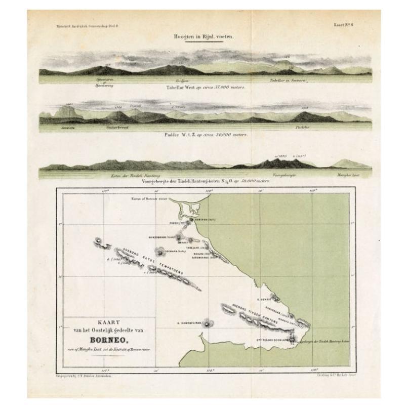
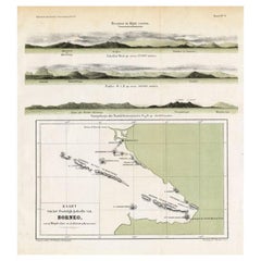
- Antique Map of Eastern Borneo, Indonesia with Views of Mountain Ranges, c.1875Located in Langweer, NLAntique map titled 'Kaart van het Oostelijk gedeelte van Borneo.' (Map of the eastern part of Borneo.) This map shows the eastern part of Borneo, Indonesia. With views of mountain ra...Category
Antique 19th Century Maps
MaterialsPaper
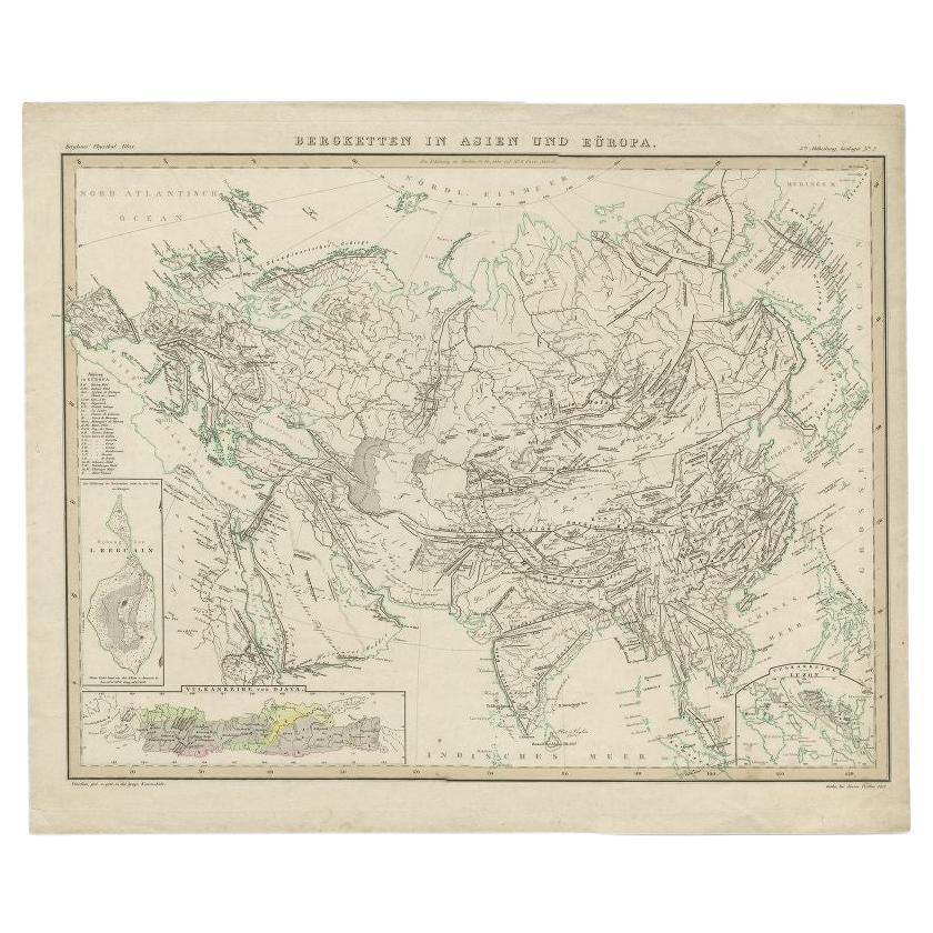
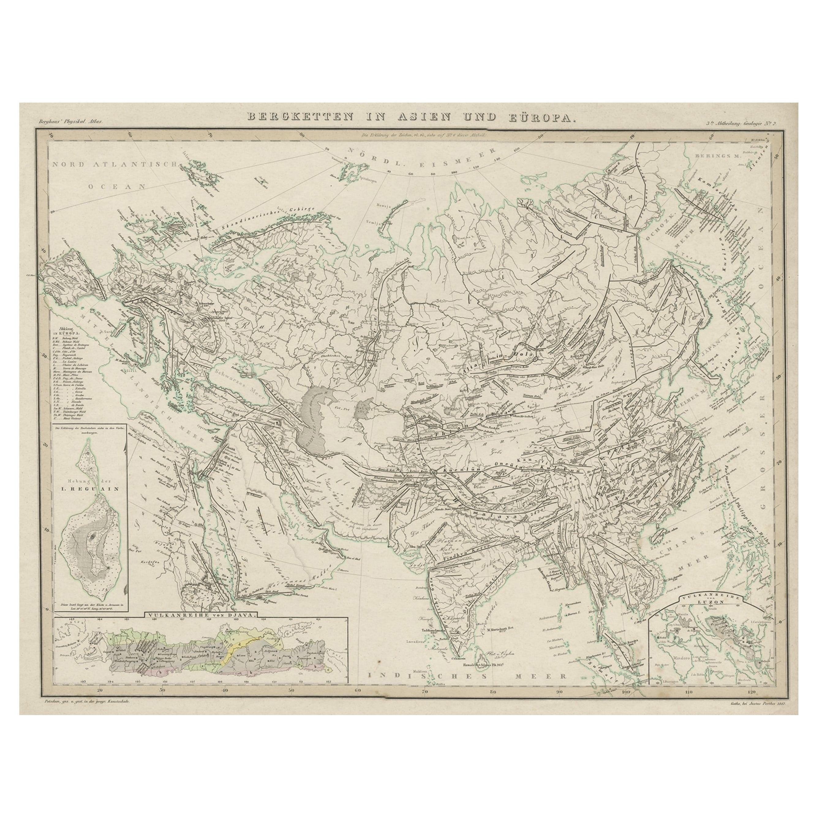
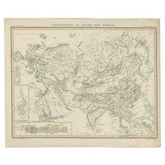
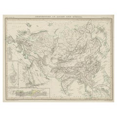
- Antique Map of the Mountain Ranges of Asia and Europe by Berghaus, 1849Located in Langweer, NLAntique map titled 'Bergketten in Asien und Eüropa'. Original antique map showing the mountain ranges in Asia and Europe. In outline color with inset maps of Java, Luzon, and Reguain...Category
Antique 19th Century Maps
MaterialsPaper
- Original Antique Map Showing the Mountain Ranges in Asia and Europe, 1849Located in Langweer, NLAntique map titled 'Bergketten in Asien und Eüropa'. Original antique map showing the mountain ranges in Asia and Europe. In outline color with inset maps of Java, Luzon, and Reguain...Category
Antique 1840s Maps
MaterialsPaper
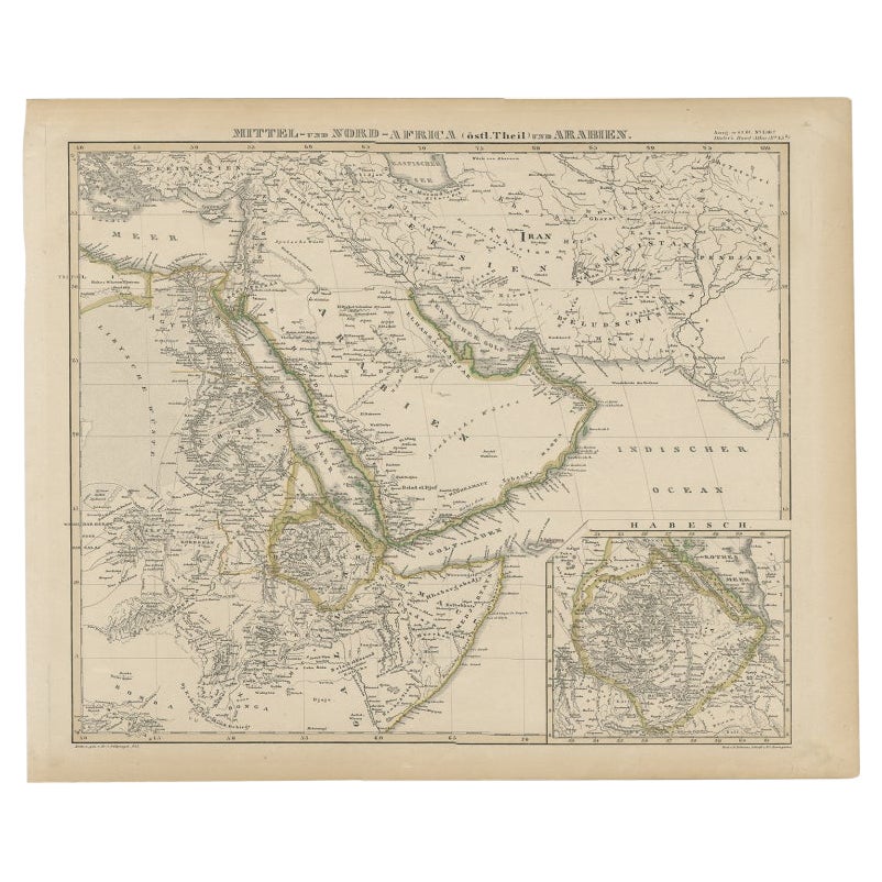
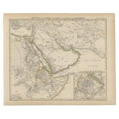
- Antique Map of Africa and Arabia with Inset Map of Ethiopia and Eritrea, 1845Located in Langweer, NLAntique map titled 'Mittel- und Nord-Africa (östl. Theil) und Arabien'. This map depicts North and Central Africa and Arabia with an inset map of Habesch (Ethiopia and Eritrea). Ar...Category
Antique 19th Century Maps
MaterialsPaper
- Original Antique Map of AfricaLocated in Langweer, NLAntique map titled 'Afrika'. Original antique map of Africa, drawn by Van Beusekom. Published by 'Seyffardt's Boekhandel' in Amsterdam, circa 1870.Category
Antique Late 19th Century Maps
MaterialsPaper

You May Also Like
- Original Antique Map of South Africa, Arrowsmith, 1820Located in St Annes, LancashireGreat map of South Africa. Drawn under the direction of Arrowsmith. Copper-plate engraving. Published by Longman, Hurst, Rees, Orme and Br...Category
Antique 1820s English Maps
MaterialsPaper
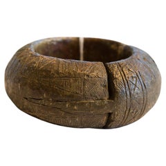
- Antique African Thick Bronze Bracelet with Geometric DetailingLocated in Katonah, NYAntique handmade African thick bronze bracelet with geometric detailing. Exceptional antique circa 19th century or older bracelet, possibly used as curren...Category
Antique 19th Century African Tribal Collectible Jewelry
MaterialsMetal, Bronze
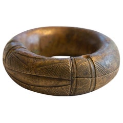
- Antique African Small Thick Bronze Bracelet with Geometric DetailingLocated in Katonah, NY:: Antique handmade African small thick bronze bracelet with geometric detailing. Exceptional antique circa 19th century or older bracelet, possibly used ...Category
Antique 19th Century African Tribal Collectible Jewelry
MaterialsMetal, Bronze
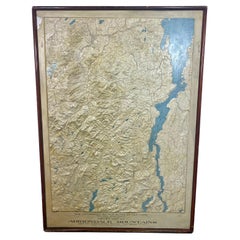
- Rare and Early Plaster Relief Map of Adirondack Mountains by F J H MerrillBy E. W. Merrill, P.F. HowellsLocated in Buffalo, NYRare and Early Monumental Plaster Relief Map of Adirondack Mountains by The University of the State of New York, New York State Museum..F J H Merrill director,,,modeled by Howell's ...Category
Vintage 1910s American Industrial Maps
MaterialsPlaster, Wood
- Antique Lithography Map, West Africa, English, Framed, Cartography, VictorianLocated in Hele, Devon, GBThis is an antique lithography map of Western Africa. An English, framed atlas engraving of cartographic interest by John Rapkin, dating to the early Victorian period and later, circ...Category
Antique Mid-19th Century British Early Victorian Maps
MaterialsWood
- London 1744 Published Watercolour Antique Map of East Africa by Eman BowenLocated in GBWe are delighted to offer for sale this New and Accurate Map of Nubia & Abissinia, together with all the Kingdoms Tributary Thereto, and bordering upon them published in 1744 by Emanuel Bowen This is a decorative antique engraved map of East Africa...Category
Antique 1740s English George III Maps
MaterialsPaper


Recently Viewed
View AllMore Ways To Browse
18th Engineer
Antique Map Of Cuba
Antique Maps Of Cuba
Cuba Antique Map
Nebraska Map
Santa Cruz Island
Map Of Kentucky
Yorkshire Ridings Map
Idaho Map
Rail Road Collectables
Antique Map Delaware
Antique Maps San Diego
Australasia Antique Map
Hawaii Map Vintage
Hawaii Vintage Map
Map Of Ural
Trinidad Map
Antique Montana Map