Items Similar to Original Antique Map Showing the Mountain Ranges in Asia and Europe, 1849


Want more images or videos?
Request additional images or videos from the seller
1 of 5
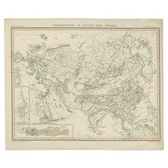
Original Antique Map Showing the Mountain Ranges in Asia and Europe, 1849
About the Item
Antique map titled 'Bergketten in Asien und Eüropa'. Original antique map showing the mountain ranges in Asia and Europe. In outline color with inset maps of Java, Luzon, and Reguain (an island off the coast of Burma). Originates from 'Physikalischer Atlas oder Sammlung von Karten'.
Artists and Engravers: Published by Gotha: Justus Perthes.
- Dimensions:Height: 15.16 in (38.5 cm)Width: 18.31 in (46.5 cm)Depth: 0 in (0.02 mm)
- Materials and Techniques:
- Period:
- Date of Manufacture:1849
- Condition:Condition: Good, some foxing and toning. Please study image carefully.
- Seller Location:Langweer, NL
- Reference Number:
About the Seller
5.0
Platinum Seller
These expertly vetted sellers are 1stDibs' most experienced sellers and are rated highest by our customers.
Established in 2009
1stDibs seller since 2017
1,940 sales on 1stDibs
Typical response time: <1 hour
- ShippingRetrieving quote...Ships From: Langweer, Netherlands
- Return PolicyA return for this item may be initiated within 14 days of delivery.
More From This SellerView All
- Antique Map of the Mountain Ranges of Asia and Europe by Berghaus, 1849Located in Langweer, NLAntique map titled 'Bergketten in Asien und Eüropa'. Original antique map showing the mountain ranges in Asia and Europe. In outline color with inset maps of Java, Luzon, and Reguain...Category
Antique 19th Century Maps
MaterialsPaper
- Antique Detailed Map of the Mountain Chains of Europe and Asia, c.1850Located in Langweer, NLAntique map titled 'The Mountain Chains of Europe & Asia'. Old map depicting the mountain chains of Europe and Asia. Originates from 'The Physical Atlas of Natural Phenomena'. Ar...Category
Antique 19th Century Maps
MaterialsPaper
- Antique Map of the Mountain Chains of Europe and Asia by Johnston '1850'Located in Langweer, NLAntique map titled 'The Mountain chains of the Europe and Asia '. Original antique map of the mountain chains of Europe and Asia. This map originates from 'The Physical Atlas of Natu...Category
Antique Mid-19th Century Maps
MaterialsPaper
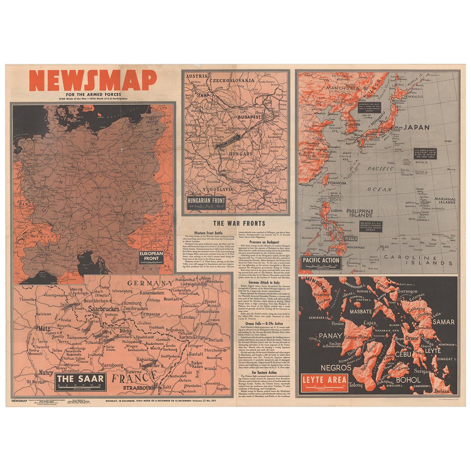
- Antique Map of the War Situation in Europe and Asia, 1944Located in Langweer, NLAntique map titled 'Newsmap for the Armed Forces'. This "newsmap" was issued on Monday, December 18, 1944, and covers the news from December 6-13, 1945 - the 275th week of the war. T...Category
20th Century Maps
MaterialsPaper
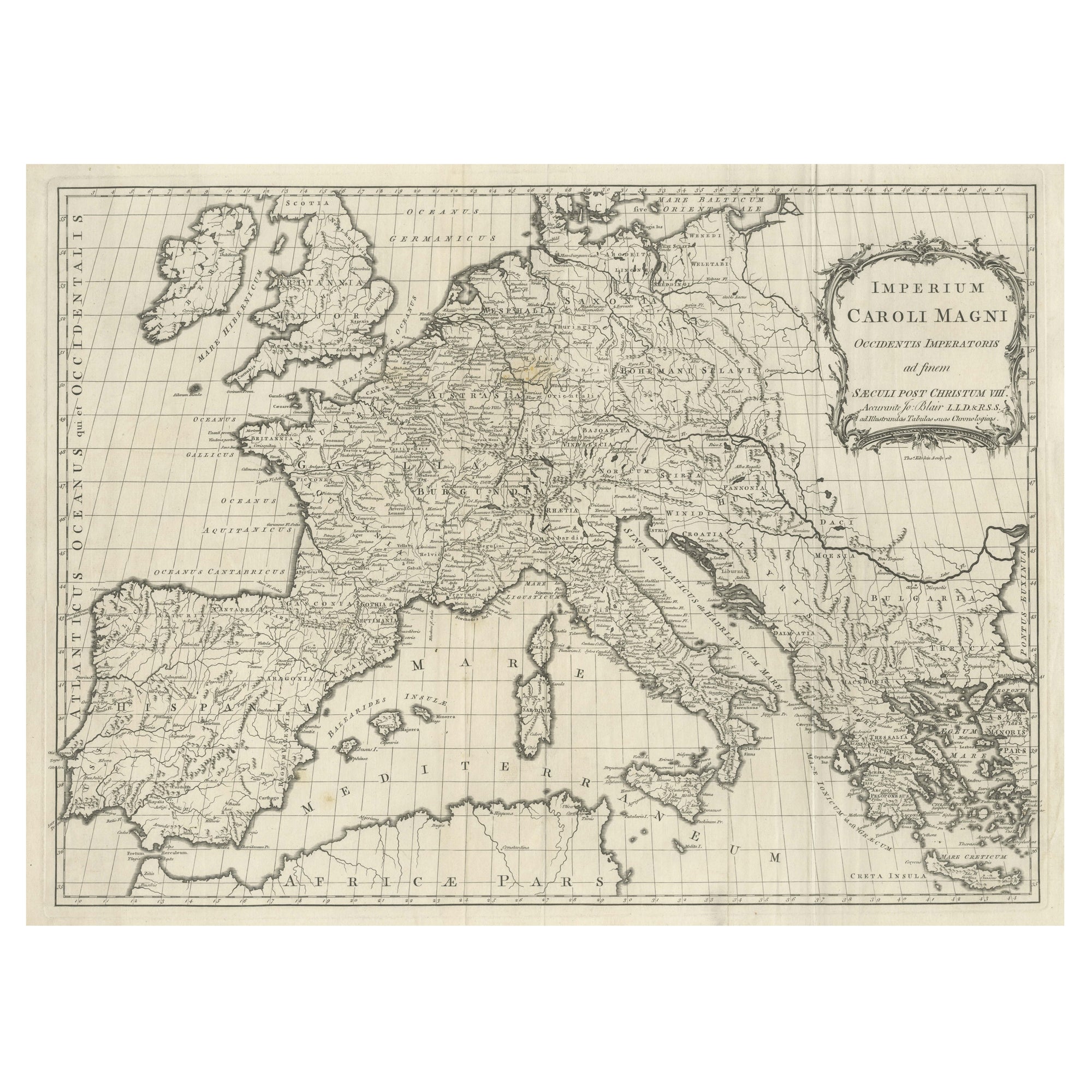
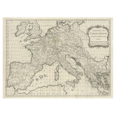
- Large Antique Map of Europe, Showing the Empire of CharlemagneLocated in Langweer, NLAntique map titled 'Imperium Caroli Magni (..)'. Large antique map of Europe, showing the Empire of Charlemagne in the 8th Century. Engraved by T. Kitchin. Published J. Blair, circa ...Category
Antique Late 18th Century Maps
MaterialsPaper
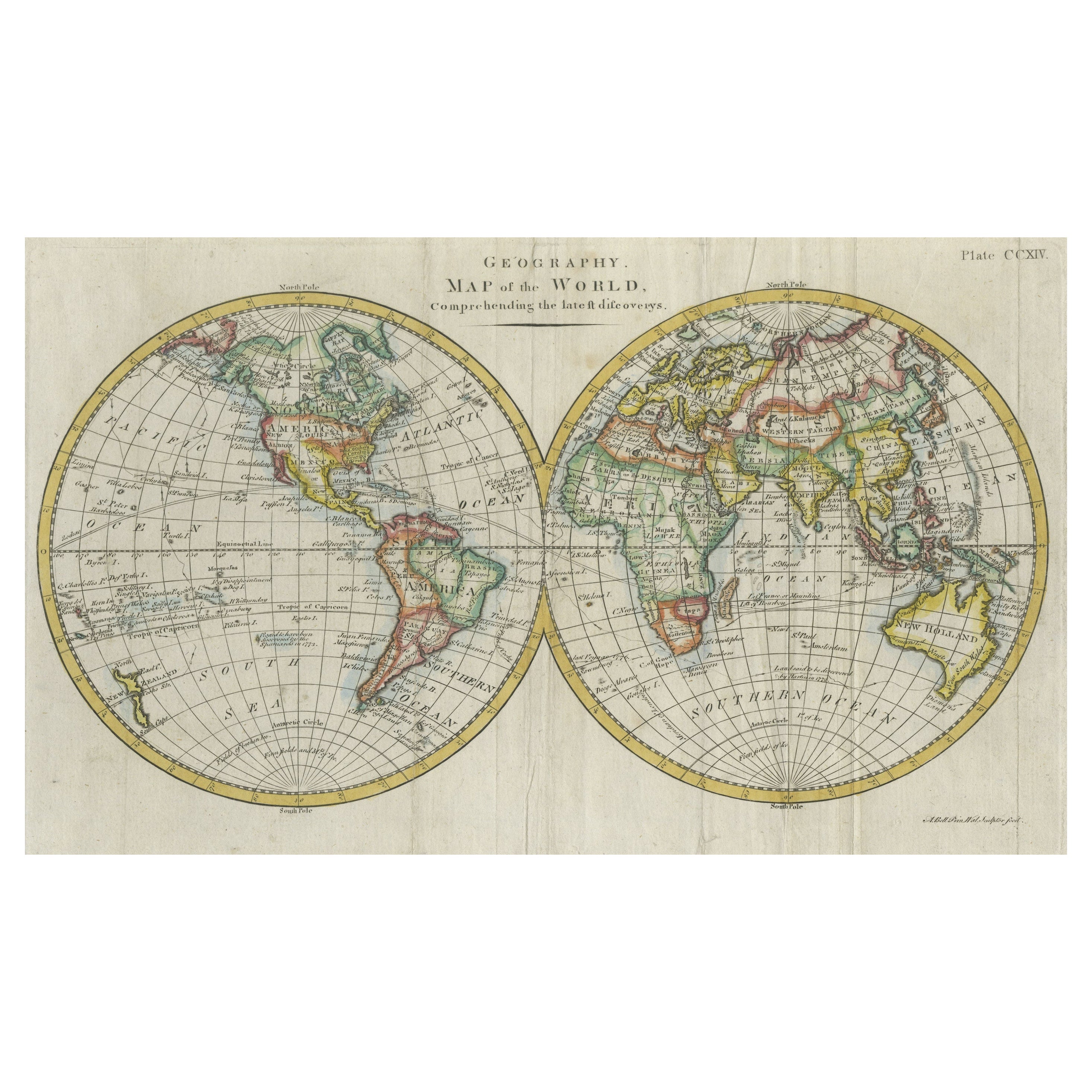
- Interesting Original Antique Hemisphere Map Showing the Latest DiscoveriesLocated in Langweer, NLAntique world map titled 'A Map of the World from the best Authorities'. Detailed map of the World, showing tracks of Captain James Cook in his 3 voyages in great detail. The map is ...Category
Antique Late 18th Century Maps
MaterialsPaper


You May Also Like
- Original Antique Map of Europe, Arrowsmith, 1820Located in St Annes, LancashireGreat map of Europe Drawn under the direction of Arrowsmith. Copper-plate engraving. Published by Longman, Hurst, Rees, Orme and Brown, 1820 ...Category
Antique 1820s English Maps
MaterialsPaper
- Original Antique Map of South East Asia, Arrowsmith, 1820Located in St Annes, LancashireGreat map of South East Asia Drawn under the direction of Arrowsmith Copper-plate engraving Published by Longman, Hurst, Rees, Orme and Brown, 1820 Unframed.Category
Antique 1820s English Maps
MaterialsPaper
- Original Antique Map of South East Asia by Thomas Clerk, 1817Located in St Annes, LancashireGreat map of South East Asia Copper-plate engraving Drawn and engraved by Thomas Clerk, Edinburgh. Published by Mackenzie And Dent, 1817 Unframed.Category
Antique 1810s English Maps
MaterialsPaper
- Original Antique Map of South East Asia by Becker, circa 1840Located in St Annes, LancashireGreat map of South East Asia Steel engraving with original color outline Engraved by Becker Published by Virtue, circa 1840. Unframed.Category
Antique 1840s English Other Maps
MaterialsPaper
- Original Antique Map of The World by Thomas Clerk, 1817Located in St Annes, LancashireGreat map of The Eastern and Western Hemispheres On 2 sheets Copper-plate engraving Drawn and engraved by Thomas Clerk, Edinburgh. Published by Mackenzie And Dent, 1817 ...Category
Antique 1810s English Maps
MaterialsPaper
- Original Antique Map of Spain and Portugal, circa 1790Located in St Annes, LancashireSuper map of Spain and Portugal Copper plate engraving by A. Bell Published, circa 1790. Unframed.Category
Antique 1790s English Other Maps
MaterialsPaper


Recently Viewed
View AllMore Ways To Browse
Java Map
Burma Antique Map
Wood Carvings Of Ships
Classroom Furniture Used
Fine Antique Maps
17th Century World Map
Book Of Antique Maps
18th Century Southern Antiques
Antique French Globe
South African Antique Furniture
Antique Furniture South Africa
Antique Map Border
Compass Map
Antique Maps Of Africa
Used Booksellers
Used Bookseller
Antique British Maps
Antique 17th Century World Map