Items Similar to Antique Map of the Township of Ruinen, Drenthe in the Netherlands, circa 1865

Want more images or videos?
Request additional images or videos from the seller
1 of 7
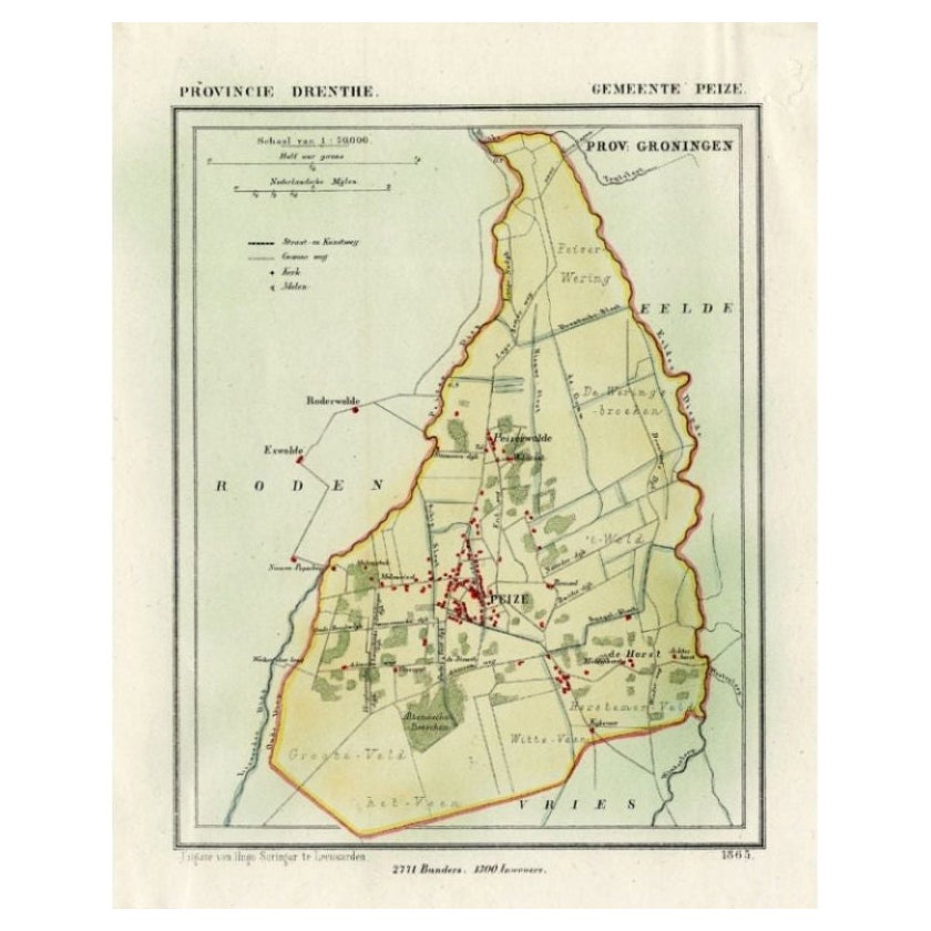
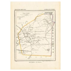
Antique Map of the Township of Ruinen, Drenthe in the Netherlands, circa 1865
About the Item
Drenthe: Gemeente Ruinen, Ansen, Bultinge, Oostering. These scarse detailed maps of Dutch Towns originate from the 'Gemeente-atlas' of Jacob Kuyper. This atlas of all towns in the Netherlands was published from 1865-1870 and included all towns in the Dutch province of Drenthe. These maps are also known as a Kuyper kaart or Kuyper kaartjes from Drenthe.
Artists and Engravers: Author: Jacob Kuyper: He was one of the most important of the Dutch atlas editors of the second half of the 19th century. He is particularly known for the "Gemeente Atlas", with 1210 plans of all the towns and villages in the Netherlands.
Condition: fine; occasional foxing as visible on the scans; sheet irregularly cut, not affecting image. Please study image carefully.
Date: 1865
Overall Size: 22.5 x 18 cm.
Image Size: 19.5 x 16.5 cm.
We sell original antique maps to collectors, historians, educators and interior decorators all over the world. Our collection includes a wide range of authentic antique maps from the 16th to the 20th centuries. Buying and collecting antique maps is a tradition that goes back hundreds of years. Antique maps have proved a richly rewarding investment over the past decade, thanks to a growing appreciation of their unique historical appeal. Today the decorative qualities of antique maps are widely recognized by interior designers who appreciate their beauty and design flexibility. Depending on the individual map, presentation, and context, a rare or antique map can be modern, traditional, abstract, figurative, serious or whimsical. We offer a wide range of authentic antique maps for any budget.
- Dimensions:Height: 7.09 in (18 cm)Width: 8.86 in (22.5 cm)Depth: 0 in (0.01 mm)
- Materials and Techniques:
- Period:
- Date of Manufacture:1865
- Condition:Condition: Fine; occasional foxing as visible on the scans; sheet irregularly cut, not affecting image. Please study image carefully.
- Seller Location:Langweer, NL
- Reference Number:
About the Seller
5.0
Platinum Seller
These expertly vetted sellers are 1stDibs' most experienced sellers and are rated highest by our customers.
Established in 2009
1stDibs seller since 2017
1,929 sales on 1stDibs
Typical response time: <1 hour
- ShippingRetrieving quote...Ships From: Langweer, Netherlands
- Return PolicyA return for this item may be initiated within 14 days of delivery.
More From This SellerView All
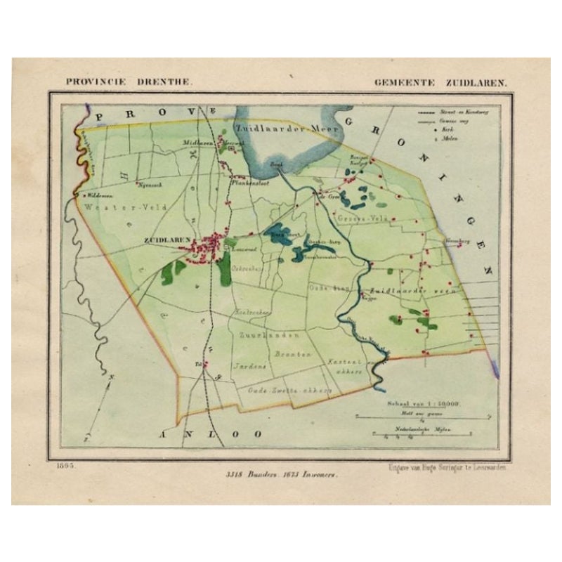
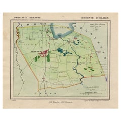
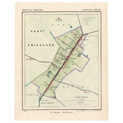
- Antique Map of the Township of Zuidlaren, Drenthe in the Netherlands, 1865Located in Langweer, NLDrenthe: Gemeente Zuidlaren, Midlaren, Plankersloot. These scarse detailed maps of Dutch Towns originate from the 'Gemeente-atlas' of Jacob Kuyper. This atlas of all towns in the Net...Category
Antique 19th Century Maps
MaterialsPaper
- Antique Map of the Township of Eelde in Drenthe, The Netherlands, 1865Located in Langweer, NLDrenthe: Gemeente Eelde. These scarse detailed maps of Dutch Towns originate from the 'Gemeente-atlas' of Jacob Kuyper. This atlas of all towns in the Netherlands was published from ...Category
Antique 19th Century Maps
MaterialsPaper
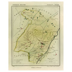
- Antique Map of the Township of Norg in Drenthe, the Netherlands, 1865Located in Langweer, NLDrenthe: Gemeente Norg, Fen, Langeloo, Veenhuizen, Norgervaart. These scarse detailed maps of Dutch Towns originate from the 'Gemeente-atlas' of Jacob Kuyper. This atlas of all towns...Category
Antique 19th Century Maps
MaterialsPaper
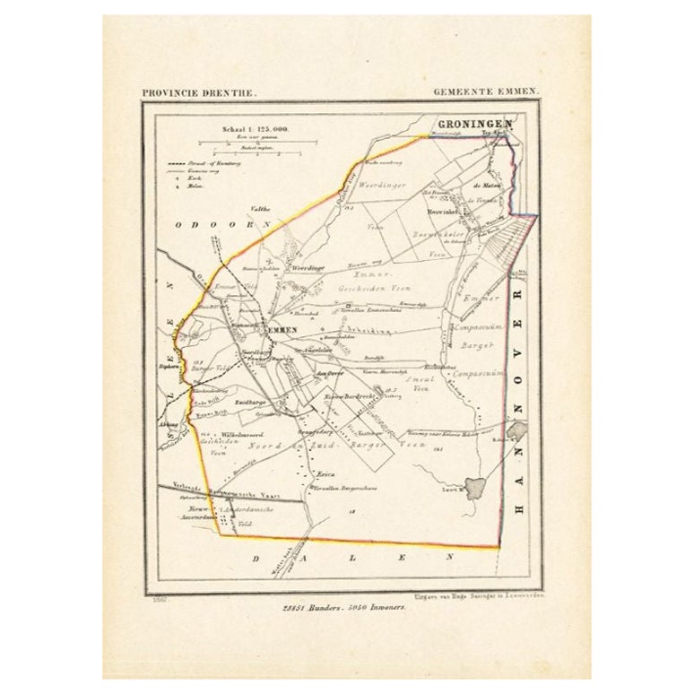
- Antique Map of the Township of Emmen, Drenthe in The Netherlands, 1865Located in Langweer, NLDrenthe: Gemeente Emmen, Roswinkel, Werdinge, Zuidbarge. These scarse detailed maps of Dutch Towns originate from the 'Gemeente-atlas' of Jacob Kuyper. This atlas of all towns in the...Category
Antique 19th Century Maps
MaterialsPaper
- Antique Map of the Township of Smilde, Drenthe in the Netherlands, 1865Located in Langweer, NLDrenthe: Gemeente Smilde, Bovensmilde, Hoogersmilde. These scarse detailed maps of Dutch Towns originate from the 'Gemeente-atlas' of Jacob Kuyper. This atlas of all towns in the Net...Category
Antique 19th Century Maps
MaterialsPaper
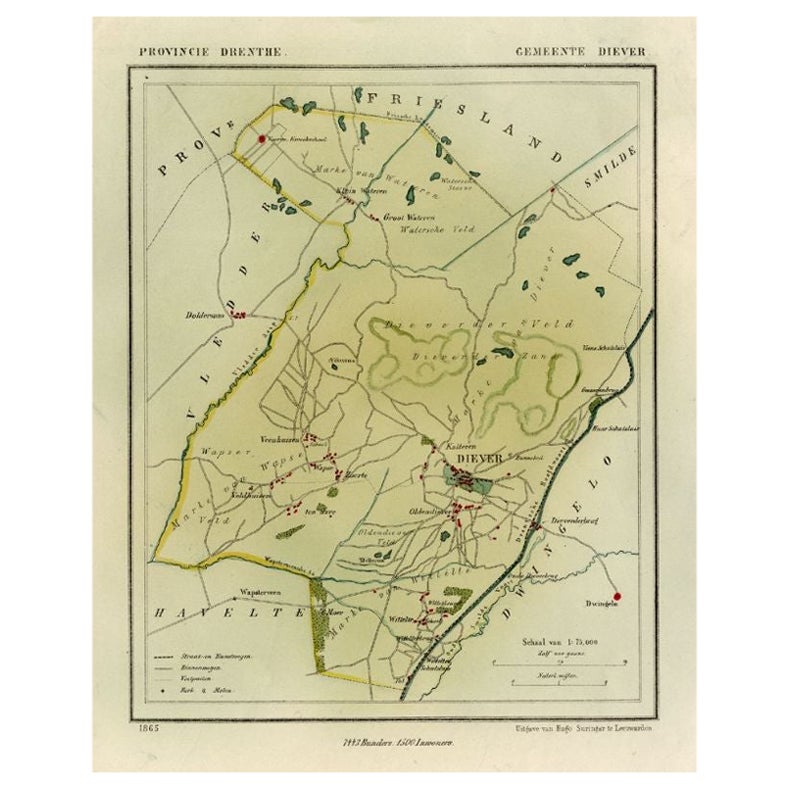
- Antique Map of the Township of Diever, Drenthe in The Netherlands, 1865Located in Langweer, NLDrenthe: Gemeente Diever, Veenhuizen, Aendiever, Wittelte. These scarse detailed maps of Dutch Towns originate from the 'Gemeente-atlas' of Jacob Kuyper. This atlas of all towns in t...Category
Antique 19th Century Maps
MaterialsPaper
You May Also Like
- Original Antique Map of The Netherlands, Engraved by Barlow, Dated 1807Located in St Annes, LancashireGreat map of Netherlands Copper-plate engraving by Barlow Published by Brightly & Kinnersly, Bungay, Suffolk. Dated 1807 Unframed.Category
Antique Early 1800s English Maps
MaterialsPaper
- Original Antique Map of The Netherlands, Sherwood, Neely & Jones, Dated 1809Located in St Annes, LancashireGreat map of The Netherlands Copper-plate engraving by Cooper Published by Sherwood, Neely & Jones. Dated 1809 Unframed.Category
Antique Early 1800s English Maps
MaterialsPaper
- Original Antique Map of The United States of America, circa 1890Located in St Annes, LancashireGreat map of the USA By The Stanford's Geographical Establishment Original colour Unframed.Category
Antique 1890s English Victorian Maps
MaterialsPaper
- Large Original Antique Map of the World, Fullarton, circa 1870Located in St Annes, LancashireGreat map of the World. From the celebrated Royal Illustrated Atlas Lithograph. Original color. Published by Fullarton, Edinburgh, circa 1870. Unframed.Category
Antique 1870s Scottish Maps
MaterialsPaper
- School Chart or Pull Down Map of Geography of the Netherlands, 1950sLocated in Hemiksem, VANA beautiful old school map of the Netherlands, painted on linen. The map shows the 3 different reliefs (low, middle, high) of the Netherlands. The beau...Category
Vintage 1950s Belgian Mid-Century Modern Maps
MaterialsLinen, Paint
- Large Original Antique Map of The Environs of Dublin, Ireland, circa 1880Located in St Annes, LancashireGreat map of The Environs of Dublin Published circa 1880 Unframed Free shipping.Category
Antique 1880s Scottish Maps
MaterialsPaper


Recently Viewed
View AllMore Ways To Browse
Nebraska Map
Antique Map Of Massachusetts
Cornwall Map
Jeffery Brown
Antique Maps Kansas City
Hawaii Map Vintage
Hawaii Vintage Map
Vintage Hawaiian Map
Vintage Hawaiian Maps
Wyoming Map
Antique Montana Maps
Larousse Universel
Lebanon Antique Map
Livonia Map
Map Of Native American Tribes
Native American Tribes Map
Tanzania Antique Map
1847 Rio