Antique Montana Maps

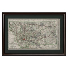
"Clason's Guide Map of Montana" by The Clason Map Company, Circa 1920s
Located in Colorado Springs, CO
Presented is “Clason's Guide Map of Montana,” published in the early 1920s by the Clason Map
Category

1920s American Art Deco Antique Montana Maps

Materials

Paper

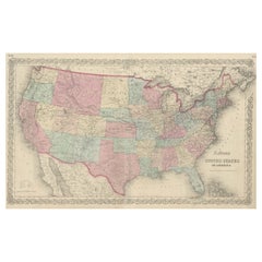
Antique Map Colton's United States of America
Located in Langweer, NL
Antique map titled 'Colton's United States of America'. Show railroads, canals, state capitals
Category

Mid-19th Century Antique Montana Maps

Materials

Paper

Antique Map Colton's United States of America
H 17.45 in W 27.45 in D 0.02 in
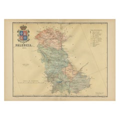
Original Antique Map of Palencia Province, in Northern Spain, 1901
Located in Langweer, NL
This historical map is of Palencia, a province in the northern part of Spain. Palencia is
Category

Early 1900s Antique Montana Maps

Materials

Paper

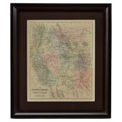
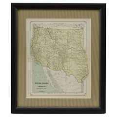
1889 "The Pacific States and Territories"
Located in Colorado Springs, CO
Territories.” The vertical map depicts the Western states at the time: Washington, Oregon, California, Montana
Category

1880s American Antique Montana Maps

Materials

Paper

Antique 1889 "The Pacific States and Territories"
1889 "The Pacific States and Territories"
H 16.25 in W 14.25 in D 1 in
1879 "United States of America, Western Part" by O. J. Stuart
Located in Colorado Springs, CO
This colorful original map, titled “United States of America, Western Part,” was issued in Volume
Category

1870s American Antique Montana Maps

Materials

Paper

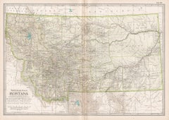
Montana. USA. Century Atlas state antique vintage map
Located in Melbourne, Victoria
'The Century Atlas. Montana' Original antique map, 1903. Central fold as issued. Map name and
Category

Early 20th Century Victorian Antique Montana Maps

Materials

Lithograph

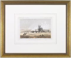
'Victor's Camp - Hell Gate Ronde' original John Mix Stanley lithograph
By John Mix Stanley
Located in Milwaukee, WI
: to produce topographical maps, to document flora and fauna, and to document natural resources to
Category

1850s Romantic Antique Montana Maps

Materials

Lithograph

People Also Browsed

American Victorian Oak and Pink and Green Patterned Fabric Upholstered Circular
Located in New York, NY
American Victorian circular borne / conversation seat with an oak frame, upholstered in a pink and green bow patterned damask fabric with a channeled center post and pleated seat ski...
Category

19th Century Victorian Antique Montana Maps

Materials

Oak

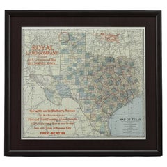
1908 "Map of Texas" by The Kenyon Company
Located in Colorado Springs, CO
Presented is an antique map of the state of Texas, printed as a pocket map in 1908 by The Kenyon Company. The state map is brightly colored by county, with principal cities and towns...
Category

Early 1900s American Antique Montana Maps

Materials

Paper

Charles II Carved Crest Of The Arms Of Westminster School
Located in Essex, MA
A large crest with shell and scroll carved frame enclosing an azure ground with gilded coat of arms featuring a cross with four birds over lions and fleur de lis and Tudor roses. Onl...
Category

1670s English Baroque Antique Montana Maps

Materials

Wood, Giltwood

19th Century Embroidered Silk Panel Map Of The World
Located in Forney, TX
A rare and visually striking framed antique European embroidered silk panel. Exquisitely hand-crafted in Continental Europe in the 19th century, depicting map of the world, double ...
Category

19th Century European Victorian Antique Montana Maps

Materials

Silk, Thread

Now We Are Six, by A. A. Milne
Located in Middletown, NY
Milne, A.A. (Alan Alexander: 1882–1956). NOW WE ARE SIX. London: Methuen & Co. Ltd., 1927. First Edition. Crown 8vo, 7 1/2 x 5 in (191 x 125 mm), pp. xi + 103 + colophon. With its...
Category

1920s English Antique Montana Maps

Materials

Paper

Now We Are Six, by A. A. Milne
H 7.5 in W 5 in D 0.75 in
Large Antique Map of the State of Texas, 1861
Located in Langweer, NL
Antique map titled 'Johnson's New Map of the State of Texas' Large map of Texas, shows railroads, wagon roads, the U.S. Mail Route, rivers, ports, large towns, and villages of the mi...
Category

Mid-19th Century Antique Montana Maps

Materials

Paper

Large Antique Map of the State of Texas, 1861
Free Shipping
H 18.04 in W 26.58 in D 0.02 in
1859 "Colton's New Map of the State of Texas..." by Johnson & Browning
Located in Colorado Springs, CO
Presented is "Colton's New Map of the State of Texas Compiled from De Cordova's Large Map", published in Alivin J. Johnson’s “New Illustrated Family Atlas.” The map was published in ...
Category

1850s American Antique Montana Maps

Materials

Paper

A Farewell to Arms by Ernest Hemingway, First Trade Edition, in Dust Jacket
By Ernest Hemingway
Located in Colorado Springs, CO
Hemingway, Ernest. A Farewell to Arms. New York: Charles Scribner's Sons, 1929. First trade edition, first issue. In the original first-state dust jacket and publisher’s black cloth ...
Category

1920s American Modern Antique Montana Maps

Materials

Paper

Antique Map of The Kingdom of Alexander the Great, Published in 1880
Located in Langweer, NL
The map is titled "ALEXANDRI MAGNI REGNUM," which translates to "The Kingdom of Alexander the Great." It depicts the vast territories conquered by Alexander the Great during his reig...
Category

1880s Antique Montana Maps

Materials

Paper

James Paine – Plans, Elevations and Section of Noblemen and Gentlemen's Houses
Located in Middletown, NY
A fine FIRST EDITION ELEPHANT FOLIO of Jame's Paine monumental work: Plans, Elevations and Section of Noblemen and Gentlemen's Houses, and also of Stabling, Bridges, Public and Priv...
Category

Mid-18th Century English Antique Montana Maps

Materials

Leather, Paper

1859 "Map of the United States of America..." by J. H. Colton
By J.H. Colton
Located in Colorado Springs, CO
Presented is an 1859 “Map of the United States of America, the British Provinces, Mexico, the West Indies and Central America with Part of New Granada and Venezuela” by John Hutchins...
Category

1850s American Antique Montana Maps

Materials

Paper

Rare Cut Crystal & Bronze Newel Post
Located in Atlanta, GA
A rare cut crystal & bronze newel post, hand cut. Ruby Red Crystal Neck. France, circa 1900. Height 6" Diameter 3 1/2" CW5355.
Category

Early 1900s French Antique Montana Maps

Materials

Crystal, Bronze

Pair of 19th Century coaching scene oil paintings of a highway robbery
By John Charles Maggs
Located in Moreton-In-Marsh, Gloucestershire
**PLEASE NOTE: EACH PAINTING INCLUDING THE FRAME MEASURES 19.25 INCHES X 31.25 INCHES** John Charles Maggs British, (1819-1896) Highway Robbery & After the Robbery Oil on canvas, pa...
Category

19th Century Victorian Antique Montana Maps

Materials

Oil, Canvas

Antique Canada Post Office Balance Scale with Cast Metal Base and Brass Accents
Located in Hamilton, Ontario
This antique postal scale is unsigned, but presumed to have originated from Canada and date to approximately 1952 and done in the Late Victorian style. The scale is composed of cast ...
Category

Late 19th Century Canadian Late Victorian Antique Montana Maps

Materials

Metal, Brass

Large Original Vintage Map of Texas and Adjacent States, circa 1920
Located in St Annes, Lancashire
Great map of Texas and adjacent States Original color. Good condition Published by Alexander Gross Unframed.
Category

1920s English Antique Montana Maps

Materials

Paper

1863 "Lloyd's New Map of the United States, the Canadas, and New Brunswick"
Located in Colorado Springs, CO
Presented is “Lloyd's New Map of the United States, the Canadas and New Brunswick, From the latest Surveys, Showing Every Railroad & Station Finished to June 1863, and the Atlantic a...
Category

1860s American Antique Montana Maps

Materials

Linen, Wood, Paper

Recent Sales

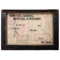
1874 Antique Map of Nebraska, Dakota, Montana, and Wyoming
Located in Colorado Springs, CO
Presented is an original map of Nebraska, Dakota, Montana, and Wyoming from 1874. This authentic
Category

1870s American Antique Montana Maps

Materials

Paper

1911 Rand-McNally Pocket Map and Shippers' Guide of Montana
Located in Colorado Springs, CO
1911 Rand-McNally Indexed County and Township Pocket Map and Shippers' Guide of Montana This is a
Category

1910s Antique Montana Maps

Materials

Paper

Map of Montana, Idaho & Wyoming, from Colton's Atlas, Antique Hand-Colored, 1876
By G.W. & C.B. Colton
Located in Colorado Springs, CO
This is a remarkable large format map of the Territories of Montana, Wyoming, and Idaho, from a
Category

1870s American Antique Montana Maps

Materials

Paper

1854 "New Map of That Portion of North America" Published by Jacob Monk
Located in Colorado Springs, CO
“New Map of that Portion of North America, exhibiting the United States and Territories, The
Category

1850s American Antique Montana Maps

Materials

Paper

Juvenile Triceratops Skull
Located in London, GB
skull of a juvenile triceratops. Find-site This specimen was found in Montana USA, coordinates
Category

15th Century and Earlier North American Antique Montana Maps

Materials

Bone

Juvenile Triceratops Skull
H 82.68 in W 29.53 in D 40.56 in
Large Original Antique Map of Montana, USA, 1894
By Rand McNally & Co.
Located in St Annes, Lancashire
Fabulous map of Montana Original color. By Rand, McNally & Co. Published, 1894
Category

1890s American Antique Montana Maps

Materials

Paper

Large Original Antique Map of Montana, USA, 1894
1 bid
No Reserve
H 13.5 in W 20.5 in D 0.07 in
Large Original Antique Map of Montana, USA, circa 1900
Located in St Annes, Lancashire
Fabulous map of Montana Original color Engraved and printed by the George F. Cram Company
Category

1890s American Antique Montana Maps

Materials

Paper

Large Original Antique Map of Montana, USA, circa 1900
No Reserve
H 14.5 in W 22 in D 0.07 in
Original Antique Map of Montana by Rand McNally, circa 1900
By Rand McNally & Co.
Located in St Annes, Lancashire
Fabulous monochrome map with red outline colour Original color By Rand, McNally & Co
Category

Early 1900s American Edwardian Antique Montana Maps

Materials

Paper

Original Antique Map of Montana by Rand McNally, circa 1900
Free Shipping
H 14 in W 20.5 in D 0.07 in
Original Antique Map of The States of Wyoming, Idaho, Montana & Dakota
Located in St Annes, Lancashire
Great map of Wyoming, Idaho, Montana and Dakota Drawn and Engraved by W. & A.K. Johnston
Category

1880s Scottish Victorian Antique Montana Maps

Materials

Paper

Antique Map of Nebraska, Dakota, Idaho, Montana and Wyoming by Johnson '1872'
Located in Langweer, NL
Antique map titled 'Johnson's Nebraska (..)'. Original map of Nebraska, Dakota, Idaho, Montana and
Category

Late 19th Century Antique Montana Maps

Materials

Paper

1897 Map of the State of Montana by the General Land Office
Located in Colorado Springs, CO
This is an authentic map of the state of Montana, published by the General Land Office in 1897
Category

1890s American Antique Montana Maps

Arbuckle Coffee Company Maps of Colorado, Utah, Montana, Minnesota
Located in New York, NY
Sheet with lithograph maps of four states in full color. Beautifully presented in a antiqued gold
Category

1880s Realist Antique Montana Maps

Materials

Lithograph

Get Updated with New Arrivals
Save "Antique Montana Maps", and we’ll notify you when there are new listings in this category.

Read More

Pamela Shamshiri Shares the Secrets behind Her First-Ever Book and Its Effortlessly Cool Interiors

The sought-after designer worked with the team at Hoffman Creative to produce a monograph that beautifully showcases some of Studio Shamshiri's most inspiring projects.

Moroccan Artworks and Objects Take Center Stage in an Extraordinary Villa in Tangier

Italian writer and collector Umberto Pasti opens the doors to his remarkable cave of wonders in North Africa.

Montecito Has Drawn Royalty and Celebrities, and These Homes Are Proof of Its Allure

Hollywood A-listers, ex-pat aristocrats and art collectors and style setters of all stripes appreciate the allure of the coastal California hamlet — much on our minds after recent winter floods.

Whaam! Blam! Pow! — a New Book on Pop Art Packs a Punch

Publishing house Assouline and writer Julie Belcove have teamed up to trace the history of the genre, from Roy Lichtenstein, Andy Warhol and Yayoi Kusama to Mickalene Thomas and Jeff Koons.

The Sparkling Legacy of Tiffany & Co. Explained, One Jewel at a Time

A gorgeous new book celebrates — and memorializes — the iconic jeweler’s rich heritage.

What Makes a Gem-Encrusted Chess Set Worth $4 Million?

The world’s most opulent chess set, weighing in at 513 carats, is literally fit for a king and queen.

Tauba Auerbach’s Geometric Pop-Up Book Is Mighty Rare, Thanks to a Hurricane

This sculptural art book has an epic backstory of its own.

Step inside the Storied Mansions of Palm Beach’s Most Effervescent Architect

From Spanish-style courtyards to fanciful fountains, these acclaimed structures abound in surprising and elegant details.