Items Similar to Antique Map of the Township of Het Zandt in The Netherlands, 1862

Want more images or videos?
Request additional images or videos from the seller
1 of 6
Antique Map of the Township of Het Zandt in The Netherlands, 1862
About the Item
Groningen: Gemeente Het Zandt. These scarse detailed maps of Dutch Towns originate from the 'Gemeente atlas van de Provincie Groningen in 62 kaarten.' by C. Fehse. This atlas of all towns in Groningen, the Netherlands, was published in 1862 by J. Oomkens
Artists and Engravers: Author: C. Fehse. This atlas is the only atlas known by C. Fehse. It is assumed that Jacob Kuyper was inspired by this atlas leading to the publication of the "Gemeente Atlas", with 1210 plans of all the towns and villages in the Netherlands
Condition: Fine. Occasional foxing and light staining. Please study scan carefully.
Date: 1862
Overall size: 19 x 25 cm.
Image size: 15 x 19 cm.
We sell original antique maps to collectors, historians, educators and interior decorators all over the world. Our collection includes a wide range of authentic antique maps from the 16th to the 20th centuries. Buying and collecting antique maps is a tradition that goes back hundreds of years. Antique maps have proved a richly rewarding investment over the past decade, thanks to a growing appreciation of their unique historical appeal. Today the decorative qualities of antique maps are widely recognized by interior designers who appreciate their beauty and design flexibility. Depending on the individual map, presentation, and context, a rare or antique map can be modern, traditional, abstract, figurative, serious or whimsical. We offer a wide range of authentic antique maps for any budget.
- Dimensions:Height: 9.85 in (25 cm)Width: 7.49 in (19 cm)Depth: 0 in (0.01 mm)
- Materials and Techniques:
- Period:
- Date of Manufacture:1862
- Condition:Good, given age. A few spots in the margins. Original folds as issued. General age-related toning and/or occasional minor defects from handling. Please study image carefully.
- Seller Location:Langweer, NL
- Reference Number:
About the Seller
5.0
Platinum Seller
These expertly vetted sellers are 1stDibs' most experienced sellers and are rated highest by our customers.
Established in 2009
1stDibs seller since 2017
1,946 sales on 1stDibs
Typical response time: <1 hour
- ShippingRetrieving quote...Ships From: Langweer, Netherlands
- Return PolicyA return for this item may be initiated within 14 days of delivery.
More From This SellerView All
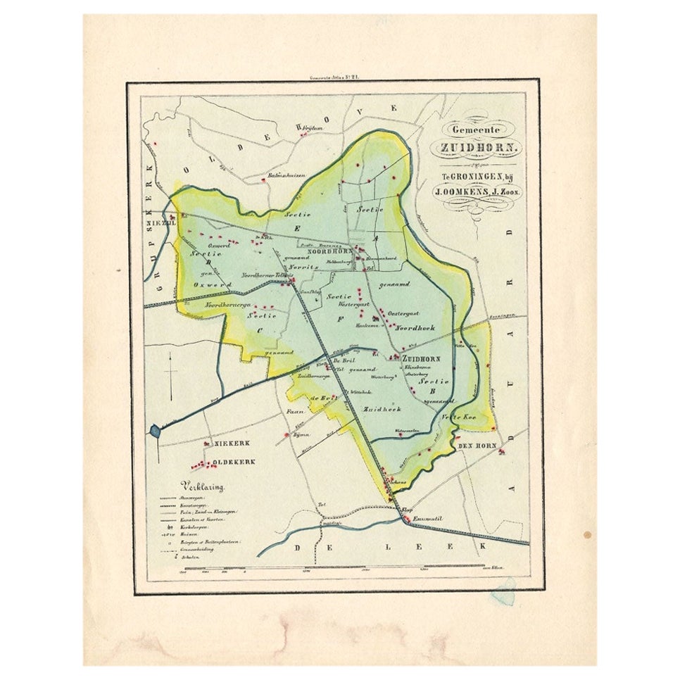
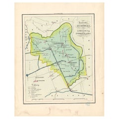
- Antique Map of the Township of Zuidhorn in The Netherlands, 1862Located in Langweer, NLGroningen: Gemeente Noordhorn-Zuidhorn. These scarse detailed maps of Dutch Towns originate from the 'Gemeente atlas van de Provincie Groningen in 62 kaarten.' by C. Fehse. This atla...Category
Antique 19th Century Maps
MaterialsPaper
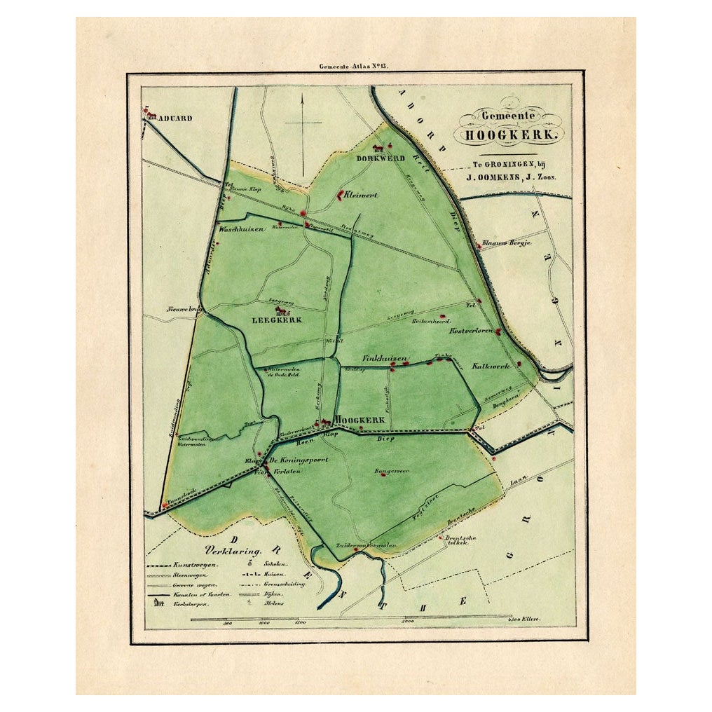
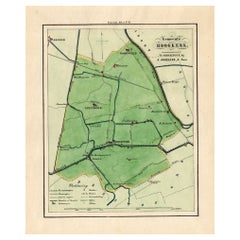
- Antique Map of the Township of Hoogkerk in Groningen, The Netherlands, 1862Located in Langweer, NLGroningen: Gemeente Dorkwerd-Hoogkerk-Leegkerk-Vinkhuizen. These scarse detailed maps of Dutch Towns originate from the 'Gemeente atlas van de Provincie Groningen in 62 kaarten.' by ...Category
Antique 19th Century Maps
MaterialsPaper
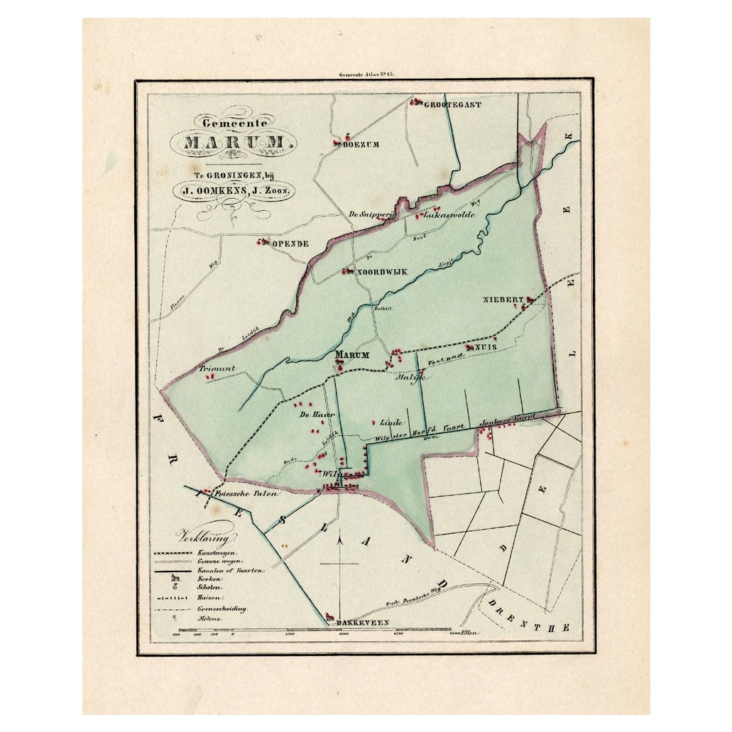
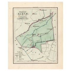
- Antique Map of the Township of Marum in Groningen, The Netherlands, 1862Located in Langweer, NLGroningen: Gemeente Marum-Noordwijk-NuiS. These scarse detailed maps of Dutch Towns originate from the 'Gemeente atlas van de Provincie Groningen in 62 kaarten.' by C. Fehse. This at...Category
Antique 19th Century Maps
MaterialsPaper
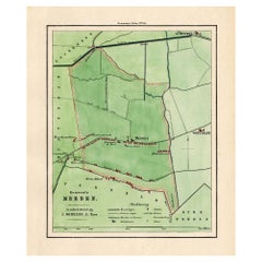
- Antique Map of the Township of Meeden in Groningen, the Netherlands, 1862Located in Langweer, NLGroningen: Gemeente Meeden. These scarse detailed maps of Dutch Towns originate from the 'Gemeente atlas van de Provincie Groningen in 62 kaarten.' by C. Fehse. This atlas of all tow...Category
Antique 19th Century Maps
MaterialsPaper
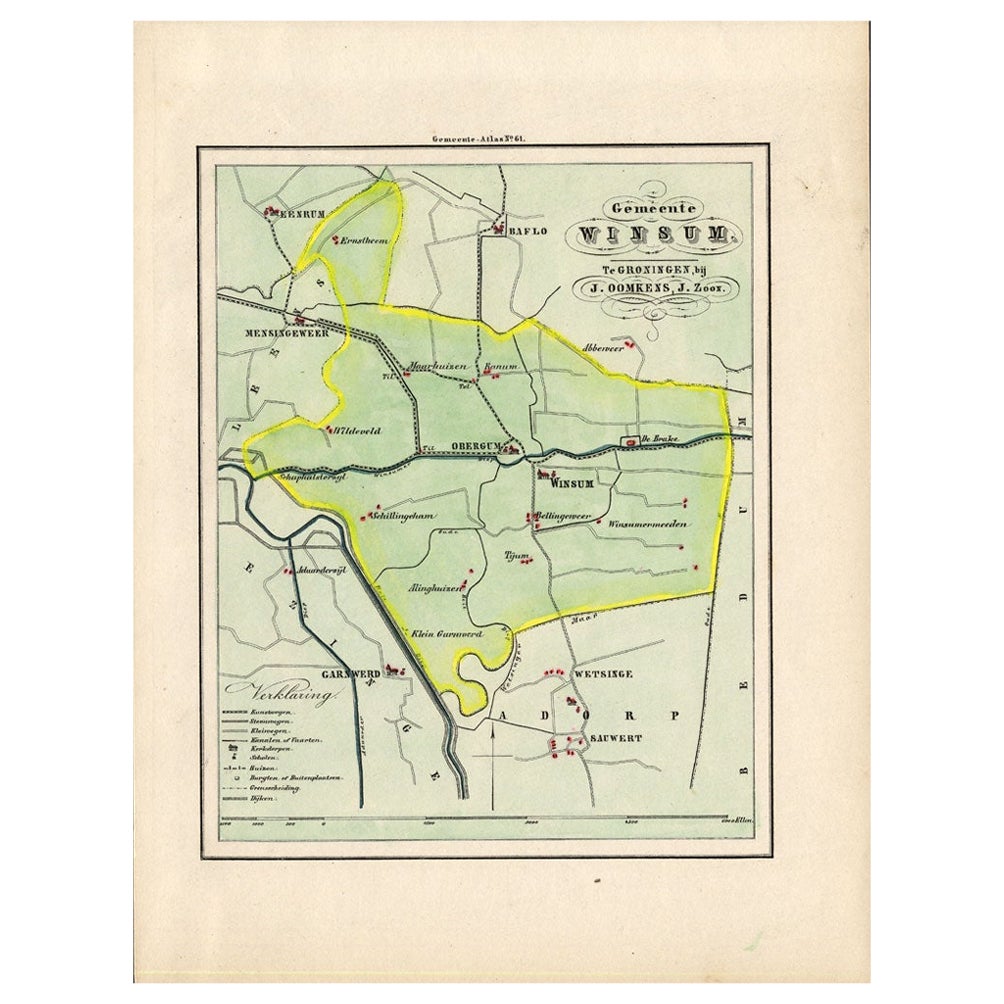
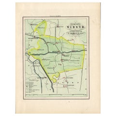
- Antique Map of the Township of Winsum, Groningen in The Netherlands, 1862Located in Langweer, NLGroningen: Gemeente Obergum-Winsum. These scarse detailed maps of Dutch Towns originate from the 'Gemeente atlas van de Provincie Groningen in 62 kaarten.' by C. Fehse. This atlas of...Category
Antique 19th Century Maps
MaterialsPaper
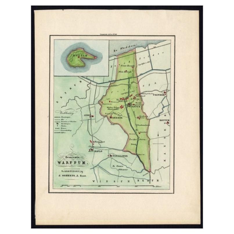
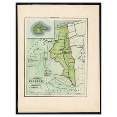
- Original Antique Map of the township of Warffum in The Netherlands, 1862Located in Langweer, NLGroningen: Gemeente Rottumeroog-Warffum. These scarse detailed maps of Dutch Towns originate from the 'Gemeente atlas van de Provincie Groningen in 62 kaarten.' by C. Fehse. This atl...Category
Antique 19th Century Maps
MaterialsPaper
You May Also Like
- Original Antique Map of The Netherlands, Engraved by Barlow, Dated 1807Located in St Annes, LancashireGreat map of Netherlands Copper-plate engraving by Barlow Published by Brightly & Kinnersly, Bungay, Suffolk. Dated 1807 Unframed.Category
Antique Early 1800s English Maps
MaterialsPaper
- School Chart or Pull Down Map of Geography of the Netherlands, 1950sLocated in Hemiksem, VANA beautiful old school map of the Netherlands, painted on linen. The map shows the 3 different reliefs (low, middle, high) of the Netherlands. The beau...Category
Vintage 1950s Belgian Mid-Century Modern Maps
MaterialsLinen, Paint
- 1752 Vaugoundy Map of Flanders : Belgium, France, and the Netherlands, Ric.a002Located in Norton, MALarge Vaugoundy Map of Flanders: Belgium, France, and the Netherlands Colored -1752 Ric.a002 Description: This is a 1752 Didier Robert de Vaugondy map of Flanders. The map de...Category
Antique 17th Century Unknown Maps
MaterialsPaper
- 1861 Topographical Map of the District of Columbia, by Boschke, Antique MapLocated in Colorado Springs, COPresented is an original map of Albert Boschke's extremely sought-after "Topographical Map of the District of Columbia Surveyed in the Years 1856 ...Category
Antique 1860s American Historical Memorabilia
MaterialsPaper
- Original Antique Map of the American State of Oregon, 1889Located in St Annes, LancashireGreat map of Oregon Drawn and Engraved by W. & A.K. Johnston Published By A & C Black, Edinburgh. Original colour Unframed.Category
Antique 1880s Scottish Victorian Maps
MaterialsPaper
- Original Antique Map of the American State of Washington, 1889Located in St Annes, LancashireGreat map of Washington Drawn and Engraved by W. & A.K. Johnston Published By A & C Black, Edinburgh. Original colour Unframed.Category
Antique 1880s Scottish Victorian Maps
MaterialsPaper


Recently Viewed
View AllMore Ways To Browse
Vintage Butcher Shop Poster
Antique Queensland
Map Ukraine
Antique Map Of Uk
Antique Maps Uk
Antique Uk Map
Antique Uk Maps
Uk Antique Map
Tunisia Antique Map
Antique Map Cornwall
Antique Map Of Cornwall
Antique Maps Cornwall
Queensland Maps
Antique Map Of Bermuda
Antique Land Surveyor
Laos Antique Map
Map Of Barbados
Antique Furniture Denver Co