Indian Territory Maps
to
4
43
22
40
20
16
16
16
10
9
7
7
5
5
5
5
4
3
3
2
2
2
2
2
2
1
1
1
1
1
1
1
1
9
7
3
1
1
Sort By
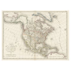
Antique Map of North America, 1821
Located in Langweer, NL
Indian Tribes named. This map originates from 'Atlas pour Servir a l'Intelligence de l'Histoire Generale
Category
Antique 19th Century Maps
Materials
Paper
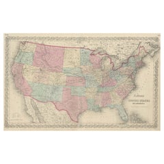
Antique Map Colton's United States of America
Located in Langweer, NL
; Indian Territory and state of West Virginia. Relief shown by hachures and spot heights. Published by J.H
Category
Antique Mid-19th Century Maps
Materials
Paper
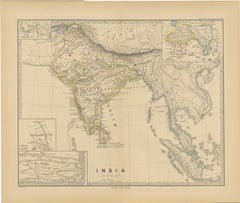
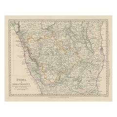
Ancient Cartography of the Indian Subcontinent, Published in 1880
Located in Langweer, NL
This map is titled "INDIA," and it provides a detailed view of the Indian subcontinent with various
Category
Antique 1880s Maps
Materials
Paper
Free Shipping
H 15.56 in W 18.51 in D 0 in
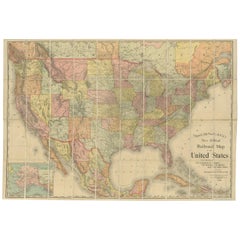
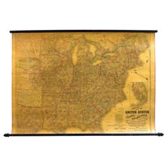
Antique Railroad Map of the United States by Rand, McNally & Co, 1900
Located in Langweer, NL
reservations, and railroads; Oklahoma and "Indian Territory." Inset: "Map of Alaska." Published, 1900.
Category
20th Century Maps
Materials
Linen, Paper
Free Shipping
H 30.91 in W 43.9 in D 0.02 in
1863 "Lloyd's New Map of the United States, the Canadas, and New Brunswick"
Located in Colorado Springs, CO
, "Indian Territory," and Texas. The southern continuation of Florida is shown in an inset map along the
Category
Antique 1860s American Maps
Materials
Linen, Wood, Paper
H 37 in W 49.5 in D 1 in
Old Steel Engraved Map of the Western Part of the Madras Presidency, 1831
Located in Langweer, NL
Antique map titled 'India II Madras Presidency'.
Old steel engraved map of the western part of
Category
Antique 1830s Maps
Materials
Paper
H 13.78 in W 16.15 in D 0 in
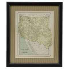
1879 "United States of America, Western Part" by O. J. Stuart
Located in Colorado Springs, CO
, Colorado, Arizona, New Mexico, Dakota, Nebraska, Kansas, Indian Territory, and Texas. The state borders are
Category
Antique 1870s American Maps
Materials
Paper
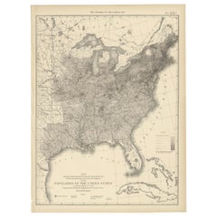
Pl. 17A Antique Chart of the US Population 1860 by Walker, '1874'
Located in Langweer, NL
territory east of the 100th Meridian, of the population of the United States, excluding Indians not taxed
Category
Antique Late 19th Century Maps
Materials
Paper
Pl. 17 Antique Chart of the US Population 1850 by Walker, 1874
Located in Langweer, NL
territory east of the 100th Meridian, of the population of the United States, excluding Indians not taxed
Category
Antique Late 19th Century Maps
Materials
Paper
Pl. 16A Antique Chart of the US Population 1830-1840 by Walker, 1874
Located in Langweer, NL
territory east of the 100th Meridian, of the population of the United States, excluding Indians not taxed
Category
Antique Late 19th Century Maps
Materials
Paper
Antique Chart of the US Population in 1870, published in 1874
Located in Langweer, NL
territory of the United States, of the constitutional population, i.e., excluding Indians not taxed
Category
Antique Late 19th Century Maps
Materials
Paper
Pl. 16 Antique Chart of the US Population 1790-1820 by Walker, '1874'
Located in Langweer, NL
Antique chart titled 'The progress of the nation, 1790-1820. Maps showing in five degrees of
Category
Antique Late 19th Century Maps
Materials
Paper
H 21.66 in W 16.15 in D 0.02 in
Oklahoma and Indian Territory. USA. Century Atlas state antique vintage map
Located in Melbourne, Victoria
'The Century Atlas. Oklahoma and Indian Territory'
Original antique map, 1903.
Central fold as
Category
Early 20th Century Victorian More Prints
Materials
Lithograph
H 11.62 in W 15.95 in
Colonial Crossroads: Angola and Mozambique in 1903
Located in Langweer, NL
The image for sale is an original historical map from 1903 that shows the Portuguese colonies of
Category
Antique Early 1900s Maps
Materials
Paper
1877 "Geological and Geographical Atlas of Colorado" by F. V. Hayden
Located in Colorado Springs, CO
Territory, an unmatched geological record for its time. Published by the Department of the Interior in 1877
Category
Antique 1870s American Maps
Materials
Paper
Cemetery on Amsterdam Island, French Territory in the Indian Ocean, ca.1785
Located in Langweer, NL
on Amsterdam Island, a small French territory in the southern Indian Ocean. Originates from 'Reizen
Category
Antique 1780s Prints
Materials
Paper
H 9.85 in W 15.36 in D 0 in
Railway Map of India.
Located in London, GB
THUILLIER, Colonel Henry Ravenshaw.
Railway Map of India. Railways Brought up to October 1895
Category
1890s Other Art Style More Art
Materials
Lithograph
Map of the World: An Original 18th Century Hand-colored Map by E. Bowen
Located in Alamo, CA
, Pacific, and Indian Oceans. The map is laid out according to the Mercator projection, a type of
Category
Mid-18th Century Old Masters Landscape Prints
Materials
Engraving
First Edition of Historical Work on ". Indians of North America" by Paul Kane
Located in Middletown, NY
Kane, Paul (1810-1871)
Wanderings of an Artist Among the Indians of North America; From Canada to
Category
Antique Mid-19th Century English Books
Materials
Leather, Paper
H 8.5 in W 5.25 in D 1.5 in
Keating, William. Narrative of an Expedition to the Source of St. Peter's River
Located in Middletown, NY
opposite plates.
Vol. 1 includes 3 copper engravings etched by R Fenner, a large folded map 12 3/8 x 21 in
Category
Antique Early 19th Century English Books
Materials
Leather, Paper
H 8.75 in W 5.5 in D 3 in
Pocket Globe, Nicholas Lane, London, post 1779
By Nicholas Lane
Located in Milano, IT
already depicted as a peninsula, but the northern territories of the continent are represented
Category
Antique 1780s English Other Models and Miniatures
Materials
Leather, Wood, Paper
'Camp Red River Hunters' original lithograph by John Mix Stanley
By John Mix Stanley
Located in Milwaukee, WI
newly acquired lands and territories west of the Mississippi. The goals of these surveys were manifold
Category
1850s Romantic Landscape Prints
Materials
Lithograph
'Distribution of Goods to the Assiniboines' original John Mix Stanley lithograph
By John Mix Stanley
Located in Milwaukee, WI
newly acquired lands and territories west of the Mississippi. The goals of these surveys were manifold
Category
1850s Romantic Landscape Prints
Materials
Lithograph
'Distribution of Goods to the Gros Ventres' lithograph by John Mix Stanley
By John Mix Stanley
Located in Milwaukee, WI
newly acquired lands and territories west of the Mississippi. The goals of these surveys were manifold
Category
1850s Romantic Landscape Prints
Materials
Lithograph
The paradise Syndrome, Voyage #20
By Sonny Assu
Located in Montreal, Quebec
. Combining Indigenous content with appropriated images and text from marine chart maps, covers from Choose
Category
2010s Abstract Abstract Prints
Materials
Archival Pigment
The paradise Syndrome, Voyage #36
By Sonny Assu
Located in Montreal, Quebec
. Combining Indigenous content with appropriated images and text from marine chart maps, covers from Choose
Category
2010s Abstract Abstract Prints
Materials
Archival Pigment
The paradise Syndrome, Voyage #30
By Sonny Assu
Located in Montreal, Quebec
. Combining Indigenous content with appropriated images and text from marine chart maps, covers from Choose
Category
2010s Abstract Abstract Prints
Materials
Archival Pigment
The paradise Syndrome, Voyage #9
By Sonny Assu
Located in Montreal, Quebec
. Combining Indigenous content with appropriated images and text from marine chart maps, covers from Choose
Category
2010s Abstract Abstract Prints
Materials
Archival Pigment
The paradise Syndrome, Voyage #38
By Sonny Assu
Located in Montreal, Quebec
. Combining Indigenous content with appropriated images and text from marine chart maps, covers from Choose
Category
2010s Abstract Abstract Prints
Materials
Archival Pigment
The paradise Syndrome, Voyage #11, #12
By Sonny Assu
Located in Montreal, Quebec
. Combining Indigenous content with appropriated images and text from marine chart maps, covers from Choose
Category
2010s Abstract Abstract Prints
Materials
Archival Pigment
The paradise Syndrome, Voyage #37
By Sonny Assu
Located in Montreal, Quebec
. Combining Indigenous content with appropriated images and text from marine chart maps, covers from Choose
Category
2010s Abstract Abstract Prints
Materials
Archival Pigment
Suzanne Benton, Suspended in Time, 2014, Monoprint
By Suzanne Benton
Located in Darien, CT
this new territory she provides a map that others may follow.
Proust’s novel recreates the huge
Category
2010s Symbolist Portrait Prints
Materials
Monoprint
Suzanne Benton, Male Grace, 2017, Monoprint
By Suzanne Benton
Located in Darien, CT
this new territory she provides a map that others may follow.
Proust’s novel recreates the huge
Category
2010s Symbolist Portrait Prints
Materials
Monoprint
Suzanne Benton, Maiden and the Night, 2017, Monoprint
By Suzanne Benton
Located in Darien, CT
this new territory she provides a map that others may follow.
Proust’s novel recreates the huge
Category
2010s Symbolist Portrait Prints
Materials
Monoprint
Suzanne Benton, Over the Shoulder, 2017, Monoprint
By Suzanne Benton
Located in Darien, CT
this new territory she provides a map that others may follow.
Proust’s novel recreates the huge
Category
2010s Symbolist Portrait Prints
Materials
Monoprint
Suzanne Benton, Renaissance Student, 2017, Monoprint
By Suzanne Benton
Located in Darien, CT
this new territory she provides a map that others may follow.
Proust’s novel recreates the huge
Category
2010s Symbolist Abstract Prints
Materials
Monoprint
Suzanne Benton, Renaissance Maiden, 2017, Monoprint
By Suzanne Benton
Located in Darien, CT
this new territory she provides a map that others may follow.
Proust’s novel recreates the huge
Category
2010s Symbolist Portrait Prints
Materials
Monoprint
Suzanne Benton, Child of Fortune, 2017, Monoprint
By Suzanne Benton
Located in Darien, CT
this new territory she provides a map that others may follow.
Proust’s novel recreates the huge
Category
2010s Symbolist Portrait Prints
Materials
Monoprint
The paradise Syndrome, Voyage #32
By Sonny Assu
Located in Montreal, Quebec
. Combining Indigenous content with appropriated images and text from marine chart maps, covers from Choose
Category
2010s Abstract Abstract Prints
Materials
Archival Pigment
1883 "Map of Texas and Indian Territory" by Hiram H. Hardesty
Located in Colorado Springs, CO
Presented is a very detailed “Map of Texas and Indian Territory” by Hiram H. Hardesty. This map is
Category
Antique 1880s American Maps
Materials
Paper
Map of American Indian Reservations 1884 in Period Walnut Frame
Located in San Francisco, CA
the lower left. Another inset shows the Indian Territory in northwest Oklahoma. The map identifies
Category
Antique 1880s American Maps
Materials
Walnut, Paper
"Geographically Correct Map of the United States" Vintage Map, circa 1940
Located in Colorado Springs, CO
white. Indian reservations and National Parks are also marked. In the lower left corner is an inset map
Category
Vintage 1940s American Maps
Materials
Paper
1860 Map of South Central United States by Swanston, Antique Hand-Colored Map
Located in Colorado Springs, CO
.
Centered on Indian Territory and Texas, this map shows town names, rivers, and travel and rail routes. The
Category
Antique 1860s British Maps
Materials
Paper
H 28.5 in W 24 in D 1 in
1847 Guide Map of the U.S., from Phelps's Travellers Guide, Antique Map
Located in Colorado Springs, CO
large part of the eastern parts of Texas and Indian Territory are shown. The inclusion of the areas
Category
Antique 1840s American Maps
Materials
Paper
Texas Civil War Map, circa 1863
Located in Colorado Springs, CO
of adjacent New Mexico, Arkansas, and the Indian Territory (Oklahoma). The map shows the Elevated
Category
Antique 1860s American Maps
"Little Big Horn, 1876" Raised Relief Map, 1989
Located in Colorado Springs, CO
Little Bighorn River in the Crow Indian Reservation, situated in Montana Territory. The US 7th Cavalry, a
Category
Vintage 1980s American Maps
Materials
Plastic
1874 Antique Map of Colorado, Utah, New Mexico, and Arizona
Located in Colorado Springs, CO
Presented is an original map of Colorado, Utah, New Mexico, and Arizona from 1874. This authentic
Category
Antique 1870s American Maps
Materials
Paper
1842 Map of Lewis and Clark's Expedition of North America
Located in Colorado Springs, CO
Yellowstone River. Indian tribes, forts, rivers, and creeks are located on the map, including “Monnels Ft
Category
Antique 1840s American Maps
Materials
Paper
1856 Hanging "Map of the United States from the Latest Authorities"
Located in Colorado Springs, CO
Minnesota, Nebraska, Kansas Territory, Indian Territory and Texas. Inset maps in the lower right include a
Category
Antique 1850s American Maps
Materials
Linen, Wood, Paper
1856 Map of the State of Texas by J. H. Colton
Located in Colorado Springs, CO
Mexico, Arkansas and the Indian Territory (Oklahoma). At lower left, Colton included three inset maps
Category
Antique 1850s American Maps
Materials
Paper
1857 Wall Map of the United States by Fanning, Bridgman & Ensign
By Thayer, Bridgman and Fanning
Located in Colorado Springs, CO
Trail, and the Santa Fe Caravan route. American Indian lands are identified throughout.
This map was
Category
Antique 1850s American Maps
Materials
Paper
The Southern States of North America with Military Positions, Antique Map, 1861
Located in Colorado Springs, CO
states. The map covers the area from Long Island in the northeast to eastern Texas and Indian Territory
Category
Antique 1860s American Maps
Materials
Paper
H 34.75 in W 48.25 in D 1.75 in
1854 "New Map of That Portion of North America" Published by Jacob Monk
Located in Colorado Springs, CO
“New Map of that Portion of North America, exhibiting the United States and Territories, The
Category
Antique 1850s American Maps
Materials
Paper
Pocket Globe John and William Cary, London 1791
By Cary’s
Located in Milano, IT
the sphere.
In the South East Indian Ocean there is a cartouche with the inscription:
CARY’S
Category
Antique 1790s English George III Maps
Materials
Shagreen, Paper
Important giant Map of Asia, for the King of France, 1696
By Nicolas de Fer
Located in Amsterdam, NL
le Quay de l’Horloge, à la Sphere Royal. Avec le Privilege du Roy, 1696
(See also his Giant Map of
Category
Late 17th Century Old Masters More Prints
Materials
Watercolor, Engraving
Rare Engraved "Map of North America", Emanuel Bowen & John Gibson Published 1776
By Emanuel Bowen
Located in Shippensburg, PA
"An Accurate Map Of North America. Describing and distinguishing the British and Spanish Dominions
Category
Antique 18th Century British Neoclassical Prints
Materials
Wood, Paper, Glass
H 46.63 in W 51.75 in D 1.38 in
Framed Hand Colored Map of Asia by Nicolas de Fer for Le Dauphine
Located in Amsterdam, NL
in relief printing, later hand coloring, 109.5 x 163 cm
Note:
The map is surrounded by richly
Category
Antique Late 17th Century French Decorative Art
Materials
Other
"Journal of Major George Washington to Robert Dinwiddie" Limited Edition, 1865
Located in Colorado Springs, CO
Sabin, 1865. Limited edition. Includes folding map and housed in custom archival slipcase.
This 1865
Category
Antique 1860s American Books
Materials
Paper
H 9.5 in W 6 in D 1 in
"History of the Expedition of Captains Lewis and Clark" Limited Edition, 1904
Located in Colorado Springs, CO
of Discovery, with William Clark. Their Mission was to explore the territory of the Louisiana
Category
Early 20th Century American Books
Materials
Leather, Paper
H 10 in W 2.75 in D 7 in
1930s WPA Plaster/Resin Sculpture Petit Trianon at Versailles
Located in New York, NY
example, Indian Dioramas were prefaced with the number 51, showing that the actual object was produced in
Category
Vintage 1930s American Louis XIV Architectural Models
Materials
Plaster, Wood, Paint
- 1
Get Updated with New Arrivals
Save "Indian Territory Maps", and we’ll notify you when there are new listings in this category.
Indian Territory Maps For Sale on 1stDibs
There is a range of indian territory maps for sale on 1stDibs. The range of distinct indian territory maps — often made from paper, wood and animal skin — can elevate any home. There are all kinds of indian territory maps available, from those produced as long ago as the 18th Century to those made as recently as the 20th Century. There are many kinds of indian territory maps to choose from, but at 1stDibs, folk art, Georgian and neoclassical indian territory maps are of considerable interest. Indian territory maps have been a part of the life’s work for many furniture makers, but those produced by Cary’s, Emanuel Bowen and J.H. Colton are consistently popular.
How Much are Indian Territory Maps?
Prices for indian territory maps start at $85 and top out at $48,519 with the average selling for $2,000.
More Ways To Browse
Arkansas Indian Map
Op Ocean Pacific
Rocky Mountain Hardware
Plains Cree
Cree Native
Rand Mcnally Map Of California
Lakota Sioux
Richmond Map
Antique Montana Map
Antique Montana Maps
Beaded War Shirt
Cincinnati Map
Montana Maps
Used Furniture Cabo San Lucas
Colt Navy
Miniature Colts
Antique Map Of Republic Of Texas
Union Pacific Map
