Brabant Map
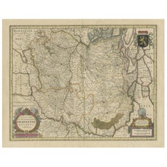
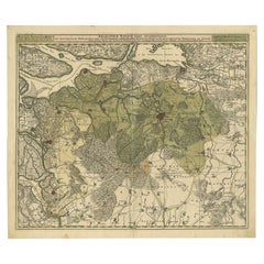
Antique Map of Brabant, the Netherlands, with Original Hand Coloring
Located in Langweer, NL
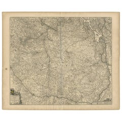
Brabant, the Netherlands. North is to the right. Like all other maps of Brabantiae Ducatus, it encloses
Category
Antique Mid-17th Century Maps
Materials
Paper
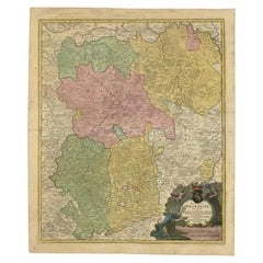
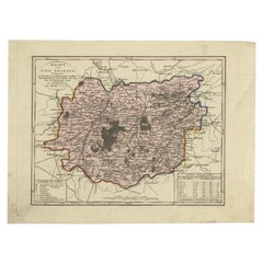
Antique Map of Vlaams-Brabant by Homann Heirs, c.1720
By Homann Heirs
Located in Langweer, NL
Antique map titled 'Ducatus Brabantiae Nova Tabula in qua (..).' Fully engraved copper plate map
Category
Antique 18th Century Maps
Materials
Paper
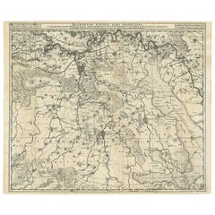
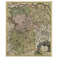
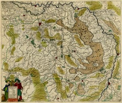
Antique Map of Brabant 'The Netherlands' by N. Visscher, circa 1690
Located in Langweer, NL
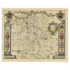
sylvaeducensem in ejusdem subjacentes ditiones (..)'. Map of the Dutch province 'Brabant' depiciting the cities
Category
Antique Mid-18th Century Maps
Materials
Paper
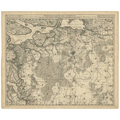
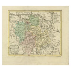
Antique Map of Brabant 'The Netherlands' by N. Visscher, circa 1690
Located in Langweer, NL
Antique map titled 'Brabantiae Batavae Pars Occidentalis (..)'. Highly detailed map of the region
Category
Antique Late 17th Century Maps
Materials
Paper
Antique Map of Brabant 'The Netherlands' by N. Visscher, circa 1670
Located in Langweer, NL
Detailed map of the southern part of The Netherlands and the northern part of Belgium with Antwerp
Category
Antique Mid-17th Century Maps
Materials
Paper
Antique Map of the Duchy of Brabant by Keizer & De Lat, 1788
Located in Langweer, NL
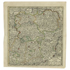
Antique map titled 'Nouvelle Carte du Duché de Brabant'. Uncommon antique map of the Duchy of
Category
Antique 18th Century Maps
Materials
Paper
Decorative Antique Map of the Dutch Province of Noord-Brabant, ca.1640
Located in Langweer, NL
'.
Highly detailed original antique map of the province of Noord-Brabant, the Netherlands. It shows the
Category
Antique 1640s Maps
Materials
Paper
Map of the Duchy Clivia & Ravestein, Brabant in The Netherlands & Germany, 1635
Located in Langweer, NL
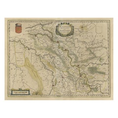
Antique map titled 'Clivia Ducatus et Ravestein Dominium.'
Map of the Duchy Clivia and
Category
Antique 1630s Maps
Materials
Paper
H 16.86 in W 22.05 in D 0 in
Highly Detailed Antique Map of Brabant, Province of the Netherlands, ca.1700
Located in Langweer, NL
.'
Highly detailed map of the region between Bergen Op Zoom, Breda, Hoogstraten and Sandvliet, The
Category
Antique Early 1700s Maps
Materials
Paper
H 20.95 in W 24.41 in D 0 in
Antique Map of the Province of Brabant in Belgium by Veelwaard, C.1840
Located in Langweer, NL
Antique map titled 'Kaart van Zuid Braband (..).' Uncommon map showing the province of Zuid-Brabant
Category
Antique 19th Century Maps
Materials
Paper
Map of Duchy of Brabant Centered on Fortress of Louvain or Leuven, Belgium, 1720
Located in Langweer, NL
Antique map titled 'Ducatus Brabantiae Nova Tabula in qua Lovanii Bruxellarum March S. Impreii
Category
Antique 1720s Maps
Materials
Paper
H 23.63 in W 20.87 in D 0 in
Antique Map of Part of the Former Duchy of Brabant by Van Baarsel, 1803
Located in Langweer, NL
Antique map titled 'Nieuwe Kaart der Meierij van s Hertogenbosch (..).' Map of 'The Meierij van 's
Category
Antique 19th Century Maps
Materials
Paper
Engraving of Tienen in the province of Flemish Brabant, in Flanders, Belgium
Located in Langweer, NL
Antique map titled 'Thienen'. Old map of Tienen showing the siege of Tienen in 1588. This map
Category
Antique 17th Century Maps
Materials
Paper
H 10.44 in W 13.19 in D 0 in
Antique Map of Belgium and Surroundings, 1692
Located in Langweer, NL
Antique map titled 'Provincie Meridionali de Paesi Bassi Intese sotto nome di Fiandra overo Li
Category
Antique 17th Century Maps
Materials
Paper
Antique Map of Belgium and Luxembourg by Homann Heirs, 1747
Located in Langweer, NL
Antique map titled 'Belgium Catholicum seu Decem provinciae Germaniae Inferioris cum confiniis
Category
Antique 18th Century Maps
Materials
Paper
Antique Map of Belgium and Luxembourg by Homann Heirs, 1747
Located in Langweer, NL
Antique map titled 'Belgium Catholicum seu Decem provinciae Germaniae Inferioris cum confiniis
Category
Antique 18th Century Maps
Materials
Paper
Old Map of the Dutch City of Megen in Holland, 1916
Located in Langweer, NL
Antique map Megen titled 'Megen'. Antique map depicting the city of Megen, Noord-Brabant, The
Category
20th Century Maps
Materials
Paper
Antique Map of the Netherlands and Belgium by Homann, circa 1710
By Johann Baptist Homann
Located in Langweer, NL
Antique map titled 'Tabula Generalis Totius Belgii Provinciae XVII. Infer. Germaniae (..)'. Map of
Category
Antique Early 18th Century German Maps
Materials
Paper
Free Shipping
H 20.87 in W 24.02 in D 0.02 in
Antique Map of the City of Leuven, Belgium, with Original Coloring, 1609
Located in Langweer, NL
An original antique map titled "Lovanium Brabantiarum," which depicts the city of Leuven in Belgium
Category
Antique Early 17th Century Maps
Materials
Paper
H 11.74 in W 13.94 in D 0.02 in
Original Copper Engraving of a Map of Syria and Lebanon, 1698
Located in Langweer, NL
Antique map titled 'Syriae, sive Soriae, Nova et Accurata Descriptio.'
Map of Syria and Lebanon
Category
Antique 1690s Maps
Materials
Paper
Free Shipping
H 12.41 in W 14.45 in D 0 in
1752 Vaugoundy Map of Flanders : Belgium, France, and the Netherlands, Ric.a002
Located in Norton, MA
Large Vaugoundy Map of Flanders:
Belgium, France, and the Netherlands
Colored -1752
Ric.a002
Category
Antique 17th Century Unknown Maps
Materials
Paper
H 51.5 in W 66 in D 1 in
Antique Map of Walcheren in the Province of Zeeland, the Netherlands, ca.1910
Located in Langweer, NL
Antique map of Walcheren, part of the province of Zeeland, the Netherlands.
Shows the cities of
Category
Vintage 1910s Maps
Materials
Paper
H 7.49 in W 8.08 in D 0 in
Antique Handcolored Engraving of a Woman of Brabant, the Netherlands, 1817
Located in Langweer, NL
Antique costume print titled 'Woman of Brabant'. Old costume print depictinga woman of Brabant, a
Category
Antique 19th Century Prints
Materials
Paper
H 14.18 in W 9.85 in D 0 in
18th Century Map Engraving - Mechlin, or Malines
Located in Corsham, GB
A map of Mechelen, known as Malines in French and Mechlin in English, a city and municipality in
Category
18th Century More Prints
Materials
Engraving
Cartusia Bruxellensis Monastery in Brussels: A 17th C. Hand-colored Engraving
By Lucas Vorsterman the Younger
Located in Alamo, CA
et coenobiorum descriptio . . . Brussel' (A sacred chorography of Brabant, or a description of
Category
Mid-17th Century Old Masters Landscape Prints
Materials
Engraving
People Also Browsed
Set of Twelve Paris Exhibition Plates
By Sarraguemines
Located in New York, NY
Set of twelve Paris Exhibition plates. Twelve Sarraguemines creamware souvenir plates from the Universal Exposition of 1889 in Paris Twelve different scenes on creamware ground repr...
Category
Antique Late 19th Century French Dinner Plates
Materials
Creamware
Antique Map of Switzerland by N. Visscher, circa 1690
Located in Langweer, NL
Beautifully detailed map of Switzerland and surrounding regions in present-day France, Germany, and Italy. This map features two decorative cartouches: the larger is flanked by two p...
Category
Antique Late 17th Century Maps
Materials
Paper
Lithograph "Lawyers' Conversations" by Honore Daumier (1808-1879), Signed.
By Honoré Daumier
Located in NICE, FR
Rare lithograph signed by the artist in the series "People of Justice", this one representing "The Conversations of Lawyers" from the 19th century. The paper is fresh and without any...
Category
Antique 19th Century French Restauration Drawings
Materials
Paper
H 14.97 in W 11.82 in D 0.4 in
Antique American Boston Classical Mahogany Pedestal Center Table
By Isaac Vose, John & Thomas Seymour, Thomas Seymour
Located in Forney, TX
A fine 200 year old American Federal period Boston Classical mahogany pedestal center table. circa 1825
Exquisitely hand-crafted in the Northeastern United States in the early 19th ...
Category
Antique Early 19th Century American American Classical Center Tables
Materials
Marble, Brass
De Stijl Movement Design Red Chair Attributed to Jan Wils, 1920's Netherlands
By Jan Wils
Located in Oud-Turnhout, VAN
Very Rare Early 20th Century 'De Stijl Movement' Dutch Modernist Design Side Chair attributed to Jan Wils. Made in the Netherlands, 1920's / 30's period. Red painted oak, beech and p...
Category
Vintage 1920s Dutch De Stijl Side Chairs
Materials
Beech, Oak, Plywood
H 37.01 in W 17.92 in D 18.51 in
Joseph B. Pruitt Signed Original 19th Century Lithograph of Waves Crashing
Located in Chicago, IL
Magnificent restored mid-19th century lithograph in it's original frame. Transporting your senses to a place far away is what great art does, thus being the case with this. The waves...
Category
Antique 1890s English Prints
Materials
Paper
H 35 in W 45.5 in D 0.75 in
Early 1800’s Pennsylvania Dutch Pine Country Cupboard with Wavy Glass Doors
Located in Louisville, KY
This simple, yet beautiful country pine cupboard features a primitive design of two solid doors on the bottom and two framed wavy glass doors on the top, which is set back allowing f...
Category
Antique Early 19th Century American Primitive Cupboards
Materials
Iron
H 72.75 in W 49 in D 22.5 in
Dutch 18th Century Oak & Ebonized Armoire
Located in Baton Rouge, LA
A Dutch armoire made of solid oak from the 1700’s. This armoire has geometric paneling instead of the classic pillowed carvings of the similarly styled Dutch kussenkast. Built in fou...
Category
Antique 18th Century Dutch Other Cabinets
Materials
Oak
Natural history lithograph, 4 tropical fish - Plate 32 - P. Oudart & C. Motte
By Charles Etienne Pierre Motte, Charles Etienne Pierre Motte
Located in EINDHOVEN, NL
Naturaly history lithograph, 4 tropical fish - Plate 32 - P. Oudart & C. Motte.
In style of Maria Sibylla Merian
This is a hand-colored lithograph depicting "Four Tropical Fish" on ...
Category
Antique 1780s French Other Decorative Art
Materials
Metal
H 9.26 in W 5.4 in D 2.76 in
Mid-Late 19th Century Hand-Colored Wood Pigeon Lithograph
Located in Chapel Hill, NC
Mid-late 19th century hand-colored lithograph of the Wood Pigeon. It is from the Rev. F.O. Morris' "History of British Birds" published by Groombridge and Sons in London Sight: 7.5" ...
Category
Antique Mid-19th Century English Victorian Decorative Art
Materials
Glass, Wood, Parchment Paper
Dutch 19th Century Oak Empire Chest
Located in Baton Rouge, LA
A classic Dutch Empire chest made of oak during the 1800’s. The top drawer protrudes forward over three drawers flaked with ebonized columns featuring brass capitals at the top and b...
Category
Antique 19th Century Dutch Empire Commodes and Chests of Drawers
Materials
Brass
19th Century Framed Botanical by Leopold Kny
Located in Chicago, IL
19th century framed botanical
Wall chart of a botanical cell structure produced by Leopold Kny.
He was a professor and research scientist in the field of plant physiology at the U...
Category
Antique 19th Century German Prints
Materials
Paper
Antique Map of the Northern Part of South America by J. Tallis, circa 1851
Located in Langweer, NL
A decorative and detailed mid-19th century map of the northern part of South America (including modern day Venezuela, Colombia, Ecuador, Guyana, Suriname and French Guiana) which was...
Category
Antique Mid-19th Century Maps
Materials
Paper
H 10.6 in W 14.41 in D 0.02 in
Dutch Rosewood Extending Dining Table
Located in Baton Rouge, LA
This rosewood extending dining table has self storing leaves making for a versatile dining table. This table easily seats six guests while closed and opens to seat up to ten. Cleaned...
Category
Antique 19th Century Dutch Other Dining Room Tables
Materials
Brass
Original On the Job for Victory vintage WW1 lithograph poster.
By Jonas Lie
Located in Spokane, WA
Original Vintage Poster "On The Job For Victory" by Jonas Lie. U. S. military World War 1 antique poster, archival linen backed and in A- condition. Ready to frame. Horizontal ...
Category
1910s American Realist Landscape Prints
Materials
Lithograph
H 38.5 in W 29.25 in D 0.05 in
Fine Pair of Wonderfully Framed Lithographs
Located in Stamford, CT
19Th Century Pair of Lithographs Birds, Custom Framed, Signed W Hart and Dated
A fine pair of large lithographs. Each depicting colorful birds perched upon a branch. Both custom ma...
Category
Early 20th Century English Prints
Materials
Paper
Recent Sales
Brabantiae Belgarum provinciae - Map of Brabant.
By Johann Busschemacher
Located in Zeeland, Noord-Brabant
Etching/engraving on hand laid (verge) paper.
Brabantiae Belgarum provinciae - Map of Brabant
Category
16th Century More Prints
Materials
Engraving, Etching
Antique map of Brabant (Brabantiae) by Hondius - Handcol. engraving - 17th c.
By Henricus Hondius
Located in Zeeland, Noord-Brabant
: 'Brabantiae pars Orientalis.' - Map of Eastern Brabant. Regional map mainly of Brabant in the Netherlands
Category
1620s Old Masters More Prints
Materials
Engraving
Antique map of Brabant and Limburg by Tirion - Handcoloured engraving - 18th c.
By Isaak Tirion
Located in Zeeland, Noord-Brabant
, Limburg en Opper Gelder.' - (New Map of the Duchy of Brabant, Limburg and Gelderland.) Detailed map
Category
1730s Old Masters More Prints
Materials
Engraving
Carte du Brabant [...].
By Guillaume De L'Isle
Located in Zeeland, Noord-Brabant
Map of Brabant. Large overview map of the Province of Brabant, part of present day Belgium and The
Category
Late 18th Century More Prints
Materials
Engraving
Antique map of Duchy of Brabant by Visscher - Handcoloured engraving - 17th c.
By Nicolaus Visscher
Located in Zeeland, Noord-Brabant
Ducatus cum adjacentibus provinciis.' - This map shows the duchy of Brabant with the adjacent provinces in
Category
1690s Old Masters More Prints
Materials
Engraving
Carte du Brabant [...].
By Liebaux le fils & Guillaume de l'Isle
Located in Zeeland, Noord-Brabant
Etching / engraving with hand colouring on hand laid paper.
Large overview map of the Province of
Category
Early 18th Century More Prints
Materials
Etching, Engraving
1732 Map of Brussels
Located in New York, NY
Map of Brussels, 1732, with decorated cartouche. Full title: "Brussels A Large and Beautiful City
Category
1730s Realist Landscape Prints
Materials
Engraving
Map of military campaign - Maurits of Nassau by Balthasars - Engraving - 17th c.
Located in Zeeland, Noord-Brabant
States General in 1602 through the land of Luik, and his return through Brabant to Grave.) Map of the
Category
1610s Old Masters More Prints
Materials
Engraving
Eindhoven, Gestel, Stratum, Strijp, Woensel.
By Jacob Kuyper
Located in Zeeland, Noord-Brabant
the Dutch province of Noord-Brabant. These maps are also known as a Kuyper kaart or Kuyper kaartjes
Category
1860s More Prints
Materials
Lithograph
Herzog Fridrich von Wirtenbergk [..].
By Franz Hogenberg
Located in Zeeland, Noord-Brabant
German / Flemish cartographer from Brabant. He drew maps for Dutch, German and English publishers. He was
Category
Early 1600s Figurative Prints
Materials
Etching
Brabantiae ducatus S.R. Imperii Marchionatus Mechliniae dominii [...].
Located in Zeeland, Noord-Brabant
edita per I. Covens & C. Mortier. - Large overview map of the Province of Brabant, part of present day
Category
Early 18th Century More Prints
Materials
Engraving, Etching
H 24.73 in W 21.03 in
Antique Map of Brabant 'The Netherlands' by J. Hondius, 1616
Located in Langweer, NL
Small antique map of Brabant (The Netherlands). This map originates from 'Tabulae geographicae
Category
Antique Early 17th Century Maps
Materials
Paper
Antique Map of Brabant and part of Belgium by Munster, c.1580
Located in Langweer, NL
Antique map titled 'Braband'. Original woodcut print of the region of Brabant (the Netherlands) and
Category
Antique 16th Century Maps
Materials
Paper
Get Updated with New Arrivals
Save "Brabant Map", and we’ll notify you when there are new listings in this category.
Brabant Map For Sale on 1stDibs
At 1stDibs, there are many versions of the ideal brabant map for your home. Frequently made of paper, every brabant map was constructed with great care. There are many kinds of the brabant map you’re looking for, from those produced as long ago as the 18th Century to those made as recently as the 20th Century. Homann Heirs and Johann Baptist Homann each produced at least one beautiful brabant map that is worth considering.
How Much is a Brabant Map?
The average selling price for a brabant map at 1stDibs is $499, while they’re typically $92 on the low end and $2,965 for the highest priced.
More Ways To Browse
Ten Fold
Black Watch Regiment
Antique Barrel Cart
Canadian Railway Map
Map Of The Netherlands
Antique Map Coats Of Arms
Historical Framed World Map
Stop Watch Antique
Spice Fish
Map Collection
Train Collectibles
Wing And Son
Vintage Old World Maps
Vintage Old World Map
Vintage Old Map Of The World
Vintage Old Maps Of The World
Spanish Horseback Portrait
Isle Royale
