Items Similar to Antique Map of Part of the Former Duchy of Brabant by Van Baarsel, 1803

Want more images or videos?
Request additional images or videos from the seller
1 of 5
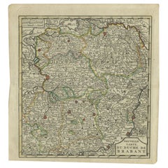
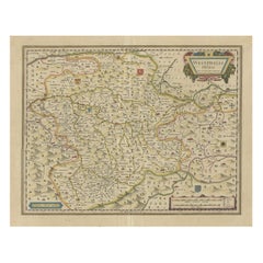
Antique Map of Part of the Former Duchy of Brabant by Van Baarsel, 1803
About the Item
Antique map titled 'Nieuwe Kaart der Meierij van s Hertogenbosch (..).' Map of 'The Meierij van 's-Hertogenbosch', (Dutch for Bailiwick of Bois le Duc), it was one of the four parts of the former duchy of Brabant, The Netherlands. Source unknown, to be determined. Artists and Engravers: Made by 'C. van Baarsel' after 'S. Hanewinckel'.
Artist: Made by 'C. van Baarsel' after 'S. Hanewinckel'.
Condition: Good, given age. Irregular bottom and right edges as issued with an occasional tiny tear. Original middle fold as issued. General age-related toning and/or occasional minor defects from handling. Please study image carefully.
Date: 1803
Overall size: 42.5 x 37.5 cm.
Image size: 0.001 x 34 x 28.7 cm.
Antique prints have long been appreciated for both their aesthetic and investment value. They were the product of engraved, etched or lithographed plates. These plates were handmade out of wood or metal, which required an incredible level of skill, patience and craftsmanship. Whether you have a house with Victorian furniture or more contemporary decor an old engraving can enhance your living space. We offer a wide range of authentic antique prints for any budget.
- Dimensions:Height: 14.77 in (37.5 cm)Width: 16.74 in (42.5 cm)Depth: 0 in (0.01 mm)
- Materials and Techniques:
- Period:
- Date of Manufacture:1803
- Condition:
- Seller Location:Langweer, NL
- Reference Number:
About the Seller
5.0
Platinum Seller
These expertly vetted sellers are 1stDibs' most experienced sellers and are rated highest by our customers.
Established in 2009
1stDibs seller since 2017
1,938 sales on 1stDibs
Typical response time: <1 hour
- ShippingRetrieving quote...Ships From: Langweer, Netherlands
- Return PolicyA return for this item may be initiated within 14 days of delivery.
More From This SellerView All
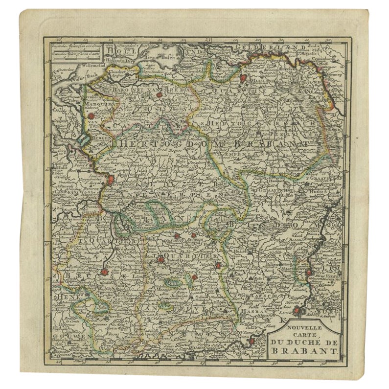
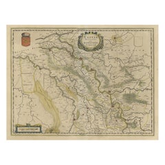
- Antique Map of the Duchy of Brabant by Keizer & De Lat, 1788Located in Langweer, NLAntique map titled 'Nouvelle Carte du Duché de Brabant'. Uncommon antique map of the Duchy of Brabant, the Netherlands. This map originates from 'Nieuwe Natuur- Geschied- en Handelku...Category
Antique 18th Century Maps
MaterialsPaper
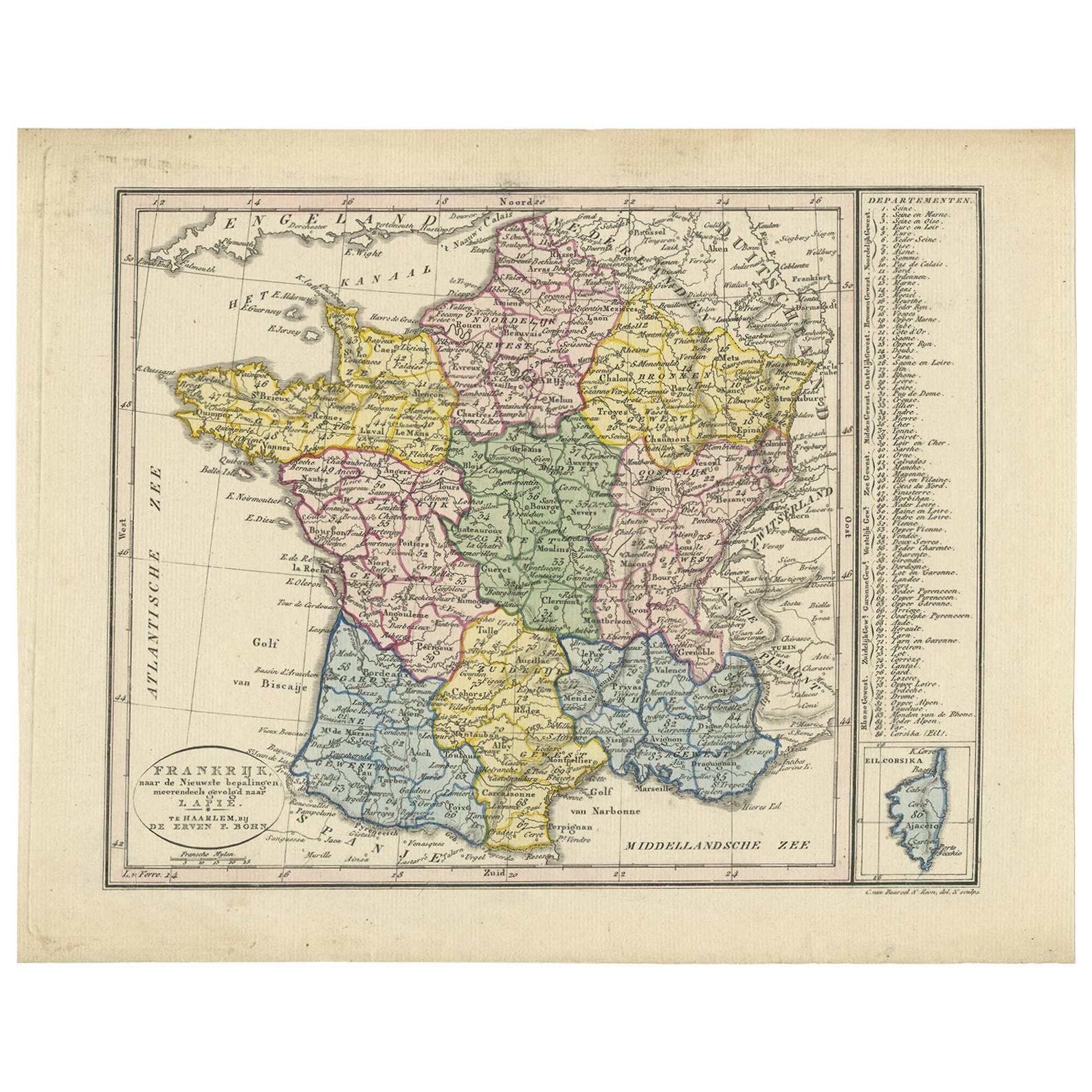
- Antique Map of France by Van Baarsel (c.1820)Located in Langweer, NL'Frankrijk naar de nieuwste bepalingen meerendeels gevolgd naar Lapie'. Beautiful map of France with an inset map of the island of Corsica. Includes a table with reference to the dep...Category
Antique Early 19th Century Maps
MaterialsPaper
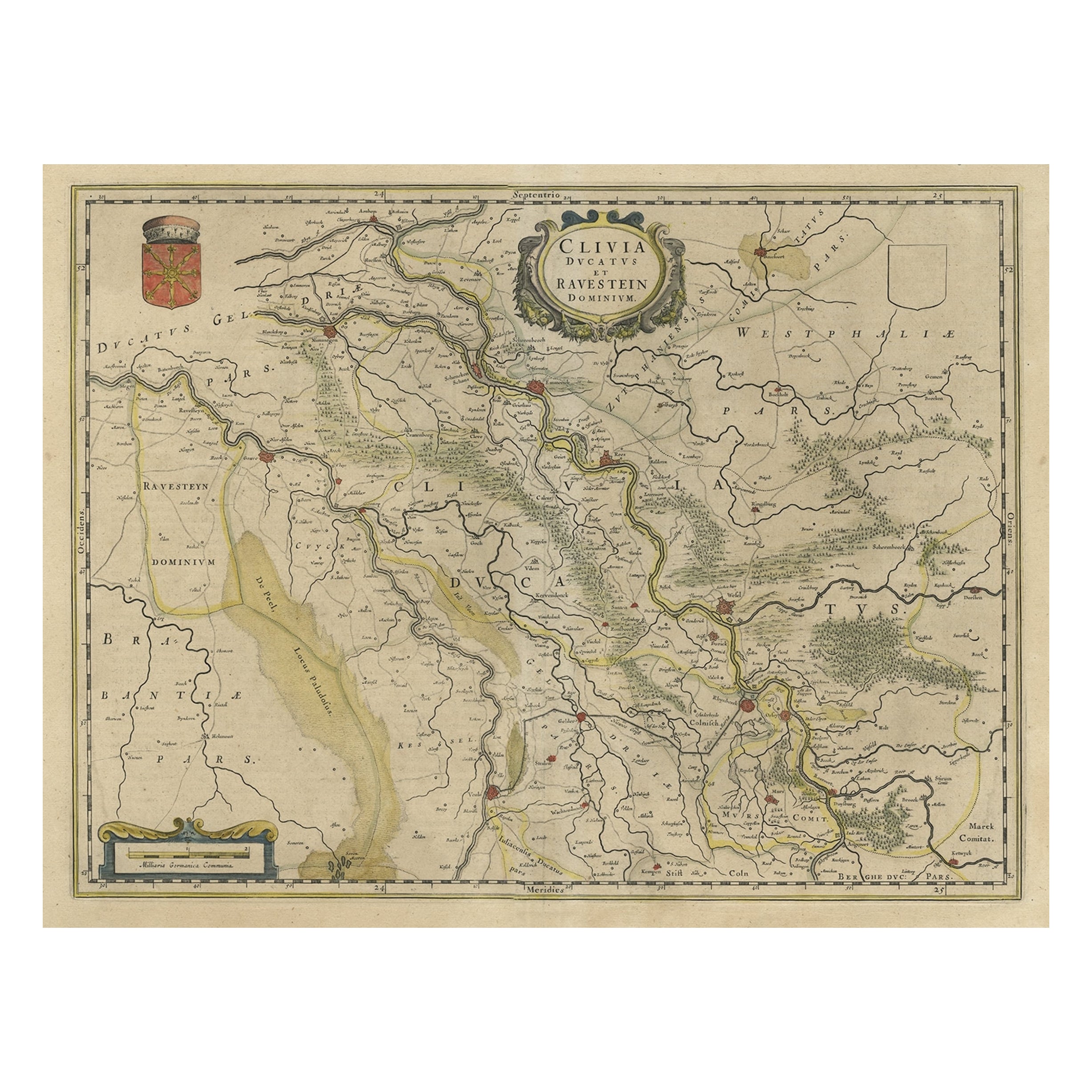
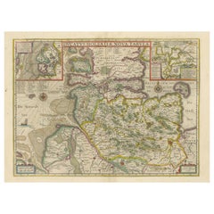
- Map of the Duchy Clivia & Ravestein, Brabant in The Netherlands & Germany, 1635Located in Langweer, NLAntique map titled 'Clivia Ducatus et Ravestein Dominium.' Map of the Duchy Clivia and Ravestein, part of Brabant in The Nethe...Category
Antique 1630s Maps
MaterialsPaper
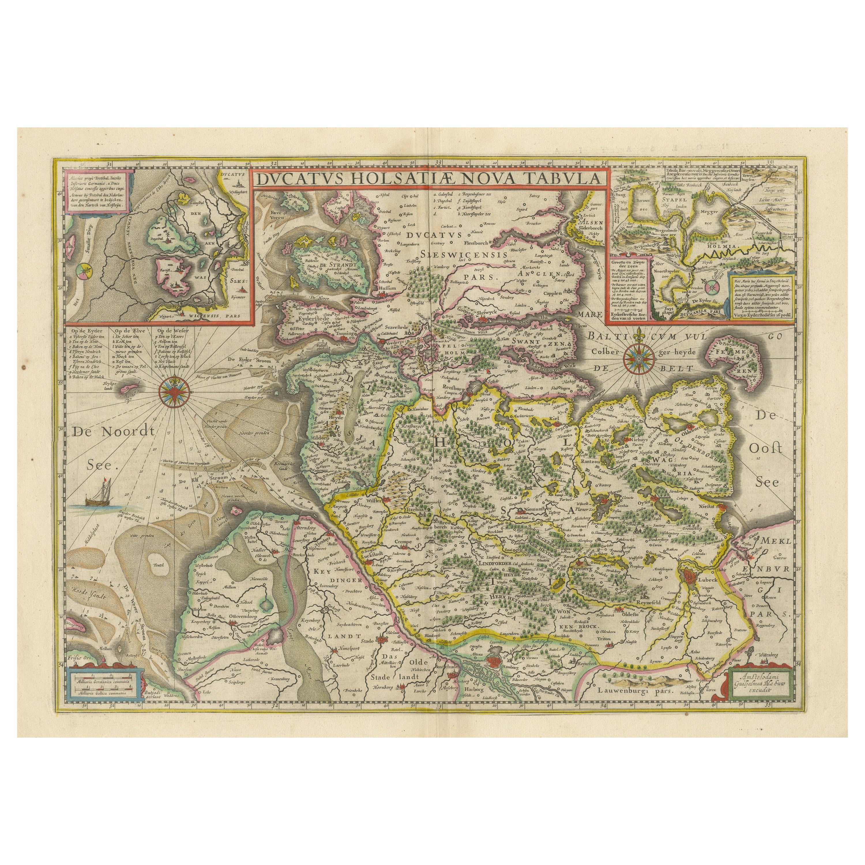
- Original Antique Map of the Duchy of HolsteinBy Willem BlaeuLocated in Langweer, NLAntique map titled 'Ducatus Holsatiae Nova Tabula'. Original old map of the Duchy of Holstein, the northernmost territory of the Holy Roman Empire, from the mid-17th Century. To the ...Category
Antique Mid-17th Century Maps
MaterialsPaper
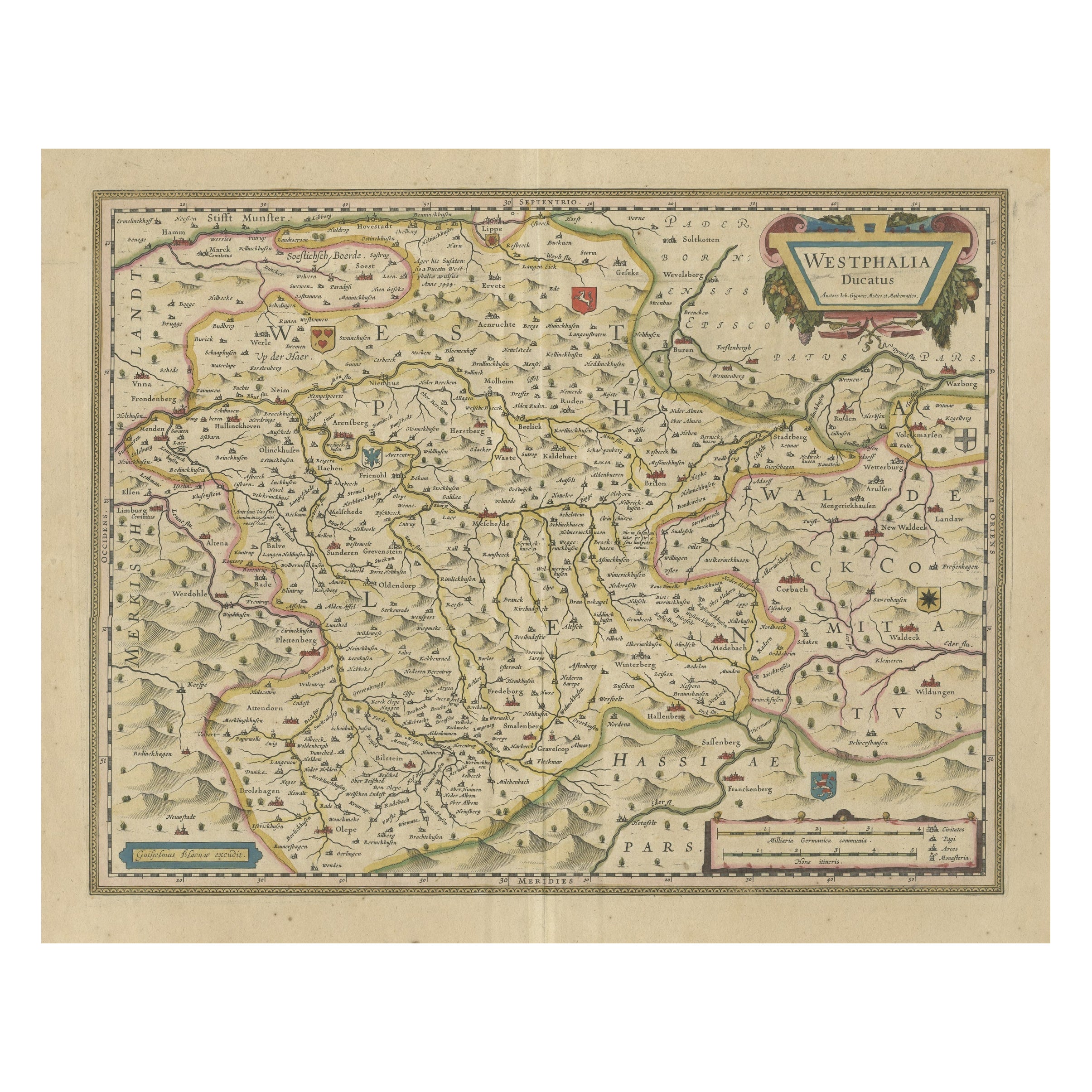
- Antique Map of the Duchy of Westphalia, GermanyLocated in Langweer, NLOriginal antique map titled 'Westphalia Ducatus'. Fine map of the Duchy of Westphalia, Germany. The map is centered on Meschede and includes Arensberg, Beelick, and Brilon. Published...Category
Antique Mid-17th Century Maps
MaterialsPaper
- Antique Map of the Duchy of Saxony by De Wit, c.1680Located in Langweer, NLAntique map titled 'Circuli Saxoniae Superior Pars Meridionalis in qua sunt Ducatus Saxoniae, Comitatus Mansfeldiae, et Voitlandiae, Landgraviat Thuringiae, Marchionatus Misniae Prin...Category
Antique 17th Century Maps
MaterialsPaper

You May Also Like
- Curaçao map - C. van Baarsel en zoonLocated in UTRECHT, UT“Kaart van het eiland Curaçao.”, “Algemeene kaart der Caraïbische eilanden”, “Plan van het fort Amsterdam op Curaçao” from the atlas “Atlas der overzeesche bezittingen van Zijne Maje...Category
Antique 1810s Dutch Other Maps
MaterialsPaper
- Antique 1803 Italian Map of Asia Including China Indoneseia IndiaLocated in Amsterdam, Noord HollandAntique 1803 Italian Map of Asia Including China Indoneseia India Very nice map of Asia. 1803. Additional information: Type: Map Country of Manufacturing: Europe Period: 19th centu...Category
Antique 19th Century European Maps
MaterialsPaper
- 1861 Topographical Map of the District of Columbia, by Boschke, Antique MapLocated in Colorado Springs, COPresented is an original map of Albert Boschke's extremely sought-after "Topographical Map of the District of Columbia Surveyed in the Years 1856 ...Category
Antique 1860s American Historical Memorabilia
MaterialsPaper
- Map of the Kingdom of Sardinia and Part of the Kingdom of Genoa, RomeBy Giovanni Maria CassiniLocated in Hamilton, Ontario18th century map by Italian engraver Giovanni Maria Cassini (Italy 1745-1824). Map of Part of the Kingdom of Sardinia and Part of the Kingdom of Genoa: Rome. This is a hand colored a...Category
Antique 18th Century Italian Maps
MaterialsPaper
- 1868 Map of the Upper Part of the Island of Manhattan Above 86th StreetBy Wm. Rogers Mfg. Co.Located in San Francisco, CAThis wonderful piece of New York City history is over 150 years old. It depicts 86th street and above. It was lithographed by WC Rogers and company. It was made to show what was the Battle of Harlem during the Revolutionary war...Category
Antique 1860s American American Colonial Maps
MaterialsPaper
- 1844 Map "Russia in Eurpoe, Part II to Part VIII", 7 Maps Ric.r023Located in Norton, MA1844 Map "Russia in Eurpoe, Part II to Part VIII" 7 Maps Ric.r023 Fine, original, steel-engraved Map of Russia in Europe Part II t oPart VIII, by the Society for the Diffusion of Useful Knowledge. Detailed map of the regions to the northeast of Moscow. Including Arkhangel, Vologda, Viatka, Perm, Olonetz, Iaroslavl. The SDUK began its map publishing project under the leadership of Captain Francis Beaufort R.N. in 1829, and published the maps in parts, haltingly, over the next 15 years, completing the series in 1844, finally permitting the publication of a whole atlas. Many of the maps were actually drawn by Beaufort, who at the time was the Hydrographer to the Royal Navy, and all were closely supervised by him. J. & C. Walker worked closely with Beaufort in engraving the maps. Finely engraved, carefully researched, the maps set...Category
Antique 19th Century Unknown Maps
MaterialsPaper


Recently Viewed
View AllMore Ways To Browse
Antique Bois
Four A Bois Antique
Antique Maps Of New York
Antique Map Of New York
Rare Compass
Map Of United Kingdom
Antique Presentation Plates
Antique Map Fair
Antique Mallet
Antique 16th Century Plates
Antique Caribbean Furniture
Map Of Scotland
Antique Bookseller
17th Century Plate Set
Antique Booksellers
Antique Rose Compass
Antique Compass Rose
Compass Rose Antique