Items Similar to Curaçao map - C. van Baarsel en zoon

Want more images or videos?
Request additional images or videos from the seller
1 of 7
Curaçao map - C. van Baarsel en zoon
About the Item
“Kaart van het eiland Curaçao.”, “Algemeene kaart der Caraïbische eilanden”, “Plan van het fort Amsterdam op Curaçao” from the atlas “Atlas der overzeesche bezittingen van Zijne Majesteit den Koning der Nederlanden, aan hoogst denzelven opgedragen”, engraved by C. van Baarsel en zoon and published by Gebroeders van Cleef in The Hague in 1818. Later coloured in by hand. Size: 52,5 x 38 cm. Size including frame: 70 x 55,5 cm.
Van Baarsel was born on November 15, 1761 in Utrecht. His father was Cornelis van Baarsel Sr., a grocer from Utrecht. At a young age, Van Baarsel moved with his family to Amsterdam, where his father opened a grocery store. There, the young Cornelis was also trained as a grocer, but he felt out of place and could not use his creativity. To find his true calling, Van Baarsel has had a number of different jobs. He has worked in a cloth shop and at a drugstore. However, because he was always drawing and not paying attention to the shop, Van Baarsel was fired by both his employers. He then spent a number of years at sea before devoting himself entirely to drawing.
After Van Baarsel's time at sea, he returned to Amsterdam and married his childhood sweetheart Dorothea Veelwaard. In 1791 they had a son, Willem Cornelis van Baarsel. His wife Dorothea was related to the well-known engraver Daniel Veelwaard. Her family recognized his talent and urged him to retrain as an engraver. Then in 1789 he started working as an independent engraver and specialized mainly in engraving maps. His studio was probably located on the Haarlemmerdijk.
Under the reign of King Lodewijk, Van Baarsel was appointed first engraver at the Depot General of the War in Amsterdam and then The Hague. After the departure of King Lodewijk around 1810, Van Baarsel left for Paris to work as an engraver at the war depot there. In 1815 he returned to Amsterdam to work as an engraver for private individuals.
Van Baarsel trained his son Willem Cornelis van Baarsel as an engraver and from 1817 the work from Van Baarsel's studio was provided with the signature 'C. van Baarsel & Son.’ After the death of his father in 1826, Willem Cornelis continued his studio under the name W. C. Van Baarsel. In addition to his son, Van Baarsel also regularly worked with Cornelis Covens and sons, and P. N. Tuyn.
- Dimensions:Height: 21.86 in (55.5 cm)Width: 27.56 in (70 cm)Depth: 0.79 in (2 cm)
- Style:Other (In the Style Of)
- Materials and Techniques:
- Place of Origin:
- Period:
- Date of Manufacture:1818
- Condition:Wear consistent with age and use.
- Seller Location:UTRECHT, NL
- Reference Number:1stDibs: LU6566238893262
About the Seller
No Reviews Yet
Vetted Seller
These experienced sellers undergo a comprehensive evaluation by our team of in-house experts.
Established in 2014
1stDibs seller since 2022
- ShippingRetrieving quote...Ships From: UTRECHT, Netherlands
- Return PolicyA return for this item may be initiated within 14 days of delivery.
More From This SellerView All
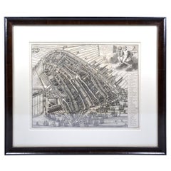
- Amsterdam city plan - Joost van SassenLocated in UTRECHT, UT“Afbeeldinge der Stad Amsterdam, gelyk deselve in den jaren 1536 door Cornelis Antonisz na ’t leven is geschildert, en Ao 1544 in druk uytgegeven.”, engraved by Joost van Sassen and ...Category
Antique 1720s Dutch Other Maps
MaterialsPaper
- Utrecht city planLocated in UTRECHT, UT“Platte grond der Stad Utrecht vertonende alle Gragten, Straaten, Stegen, Gangen, Markten, en plaatsen der openbare Gebouwen”, engraving published by Johannes van Schoonhoven in Amst...Category
Antique 1770s Dutch Other Maps
MaterialsPaper
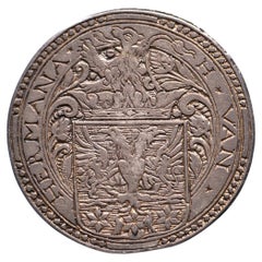
- N.d. Marriage Hessel van Hermane & Anna van LyauckemaLocated in UTRECHT, UTObverse: H ✶ VAN ✶ – HERMANA ✶, crowned coat of arms with lion crest Reverse: ✶ A ✶ VAN ✶ – ✶ LYAUCKEMA ✶, crowned diamond-shaped coat of arms Earliest known Dutch wedding medal and...Category
Antique 16th Century Other Antiquities
MaterialsSilver
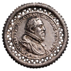
- Capture of Grave by Prince MauritsLocated in UTRECHT, UTObverse: MAVRITIVS. PR. AVR. CO. NASS. CAT. MARC. VER. ET. VLIS, armoured bust right, ÆT 34 on arm, underneath G.V.B.F. Reverse: TANDEM. FIT. SVRCVLVS. ARBOR, young orange tree sprou...Category
Antique Early 1600s Dutch Other Antiquities
MaterialsSilver
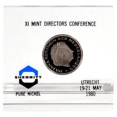
- Paper weight 1980 Mint Directors ConferenceLocated in UTRECHT, UTIssued as gift to attendees at the Mint Directors Conference on 19-21 May 1980 in Utrecht. With 2 1/2 guilder 1980 Proof VERY RARE Only ca. 20 pcs issued Dimensions: 79(b) x 75(h...Category
Vintage 1980s Dutch Other Paperweights
MaterialsNickel
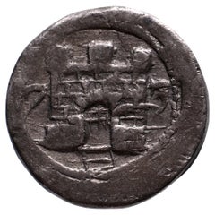
- 1/4 daalder siege coin in tin AlkmaarLocated in UTRECHT, UTObverse: castle between 7 – 3 Reverse: blank VERY RARE Weight: 9.86 g Diameter: 25.0 mm Grade: Very Fine Reference: vG. 49; CNM 2.01.5 After the fall of Haarlem, Don Frederik turn...Category
Antique 16th Century Dutch Other Antiquities
MaterialsTin

You May Also Like
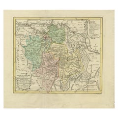
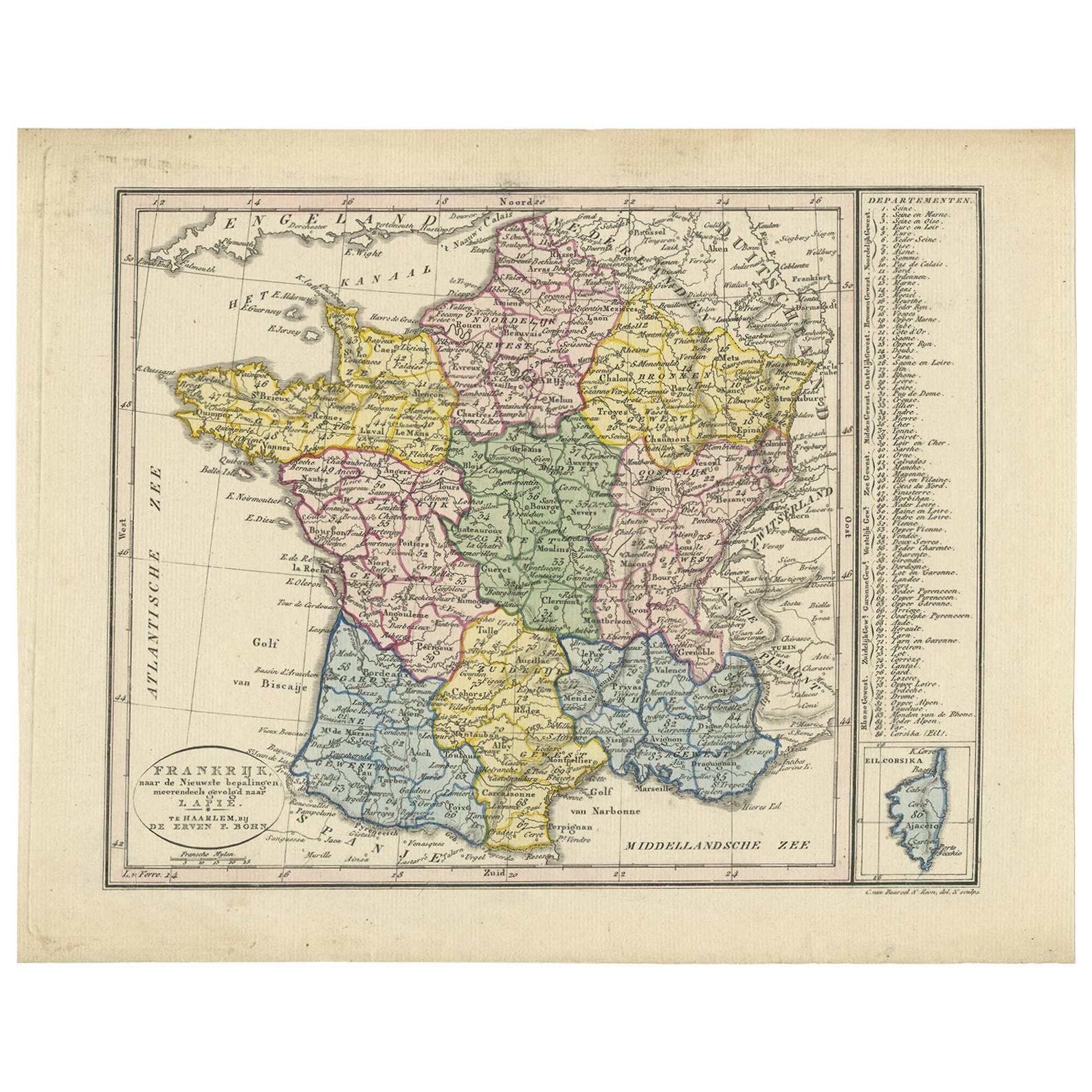
- Antique Map of France by Van Baarsel (c.1820)Located in Langweer, NL'Frankrijk naar de nieuwste bepalingen meerendeels gevolgd naar Lapie'. Beautiful map of France with an inset map of the island of Corsica. Includes a table with reference to the dep...Category
Antique Early 19th Century Maps
MaterialsPaper
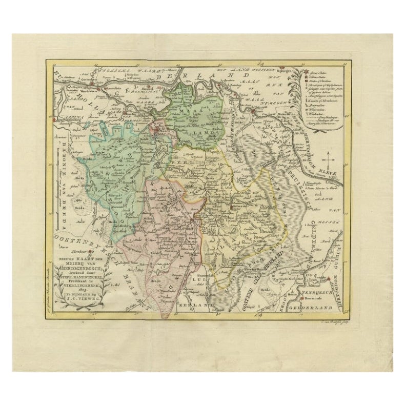
- Antique Map of Part of the Former Duchy of Brabant by Van Baarsel, 1803Located in Langweer, NLAntique map titled 'Nieuwe Kaart der Meierij van s Hertogenbosch (..).' Map of 'The Meierij van 's-Hertogenbosch', (Dutch for Bailiwick of Bois le Duc), it was one of the four parts ...Category
Antique 19th Century Maps
MaterialsPaper
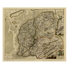
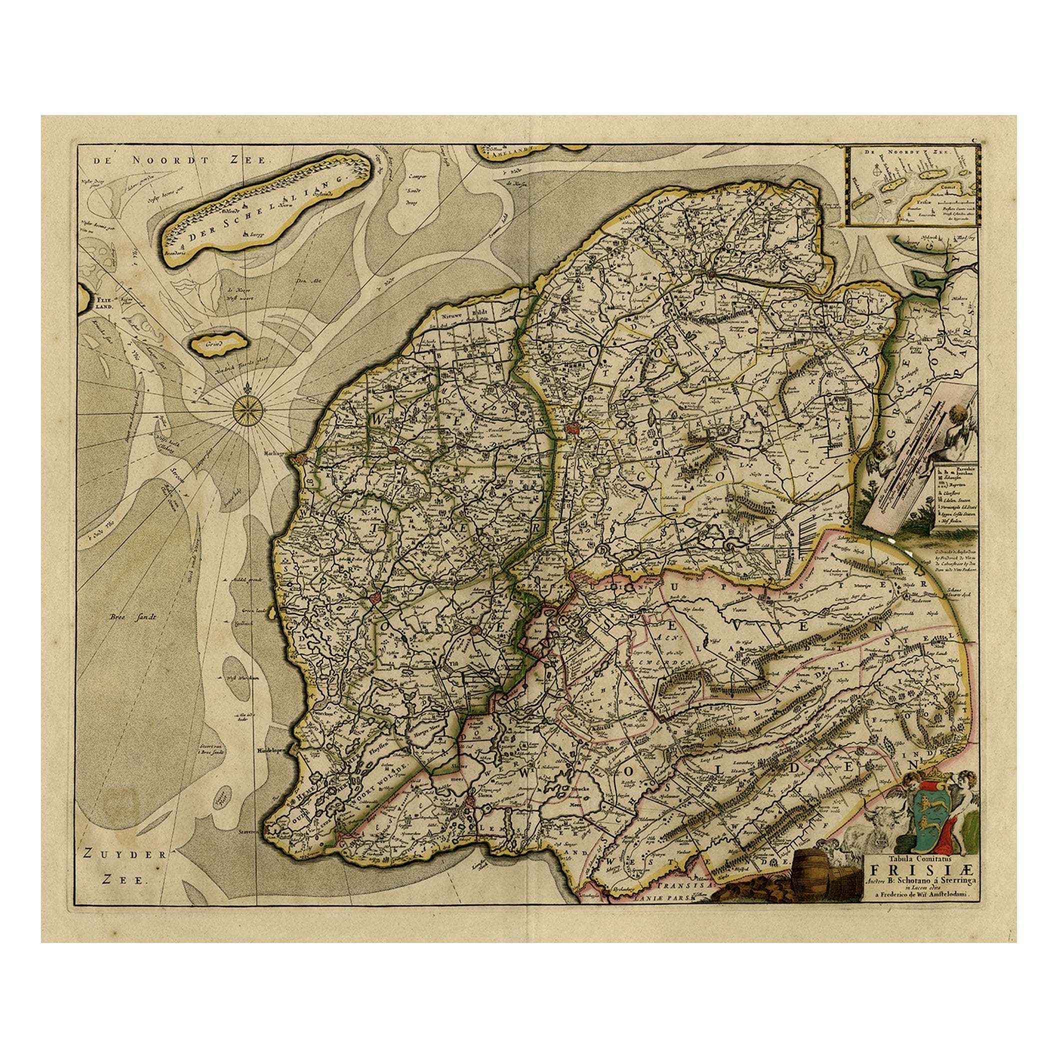
- Map of Friesland with Terschelling, Vlieland, Ameland En Schiermonnikoog, C.1670Located in Langweer, NLAntique print, titled: 'Tabula Comitatus Frisiae …' Map of Friesland with the island Terschelling, Vlieland, Ameland en Schiermonnikoog. With a cartouche and a compass rose. Publ...Category
Antique 1670s Maps
MaterialsPaper
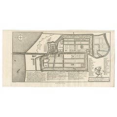
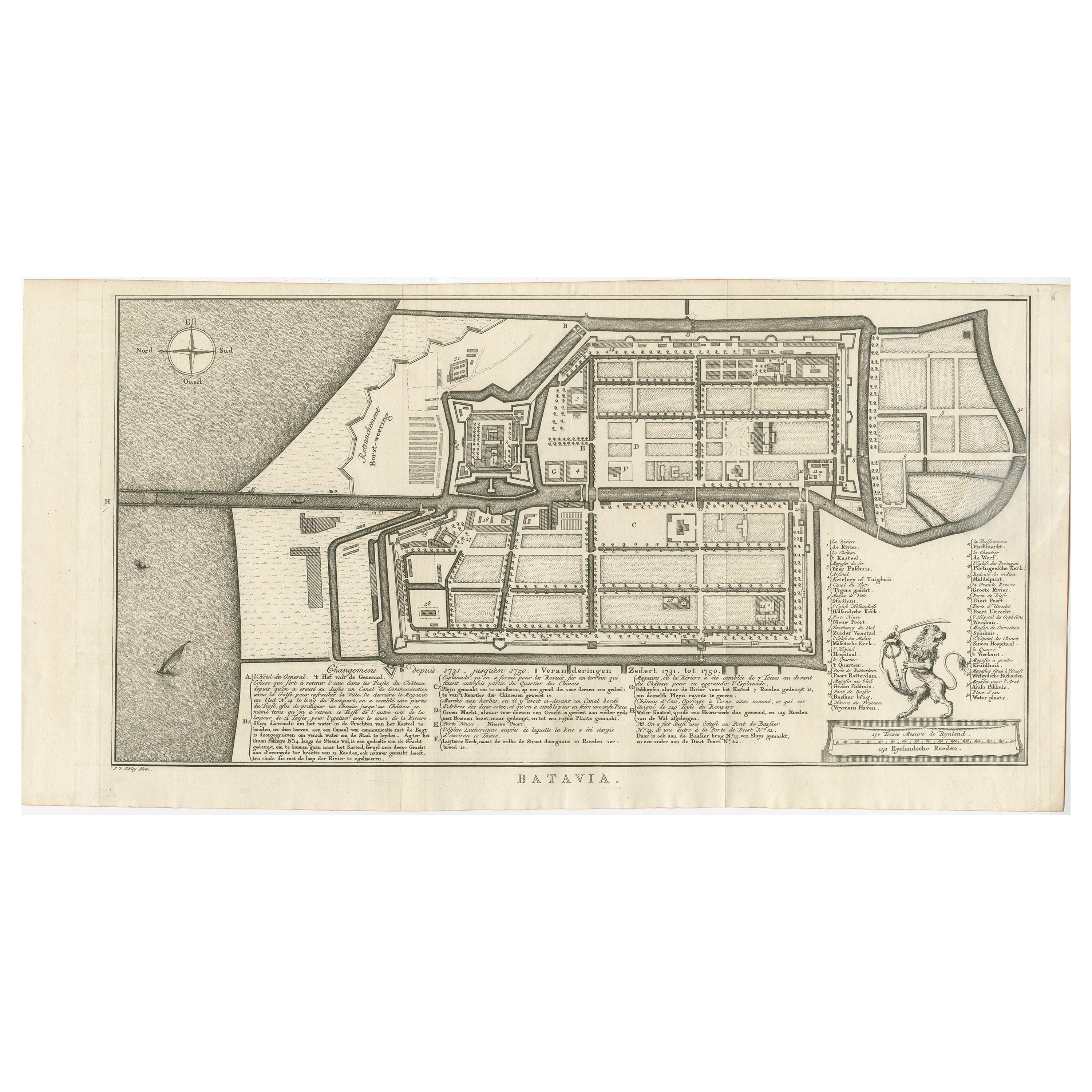
- Antique Map of Batavia by Van Schley 'c.1750'Located in Langweer, NLAntique map titled 'Batavia'. Original antique map of Batavia, Jakarta, Indonesia. This print originates from the Dutch edition of Prevost's 'Histoire Generale des Voyages' (Paris 17...Category
Antique Mid-18th Century Prints
MaterialsPaper
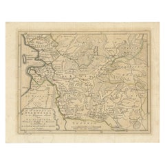
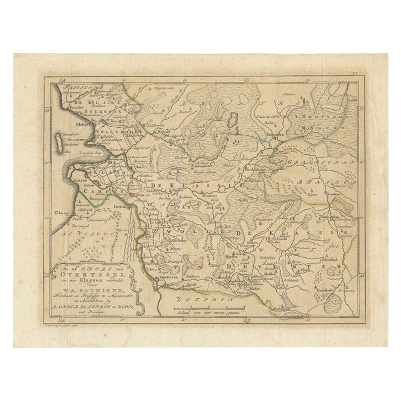
- Antique Map of Overijssel by Van Jagen, 1771Located in Langweer, NLAntique map titled 'L'Over-Issel'. This map depicts the Dutch province Overijssel. This map originates from 'Nouvel Atlas, très exact et fort commode pour toutes sortes de personnes,...Category
Antique 18th Century Maps
MaterialsPaper
- Antique Map of Friesland by Van Krevelt, 1787Located in Langweer, NLAntique map titled 'Nieuwe Kaart van Friesland behoorende tot het Vaderlandsch Woordenboek van Jacobus Kok'. Original antique map of the province of Friesland, the Netherlands. This ...Category
Antique 18th Century Maps
MaterialsPaper