Items Similar to Utrecht city plan

Want more images or videos?
Request additional images or videos from the seller
1 of 9
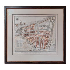
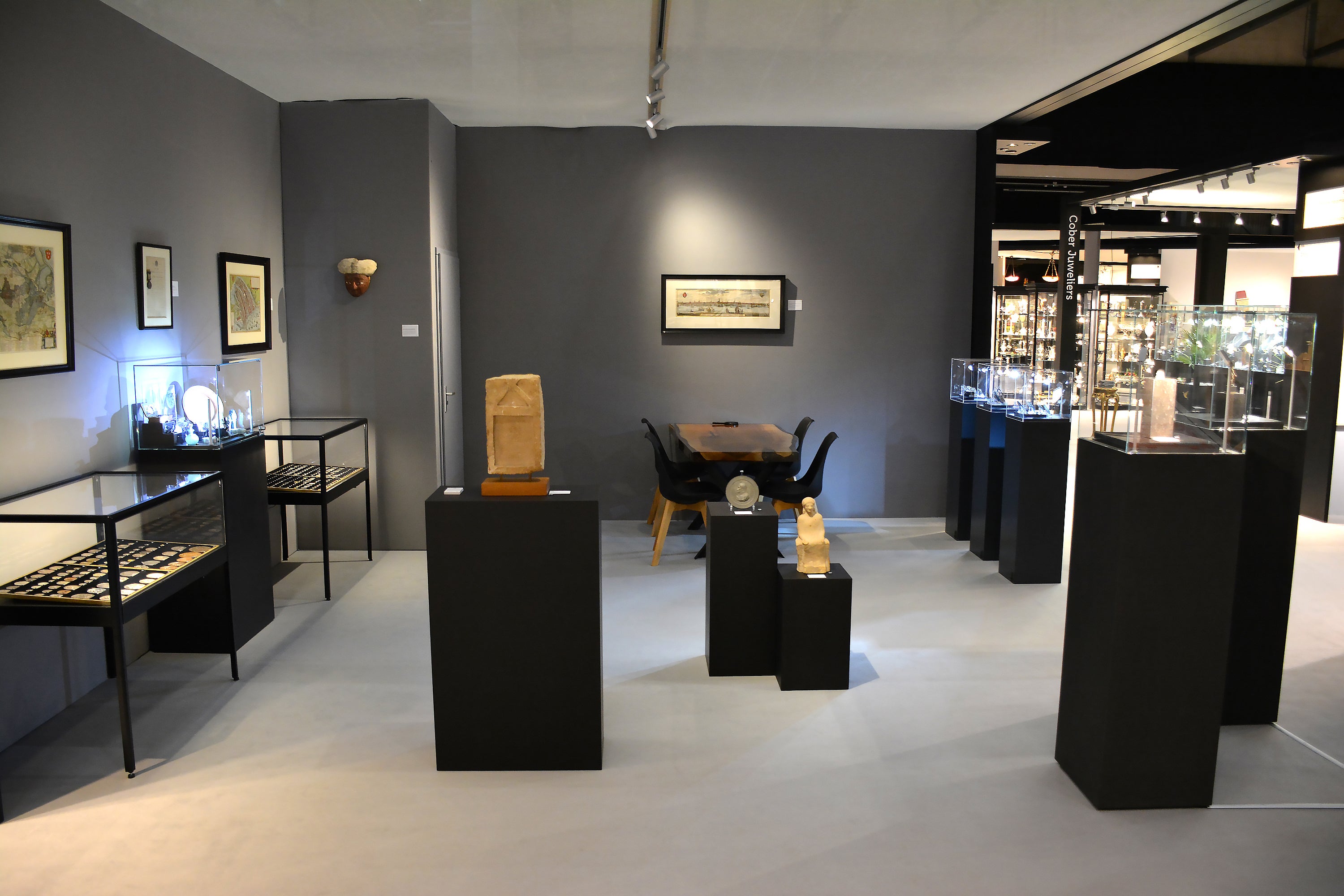
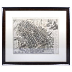
Utrecht city plan
About the Item
“Platte grond der Stad Utrecht vertonende alle Gragten, Straaten, Stegen, Gangen, Markten, en plaatsen der openbare Gebouwen”, engraving published by Johannes van Schoonhoven in Amsterdam in 1778. Edition: 400 copies. Later coloured in by hand. Size: 59,5 x 94 cm. Size including frame: 110 x 76,5 cm.
The map was drawn by three orphans from the Fundatie van Renswoude, an 18th century institution where gifted orphans could receive an education. In preparation of making this map the city was measured during three years. It is the first map of Utrecht that includes street names.
- Dimensions:Height: 2.37 in (6 cm)Width: 3.71 in (9.4 cm)Depth: 0.6 in (1.5 cm)
- Style:Other (In the Style Of)
- Materials and Techniques:
- Place of Origin:
- Period:1770-1779
- Date of Manufacture:1778
- Condition:Wear consistent with age and use.
- Seller Location:UTRECHT, NL
- Reference Number:1stDibs: LU6566238892962
About the Seller
No Reviews Yet
Vetted Seller
These experienced sellers undergo a comprehensive evaluation by our team of in-house experts.
Established in 2014
1stDibs seller since 2022
- ShippingRetrieving quote...Ships From: UTRECHT, Netherlands
- Return PolicyA return for this item may be initiated within 14 days of delivery.
More From This SellerView All
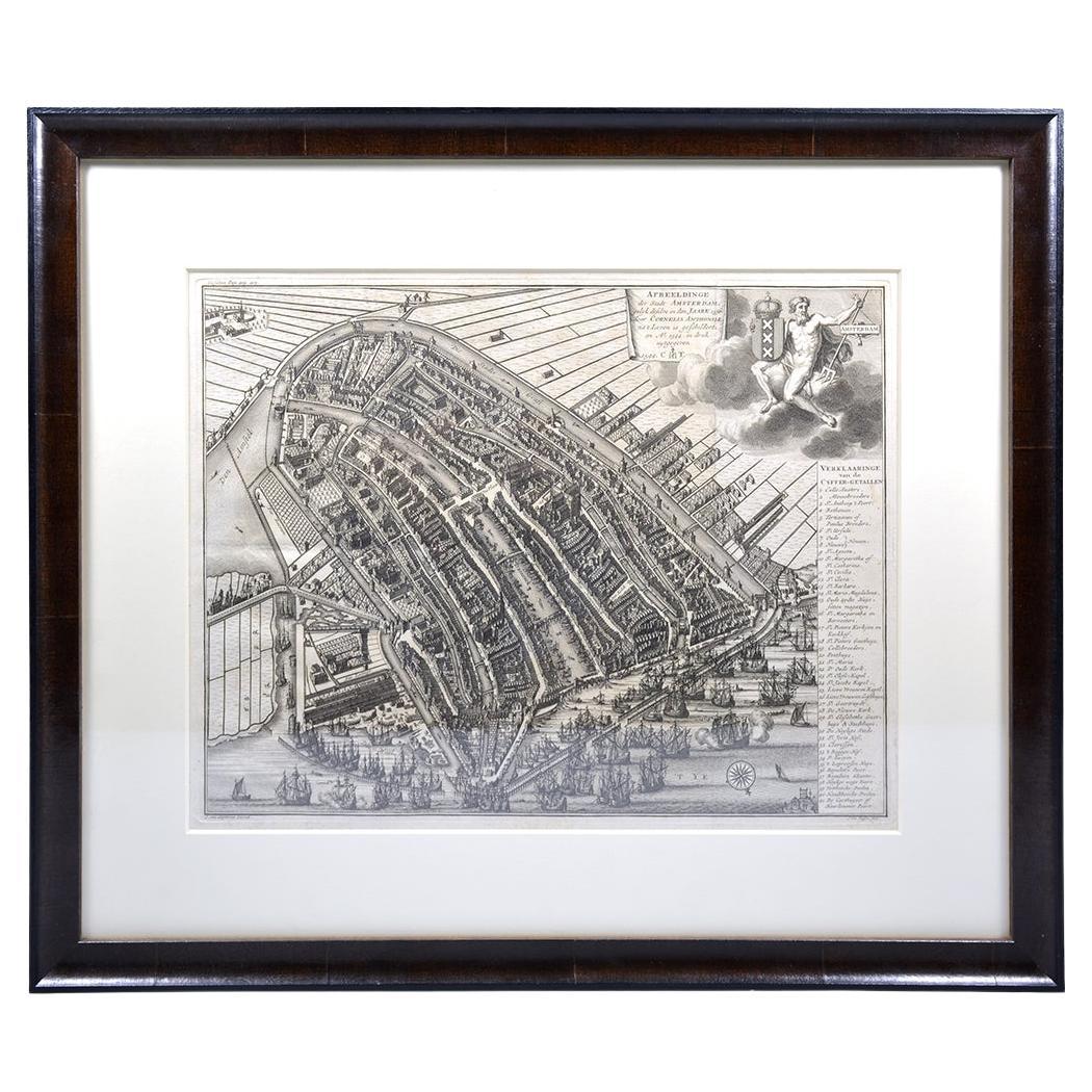
- Amsterdam city plan - Joost van SassenLocated in UTRECHT, UT“Afbeeldinge der Stad Amsterdam, gelyk deselve in den jaren 1536 door Cornelis Antonisz na ’t leven is geschildert, en Ao 1544 in druk uytgegeven.”, engraved by Joost van Sassen and ...Category
Antique 1720s Dutch Other Maps
MaterialsPaper
- Promotional Medal University of UtrechtLocated in UTRECHT, UTObverse: ME DOCTARVM PRAEMIA FRONTIVM DIS MISCENT SVPERIS, under a radiant sun, three angels on clouds hold a wreath above a doctoral candidate, turned to the left, with gown and boo...Category
Antique 1730s Dutch Neoclassical Antiquities
MaterialsSilver
- Curaçao map - C. van Baarsel en zoonLocated in UTRECHT, UT“Kaart van het eiland Curaçao.”, “Algemeene kaart der Caraïbische eilanden”, “Plan van het fort Amsterdam op Curaçao” from the atlas “Atlas der overzeesche bezittingen van Zijne Maje...Category
Antique 1810s Dutch Other Maps
MaterialsPaper
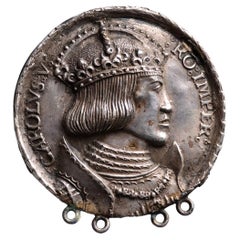
- N.d. Charles V dedication medal on his crowning and the planned ImperialLocated in UTRECHT, UTObverse: crowned and armoured bust right with order chain of the Golden Fleece Reverse: blank After H. Krafft, after a design by A. Dürer OLD SILVER CAST EXTREMELY RARE Four ...Category
Antique 16th Century German Classical Roman Antiquities
MaterialsSilver
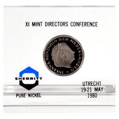
- Paper weight 1980 Mint Directors ConferenceLocated in UTRECHT, UTIssued as gift to attendees at the Mint Directors Conference on 19-21 May 1980 in Utrecht. With 2 1/2 guilder 1980 Proof VERY RARE Only ca. 20 pcs issued Dimensions: 79(b) x 75(h...Category
Vintage 1980s Dutch Other Paperweights
MaterialsNickel
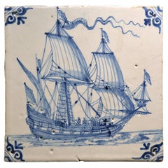
- A Blue and White tile with a Dutch Merchant ShipLocated in UTRECHT, UTThree-master sailing to the right, three men visible. Corners decorated with motif.Category
Antique 17th Century Dutch Other Ceramics
MaterialsCeramic
You May Also Like
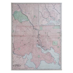
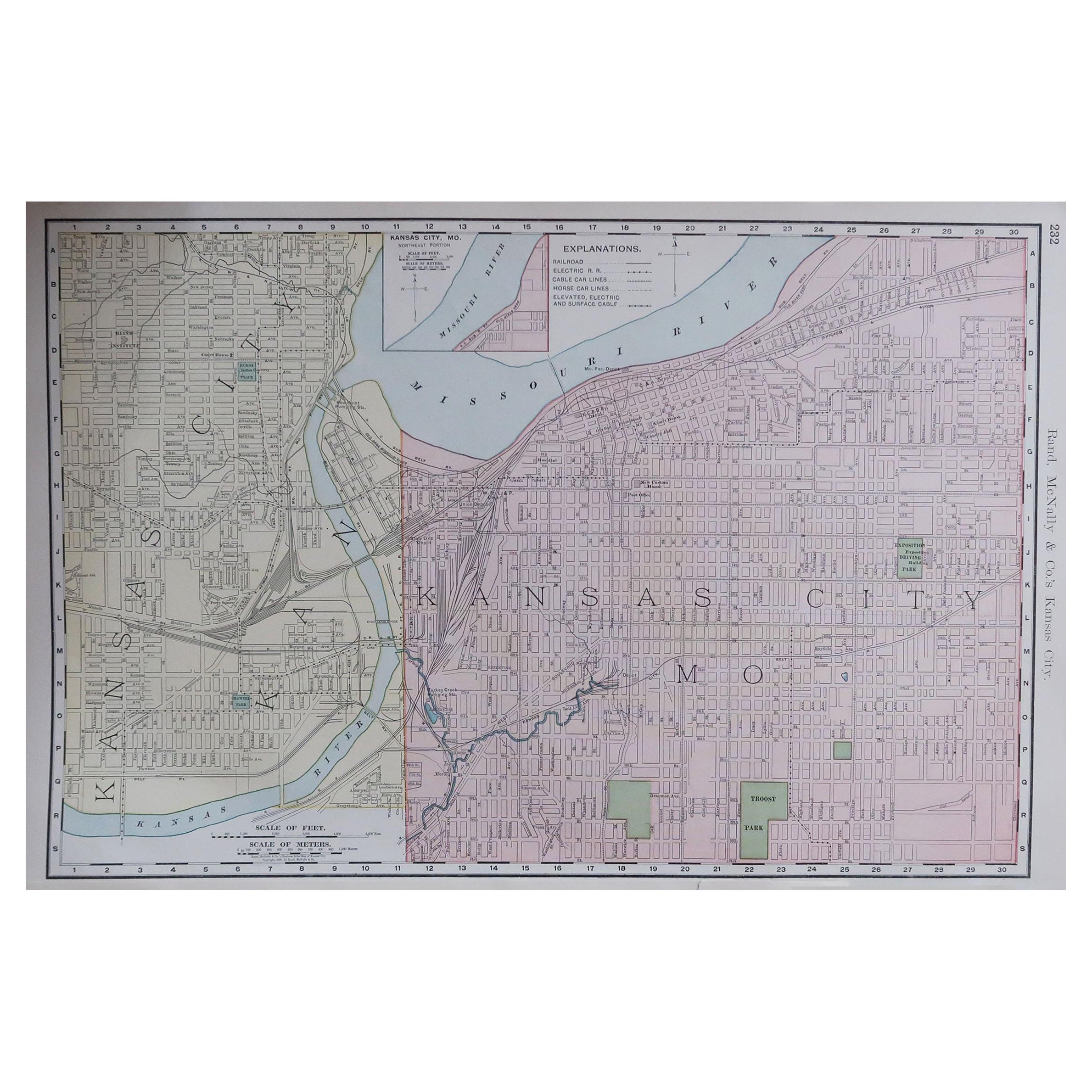
- Original Antique City Plan of Kansas City, USA. 1894By Rand McNally & Co.Located in St Annes, LancashireFabulous colorful map of Kansas City Original color By Rand, McNally & Co. Published, 1894 Unframed Slightly reduced bottom margin. Free shipping.Category
Antique 1890s American Maps
MaterialsPaper
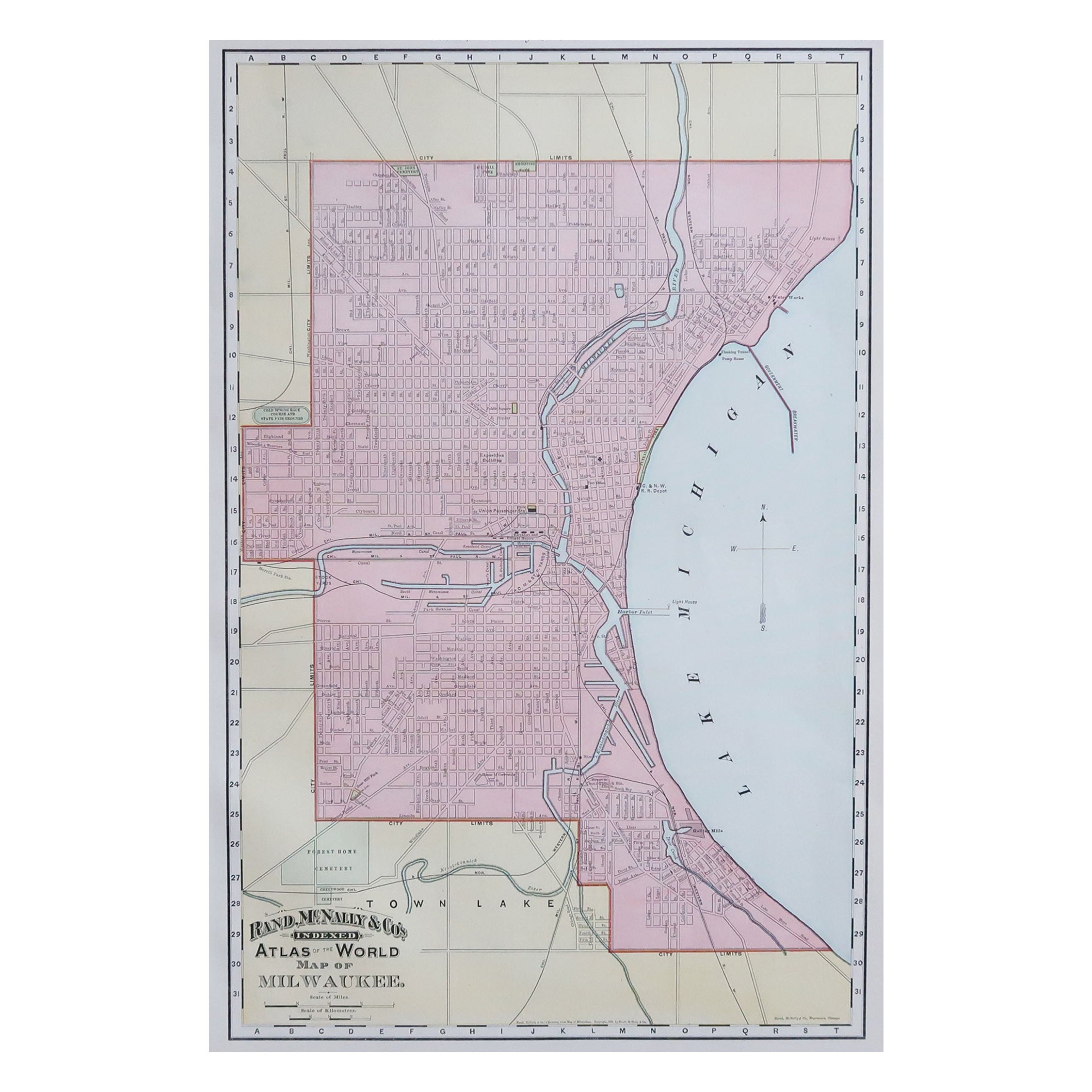
- Original Antique City Plan of Milwaukee, USA, 1894By Rand McNally & Co.Located in St Annes, LancashireFabulous colorful map of Milwaukee Original color By Rand, McNally & Co. Published, 1894 Unframed Free shipping.Category
Antique 1890s American Maps
MaterialsPaper
- Antique Plan of the City of Bayonne, FranceLocated in Langweer, NLAntique map titled 'Plan de Bayonne'. Original old plan of the city of Bayonne, France. This map originates from 'Le Petit Atlas Maritime (..)' by J.N. Bellin. Published 1764. Be...Category
Antique Mid-18th Century Maps
MaterialsPaper
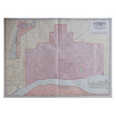
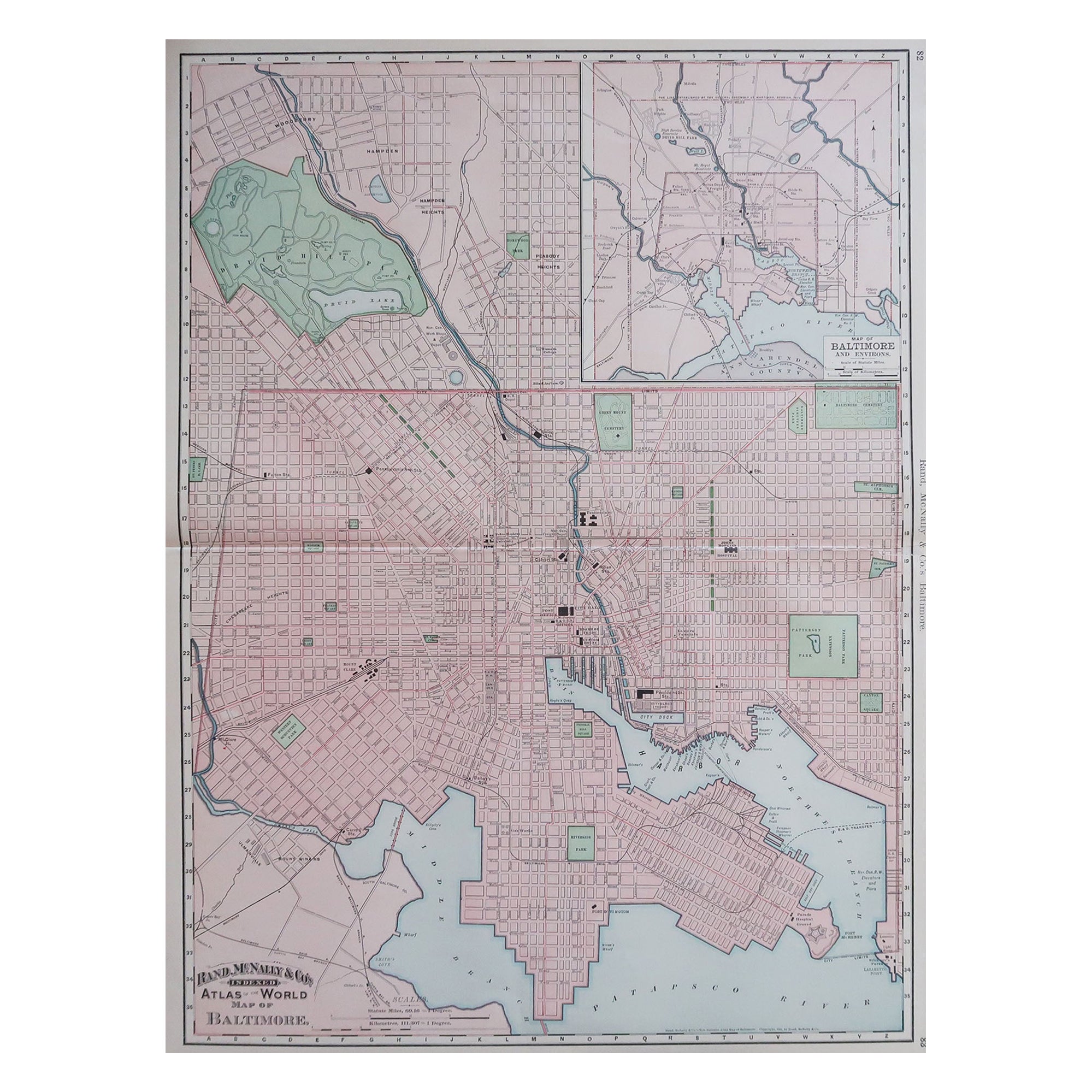
- Large Original Antique City Plan of Baltimore, USA, 1894By Rand McNally & Co.Located in St Annes, LancashireFabulous colorful map of Baltimore Original color By Rand, McNally & Co. Published, 1894 Unframed Free shipping.Category
Antique 1890s American Maps
MaterialsPaper
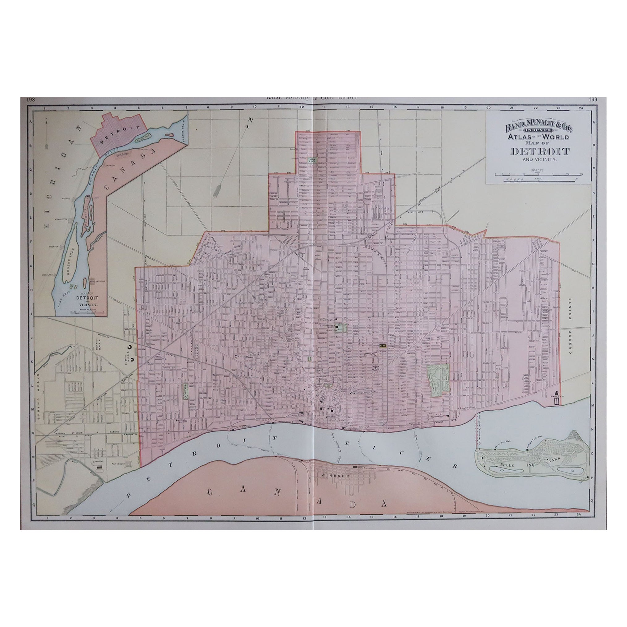
- Large Original Antique City Plan of Detroit, USA, 1894By Rand McNally & Co.Located in St Annes, LancashireFabulous colorful map of Detroit Original color By Rand, McNally & Co. Published, 1894 Unframed Free shipping.Category
Antique 1890s American Maps
MaterialsPaper
- Antique City Plan of Rotterdam in Frame, ca.1850Located in Langweer, NLAntique map titled 'Grondkaart der stad Rotterdam (..)'. Original antique city plan of Rotterdam, the Netherlands. Published circa 1850. Artists...Category
Antique 19th Century Prints
MaterialsPaper