Items Similar to Amsterdam city plan - Joost van Sassen


Want more images or videos?
Request additional images or videos from the seller
1 of 7
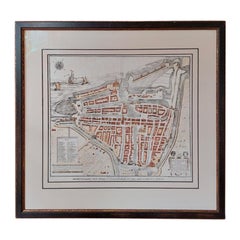
Amsterdam city plan - Joost van Sassen
About the Item
“Afbeeldinge der Stad Amsterdam, gelyk deselve in den jaren 1536 door Cornelis Antonisz na ’t leven is geschildert, en Ao 1544 in druk uytgegeven.”, engraved by Joost van Sassen and published by Johannes van Septeren in Amsterdam in 1729. Size: 35,5 x 27,5 cm. Size including frame: 52 x 44,5 cm.
Anthonisz was a grandson of Jacob Cornelisz. van Oostsanen, who was probably also his teacher, and a cousin of Dirck Jacobsz. In 1538 he painted the first complete and (relatively) accurate map of Amsterdam, commissioned by the city as a gift for Emperor Charles V. He is best known for his woodcuts.
His most famous woodcut is the Vogelvlucht map of Amsterdam from 1544, which was printed with 12 blocks. This woodcut was very popular and was reprinted well into the seventeenth century, so there are several versions, such as a version with a Gothic initial D at the top right, one with a Latin initial D decorated with plant motifs (see image center right) and one with Latin initial D depicting King David (see image bottom right).
He also made many royal portraits and allegorical prints. Only two paintings can be attributed to him with certainty, both of which have been given on permanent loan by the city of Amsterdam to the Amsterdam Museum. According to the legend on his Vogelvlucht map, he lived “behind the Nieuwe Kerk” in “de Schrijvende handt”. A facing stone with a writing hand on it was the identification mark of writers, booksellers and mapmakers.
- Dimensions:Height: 17.52 in (44.5 cm)Width: 20.48 in (52 cm)Depth: 0.79 in (2 cm)
- Style:Other (In the Style Of)
- Materials and Techniques:
- Place of Origin:
- Period:1720-1729
- Date of Manufacture:1729
- Condition:Wear consistent with age and use.
- Seller Location:UTRECHT, NL
- Reference Number:1stDibs: LU6566238893152
About the Seller
No Reviews Yet
Vetted Seller
These experienced sellers undergo a comprehensive evaluation by our team of in-house experts.
Established in 2014
1stDibs seller since 2022
- ShippingRetrieving quote...Ships From: UTRECHT, Netherlands
- Return PolicyA return for this item may be initiated within 14 days of delivery.
More From This SellerView All
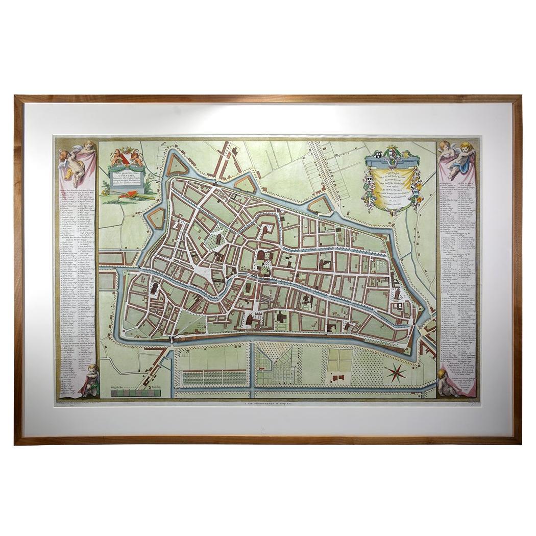
- Utrecht city planLocated in UTRECHT, UT“Platte grond der Stad Utrecht vertonende alle Gragten, Straaten, Stegen, Gangen, Markten, en plaatsen der openbare Gebouwen”, engraving published by Johannes van Schoonhoven in Amst...Category
Antique 1770s Dutch Other Maps
MaterialsPaper
- Curaçao map - C. van Baarsel en zoonLocated in UTRECHT, UT“Kaart van het eiland Curaçao.”, “Algemeene kaart der Caraïbische eilanden”, “Plan van het fort Amsterdam op Curaçao” from the atlas “Atlas der overzeesche bezittingen van Zijne Maje...Category
Antique 1810s Dutch Other Maps
MaterialsPaper
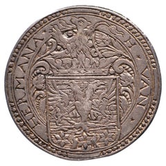
- N.d. Marriage Hessel van Hermane & Anna van LyauckemaLocated in UTRECHT, UTObverse: H ✶ VAN ✶ – HERMANA ✶, crowned coat of arms with lion crest Reverse: ✶ A ✶ VAN ✶ – ✶ LYAUCKEMA ✶, crowned diamond-shaped coat of arms Earliest known Dutch wedding medal and...Category
Antique 16th Century Other Antiquities
MaterialsSilver
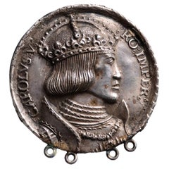
- N.d. Charles V dedication medal on his crowning and the planned ImperialLocated in UTRECHT, UTObverse: crowned and armoured bust right with order chain of the Golden Fleece Reverse: blank After H. Krafft, after a design by A. Dürer OLD SILVER CAST EXTREMELY RARE Four ...Category
Antique 16th Century German Classical Roman Antiquities
MaterialsSilver
- Trompe l’oeil of silver medal of Dr. Nicolaes Tulp, mayor of AmsterdamLocated in UTRECHT, UTFramed trompe l’oeil of silver medal celebrating Dr. Nicolaes Tulp’s fourth term as mayor of Amsterdam Pen and black ink with grey and yellow-brown wash, over black chalk, within black ink framing lines. Signed at the lower right of the fictive sheet of paper: Antonina houbraken. Inscribed, below medallion: Dr Nicolaas Tulp. Ao1672. / oudste Raad.Burgermeester van Amsterdam By Antonina Houbraken Paper watermarked with a fleur de lis 208 x 297 mm Bears stamp, verso, indicating the drawing was at one point a gift from Dr. B.W.Th. Nuyens (1866-1945), a medical doctor in Amsterdam, known, among many other things, for his efforts to fight tuberculosis and his promotion of post-natal care. Antonina Houbraken (1686 Dordrecht – 1736 Amsterdam) was a draughtswoman who is known for her many topographical drawings of Dutch sites. She also drew landscapes and is recorded as a skilled portraitist. Houbraken was the daughter of painter and writer Arnold Houbraken and sister of the printmaker Jacob Houbraken. It is assumed she learned to draw in her father’s workshop. In 1723 she married Jacobus Stellingwerff, a draughtsman who also made topographical drawings for the albums of Andries Schoemaker, a numismatist and medal specialist and collector of topographical prints and drawings. Schoemaker was also a contributor to the famous standard work on Dutch medals...Category
Antique 17th Century Dutch Drawings
MaterialsPaper
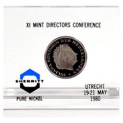
- Paper weight 1980 Mint Directors ConferenceLocated in UTRECHT, UTIssued as gift to attendees at the Mint Directors Conference on 19-21 May 1980 in Utrecht. With 2 1/2 guilder 1980 Proof VERY RARE Only ca. 20 pcs issued Dimensions: 79(b) x 75(h...Category
Vintage 1980s Dutch Other Paperweights
MaterialsNickel

You May Also Like
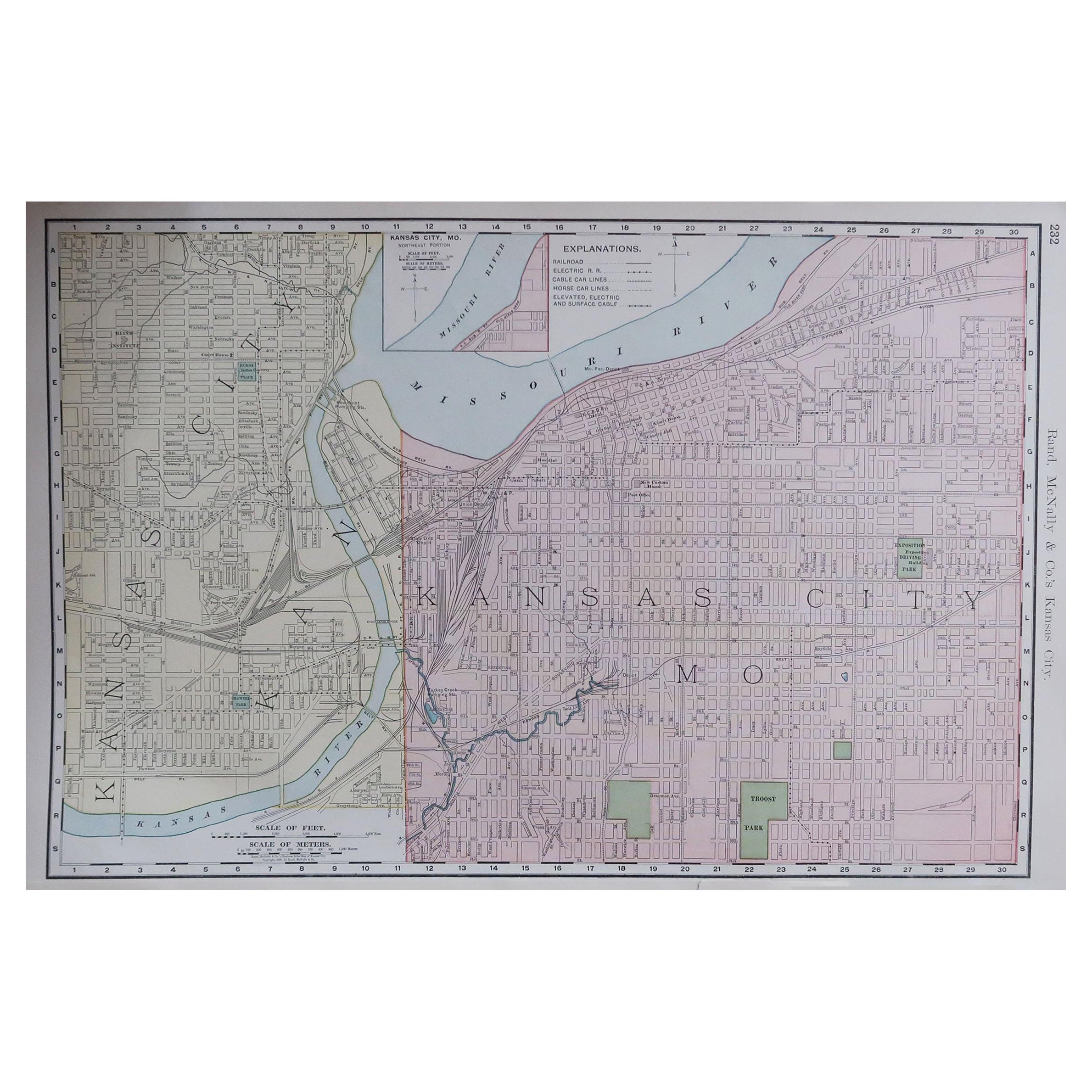
- Original Antique City Plan of Kansas City, USA. 1894By Rand McNally & Co.Located in St Annes, LancashireFabulous colorful map of Kansas City Original color By Rand, McNally & Co. Published, 1894 Unframed Slightly reduced bottom margin. Free shipping.Category
Antique 1890s American Maps
MaterialsPaper
- Van Gogh's Van Goghs: Masterpieces from the Van Gogh Museum, Amsterdam BookBy Vincent van GoghLocated in North Hollywood, CAVan Gogh's Van Goghs: Masterpieces from the Van Gogh Museum, Amsterdam by Kendall, Richard, Gogh, Vincent Van, Leighton, John, Van Gogh Museum, Amsterdam, National Gallery of Art (U. S.), Los Angeles County Museum of Art, Title: Van Gogh's Van Goghs: Masterpieces from the ... Publisher: Natl Gallery of Art Publication Date: 1998 Binding: Soft cover A catalog of an exhibition. This lavish but manageable book is the catalog for one of the most successful van Gogh exhibitions...Category
20th Century European Expressionist Books
MaterialsPaper
- Antique Plan of the City of Bayonne, FranceLocated in Langweer, NLAntique map titled 'Plan de Bayonne'. Original old plan of the city of Bayonne, France. This map originates from 'Le Petit Atlas Maritime (..)' by J.N. Bellin. Published 1764. Be...Category
Antique Mid-18th Century Maps
MaterialsPaper
- Original Antique City Plan of Milwaukee, USA, 1894By Rand McNally & Co.Located in St Annes, LancashireFabulous colorful map of Milwaukee Original color By Rand, McNally & Co. Published, 1894 Unframed Free shipping.Category
Antique 1890s American Maps
MaterialsPaper
- Antique City Plan of Rotterdam in Frame, ca.1850Located in Langweer, NLAntique map titled 'Grondkaart der stad Rotterdam (..)'. Original antique city plan of Rotterdam, the Netherlands. Published circa 1850. Artists...Category
Antique 19th Century Prints
MaterialsPaper
- Large Original Antique City Plan of Baltimore, USA, 1894By Rand McNally & Co.Located in St Annes, LancashireFabulous colorful map of Baltimore Original color By Rand, McNally & Co. Published, 1894 Unframed Free shipping.Category
Antique 1890s American Maps
MaterialsPaper