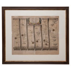
Historical Framed World Map
1
to
8
42
42
34
25
23
15
13
12
12
9
8
7
6
5
5
4
4
3
3
2
2
1
1
1
1
1
1
1
1
1
1
5
4
2
2
1
Sort By
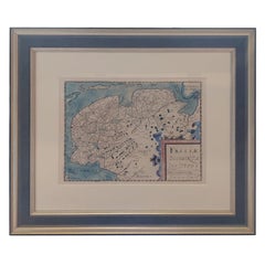
Original Antique Map of Friesland in Frame, The Netherlands, 1612
Located in Langweer, NL
Antique map titled 'Frisiae Occidentalis Typus'. Original antique map of the province of Friesland
Category
Antique 17th Century Maps
Materials
Paper
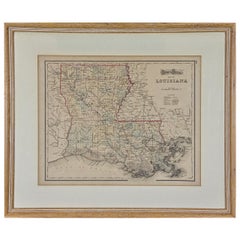
Louisiana: A Framed 19th Century Map by O. W. Gray
By Gray and Co
Located in Alamo, CA
United States with General Maps of the World, accompanied by Descriptions Geographical, Historical
Category
Antique Mid-19th Century American Other Maps
Materials
Paper
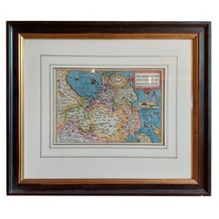
Antique Map of Friesland by Bussemacher in Frame, c.1592
Located in Langweer, NL
Original antique map titled 'Frisiae Antiquissimae (..)'. Original antique map of Friesland
Category
Antique 18th Century Maps
Materials
Paper
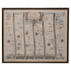
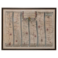
Road Map John Ogilby No 75 Kings Lyn Harwich, Britannia Framed Wallhanging
By John Ogilby
Located in BUNGAY, SUFFOLK
floated in the original black and gold frame, c1961. Some creasing commensurate with age. The back of the
Category
Antique 1670s European Baroque Maps
Materials
Paper
H 15.75 in W 19.69 in D 0.6 in
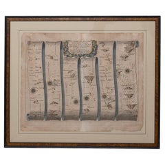
Map Road John Ogilby Britannia No 74 Ipswich to Norwich Cromer Framed
By John Ogilby
Located in BUNGAY, SUFFOLK
comprehending the Historical and Geographical Description of England, with the County-Maps truly and actually
Category
Antique 1670s English Baroque Maps
Materials
Paper
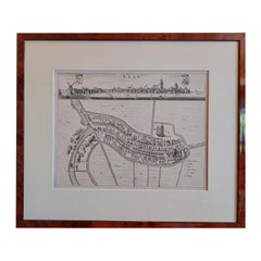
Antique City View and Map of IJlst, City in Friesland, Holland, Framed, 1664
Located in Langweer, NL
world. Our collection includes a wide range of authentic antique maps from the 16th to the 20th
Category
Antique 17th Century Maps
Materials
Paper
H 21.78 in W 18.59 in D 0 in
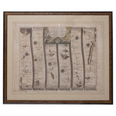
Road Map John Ogilby London St David's Britannia No 15 Abingdon Monmouth Framed
By John Ogilby
Located in BUNGAY, SUFFOLK
John Ogilby (British 1600-1676) Cosmographer and Geographick Printer to Charles II. A road map from
Category
Antique 1670s English Baroque Maps
Materials
Paper
H 20.48 in W 24.41 in D 0.6 in
Road Map Britannia No 32 the Road from London to Barnstable John Ogilby Framed
By John Ogilby
Located in BUNGAY, SUFFOLK
collector with no 15 London to St Davids. Framed as a pair.
Measures: Black Linear Border around Map
Category
Antique Late 17th Century English Charles II Maps
Materials
Paper
H 20.48 in W 24.41 in D 0.6 in
Road Map Britannia No 15 London to St Davids John Ogilby Brown Gilt Frame
By John Ogilby
Located in BUNGAY, SUFFOLK
Lechlade, to Fairford, to Barnsley to Gloucester showing Monmouth as the destination. A road map from
Category
Antique Late 17th Century British Charles II Maps
Materials
Paper
H 22.05 in W 26.19 in D 0.6 in
Road Map Britannia No 25 London to the Lands End, John Ogilby Brown Gilded Frame
By John Ogilby
Located in BUNGAY, SUFFOLK
Senan in Cornwall. By John Ogilby His Majesties Cosmographer. A road map from Britannia, 1675/6. No 25
Category
Antique Late 17th Century British Charles II Maps
Materials
Paper
H 22.05 in W 26.19 in D 0.6 in
Road Map Britannia 1675/6 No 5 Road London to Barwick, London Stilton Grey Frame
By John Ogilby
Located in BUNGAY, SUFFOLK
John Ogilby (British 1600-1676) cosmographer and geographick printer to Charles II.
A road map from
Category
Antique Late 17th Century British Charles II Maps
Materials
Paper
H 22.84 in W 25.99 in D 0.4 in
Antique Map of Turkey in Europe by Russell, circa 1795
Located in Langweer, NL
of the World' by J. Russell. Published circa 1795.
Frame included. We carefully pack our framed
Category
Antique Late 18th Century Maps
Materials
Paper
Road Map, John Ogilby, No 54, London, Yarmouth, Britannia
By John Ogilby
Located in BUNGAY, SUFFOLK
Yarmouth.
Hand colored and floated in the original black and gold frame, circa 1961. Some creasing
Category
Antique 1670s English Baroque Maps
Materials
Paper
Antique Map of Westfriesland in Ancient Times by Alting, 1697
Located in Langweer, NL
original antique maps to collectors, historians, educators and interior decorators all over the world. Our
Category
Antique 17th Century Maps
Materials
Paper
Antique Map of the City of Haarlem by Tirion, 1742
By Isaak Tirion
Located in Langweer, NL
Antique map titled 'Grondtekening van Haarlem (..)'. Original antique map of the city of Haarlem
Category
Antique 18th Century Maps
Materials
Paper
Antique Map of the Netherlands and Belgium by Hérisson, 1829
Located in Langweer, NL
map, was a known figure in the cartographic and publishing world of the early 19th century. His work
Category
Antique Mid-19th Century Maps
Materials
Paper
Antique Map of the City of Grave by Blaeu, 1649
Located in Langweer, NL
original antique maps to collectors, historians, educators and interior decorators all over the world. Our
Category
Antique 17th Century Maps
Materials
Paper
Antique Map of the City of Muiden by Merian, 1659
Located in Langweer, NL
interior decorators all over the world. Our collection includes a wide range of authentic antique maps from
Category
Antique 17th Century Maps
Materials
Paper
Antique Map of the Maluku Islands by Blaeu, c.1640
Located in Langweer, NL
the world. Our collection includes a wide range of authentic antique maps from the 16th to the 20th
Category
Antique 17th Century Maps
Materials
Paper
Antique Map of the Middle East by Von Sandrart, 1708
Located in Langweer, NL
Antique map titled 'Die Gegend des Irdlisches Paradieses und des Landes Kanaan.' Map of the Middle
Category
Antique 18th Century Maps
Materials
Paper
Antique Map of the Provinces of Gelderland and Overijssel by Kaerius, 1617
Located in Langweer, NL
), containing altogether 63 maps of the entire world.
Condition: Good, general age-related toning; some light
Category
Antique 17th Century Maps
Materials
Paper
H 15.75 in W 20.67 in D 0 in
Antique Map of Africa, Cartouche with Elephant Tusks and Horned Serpent, 1737
Located in Langweer, NL
the map is the large title cartouche that is framed by elephant tusks and a horned serpent. In the
Category
Antique 18th Century Maps
Materials
Paper
H 21.26 in W 24.81 in D 0 in
1817 John Thomson's Handcolored Antique Map of St. Kitts, Nevis, and St. Lucia
Located in Langweer, NL
, including its mountains and natural harbors. Each island's map is framed within its own neat line border
Category
Antique Early 19th Century Maps
Materials
Paper
No Reserve
H 21.07 in W 29.34 in D 0 in
1948 "A Hysterical Map of Yellowstone National Park" by Jolly Lindgren, 2nd Ed.
Located in Colorado Springs, CO
the word “hysterical” in the title, over “historical,” as historical maps were also common souvenirs
Category
Vintage 1940s American Maps
Materials
Paper
H 20 in W 20 in D 0.75 in
Map Road Strip Britannia Sheet 2 John Ogilby London Aberistwith Islip Bramyard
By John Ogilby
Located in BUNGAY, SUFFOLK
framer, print seller, Oxford. Annotated.
The second of 100 sheets of strip maps made for John Ogilby
Category
Antique 17th Century English Baroque Maps
Materials
Paper
H 14.38 in W 19.3 in D 0.79 in
17th Century Topographical Map of Cote D'azur, Avignon, Frejus by Iohan Peeters
Located in New York, NY
is one of the most admired historical centers in Southern France. It includes three UNESCO World
Category
Antique 17th Century Dutch Maps
Materials
Paper
H 12.5 in W 15 in D 0 in
Road Map No43 London to Kings Lynn, Royston to Downham, John Ogilby, Britannia
By John Ogilby
Located in BUNGAY, SUFFOLK
John Ogilby (British 1600-1676) Cosmographer and Geographick Printer to Charles II.
A road map
Category
Antique Late 17th Century British Charles II Maps
Materials
Paper
H 20.48 in W 24.41 in D 0.4 in
Mediterranean Encounters: From the Punic Wars to the Hannibalic War, 1880
Located in Langweer, NL
frame.
3. **Historical Annotations**: There are notes and annotations that possibly give context about
Category
Antique 1880s Maps
Materials
Paper
Free Shipping
H 15.56 in W 18.51 in D 0 in
Detailed Antique Cartography of Asian Russia, 1882
Located in Langweer, NL
This exquisite map, hailing from the year 1882, is a remarkable historical cartographic artifact
Category
Antique 1880s Maps
Materials
Paper
Levasseur's 1852 Cartographic Portrait of Gironde: Celebrating the Bordeaux Wine
Located in Langweer, NL
This original hand-colored map is from the "Atlas National Illustré," a work by Victor Levasseur, a
Category
Antique 1850s Maps
Materials
Paper
H 20.67 in W 14.06 in D 0 in
Dartmouth, England: A Hand-Colored 17th Century Sea Chart by Captain Collins
By Captain Greenvile Collins
Located in Alamo, CA
(1643-1694) are beautiful, colorful and striking, as well as historically very important to the British
Category
Antique Late 17th Century English Maps
Materials
Paper
H 23 in W 27.75 in D 0.5 in
Plymouth, England: A Hand-Colored 17th Century Sea Chart by Captain Collins
By Captain Greenvile Collins
Located in Alamo, CA
-1694) are beautiful, colorful and striking, as well as historically very important to the British navy
Category
Antique Late 17th Century English Maps
Materials
Paper
H 23 in W 27.75 in D 0.5 in
Flanders, Holland & Norfolk: Hand-Colored 17th Century Sea Chart by Collins
By Captain Greenvile Collins
Located in Alamo, CA
Collins (1643-1694) are beautiful, colorful and striking, as well as historically very important to the
Category
Antique Late 17th Century English Maps
Materials
Paper
H 23 in W 27.75 in D 0.5 in
Edinburgh, Scotland Coast: A 17th Century Hand-Colored Sea Chart by Collins
By Captain Greenvile Collins
Located in Alamo, CA
Captain Greenvile Collins (1643-1694) are beautiful, colorful and striking, as well as historically very
Category
Antique Late 17th Century English Maps
Materials
Paper
H 23 in W 27.75 in D 0.5 in
Louisiana: A Framed 19th Century Map by O.W. Gray
Located in Alamo, CA
United States with General Maps of the World, accompanied by Descriptions Geographical, Historical
Category
1870s Landscape Prints
Materials
Engraving
H 20 in W 22.63 in D 0.88 in
"The Story Map Of The West Indies" 1936
Located in Bristol, CT
Framed colour map of the West Indies published 1936 w/ border design motif adapted from native West
Category
1930s More Prints
Materials
Paper
'Map of Milwaukee' color lithograph published by George F. Cram of Chicago
Located in Milwaukee, WI
13.5 inches, map
30.63 x 24.13 inches, frame
Inscribed lower left "Map of Milwaukee; Published by
Category
1890s Other Art Style More Prints
Materials
Lithograph
Sur Mesure II
By Beatriz Guzman
Located in New York, NY
everyday scene of my life. What has survived in memory is ranked, categorized. Maps, blueprints, any
Category
2010s Contemporary Paintings
Materials
Oil
Climbing II
By Beatrice Guzman Catena
Located in New York, NY
ranked, categorized. Maps, blueprints, any cartography or visual reference from the real world are the
Category
2010s Contemporary Figurative Paintings
Materials
Acrylic
'Portrait of a Young Woman' original Hollar engraving after Hans Holbein
By Wenceslaus Hollar
Located in Milwaukee, WI
, including scenes from the bible, historical pictures, maps, portraits of his chief contemporaries, views of
Category
17th Century Old Masters Portrait Prints
Materials
Engraving
Boardwalk Beauty, Danny Galieote, Oil on Canvas, Pop Art, Americana-Figurative
By Danny Galieote
Located in 326 N Coast Hwy. | Laguna Beach, CA
"Boardwalk Beauty"
34" x 27" (41" x 34" Framed)
Oil on Canvas
Danny Galieote juxtaposes the
Category
2010s American Realist Figurative Paintings
Materials
Oil, Canvas
October Fog (West Chester, Chester County PA Landscape)
Located in Wilton Manors, FL
framed. Signed and dated lower right. Original label affixed verso. Excellent condition. original frame
Category
Mid-20th Century American Realist Landscape Paintings
Materials
Canvas, Oil
H 23.5 in W 43.5 in D 1.25 in
The story of the Belle époque in one portrait by John da Costa
By John da Costa
Located in Stockholm, SE
both private and public collections across the world, very little research has been carried out to map
Category
Early 1900s Figurative Paintings
Materials
Canvas, Oil
Antique Print of Abcoude Castle in the Netherlands, 1711
Located in Langweer, NL
interior decorators all over the world. Our collection includes a wide range of authentic antique maps from
Category
Antique 18th Century Prints
Materials
Paper
Antique Portrait of Henry VIII, King of England, France & Ireland, 1750
By Jacobus Houbraken
Located in Langweer, NL
inscription on the frame. With a scene of a child dressing in the manner of the Pope below.
Artists and
Category
Antique 18th Century Prints
Materials
Paper
2 Saucemere Drive NG24 4HR Newark Nottinghamshire
By Federico Cortese
Located in Yardley, PA
other hand, the starting point is a "historical" map, representing real events in the past, such as maps
Category
2010s Abstract Abstract Paintings
Materials
Oil
The third voyage of Christopher Columbus, 1498, Painting, Oil on Paper
By Federico Cortese
Located in Yardley, PA
, on the other hand, the starting point is a "historical" map, representing real events in the past
Category
2010s Abstract Abstract Paintings
Materials
Oil
the second voyage of Christopher Columbus, 1493, Painting, Oil on Paper
By Federico Cortese
Located in Yardley, PA
, on the other hand, the starting point is a "historical" map, representing real events in the past
Category
2010s Abstract Abstract Paintings
Materials
Oil
19TH CENTURY TINTERN ABBEY FRANCIS NICHOLSON 1753-1844 WATERCOLOUR PAiNTING
Located in GB
nationality of the Transatlantic Slaves as Judah, making this map historically priceless and of extreme
Category
Antique 19th Century English Country Decorative Art
Materials
Paper
H 16.15 in W 20.48 in D 0.6 in
Pair of Contemporary Ivory Upholstered Lounge Chairs, Circe by Ini Archibong
By Ini Archibong
Located in Warsaw, PL
Frame upholstered in Dedar Karakorum fabric. Available also in a choice of leathers or fabrics, or in
Category
21st Century and Contemporary Slovenian Modern Armchairs
Materials
Steel
H 32.29 in W 24.81 in D 22.45 in
Outgoing Fog (South Bristol, Maine)
Located in Fairlawn, OH
later became the Cleveland Institute of Art.
During World War II, he made topographical maps in the
Category
1970s Realist Landscape Drawings and Watercolors
Materials
Watercolor
MIxed Media Conceptual Art Sculpture Drawing Human Rights Welded Iron
By Francoise Schein
Located in Surfside, FL
This is a large sculpture and also includes an artist custom framed silkscreen with extensive
Category
Late 20th Century Conceptual Abstract Sculptures
Materials
Iron
When the Land was His
Located in San Francisco, CA
framed.
About the artist:
Artist Arnold Friberg graduated from the Chicago Academy of Fine Arts in 1935
Category
Late 20th Century American Realist Figurative Prints
Materials
Lithograph
The 1564 Medici Danti Map of California
By Fra Egnazio Danti
Located in New York, NY
were to be placed large hand-painted maps specially commissioned to document and illustrate the current
Category
17th Century Old Masters Drawings and Watercolor Paintings
Materials
Canvas, Pen, Gouache, Watercolor, Ink, Paper
Elements Usuels, mixed media painting by Jean Daniel Rohrer
Located in Miami, FL
-Daniel Rohrer’s paintings are like memory maps. They are never caught up in a specific moment in time
Category
2010s Contemporary Abstract Paintings
Materials
Mixed Media, Oil, Spray Paint
H 30 in W 30 in D 3 in
Amerika, Abstract painting by Jean Daniel Rohrer
Located in Miami, FL
“Jean-Daniel Rohrer’s paintings are like memory maps. They are never caught up in a specific moment
Category
2010s Contemporary Abstract Paintings
Materials
Canvas, Mixed Media, Oil, Spray Paint
McKay's Ship Yard- The Launching of Clippership "Flying Cloud" in 1851
By Paul Garnett
Located in Stonington, CT
complete fabrication.
Accurate maps of the land on both sides of the river from the period of the 1850’s
Category
21st Century and Contemporary American Realist Landscape Paintings
Materials
Oil
H 24 in W 48 in D 2 in
Map of United States, World War II Vintage Pictorial Map, circa 1943
Located in Colorado Springs, CO
during World War II and is so titled “United States at War.” Around the map’s edges are several vignette
Category
Vintage 1940s Canadian Maps
Materials
Paper
1858 "Mitchell's New National Map Exhibiting the United States" Hanging Wall Map
By Samuel Augustus Mitchell 1
Located in Colorado Springs, CO
Ocean. It also included inset maps of the “World on Mercator's Projection” and the “World on Globular
Category
Antique 1850s American Maps
Materials
Paper
H 84 in W 80.5 in D 6 in
Paris in 1848 Bird's-Eye View, Published by Illustrated London News, Antique Map
Located in Colorado Springs, CO
cities of the World. The panorama is designed to provide a unique perspective of the city, from a
Category
Antique 1840s British Historical Memorabilia
Materials
Paper
H 35.5 in W 56.5 in D 1.5 in
- 1
Get Updated with New Arrivals
Save "Historical Framed World Map", and we’ll notify you when there are new listings in this category.
Historical Framed World Map For Sale on 1stDibs
At 1stDibs, there are many versions of the ideal historical framed world map for your home. Frequently made of paper, fabric and wood, every historical framed world map was constructed with great care. Your living room may not be complete without a historical framed world map — find older editions for sale from the 18th Century and newer versions made as recently as the 21st Century. Each historical framed world map bearing Baroque, industrial or modern hallmarks is very popular. Captain Greenvile Collins, Abraham Ortelius and Gray and Co each produced at least one beautiful historical framed world map that is worth considering.
How Much is a Historical Framed World Map?
Prices for a historical framed world map start at $167 and top out at $135,000 with the average selling for $2,139.
More Ways To Browse
1980s Bathing Suits
Set Wall Pocket
Eras Tour Christmas
Map Of Edinburgh
1 Inch Scale Miniatures
Vintage Map Of The Bahamas
Bassett China
Video Clock
Les Ameriques Hermes Scarf
Hermes Ocean Scarf
Dutch Merchant
Hermes Scarf Ameriques
Pull Down World Map
Lea Michele
Rolex Air King Ii
Hermes Les Ameriques
Hermes Native American Scarf
Hermes Scarf Designer Texas
