Items Similar to 17th Century Topographical Map of Cote D'azur, Avignon, Frejus by Iohan Peeters


Want more images or videos?
Request additional images or videos from the seller
1 of 8
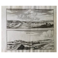
17th Century Topographical Map of Cote D'azur, Avignon, Frejus by Iohan Peeters
About the Item
Fine topographical 17th century map by Iohan Peeters of the towns of Avignon and Frejus in the Cote d'Azur-Provence-Alpes Region of Southeastern France.
Beautifully suited decorative element for a French Provincial theme. Lovely memento of a memorable trip to the South of France.
The beautiful city of Avignon is one of the most admired historical centers in Southern France. It includes three UNESCO World Heritage cites- the Cathedral, Palais de Papes and Pont d'Avignon. The medieval monuments of the city provide a striking backdrop to the annual Festival d'Avignon, one of the world's largest Performing Arts festivals. The Avignon engraving illustrates Les Grands Augustins, La Maison de Ville, L'Eglise de St. Pierre, Le College du Roure, Coll. de Sinanque, les sette Rotonde, Les Recollez, Les Capucins and Notre Dame des sept Douleurs.
The bucolic coastal town of Frejus was a strategically important Roman city. Julius Caesar founded the city as Forum Julii and Augustus made the city the capital of Narbonensis in 22 BC. Frejus became one of the most important ports in the Mediterranean, being the only naval base for the Roman fleet in Gaul. Roman period buildings include an aquaduct, amphitheater and theater. Also of note is the Notre-Dame de Jerusalem Chapel which was designed in the 1960's by Jean Cocteau. The Frejus engraving shows the town proper, surrounded by the picturesque Roman ruins
Fine antique engraving of beautiful detail and workmanship.
In very good condition commensurate with age, small area of separation along the center joint and minor edge tearing at the top, covered when framed.
Size: 15 inches by 12.5 inches
Similar pieces depicting different town and cities of the region are available.
Iohan Peeters Delin. Topographia Galliae ... Het tweede deel. Amsterdam : By de Weduw van Ioost Broersz en Casper Meriaen, 1661
- Dimensions:Height: 12.5 in (31.75 cm)Width: 15 in (38.1 cm)Depth: 0 in (0 mm)
- Materials and Techniques:
- Place of Origin:
- Period:
- Date of Manufacture:17th Century
- Condition:Wear consistent with age and use.
- Seller Location:New York, NY
- Reference Number:1stDibs: LU5828228768022
About the Seller
5.0
Gold Seller
These expertly vetted sellers are highly rated and consistently exceed customer expectations.
1stDibs seller since 2021
32 sales on 1stDibs
Typical response time: 2 hours
- ShippingRetrieving quote...Ships From: New York, NY
- Return PolicyA return for this item may be initiated within 3 days of delivery.
More From This SellerView All
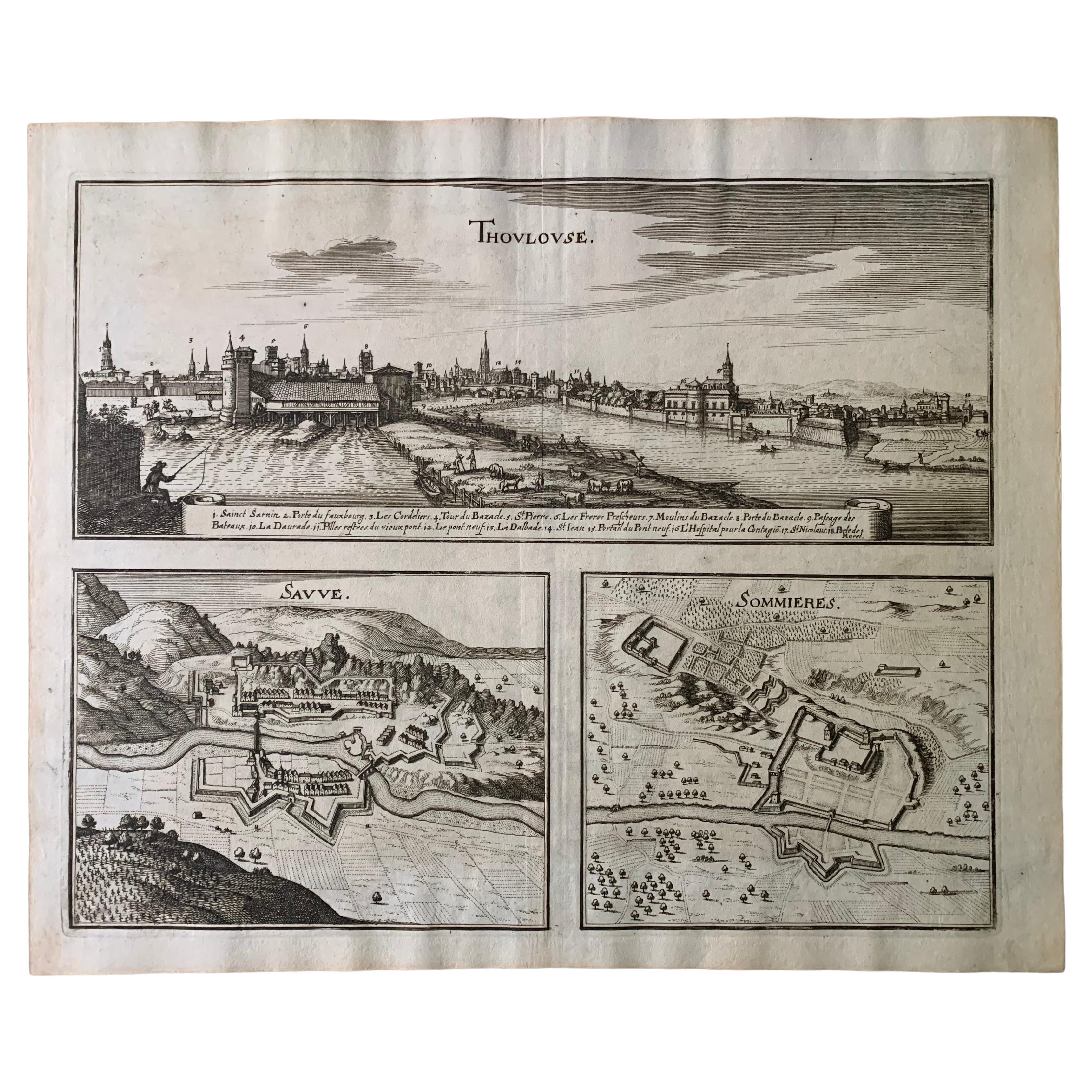
- 17th Century Toulouse, Savve, Sommieres Topographical Map by Iohan PeetersLocated in New York, NYFine topographical 17th century map of Toulouse, Savve and Sommieres by Iohan Peeters Beautiful engraving of the capital of France's Occitanie Region, Toulouse, called La Ville Rose- the Pink City, for the terracotta bricks used in its many buildings, giving the city a distinct apricot-rose hue. An important cultural and educational center, the city's residents included Nobel Prize winners and world renown artists- Henri de Toulouse-Lautrec, Henri Martin, Jean-Auguste-Dominique Ingres, Antonin Mercie, Alexandre Falguiere and more recently Cyril Kongo...Category
Antique 17th Century Dutch Maps
MaterialsPaper
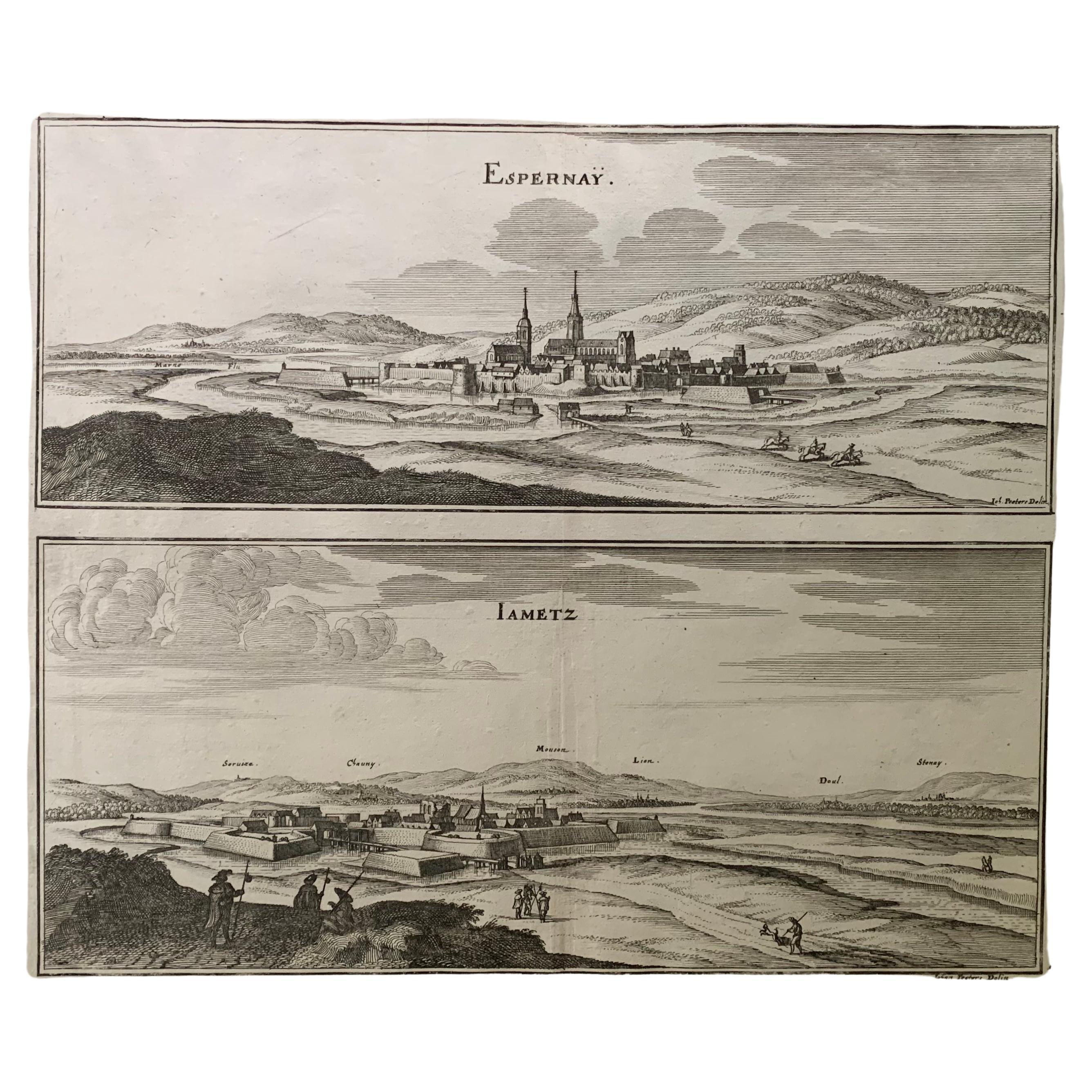
- 17th Century Topographical Map, French Champagne Region, Epernay, Iohan PeetersLocated in New York, NYFine topographical 17th century map by Iohan Peeters of the towns of Epernay and Lametz in the Champagne Region of North Eastern France. Fabulous period engraving for a Wine Cellar,...Category
Antique 17th Century Dutch Maps
MaterialsPaper
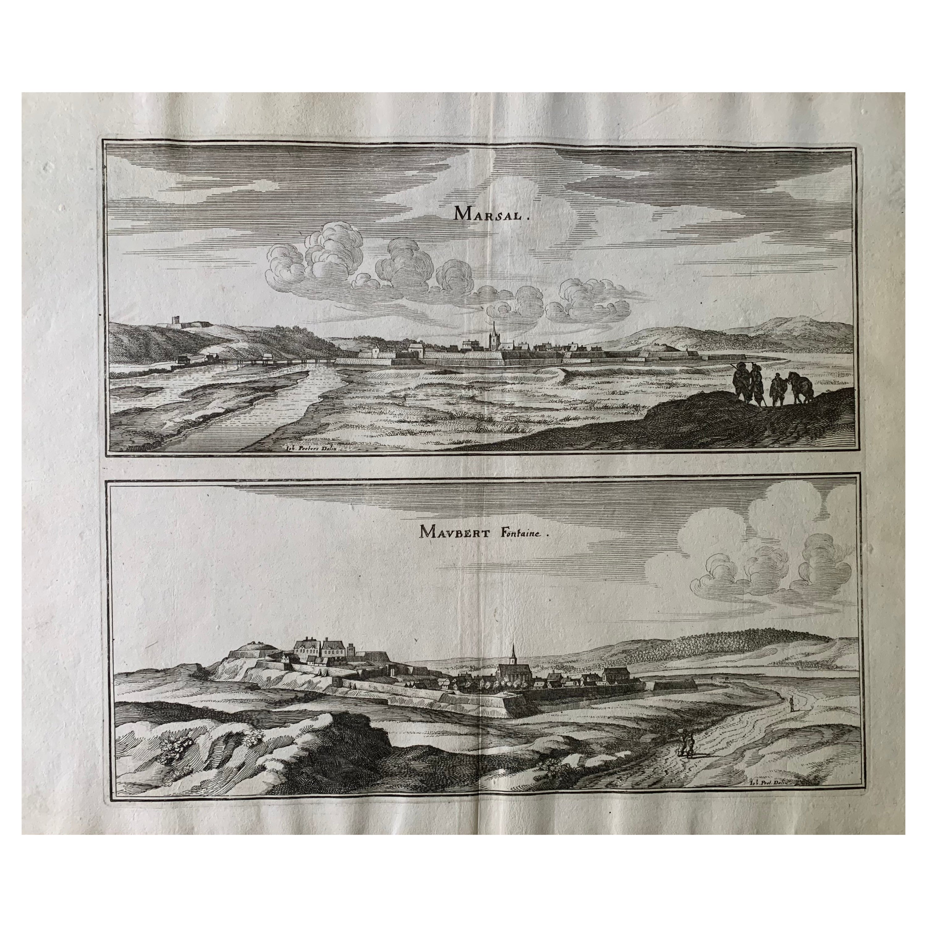
- 17th Century Topographical Map, Champagne-Ardenne, Marsal, Maubert Iohan PeetersLocated in New York, NYFine topographical 17th century map by Iohan Peeters of Marsal and Maubert Fontaine in the Champagne-Ardennes Region of North Eastern France. Fabulous period engraving for a Wine Ce...Category
Antique 17th Century Dutch Maps
MaterialsPaper
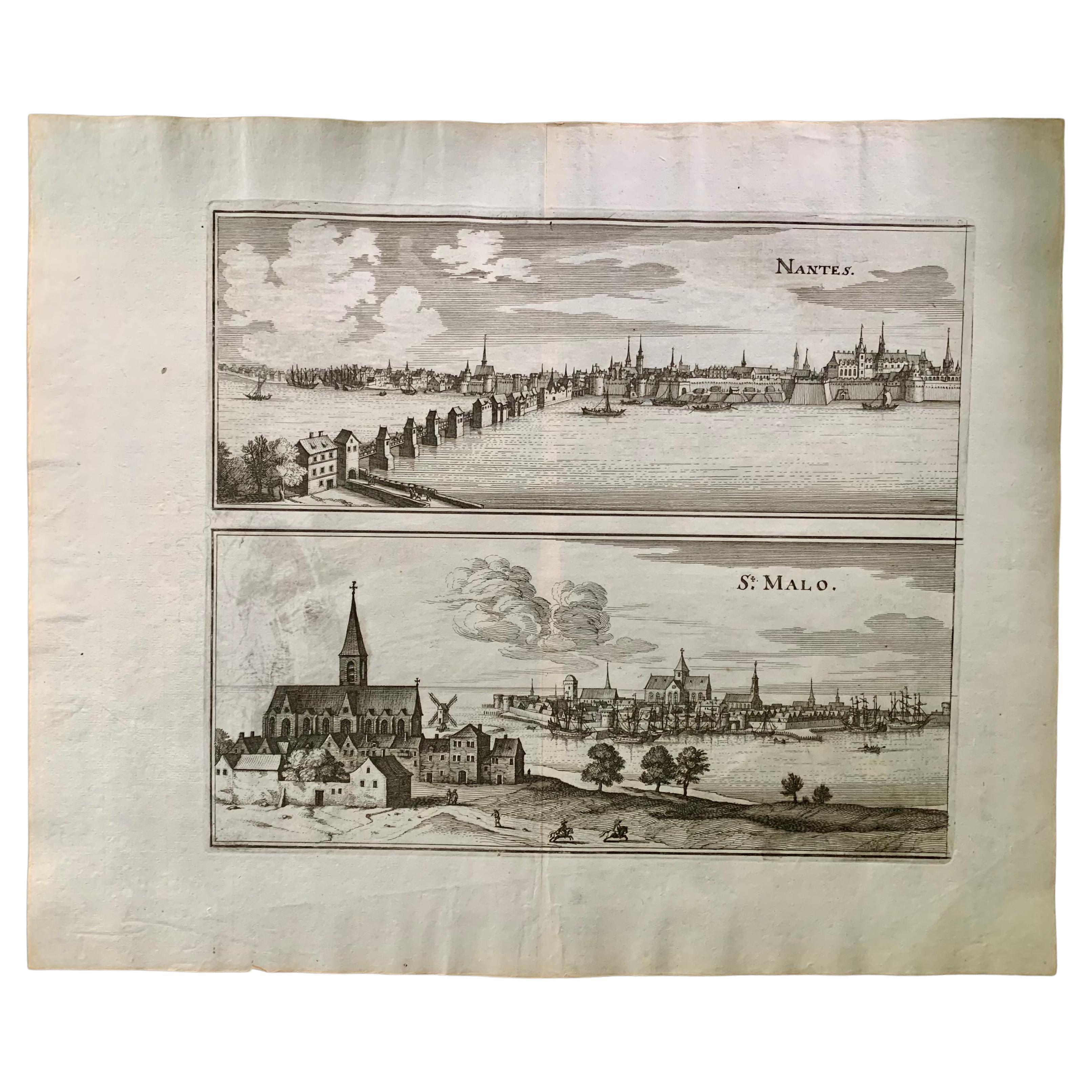
- 17th Century Topographical Engraving Nantes & St. Malo, France, by Iohan PeetersLocated in New York, NYThe ancient city of Saint Malo in North Western France has long been associated with adventure on the high seas, piracy and exploration. It was the birthplace of several important in...Category
Antique 17th Century Dutch Maps
MaterialsPaper
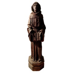
- Antique Large Carved Oak Figure of Saint Anthony of Padua, 18th-19th CenturyLocated in New York, NYFine hand carved oak figure of Saint Anthony of Padua Late 18th- Early 19th Century Saint Anthony is depicted with his head raised, mouth ajar, as if in the process of speaking. He stands upright wearing his traditional Franciscan robes and holding open a book. Beautifully carved with high level of detail, unusual for oak pieces. Oak is a dense hardwood which is difficult to carve and it's rare to see this level of detail in an early oak sculpture. Saint Anthony is the Patron Saint of lost things. While living at the monastery, he had a treasured book which contained psalms and personal observations. His book was stolen by a man who decided to leave the monastery and Anthony ferverently prayed for its return as the cost of a new book would have been beyond his means. The thief repented and returned the book which is believed to be preserved at the Franciscan Library in Bologna. He is one of the most popular Catholic saints...Category
Antique Early 19th Century European Medieval Figurative Sculptures
MaterialsWood, Oak
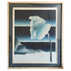
- Neil Welliver Nocturnal Grace Limited Edition Aquatint, 20th CenturyBy Neil WelliverLocated in New York, NYA fine Neil Welliver aquatint on embossed Rives BFK paper, pencil signed, titled and numbered 32/500 in the lower margin. Professional framing in a natural wood frame and matting in ...Category
20th Century American Modern Prints
MaterialsPaper


You May Also Like
- "Africa Vetus": a 17th Century Hand-Colored Map by SansonBy Nicolas SansonLocated in Alamo, CAThis original hand-colored copperplate engraved map of Africa entitled "Africa Vetus, Nicolai Sanson Christianiss Galliar Regis Geographi" was originally created by Nicholas Sanson d...Category
Antique Late 17th Century French Maps
MaterialsPaper
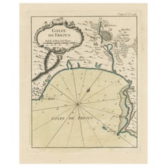
- Antique Map of the Region of Fréjus, FranceLocated in Langweer, NLTitle: "Golf de Fréjus" Description: This antique map, titled "Golf de Fréjus," is an original depiction of the region of Fréjus, France. It is part of the work "Le Petit Atlas Mari...Category
Antique Mid-18th Century Maps
MaterialsPaper
- 17th Century Hand-Colored Map of West Africa by Mercator/HondiusLocated in Alamo, CAA 17th century hand-colored map entitled "Guineae Nova Descriptio" by Gerard Mercator and Jodocus Hondius, published in their 'Atlas Minor' in Amsterdam in 1635. It is focused on the...Category
Antique Mid-17th Century Dutch Maps
MaterialsPaper
- Northern Scotland: A 17th Century Hand-colored Map by MercatorBy Gerard MercatorLocated in Alamo, CAThis is a framed hand-colored 17th century map of Northern Scotland by Gerard Mercator entitled "Scotiae pars Septentrionalis", published in Amsterdam in 1636. It is a highly detailed map of the northern part of Scotland, with the northwest Highlands and the cities Inverness and Aberdeen, as well as the Orkney Islands and the Hebrides. There is a decorative title cartouche in the upper left corner. The map is presented in an antiqued brown wood...Category
Antique 1630s Dutch Maps
MaterialsPaper
- "Africae Accurata", a Hand-Colored 17th Century Map of Africa by VisscherBy Nicolaes Visscher IILocated in Alamo, CAAn 18th century hand-colored map of Africa entitled "Africae Accurata Tabula ex officina" by Nicolaes Visscher, published in Amsterdam in 1680. This beautiful, colorful and detailed map is embellished by eleven sailing ships, a whale, flying fish and multiple land animals. It includes the Mediterranean Sea and adjacent portions of Portugal, Spain, Italy, Greece and Asia Minor. The map perpetuates several long-standing errors, including the origin of the Nile River from two imaginary lakes in southern Africa, which are shown adjacent to the imaginary Lunae Montes (Mountains of the Moon...Category
Antique Late 17th Century Dutch Maps
MaterialsPaper
- 17th Century Map of Denmark by French Cartographer Sanson, Dated 1658By Nicolas SansonLocated in Copenhagen, K17th century map of Denmark by French cartographer Sanson. Nicolas Sanson (20 December 1600-7 July 1667) was a French cartographer, termed by some the creator of French geography an...Category
Antique 17th Century French Maps
MaterialsPaper


Recently Viewed
View AllMore Ways To Browse
17th Century Netherlands
Pierre Chapel
Fleet Furniture Antique
Avignon Antique
Antique Notre Dame
Notre Dame Antique
Antique Forum
Alpes Furniture
Roman Capital
Notre Dame Cathedral
Theater Backdrop
Framed Antique French Engravings
Medieval Cathedral
French Provence Antique Pieces
Maps Of Mediterranean
Framed World Map
Sette Used
Antique Furniture Forum