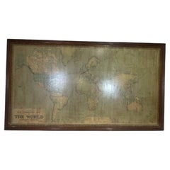
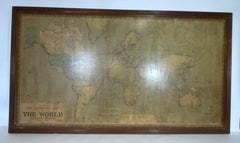
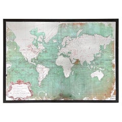
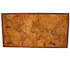
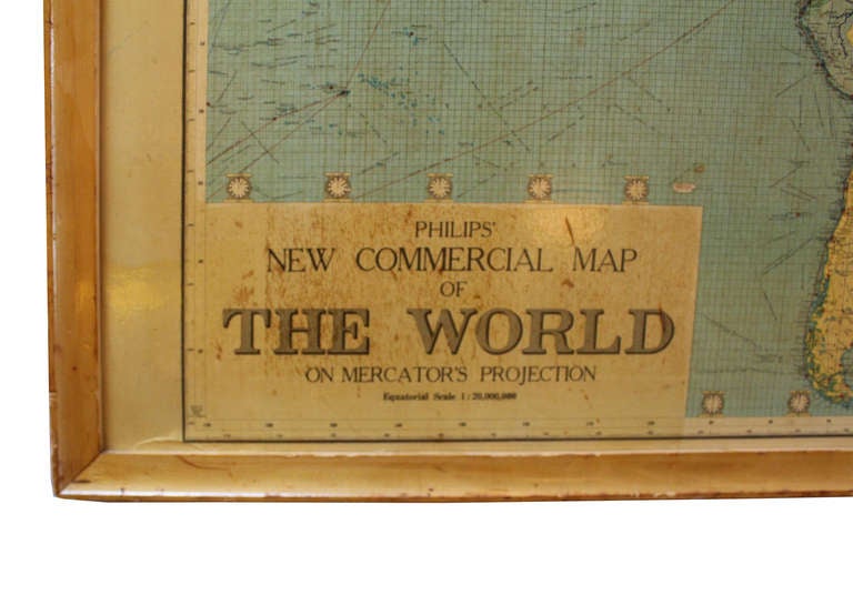
8 Foot Framed World Map by Philips
Located in Norwell, MA
1951 map of the world by George Philip and Son. Large beautiful map as it was in 1951.
Category
Vintage 1950s North American Maps
Materials
Paper
8 Foot Framed World Map by Philips
Located in Norwell, MA
1951 map of the world by George Philip and Son. Large beautiful map as it was in 1951.
Paper
$268Sale Price|20% Off
H 19.69 in W 27.56 in D 1.58 in
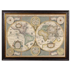
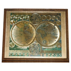
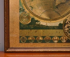
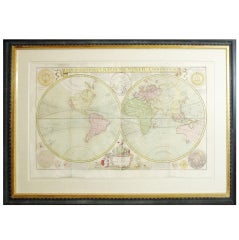
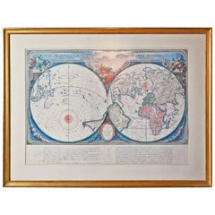
Framed World Map print showing double hemisphere dating to 1642 originally, New
Located in Lincoln, Lincolnshire
This is a digitally remastered World Map Conjuring up the golden age of exploration, from an original 1642 double hemisphere map of the world.
Glass, Wood, Paper

$4,201Sale Price|20% Off
H 28.75 in W 33.67 in D 1.58 in
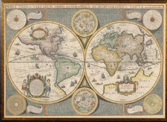
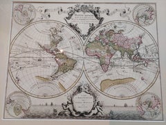
Original Antique Hand-colored World Map with or without Frame, '1696'
Located in Langweer, NL
Antique world map titled 'Mappe-Monde dressee sur les Observations de Mrs. de l'Academie Royale des Sciences (..)'. Beautiful original antique world map. Relief shown pictorially. In...
Paper
$1,662
H 17.52 in W 21.46 in D 0.79 in
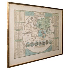
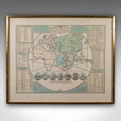
Antique Plan de l'Historie Universelle World Map, Framed Cartography, Circa 1730
Located in Hele, Devon, GB
This is an antique Plan de l'Historie Universelle World Map. A Dutch, framed atlas engraving by Henri Abraham Chatelain, dating to the 18th century and later, circa 1730.
Glass, Paper

$945Sale Price|30% Off
H 47 in W 38 in D 2 in
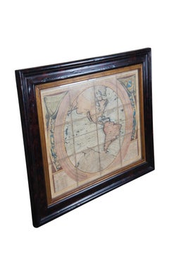
Vincenzo Coronelli's Colored Map of the New World Western Hemisphere Framed 47"
By Vincenzo Coronelli
Located in Dayton, OH
A Framed Reproduction of Coronelli's Map of the New World, Attributed to Trevor James Company.
Paper
$2,950
H 88.25 in W 90.25 in D 2 in
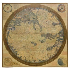
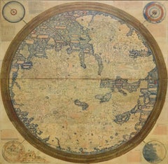
Monumental Framed Medieval Facsimile Map Of The World Fra Mauro Wood Wall Panel
Located in Forney, TX
A remarkable palatial nearly 7.5ft x 7.5ft facsimile of the important Map of the World (circa 1450) by Fra MauroFra Mauro (Italian; circa 1400–1464), featuring a solid wood framed hi...
Linen, Wood, Paper

$443
H 14.77 in W 17.88 in D 0.01 in
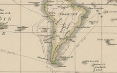
World Map – Mercator Projection with Global Sea Routes, Published in 1857
Located in Langweer, NL
Colours remain fresh, and the paper is strong throughout. Framing tips: This world map will display beautifully in a black or dark wood frame to emphasise its cartographic precision...
Paper
$475 / item
H 32.75 in W 32.5 in D 1 in
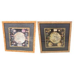
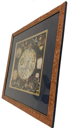
Pair of Prints Depicting Antique World Maps Framed in Burl Wood
Located in Dallas, TX
A pair of prints depicting antique world maps framed in burl wood. One picture contains a depiction of Africa, Europe, and Oceania.
Paper
$472
H 18.51 in W 22.45 in D 0.79 in
VINTAGE FRAMED PRINT PLANISPHAERIUM TERRESTRE GOLD FOiL MAP WORLD PETER SCHENK
Located in Pulborough, GB
Antiques of London This clever and characterful vintage piece is designed as a traditional military campaign chest of drawers, concealing a record player cabinet within. Finished...
Foil
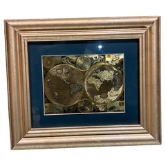
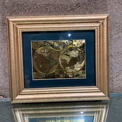
Late 20th Century Gold Foil World Map Double Hemisphere
Located in Chula Vista, CA
Late 20th Century Gold Foil Ancient World Map Double Hemisphere Gold Foil Old World Framed Map information on reverse of the print.
Gold
Unavailable
H 0.6 in W 34.45 in D 45.67 in
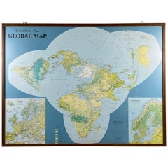
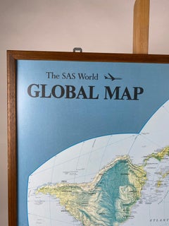
Framed World Map by Scandinavian Airlines, Esselte Map Service 1979
Located in Achterveld, NL
Rare massive world map published by Scandinavian Airlines and printed by the Esselte Map Service.
Wood
Large Framed Eighteenth Century World Map
By Herman Moll
Located in New York, NY
Herman Moll (1654-1732) A New and Correct Map of the World London, c. 1730 Engraving with hand-coloring Excellent condition Framed to full museum specifications (framed size - 3...
Paper, Watercolor
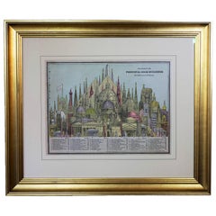
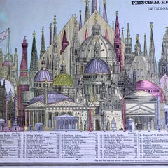
1887 Engraving of Old World Buildings Framed
By George F. Cram
Located in Pataskala, OH
Hand colored from Cram's Unrivaled Family Atlas of the World. We have used glare reducing Museum Glass and archival matting and backing in the framing.
Paper
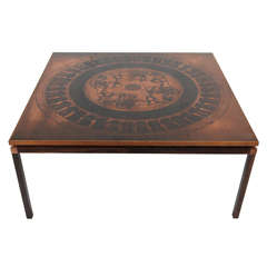
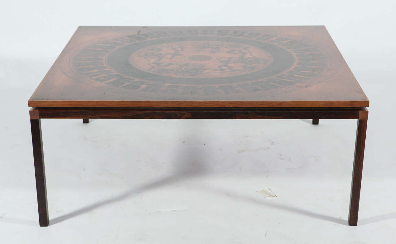
COPPER COFFEE TABLE, DENMARK, c. 1970
Located in Los Angeles, CA
Coffee table with embossed copper plate in the form of world maps. Rosewood frame, naturally patinated.
Copper

Steel-Framed World Map Mirror
Located in Chicago, IL
A 21st century American steel-framed world map mirror—an exquisite fusion of functionality and artistry that adds a touch of wanderlust to any space.
Steel
Sold
H 36 in W 53 in D 1 in
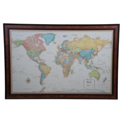
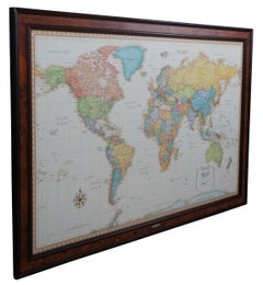
Frontgate Rand McNally World Classic Magnetic Travel Map with Burlwood Frame
Located in Dayton, OH
Frontgate Magnetic Travel Map by Rand McNally. Allows you to chart your journeys around the globe and even plan that “someday” trip of a lifetime. Printed on parchment-style paper wi...
Burl, Paper
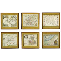

Six Framed & Matted Map Prints Of The World
Located in Chicago, IL
A wonderful collection of mid 20th century reproductions of cartography prints from the 16th and 17th centuries. Framed in walnut, with natural burlap mats. Each one is unique, with...

A Large Early 20th Century World Map in Wood Frame
Located in Palm Beach, FL
A Large Early 20th Century World Map in Wood Frame
Paper, Wood
Framed 18th Century Copy of French World Map by Francois Santini
Located in Sheffield, MA
The map is drawn and engraved, matted and has a gilt frame.
Wood
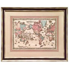

World Map by J.H. Colton 1860 Custom Framed with French Mat
Located in San Francisco, CA
A highly decorative colored engraving depicting the world published by J.H. Colton & Co. in 1860, the map beautifully hand colored and rendered.
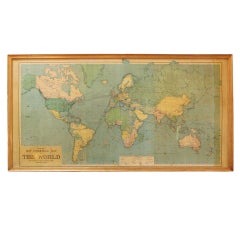
large framed world map
Located in Los Angeles, CA
vintage framed philips new commerical map of the world, nautical cylindrical map projection, 1958.
Wood
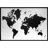
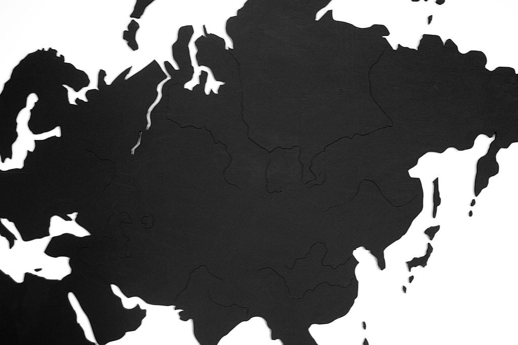
Framed Wooden map of the world
Located in Los Angeles, CA
Wooden map of the world. Black and white. Framed. Available in custom finishes.
Wood
Framed Wooden Map of the World
Located in Los Angeles, CA
Wooden map of the world. Framed. Dark wood. Available in custom finishes.
Wood
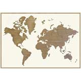
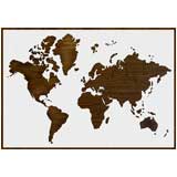
Framed wooden map of the world
Located in Los Angeles, CA
Wooden map of the world. Available in natural wood as shown or in other finished.
Wood
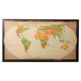
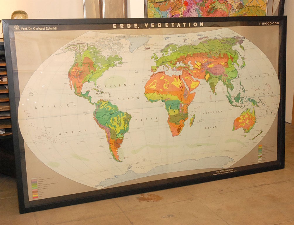
World Vegetation Map
Located in Los Angeles, CA
Framed map of the world of various vegetation patterns.
Plexiglass
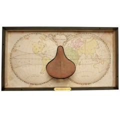

Sitting On Top of the World
Located in Los Angeles, CA
Shadowbox frame. Antique map of the world in relief with a vintage bicycle seat.

Sold
H 17 in W 14.25 in D 0.5 in
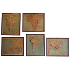
Set of Five Framed World Relief Maps from a Schoolhouse in France, circa 1910
Located in Seattle, WA
This is a wonderful set of five individually framed world relief maps from a school house in France, circa 1910.
Paper, Wood
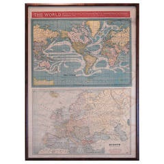

Framed Print of World Maps
By George F. Cram
Located in Pittsburgh, PA
Framed print of The World, showing ocean currents, International Date Line, Steamship Routes and Distances and Comparative Times. Overall framed dimension: 23 3/8" x 32 3/8". By Geor...
Paper
$33,847
H 6.3 in W 15.75 in D 5.91 in
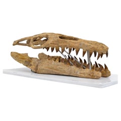
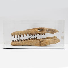
Fossilised Skull of Prehistoric Marine Reptile the Mosasaur, 70Million Years Ago
Located in Puglia, Puglia
Upper Cretaceous, about 70-65 million years ago (Maastrichtian) Morocco The skull is reconstructed in good proportions with fossil pieces found in a phosphate mine in Morocco. I att...
Bone
$688
H 7.09 in W 12.6 in D 0.12 in
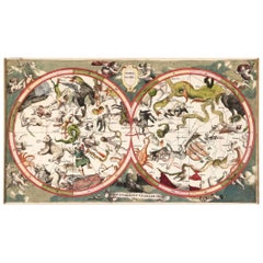
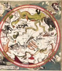
Decorative Antique Celestial Map – Zodiac, Stars & Hemel Globe, 1720
Located in Langweer, NL
Antique Celestial Map – Hemel Globe, Zodiac & Constellations by Halma, 1720 This striking double-hemisphere celestial chart, titled Hemel Globe. Coeli enarrant gloriam Dei (The ...
Paper
$10,271Sale Price|41% Off
H 31.5 in W 43.31 in D 27.17 in
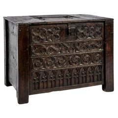
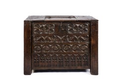
Rare 15th Century Solid Oak Medieval Dutch Gothic Chest or Trunk
Located in Casteren, NL
A very rare chest that was completely made of solid oak from the Netherlands middle ages. It is a joined chest with hand carved geometric gothic front panels. The ornaments used ar...
Wrought Iron
$437,162
H 70.87 in W 125.99 in D 2.17 in
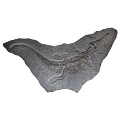
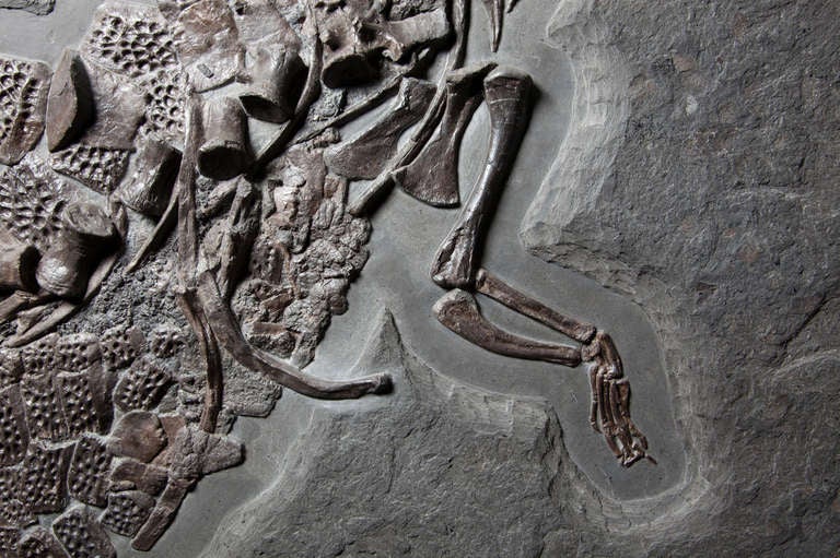
Giant Crocodile Fossil Wall Plate, Germany. 180 Million Years Old.
Located in London, GB
This outstanding fossilised skeleton is that of the ancestral crocodile species Steneosaurus bollensis that lived during the early Jurassic period. The skeleton, complete with armour...
Other

$3,754Sale Price|35% Off
H 13.78 in W 19.3 in D 0.02 in
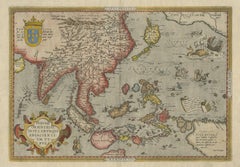
Antique Ortelius Map of Asia Featuring Japan, China, Taiwan & East Indies, 1587
By Abraham Ortelius
Located in Langweer, NL
Ortelius Asia Japan China Taiwan Philippines East Indies Antique Map 1570 This highly important early map of Asia titled “Indiae Orientalis Insularumque Adiacientium Typus” is one o...
Paper
$38,516
H 8.67 in W 19.69 in D 19.69 in
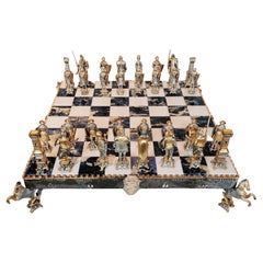
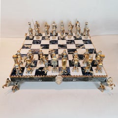
Italian Sterling Silver Chess Board, Chess Game, Sodalite Marble
By Arval Argenti Valenza
Located in VALENZA, IT
Impressive sterling silver chess board medieval style chess set. The chess board, made by ARVAL ARGENTI VALENZA, was made in white marble and sodalite is supported by a STERLING SIL...
Marble, Sterling Silver
The exhibition includes his portraits of wide-eyed kids with mayhem on their minds, as well as some of the artist’s personal belongings.
The ancient practice of covering walls in artistic scenery is back.
Despite the obstacles, the piece’s protagonist navigates the chaos without losing his humanity.
Who needs a flower garden? Just use your imagination — and some beautifully patterned wallpaper or fabric — to bring the outdoors in.
A longtime admirer of Kahn’s work, 1stDibs editorial director Anthony Barzilay Freund explores why it’s relevant now more than ever.
The streets of fin-de-siècle Paris were set aglow with colorful poster ads, thanks to the printing techniques invented by Jules Chéret. Now, the Milwaukee Art Museum is celebrating this undersung talent in America's first solo show dedicated his exuberant works.
From her historic Manhattan townhouse, the talented creator and curator of 1stDibs' latest NFT exhibition tells us about the art in her home and how she got involved with cryptoart.
The former football player is as serious about becoming a great contemporary-art patron as he once was about making tackles. Here, Rivers tells us how he got the collecting bug and how his tastes have evolved over the years.