Items Similar to Framed World Map print showing double hemisphere dating to 1642 originally, New

Want more images or videos?
Request additional images or videos from the seller
1 of 6
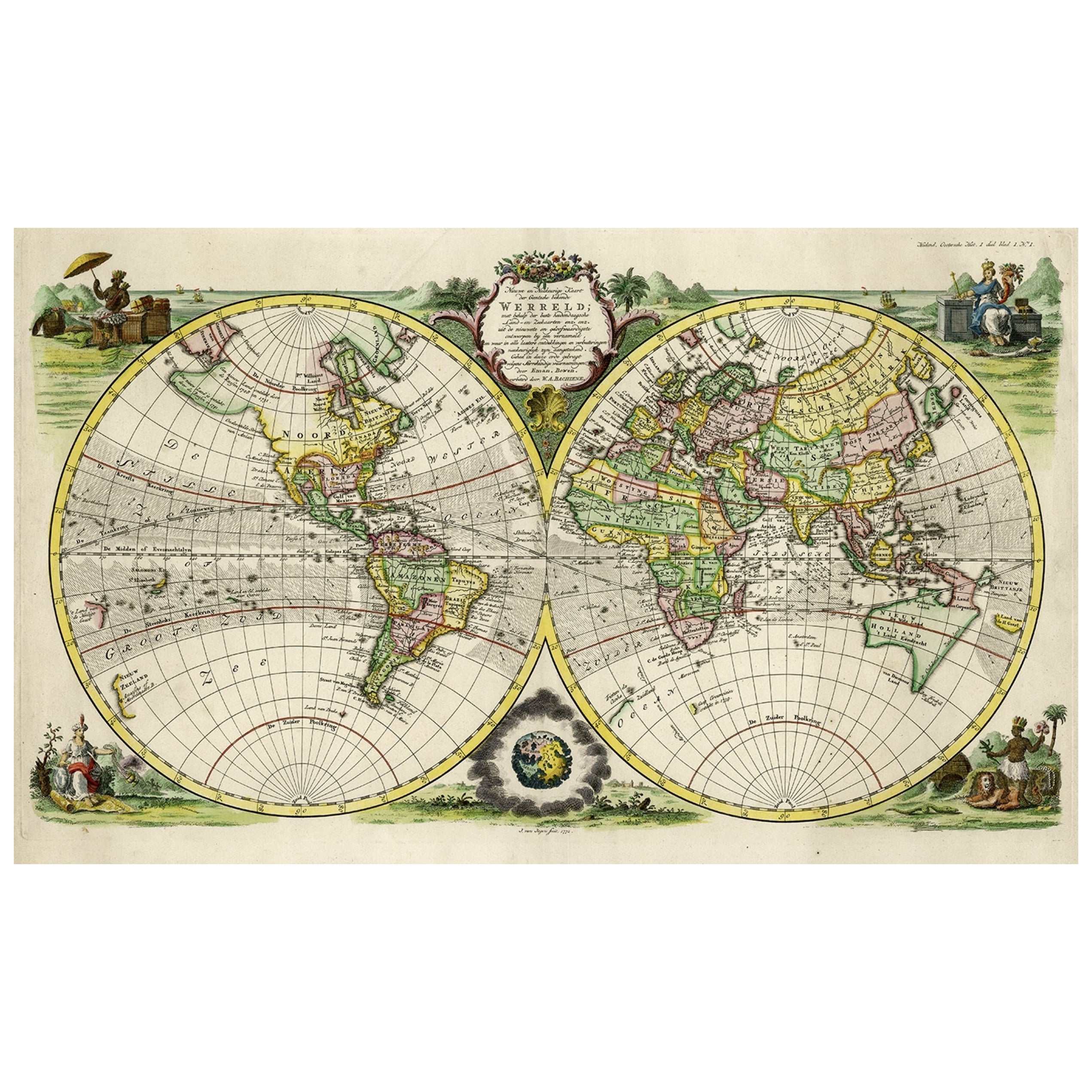
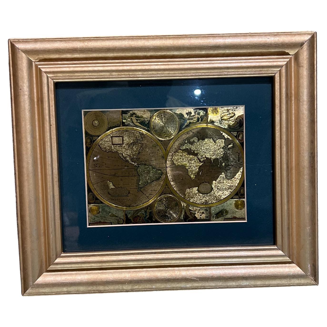
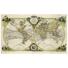
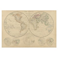
Framed World Map print showing double hemisphere dating to 1642 originally, New
About the Item
This is a digitally remastered World Map Conjuring up the golden age of exploration, from an original 1642 double hemisphere map of the world. It includes pictorial relief illustrations and detailed notations from Marco Polo, most notably the place name ‘Terra Australis Incognita’.
Originally hand-coloured to define the continents, it’s embellished with allegorical spandrel vignettes representing celestial hemispheres, North and South Poles, sailing ships and sea monsters. Full of fascinating detail, it shows the world as it was understood in the 17th century, complete with inaccuracies such as North America extending to an oddly shaped Japan.
The print is made using archival methods for the highest quality and durability and framed with sustainable wood. All elements are hand cut, printed and assembled in Britain to create a picture of distinction with minimal carbon footprint.
Framed ready to hang.
- Dimensions:Height: 19.69 in (50 cm)Width: 27.56 in (70 cm)Depth: 1.58 in (4 cm)
- Style:Charles II (In the Style Of)
- Materials and Techniques:
- Place of Origin:
- Period:
- Date of Manufacture:2023
- Production Type:New & Custom(Current Production)
- Estimated Production Time:1-2 weeks
- Condition:New Item. Please see description for available sizes.
- Seller Location:Lincoln, GB
- Reference Number:
This Listing : 70 x 50cm
About the Seller
5.0
Platinum Seller
These expertly vetted sellers are 1stDibs' most experienced sellers and are rated highest by our customers.
Established in 1993
1stDibs seller since 2013
1,256 sales on 1stDibs
Typical response time: <1 hour
Associations
LAPADA - The Association of Arts & Antiques Dealers
- ShippingRetrieving quote...Ships From: Lincoln, United Kingdom
- Return PolicyA return for this item may be initiated within 3 days of delivery.
More From This SellerView All
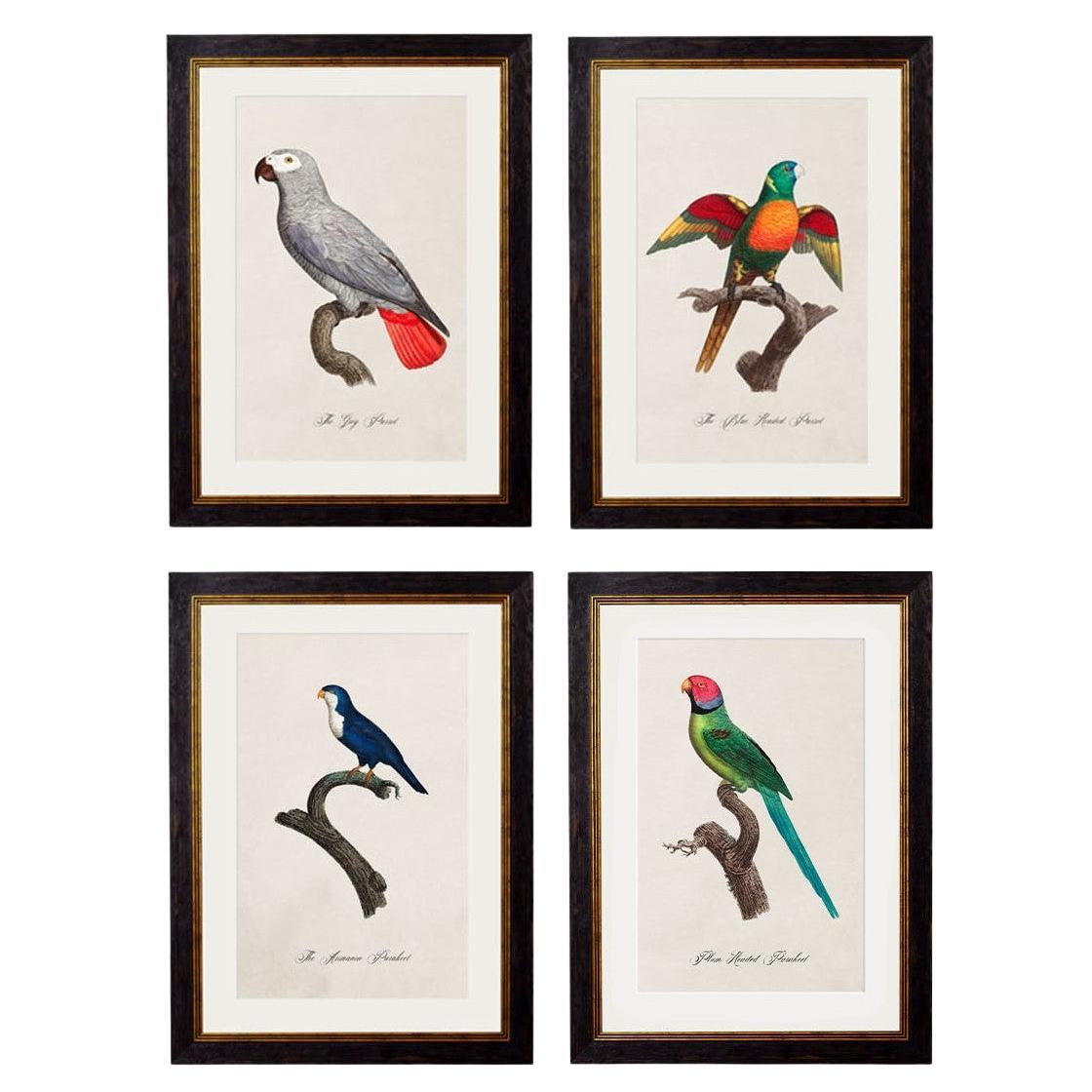
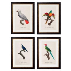
- Set of FOUR Parrot Prints originally Circa 1800s in Rectangular Frames, New (B)By John James AudubonLocated in Lincoln, LincolnshireThese are a set of FOUR digitally remastered prints of Parrots, hand coloured framed prints, originally from Circa 1800s. Prints of this style we...Category
2010s British Georgian Prints
MaterialsGlass, Wood, Paper
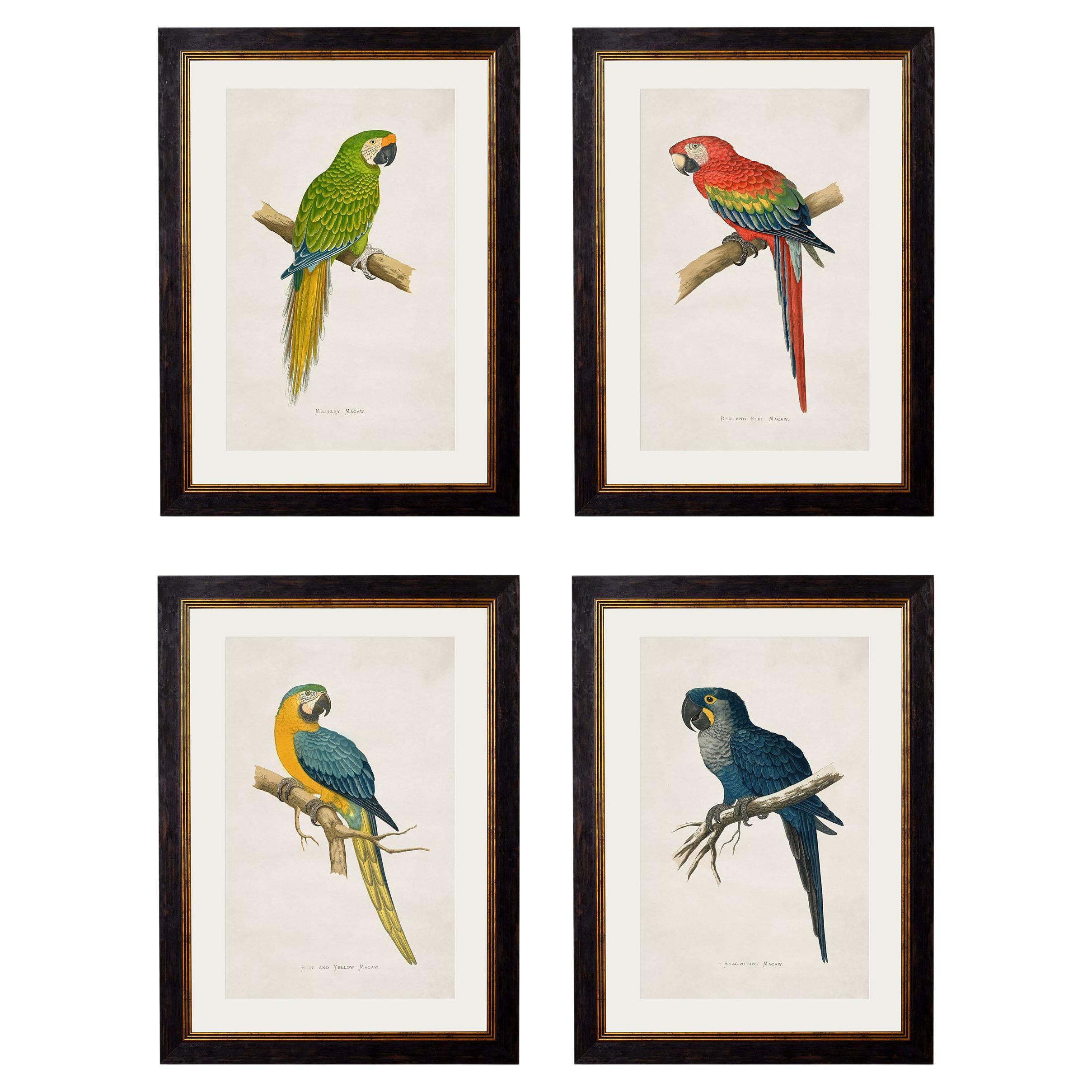
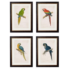
- Set of FOUR Macaws Prints originally Circa 1838 in Rectangular Frames, NewBy John James AudubonLocated in Lincoln, LincolnshireThese are a set of FOUR digitally remastered prints of Macaws, hand coloured framed prints, originally from Circa 1864. Prints of this style were...Category
2010s British Victorian Prints
MaterialsGlass, Wood, Paper
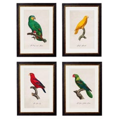
- Set of FOUR Parrot Prints originally Circa 1800s in Rectangular Frames, NewBy John James AudubonLocated in Lincoln, LincolnshireThese are a set of FOUR digitally remastered prints of Parrots, hand coloured framed prints, originally from Circa 1800s. Prints of this style we...Category
2010s British Victorian Prints
MaterialsGlass, Wood, Paper
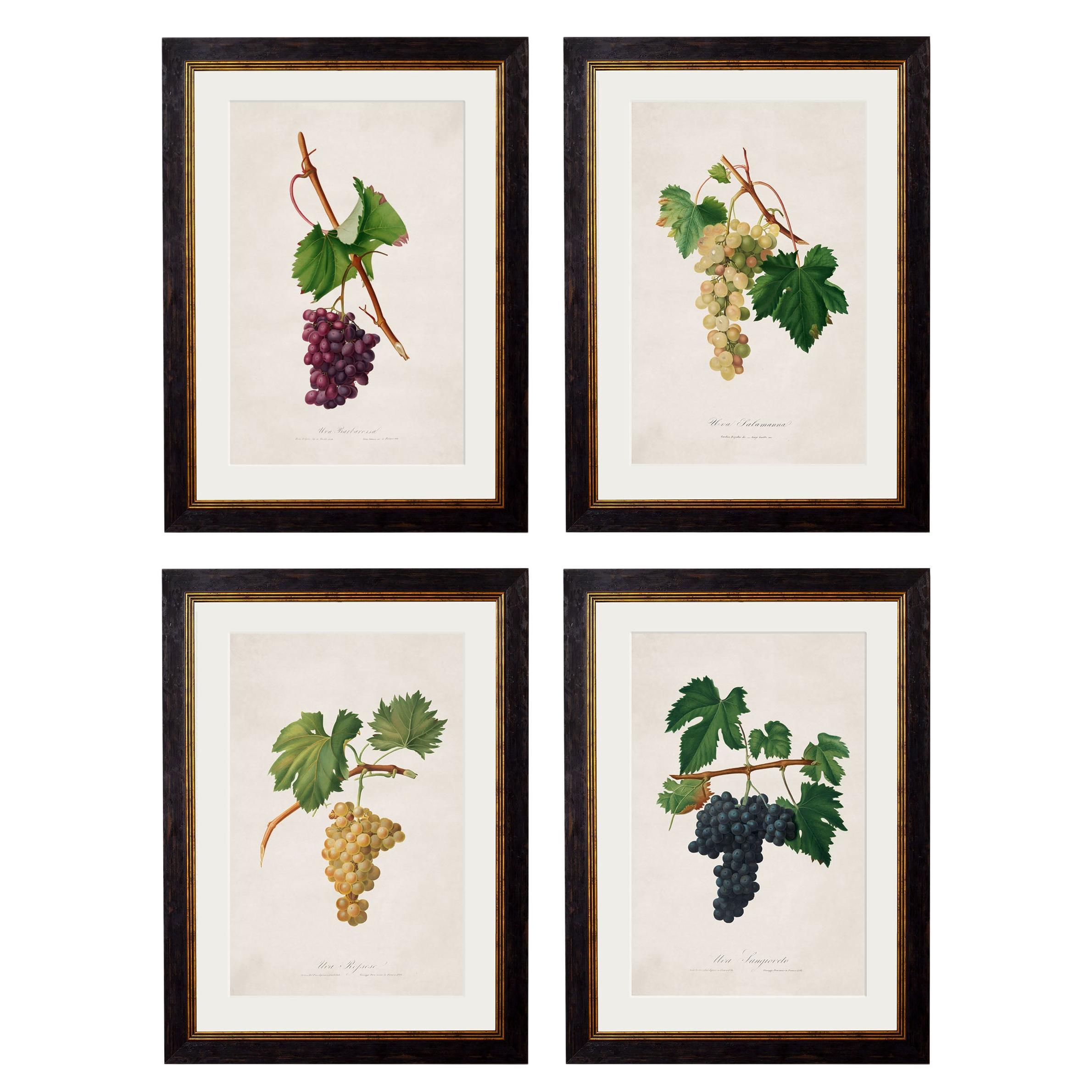
- Set of FOUR Prints of Grapes originally Circa 1817 in Rectangular Frames, NewLocated in Lincoln, LincolnshireThese are a set of FOUR digitally remastered prints of Grape studies, hand coloured and framed, originally from French drawings, Circa 1817. Prints of this style were originally pr...Category
2010s British Georgian Prints
MaterialsGlass, Wood, Paper
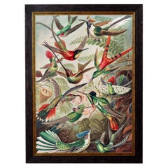
- Hummingbirds framed Print from original by Ernst Haeckel Circa 1904, NewBy Ernst Heinrich HaeckelLocated in Lincoln, LincolnshireThis stunning print of Hummingbirds references a beautiful print from the 1900s by Ernst Haeckel as per similar pieces; reference Sea anemones and Mosses from Ernst Haeckels Kunstfor...Category
2010s British Edwardian Prints
MaterialsGlass, Wood, Paper
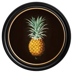
- Pineapple botanical study framed Print from French original of 1812, NewLocated in Lincoln, LincolnshireThis is a delightful round framed print of a Pineapple study originally from a hand coloured early 19th Century French botanical illust...Category
2010s British Georgian Prints
MaterialsGlass, Wood, Paper

You May Also Like
- Rare Original Double Hemisphere World Map with Allegorical Figures, 1785Located in Langweer, NLAntique map titled 'Nieuwe en Naukeurige Kaart der Gantsche bekende Werreld.' A double hemisphere world map. Four allegorical figures in the c...Category
Antique 1780s Maps
MaterialsPaper
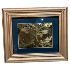
- Late 20th Century Gold Foil World Map Double HemisphereLocated in Chula Vista, CALate 20th Century Gold Foil Ancient World Map Double Hemisphere Gold Foil Old World Framed Map information on reverse of the print. Original vintage ...Category
Late 20th Century English Mid-Century Modern Prints
MaterialsGold
- Interesting Original Antique Hemisphere Map Showing the Latest DiscoveriesLocated in Langweer, NLAntique world map titled 'A Map of the World from the best Authorities'. Detailed map of the World, showing tracks of Captain James Cook in his 3 voyages in great detail. The map is ...Category
Antique Late 18th Century Maps
MaterialsPaper
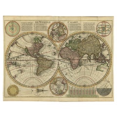
- Antique Double Hemisphere World Map with California as an Island, 1710Located in Langweer, NLDescription: Antique map titled 'De Werelt Caart'. First state (out of three) antique double hemisphere world map from a Dutch bible by Cornelis D...Category
Antique 1710s Maps
MaterialsPaper
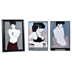
- (3) Patrick Nagel Framed PrintsBy Patrick NagelLocated in Chattanooga, TNStunning set of (3) vintage 1980s Patrick Nagel prints. These 3 images work perfectly as an assemblage! The first image is “Portfolio 1” – a young woman wearing a bralette and headba...Category
Vintage 1980s American Post-Modern Prints
MaterialsMetal
- Antique Map of The World in Hemispheres by W. G. Blackie, 1859Located in Langweer, NLAntique map titled 'The World in Hemispheres with other projections'. Original antique map of The World. This map originates from ‘The Imperial Atlas of Modern Geography’. Published ...Category
Antique Mid-19th Century Maps
MaterialsPaper

Recently Viewed
View AllMore Ways To Browse
Modern Teak Lamp
Vintage Mid Century Danish Coffee Table
Vintage Posters Of Flowers
Brass Wall Lamp And Brass Shade
Italian Vintage Chandelier Pair
20th Century Vintage Glass Bottles
Vintage Mirror Shaped
Tall Cabinet With Drawers
Marble Table With Bronze Base
Upholstered Leg Dining Chair Set
Vintage Belgium Chairs
Glass Chrome Mid Century Modern Dining Table
Vintage Pendants Uk
White Mid Century Desk
Dining Room Set Modern Walnut
Mid Century Modern Pillows
1970 Chrome Glass Light
Crystal And Bronze Lights