Items Similar to 17th Century Map of Denmark by French Cartographer Sanson, Dated 1658


Want more images or videos?
Request additional images or videos from the seller
1 of 8
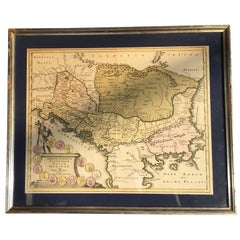
17th Century Map of Denmark by French Cartographer Sanson, Dated 1658
About the Item
17th century map of Denmark by French cartographer Sanson.
Nicolas Sanson (20 December 1600-7 July 1667) was a French cartographer, termed by some the creator of French geography and has been called the "father of French cartography.
The engraved map is hand-colored and dated 1658.
The gilded frame is from circa 1900 and has minor losses to the gilding to the upper left corner.
- Creator:Nicolas Sanson (Artist)
- Dimensions:Height: 18.51 in (47 cm)Width: 23.23 in (59 cm)Depth: 0.4 in (1 cm)
- Materials and Techniques:
- Place of Origin:
- Period:
- Date of Manufacture:1658
- Condition:Wear consistent with age and use. Minor losses. Minor fading.
- Seller Location:Copenhagen, DK
- Reference Number:
About the Seller
4.9
Vetted Seller
These experienced sellers undergo a comprehensive evaluation by our team of in-house experts.
Established in 1949
1stDibs seller since 2013
135 sales on 1stDibs
Typical response time: 1 to 2 days
- ShippingRetrieving quote...Ships From: Copenhagen, Denmark
- Return PolicyA return for this item may be initiated within 3 days of delivery.
More From This SellerView All
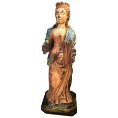
- Early 17th Century SculptureLocated in Copenhagen, KAmazing Baroque sculpture of a woman wearing a crown in original paint. Her hands are missing. Colors are untouched, recently cleaned off from a thick dark coating, I have images fro...Category
Antique Early 17th Century French Baroque Figurative Sculptures
MaterialsOak
- Four 18th Century Engraved and Hand-Colored Maps by WeigelBy Christoph WeigelLocated in Copenhagen, KSmall collection of four engraved maps of Italy, Balkan and of Central Asia. Two are of Italy, one Corsica and Northern Italy and the other of the Southern Italian boot...Category
Antique 18th Century German Maps
MaterialsPaper
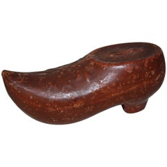
- Danish 19th Century Faience Money Bank In The Shape Of A ClogsLocated in Copenhagen, KDanish 19th Century Faience Money Bank In The Shape Of A ClogsCategory
Antique Late 19th Century Danish Folk Art Collectibles and Curiosities
MaterialsEarthenware
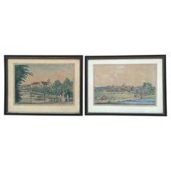
- 19th Century Engravings of Landscape and Estate of Herlufsholm and NaestvedLocated in Copenhagen, KThe two 19th century engravings of the town of Naestved and Estate of Herlufsholm are hand-colored and dated circa 1820s. The engravings are made by Heinrich Gustav Ferdinand Holm, ...Category
Antique Early 19th Century Danish Prints
MaterialsPaper
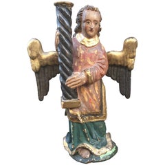
- Scandinavian Late 17th Century Baroque Angel CandleholderLocated in Copenhagen, KLate 17th Century Baroque Angel Candlestick, Scandinavian Amazing carved wood and polychrome candleholder.Category
Antique Late 17th Century Scandinavian Baroque Sculptures and Carvings
MaterialsWood
- 19th Century Bronze PipeLocated in Copenhagen, KFantastic bronze pipe from the Vienna tobacco museum’s collection, from Belgian Congo.Category
Antique 19th Century Congolese Folk Art Tobacco Accessories
MaterialsBronze
You May Also Like
- "Africa Vetus": a 17th Century Hand-Colored Map by SansonBy Nicolas SansonLocated in Alamo, CAThis original hand-colored copperplate engraved map of Africa entitled "Africa Vetus, Nicolai Sanson Christianiss Galliar Regis Geographi" was originally created by Nicholas Sanson d...Category
Antique Late 17th Century French Maps
MaterialsPaper
- Greece, "Graeciae Antiquae"" A 17th Century Hand-colored Map by SansonBy Nicolas SansonLocated in Alamo, CAThis is an original 17th century hand colored copperplate engraved map of Greece entitled "Graeciae Antiquae Tabula Hanc Geographicam" by Nicolas d'Abbeville Sanson, engraved and pub...Category
Antique Mid-17th Century French Maps
MaterialsPaper
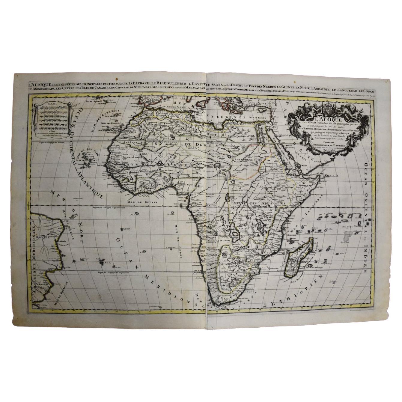
- Africa: A Large 17th Century Hand-Colored Map by Sanson and JaillotBy Nicolas SansonLocated in Alamo, CAThis large original hand-colored copperplate engraved map of Africa entitled "L'Afrique divisee suivant l'estendue de ses principales parties ou sont distingues les uns des autres, L...Category
Antique 1690s French Maps
MaterialsPaper
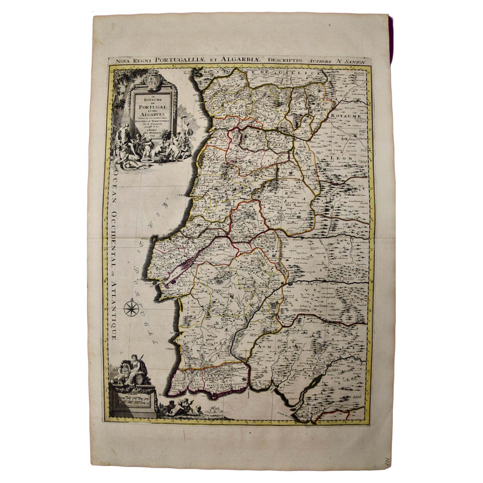
- Portugal: A Large 17th Century Hand-colored Map by Sanson and JaillotBy Nicolas SansonLocated in Alamo, CAThis large hand-colored map entitled "Le Royaume de Portugal et des Algarves Divisee en see Archeveches, Eveches et Territoires Par le Sr Sanson" was originally created by Nicholas S...Category
Antique 1690s French Maps
MaterialsPaper
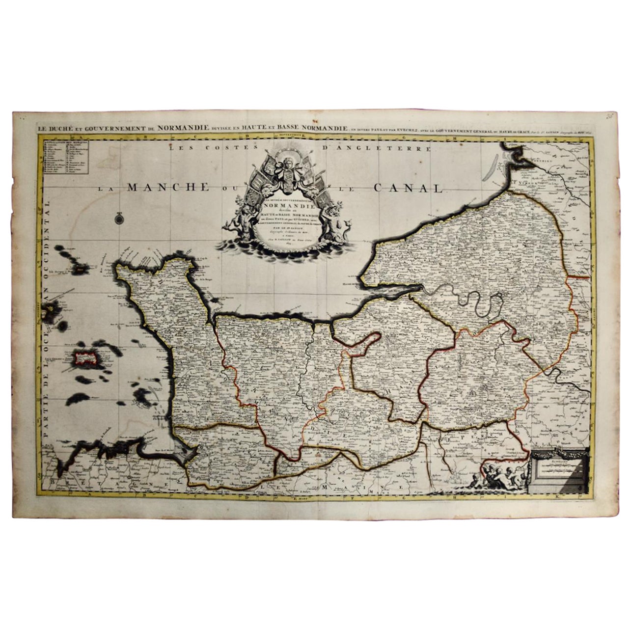
- The Normandy Region of France: A 17th C. Hand-colored Map by Sanson and JaillotBy Nicolas SansonLocated in Alamo, CAThis large hand-colored map entitled "Le Duché et Gouvernement de Normandie divisée en Haute et Basse Normandie en divers Pays; et par evêchez, avec le Gouvernement General du Havre ...Category
Antique 1690s French Maps
MaterialsPaper
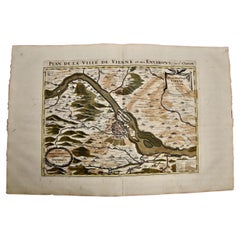
- Vienna, Austria: A Large 17th Century Hand-Colored Map by Sanson and JaillotBy Nicolas SansonLocated in Alamo, CAThis large 17th century hand-colored map of Vienna, Austria and the surrounding countryside and villages entitled "Plan de la Ville de Vienne en Austrich...Category
Antique 1690s French Maps
MaterialsPaper


Recently Viewed
View AllMore Ways To Browse
Dated 17th Century Furniture
17th Century Danish
Antique Furniture South East London
Antique Island Caribbean
Teak Sphere
Atlas Stand
Antique Battle Maps
Reclaimed Lumber
Map Of Virginia
Antique Pirate
Bag With Map
Pirate Antique
Bonne Map
Antique Irish Maps
Antique Map Ireland
Antique Map Of Ireland
Antique Maps Of Ireland
George Fleet