Items Similar to 1817 John Thomson's Handcolored Antique Map of St. Kitts, Nevis, and St. Lucia


Want more images or videos?
Request additional images or videos from the seller
1 of 7
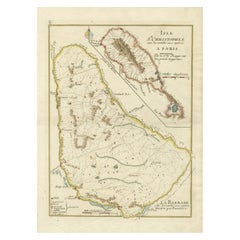
1817 John Thomson's Handcolored Antique Map of St. Kitts, Nevis, and St. Lucia
About the Item
This is an antique map depicting the islands of St. Kitts (St. Christopher's) and Nevis in the West Indies, along with a smaller inset map of St. Lucia.
The main map focuses on St. Kitts, with detailed topographical features such as mountain ranges, volcanic peaks, and plantation areas indicated by cross-hatching and stippling. The coastline is meticulously outlined, with bays and capes labeled. The island of Nevis appears in a smaller inset on the right, detailed in a similar fashion with its own unique landscape features.
The inset of St. Lucia at the bottom left shows the rugged terrain of the island, including its mountains and natural harbors. Each island's map is framed within its own neat line border, with a title block for identification.
The map appears to be hand-colored, a common practice of the time for high-quality maps, which emphasizes the land against the sea. Pink shading outlines the islands, while green tones likely represent lower elevations and yellow tones for higher elevations.
The condition of the map suggests it has been well-preserved, with the paper maintaining its integrity and the colors remaining vivid. There are signs of aging, such as slight discoloration and possible foxing, but these are typical for documents of this era and do not significantly detract from the visual appeal or the information presented.
This map would have been an important navigational aid for sailors and a source of geographic knowledge for those interested in the West Indies during the period it was made. The craftsmanship and detail also make it a fine example of cartographic art from the era.
More about the maker:
John Thomson was a notable Scottish cartographer from the late 18th and early 19th centuries. He was active in Edinburgh, which was a center for Enlightenment science, literature, and education, and it became an important hub for cartographic publishing during that time.
Thomson's work is best known for its accuracy, detail, and the aesthetic appeal of his maps. He published "Thomson's New General Atlas" around 1817, which was considered one of the most detailed world atlases of the time. This work was significant for its use of dramatic color and for including updates based on new discoveries and contemporary geopolitical changes.
Thomson's maps were also distinctive for their lack of decorative embellishments, which were common in maps of the earlier periods. Instead, he focused on the clarity and functionality of the cartographic information, which made his maps particularly useful for navigators and scholars. The quality of the paper and printing techniques used by Thomson were also superior for the time, contributing to the longevity and crisp appearance of his maps.
The New General Atlas by John Thomson included detailed maps of countries from around the world, reflecting the state of geographic knowledge during the Regency period. His works remain valuable to collectors and historians for their representation of historical geography and as artifacts of the cartographic arts of the early 19th century.
- Dimensions:Height: 21.07 in (53.5 cm)Width: 29.34 in (74.5 cm)Depth: 0 in (0.02 mm)
- Materials and Techniques:Paper,Engraved
- Period:
- Date of Manufacture:1817
- Condition:Good condition considering its age. The paper showing signs of aging and foxing that contribute to its antique character. The light browning, folds and creases are typical of maps that were used or stored in atlases. Study image carefully.
- Seller Location:Langweer, NL
- Reference Number:Seller: BG-31618-41stDibs: LU3054337731762
About the Seller
5.0
Platinum Seller
These expertly vetted sellers are 1stDibs' most experienced sellers and are rated highest by our customers.
Established in 2009
1stDibs seller since 2017
1,916 sales on 1stDibs
Typical response time: <1 hour
- ShippingRetrieving quote...Ships From: Langweer, Netherlands
- Return PolicyA return for this item may be initiated within 14 days of delivery.
Auctions on 1stDibs
Our timed auctions are an opportunity to bid on extraordinary design. We do not charge a Buyer's Premium and shipping is facilitated by 1stDibs and/or the seller. Plus, all auction purchases are covered by our comprehensive Buyer Protection. Learn More
More From This SellerView All
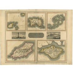
- Antique Map of the British Islands by J. Thomson, 1817Located in Langweer, NLGroup of 5 maps of the Channel Islands, Scilly, Jersey, the Isle of Mann and the Isle of Wight. Engraved views of the Eddystone Lighthouse and Freshwater Bay on the Isle of Wight, wi...Category
Antique Early 19th Century Maps
MaterialsPaper
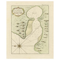
- Roseaux, St. Lucia Island Map by BELLIN, Handcolored Engraving, 1763Located in Langweer, NLDating back to around 1763, this antique hand-colored print, a creation by Jacques Nicolas Bellin, unveils a meticulously detailed "Plan du Cul de Sac des Roseaux dans l'Isle de Ste....Category
Antique 1760s Maps
MaterialsPaper
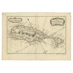
- Barados and St Christopher or St Kitts and Nevis Islands in the Caribbean, 1748Located in Langweer, NLThis original map, a copperplate engraving by Le Rouge, presents two significant areas in the Caribbean. Titled "Isle St. Christophle une des Antilles aux anglois" and "La Barbade. d...Category
Antique Mid-18th Century Maps
MaterialsPaper
- Antique Map of the Caribbean Island of St Kitts, ca.1750Located in Langweer, NLDescription: Antique map titled 'Carte de l'Isle St. Christophe pour Servir a l'Histoire Genle. des Voyages.' Detailed map of the Island of St. Kitts, showing the Parishes, towns, ...Category
Antique 1750s Maps
MaterialsPaper
- Antique Map of the Atlantic Islands, 1817Located in Langweer, NLAntique map titled 'Atlantic Islands'. Large map of the Atlantic Islands include the Cape Verde islands, Canary islands, Azore islands and Madeira islands. Also included a view of th...Category
Antique Early 19th Century Maps
MaterialsPaper
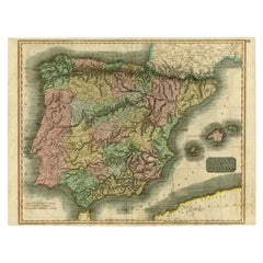
- Antique Map of Spain and Portugal by Thomson, 1815Located in Langweer, NLAntique map titled 'Spain & Portugal.' Map of Spain and Portugal. From Thomson's 'New General Atlas', 1815. Artists and Engravers: Made by 'J. & G. Menzies'. Publisher: John Thomson ...Category
Antique 19th Century Maps
MaterialsPaper

You May Also Like
- St. Christophe 'St. Kitts' Island: An 18th Century Hand-colored Map by BellinBy Jacques-Nicolas BellinLocated in Alamo, CAJacques Bellin's copper-plate map of the Caribbean island of Saint Kitts entitled "Carte De De l'Isle St. Christophe Pour servir á l'Histoire Genle. des V...Category
Antique Mid-18th Century French Maps
MaterialsPaper
- Antique "New Plan of London" Map by John Bartholomew, 1900Located in Bridgeport, CTProduced for the W.H. Smith guide, folded in the original. The map here is unfolded and framed flat, with transportation routes shown and color details. sight 22 x 32" (original ful...Category
Antique Early 1900s English Victorian Maps
MaterialsPaper
- English Engraved Hand Colored Map of the North Eastern United States, circa 1817Located in Hollywood, SCEnglish copper engraved hand colored map of the North Eastern United States matted under glass in a gilt frame, Early 19th Century. Drawn and Engraved for Thomson's New General Atlas...Category
Antique 1810s English George III Maps
MaterialsGlass, Giltwood, Paint, Paper
- 1854 Map of Massachusetts, Connecticut and Rhode Island, Antique Wall MapLocated in Colorado Springs, COThis striking wall map was published in 1854 by Ensign, Bridgman & Fanning and has both full original hand-coloring and original hardware. This impression is both informative and highly decorative. The states are divided into counties, outlined in red, green, and black, and subdivided into towns. Roads, canals, and railroad lines are prominently depicted, although they are not all labeled. The mapmakers also marked lighthouses, banks, churches, and prominent buildings, with a key at right. The map is an informative and comprehensive overview of the infrastructural development of New England prior to the Civil War. Physical geographies depicted include elevation, conveyed with hachure marks, rivers and lakes. The impression features an inset map of Boston...Category
Antique 19th Century American Maps
MaterialsPaper
- Antique Map of Principality of MonacoBy Antonio Vallardi EditoreLocated in Alessandria, PiemonteST/619 - "Old Geographical Atlas of Italy - Topographic map of ex-Principality of Monaco" - ediz Vallardi - Milano - A somewhat special edition ---Category
Antique Late 19th Century Italian Other Prints
MaterialsPaper
- 5 Vols, Antique Books, Lives of the British Admirals, English, Georgian, 1817Located in Hele, Devon, GBThis is a set of 5 antique volumes, Lives of the British Admirals by Dr John Campbell et al. An English language, hard bound naval interest book, published in London, 1817. Includes...Category
Antique Early 19th Century British Georgian Books
MaterialsPaper


Recently Viewed
View AllMore Ways To Browse
18th Century Revolutionary
Wenceslas Hollar
Bad Bentheim
English County Maps By Blaeu
Von Meer
Minature Map
Anguilla Map
James Calvert Smith
Montenegro Antique Map
Mozambique Antique Map
Nottinghamshire Antique Map
Panama Antique Map
Wisconsin Map
Antique Map Sydney
Historical Balkan Map
Map Of Majorca
Yorkshire Ridings Map
Antique Map Dordogne