Items Similar to Antique Map of Friesland by Bussemacher in Frame, c.1592


Want more images or videos?
Request additional images or videos from the seller
1 of 6
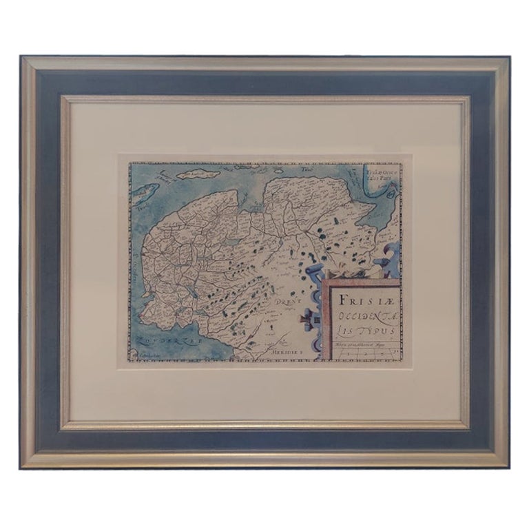
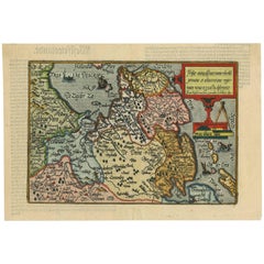
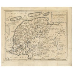
Antique Map of Friesland by Bussemacher in Frame, c.1592
About the Item
Original antique map titled 'Frisiae Antiquissimae (..)'. Original antique map of Friesland. Published by J. Bussemacher, circa 1592. Artists and Engravers: Bussemacher was active as an engraver, printer and art dealer in Cologne from about 1580 to 1613.
Artist: Bussemacher was active as an engraver, printer and art dealer in Cologne from about 1580 to 1613.
Condition: Good, general age-related toning. Frame included, with a few small defects. Please study images carefully.
Date: c.1592
Overall size: 50 x 42.3 cm.
Image size: 27.5 x 19 cm.
We sell original antique maps to collectors, historians, educators and interior decorators all over the world. Our collection includes a wide range of authentic antique maps from the 16th to the 20th centuries. Buying and collecting antique maps is a tradition that goes back hundreds of years. Antique maps have proved a richly rewarding investment over the past decade, thanks to a growing appreciation of their unique historical appeal. Today the decorative qualities of antique maps are widely recognized by interior designers who appreciate their beauty and design flexibility. Depending on the individual map, presentation, and context, a rare or antique map can be modern, traditional, abstract, figurative, serious or whimsical. We offer a wide range of authentic antique maps for any budget.
- Dimensions:Height: 16.66 in (42.3 cm)Width: 19.69 in (50 cm)Depth: 0 in (0.01 mm)
- Materials and Techniques:
- Period:
- Date of Manufacture:circa 1592
- Condition:
- Seller Location:Langweer, NL
- Reference Number:
About the Seller
5.0
Platinum Seller
These expertly vetted sellers are 1stDibs' most experienced sellers and are rated highest by our customers.
Established in 2009
1stDibs seller since 2017
1,916 sales on 1stDibs
Typical response time: <1 hour
- ShippingRetrieving quote...Ships From: Langweer, Netherlands
- Return PolicyA return for this item may be initiated within 14 days of delivery.
More From This SellerView All
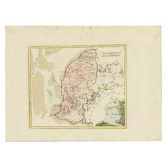
- Antique Map of Friesland 'The Netherlands' by J. Bussemacher, 1596By Johann BussemacherLocated in Langweer, NLBeautiful hand-colored engraving of the province Friesland (The Netherlands). This map originates from the Atlas 'Europae totius orbis terrarium partis praestantissimae, universalis ...Category
Antique 16th Century Maps
MaterialsPaper
- Original Antique Map of Friesland in Frame, The Netherlands, 1612Located in Langweer, NLAntique map titled 'Frisiae Occidentalis Typus'. Original antique map of the province of Friesland, the Netherlands. Second state, published 1612. Artists and Engravers: Published by...Category
Antique 17th Century Maps
MaterialsPaper
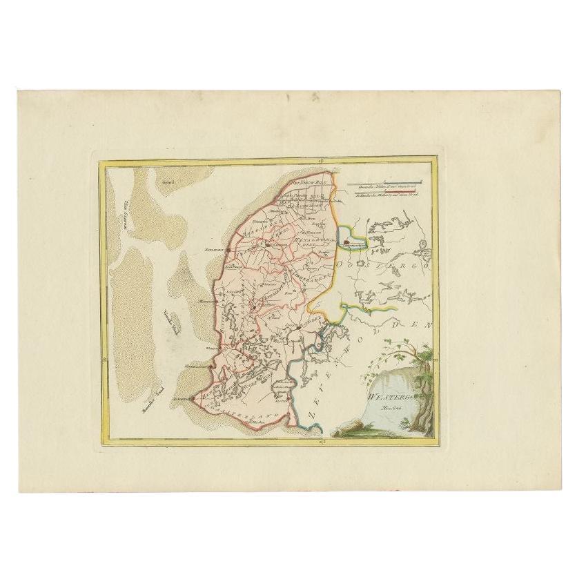
- Antique Map of Westergo in Friesland, 1791Located in Langweer, NLAntique map titled 'Westergo'. Map of the Westergo region, Friesland, the Netherlands. This map orginates from 'Schauplatz der fünf Theile der Welt'. Artists and Engravers: Franz...Category
Antique 18th Century Maps
MaterialsPaper
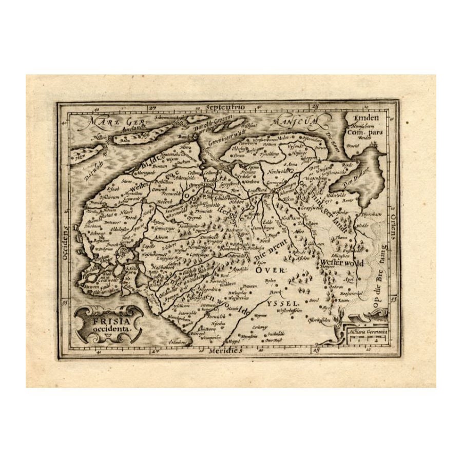
- Antique Map of Friesland by Guicciardini, 1613Located in Langweer, NLAntique map titled 'Frisia Occidenta.' (Map of the province of Friesland, the Netherlands.) This original old antique print / plate originates from the scarse French edition of 'Desc...Category
Antique 17th Century Maps
MaterialsPaper
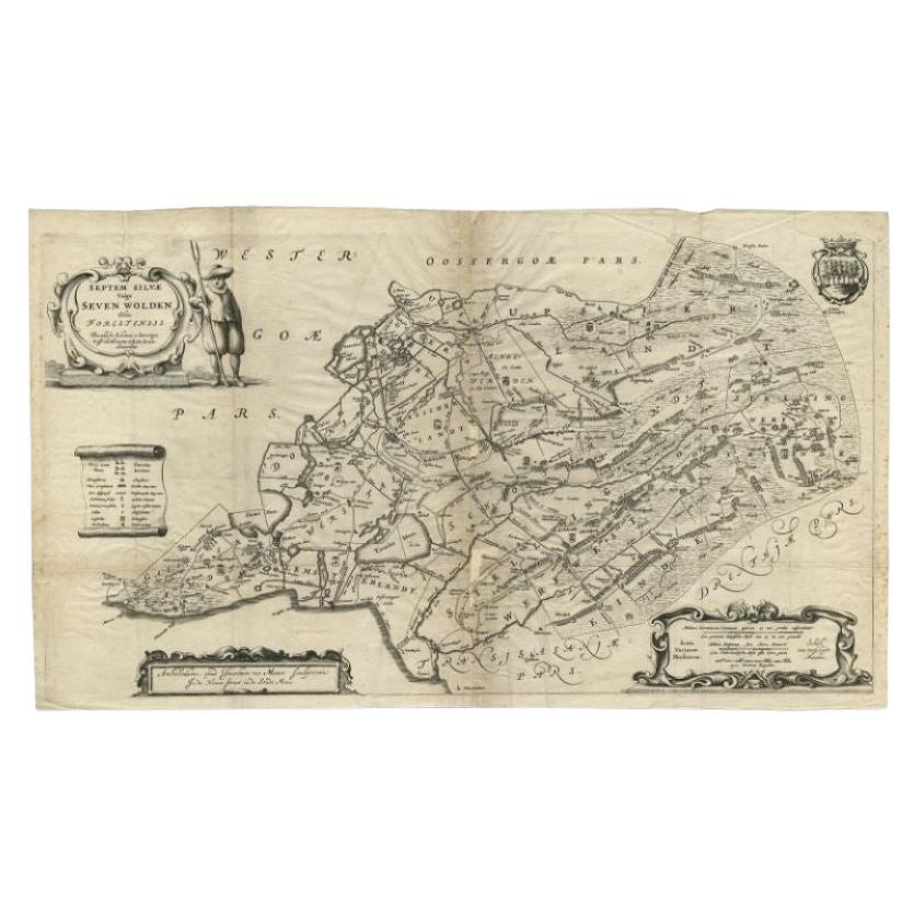
- Antique Map of Zevenwouden in Friesland by Schotanus, 1664Located in Langweer, NLAntique map titled 'Septem silvae vulgo Seven Wolden olim forestensis.' Map of the region of Zevenwouden in Friesland, the Netherlands. This region include the villages of Langweer, ...Category
Antique 17th Century Maps
MaterialsPaper
- Antique Map of Friesland in the Netherlands, 1770Located in Langweer, NLAntique map titled 'De Synode van Friesland, in VI Klassen verdeeld door W.A. Bachiene?. Map of the province of Friesland, the Netherlands. This map originates from 'Nieuwe kerkelyke...Category
Antique 18th Century Maps
MaterialsPaper

You May Also Like
- 1592 Abraham Ortelius Map "Lorraine: Lotharingiae Nova Descripti, Ric.A005Located in Norton, MA1592 Abraham Ortelius map entitled "Lorraine: Lotharingiae Nova Descripti Ric.a005 Description: Ortelius is best known for producing the atlas from which this map comes from, "...Category
Antique 16th Century Dutch Maps
MaterialsPaper
- Antique Hand Colored Framed Map of EuropeLocated in West Palm Beach, FLAntique reproduction copied from an edition dated 1595 by Ortelius.Category
Antique Late 19th Century Maps
- Framed Map of ChinaLocated in Greenwich, CTMap of China, 19th century. European print map of China Conservation frame with walnut frame Overall dimension : 28 1/2" wide 31" high 2" depth with fra...Category
Antique 19th Century European Qing Prints
MaterialsPaper
- Antique Lithography Map of Cheshire, English, Framed, Cartography, VictorianLocated in Hele, Devon, GBThis is an antique lithography map of Cheshire. An English, framed atlas engraving of cartographic interest, dating to the mid 19th century and lat...Category
Antique Mid-19th Century British Victorian Maps
MaterialsWood
- 1907 Map of Colorado, Antique Topographical Map, by Louis NellLocated in Colorado Springs, COThis highly detailed pocket map is a topographical map of the state of Colorado by Louis Nell from 1907. The map "has been complied from all availabl...Category
Antique Early 1900s American Maps
MaterialsPaper
- 1861 Topographical Map of the District of Columbia, by Boschke, Antique MapLocated in Colorado Springs, COPresented is an original map of Albert Boschke's extremely sought-after "Topographical Map of the District of Columbia Surveyed in the Years 1856 ...Category
Antique 1860s American Historical Memorabilia
MaterialsPaper


Recently Viewed
View AllMore Ways To Browse
Antique Antiques Art Collectables Collectables
Antique Frames Art Collectibles
Authentic Antique Frames
Antique Cologne
16th C Frame
Antique Curiosities Framed Art
Framed World Map
Antique Map Art Collectibles
Antique Maps Art Collectibles
Netherlands 16th Century
Antique Furniture In Texas
Antique Maps Of England
Antique Map Of England
Antique Furniture North East
Natural History Curiosities
Antique United States Maps
Antique Map United States
United States Map Antique