Items Similar to Antique Map of Westergo in Friesland, 1791

Want more images or videos?
Request additional images or videos from the seller
1 of 6
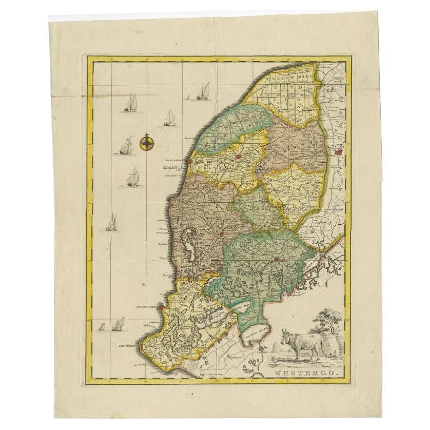
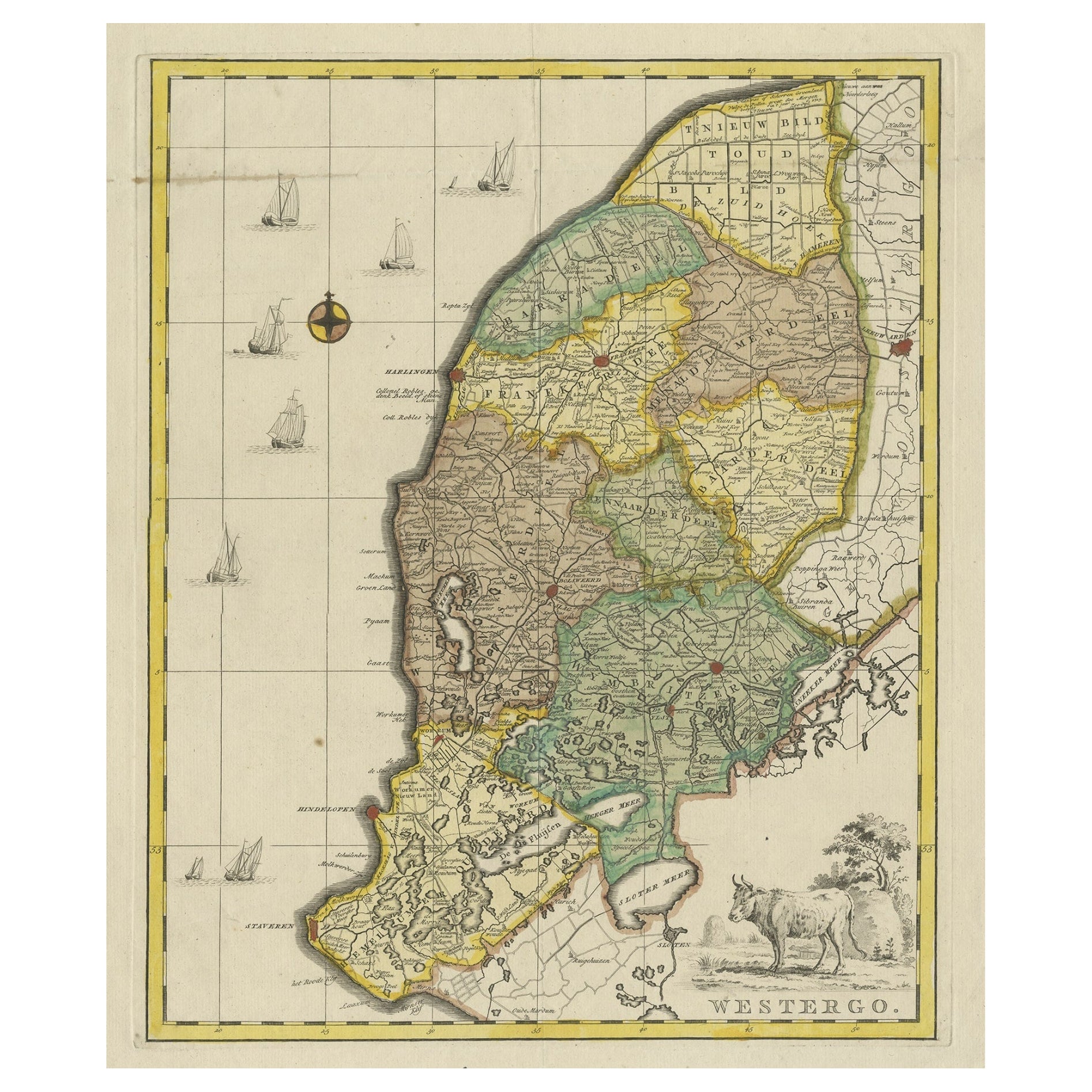
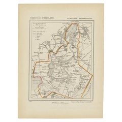
Antique Map of Westergo in Friesland, 1791
About the Item
Antique map titled 'Westergo'. Map of the Westergo region, Friesland, the Netherlands. This map orginates from 'Schauplatz der fünf Theile der Welt'.
Artists and Engravers: Franz Joseph Johann von Reilly (1766-1820) was a Vienna based art dealer. He is also known as the author of two atlases. The maps were engraved by Ignaz Alberti (also Ignaz Albrecht, 1760-1794). Ignaz was an Austrian illustrator, publisher and engraver.
Condition: Good, general age-related toning. Original/contemporary hand coloring. Blank verso. Please study image carefully.
Date: 1791
Overall size: 39 x 29 cm.
Image size: 24.5 x 21 cm.
We sell original antique maps to collectors, historians, educators and interior decorators all over the world. Our collection includes a wide range of authentic antique maps from the 16th to the 20th centuries. Buying and collecting antique maps is a tradition that goes back hundreds of years. Antique maps have proved a richly rewarding investment over the past decade, thanks to a growing appreciation of their unique historical appeal. Today the decorative qualities of antique maps are widely recognized by interior designers who appreciate their beauty and design flexibility. Depending on the individual map, presentation, and context, a rare or antique map can be modern, traditional, abstract, figurative, serious or whimsical. We offer a wide range of authentic antique maps for any budget.
- Dimensions:Height: 11.42 in (29 cm)Width: 15.36 in (39 cm)Depth: 0 in (0.01 mm)
- Materials and Techniques:
- Period:
- Date of Manufacture:1791
- Condition:Condition: Good, general age-related toning. Original/contemporary hand coloring. Blank verso. Please study image carefully.
- Seller Location:Langweer, NL
- Reference Number:
About the Seller
5.0
Platinum Seller
These expertly vetted sellers are 1stDibs' most experienced sellers and are rated highest by our customers.
Established in 2009
1stDibs seller since 2017
1,929 sales on 1stDibs
Typical response time: <1 hour
- ShippingRetrieving quote...Ships From: Langweer, Netherlands
- Return PolicyA return for this item may be initiated within 14 days of delivery.
More From This SellerView All
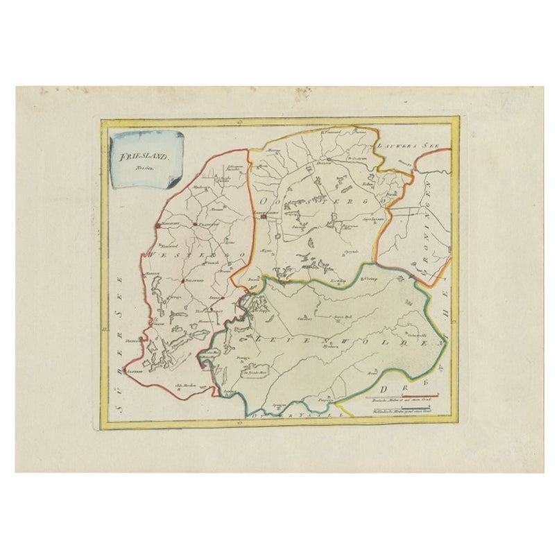
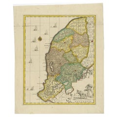
- Antique Map of Friesland by Von Reilly, 1791Located in Langweer, NLAntique map titled 'Friesland'. Map of the province of Friesland, the Netherlands. This map orginates from 'Schauplatz der fünf Theile der Welt'. Artists and Engravers: Franz Joseph ...Category
Antique 18th Century Maps
MaterialsPaper
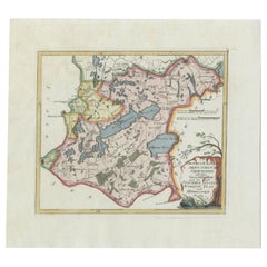
- Antique Map of Westergo, Friesland in the the Netherlands, by Tirion, 1744By Isaak TirionLocated in Langweer, NLAntique map titled 'Westergo'. Original antique map of Westergo, part of the province of Friesland, the Netherlands. Published 1744. Artists and Engravers: Isaak Tirion (1705 in U...Category
Antique 18th Century Maps
MaterialsPaper
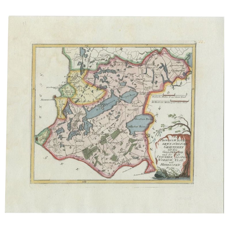
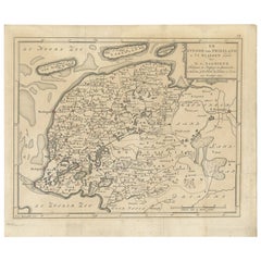
- Antique Map of the Region of Gaasterland, Friesland, The Netherlands, 1791Located in Langweer, NLAntique map titled 'Der Provinz Westergo zwey südliche Grietenyen mit dem Gaasterland und der Stadt Staveren, Sloten, Workum, Ylst und Hindelopen'. Map of the region of Gaasterland, ...Category
Antique 18th Century Maps
MaterialsPaper
- Antique Map of Friesland in the Netherlands, 1770Located in Langweer, NLAntique map titled 'De Synode van Friesland, in VI Klassen verdeeld door W.A. Bachiene?. Map of the province of Friesland, the Netherlands. This map originates from 'Nieuwe kerkelyke...Category
Antique 18th Century Maps
MaterialsPaper
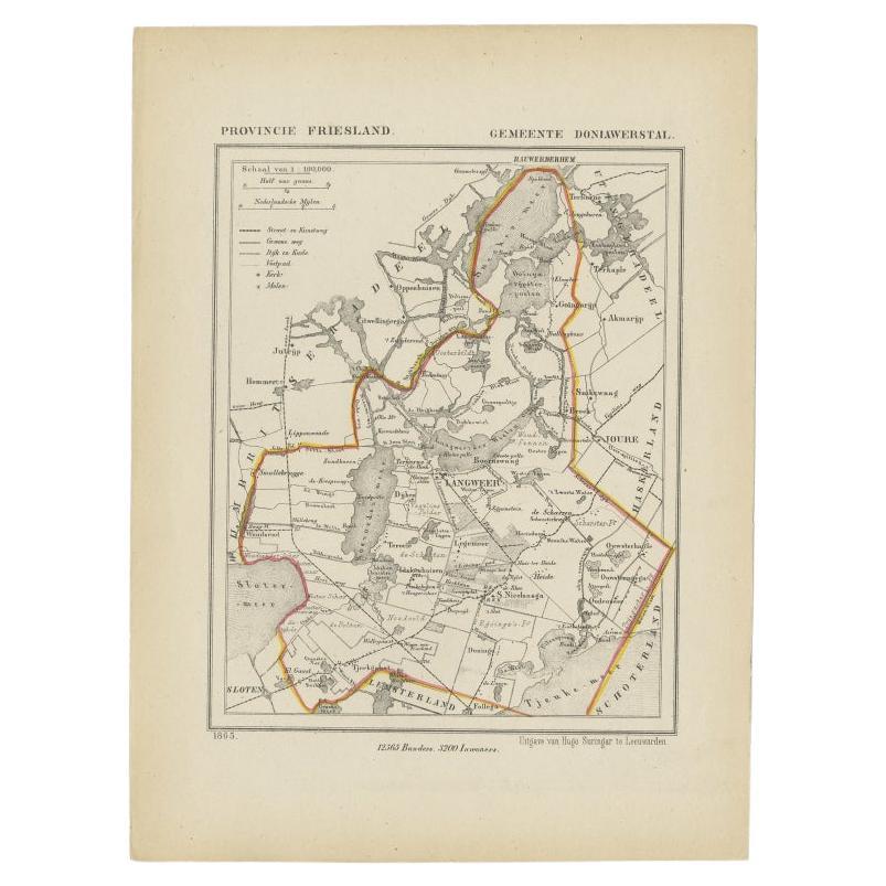
- Antique Map of Doniawerstal in Friesland, Holland, 1868Located in Langweer, NLAntique map titled 'Provincie Friesland - Doniawerstal'. Map of the township Doniawerstal including Langweer, Boornzwaag, Idskenhuizen and many other villages. This map originates fr...Category
Antique 19th Century Maps
MaterialsPaper
- Original Copper-Engraving of Westergo, Part of Friesland, the Netherlands, 1744Located in Langweer, NLAntique map titled 'Westergo'. Original antique map of Westergo, part of the province of Friesland, the Netherlands. Published 1744. Artists and engravers: Isaak Tirion (1705 ...Category
Antique 1740s Maps
MaterialsPaper


You May Also Like
- Antique Map of Principality of MonacoBy Antonio Vallardi EditoreLocated in Alessandria, PiemonteST/619 - "Old Geographical Atlas of Italy - Topographic map of ex-Principality of Monaco" - ediz Vallardi - Milano - A somewhat special edition ---Category
Antique Late 19th Century Italian Other Prints
MaterialsPaper
- Geographical Antique Map of Principality of MonacoBy Bruno SantiniLocated in Alessandria, PiemonteST/609 - Interesting antique color map of Monaco Principality in French language : "Carte qui contient le Principauté de Piémont, le Monferrat et la comté de...Category
Antique Late 18th Century Italian Other Maps
MaterialsPaper
- 1907 Map of Colorado, Antique Topographical Map, by Louis NellLocated in Colorado Springs, COThis highly detailed pocket map is a topographical map of the state of Colorado by Louis Nell from 1907. The map "has been complied from all availabl...Category
Antique Early 1900s American Maps
MaterialsPaper
- Original Antique Map of Italy. C.1780Located in St Annes, LancashireGreat map of Italy Copper-plate engraving Published C.1780 Unframed.Category
Antique Early 1800s English Georgian Maps
MaterialsPaper

- Original Antique Map of Asia. C.1780Located in St Annes, LancashireGreat map of Asia Copper-plate engraving Published C.1780 Two small worm holes to right side of map Unframed.Category
Antique Early 1800s English Georgian Maps
MaterialsPaper

- Original Antique Map of India. C.1780Located in St Annes, LancashireGreat map of India Copper-plate engraving Published C.1780 Three small worm holes to right side of map and one bottom left corner Unframed.Category
Antique Early 1800s English Georgian Maps
MaterialsPaper


Recently Viewed
View AllMore Ways To Browse
Cambodia Antique Map
Antique Map Singapore
Guyana Antique Map
Antique Map Vietnam
Antique Maps Michigan
Puerto Rico Map
Wisconsin Map
Antique Map Sydney
Antique Maps Sydney
J Beringer
Antique Map Of Michigan
Antique Wisconsin Maps
Bedfordshire Antique Map
Herefordshire Antique Map
Antique Furniture Pondicherry
Antique Indiana Map
Antique Maps Rhode Island
Buckinghamshire Antique Map