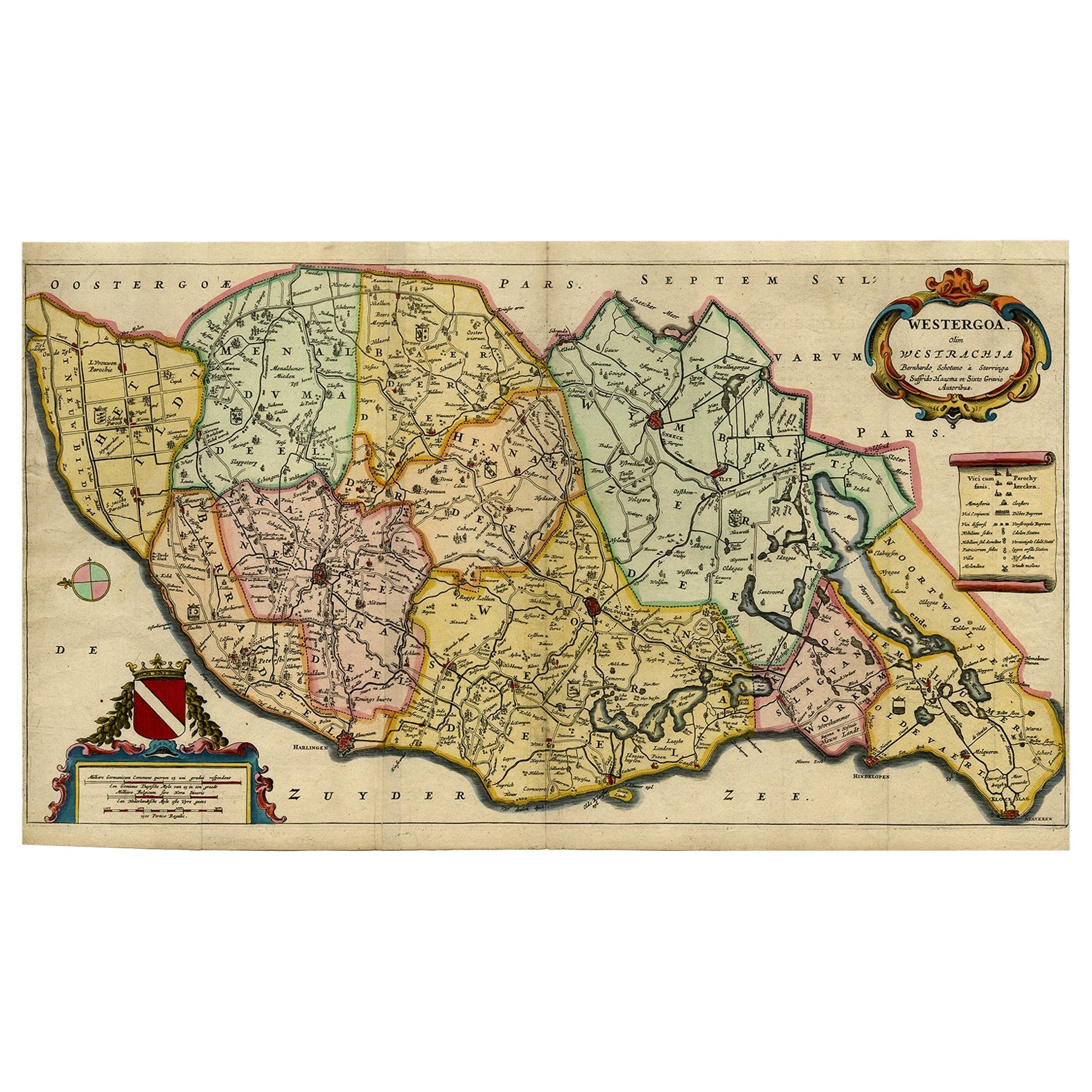
Items Similar to Original Copper-Engraving of Westergo, Part of Friesland, the Netherlands, 1744
Want more images or videos?
Request additional images or videos from the seller
1 of 5
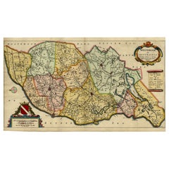
Original Copper-Engraving of Westergo, Part of Friesland, the Netherlands, 1744
About the Item
Antique map titled 'Westergo'.
Original antique map of Westergo, part of the province of Friesland, the Netherlands. Published 1744.
Artists and engravers: Isaak Tirion (1705 in Utrecht – 1765 in Amsterdam) was an 18th-century publisher from the Northern Netherlands.
- Dimensions:Height: 19.49 in (49.5 cm)Width: 15.75 in (40 cm)Depth: 0 in (0.02 mm)
- Materials and Techniques:
- Period:1740-1749
- Date of Manufacture:1744
- Condition:Wear consistent with age and use. Condition: Good, original/contemporary hand coloring. Original folding lines. General age-related toning, minor wear. Blank verso. Please study image carefully.
- Seller Location:Langweer, NL
- Reference Number:
About the Seller
5.0
Platinum Seller
These expertly vetted sellers are 1stDibs' most experienced sellers and are rated highest by our customers.
Established in 2009
1stDibs seller since 2017
1,948 sales on 1stDibs
Typical response time: <1 hour
- ShippingRetrieving quote...Ships From: Langweer, Netherlands
- Return PolicyA return for this item may be initiated within 14 days of delivery.
More From This SellerView All
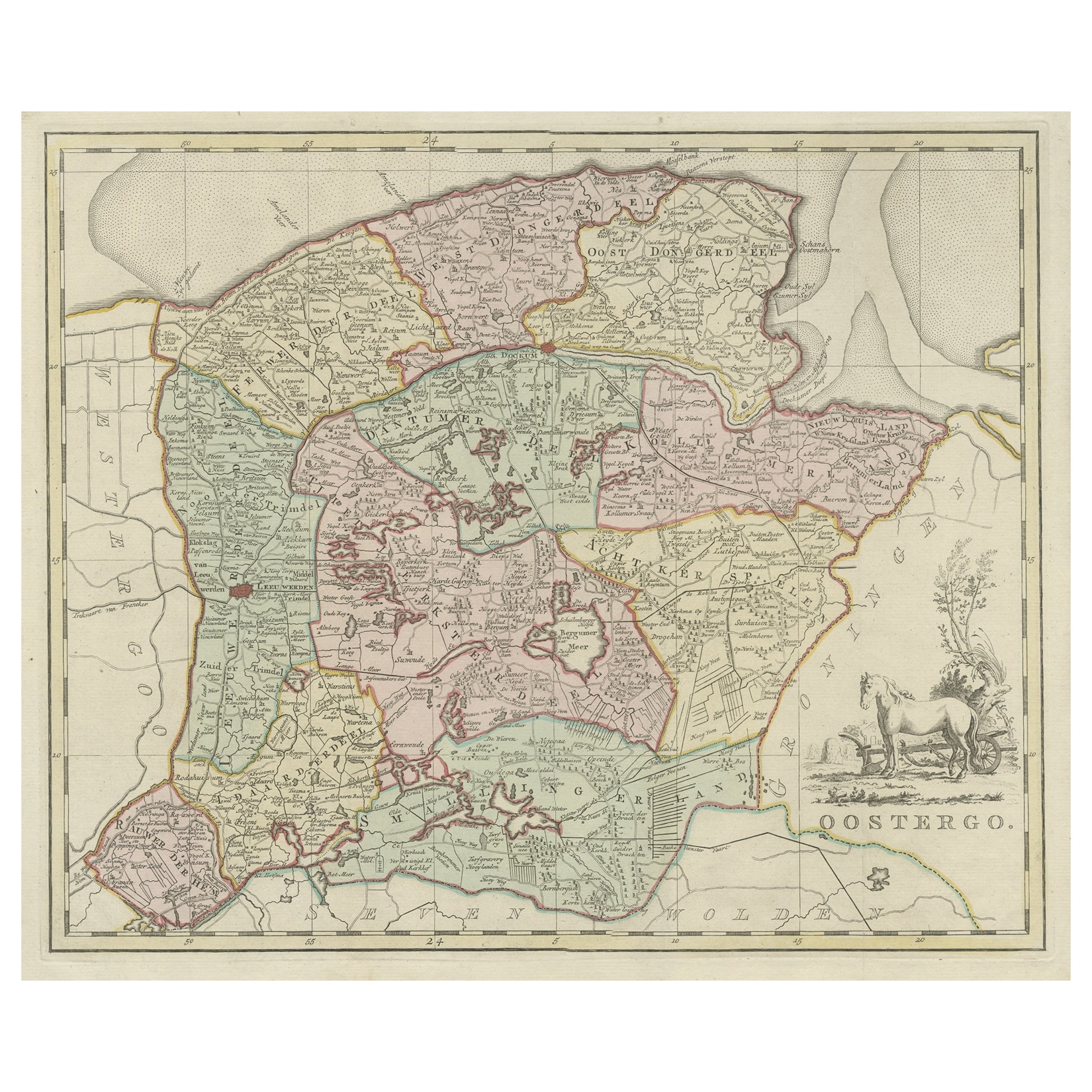
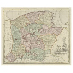
- Antique Map of Oostergo, Part of Friesland, the Netherlands. Published in 1744Located in Langweer, NLAntique map titled 'Oostergo'. Original antique map of Oostergo, part of the province of Friesland, the Netherlands. Published 1744. Artists and Engravers: Isaak Tirion (1705 in U...Category
Antique 1740s Maps
MaterialsPaper
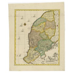
- Map of the Shire of Westergo in the Province of Friesland, the Netherlands, 1664Located in Langweer, NLAntique map titled 'Westergoa Olim Westrachia.' Map of the shire of Westergo in the province of Friesland in the Netherlands, including Stavoren, Bolswar...Category
Antique 1660s Maps
MaterialsPaper
- Antique Map of Westergo, Friesland in the the Netherlands, by Tirion, 1744By Isaak TirionLocated in Langweer, NLAntique map titled 'Westergo'. Original antique map of Westergo, part of the province of Friesland, the Netherlands. Published 1744. Artists and Engravers: Isaak Tirion (1705 in U...Category
Antique 18th Century Maps
MaterialsPaper
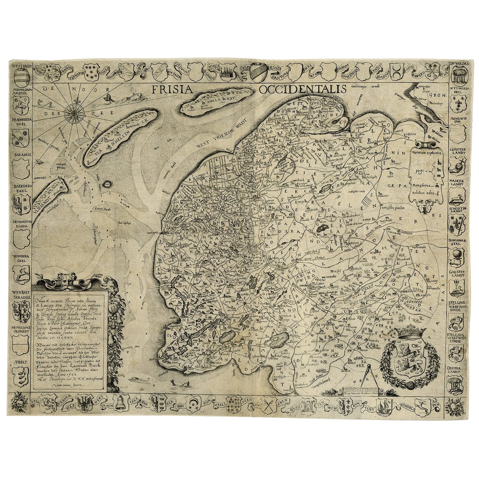
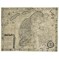
- Frisia Occidentalis, A Rare Antique Engraving of Friesland, The NetherlandsLocated in Langweer, NLAntique map titled 'Frisia Occidentalis.' - A very decorative map of the Dutch province Friesland, also showing the Wadden islands Terschelling and Ameland. With coats of arms of the...Category
Antique 1620s Maps
MaterialsPaper
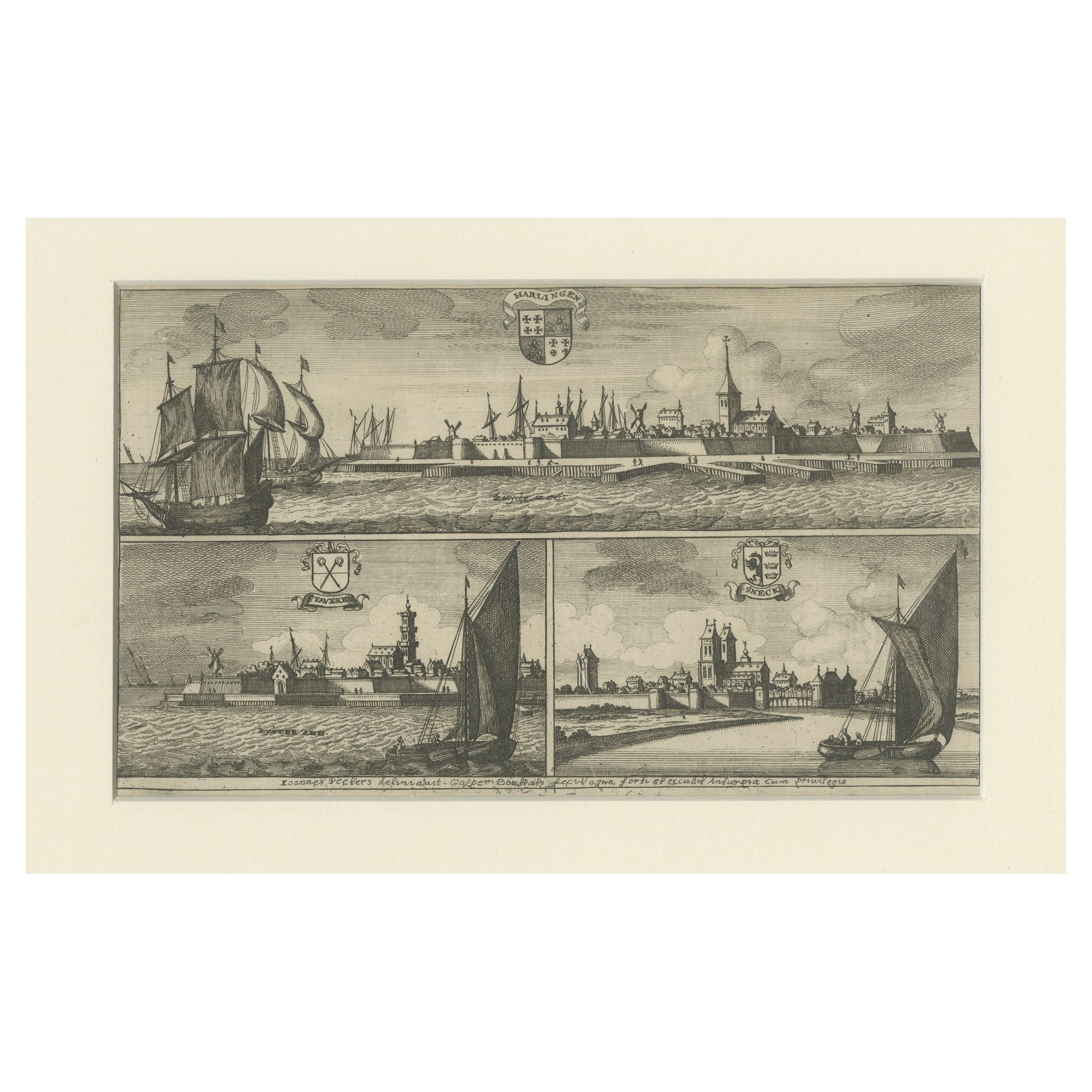
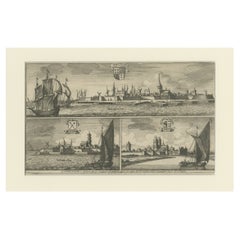
- Engravings of Harlingen, Stavoren and Sneek in Friesland, the Netherlands, 1680Located in Langweer, NLAntique print titled 'Harlingen, Staveren, Sneck'. Views of the cities of Harlingen, Stavoren and Sneek, Friesland, the Netherlands. This print originates from 'Thooneel der Steden e...Category
Antique 17th Century Prints
MaterialsPaper
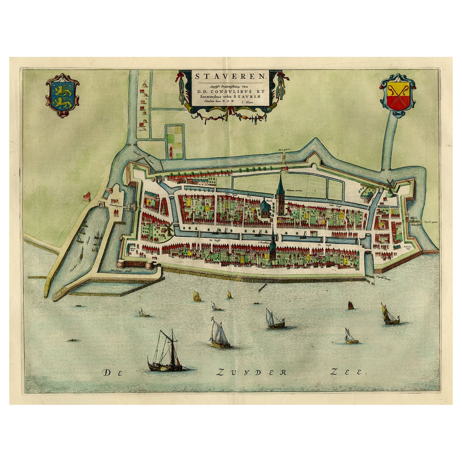
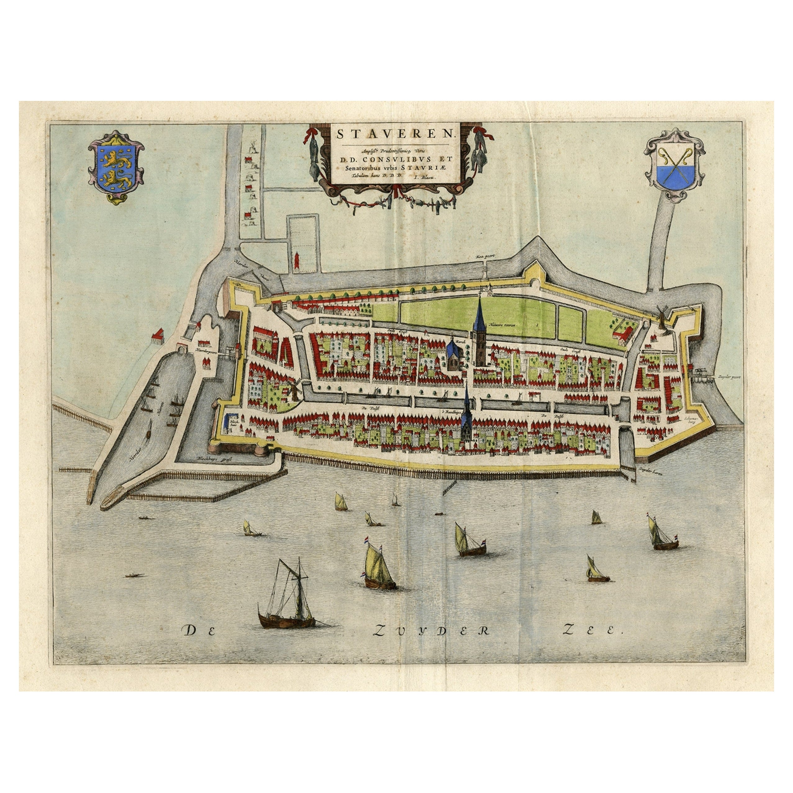
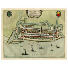
- Original Antique Map of the City of Stavoren, Friesland, The Netherlands, 1649Located in Langweer, NLAntique map titled 'Staveren'. Original antique map of the city of Stavoren, Friesland, The Netherlands. This map originates from 'Toonneel der Steden van de Vereenighde Nederlanden'...Category
Antique 1640s Maps
MaterialsPaper
You May Also Like
- Original Antique Map of The Netherlands, Sherwood, Neely & Jones, Dated 1809Located in St Annes, LancashireGreat map of The Netherlands Copper-plate engraving by Cooper Published by Sherwood, Neely & Jones. Dated 1809 Unframed.Category
Antique Early 1800s English Maps
MaterialsPaper
- Original Antique Map of The Netherlands, Engraved by Barlow, Dated 1807Located in St Annes, LancashireGreat map of Netherlands Copper-plate engraving by Barlow Published by Brightly & Kinnersly, Bungay, Suffolk. Dated 1807 Unframed.Category
Antique Early 1800s English Maps
MaterialsPaper
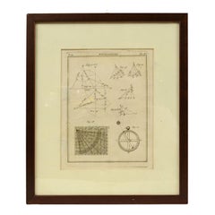
- Engraving on Copper Print from the Volume Navigazione Nautical Subject 1790Located in Milan, ITPrint by engraving on copper plate Tav III TIX fig. 17-22 from the volume Navigazione; with frame 28 x 33. Some calculations are depicted. Very good condition. Shipping is insured by...Category
Antique 1790s Italian Nautical Objects
MaterialsPaper
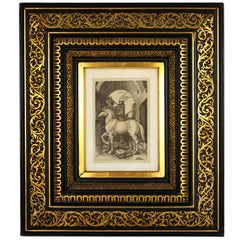
- Albrecht Dürer "The Small Horse, " 19th Century Copper Plate EngravingBy Albrecht DürerLocated in Barcelona, ES"The Small Horse" copper plate engraving by Albrecht Dürer, circa 1505. This is a 19th century engraving, printed in black on laid paper, framed by a beautiful gilt and ebonized carv...Category
Antique Late 19th Century French Renaissance Prints
MaterialsWood, Paper
- “The Restaurant of the House of Representatives” Engraving by Harper's WeeklyLocated in Colorado Springs, COThis original wood engraving is titled “The Restaurant of the House of Representatives, Washington, DC.” It was published as a double-page image, in the August 12, 1893 issue of the famous 19th century newspaper Harper’s Weekly. The print was illustrated by Charles Stanley Reinhardt. The House Restaurant, a unique part of life in the Capitol, has been in the same location since the 1857 Capitol Expansion. Congressional members’ busy work schedule made the availability of food on site a necessity. But the restaurant also served as an informal meeting spot for members to continue conversations and deal making. This 1893 print illustrates the convivial atmosphere. Details including elegantly dressed tables...Category
Antique 1890s American Prints
MaterialsPaper
- 1876 "Gettysburg, The Repulse of Longstreet's Assault." EngravingLocated in Colorado Springs, COPresented here is an 1876 engraving of John B. Bachelder and James Walker’s Gettysburg. The Repulse of Longstreet’s Assault. The engraved scene depicts the decisive battle on the final day of the Battle of Gettysburg. Researched by the photographer and topographer John B. Bachelder and painted by James Walker, the original painting was created in 1870. This detailed engraving was done by H. B. Hall Jr. and published by James Drummond Ball. Otherwise called Pickett’s Charge, the battle occurred on July 3, 1863. Pickett’s corp commander, Lieutenant General James Longstreet was placed in charge of the attack despite his hesitations. Longstreet’s central role led to the title of the work, Repulse of Longstreet’s Assault. In an attempt to gain control of an important supply route, nine Confederate brigades charged across three-quarters of a mile of open ground against cannon fire to take Cemetery Ridge from the defending Union Army. Despite their overwhelming numbers, the Confederate forces were repelled with considerable casualties marking not only a decisive victory for the Union, but also the beginning of the slow defeat of Lee’s Army. The furthest the charging forces advanced before being repulsed would forever be known as the “High Water Mark of the Confederacy.” The Confederate army never recovered from the losses at Gettysburg and it effectively ended Lee’s campaign into Pennsylvania. The engraving gives the perspective from the Union rear, one that encompasses most of the battlefield, from Big Round Top on the left to the northern reaches of Cemetery Ridge on the right. The Confederate lines at Seminary Ridge are in the far distance, partially obscured by bursting shells. The image centers on the main Confederate assault, in the vicinity of what today are known as "The Copse" and "The Bloody Angle." The composition has elemen...Category
Antique 1870s American Prints
MaterialsPaper