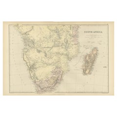
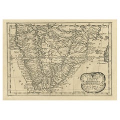
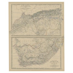
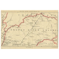
South Africa Antique Map
7
to
18
97
38
71
49
41
25
23
23
17
16
11
10
9
8
8
8
7
6
4
3
3
3
3
3
3
2
2
2
2
2
2
1
1
1
1
1
1
1
1
1
1
1
7
4
2
2
2
Sort By
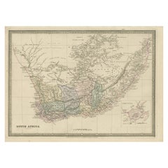
Antique Map of South Africa by Wyld '1845'
Located in Langweer, NL
Antique map titled 'South Africa'. Original antique map of South Africa.
This decorative original
Category
Mid-19th Century South Africa Antique Map
Materials
Paper
Antique Map of South Africa by Lowry, 1852
Located in Langweer, NL
Antique map titled 'South Africa'. Two individual sheets of South Africa. This map originates from
Category
Mid-19th Century South Africa Antique Map
Materials
Paper
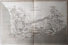
Original Antique Map of South Africa, Arrowsmith, 1820
Located in St Annes, Lancashire
Great map of South Africa.
Drawn under the direction of Arrowsmith.
Copper-plate engraving
Category
1820s English South Africa Antique Map
Materials
Paper
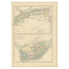
Antique Map of North Africa and South Africa by Black, 1854
Located in Langweer, NL
Antique map titled 'Africa north part - Africa south part'. Old map of Africa showing the region of
Category
19th Century South Africa Antique Map
Materials
Paper
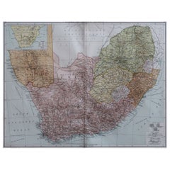
Large Original Vintage Map of South Africa, circa 1920
Located in St Annes, Lancashire
Great map of South Africa
Original color.
Good condition / repair to a minor edge tear middle
Category
1920s English Edwardian South Africa Antique Map
Materials
Paper
Antique Decorative Coloured Map of South Africa and Madagascar, 1882
Located in Langweer, NL
The map of South Africa is from the Blackie & Son Atlas, published in 1882. This historical map is
Category
1880s South Africa Antique Map
Materials
Paper
Free Shipping
H 14.97 in W 22.45 in D 0 in
Original Copperplate Engraved Detailed Map of South Africa, ca.1680
Located in Langweer, NL
South Africa. Engraved by Antoine d'Winter for a Dutch edition of Sanson's pocket atlas.
Artists and
Category
1680s South Africa Antique Map
Materials
Paper
Antique Map of North and South Africa by Johnston, 1882
Located in Langweer, NL
Two antique maps on one sheet titled 'N.W. Africa, Marocco, Algeria & Tunis' and 'Southern Africa
Category
19th Century South Africa Antique Map
Materials
Paper
Antique Map of the Orange River Colony in South Africa, 1901
Located in Langweer, NL
colony ceased to exist in 1910, when it was absorbed into the Union of South Africa as Orange Free State
Category
Early 20th Century South Africa Antique Map
Materials
Paper
Antique Map of South Africa showing the Travels of Truter and Somerville
Located in Langweer, NL
Antique map titled 'Charte von Süd-Afrika'. Original antique map of South Africa showing the
Category
Early 19th Century South Africa Antique Map
Materials
Paper
H 12.6 in W 16.93 in D 0.02 in
Antique Map of South American, The West Indies & Most of Africa, Ca.1775
Located in Langweer, NL
du Commerce des Europeens dans les deux Indes'.
This map is roughly centered on South America
Category
1770s South Africa Antique Map
Materials
Paper
H 15.04 in W 19.77 in D 0 in
Antique Map of North-Western and South Africa by A.K. Johnston, 1865
Located in Langweer, NL
Two maps on one sheet titled 'North-Western Africa' and 'Southern Africa'. Depicting Morocco
Category
Mid-19th Century South Africa Antique Map
Materials
Paper
Antique Map of Saldanha Bay 'Near Cape Town, South Africa' by Bellin, 1750
By Jacques-Nicolas Bellin
Located in Langweer, NL
Navigateurs’. Detailed plan of Saldanha Bay, northwest of Cape Town, South Africa. This map originates from
Category
18th Century South Africa Antique Map
Materials
Paper
H 8.86 in W 11.42 in D 0.01 in
Very Attractive Map of North and South America and Western Part of Africa, 1744
Located in Langweer, NL
western part of Africa and south west Europe. With full contemporary hand colouring. This map originates
Category
18th Century South Africa Antique Map
Materials
Paper
H 16.34 in W 21.26 in D 0 in
Old Map of the Namibia and South Africa Coasts & Inset of Saldanha Bay, ca.1700
Located in Langweer, NL
and South Africa. With an inset map of Saldanha Bay.
Artists and Engravers: Published by H
Category
Early 1700s South Africa Antique Map
Materials
Paper
H 24.81 in W 20.87 in D 0 in
Antique Map of the Coast of Angola Up to Port Elizabeth in South Africa, 1675
Located in Langweer, NL
map depicts the coast of Angola, South-West Africa and South Africa up to Port Elizabeth. The
Category
1670s South Africa Antique Map
Materials
Paper
H 21.26 in W 24.41 in D 0 in
Antique Map of North Africa by Ortelius, c.1580
Located in Langweer, NL
Africa. The map covers the regions of Barbaria and Biledulgerid, essentially the territories north and
Category
16th Century South Africa Antique Map
Materials
Paper
Antique Hand-Coloured Map of North and South America, ca.1765
Located in Langweer, NL
Description: Antique map titled 'Nieuwe Kaart van Amerika.' Attractive map of North and South
Category
1760s South Africa Antique Map
Materials
Paper
Original Detailed Antique Map of the East Coast of Africa, 1747
Located in Langweer, NL
'.
Original antique map of the east coast of Africa. Reaches from Cape of Good Hope and the land of the
Category
1740s South Africa Antique Map
Materials
Paper
Antique Map of Africa with a Decorative Dedication to the Dauphin, 1717
Located in Langweer, NL
Decouvertes (..).'
This map is a reduced derivative of De Fer's wall map of Africa (1696-98) with its
Category
18th Century South Africa Antique Map
Materials
Paper
Africa: A Large 17th Century Hand-Colored Map by Sanson and Jaillot
By Nicolas Sanson
Located in Alamo, CA
This large original hand-colored copperplate engraved map of Africa entitled "L'Afrique divisee
Category
1690s French South Africa Antique Map
Materials
Paper
Antique Old Map of Africa with Insets of Mauritius, Reunion and Natal, 1882
Located in Langweer, NL
The uploaded image is a historical map of Africa from the 1882 atlas by Blackie & Son. The map
Category
1880s South Africa Antique Map
Materials
Paper
Free Shipping
H 14.97 in W 22.45 in D 0 in
Sea Chart Titled 'Baya de Saldanha' with Robben Island in South Africa, 1726
Located in Langweer, NL
Antique map titled 'Baya de Saldanha'.
Sea chart covering the South African coast from the Cape
Category
1720s South Africa Antique Map
Materials
Paper
H 13.39 in W 15.95 in D 0 in
Antique Map of the Coast of Zanguebar and Madagascar 'Africa' by J. van Schley
Located in Langweer, NL
Decorative map of the area between the east coast of South Africa, the Seychelles, Mauritius and
Category
Mid-18th Century South Africa Antique Map
Materials
Paper
H 10.24 in W 12.8 in D 0.02 in
Authentic Map of the Coast from Cape Formosa to the Dony River, Africa, 1732
Located in Langweer, NL
Antique map titled 'The New Correct Mapp of Calbar River vulgarly call'd Calabar (..)'.
An
Category
1730s South Africa Antique Map
Materials
Paper
No Reserve
H 12.76 in W 17.25 in D 0 in
Dutch Antique Map of the West Coast of Africa, to the Cape of Good Hope, 1747
Located in Langweer, NL
west coast of Africa, from 11 degrees south latitude to the Cape of Good Hope. This map originates from
Category
1740s South Africa Antique Map
Materials
Paper
H 10.63 in W 12.6 in D 0 in
Old Print with a View of the Cape of Good Hope and Table Bay, South Africa, 1750
Located in Langweer, NL
Antique print titled 'Gezigt van de Kaap de Goede-Hoop'.
Old print with a view of the Cape of Good Hope and Table Bay. Engraved by J. van Schley for a Dutch edition of 'l'Histoir...
Category
1750s South Africa Antique Map
Materials
Paper
H 9.93 in W 7.17 in D 0 in
Bay of Arguin, West Coast of Africa from Cape Blanco to Tanit, Africa, 1747
Located in Langweer, NL
Arguin on the West Coast of Africa from Cape Blanco in the north to Tanit in the south. This map
Category
1740s South Africa Antique Map
Materials
Paper
H 10.75 in W 8.19 in D 0 in
Puzzle Atlas with Maps, Italy, circa 1900
Located in Milan, IT
of Italy, Europe, North America, South America, Asia and Africa. Models for teaching class. G.B
Category
Early 20th Century Italian South Africa Antique Map
Materials
Wood, Paper
Antique Map of the Sinai Peninsula, '1895'
Located in Langweer, NL
the north and the Red Sea to the south, and is a land bridge between Asia and Africa. Published by D
Category
Late 19th Century South Africa Antique Map
Materials
Paper
Antique Map of Northern Natal by Stanford, 1900
Located in Langweer, NL
British colony in south-eastern Africa. It was proclaimed a British colony on 4 May 1843 after the British
Category
Early 20th Century South Africa Antique Map
Materials
Paper
Antique Map of Asia by A. Blondeau, circa 1800
Located in Langweer, NL
Africa and the Mediterranean east to the Bering Sea and south as far as Java and New Guinea. This map is
Category
Early 19th Century South Africa Antique Map
Materials
Paper
Original Steel Engraved Map of French Colonies in America, 1854
Located in Langweer, NL
Antique map titled 'Colonies Francaises (en Amerique)'. Detailed map bordered by vignettes showing
Category
Mid-19th Century South Africa Antique Map
Materials
Paper
Free Shipping
H 13.12 in W 18.71 in D 0.02 in
Antique Map of Edom, an Ancient Kingdom in Transjordan, 1773
Located in Langweer, NL
Antique print titled 'Idumea, of thet Land der Philistynen'. Old map of Edom, an ancient kingdom in
Category
18th Century South Africa Antique Map
Materials
Paper
Antique Map Showing the Religions Around the World by Johnston '1854'
Located in Langweer, NL
and Pagans. Three side maps show the distribution of missions in India, South Africa and Canada. Two
Category
Mid-19th Century South Africa Antique Map
Materials
Paper
No Reserve
H 21.66 in W 26.38 in D 0.02 in
Antique Map of the region near Annesley Bay by Wagner, 1870
Located in Langweer, NL
Annesley Bay (Gulf of Zula, Bay of Arafali), Eritrea, Africa. The bay is located about 30 miles south of
Category
Mid-19th Century South Africa Antique Map
Materials
Paper
St. Christophe 'St. Kitts' Island: An 18th Century Hand-colored Map by Bellin
By Jacques-Nicolas Bellin
Located in Alamo, CA
Jacques Bellin's copper-plate map of the Caribbean island of Saint Kitts entitled "Carte De De
Category
Mid-18th Century French South Africa Antique Map
Materials
Paper
H 10 in W 14.25 in D 0.07 in
Antique Map of Mozambique Channel with Madagascar and Inset of Cape Region, 1780
Located in Langweer, NL
Cape of Good Hope to Melinde. The inset map shows the Cape region in South Africa with False Bay
Category
18th Century South Africa Antique Map
Materials
Paper
H 14.97 in W 10.24 in D 0 in
Antique Map of the Harbour of Praia, Santiago Island, Cape Verde, c.1750
Located in Langweer, NL
colonisation of Africa and South America by the Portuguese. With 817,845 metric tonnes of cargo and 85,518
Category
18th Century South Africa Antique Map
Materials
Paper
Antique Map of the Southern Part of the Orange River Colony by Stanford, 1901
Located in Langweer, NL
colony ceased to exist in 1910, when it was absorbed into the Union of South Africa as Orange Free State
Category
Early 20th Century South Africa Antique Map
Materials
Paper
H 7.88 in W 7.88 in D 0.02 in
Old Map of the Sinai Peninsula Showing the Mediterranean and the Red Sea, 1773
Located in Langweer, NL
the south.
The map is decorated with images of a Persian wheel and a view of a village near the
Category
1770s South Africa Antique Map
Materials
Paper
H 17.05 in W 21.19 in D 0 in
Antique Map of Mozambique and Cape of Good Hope with Kingdom Monomotapa, 1780
Located in Langweer, NL
, details the Dutch claims in the western of South Africa from the Cape of Good Hope north as far as St
Category
18th Century South Africa Antique Map
Materials
Paper
H 14.69 in W 10.44 in D 0 in
Ancient Cartography of the Indian Subcontinent, Published in 1880
Located in Langweer, NL
Africa.
5. **Latin Labels**: Following the convention of the time it was created, the map uses Latin for
Category
1880s South Africa Antique Map
Materials
Paper
Free Shipping
H 15.56 in W 18.51 in D 0 in
Very Large Hand-Drawn View of St Iago Cape Verde, by Frederici, 1783
Located in Amsterdam, NL
The largest recorded early modern panoramic view of Cape Verde, by “the best VOC map maker in South
Category
Late 18th Century Cape Verdean Dutch Colonial South Africa Antique Map
Materials
Paper
Free Shipping
H 11.62 in W 47.45 in D 0.08 in
Original Antique Sea Chart of the Coastline from England to Gibraltar, ca.1700
Located in Langweer, NL
Antique map titled 'A Chart of the Sea-Coast from England to the Streights.'
Original antique map
Category
Early 1700s South Africa Antique Map
Materials
Paper
No Reserve
H 18.47 in W 23.55 in D 0 in
Miniature Terrestrial Globe Newton & Son London, Post 1833, Ante 1858
By Newton and Son
Located in Milano, IT
1831 and the "Land of Enderby" which he discovered on the coast of Antarctica, south of Africa, are
Category
1840s English Early Victorian South Africa Antique Map
Materials
Bronze
Pair of Miniature Globes Lane’s on Tripod Bases, London post 1833, ante 1858
By Lane's
Located in Milano, IT
Much of central Africa is empty and the great lakes Tanganyika and Victoria are not marked (Europeans
Category
1840s English Early Victorian South Africa Antique Map
Materials
Paper, Wood
View of the Island Onrust Near Batavia 'Jakarta', Indonesia, 1739
Located in Langweer, NL
this tradition when they interned Chris Soumokil president of the Republic of South Maluku. On 12 April
Category
1730s South Africa Antique Map
Materials
Paper
Antique Map of the Southern Oceans, South America and Africa
Located in Larchmont, NY
Antique Map of the South Atlantic, c. 1800s
Engraving
20 x 28 in.
Framed: 25 3/4 x 33 3/4 in.
Category
19th Century Realist South Africa Antique Map
Materials
Engraving
H 25.75 in W 33.75 in D 0.75 in
Africa: A Large 17th Century Hand-colored Map By Sanson and Jaillot
By Nicholas Sanson d'Abbeville
Located in Alamo, CA
This large original hand-colored copperplate engraved map of Africa entitled "L'Afrique divisee
Category
1690s South Africa Antique Map
Materials
Engraving
Map of the World: An Original 18th Century Hand-colored Map by E. Bowen
Located in Alamo, CA
America, South America, Europe, Africa, and Asia are depicted, as well as various islands in the Atlantic
Category
Mid-18th Century Old Masters South Africa Antique Map
Materials
Engraving
Map of the Russian Empire: An Original 18th Century Hand-colored Map by E. Bowen
Located in Alamo, CA
Isles, Europe, North America, Africa, and Asia. He also created maps for several important atlases
Category
Mid-18th Century Old Masters South Africa Antique Map
Materials
Engraving
Map of the East Indies: An Original 18th Century Hand-colored Map by E. Bowen
Located in Alamo, CA
the British Isles, Europe, North America, Africa, and Asia. He also created maps for several important
Category
Mid-18th Century Old Masters South Africa Antique Map
Materials
Engraving
Map Tabula Asiae IX Pakistan Afghanistan Iran Indian Ocean
Located in Florham Park, NJ
thirty-seven were considered “modern maps”. These showed early glimpses of North and South America
Category
16th Century Realist South Africa Antique Map
Materials
Copper
H 16.75 in W 19 in D 2 in
St. Christophe (St. Kitts): Bellin 18th Century Hand Colored Map
Located in Alamo, CA
Jacques Bellin's copper-plate map of the Caribbean island of Saint Kitts entitled "Carte De De
Category
1740s Other Art Style South Africa Antique Map
Materials
Engraving
Europe: An Original 18th Century Hand-colored Map by E. Bowen
Located in Alamo, CA
Mediterranean Sea in the south. Iceland is also included in the northwest, Russia in the east and North Africa
Category
Mid-18th Century Old Masters South Africa Antique Map
Materials
Engraving
China: An Original 18th Century Hand-colored Map by E. Bowen
Located in Alamo, CA
cities of China and a portion of Mongolia in the north and Southeast Asia in the south..
The map is
Category
Mid-18th Century Old Masters South Africa Antique Map
Materials
Engraving
H 15.75 in W 19.75 in
Mediterranean and Adriatic Seas: Original 18th Century Hand-colored Map by Bowen
Located in Alamo, CA
range of maps, including maps of the British Isles, Europe, North America, Africa, and Asia. He also
Category
Mid-18th Century Old Masters South Africa Antique Map
Materials
Engraving
Europa Regnorum Provinciarum: 18th Century Hand-colored Map of Europe by Lotter
By Tobias Conrad Lotter
Located in Alamo, CA
extends from Iceland, Scandinavia and Russia in the north to North Africa in the south.
This beautiful
Category
Mid-18th Century South Africa Antique Map
Materials
Engraving
Asia Declineatio: A 17th Century Hand-colored Map of Asia by Justus Danckerts
Located in Alamo, CA
"Atlas Coelestis". He created maps of Europe, Asia, Africa, and the Americas, as well as city plans of
Category
Late 17th Century Old Masters South Africa Antique Map
Materials
Engraving
- 1
Get Updated with New Arrivals
Save "South Africa Antique Map", and we’ll notify you when there are new listings in this category.
South Africa Antique Map For Sale on 1stDibs
At 1stDibs, there are many versions of the ideal south africa antique map for your home. Each south africa antique map for sale was constructed with extraordinary care, often using paper. Whether you’re looking for an older or newer south africa antique map, there are earlier versions available from the 18th Century and newer variations made as recently as the 20th Century. Jacques-Nicolas Bellin each produced at least one beautiful south africa antique map that is worth considering.
How Much is a South Africa Antique Map?
The average selling price for a south africa antique map at 1stDibs is $284, while they’re typically $167 on the low end and $1,247 for the highest priced.
More Ways To Browse
Charles Morin Fine Art
South Seas Tribal Art
G Plan Ottoman
Isle Royale
Pro Patria
3 Carat Solitaire Tiffany Setting
Missouri Sellers
Antique Maps Of South Carolina
F Gall
Gibraltar Antique Map
Antique Blanco
Armenian Map
Tiffany And Co Ruby Engagement Ring
Tiffany And Co Ruby Engagement Rings
Personalized Tiffany
Tiffany Personalization
Armenia Map
Tiffany Silver Cigarette
