Items Similar to Antique Map of the Coast of Angola Up to Port Elizabeth in South Africa, 1675


Want more images or videos?
Request additional images or videos from the seller
1 of 5
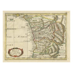
Antique Map of the Coast of Angola Up to Port Elizabeth in South Africa, 1675
About the Item
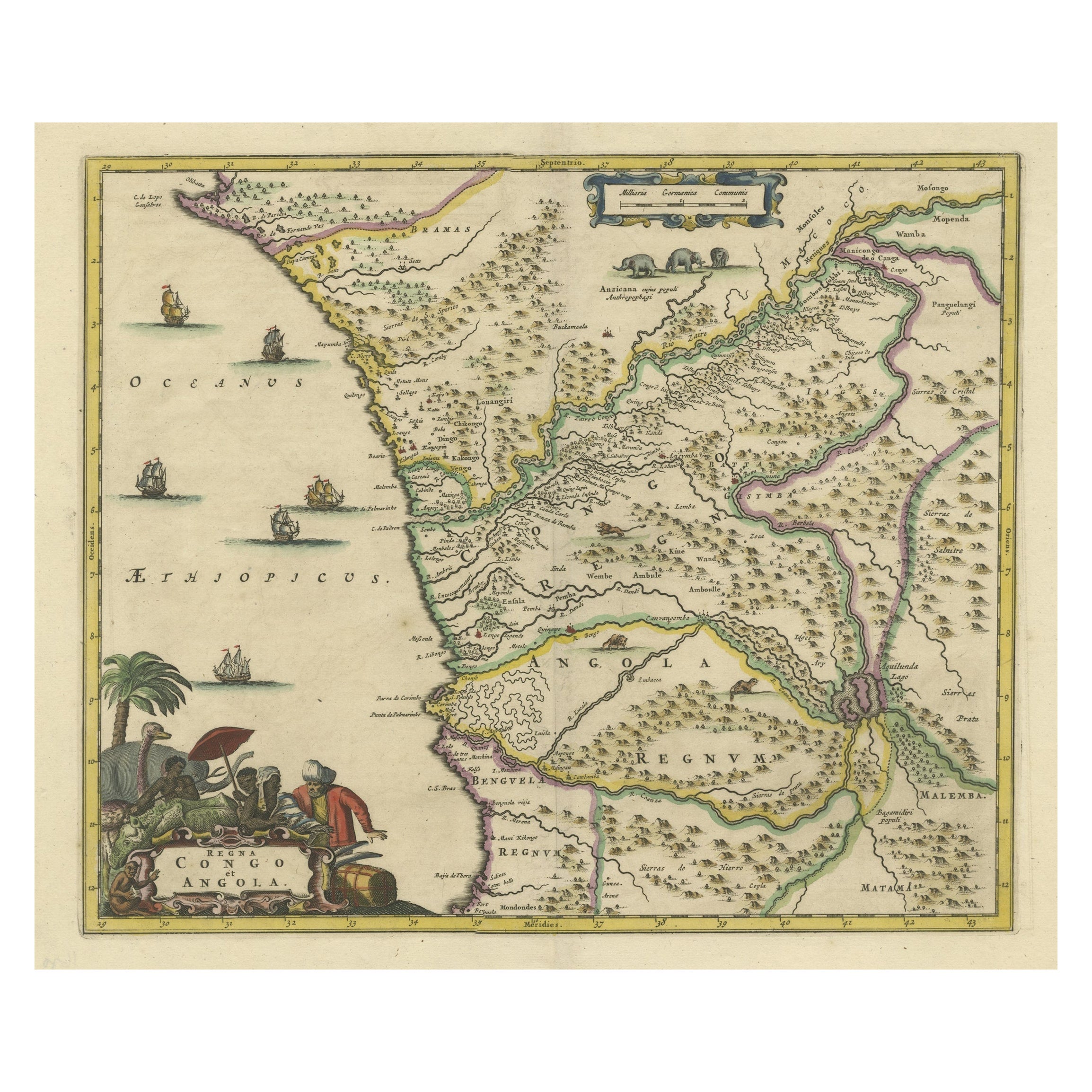
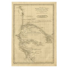
Antique map titled 'Cimbebas et Caffariae Littora a Catenbela ad Promontorium Bonae Spei'.
This map depicts the coast of Angola, South-West Africa and South Africa up to Port Elizabeth. The southwestern coastline is covered including the Cape of Good Hope. The large title cartouche is a great compendium of Africa featuring exotic wildlife, European traders and natives. At the bottom right a large vignette shows Neptune and his consort in a chariot drawn by three aquatic horses.
Artists and Engravers: Frederick de Wit [1629-1706 was known as a map publisher, engraver and seller. He worked in Amsterdam from the Kalverstraat (‘bij den Dam inde dry Crabben) to 1654 and then from ‘in de Witte paskaert from 1655 to 1706. He produced a prodigious amount of cartographic material including separate terrestrial maps and sea charts, sea and terrestrial atlases, wall maps, and town views. Many of his maps were superbly colored by master Dutch colourists of his day such as Dirck van Santen. De Wit also acquired numerous copperplates from those auctioned by the Blaeu and Janssonius publishing houses sometime after 1674 and republished these works, often with his imprint added. On his death in 1706, The business was continued for a time by his widow Maria untill 1709. In 1710, the De Wit plates were sold to Mortier, Van der Aa, and Renard.
Condition: Overall in good condition, some damages in title cartouche, large part repaired. Repair on folding line. General age-related toning, please study image carefully.
- Dimensions:Height: 21.26 in (54 cm)Width: 24.41 in (62 cm)Depth: 0 in (0.02 mm)
- Sold As:Set of 2
- Materials and Techniques:
- Period:1670-1679
- Date of Manufacture:1675
- Condition:Repaired: Overall in good condition, some damages in title cartouche, large part repaired. Repair on folding line. General age-related toning, please study image carefully. Wear consistent with age and use.
- Seller Location:Langweer, NL
- Reference Number:
About the Seller
5.0
Platinum Seller
These expertly vetted sellers are 1stDibs' most experienced sellers and are rated highest by our customers.
Established in 2009
1stDibs seller since 2017
1,919 sales on 1stDibs
Typical response time: <1 hour
- ShippingRetrieving quote...Ships From: Langweer, Netherlands
- Return PolicyA return for this item may be initiated within 14 days of delivery.
More From This SellerView All
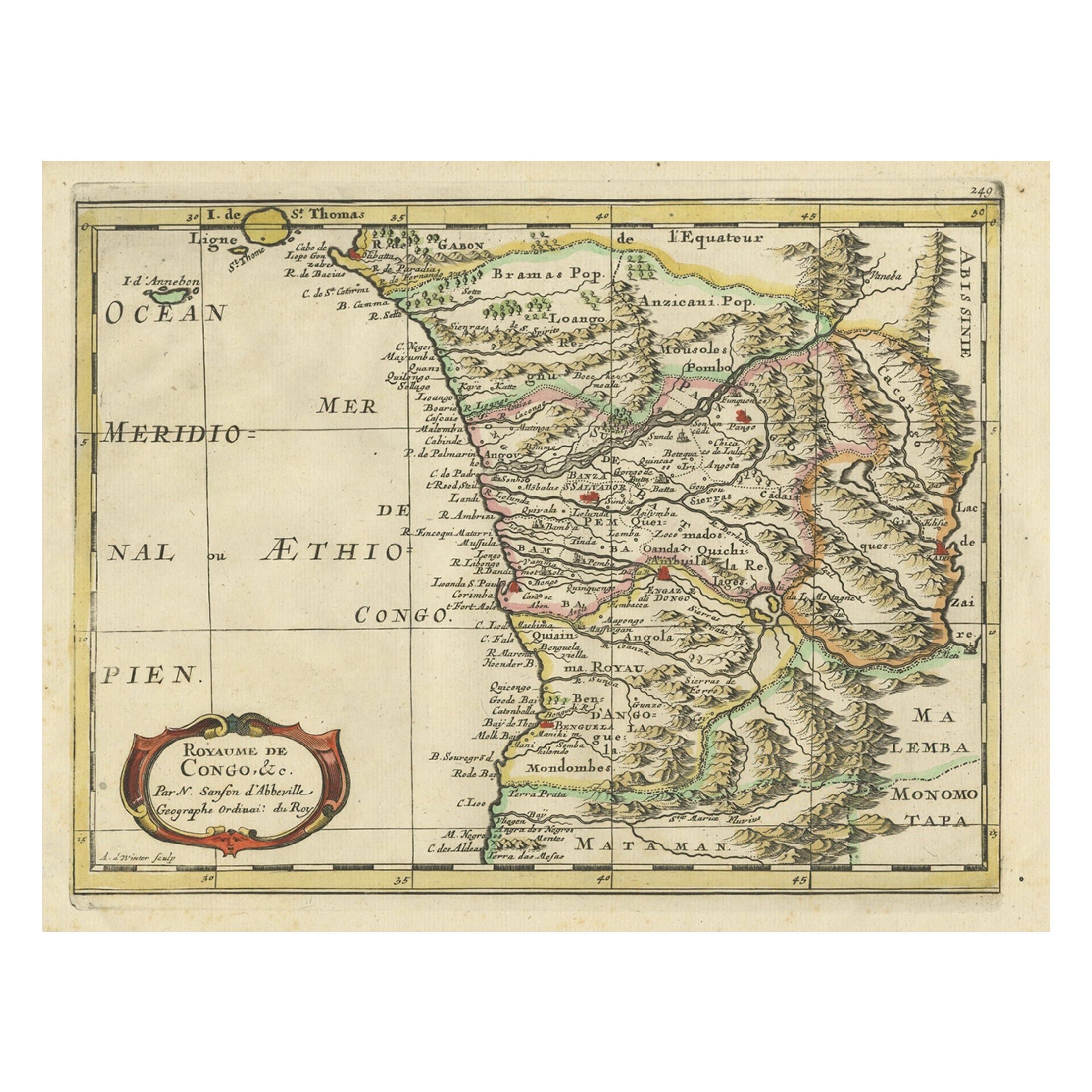
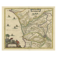
- Antique Map of Gabon, Angola and the Congo Region in Africa c.1680Located in Langweer, NLAntique map titled 'Royaume de Congo'. Map of Gabon, the Congo and Angola from Cape Lopez and Sao Tomé to approximately the border with present-day Namibia. The map is fully engrav...Category
Antique 17th Century Maps
MaterialsPaper
- Antique Map of West Africa, focused on the Congo and AngolaLocated in Langweer, NLOriginal antique map titled 'Regna Congo et Angola'. Decorative 17th Century English map of a portion of West Africa, focused on the Congo and Angola. The map is centered on the Zair...Category
Antique Late 17th Century Maps
MaterialsPaper
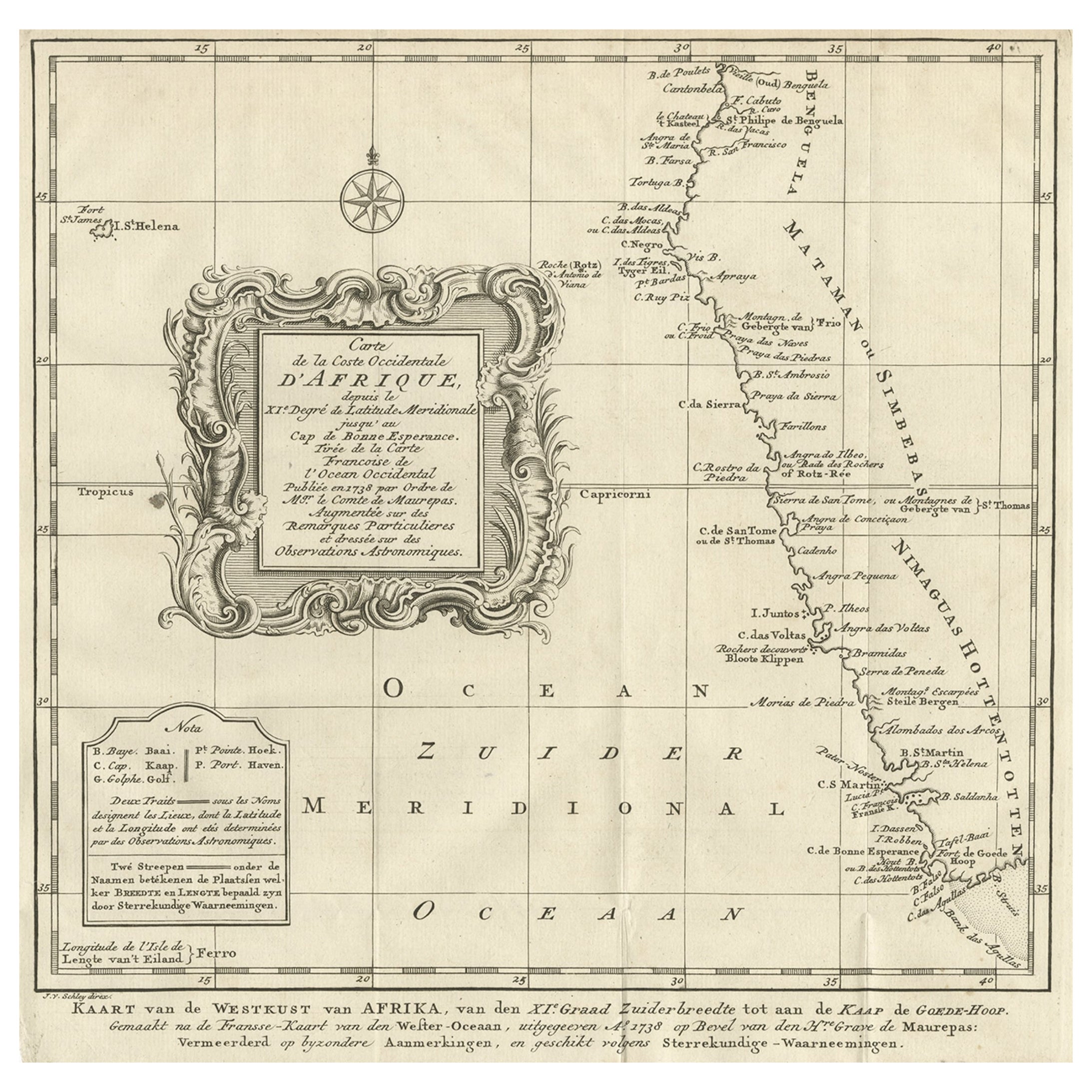
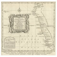
- Dutch Antique Map of the West Coast of Africa, to the Cape of Good Hope, 1747Located in Langweer, NLAntique map of the Coast of Africa titled 'Kaart van de West Kust van Afrika (..)'. Map of the west coast of Africa, from 11 degrees south latitude to the Cape of Good Hope. This...Category
Antique 1740s Maps
MaterialsPaper
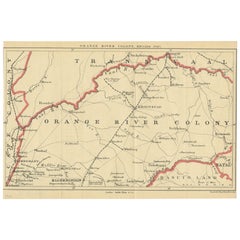
- Antique Map of the Orange River Colony in South Africa, 1901Located in Langweer, NLAntique map titled 'Orange River Colony, northern part'. Lithograph of the northern part of the Orange River Colony, Africa. The Orange River Colony was the British colony created af...Category
Early 20th Century Maps
MaterialsPaper
- Original Detailed Antique Map of the East Coast of Africa, 1747Located in Langweer, NLAntique map titled 'Carte de la coste Orientale d'Afrique - Kaart van de Oostkust van Afrika'. Original antique map of the east coast of Africa. Reaches from Cape of Good Hope an...Category
Antique 1740s Maps
MaterialsPaper
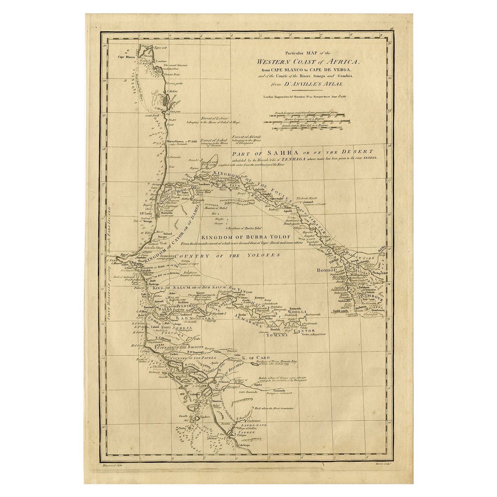
- Map of the West African coast from the North of Mauretania to Guinee, 1788Located in Langweer, NLAntique map titled 'Particular Map of the Western Coast of Africa, from Cape Blanco to Cape de Verga, and of the Course of the Rivers Senega and Gambia.' Map of the African coast...Category
Antique 1780s Maps
MaterialsPaper

You May Also Like
- Original Antique Map of South Africa, Arrowsmith, 1820Located in St Annes, LancashireGreat map of South Africa. Drawn under the direction of Arrowsmith. Copper-plate engraving. Published by Longman, Hurst, Rees, Orme and Br...Category
Antique 1820s English Maps
MaterialsPaper
- Original Antique Map of South America. C.1780Located in St Annes, LancashireGreat map of South America Copper-plate engraving Published C.1780 Two small worm holes to left side of map Unframed.Category
Antique Early 1800s English Georgian Maps
MaterialsPaper
- Original Antique Map of South America, circa 1830Located in St Annes, LancashireGreat map of South America Copper plate engraving Published by Butterworth, Livesey & Co., circa 1830 Unframed.Category
Antique Early 1800s English Other Maps
MaterialsPaper
- West Coast of Africa, Guinea & Sierra Leone: An 18th Century Map by BellinBy Jacques-Nicolas BellinLocated in Alamo, CAJacques Bellin's copper-plate map entitled "Partie de la Coste de Guinee Dupuis la Riviere de Sierra Leona Jusquau Cap das Palmas", depicting the coast of Guinea and Sierra Leone in ...Category
Antique Mid-18th Century French Maps
MaterialsPaper
- Original Antique Map of South East Asia, Arrowsmith, 1820Located in St Annes, LancashireGreat map of South East Asia Drawn under the direction of Arrowsmith Copper-plate engraving Published by Longman, Hurst, Rees, Orme and Brown, 1820 Unframed.Category
Antique 1820s English Maps
MaterialsPaper
- Original Antique Map of South East Asia by Becker, circa 1840Located in St Annes, LancashireGreat map of South East Asia Steel engraving with original color outline Engraved by Becker Published by Virtue, circa 1840. Unframed.Category
Antique 1840s English Other Maps
MaterialsPaper


Recently Viewed
View AllMore Ways To Browse
South Africa
Map Wall
Auctions Of Antique Furniture
Antique Wall Map
Antique Wall Maps
Antique Horse Collectibles
Collectable Wall Plates
South African Antique
Large Wall Map
African Horses
African Plate
South African Antique Furniture
Antique Furniture South Africa
Horse Antiques Collectables
Antique Trader
West African Antiques
The Antique Trader
Large Wall Maps