Items Similar to Map of Lancashire

Want more images or videos?
Request additional images or videos from the seller
1 of 5
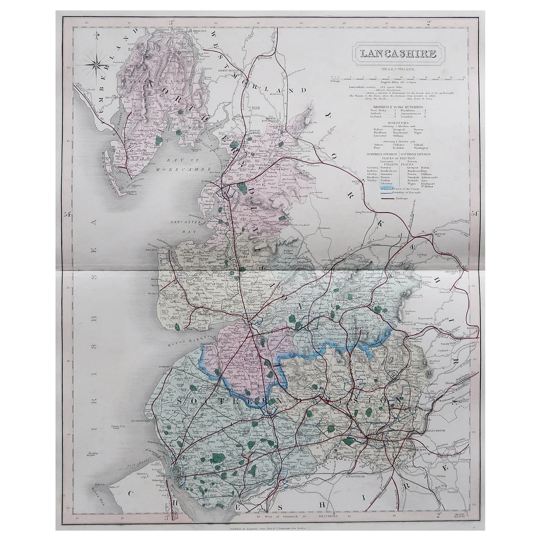
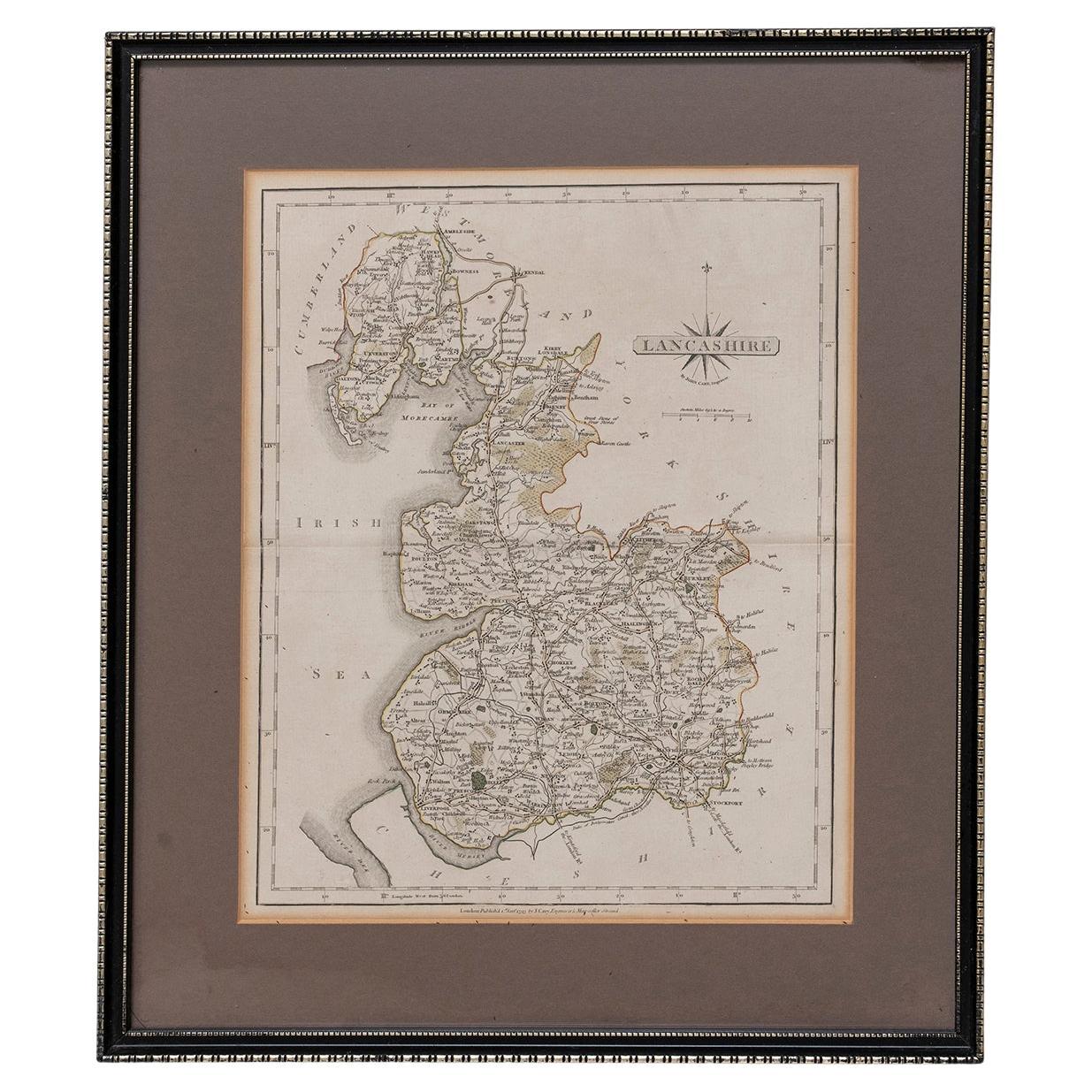
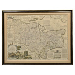
Map of Lancashire
About the Item
Saxton Map of Lancashire hand coloured. Encased in an ebonised frame.
Dimensions
Height 21 Inches
Width 24 Inches
Depth 1 Inches
- Dimensions:Height: 21 in (53.34 cm)Width: 24 in (60.96 cm)Depth: 1 in (2.54 cm)
- Materials and Techniques:
- Place of Origin:
- Period:
- Date of Manufacture:circa 1900
- Condition:Wear consistent with age and use.
- Seller Location:Cheshire, GB
- Reference Number:1stDibs: LU947636261522
About the Seller
5.0
Platinum Seller
These expertly vetted sellers are 1stDibs' most experienced sellers and are rated highest by our customers.
Established in 1980
1stDibs seller since 2012
380 sales on 1stDibs
Typical response time: 1 hour
Associations
LAPADA - The Association of Arts & Antiques DealersInternational Confederation of Art and Antique Dealers' Associations
- ShippingRetrieving quote...Ships From: Cheshire, United Kingdom
- Return PolicyA return for this item may be initiated within 7 days of delivery.
More From This SellerView All
- Map of Essex by Emanuel BowenLocated in Cheshire, GBMap of part of Essex and part of Kent, hand-coloured. Encased in an ebonized and gilded frame. Dimensions Height 25.5 Inches Length 32.5 Inches width 1 Inches.Category
Antique Late 19th Century British Maps
MaterialsPaper
- Northwest Coast and Isle of Man MapLocated in Cheshire, GBGreenville Collins Northwest Coast and Isle of Man. hand coloured chart, encased in an ebonised frame. Dimensions Height 26.5 Inches Width 30 Inches Depth 1 InchesCategory
Early 20th Century British Maps
MaterialsPaper
- Chart of the Harbour of LiverpoolLocated in Cheshire, GBPL Burdett A Chart of the Harbour of Liverpool hand coloured. Encased in an ebonised frame. Dimensions Height 23.5 Inches Width 28 Inches Depth 1 InchesCategory
Early 20th Century British Maps
MaterialsPaper
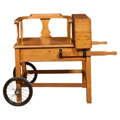
- Set of Oak Doctors ScalesLocated in Cheshire, GBSet of doctors scales for C.F Thakray Chemists. The solid oak seat with shaped back alongside cast balance scale. standing on square sports with pull out ...Category
Early 20th Century British Scientific Instruments
MaterialsOak
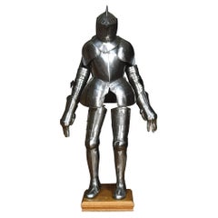
- Suit of 16th Century Style ArmourLocated in Cheshire, GBA suit of 16th century style armour, the helmet with pierced visor, raised comb applied and twist border collar, two-piece breastplate with medial ridge, twist border shoulder plates...Category
Antique 19th Century British Arms, Armor and Weapons
MaterialsMetal
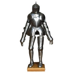


You May Also Like
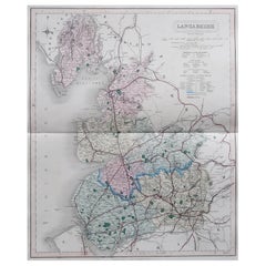
- Original Antique English County Map, Lancashire, J & C Walker, 1851Located in St Annes, LancashireGreat map of Lancashire Original colour By J & C Walker Published by Longman, Rees, Orme, Brown & Co. 1851 Unframed.Category
Antique 1850s English Other Maps
MaterialsPaper
- Map Lancashire 1793 John Cary engraver 37cm 14 1/2" highLocated in BUNGAY, SUFFOLKMap of Lancashire by John Cary engraver published 1st Jan 1793 by J Cary Engraver & Mapseller Strand in original black and gold classic map frameCategory
Antique 18th Century English Georgian Maps
MaterialsPaper
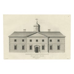
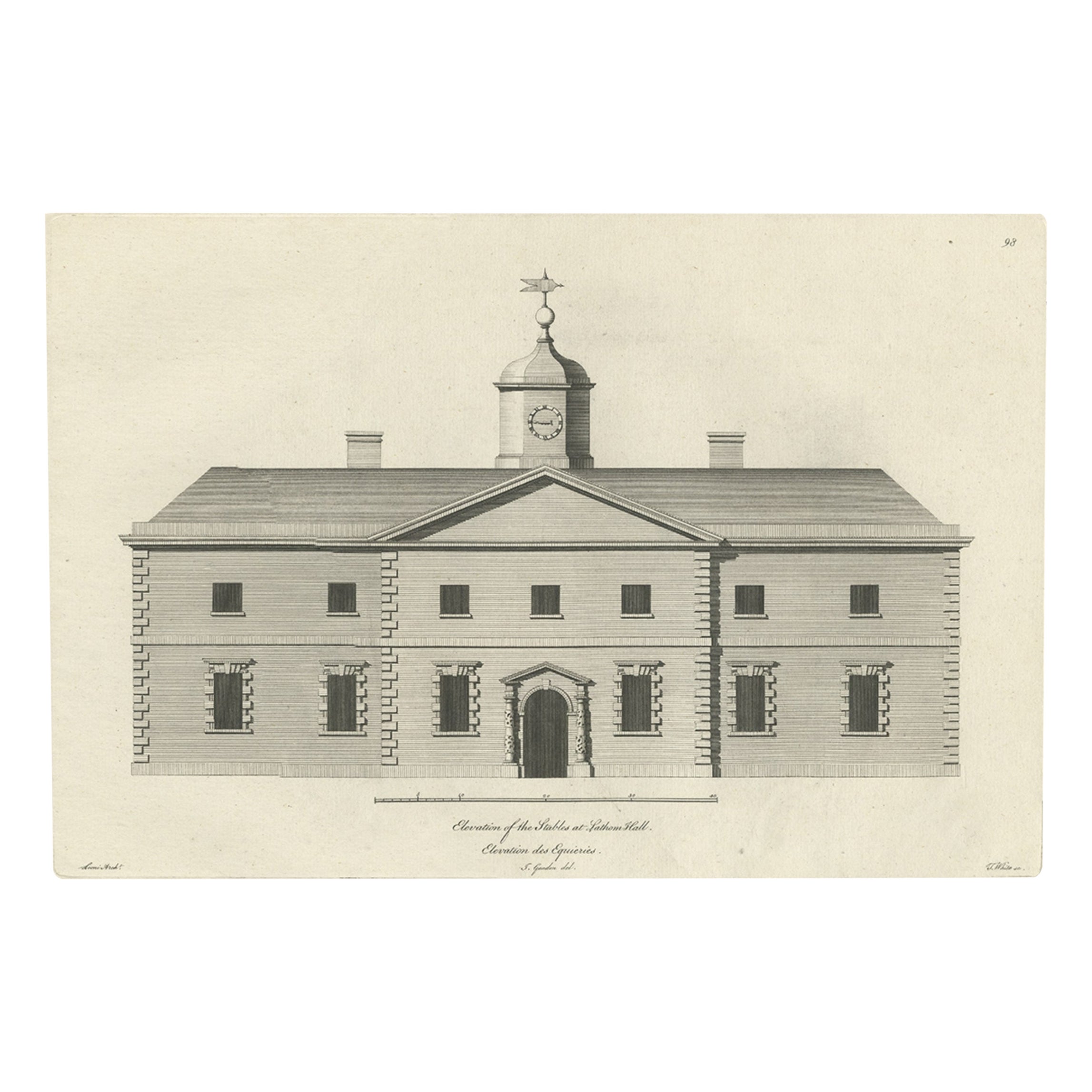
- Antique Print of the Stables of Lathom House in Lancashire, England, c.1770Located in Langweer, NLAntique print titled 'Elevation of the Stables at Lathom Hall'. Elevation of the stables at Lathom House, Lancashire. Lathom House was a large c...Category
Antique 18th Century Prints
MaterialsPaper
- Antique Map of Wisconsin with Inset Geological Map of WisconsinLocated in Langweer, NLAntique map titled 'Wisconsin'. Original antique map of Wisconsin, United States. With inset geological map of Wisconsin. This print originates from '...Category
Antique Late 19th Century Maps
MaterialsPaper
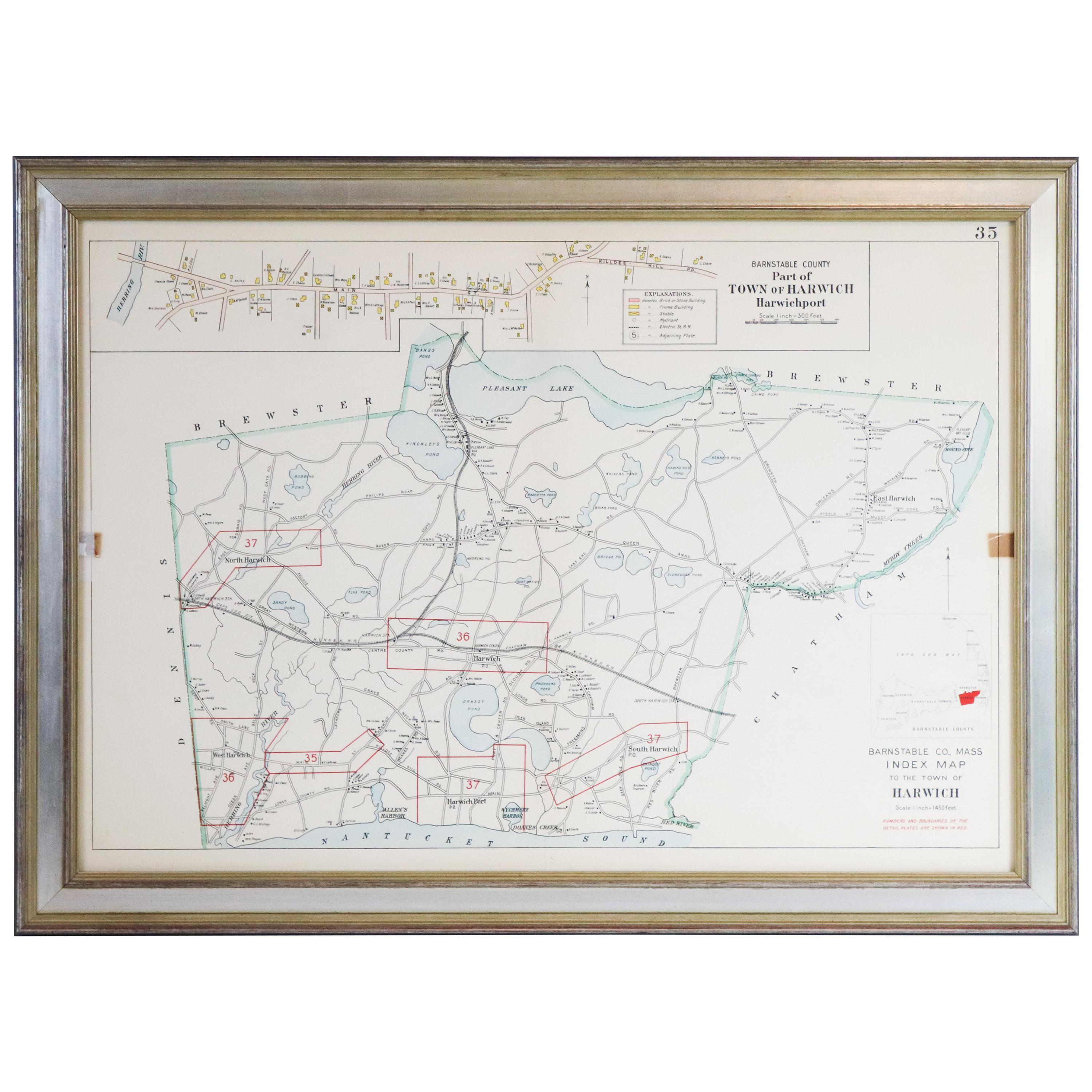
- Map of Harwich, MassachusettsLocated in Norwell, MATurn of the century map of Harwich, Massachusetts. Plate from a Cape Cod County Map book showing the Barnstable county town of Harwich including Allens Harbor, Pleasant Lake, Harwich...Category
20th Century Maps
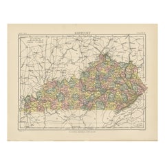
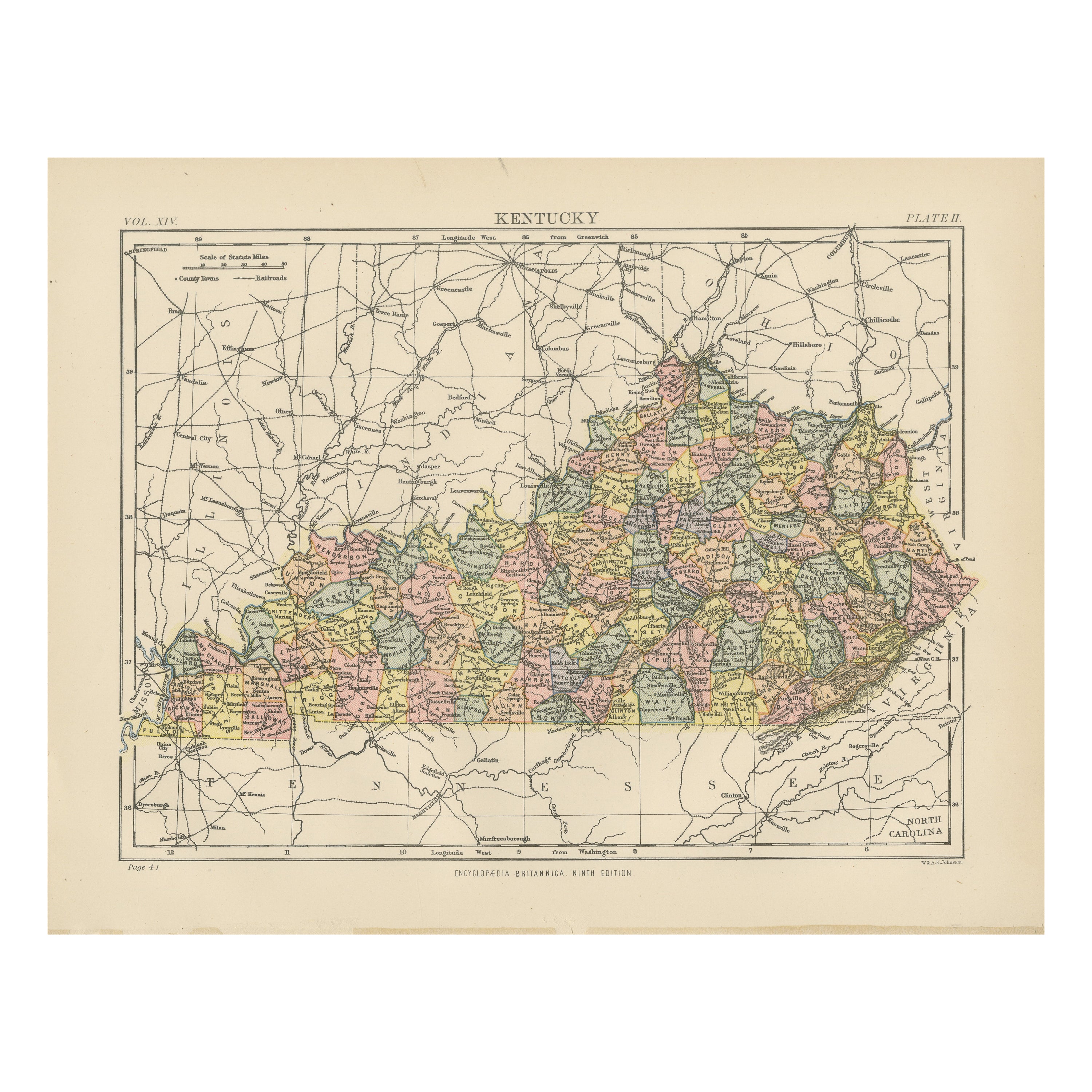
- Antique Map of KentuckyLocated in Langweer, NLAntique map titled 'Kentucky'. Original antique map of Kentucky, United States. This print originates from 'Encyclopaedia Britannica', Ninth E...Category
Antique Late 19th Century Maps
MaterialsPaper