Items Similar to Map of Essex by Emanuel Bowen


Want more images or videos?
Request additional images or videos from the seller
1 of 5
Map of Essex by Emanuel Bowen
About the Item
Map of part of Essex and part of Kent, hand-coloured. Encased in an ebonized and gilded frame.
Dimensions
Height 25.5 Inches
Length 32.5 Inches
width 1 Inches.
- Dimensions:Height: 25.5 in (64.77 cm)Width: 32.5 in (82.55 cm)Depth: 1 in (2.54 cm)
- Materials and Techniques:
- Place of Origin:
- Period:
- Date of Manufacture:circa 1890
- Condition:Wear consistent with age and use.
- Seller Location:Cheshire, GB
- Reference Number:1stDibs: LU947628153752
About the Seller
5.0
Platinum Seller
These expertly vetted sellers are 1stDibs' most experienced sellers and are rated highest by our customers.
Established in 1980
1stDibs seller since 2012
379 sales on 1stDibs
Typical response time: 1 hour
Associations
LAPADA - The Association of Arts & Antiques DealersInternational Confederation of Art and Antique Dealers' Associations
- ShippingRetrieving quote...Ships From: Cheshire, United Kingdom
- Return PolicyA return for this item may be initiated within 7 days of delivery.
More From This SellerView All
- Map of LancashireLocated in Cheshire, GBSaxton Map of Lancashire hand coloured. Encased in an ebonised frame. Dimensions Height 21 Inches Width 24 Inches Depth 1 InchesCategory
Early 20th Century British Maps
MaterialsPaper
- Northwest Coast and Isle of Man MapLocated in Cheshire, GBGreenville Collins Northwest Coast and Isle of Man. hand coloured chart, encased in an ebonised frame. Dimensions Height 26.5 Inches Width 30 Inches Depth 1 InchesCategory
Early 20th Century British Maps
MaterialsPaper
- Chart of the Harbour of LiverpoolLocated in Cheshire, GBPL Burdett A Chart of the Harbour of Liverpool hand coloured. Encased in an ebonised frame. Dimensions Height 23.5 Inches Width 28 Inches Depth 1 InchesCategory
Early 20th Century British Maps
MaterialsPaper
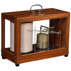
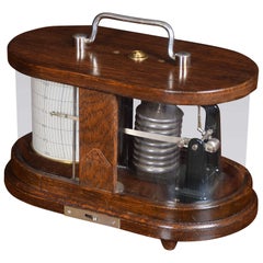
- Barograph by R FuessLocated in Cheshire, GBMahogany framed barograph by R Fuess Berlin. The mechanical eight-day movement is housed in the drum, fitted with a seven-day chart which covers one full rotation of the drum. The in...Category
Antique Late 19th Century German Scientific Instruments
MaterialsWalnut
- Oak Barograph by C P GoerzLocated in Cheshire, GBArt Deco barograph by C P Goerz. The oak and plated metal Barograph encase with rounded ends. The mechanical eight-day movement is housed in the drum, fi...Category
Early 20th Century German Scientific Instruments
MaterialsOak
- Set of Oak Doctors ScalesLocated in Cheshire, GBSet of doctors scales for C.F Thakray Chemists. The solid oak seat with shaped back alongside cast balance scale. standing on square sports with pull out ...Category
Early 20th Century British Scientific Instruments
MaterialsOak


You May Also Like
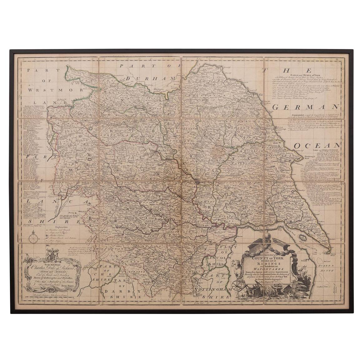
- 18th Century Emanuel Bowen Map of County of York, c.1740By Emanuel BowenLocated in Royal Tunbridge Wells, KentAntique 18th century British rare and original Emanuel Bowen (1694-1767) map of the County of York divided into its Ridings and subdivided into wapontakes, mounted in solid wood fram...Category
Antique Early 18th Century British Maps
MaterialsPaper
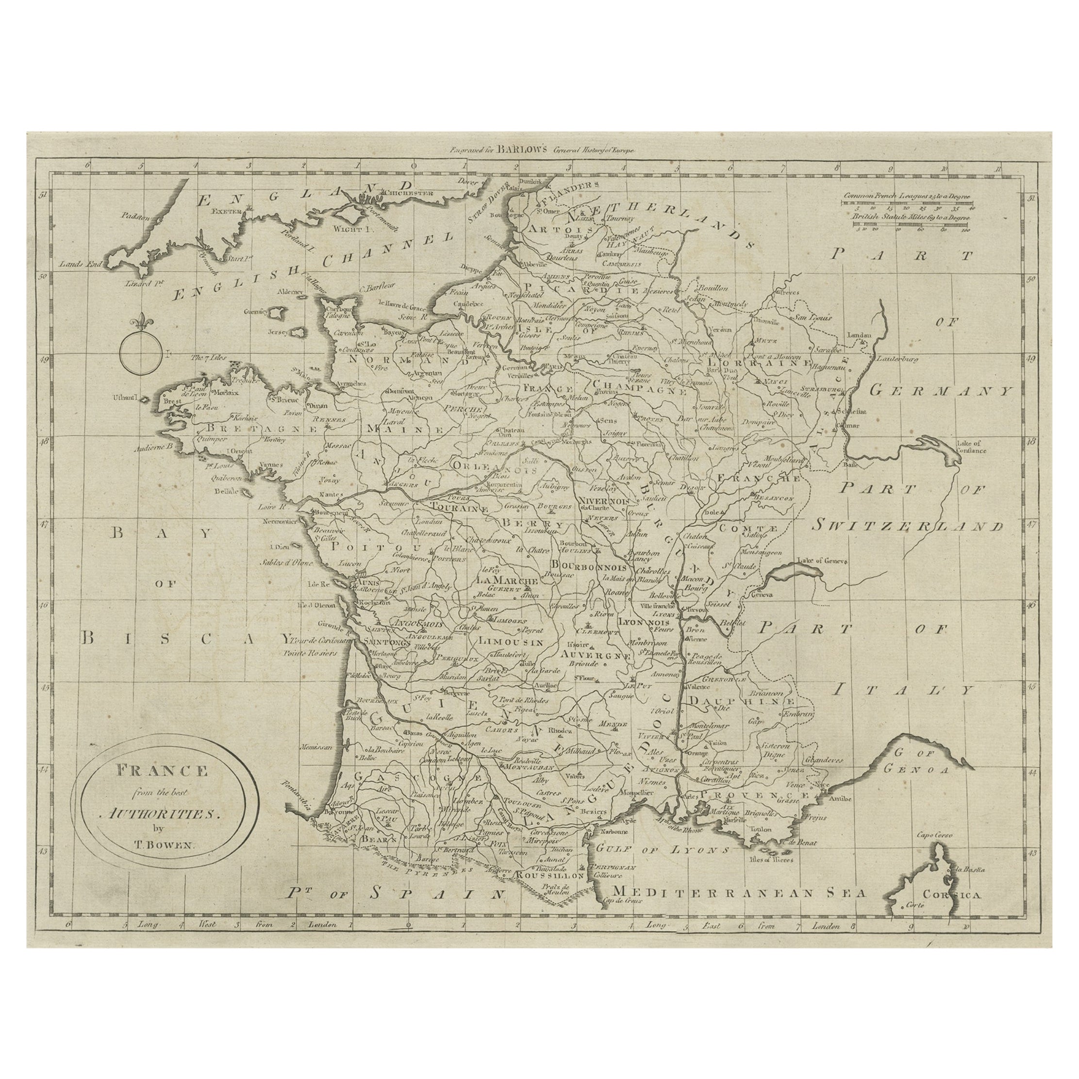
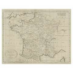
- Antique Map of France by Bowen, c.1790Located in Langweer, NLAntique map titled 'France from the best Authorities'. Original antique map of France. Engraved for Barlow's General history of Europe. Published circa 1790. Artists and Engraver...Category
Antique 18th Century Maps
MaterialsPaper
- Antique Map of Sweden by Bowen, 1747Located in Langweer, NLAntique map titled 'A New & Accurate Map of Sweden'. This map covers Sweden and Finland (shown as part of Sweden) as well as parts of modern day Estonia,...Category
Antique 18th Century Maps
MaterialsPaper
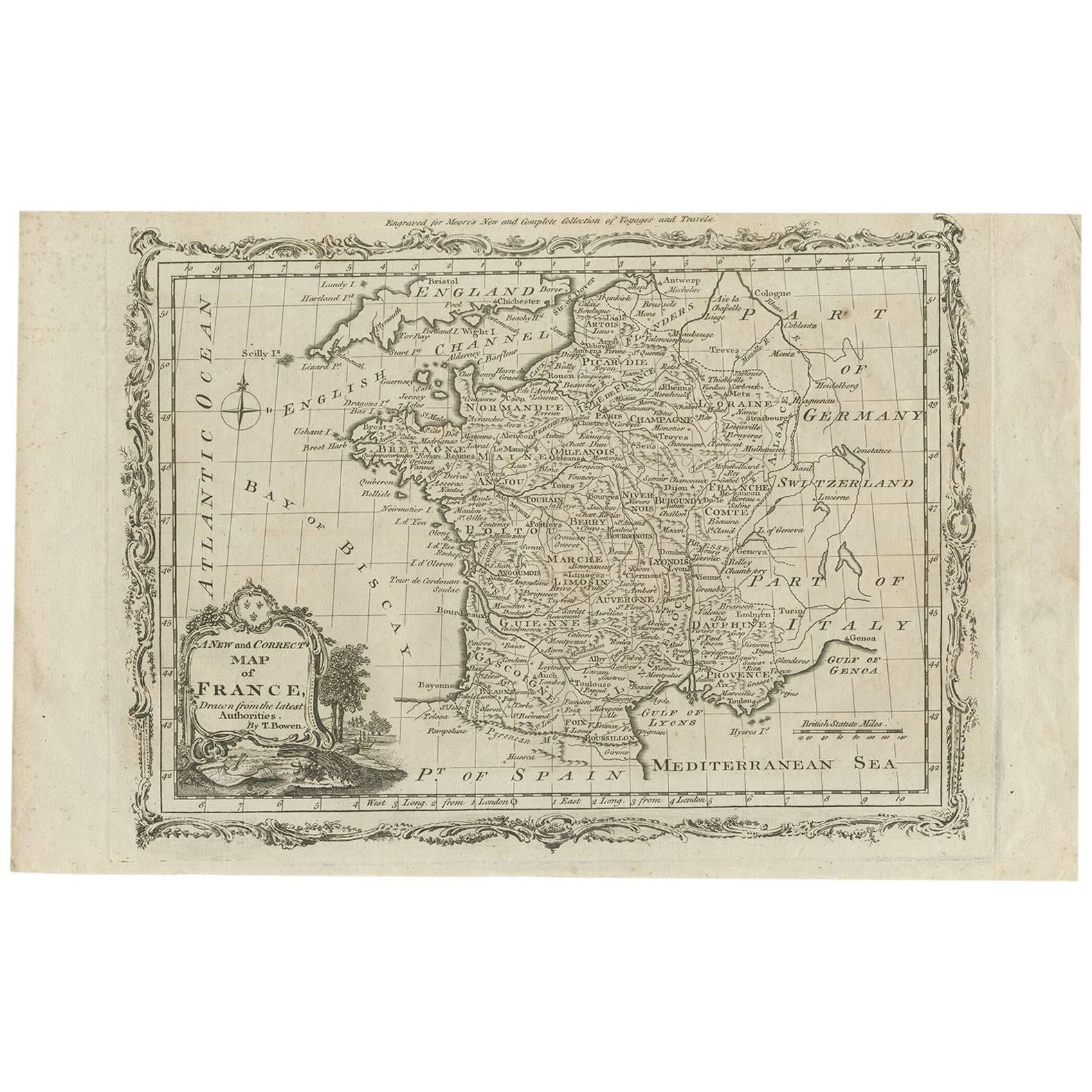
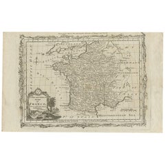
- Antique Map of France by T. Bowen, 1785Located in Langweer, NLDecorative antique map of France titled 'A new and accurate map of France, Drawn from the latest Authorities by T. Bowen'. Engraved for Moore’s new and complete collection of Voyages...Category
Antique Late 18th Century Maps
MaterialsPaper
- Antique Map of Moscovy 'Russia' by E. Bowen, 1747Located in Langweer, NLBeautiful map of European Russia by the English cartographer Emmanuel Bowen. It depicts the European portion of Russia extending from the Gulf of Finland to the Ural Mountains. The m...Category
Antique Mid-18th Century Maps
MaterialsPaper
- Antique Map of Essex by Overton, circa 1710Located in Langweer, NLAntique map titled 'Essex, devided into Hundreds, with the most antient and fayre Towne Colchester (..)'. Map of Essex, England. Includes an inset town pl...Category
Antique Early 18th Century Maps
MaterialsPaper


Recently Viewed
View AllMore Ways To Browse
Antique Kent
Essex Antique
Antique Furniture In Kent
Essex Used Furniture
Antique Furniture Essex
Map Of Kent
Antique Map Of Kent
Antique Maps Kent
Map Of Essex
Antique Maps Essex
Large Antique Compass
Antique New England Maps
Antique Map New England
Antique Map Of New England
Antique Maps New England
Antique Greek Map
Antique Greece Map
Antique Map Of Greece