Antique Maps Kent

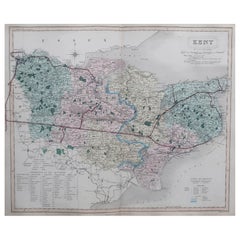
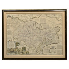
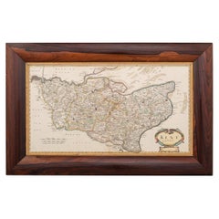
Original Antique English County Map, Kent. J & C Walker, 1851
Located in St Annes, Lancashire
Great map of Kent Original colour By J & C Walker Published by Longman, Rees, Orme, Brown
Category

1850s English Other Antique Maps Kent

Materials

Paper

Original Antique English County Map, Kent. J & C Walker, 1851
No Reserve
H 13.75 in W 17.25 in D 0.07 in
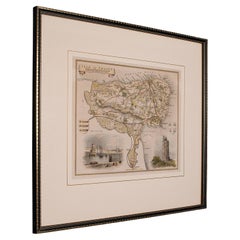
Antique Lithography Map, Isle of Thanet, Kent, English, Cartography, Victorian
Located in Hele, Devon, GB
This is an antique lithography map of The Isle of Thanet in Kent. An English, framed atlas
Category

Mid-19th Century British Victorian Antique Maps Kent

Materials

Wood

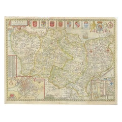
Antique Map of Kent with Inset Plans of Rochester & Canterbury, England, 1676
Located in Langweer, NL
Antique map titled 'Kent with her Cities and Earles described and observed'. Map of Kent, England
Category

17th Century Antique Maps Kent

Materials

Paper

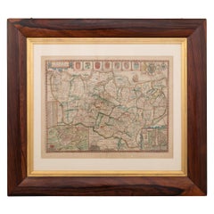
17th Century John Speed Map of Kent with Her Cities & Earles Described, C.1676
By John Speed
Located in Royal Tunbridge Wells, Kent
Antique 17th century British very rare and original John Speed (1551-1629) map of Kent with her
Category

17th Century British Antique Maps Kent

Materials

Paper

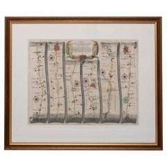
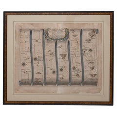
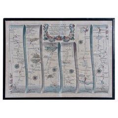
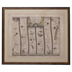
Road Map, John Ogilby, No 54, London, Yarmouth, Britannia
By John Ogilby
Located in BUNGAY, SUFFOLK
volume, only three counties and three towns were mapped (Kent, Middlesex & Essex; and Canterbury, Ipswich
Category

1670s English Baroque Antique Maps Kent

Materials

Paper

Map of Essex by Emanuel Bowen
Located in Cheshire, GB
Map of part of Essex and part of Kent, hand-coloured. Encased in an ebonized and gilded frame
Category

Late 19th Century British Antique Maps Kent

Materials

Paper

Antique Map of Essex by Emanuel Bowen
Map of Essex by Emanuel Bowen
H 25.5 in W 32.5 in D 1 in
Map Road John Ogilby Britannia No 74 Ipswich to Norwich Cromer Framed
By John Ogilby
Located in BUNGAY, SUFFOLK
mapped (Kent, Middlesex & Essex; and Canterbury, Ipswich & Maldon). Of the sixth volume, on London, only
Category

1670s English Baroque Antique Maps Kent

Materials

Paper

Road Map John Ogilby No 75 Kings Lyn Harwich, Britannia Framed Wallhanging
By John Ogilby
Located in BUNGAY, SUFFOLK
volume, only three counties and three towns were mapped (Kent, Middlesex & Essex; and Canterbury, Ipswich
Category

1670s European Baroque Antique Maps Kent

Materials

Paper

Road Map No43 London to Kings Lynn, Royston to Downham, John Ogilby, Britannia
By John Ogilby
Located in BUNGAY, SUFFOLK
three counties and three towns were mapped (Kent, Middlesex & Essex; and Canterbury, Ipswich & Maldon
Category

Late 17th Century British Charles II Antique Maps Kent

Materials

Paper

Road Map John Ogilby London St David's Britannia No 15 Abingdon Monmouth Framed
By John Ogilby
Located in BUNGAY, SUFFOLK
three counties and three towns were mapped (Kent, Middlesex & Essex; and Canterbury, Ipswich & Maldon
Category

1670s English Baroque Antique Maps Kent

Materials

Paper

Map Road Strip Britannia Sheet 2 John Ogilby London Aberistwith Islip Bramyard
By John Ogilby
Located in BUNGAY, SUFFOLK
of England and Wales. Strip map Islip to Bramyard, on a scale of approximately one inch to the mile
Category

17th Century English Baroque Antique Maps Kent

Materials

Paper

Road Map Britannia No 32 the Road from London to Barnstable John Ogilby Framed
By John Ogilby
Located in BUNGAY, SUFFOLK
volume, only three counties and three towns were mapped (Kent, Middlesex & Essex; and Canterbury, Ipswich
Category

Late 17th Century English Charles II Antique Maps Kent

Materials

Paper

Road Map Britannia No 15 London to St Davids John Ogilby Brown Gilt Frame
By John Ogilby
Located in BUNGAY, SUFFOLK
three counties and three towns were mapped (Kent, Middlesex & Essex; and Canterbury, Ipswich & Maldon
Category

Late 17th Century British Charles II Antique Maps Kent

Materials

Paper

Road Map Britannia 1675/6 No 5 Road London to Barwick, London Stilton Grey Frame
By John Ogilby
Located in BUNGAY, SUFFOLK
counties and three towns were mapped (Kent, Middlesex & Essex; and Canterbury, Ipswich & Maldon). Of the
Category

Late 17th Century British Charles II Antique Maps Kent

Materials

Paper

Road Map Britannia No 25 London to the Lands End, John Ogilby Brown Gilded Frame
By John Ogilby
Located in BUNGAY, SUFFOLK
three counties and three towns were mapped (Kent, Middlesex & Essex; and Canterbury, Ipswich & Maldon
Category

Late 17th Century British Charles II Antique Maps Kent

Materials

Paper

Mid-18th Century Hand Drawn English Farm Map on Vellum, circa 1740s
Located in San Francisco, CA
, Surveyors. A Map of a Farm in the Parish of Blean in the County of KENT: Belonging to Mrs Elizabeth
Category

Mid-18th Century English Antique Maps Kent

Materials

Lambskin

Antique Print of Dover Castle by Willmore, circa 1875
Located in Langweer, NL
Dover, Kent, England. This print originates from 'Picturesque Europe'. Artists and Engravers
Category

19th Century Antique Maps Kent

Materials

Paper

People Also Browsed

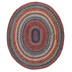
Vintage American Braided Rug
Located in New York, NY
A vintage American Braided carpet from the second quarter of the 20th century. Although America (British-America) has been producing rugs since the 16th century it was never industri...
Category

Mid-20th Century American American Colonial Antique Maps Kent

Materials

Wool

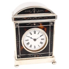
Charles & Richard Comyns 1920 London Neo Classic Carriage Table Clock in Sterlin
By Charles and Richard Comyns
Located in Miami, FL
Travel carriage clock designed by Charles & Richard Comyns. Beautiful small travel-desk clock, created by the top notch and prestigious silversmith company of Charles & Richard Co...
Category

1920s English Neoclassical Antique Maps Kent

Materials

Silver, Sterling Silver

Napoleon III Style French "Chinoserie" Hand-Painted Metal Tray
Located in Prato, Tuscany
We kindly suggest that you read the entire description, as with it we try to give you detailed technical and historical information to ensure the authenticity of our objects. Origina...
Category

Late 19th Century French Napoleon III Antique Maps Kent

Materials

Iron

Montague Dawson: Wind Aft, The Repulse
By Montague Dawson
Located in Lymington, Hampshire
This watercolour on paper is framed under glass and signed in the left corner. It shows the East Indiaman sailing downwind under full canvas. The reverse has a paper trade label fr...
Category

Mid-20th Century English Antique Maps Kent

Materials

Paper

Montague Dawson: Wind Aft, The Repulse
H 18.5 in W 28.75 in D 1 in
Large Antique Map of New York State with Inset Maps
Located in Langweer, NL
Antique map titled 'Johnson's New York' Large map of New York State. With insets of Albany, Oswego, Buffalo, Rochester, Syracuse, Troy and NYC. Published by Johnson and Browning, 186...
Category

Mid-19th Century Antique Maps Kent

Materials

Paper

Antique 17th Century Oak Door
Located in Wormelow, Herefordshire
An antique 17th century English oak plank door, salvaged from Wingfield castle. Suitable for interior use, this antique door tells the story of craftsmanship in circa 1650. With a b...
Category

Mid-17th Century English Country Antique Maps Kent

Materials

Wood, Oak

Antique 17th Century Oak Door
H 69.49 in W 30.71 in D 0.99 in
16th Century Elizabethan Tigerware Jug
Located in New Orleans, LA
This exceptionally rare silver-gilt mounted tigerware jug was crafted during the Elizabethan period. This handsome vessel is adorned with highly elaborate silver-gilt mounts, includi...
Category

16th Century English Elizabethan Antique Maps Kent

Materials

Silver

Cheerleaders, New Orleans, Louisiana
By Amy Stein
Located in New York, NY
Digital C-print Signed and numbered, verso 16 x 20 inches (Edition of 15) 24 x 30 inches (Edition of 10) 30 x 37.5 inches (Edition of 5) This photograph is offered by ClampArt, l...
Category

Early 2000s Contemporary Antique Maps Kent

Materials

C Print

Pair of Prints Depicting Antique World Maps Framed in Burl Wood
Located in Dallas, TX
A pair of prints depicting antique world maps framed in burl wood. One picture contains a depiction of Africa, Europe, and Oceania. The other picture is of North and South America. T...
Category

20th Century American Antique Maps Kent

Materials

Paper

Curtains, Set of 3, Silk Velvet, Charles II-Style, Burgundy Damask Cowdray Park
Located in BUNGAY, SUFFOLK
Each with a damask pattern of scrolling foliage, peonies, tulips and fruit. Massive pattern repeat, see image. Original braid. Cleaned and conserved. Measures: Two height 315 cm...
Category

Early 20th Century European Charles II Antique Maps Kent

Materials

Velvet

Steven, Route 10, Louisiana
By Amy Stein
Located in New York, NY
Digital C-print Signed and numbered, verso 16 x 20 inches (Edition of 15) 24 x 30 inches (Edition of 10) 30 x 37.5 inches (Edition of 5) This photograph is offered by ClampArt, l...
Category

Early 2000s Contemporary Antique Maps Kent

Materials

C Print

Route 14, New Mexico
By Amy Stein
Located in New York, NY
Digital C-print Signed and numbered, verso 16 x 20 inches (Edition of 15) 24 x 30 inches (Edition of 10) 30 x 37.5 inches (Edition of 5) This photograph is offered by ClampArt, l...
Category

Early 2000s Contemporary Antique Maps Kent

Materials

C Print

Vanity Fair, Military Print, the Cavalry Division
By Godfrey Douglas Giles
Located in Oxfordshire, GB
Vanity fair military print 'the Cavalry Division' after G.D.G. A chromolithograph military print published 12th July, 1900, by Vincent Brooks, Day & Son Ltd. Lith., for Vanity Fair....
Category

20th Century British Sporting Art Antique Maps Kent

Materials

Paper

Antique Map of the region of Siberia, Mongolia and Manchuria
Located in Langweer, NL
Antique map titled 'Siberia and Chinese Tartary'. Detailed antique map of the region of Siberia, Mongolia and Manchuria. Engraved by J. & C. Walker. Published 1838.
Category

Mid-19th Century Antique Maps Kent

Materials

Paper

Portrait in Oil of Robert Harley 1st Earl of Oxford by Sir Godfrey Kneller
By Sir Godfrey Kneller
Located in Savannah, GA
19th Century copy of 18th century portrait of Robert Harley, 1st Earl of Oxford, (born 1661, London, died 1724, London). He was a British statesman who headed the Tory ministry from ...
Category

Early 18th Century English Georgian Antique Maps Kent

Materials

Giltwood, Paint

Antique Map of the Rhine and Moselle River Region in Germany and France, c.1680
Located in Langweer, NL
Antique map titled 'Tabula Geographica qui Pars Meridionalis sive Superior Rheni, Mosae et Mosellae (..).' Detailed map of the Rhine and Moselle River regions and contigous parts...
Category

17th Century Antique Maps Kent

Materials

Paper

Recent Sales

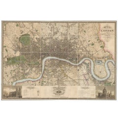
Greenwood Map of London
Located in London, GB
Map of London, published in London in 1827. Hand-coloured engraved folding map on six sheets
Category

19th Century English Antique Maps Kent

Materials

Paper

17th Century Robert Morden Map of Kent, C.1695
By Robert Morden
Located in Royal Tunbridge Wells, Kent
Antique 17th century British very rare and original Robert Morden (1650-1703) map of Kent
Category

17th Century British Antique Maps Kent

Materials

Paper

Antique 17th Century Robert Morden Map of Kent, C.1695
17th Century Robert Morden Map of Kent, C.1695
H 20.48 in W 31.89 in D 0.79 in
Pattisons' Cycling Maps
Located in Oxfordshire, GB
Pattison cycling road maps. This is a collection of 21 Pattisons' cyclists pocket road maps
Category

Early 1900s British Antique Maps Kent

Pattisons' Cycling Maps
H 3.55 in W 2.37 in D 0.04 in
1906 "Tourists Guide to Colorado Springs, Manitou, Colorado City..." Map
Located in Colorado Springs, CO
Presented is "Clason's Guide Map to Colorado Springs, Manitou, Colorado City and Pike's Peak Region
Category

Early 1900s American Antique Maps Kent

Materials

Paper

18th Century John Cary Map of Kent, c.1769
By John Cary
Located in Royal Tunbridge Wells, Kent
Antique 18th century British very rare and original John Cary sr (1755-1835) map of Kent
Category

18th Century British Antique Maps Kent

Materials

Paper

18th Century John Cary Map of Kent, c.1769
Free Shipping
H 27.96 in W 31.5 in D 0.79 in
Original Antique Belle Steamers Poster Paddle Steamer Ship Map London East Coast
Located in London, GB
Original antique advertising poster for Belle Steamers featuring an annotated illustrated map of
Category

1910s British Antique Maps Kent

Materials

Paper

Rare Georgian Period Mahogany Campaign Desk
Located in Essex, MA
replaced for map reading while the individual side cabinets were given lion head pulls, carrying handles
Category

19th Century English Antique Maps Kent

Materials

Mahogany

Road Map, from London to Kings Lynn, Royston to Downham, John Ogilby, Britannia
By John Ogilby
Located in BUNGAY, SUFFOLK
three counties and three towns were mapped (Kent, Middlesex & Essex; and Canterbury, Ipswich & Maldon
Category

Late 17th Century British Charles II Antique Maps Kent

Materials

Paper

1856s The Constellations Map for Each Month in the Year by FJ Huntington N.Y.
Located in Milan, IT
Map VI and VII depicting the constellations titled The Constellations for each Month in the Year
Category

1850s American Antique Maps Kent

Materials

Glass, Wood, Paper

Original Antique Belle Steamers Poster Paddle Steamer Ship Map London East Coast
Located in London, GB
Original antique advertising poster for Belle Steamers featuring an annotated illustrated map of
Category

1910s Antique Maps Kent

Materials

Paper

Get Updated with New Arrivals
Save "Antique Maps Kent", and we’ll notify you when there are new listings in this category.

Antique Maps Kent For Sale on 1stDibs

At 1stDibs, there are many versions of the ideal antique maps kent for your home. Frequently made of paper, animal skin and glass, every antique maps kent was constructed with great care. Your living room may not be complete without an antique maps kent — find older editions for sale from the 18th Century and newer versions made as recently as the 20th Century. An antique maps kent is a generally popular piece of furniture, but those created in Baroque styles are sought with frequency.

Finding the Right collectibles-curiosities for You

Antique and vintage collectibles and curiosities can bring whimsy and wonder to any interior. 

Decorating with old scientific instruments, historical memorabilia and vintage musical instruments, as well as other authentic collectibles and curiosities that can be found on 1stDibs, presents an opportunity to create a unique, natural history museum-like atmosphere in your home that can provoke conversation as often as it pays tribute to how far we’ve come in understanding our world. 

And bringing collectibles and curiosities into your space is actually on trend — Wunderkammern, or curiosity cabinets, were all the rage in Europe during the 1500s and continued to have adherents there and in the U.S. in the following centuries. Today, however, they’re experiencing a real surge in popularity and influencing how many interior designers are furnishing and decorating homes — combining contemporary with antique, scientific with tribal, earthly with extraterrestrial, Les Lalanne tables with Flemish tapestries.

The original Wunderkammern were entire rooms filled with objects demonstrating their owners’ worldly knowledge: A proper one included artificiala or preciosa (objets d’art); naturalia (such as skeletons, shells, minerals); exotica (taxidermy or dried plants); and scientifica (scientific instruments), frequently alongside religious relics and ancient artifacts.

Pay tribute to a history of rich and diverse musical traditions that have taken shape all over the world by decorating your home with a collection of antique and vintage musical instruments — with a little help from strong hanging wire or some wall hooks, vintage brass instruments such as a gong, French horn or trumpet can help elevate a home office or complement the efforts you’ve made to ensure a welcoming vibe in your home’s entryway. Bells or antique wind instruments can add provocative metallic contrasts to dark woods as tabletop decorative objects.  

Create an intriguing focal point with Georgian scientific instruments, such as stick barometers with mahogany cases or lacquered brass telescopes. These items stem from an era named for the monarchies of the four King Georges, who ruled England in succession starting in 1714 (plus King William’s reign, which lasted until 1837). Just as there was beautiful jewelry produced during the period that today is coveted by collectors, there is much to be found in the collectibles and curiosities realm too.

Wanderlust, nostalgia and a shared love of good design are contributing factors to certain trends in decorating — just as vintage trunks and luggage have reappeared as furniture or home accents in a bedroom or foyer, decorating with globes, maps or nautical objects is similarly rooted in the allure of travel and a penchant for the stylish finishing touch that collectibles bring to our homes.

Find a wide range of antique and vintage collectibles and curiosities on 1stDibs.

Read More

Pamela Shamshiri Shares the Secrets behind Her First-Ever Book and Its Effortlessly Cool Interiors

The sought-after designer worked with the team at Hoffman Creative to produce a monograph that beautifully showcases some of Studio Shamshiri's most inspiring projects.

Moroccan Artworks and Objects Take Center Stage in an Extraordinary Villa in Tangier

Italian writer and collector Umberto Pasti opens the doors to his remarkable cave of wonders in North Africa.

Montecito Has Drawn Royalty and Celebrities, and These Homes Are Proof of Its Allure

Hollywood A-listers, ex-pat aristocrats and art collectors and style setters of all stripes appreciate the allure of the coastal California hamlet — much on our minds after recent winter floods.

Whaam! Blam! Pow! — a New Book on Pop Art Packs a Punch

Publishing house Assouline and writer Julie Belcove have teamed up to trace the history of the genre, from Roy Lichtenstein, Andy Warhol and Yayoi Kusama to Mickalene Thomas and Jeff Koons.

The Sparkling Legacy of Tiffany & Co. Explained, One Jewel at a Time

A gorgeous new book celebrates — and memorializes — the iconic jeweler’s rich heritage.

What Makes a Gem-Encrusted Chess Set Worth $4 Million?

The world’s most opulent chess set, weighing in at 513 carats, is literally fit for a king and queen.

Tauba Auerbach’s Geometric Pop-Up Book Is Mighty Rare, Thanks to a Hurricane

This sculptural art book has an epic backstory of its own.

Step inside the Storied Mansions of Palm Beach’s Most Effervescent Architect

From Spanish-style courtyards to fanciful fountains, these acclaimed structures abound in surprising and elegant details.