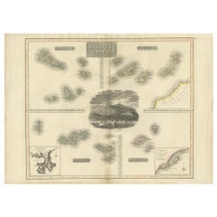
Antique Maps Of Islands

49
to
250
1,041
233
835
568
381
219
156
148
126
96
90
72
72
69
65
45
34
33
28
28
27
26
26
23
23
20
19
18
17
15
15
12
11
11
10
10
9
8
8
8
7
7
6
5
5
5
4
4
4
3
3
3
26
13
12
10
9
Sort By
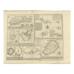
Antique Map of Islands in the Mediterranean by Bowen, 'c.1760'
Located in Langweer, NL
Antique map titled 'Particular Draughts of some of the chief African Islands (..)'. Eight small
Category

Mid-18th Century Antique Maps Of Islands

Materials

Paper

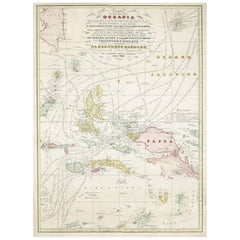
Large Italian Map of Islands of Oceania, incl Papua, Timor, Banda, Ceram, 1855
Located in Langweer, NL
Description: Antique map titled 'Carta di una parte dell'Oceania'. Beautiful large map of the
Category

1850s Antique Maps Of Islands

Materials

Paper

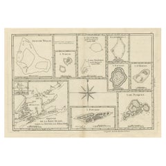
Print of Maps of Islands of the South Pacific, Incl. Pitcairn & Dusky Bay, 1788
Located in Langweer, NL
Pickersgill / I de Pasques.' Detailed set of maps of the islands of the South Pacific, with a large compass
Category

1780s Antique Maps Of Islands

Materials

Paper

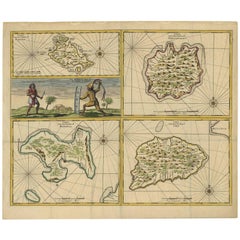
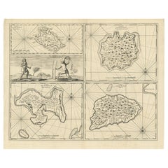
Antique Map of Manipa, Nusa-Laut, Saparua & Haruku 'Indonesia' by F. Valentijn
Located in Langweer, NL
Four maps of islands and two figures in native dress. The islands are: Manipa, Nusa-Laut (Noessa
Category

Early 18th Century Antique Maps Of Islands

Materials

Paper

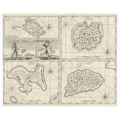
Antique Map of Manipa and Other Maluku Islands, Indonesia, 1726
Located in Langweer, NL
, een Orangkaya van Manipa.' Four maps of islands and two figures in native dress. The islands are
Category

18th Century Antique Maps Of Islands

Materials

Paper

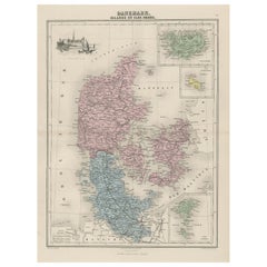
Antique Map of Denmark, Iceland and the Faroe Islands by Migeon, 1880
Located in Langweer, NL
Islands. With decorative vignette of the Kronborgh Castle and three inset maps of Island, the Bornholm and
Category

19th Century Antique Maps Of Islands

Materials

Paper

Antique Maps of Manipa, Nusa-Laut, Saparua and Haruku in Maluku, Indonesia 1726
Located in Langweer, NL
, een Orangkaya van Manipa.' Four maps of islands and two figures in native dress. The islands are
Category

18th Century Antique Maps Of Islands

Materials

Paper

Antique Map of the Islands Within the Queen Charlotte's Islands
Located in Langweer, NL
Englishman Samuel Wallis in 1767. He named it Queen Charlotte Island (French/ Reine Charlotte). This map
Category

Late 18th Century Antique Maps Of Islands

Materials

Paper

Antique Map of the Atlantic Islands, 1817
Located in Langweer, NL
Antique map titled 'Atlantic Islands'. Large map of the Atlantic Islands include the Cape Verde
Category

Early 19th Century Antique Maps Of Islands

Materials

Paper

Antique Map of the Atlantic Islands, 1817
H 21.26 in W 29.14 in D 0.02 in
Antique Map of the Wadden Islands, 1792
Located in Langweer, NL
Antique map titled 'Der Vlie Strom'. Map of the Wadden islands with Vlieland in the middle (The
Category

18th Century Antique Maps Of Islands

Materials

Paper

Antique Map of the Wadden Islands, 1792
H 16.15 in W 11.42 in D 0 in
Antique Map of Bangka Island, Indonesia, 1885
Located in Langweer, NL
Antique map titled 'Kaart van het Eiland Banka. Old map of Bangka Island, or Banka. This map
Category

19th Century Antique Maps Of Islands

Materials

Paper

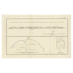
Antique Map of the Northwest Coast of Masafuera Island or Selkirk Island
Located in Langweer, NL
Antique map titled 'Vue de Cote N.O. de Masafuero'. Profile view of the north-west coast of
Category

Late 18th Century Antique Maps Of Islands

Materials

Paper

Antique Map of Ambon Island, Indonesia, 1756
Located in Langweer, NL
’. Antique map of the island of Ambon, Indonesia. This map originates from 'Historische beschryving der
Category

18th Century Antique Maps Of Islands

Materials

Paper

Antique Map of the Island of Java, Indonesia
Located in Langweer, NL
Antique map titled 'Nouvelle Carte de l'Isle de Java (..) - Nieuwe Kaart van het Eiland Java
Category

Late 18th Century Antique Maps Of Islands

Materials

Paper

Antique Map of the Island of Java, Indonesia
H 10.24 in W 18.71 in D 0.02 in
Beautiful Antique Map of Madagascar, The Comoros Islands & Reunion Island, 1667
Located in Langweer, NL
up to date of its time, utilized by contemporary explorers. This map also depicts the Comoros Islands
Category

1660s Antique Maps Of Islands

Materials

Paper

Antique Map of France with Inset Map of the Island of Corsica, 1820
Located in Langweer, NL
Antique map titled 'France in Departments'. Old map of France, with small inset map of the island
Category

19th Century Antique Maps Of Islands

Materials

Paper

Map of the Laughlan Islands, Rossel Island & Reef North of New Caledonia, 1833
Located in Langweer, NL
Particuliere d'un partie de l'Ile Rossel (Louisiade). Plan des Iles Laughlan.' Map of the Laughlan Islands
Category

1830s Antique Maps Of Islands

Materials

Paper

1854 Map of Massachusetts, Connecticut and Rhode Island, Antique Wall Map
Located in Colorado Springs, CO
This striking wall map was published in 1854 by Ensign, Bridgman & Fanning and has both full
Category

19th Century American Antique Maps Of Islands

Materials

Paper

Antique Map of Suffren Island by Cook, 1784
Located in Langweer, NL
Antique map titled 'View of Sulphur Island (..)'. Antique map and view of Suffren Island
Category

18th Century Antique Maps Of Islands

Materials

Paper

Scarce Antique Map of the Island of Java, Indonesia
Located in Langweer, NL
map, titled "Kaart van 't Eyland Groot Java," offers a rare and valuable depiction of the island of
Category

Late 18th Century Antique Maps Of Islands

Materials

Paper

Antique Map of Christmas Island by Cook, 1784
Located in Langweer, NL
Antique map Kiribati titled 'Christmas Island (..)'. Antique map of Christmas Island, also known as
Category

18th Century Antique Maps Of Islands

Materials

Paper

Antique Map of Anjouan Island by Valentijn, 1726
By F. Valentijn
Located in Langweer, NL
Antique map titled 'Anzuany'. This map depicts the island of Anjouan, one of the Comoros islands
Category

Early 18th Century Dutch Antique Maps Of Islands

Old Map of the Bangka Belitun Islands, Greater Sunda Islands, Indonesia, 1705
Located in Langweer, NL
Antique map Sunda Islands titled 'De Eilanden van Sunda, waar onder zyn Sumatra, Java, Borneo enz
Category

Early 1700s Antique Maps Of Islands

Materials

Paper

Antique Map of Buru Island, Indonesia, c.1725
Located in Langweer, NL
Antique map titled 'Boero'. Original antique map of Buru island. With an inset of the lake on top
Category

18th Century Antique Maps Of Islands

Materials

Paper

Antique Map of Coiba Island by Anson '1749'
Located in Langweer, NL
Antique map titled 'Plan van de Oost-Zyde van het Eiland Quibo'. Original antique map of the
Category

Mid-18th Century Antique Maps Of Islands

Materials

Paper

Antique Map of Coiba Island by Anson '1749'
H 10.63 in W 16.74 in D 0.02 in
Antique Map of Spain including the Balearic Islands
Located in Langweer, NL
Antique map titled 'Hispania Nova Tabula'. Ruscelli's map of Spain, including the Balearic Islands
Category

16th Century Antique Maps Of Islands

Materials

Paper

Antique Map of Ambon Island by Valentijn, 1726
By F. Valentijn
Located in Langweer, NL
Antique map titled 'Caart van het Eyland Amboina in 't bijsonder'. Map of the Islands Ambon and
Category

Early 18th Century Dutch Antique Maps Of Islands

Materials

Paper

Antique Map of Ambon Island by Valentijn, 1726
H 13.39 in W 16.93 in D 0.02 in
Antique Map of the Island of Tahiti, Polynesia, 1803
Located in Langweer, NL
Antique map Tahiti titled 'Kaart van het Eiland Otahiti'. Antique map of the Island of Tahiti
Category

Early 1800s Antique Maps Of Islands

Materials

Paper

Antique Map of Scotland With an Inset Map of the Shetland Islands, 1854
Located in Langweer, NL
: Large Antique map titled 'Scotland with its Islands, drawn from the Topographical surveys by James Wyld
Category

1850s Antique Maps Of Islands

Materials

Paper

Antique Map of the Admiralty Islands, Bismarck Archipelago
Located in Langweer, NL
Antique map titled 'Trois Vues des Isles de l'Amirauté'. Several coastal views of the Admiralty
Category

Late 18th Century Antique Maps Of Islands

Materials

Paper

18th Century Antique Map of the Virgin Islands and Caribbean Inset Maps
Located in Langweer, NL
Antilles," featuring inset maps of various islands in the Caribbean, is from the "Atlas Encyclopedique" by
Category

Late 18th Century Antique Maps Of Islands

Materials

Paper

Antique Map of Sangir Island and the Talaud Islands by Valentijn, 1726
Located in Langweer, NL
, a map of Sangir Island, Indonesia. To the right, a map of the Talaud Islands, Indonesia. This map
Category

18th Century Antique Maps Of Islands

Materials

Paper

Detailed Antique Map of Italy and surrounding Islands
Located in Langweer, NL
Antique map titled 'Italie volgens de allernieuwste Uitgave van den Heere d'Anville'. Very detailed
Category

Mid-18th Century Antique Maps Of Islands

Materials

Paper

Antique Map of Japan, the Kurile Islands and Liu Kiu Islands, 1886
Located in Langweer, NL
The map is an exquisite piece, showcasing Japan's vibrant geography. Engraved by J. Bartholomew and
Category

Late 19th Century Antique Maps Of Islands

Materials

Paper

Antique Map of Suffren Island by Cook, 1803
Located in Langweer, NL
Antique map Australia titled 'Gezigt van het Eil. Suffren'. Antique map of Suffren Island
Category

19th Century Antique Maps Of Islands

Materials

Paper

Antique Map of the Banda Islands or Spice Islands, Moluccas, Indonesia, 1697
Located in Langweer, NL
Antique map titled 'Isole di Banda Nelle Molucche'. Engraved map of Isola di Banda, Nelle
Category

17th Century Antique Maps Of Islands

Materials

Paper

Antique Map of the Santa Cruz Islands with Inset of Carteret and Gower Islands
Located in Langweer, NL
Antique map titled 'Isles de la Reine Charlotte (..)'. A detailed chart of the Santa Cruz islands
Category

Late 18th Century Antique Maps Of Islands

Materials

Paper

Map Jersey Guernsey Scilly Islands Alderney
Located in BUNGAY, SUFFOLK
Rare map of The Islands of Guernsey and Jersey, including Alderney & the Scilly Islands just
Category

18th Century English Georgian Antique Maps Of Islands

Materials

Paper

Map Jersey Guernsey Scilly Islands Alderney
H 12.21 in W 14.18 in D 0.79 in
Map of the Mozambique and Tanzania Coast & Inset Map of Anjouan Island, ca.1700
Located in Langweer, NL
Mozambique and Tanzania. With an inset map of Anjouan Island. Artists and engravers: Published by H
Category

Early 1700s Antique Maps Of Islands

Materials

Paper

Antique Map of France with an Inset Map of the Island of Corsica, c.1820
Located in Langweer, NL
'. Beautiful map of France with an inset map of the island of Corsica. Includes a table with reference to the
Category

19th Century Antique Maps Of Islands

Materials

Paper

Antique Map of the Island of Funen by Kaerius, 1628
Located in Langweer, NL
Antique map titled 'Fionia'. Copper engraved map of the Island of Funen (Denmark) by P. Kaerius
Category

Mid-17th Century Antique Maps Of Islands

Materials

Paper

Original Antique Map of the Maluku Islands or Moluccas
Located in Langweer, NL
'. This map depicts the islands of Herij, Ternate, Tidor, Pottebackers, Timor, Machian and Bachian. The
Category

Mid-18th Century Antique Maps Of Islands

Materials

Paper

Antique Map of the Islands of Iwo Jima and Sulfur
Located in Langweer, NL
Untitled Antique Map of the islands of Iwo Jima and Sulfur, with a view of Sulphur with the hill
Category

Late 18th Century Antique Maps Of Islands

Materials

Paper

Antique Map of the Queen Charlotte Islands, Haida Gwaii
Located in Langweer, NL
. The map shows only partial coastal detail along the north end of the main island, and includes two
Category

Late 18th Century Antique Maps Of Islands

Materials

Paper

Antique Map of Suffren Island by Cook, c.1781
Located in Langweer, NL
Antique map titled 'View of Sulphur Island (..)'. Antique map and view of Suffren Island
Category

18th Century Antique Maps Of Islands

Materials

Paper

Antique Map of the Island of Psara by Dapper, 1688
Located in Langweer, NL
Antique map titled 'Sara.' Map of Psara ( Psyra or Ipsera) Island (North East Aegean Islands
Category

17th Century Antique Maps Of Islands

Materials

Paper

Antique Map of Christmas Island by Cook, C.1781
Located in Langweer, NL
Antique map Kiribati titled 'Christmas Island (..)'. Antique map of Christmas Island, also known as
Category

18th Century Antique Maps Of Islands

Materials

Paper

Antique Map of Polynesia with Details of Many Islands, 1840
Located in Langweer, NL
Antique map titled 'Polynesia or Islands in the Pacific Ocean'. This map depicts various islands
Category

19th Century Antique Maps Of Islands

Materials

Paper

Antique Map of the Island of Java by Conrade, 1782
Located in Langweer, NL
Antique map titled 'Nouvelle Carte de l' Isle de Java.' (New Map of Java.) This very detailed map
Category

18th Century Antique Maps Of Islands

Materials

Paper

Antique Map of the Cocos or Keeling Islands, 1778
Located in Langweer, NL
Keppel Genannt'. Also with French subtitles. Old map of the Cocos or Keeling Islands and Traitor's Island
Category

18th Century Antique Maps Of Islands

Materials

Paper

Antique Map of the Island of Tinos by Dapper, 1687
Located in Langweer, NL
Antique map titled 'Tino.' This original antique map shows the island of Tinos, Greece. Source
Category

17th Century Antique Maps Of Islands

Materials

Paper

Antique Map of the Friendly Islands by Cook, 1803
Located in Langweer, NL
Antique map Friendly Islands titled 'Kaart van de Vrienden-Eilanden'. Antique map of the Friendly
Category

19th Century Antique Maps Of Islands

Materials

Paper

Antique Map of the Friendly Islands by Cook, 1803
Located in Langweer, NL
Antique map Friendly Islands titled 'Kaart van de Vrienden Eilanden'. Antique map of the Friendly
Category

19th Century Antique Maps Of Islands

Materials

Paper

Antique Map of Juan Fernandez Island by Anson '1749'
Located in Langweer, NL
de Zuid Zee (..)'. This map depicts Juan Fernandez Island in the Southern Sea. This map originates
Category

Mid-18th Century Antique Maps Of Islands

Materials

Paper

Antique Map of the Islands of Corsica and Sardinia, 1685
Located in Langweer, NL
maps on one sheet, showing the islands Corsica and Sardinia from the pocket atlas 'Introductionis in
Category

17th Century Antique Maps Of Islands

Materials

Paper

Antique Map of the Maluku Islands or Moluccas, Indonesia
Located in Langweer, NL
Antique map titled 'Carte Particuliere des Isles Moluques'. This map depicts the islands of Herij
Category

Mid-18th Century Antique Maps Of Islands

Materials

Paper

Original Antique Map of the Cape Verde Islands, 1746
Located in Langweer, NL
Antique map titled 'Carte Des Isles Du Cap Verd.' Original antique map of the Cape Verde Islands
Category

18th Century Antique Maps Of Islands

Materials

Paper

Antique Map of the Island Java, Indonesia, c.1650
Located in Langweer, NL
Antique map titled 'Insulae Iavae cum parte insularum Boreno Sumatrae (..)'. Beautiful map of the
Category

17th Century Antique Maps Of Islands

Materials

Paper

Antique Map of Schiermonnikoog, an island of the Netherlands, 1868
Located in Langweer, NL
Antique map titled 'Provincie Friesland - Gemeente Schiermonnikoog'. Map of the township of
Category

19th Century Antique Maps Of Islands

Materials

Paper

Antique Map of Schiermonnikoog, Wadden Island of the Netherlands, 1868
Located in Langweer, NL
Antique map titled 'Provincie Friesland - Gemeente Schiermonnikoog'. Map of the township of
Category

19th Century Antique Maps Of Islands

Materials

Paper

  • 1
  • ...
Get Updated with New Arrivals
Save "Antique Maps Of Islands", and we’ll notify you when there are new listings in this category.

Antique Maps Of Islands For Sale on 1stDibs

An assortment of antique maps of islands is available at 1stDibs. The range of distinct antique maps of islands — often made from paper, metal and wood — can elevate any home. Antique maps of islands have been produced for many years, with earlier versions available from the 18th Century and newer variations made as recently as the 21st Century. Antique maps of islands are generally popular furniture pieces, but Art Deco, Baroque and folk art styles are often sought at 1stDibs. There have been many well-made antique maps of islands over the years, but those made by Jacques-Nicolas Bellin, F. Valentijn and James Cook are often thought to be among the most beautiful.

How Much are Antique Maps Of Islands?

The average selling price for at 1stDibs is $482, while they’re typically $50 on the low end and $24,500 highest priced.

Read More

Pamela Shamshiri Shares the Secrets behind Her First-Ever Book and Its Effortlessly Cool Interiors

The sought-after designer worked with the team at Hoffman Creative to produce a monograph that beautifully showcases some of Studio Shamshiri's most inspiring projects.

Moroccan Artworks and Objects Take Center Stage in an Extraordinary Villa in Tangier

Italian writer and collector Umberto Pasti opens the doors to his remarkable cave of wonders in North Africa.

Montecito Has Drawn Royalty and Celebrities, and These Homes Are Proof of Its Allure

Hollywood A-listers, ex-pat aristocrats and art collectors and style setters of all stripes appreciate the allure of the coastal California hamlet — much on our minds after recent winter floods.

Whaam! Blam! Pow! — a New Book on Pop Art Packs a Punch

Publishing house Assouline and writer Julie Belcove have teamed up to trace the history of the genre, from Roy Lichtenstein, Andy Warhol and Yayoi Kusama to Mickalene Thomas and Jeff Koons.

The Sparkling Legacy of Tiffany & Co. Explained, One Jewel at a Time

A gorgeous new book celebrates — and memorializes — the iconic jeweler’s rich heritage.

What Makes a Gem-Encrusted Chess Set Worth $4 Million?

The world’s most opulent chess set, weighing in at 513 carats, is literally fit for a king and queen.

Tauba Auerbach’s Geometric Pop-Up Book Is Mighty Rare, Thanks to a Hurricane

This sculptural art book has an epic backstory of its own.

Step inside the Storied Mansions of Palm Beach’s Most Effervescent Architect

From Spanish-style courtyards to fanciful fountains, these acclaimed structures abound in surprising and elegant details.