Items Similar to Antique Map of Ambon Island, Indonesia, 1756


Want more images or videos?
Request additional images or videos from the seller
1 of 5
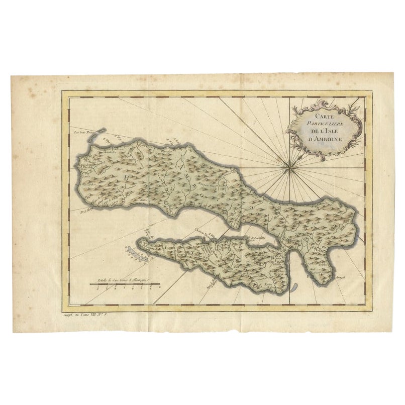
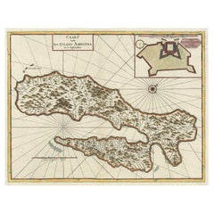
Antique Map of Ambon Island, Indonesia, 1756
About the Item
Antique map titled ‘Carte particuliere de l'Isle d'Amboine - Byzondere kaart van het eyland Amboina’. Antique map of the island of Ambon, Indonesia. This map originates from 'Historische beschryving der Reizen' published 1756.
Artists and Engravers: Made by 'Jakob van Schley' after 'Jacques Nicolas Bellin'. Jakob van der Schley (1715-1779) was a Dutch draughtsman and engraver, who studied under Bernard Picart. Jacques-Nicolas Bellin (1703-1772) was a French hydrographer, geographer and member of The Philosophes. His career, spanning over 50 years, caused an enormous output in maps, particular of maritime interest.
Condition: Good. General age-related toning. Tape on verso. Please study image carefully.
Date: 1756
Overall size: 35 x 27 cm.
Image size: 0.001 x 31x 23.5 cm.
We sell original antique maps to collectors, historians, educators and interior decorators all over the world. Our collection includes a wide range of authentic antique maps from the 16th to the 20th centuries. Buying and collecting antique maps is a tradition that goes back hundreds of years. Antique maps have proved a richly rewarding investment over the past decade, thanks to a growing appreciation of their unique historical appeal. Today the decorative qualities of antique maps are widely recognized by interior designers who appreciate their beauty and design flexibility. Depending on the individual map, presentation, and context, a rare or antique map can be modern, traditional, abstract, figurative, serious or whimsical. We offer a wide range of authentic antique maps for any budget.
- Dimensions:Height: 10.63 in (27 cm)Width: 13.78 in (35 cm)Depth: 0 in (0.01 mm)
- Materials and Techniques:
- Period:
- Date of Manufacture:1756
- Condition:
- Seller Location:Langweer, NL
- Reference Number:
About the Seller
5.0
Platinum Seller
These expertly vetted sellers are 1stDibs' most experienced sellers and are rated highest by our customers.
Established in 2009
1stDibs seller since 2017
1,932 sales on 1stDibs
Typical response time: <1 hour
- ShippingRetrieving quote...Ships From: Langweer, Netherlands
- Return PolicyA return for this item may be initiated within 14 days of delivery.
More From This SellerView All
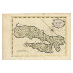
- Antique Map of Ambon Island in the Moluccas, Indonesia, c.1760Located in Langweer, NLAntique map Ambon titled 'Carte Particuliere de l 'Isle Amboine'. Old map showing Ambon, in the Moluccas Islands, better known as the Spice Islands. Ambon was the headquarters of the...Category
Antique 18th Century Maps
MaterialsPaper
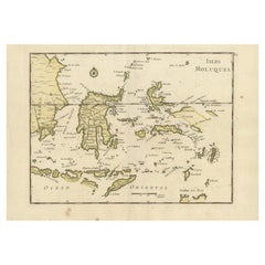
- Old Original Antique Map of the Islands of East Indonesia, 1756Located in Langweer, NLTitle: Isles Moluques. Old and rare, this decorative map of the Maluku Islands in the period it was still controlled by the Dutch colonial power. It also shows the island of Bali, Lombok, part of Borneo (Kalimantan), Celebes (Sulawesi), Timor, The Lesser Sunda Islands, West Papua...Category
Antique 1750s Maps
MaterialsPaper
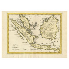
- Old Original Antique Map of the Sunda Islands of Indonesia, 1756Located in Langweer, NLTitle: Isles De La Sonde. Attractive old decorative map of the Isles de la Sonde, Borneo, Sumatra, Java and Malacca ( Malaysia) with the Straits of Malacca. Penang is spelled as P...Category
Antique 1750s Maps
MaterialsPaper
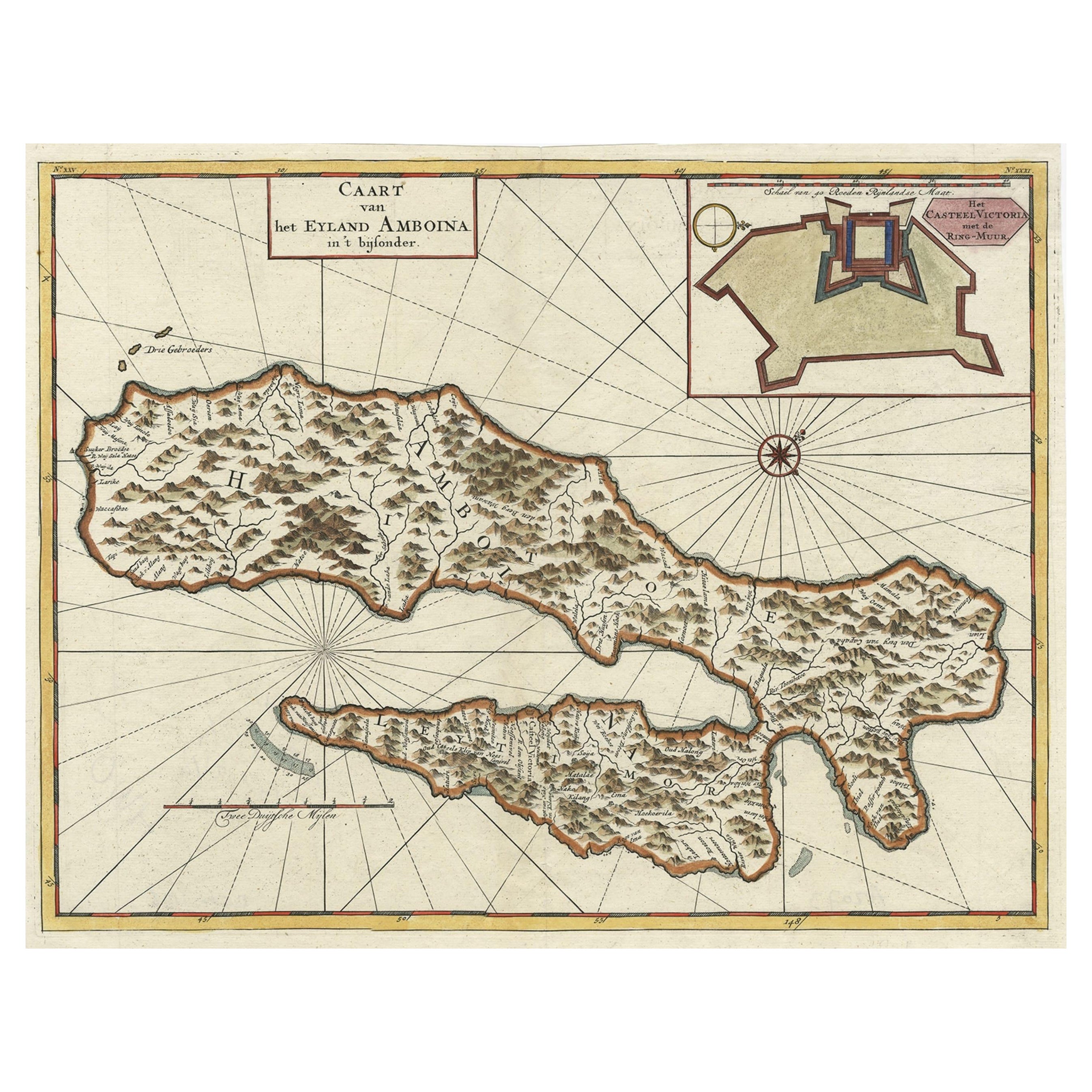
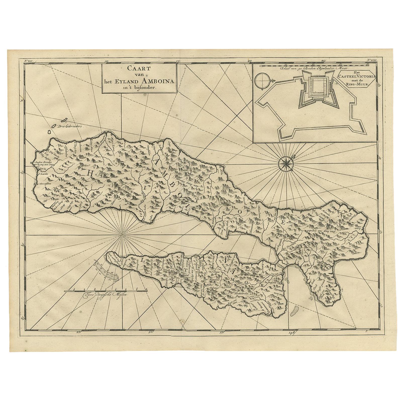
- Antique Map of Ambon Island, Indonesia with Inset of Castle Victoria, 1726Located in Langweer, NLAntique map titled 'Caart van het Eyland Amboina (..).' Detailed map of the Ambon Island and Timor, Molucca Islands, by Francois Valentyn. With an inset of castle Victoria. This map ...Category
Antique 18th Century Maps
MaterialsPaper
- Antique Map of Ambon Island by Valentijn, 1726By F. ValentijnLocated in Langweer, NLAntique map titled 'Caart van het Eyland Amboina in 't bijsonder'. Map of the Islands Ambon and Timor, one of the Moluccan Islands, Indonesia, with an inset of castle Victoria with t...Category
Antique Early 18th Century Dutch Maps
MaterialsPaper
- Antique Map of Buru Island, Indonesia, c.1725Located in Langweer, NLAntique map titled 'Boero'. Original antique map of Buru island. With an inset of the lake on top of the inland mountain. This map originates from Valentyn's 'Oud en Nieuw Oost Indie...Category
Antique 18th Century Maps
MaterialsPaper


You May Also Like
- Original Antique Map of Indonesia, 1861Located in St Annes, LancashireGreat map of Indonesia Drawn and engraved by Edward Weller Original color Published in The Weekly Dispatch Atlas, 1861 Repairs to minor e...Category
Antique 1860s English Victorian Maps
MaterialsPaper

- 1854 Map of Massachusetts, Connecticut and Rhode Island, Antique Wall MapLocated in Colorado Springs, COThis striking wall map was published in 1854 by Ensign, Bridgman & Fanning and has both full original hand-coloring and original hardware. This impression is both informative and highly decorative. The states are divided into counties, outlined in red, green, and black, and subdivided into towns. Roads, canals, and railroad lines are prominently depicted, although they are not all labeled. The mapmakers also marked lighthouses, banks, churches, and prominent buildings, with a key at right. The map is an informative and comprehensive overview of the infrastructural development of New England prior to the Civil War. Physical geographies depicted include elevation, conveyed with hachure marks, rivers and lakes. The impression features an inset map of Boston...Category
Antique 19th Century American Maps
MaterialsPaper
- Large Original Antique Map of Rhode Island, USA, C.1900Located in St Annes, LancashireFabulous map of Rhode Island Original color Engraved and printed by the George F. Cram Company, Indianapolis. Published, C.1900 Unframed Free ...Category
Antique 1890s American Maps
MaterialsPaper
- Map Jersey Guernsey Scilly Islands AlderneyLocated in BUNGAY, SUFFOLKRare map of The Islands of Guernsey and Jersey, including Alderney & the Scilly Islands just purchased more information to follow In the original cream mount and gilded frame.Category
Antique 18th Century English Georgian Maps
MaterialsPaper
- Large Original Vintage Map of British Island Possessions, circa 1920Located in St Annes, LancashireGreat map of British Island Possessions Original color. Good condition Published by Alexander Gross Unframed.Category
Vintage 1920s English Maps
MaterialsPaper
- Large Original Vintage Map of The Pacific Islands Including HawaiiLocated in St Annes, LancashireGreat map of The Pacific Islands Unframed Original color By John Bartholomew and Co. Edinburgh Geographical Institute Published, circa 1...Category
Vintage 1920s British Maps
MaterialsPaper


Recently Viewed
View AllMore Ways To Browse
Antique Islands
Antique Island
Antique Island Furniture
French Antique Island
Antique Indonesia
Indonesian Antiques
Indonesia Antique
Antiques From Indonesia
Maritime Antiques
Rare Map France
Dutch Indonesia
Indonesian Dutch
18th Century Indonesia
18th Century Indonesian
Antique French 18th Century Map
Indonesia Map
Antique Map Indonesia
Antique Maps Indonesia