Items Similar to Antique Map of Schiermonnikoog, an island of the Netherlands, 1868


Want more images or videos?
Request additional images or videos from the seller
1 of 6
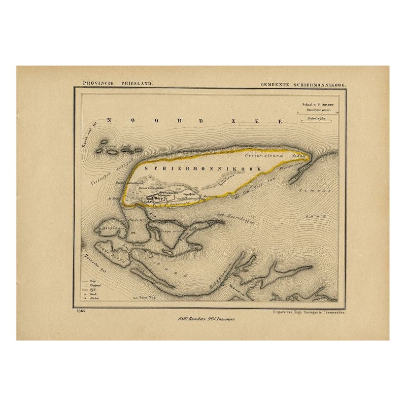
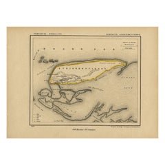
Antique Map of Schiermonnikoog, an island of the Netherlands, 1868
About the Item
Antique map titled 'Provincie Friesland - Gemeente Schiermonnikoog'. Map of the township of Schiermonnikoog, Friesland. This map originates from 'Gemeente-Atlas van Nederland' by J. Kuyper. Artists and Engravers: Published by H. Suringar.
Artist: Published by H. Suringar.
Condition: Good, general age-related toning. Minor wear, blank verso. Please study image carefully.
Date: 1868
Overall size: 26.5 x 20 cm.
Image size: 0.001 x 18 x 15 cm.
Antique prints have long been appreciated for both their aesthetic and investment value. They were the product of engraved, etched or lithographed plates. These plates were handmade out of wood or metal, which required an incredible level of skill, patience and craftsmanship. Whether you have a house with Victorian furniture or more contemporary decor an old engraving can enhance your living space. We offer a wide range of authentic antique prints for any budget.
- Dimensions:Height: 7.88 in (20 cm)Width: 10.44 in (26.5 cm)Depth: 0 in (0.01 mm)
- Materials and Techniques:
- Period:
- Date of Manufacture:1868
- Condition:
- Seller Location:Langweer, NL
- Reference Number:
About the Seller
5.0
Platinum Seller
These expertly vetted sellers are 1stDibs' most experienced sellers and are rated highest by our customers.
Established in 2009
1stDibs seller since 2017
1,922 sales on 1stDibs
Typical response time: <1 hour
- ShippingRetrieving quote...Ships From: Langweer, Netherlands
- Return PolicyA return for this item may be initiated within 14 days of delivery.
More From This SellerView All
- Antique Map of Schiermonnikoog, Wadden Island of the Netherlands, 1868Located in Langweer, NLAntique map titled 'Provincie Friesland - Gemeente Schiermonnikoog'. Map of the township of Schiermonnikoog, Friesland. This map originates from 'Gemeente-Atlas van Nederland' by J. ...Category
Antique 19th Century Maps
MaterialsPaper
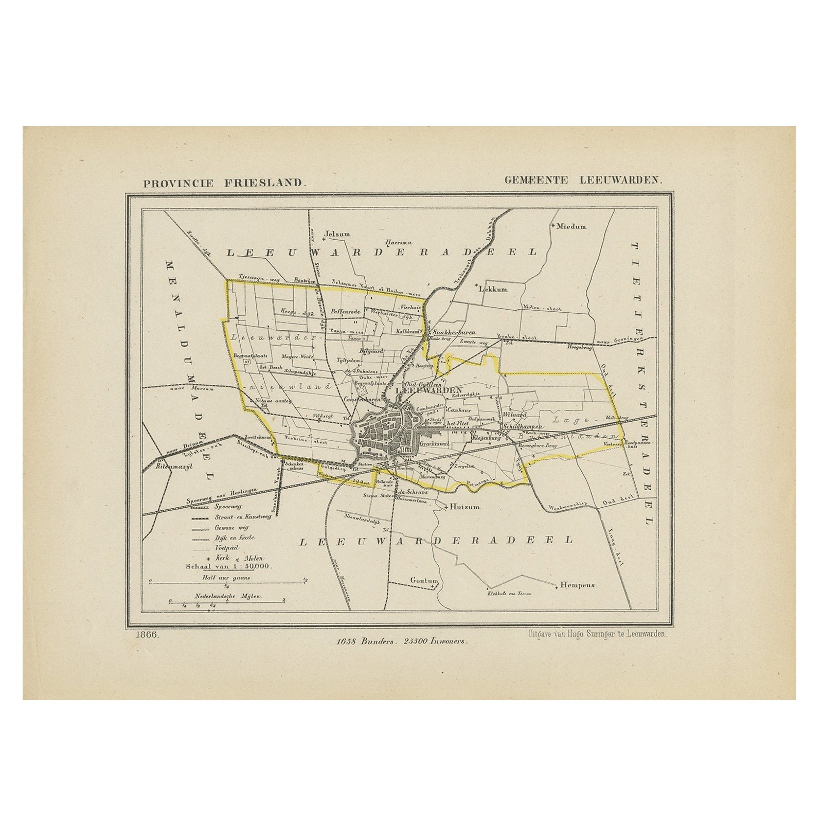
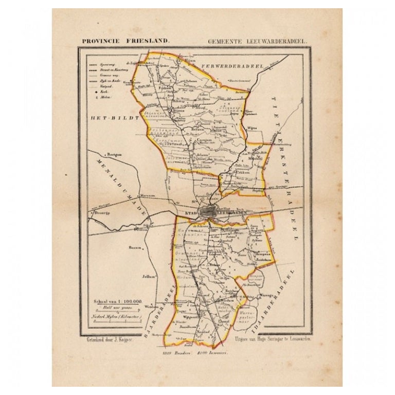
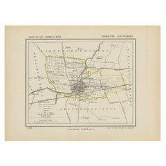
- Antique Map of Leeuwarderadeel in Friesland, The Netherlands, 1868Located in Langweer, NLAntique map titled 'Provincie Friesland - Gemeente Leeuwarderadeel'. Map of the township of Leeuwarderadeel including Friesland's Capital Leeuwarden and furthermore: Wirdum, Wytg...Category
Antique 19th Century Maps
MaterialsPaper
- Antique Map of Gaasterland, Friesland in the Netherlands, 1868Located in Langweer, NLAntique map titled 'Provincie Friesland - Gemeente Gaasterland'. Map of the township of Gaasterland including Balk, Bakhuizen, Wijckel, Sloten and many other villages. This map origi...Category
Antique 19th Century Maps
MaterialsPaper
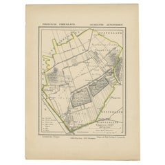
- Antique Map of Leeuwarden, Capital of Friesland, the Netherlands, 1868Located in Langweer, NLAntique map titled 'Provincie Friesland - Gemeente Leeuwarden'. Map of the township of Leeuwarden, Friesland. This map originates from 'Gemeente-Atlas van Nederland' by J. Kuyper. Ar...Category
Antique 19th Century Maps
MaterialsPaper
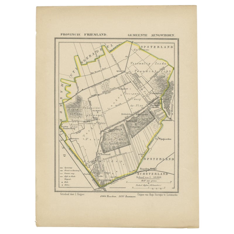
- Antique Map of Frisian Municipality Aengwirden in the Netherlands, 1868Located in Langweer, NLAntique map titled 'Provincie Friesland - Gemeente Aengwirden'. Map of the township Aengwirden including Heerenveen, Terband, Tjalleberd, Gersloot and many other villages. This map o...Category
Antique 19th Century Maps
MaterialsPaper
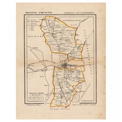
- Antique Map of Leeuwarderadeel, Township in Friesland, The Netherlands, 1868Located in Langweer, NLAntique map titled 'Provincie Friesland - Gemeente Leeuwarderadeel'. Map of the township of Leeuwarderadeel including Leeuwarden, Wirdum, Stiens and many other villages. This map ori...Category
Antique 19th Century Maps
MaterialsPaper


You May Also Like
- Original Antique Map of The Netherlands, Engraved by Barlow, Dated 1807Located in St Annes, LancashireGreat map of Netherlands Copper-plate engraving by Barlow Published by Brightly & Kinnersly, Bungay, Suffolk. Dated 1807 Unframed.Category
Antique Early 1800s English Maps
MaterialsPaper
- Original Antique Map of The Netherlands, Sherwood, Neely & Jones, Dated 1809Located in St Annes, LancashireGreat map of The Netherlands Copper-plate engraving by Cooper Published by Sherwood, Neely & Jones. Dated 1809 Unframed.Category
Antique Early 1800s English Maps
MaterialsPaper
- St. Christophe 'St. Kitts' Island: An 18th Century Hand-colored Map by BellinBy Jacques-Nicolas BellinLocated in Alamo, CAJacques Bellin's copper-plate map of the Caribbean island of Saint Kitts entitled "Carte De De l'Isle St. Christophe Pour servir á l'Histoire Genle. des V...Category
Antique Mid-18th Century French Maps
MaterialsPaper
- Map of the Republic of GenoaLocated in New York, NYFramed antique hand-coloured map of the Republic of Genoa including the duchies of Mantua, Modena, and Parma. Europe, late 18th century. Dimension: 25...Category
Antique Late 18th Century European Maps
- Hand-Colored 18th Century Homann Map of Denmark and Islands in the Baltic SeaBy Johann Baptist HomannLocated in Alamo, CAAn 18th century copper plate hand-colored map entitled "Insulae Danicae in Mari Balthico Sitae utpote Zeelandia, Fionia, Langelandia, Lalandia, Falstria, Fembria Mona" created by Joh...Category
Antique Early 18th Century German Maps
MaterialsPaper
- Antique Map of Principality of MonacoBy Antonio Vallardi EditoreLocated in Alessandria, PiemonteST/619 - "Old Geographical Atlas of Italy - Topographic map of ex-Principality of Monaco" - ediz Vallardi - Milano - A somewhat special edition ---Category
Antique Late 19th Century Italian Other Prints
MaterialsPaper


Recently Viewed
View AllMore Ways To Browse
Antique Furniture From Netherlands
Long Island Furniture
Long Island Used Furniture
Old Wood Island
Antique Wood Island
Long Island Artists
Maps Of Long Island
Long Island Map
Map Of Long Island
Antique Maps Of Long Island
Antique Map Of Long Island
Antique Map Long Island
Antique Long Island Map
Antique Surveying
Antique Style Map
Antique New York Maps
Antique Maps New York
Antique New York Map