Items Similar to Map of the Laughlan Islands, Rossel Island & Reef North of New Caledonia, 1833


Want more images or videos?
Request additional images or videos from the seller
1 of 5
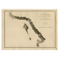
Map of the Laughlan Islands, Rossel Island & Reef North of New Caledonia, 1833
About the Item
Antique map titled 'Plan de l'extremite septentrionale du Recif de D'entrecasteaux. Carte Particuliere d'un partie de l'Ile Rossel (Louisiade). Plan des Iles Laughlan.'
Map of the Laughlan Islands (Waboma and Budelun islands, east of Papua New Guinea), Rossel Island (one of the Louisiades) and a map of the reef north of New Caledonia, d'Entrecasteaux Reef. Islands in the Coral and Solomon Seas. The route of the Astrolabe is indicated. Map no. 25 from the atlas volume of Dumont D'Urville's "Voyage de la Corvette l'Astrolabe", published in Paris: J. Tastu, 1833.
Artists and Engravers: Made by 'Ambroise Tardieu' after 'Paris & Gressien'.
- Dimensions:Height: 25.4 in (64.5 cm)Width: 19.02 in (48.3 cm)Depth: 0 in (0.02 mm)
- Materials and Techniques:
- Period:
- Date of Manufacture:1833
- Condition:Wear consistent with age and use. Condition: Good, given age. A few small stains (foxing) in the image and margins. Two small tears in the lower margin. General age-related toning and/or occasional minor defects from handling. Please study image carefully.
- Seller Location:Langweer, NL
- Reference Number:
About the Seller
5.0
Platinum Seller
These expertly vetted sellers are 1stDibs' most experienced sellers and are rated highest by our customers.
Established in 2009
1stDibs seller since 2017
1,929 sales on 1stDibs
Typical response time: <1 hour
- ShippingRetrieving quote...Ships From: Langweer, Netherlands
- Return PolicyA return for this item may be initiated within 14 days of delivery.
More From This SellerView All
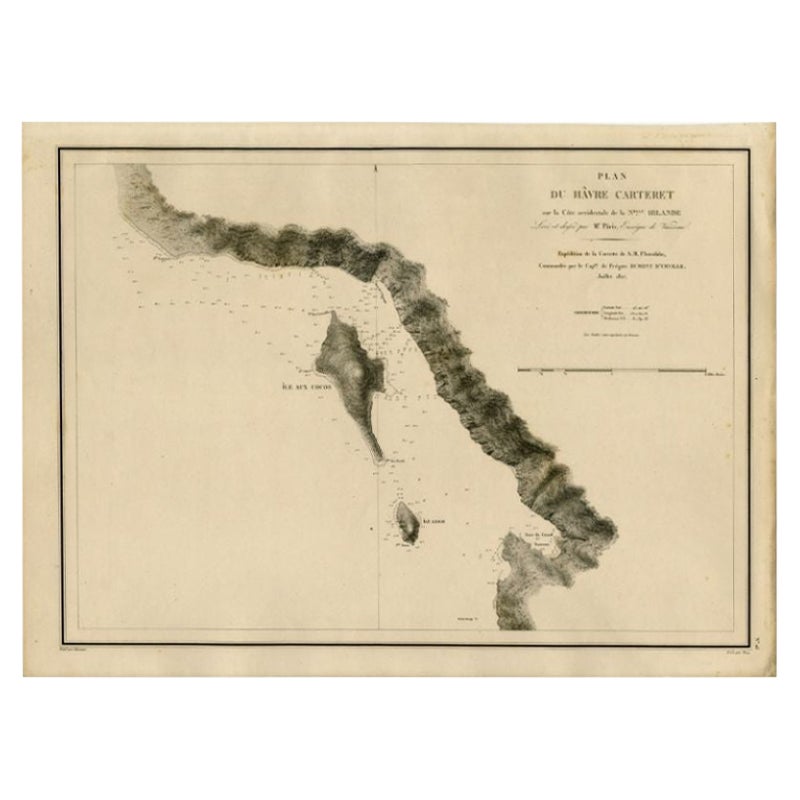
- Antique Map of the Coast of New Ireland, Earlier Part of German New Guinea, 1833Located in Langweer, NLAntique map titled 'Plan du Havre Carteret sur la Cote occidentale de la Nelle Irlande. Expedition de la Corvette de S.M. l'Astrolabe, Commandee par le CAP ne de Fregate Dumont D'Urville. Juillet 1827.' A chart of the coast of Latangai Island (then known as New Ireland), with Lamassa Island (identified as Ile Cocos), and a second island identified as Ile Leigh. Shows soundings and height profile. New Ireland, also New Mecklenburg, is the Northeastern Province of Papua New Guinea. Map no. 26 from Dumont D'Urville's "Voyage de la Corvette l'Astrolabe - Atlas"", published in Paris: J. Tastu, 1833. New Ireland or Latangai, is a large island in Papua New Guinea, approximately 7,404 km2 (2,859 sq mi) in area with c. 120,000 people. It is named after the island of Ireland. It is the largest island of New Ireland Province, lying northeast of the island of New Britain. Both islands are part of the Bismarck Archipelago, named after Otto von Bismarck...Category
Antique 19th Century Maps
MaterialsPaper
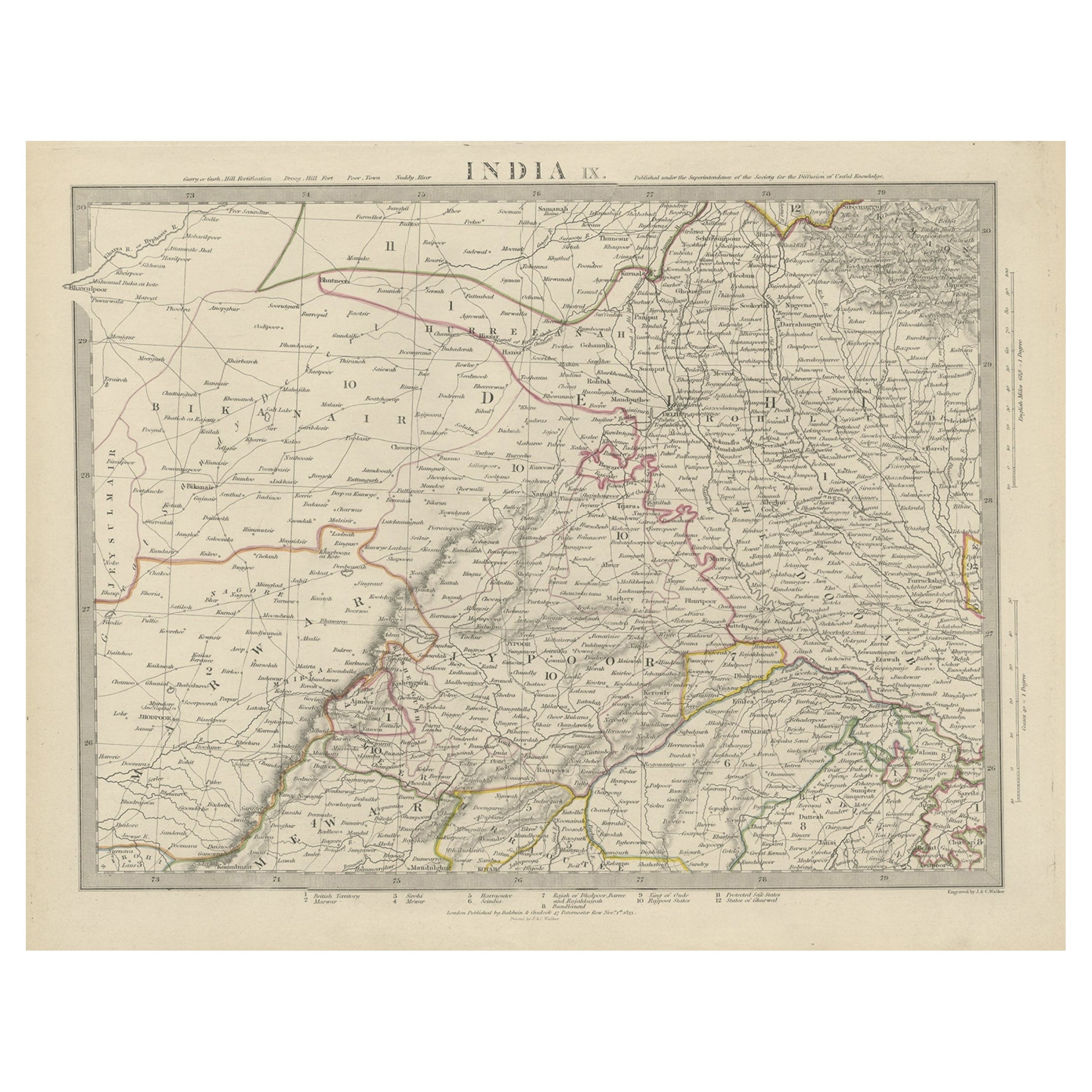
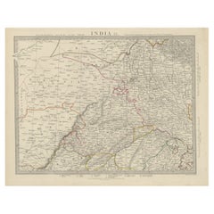
- Antique Map of the Region of Delhi in India, 1833Located in Langweer, NLAntique map titled 'India IX'. Old steel engraved map of the region of Delhi, with great detail. Artists and Engravers: Engraved by J. & C. Walker. Published under the superinten...Category
Antique 19th Century Maps
MaterialsPaper
- Antique Map of New Ireland Island in the Bismarck Archipelago, New Guinea, 1772Located in Langweer, NLAntique map titled 'Nova Hibernia'. Antique map of New Ireland, an island in the Bismarck Archipelago, New Guinea. Lying just north of New Britain, from which it is separated by St. ...Category
Antique 18th Century Maps
MaterialsPaper
- Antique Map of the Atlantic Islands, 1817Located in Langweer, NLAntique map titled 'Atlantic Islands'. Large map of the Atlantic Islands include the Cape Verde islands, Canary islands, Azore islands and Madeira islands. Also included a view of th...Category
Antique Early 19th Century Maps
MaterialsPaper
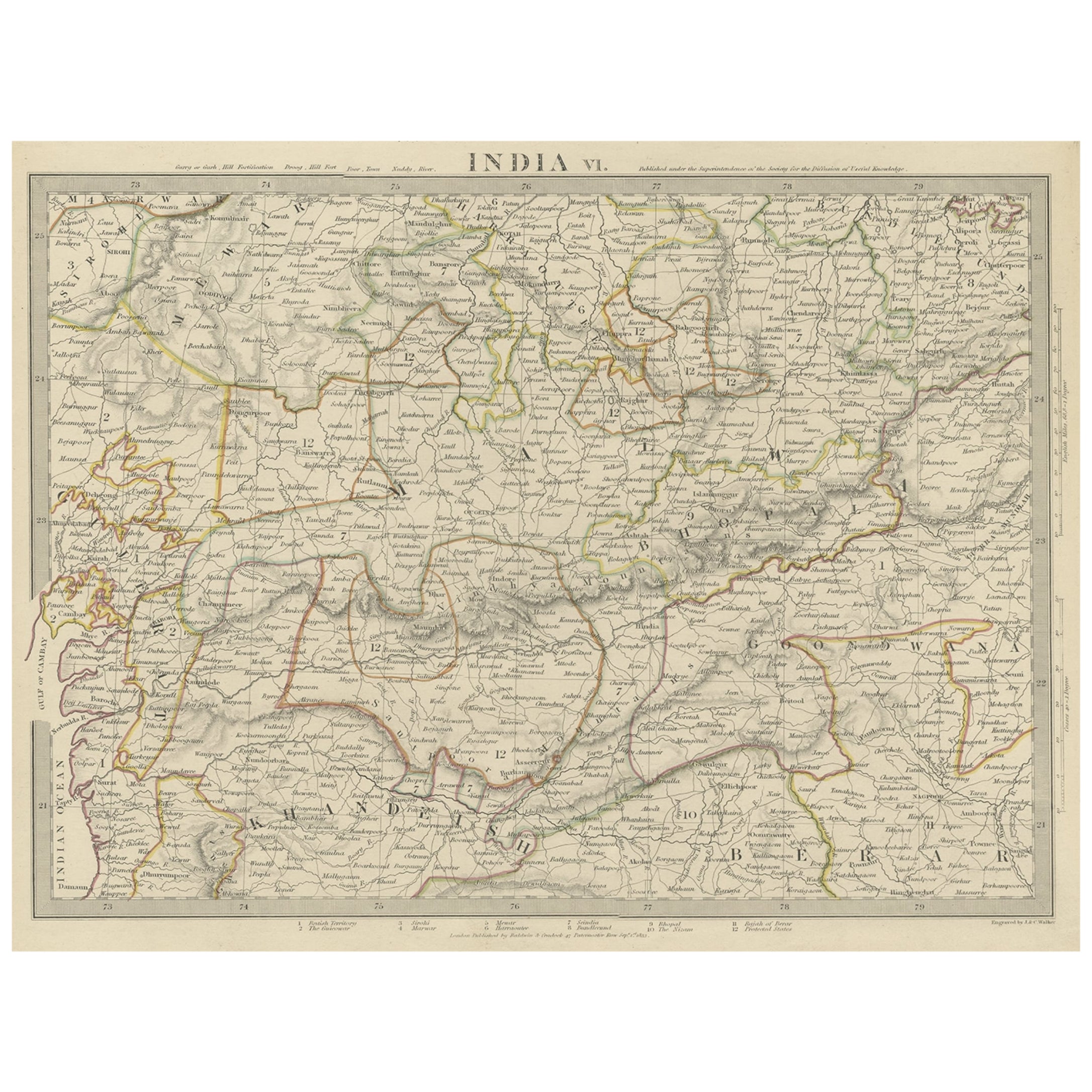
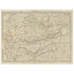
- Detailed Antique Map of the Region of Malwa in India, 1833Located in Langweer, NLAntique map titled 'India VI'. Old steel engraved map of the region of Malwa showing great detail. Artists and Engravers: Engraved by J. & C. Walker. Published under the superint...Category
Antique 19th Century Maps
MaterialsPaper
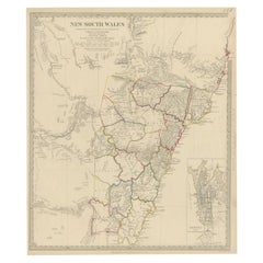
- Antique Map of New South Wales with an Inset of Sydney, Australia, 1833Located in Langweer, NLAntique map of Australia titled 'New South Wales'. Old map of New South Wales, Australia. With an inset map of Sydney. Arists and Engravers: Engraved by J. & C. Walker. Published by ...Category
Antique 19th Century Maps
MaterialsPaper

You May Also Like
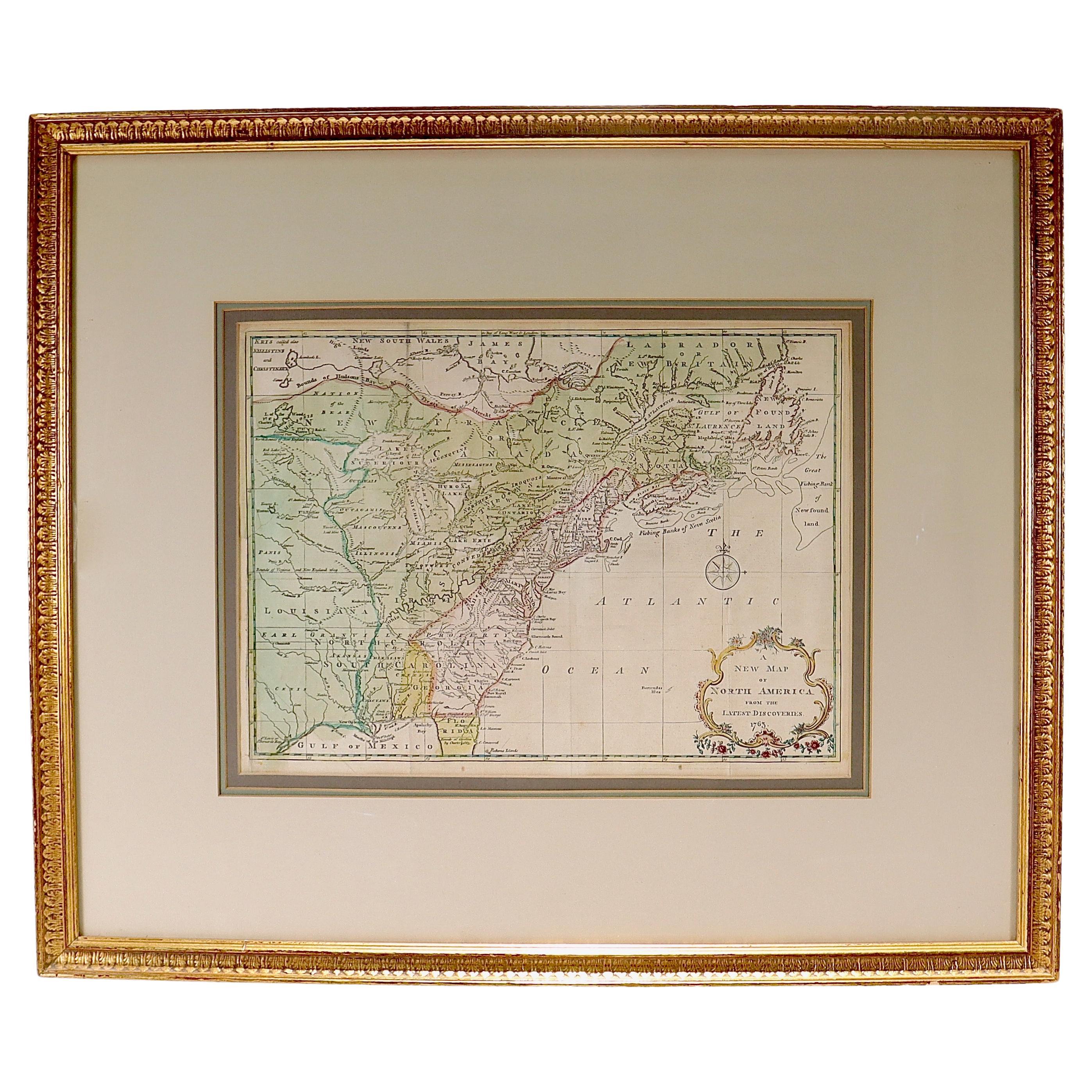
- New Map of North America from the Latest Discoveries, 1763Located in Philadelphia, PAA fine antique 18th century map of the North American seaboard. Entitled "A New Map of North America from the Latest Discoveries 1763". By the Cartographer/Engraver - John Spil...Category
Antique Mid-18th Century English Georgian Maps
MaterialsPaper
- Large Antique 1859 Map of North AmericaLocated in Sag Harbor, NYThis Map was made by Augustus Mitchell in 1859 It is in amazing condition for being 163 years old. This price is for the rolled up easy to ship version of this piece. I will be Frami...Category
Antique Mid-19th Century American Maps
MaterialsCanvas, Paper

- Map of the Republic of GenoaLocated in New York, NYFramed antique hand-coloured map of the Republic of Genoa including the duchies of Mantua, Modena, and Parma. Europe, late 18th century. Dimension: 25...Category
Antique Late 18th Century European Maps
- Hand-Colored 18th Century Homann Map of Denmark and Islands in the Baltic SeaBy Johann Baptist HomannLocated in Alamo, CAAn 18th century copper plate hand-colored map entitled "Insulae Danicae in Mari Balthico Sitae utpote Zeelandia, Fionia, Langelandia, Lalandia, Falstria, Fembria Mona" created by Joh...Category
Antique Early 18th Century German Maps
MaterialsPaper
- Map "Estuary- Mouth of the Thames"Located in Alessandria, PiemonteST/426 - Antique French Map of the estuary of the Thames, map dated 1769 - "Mape of the entrance of the Thames. Designed by filing of Navy cards fo...Category
Antique Mid-18th Century French Other Prints
MaterialsPaper
- "Nova Barbariae Descriptio", a 17th Century Hand-Colored Map of North AfricaBy Johannes JanssoniusLocated in Alamo, CAThis original attractive 17th century hand-colored map of North Africa entitled "Nova Barbariae Descriptio" by Johannes Janssonius was published in Paris in 1635. It includes the Med...Category
Antique Mid-17th Century Dutch Maps
MaterialsPaper


