Mid-18th Century More Prints
to
1
25
1
7
11
16
9
1
8
13
3
1
1
Overall Height
to
Overall Width
to
12
244
610
6,181
3,680
81
153
286
544
555
737
956
1,011
625
433
169
2
1
1
1
1
19
6
3
1
1
Period: Mid-18th Century
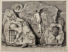
(Large!) UNA DELLE QUATTRO FIGURE RAPPRESENTANTI QUATTRO VITTORIE
Located in Santa Monica, CA
GIOVANNI BATTISTA PIRANESI (1710-1778)
UNA DELLE QUATTRO FIGURE RAPPRESENTANTI QUATTTRO VITTORIE, (Focillon 330, Wilton-Ely 463) 1750-1756
Etching, Plate 48 from “Le Antichita Romane“ vol. 3. Engraved by Jean Barbault...
Category
Old Masters Mid-18th Century More Prints
Materials
Etching
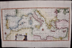
Mediterranean and Adriatic Seas: Original 18th Century Hand-colored Map by Bowen
Located in Alamo, CA
This is an original 18th century hand-colored map entitled "An Accurate Chart of The Mediterranean and Adriatic Sea's; with the Archipelago & Part of the Black Sea. Exhibiting all th...
Category
Old Masters Mid-18th Century More Prints
Materials
Engraving
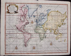
Map of the World: An Original 18th Century Hand-colored Map by E. Bowen
Located in Alamo, CA
This is an original 18th century hand-colored map entitled "A New & Correct Chart of All The Known World Laid down according to Mercator's Projection" by Emanuel Bowen. It was published in 1744 in London in John Harris's "Navigantium atque Itinerantium Bibliotheca" or "A Complete Collection of Voyages and Travels". This highly detailed and colorful map depicts the world. as it was known in the mid 18th century. A majority of the northern and central portions of Canada and America are left blank due to the purity of knowledge at the time this map was published.
The map is embellished with four Compass Roses in the lower left, lower center, lower right and center, along with many rhumb lines. There a is a decorative title cartouche in the upper left. This colorful, attractive, historical and interesting 1744 map presents the entire world on Mercator's projection as it was understood in the middle part of the 18th century, before the landmark explorations of Captain’s Cook, Vancouver, Wilkes and others. It is an example of a nautical chart, a type of map that was designed specifically for use by mariners. The map is centered on the equator and includes both the Eastern and Western Hemispheres. The continents of North America, South America, Europe, Africa, and Asia are depicted, as well as various islands in the Atlantic, Pacific, and Indian Oceans. The map is laid out according to the Mercator projection, a type of cylindrical map projection that was developed in the 16th century by Flemish cartographer Gerardus Mercator. This projection has the advantage of preserving angles and shapes, making it useful for navigation. The map presents a paucity of inland detail, particularly for the Americas, but major cities, geographical landmarks, and regions are included. Ocean currents and Tradewinds are identified, as well as the magnetic declination lines or magnetic variance, which refers to the difference between true north and compass north. The continents are color coded, enhancing the beauty of this map. The three compass roses indicate the directions of the cardinal points.
The depiction of the western coast of America, the Pacific and Australia are interesting. There was very little exploration of Australia between the navigations of William Damper in 1699 and Tobias Furneaux in 1773. Most of the maps detail relies on the 17th century Dutch expeditions to Australia's western coast, by Abel Tasman and William Janszoon. Van Diemen's Land (Tasmania) and New Guinea appear connected to the Australian continent. New Zealand appears as a single landmass. North of New Zealand there is a landmass labelled 'Ter d' St. Esprit' which probably represents the New Hebrides Islands. This map precedes the accurate exploration of the South Pacific and east coast of Australia by Captain James Cook later in the 18th century. The map includes ‘Drakes' Port,' the site where Sir Francis Drake supposedly landed in 1579 during his 1579 circumnavigation of the globe. Here he claimed territory for England, restocked, and repaired his vessels. Drake named the region New Albion. The exact location of Drake's Port is a cartographic mystery. Drake's Harbor is believed to be in the region of San Francisco Bay, Bodega Bay, San Pablo Bay...
Category
Old Masters Mid-18th Century More Prints
Materials
Engraving
Map of the East Indies: An Original 18th Century Hand-colored Map by E. Bowen
Located in Alamo, CA
This is an original 18th century hand-colored map entitled "An Accurate Map of the East Indies Exhibiting the Course of the European Trade both on the Continent and Islands" by Emanu...
Category
Old Masters Mid-18th Century More Prints
Materials
Engraving
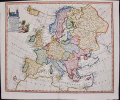
Europe: An Original 18th Century Hand-colored Map by E. Bowen
Located in Alamo, CA
This is an original 18th century hand-colored map entitled "A New & Accurate Map of Europe Drawn from the Best Authorities Assisted by the Most Improved Modern Charts and Maps." by E...
Category
Old Masters Mid-18th Century More Prints
Materials
Engraving
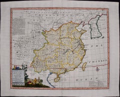
China: An Original 18th Century Hand-colored Map by E. Bowen
Located in Alamo, CA
This is an original 18th century hand-colored map entitled "A New & Accurate Map of China, Drawn from Surveys made by the Jesuit Missionaries, by order of the Emperor. The whole bein...
Category
Old Masters Mid-18th Century More Prints
Materials
Engraving
Map of the Russian Empire: An Original 18th Century Hand-colored Map by E. Bowen
Located in Alamo, CA
This is an original 18th century hand-colored map entitled "A New & Accurate Map of The Whole Russian Empire, As Contain'd Both In Europe and Asia, Drawn from Authentic Journals, Sur...
Category
Old Masters Mid-18th Century More Prints
Materials
Engraving
Siberia as Explored by Behring: Original 18th Century Hand-colored Map by Bowen
Located in Alamo, CA
This is an original 18th century hand-colored map entitled "An Exact Chart of all the Countries through which Capt. Behring Travelled from Tobolski, Capital of Siberia to the Country...
Category
Old Masters Mid-18th Century More Prints
Materials
Engraving
Draught of a Galley /// Old Masters Ship Boat Seascape Construction Diagram Art
By William Henry Toms
Located in Saint Augustine, FL
Artist: William Henry Toms (English, c.1700-1765)
Title: "Draught of a Galley" (Plate 13, Vol. III, page 131)
Portfolio: La Spectacle de la Nature
Year: 1737
Medium: Original Hand-Colored Engraving on laid paper
Limited edition: Unknown
Printer: Unknown, London, UK
Publisher: Humphreys, London, UK
Framing: Recently framed in a Regency style gold moulding with rag matting from Holland and museum glass. The frame is an antique frame we've reused, originally built by Knoedler Gallery, New York, NY
Framed size: 10.25" x 10.25"
Sheet size (irregular margins): 6.63" x 8.25"
Image size: 4.75" x 6.75"
Condition: In excellent condition with strong colors and good margins
Rare
Notes:
Comes from the 1737 volume edition of Noël-Antoine Pluche's "La Spectacle de la Nature", translated from the original French by Humphreys as "Nature Displayed". With two soft vertical folds within paper as issued. Various dealer reference numbers and an old price pencil inscribed in margins and on verso.
Biography:
William Henry Toms (c. 1700–1765) was an English engraver. He worked on portraits, book-plates, landscapes and prints of buildings. Among his works were the plates for Robert West's "Perspective Views of All the Ancient Churches in London" (1736–1739). In 1741, he worked with Thomas Badeslade on "Chorographia Britanniae or a New Set of Maps of all the Counties in England and Wales". The maps were republished on 29 September 1742, with additional place names. Among Toms's apprentices was the engraver and publisher John Boydell. W. H. Toms lived in Masham Street, London, and was the father of the painter Peter Toms. Toms died in 1765.
Noël-Antoine Pluche (1688-1761) , known as the abbé Pluche, was a French priest...
Category
Baroque Mid-18th Century More Prints
Materials
Watercolor, Laid Paper, Engraving, Intaglio
Set of Three Antique Hand Colored Seashell Engravings
Located in Palm Beach, FL
Historic set of three 18th century engravings hand painted in watercolor depicting seashell specimens in an early naturalist style. Presented u...
Category
Naturalistic Mid-18th Century More Prints
Materials
Engraving
A View of London as it was in the Year 1647 pub. by Boydell 1756
Located in Paonia, CO
A View of London as it was in the Year 1647 is a hand colored copper engraving published by the well known British publisher and engraver John Boydell (1720-1804) and engraved by R.Benning sold at Cheapside London 1756. Panoramic view on two sheets conjoined as issued linen mounted. Lettered with title in French and English along the base of the image including a numbered key to the structures. In very good condition except for one 1/8 inch tear in the sky to the left of the middle seam that is barely noticeable. This is a large very detailed panorama of London...
Category
Other Art Style Mid-18th Century More Prints
Materials
Etching
Meissen, Germany : A Large Framed 18th Century Map by Petrus Schenk
Located in Alamo, CA
This is a hand-colored 18th century map of the Meissen region of Germany, entitled "Geographischer Entwurff Derer Aemmter Meissen als Creys-Procuratur-Schul-und Stiffts-Ammt benebst ...
Category
Old Masters Mid-18th Century More Prints
Materials
Engraving
The Happy Consultation, or Modern Match
Located in Santa Monica, CA
EIGHTEENTH CENTURY BRITISH CARICATURE
THE HAPPY CONSULTATION, or MODERN MATCH, 1769 (DG 4335)
...
Category
Old Masters Mid-18th Century More Prints
Materials
Engraving
Coot Bird, "Wasserhuhn": An 18th Century Hand-colored Frisch Engraving
Located in Alamo, CA
This is a rare 18th Century hand-colored copperplate engraving entitled "Wasserhuhn" (Coot) by Johann Leonhard Frisch , which is plate 208 from ...
Category
Naturalistic Mid-18th Century More Prints
Materials
Engraving
Print, Handcolored, Copperplate, Engraved, London Bridge, William Maitland, 1739
Located in Eversholt, Bedfordshire
In original condition. Page 33, 'The History of London from its Foundation by the Romans to the Present Time', by William Maitland, published in 1739....
Category
Mid-18th Century More Prints
Materials
Paper
Black Stork, "Ciconia Nigra": An 18th Century Hand-colored Frisch Engraving
Located in Alamo, CA
This is a rare 18th Century hand-colored copperplate engraving entitled "Ciconia Nigra" (Black Stork) by Johann Leonhard Frisch is plate 197 fro...
Category
Naturalistic Mid-18th Century More Prints
Materials
Engraving
White Stork "Storch Ciconia": An 18th Century Hand-colored Frisch Engraving
Located in Alamo, CA
This is a rare 18th Century hand-colored copperplate engraving entitled "Der Storch Ciconia" (White Stork) by Johann Leonhard Frisch is plate 19...
Category
Naturalistic Mid-18th Century More Prints
Materials
Engraving
Framed 18th Century Hand Colored German Book Page W/ Illustration and Text
Located in San Francisco, CA
Framed 18th Century Hand Colored German Book Page W/ Illustration and Text
Antique Book Page
German Text
Dimensions 10" wide x 15" high
The fram...
Category
Mid-18th Century More Prints
Materials
Handmade Paper
Veduta Della Gran Curia Innocenziana from Vedute di Roma, 1752
Located in San Francisco, CA
This exceptional mid-18th century etching by Giovanni Battista (Giambattista) Piranesi (b. 1720-1778) is titled “Veduta della Gran Curia Innocenziana” (“View of the Palazzo di Montecitorio”). It is from Piranesi’s Vedute di Roma...
Category
Realist Mid-18th Century More Prints
Materials
Etching
French Commode Table Etching From "The Gentleman and Cabinet-Maker's Director"
By Thomas Chippendale
Located in Houston, TX
Engraving from a book titled, "The Gentleman and Cabinet-Maker's Director" printed in 1753. Thomas Chippendale was the designer and Mary and Matthew Darly...
Category
Rococo Mid-18th Century More Prints
Materials
Etching
Four Framed Hogarth Engravings "Four Times of the Day"
Located in Alamo, CA
The four plates in this "Four Times of the Day" set were created utilizing both engraving and etching techniques by William Hogarth in 1738. Hogarth's original copper plates were refurbished where needed by James Heath and these engravings were republished in London in 1822 by Braddock, Cradock & Joy. This was the last time Hogarth's original copper plates were used for printing. Most were melted down during World War I for the construction of bombs. Printed upon early nineteenth century wove paper and with large, full margins as published by William Heath in 1822. The inscription below each print reads "Invented Painted & Engraved by Wm. Hogarth & Publish'd March 25. 1738 according to Act of Parliament".
These large folio sized "Four Times of the Day" engravings/etchings are presented in complex gold-colored wood frames with black bands and scalloped gold inner trim. A majority of each thick impressive frame is covered with glass applied near the outer edge. Each frame measures 25.75" high, 22.25" wide and 1.88" deep. There are a few small dents in the edge of these frames, which are otherwise in very good condition. "Morning" has two focal areas of discoloration in the upper margin and some discoloration in the right margin, a short tear in the left margin and a short tear or crease in the right margin. "Noon" has a spot in the upper margin that extends into the upper image, but it is otherwise in very good condition. "Evening" has a faint spot in the upper margin, but it is otherwise in very good condition. "Night" is in excellent condition.
The "Four Times of the Day" series is in the collection of many major museums, including: The British Museum, The Metropolitan Museum of Art, The Tate Museum, The Chicago Art Institute and The Victoria and Albert Museum.
Through this series Hogarth is portraying early 18th century London street life at "Four Times of the Day". His characters are exhibiting their personalities, quircks, strange activities, but he also wants to draw attention the disparities between the wealthy aristocracy and the common working class.
Plate 1, "Morning" depicts morning in Covent Garden in the winter in front of Tom King...
Category
Old Masters Mid-18th Century More Prints
Materials
Engraving, Etching
18th Century Hand Colored Engraving of a Camel from Pennant's " British Zoology"
Located in Alamo, CA
An 18th Century Hand Colored Engraving of a Camel from Thomas Pennant's famous publication on natural history "The British Zoology, Published under the Inspection of the Cymmrodorion...
Category
Naturalistic Mid-18th Century More Prints
Materials
Engraving
Columbines Pl.162 Original mezzotint by J.W. Weinmann
Located in Paonia, CO
“Columbines Pl. 162” A Weinmann, Johann, Wilhelm Mezzotint Engraving With Some Hand Coloring from Johan Wilhelm Weinmann’s ( 1683-1741 ) Phytanthoza Iconographia, a comprehensive sci...
Category
Other Art Style Mid-18th Century More Prints
Materials
Mezzotint
Antique 1765 Wine Country Folding Map of France, Bordeau etc.
Located in Paonia, CO
Route du Carosse de Bordeaux, part de Paris tous les Mardis a 11 matin. a et pafse 1765 is a comprehensive map with two routes through the wine country of France starting in Paris going south...
Category
Other Art Style Mid-18th Century More Prints
Materials
Etching
Map of Tabula Geographica Territorium Civitatis Svevo=Hallensis by Homann 1762
By Homann Heirs
Located in Paonia, CO
Map of Tabula Geographica sistens Territorium Liberae Sacri Romani Imperi Civitatis Svevo=Hallensis in suas Praefecturas divisum unacum finitimis Regionibus delineata a Mattheo ...
Category
Other Art Style Mid-18th Century More Prints
Materials
Engraving
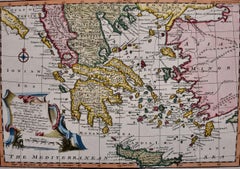
Mainland Greece & Islands: An Original 18th Century Hand-colored Map by Bowen
Located in Alamo, CA
This is an original 18th century hand-colored map entitled "An Accurate Map of the Morea Together with the Neighboring Countries in Greece; also the Islands in the Archipelago and Ae...
Category
Old Masters Mid-18th Century More Prints
Materials
Engraving
Related Items
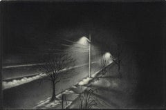
Foggy Night (the way home or a Stephen King setting)
By Carol Wax
Located in New Orleans, LA
This impression is #22
Carol Wax originally trained to be a classical musician at the Manhattan School of Music but fell in love with printmaking. Soon after she began engraving mez...
Category
American Modern Mid-18th Century More Prints
Materials
Engraving, Mezzotint
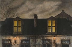
Lafitte's Blacksmith House (a bar named for a pirate on Bourbon St, New Orleans)
Located in New Orleans, LA
Lafitte's Blacksmith Shop is a New Orleans landmark at 941 Bourbon St. Like most New Orleans legends, history of Lafitte's Blacksmith Shop is a gumbo of tru...
Category
Contemporary Mid-18th Century More Prints
Materials
Mezzotint, Aquatint
View of Emden, Germany: A 16th Century Hand-colored Map by Braun & Hogenberg
Located in Alamo, CA
This is a 16th century original hand-colored copperplate engraved map of a bird's-eye View of Embden, Germany entitled " Emuda, vulgo Embden vrbs Frisia orientalis primaria" by Georg Braun & Franz Hogenberg, in volume II of their famous city atlas "Civitates Orbis Terrarum", published in Cologne, Germany in 1575.
This is a beautifully colored and detailed map of Emden, a seaport in northwestern Germany, along the Ems River and perhaps portions of over Dollart Bay, near the border with the Netherland. The map depicts a bird's-eye view of the city from the southwest, as well as a view of the harbor and an extensive system of canals. Numerous ships of various sizes, as well as two rowboats containing numerous occupants are seen in the main waterway in the foreground and additional boats line two canals in the center of the city. Two men and two women are shown on a hill in the foreground on the right, dressed in the 16th century style of nobility. Two ornate crests are included in each corner. A title strap-work cartouche is in the upper center with the title in Latin. The crest on the right including Engelke up de Muer (The Little Angel on the Wall) was granted by Emperor Maximilian I in 1495.
This is an English translation of an excerpt of Braun's description of Embden: "In Emden, the capital of East Frisia, rich merchants live in very fine houses. The city has a broad and well-situated harbour, which in my opinion is unique in Holland. Frisia and the whole of the Netherlands, for the ships can anchor here right under the city walls. They have also extended the harbour as far as the New Town, so that up to 400 ships can now find shelter here when the sea is rough."
The emphasis on the harbor and waterways within the city highlights the importance of Emden's place as a seaport at this time. Embden developed from a Dutch/Flemish trading settlement in the 7th-8th centuries into a city as late as late 14th century. In 1494 it was granted staple rights, and in 1536 the harbour was extended. In the mid-16th century Emden's port was thought to have the most ships in Europe. Its population then was about 5,000, rising to 15,000 by the end of the 16th century. The Ems River flowed directly under the city walls, but its course was changed in the 17th century by the construction of a canal. Emden has canals within its city limits, a typical feature of Dutch towns, which also enabled the extension of the harbor. In 1744 Emden was annexed by Prussia and is now part of Germany. It was captured by French forces in 1757 during the Seven Years' War, but recaptured by Anglo-German forces in 1758. During the Napoleonic French era, Emden and the surrounding lands of East Frisia were part of the short-lived Kingdom of Holland.
References:Van der Krogt 4, 1230, State 2; Taschen, Braun and Hogenberg...
Category
Old Masters Mid-18th Century More Prints
Materials
Engraving
Frankfort, Germany: A 16th Century Hand-colored Map by Braun & Hogenberg
Located in Alamo, CA
This is a 16th century original hand-colored copperplate engraved map of Frankfort, Germany entitled "Francenbergum, vel ut alij Francoburgum Hassiae Opp" by Georg Braun & Franz Hogenberg, from their famous city atlas "Civitates Orbis Terrarum", published in Cologne, Germany in 1595.
This is an English translation of an excerpt from the original text in the atlas:
"Frankenberg or, according to others, Francoburgum, a town in Hesse. Charlemagne vested the town of Frankenberg with many freedoms and privileges, which it still enjoys to this day, and on account of its valiant and victorious soldiers awarded a signet, upon which there formerly appeared a golden castle with a tower, together with the letter F and a golden crown.
Frankenberg, seen here from the northeast, lies on a hill above the River Eder. The hillside is covered with fields neatly separated by bushes and fences. Soaring above the town is the massive Liebfrauenkirche, which was modelled on St Elizabeth's church in Marburg. The New Town was founded in 1335 at the foot of the hill (right) and merged with the Old Town as late as 1556. Frankenberg was founded by Conrad of Thuringia in 1233/34 to prevent the archbishops of Mainz from expanding their sphere of influence...
Category
Old Masters Mid-18th Century More Prints
Materials
Engraving
Cranes and Concrete (in the 80s, a boom saw buildings racing into the sky?
Located in New Orleans, LA
"Cranes and Concrete" is Frederick Mershimer's mezzotint of the construction scene on Broadway between 13th and 14th streets. Mershimer is no strang...
Category
Contemporary Mid-18th Century More Prints
Materials
Mezzotint
View of Pisaro, Italy: A 16th Century Hand-colored Map by Braun & Hogenberg
Located in Alamo, CA
This is a 16th century original hand-colored copperplate engraved map of View of Pezaro (Pisaro), Italy entitled "Pisaurum vulgo Pezaro" by Georg Braun & Franz Hogenberg, from their famous city atlas "Civitates Orbis Terrarum", published in Augsberg, Germany in 1575.
The map depicts a view of Pesaro, Italy from the west looking over the town to the Adriatic Sea. The River Foglia flows into the Adriatic in the foreground. The only identifiable building is the cathedral of San Domenico, which rises above the other roofs with its tall spire. Two women, dressed in styles of the 16th century are in conversation on a hill in the foreground on the left. Pesaro is in the province of Pesaro and Urbino and lies on the Adriatic and east of Florence. The city, which was founded by the Etruscans and named Pisaurum by the Romans, belonged from AD 754 onwards to the Papal States, and after 1285 was controlled by the princely families of Malatesta, Sforza and della Rovere. Today it is the capital of the province of Pesaro and Urbino and has a population of about 92,000. Pesaro's most famous resident, composer Gioacchino Rossini, was born here in 1792.
The following is an English translation of an excerpt from Braun's description of the city: "We believe that the astonishingly short life of the inhabitants of Pesaro comes not only from the insalubrious air, but also from the great quantity of delectable and delicious fruits which they consume to excess. For this causes the production in their bodies of evil humours, which then lead to incurably fatal diseases. The area around the city is most charming and well planted with vineyards, fig trees, olive trees and other fruit-bearing trees."
References: Van der Krogt 4, 3369, state 1; Taschen, Braun and Hogenberg...
Category
Old Masters Mid-18th Century More Prints
Materials
Engraving
Here They Come !
Located in New York, NY
This impression of "Here They Come !" is from the fourth state of eight. There are six known impressions of the fourth state. Edition 150 (final state). It is signed in pencil in the lower left and inscribed "D-1". The image size 13 7/8 x 11 3/4" (34.6 x 28.8 cm) and sheet size 16 3/4 x 14 5/8" (42.8 x 37.1 cm).
FRANK W. BENSON (1862-1951)
Frank Weston Benson, well known for his American impressionist paintings, also produced an incredible body of prints - etchings, drypoints, and a few lithographs. Born and raised on the North Shore of Massachusetts, Benson, a natural outdoorsman, grew up sailing, fishing, and hunting. From a young age, he was fascinated with drawing and birding – this keen interest continued throughout his life.
His first art instruction was with Otto Grundman at the Museum of Fine Arts in Boston, and then in 1883 in Paris at the Academie Julian where he studied the rigorous ‘ecole des beaux arts’ approach to drawing and painting for two years.
During the early 1880’s Seymour Haden visited Boston giving a series of lectures on etching. This introduction to the European etching...
Category
American Impressionist Mid-18th Century More Prints
Materials
Drypoint
Persiae, Armeniae, Natoliae et Arabiae Descriptio per Frederick deWit 1666 map
Located in Paonia, CO
Map of Persiae, Armeniae, Natoliae et Arabiae Descriptio per F de Wit 1688 engraving from: Atlas Contractus Orbis Terrarum Praecipuas ac Novissimas Complectens Tabulas. Amsterdam, N. Visscher, 1656-77. (Koeman III, Vis5-8) This highly decorative map of the Middle East is by the Dutch engraver, publisher, and map seller...
Category
Realist Mid-18th Century More Prints
Materials
Engraving
Slope w.five trees
Located in New York, NY
“Slope w/five trees” is a drypoint engraving created by Robert Kipniss in 2020. The paper size is 12.50 x 10.50 inches and the printed image size is 6.75 x ...
Category
Modern Mid-18th Century More Prints
Materials
Engraving, Drypoint
India William Hodges 'The East End of the Fort of Mongheer' India Engraving
Located in Norfolk, GB
Aquatint with soft ground etching from the seminal publication, Selected Views in India, drawn on the Spot, in the Years 1780, 1781, 1782 and 1783, and Executed in Aquatint in 1786 -...
Category
Other Art Style Mid-18th Century More Prints
Materials
Engraving
Tournai (Tournay), Belgium: A 16th Century Hand-colored Map by Braun & Hogenberg
Located in Alamo, CA
This is a 16th century original hand-colored copperplate engraved map of Tournai, Belgium, entitled "Tornacum" by Georg Braun & Franz Hogenberg, in volume IV of their famous city atlas "Civitates Orbis Terrarum", published in Cologne or Augsberg, Germany in 1575. The map provides a bird's-eye view of the walled city of Tournai, the second oldest city in Belgium. It lies approximately one hour by car southwest of Brussels or from Ghent. The names of thirty of its streets, prominent buildings, churches and squares are listed in a key within a strap-work cartouche in the lower left. These locations are numbered in the key corresponding to their locations on the map.
This colorful map of Tournai (Tornacum or Tournay as it was called in the 16th century) includes the title in Latin in a cartouche in the upper center. Three crests are present across the upper map. A man and two woman are standing on a hill in the foreground in the lower right dressed in the style of 16th century upper class residents of the town.
This is an English translation of an excerpt of Braun's description of Tornai: “Tornacum or Turnacum is a city in Gallia Belgica, situated on the Schelde in the territory of the Nervii, called Tournai by its French inhabitants, but Dorneck by the Germans. Tournai has always been a large and powerful city, with an abundance of goods and commercial activities and wonderfully resourceful craftsmen, who invent new articles every day, and although some of these go out of use they constantly conceive of other new things, both useful and delightful, so that they have at all times something that provides work and a means of livelihood for the poor."
ReferencesVan der Krogt 4, 4435, State 1; Taschen, Braun and Hogenberg...
Category
Old Masters Mid-18th Century More Prints
Materials
Engraving
Canterbury: An Original 16th C. Framed Hand-colored Map by Braun & Hogenberg
Located in Alamo, CA
This is a framed 16th century map and city view of Canterbury, England entitled "Cantuarbury" by Braun & Hogenburg, from their famous landmark atlas of city views 'Civitates Orbis Terrarum' (Atlas of the Cities of the World), which was first published in Cologne, Germany in 1572. The map of Canterbury was first published in 1588. It depicts a detailed birdseye view of the completely walled and fortified city of Canterbury, with its cathedral the most prominent feature. The coat of arms of England, Canterbury, and the Archbishop of Canterbury are included.
This beautifully hand-colored map is presented in a gold-colored wood frame with a beaded inner trim and a paprika-colored mat that highlights details in the map. The frame measures 18.75" high by 22.25" wide by 0.875" deep. There is a central vertical fold, as issued. The map is in excellent condition.
Braun and Hogenberg's 'The Civitates Orbis Terrarum' was the second atlas of maps ever published and the first atlas of cities and towns of the world. It is one of the most important books published in the 16th century. Most of the maps in the atlas were engraved by Franz Hogenberg and the text, with its descriptions of the history and additional factual information of the cities, was written by a team of writers and edited by Georg Braun. The work contained 546 bird-eye views and map views of cities and towns from all over the world. It gave graphic representation of the main features of the illustrated cities and towns, including the buildings and streets. Although the ordinary buildings are stylized, the principal buildings are reproduced from actual drawings created on location. The principal landmarks and streets can still be recognized today. In addition, the maps often include the heraldic arms of the city, the nature of the surrounding countryside, the important rivers, streams and harbors, even depicting stone bridges, wooden pontoons, flat-bottomed ferries, ships and working boats, wharves and jetties, as well as land-based activities, including horsemen, pedestrians, wagons, coaches, and palanquins. Small vignettes are often included which illustrate the trade, occupations and habits of the local inhabitants, such as agriculture, paper-making and textiles, as well as local forms of punishment, such as gibbets, wheels, floggings etc. Large figures dressed in their local costume are often presented out of proportion in the foreground. The aim of the authors was to give as much information as possible in a pleasing visual form. They succeeded in creating maps that were both informative and decorative works of art. The atlas is a wonderful glimpse of life in medieval Europe.
Georg Braun (1541-1622) was German Catholic...
Category
Old Masters Mid-18th Century More Prints
Materials
Engraving
H 18.75 in W 22.25 in D 0.88 in
Previously Available Items
Mainland Greece & Islands: An Original 18th Century Hand-colored Map by Bowen
Located in Alamo, CA
This is an original 18th century hand-colored map entitled "An Accurate Map of the Morea Together with the Neighboring Countries in Greece; also the Islands in the Archipelago and Ae...
Category
Old Masters Mid-18th Century More Prints
Materials
Engraving
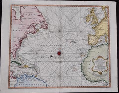
The Atlantic Ocean, Americas, Africa and Europe: Hand-colored 18th C. Bowen Map
Located in Alamo, CA
This is an original 18th century hand-colored map entitled "A New & Accurate Chart of the The Western or Atlantic Ocean Drawn from Surveys and most approved Maps & Charts" by Emanuel...
Category
Old Masters Mid-18th Century More Prints
Materials
Engraving
Veduta della vasta Fontana de Trevi anticamente detta l'Acqua Vergine
Located in New York, NY
A very good impression of this etching with strong contrasts. Fifth state (of 7), with the price erased. Large coat-of-arms with a lion watermark (Hind 4). From "Vedute di Roma."
Category
Italian School Mid-18th Century More Prints
Materials
Etching
The Sawhorse
Located in New York, NY
A superb, dark, richly-inked impression of this etching, engraving and open-bite. Fourth state (of 6); Robison's second edition, second through third issues, printed from the early 1...
Category
Italian School Mid-18th Century More Prints
Materials
Engraving, Etching
Veduta di Piazza Navona sopra le Rovine del Circo Agonale
Located in New York, NY
A very good, dark and well-inked impression of this etching with strong contrasts. Fifth state (of 6). Fleur-de-lys in a single circle watermark (Hind 1, which he notes for early imp...
Category
Baroque Mid-18th Century More Prints
Materials
Etching
Gulf of Mexico, Florida, C. America, Cuba: 18th C. Hand-colored Map by Bellin
Located in Alamo, CA
This beautiful 18th century hand-colored map entitled "Carte du Golphe du Mexique et des Isles de L'Amerique" is by Jacques Nicolas Bellin, published in The Hague, Netherlands by Ant...
Category
Mid-18th Century More Prints
Materials
Engraving
An 18th century hand coloured engraving of a 'Corneille du Senegal'
Located in Cotignac, FR
A hand coloured engraving of a ' Corneille du Senegal' by Francois Nicolas Martinet, plate 327 from 'Histoire Naturelle des Oiseaux' in association with Georges Louis Leclerc Comte d...
Category
Naturalistic Mid-18th Century More Prints
Materials
Paper, Ink, Watercolor
Set of four 18th century hand coloured bird engravings by Martinet circa 1765
Located in Cotignac, FR
A set of four hand coloured engravings by Francois Nicolas Martinet, plates 3, 4, 5 and 6 (Tits, Goldfinch, Carouge and Sparrows) from 'Histoire Naturelle des Oiseaux' in association...
Category
Naturalistic Mid-18th Century More Prints
Materials
Paper, Ink, Watercolor
Set of 9 Roman Emperor bust C18th Grand Tour engravings, c1750
By Carlo Gregori
Located in Melbourne, Victoria
8 Italian copper-line engravings of Roman Emperor busts from 'Musei Capitolini' a series of engravings showing the sculpture of the Capitoline Museum in Rome.
280mm by 180mm (plate...
Category
Renaissance Mid-18th Century More Prints
Materials
Engraving
Set of 7 Roman bust C18th Grand Tour engravings, c1750
By Carlo Gregori
Located in Melbourne, Victoria
7 Italian copper-line engravings of Roman Emperor busts from 'Musei Capitolini' a series of engravings showing the sculpture of the Capitoline Museum in Rome.
280mm by 180mm (plate...
Category
Renaissance Mid-18th Century More Prints
Materials
Engraving
Elio Cesare, Roman sculpture bust C18th Grand Tour engraving, c1750
Located in Melbourne, Victoria
Italian copper-line engraving of a Roman Emperor bust from 'Musei Capitolini' a series of engravings showing the sculpture of the Capitoline Museum in Rome.
280mm by 180mm (platema...
Category
Renaissance Mid-18th Century More Prints
Materials
Engraving
Galba, Roman sculpture bust C18th Grand Tour engraving, c1750
Located in Melbourne, Victoria
Italian copper-line engraving of a Roman Emperor bust from 'Musei Capitolini' a series of engravings showing the sculpture of the Capitoline Museum in Rome.
Galba (3 BC –69) was Ro...
Category
Renaissance Mid-18th Century More Prints
Materials
Engraving
Recently Viewed
View AllMore Ways To Browse
Vintage Ski Posters Savoie
Bermuda Travel Poster
Retro Travel Poster Edinburgh
Malaya Vintage Poster
Malaya Poster
Rolling Stones Tattoo You
Travel Poster Bermuda
Vintage Rallye Posters
Ww2 Propaganda Posters
Vintage Ww2 Propaganda Posters
Philippines Vintage Poster
Laure Prouvost
Malta Vintage Poster
Melbourne Vintage Poster
Porto Vintage Poster
Vintage Airline Posters Caribbean
Vintage Filipino Posters
Carolee Schneemann
