Items Similar to Uncommon Rare Map Showing The Louisiade Archipelago, Papua New Guinea, ca.1798

Want more images or videos?
Request additional images or videos from the seller
1 of 6
Uncommon Rare Map Showing The Louisiade Archipelago, Papua New Guinea, ca.1798
About the Item
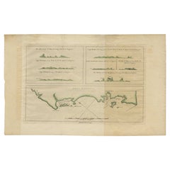
Antique map titled 'Carte de la Partie Septentrionale de l'Archipel de la Louisiade'.
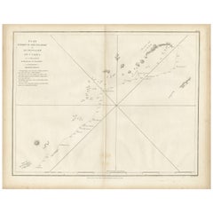
Uncommon map showing the area around the Louisiade Archipelago, named for Louis XV by Louis Antoine de Bougainville. The track of Admiral Bruny-d'Entrecasteaux's ships, Recherche and Espérance, are shown along with excellent coastal and inland survey detail. In 1792-93, at the height of the French Revolution, Admiral Bruny-d'Entrecasteaux led the search for the lost expedition of La Perouse. The expedition ended in the East Indies amid open clashes between the Royalists and the Republicans in the crew after the death of d'Entrecasteaux from scurvy.
Artists and Engravers: Published by C.F. Beautemps-Beaupré.
- Dimensions:Height: 22.84 in (58 cm)Width: 33.47 in (85 cm)Depth: 0 in (0.02 mm)
- Materials and Techniques:
- Period:1790-1799
- Date of Manufacture:circa 1798
- Condition:Repaired: repairs on the folding line. Condition: Good, some light soiling and small defects in the margins. Horizontal crease through the map and repairs on the folding line. Blank verso, please study image carefully.
- Seller Location:Langweer, NL
- Reference Number:
About the Seller
5.0
Platinum Seller
These expertly vetted sellers are 1stDibs' most experienced sellers and are rated highest by our customers.
Established in 2009
1stDibs seller since 2017
1,916 sales on 1stDibs
Typical response time: <1 hour
- ShippingRetrieving quote...Ships From: Langweer, Netherlands
- Return PolicyA return for this item may be initiated within 14 days of delivery.
More From This SellerView All
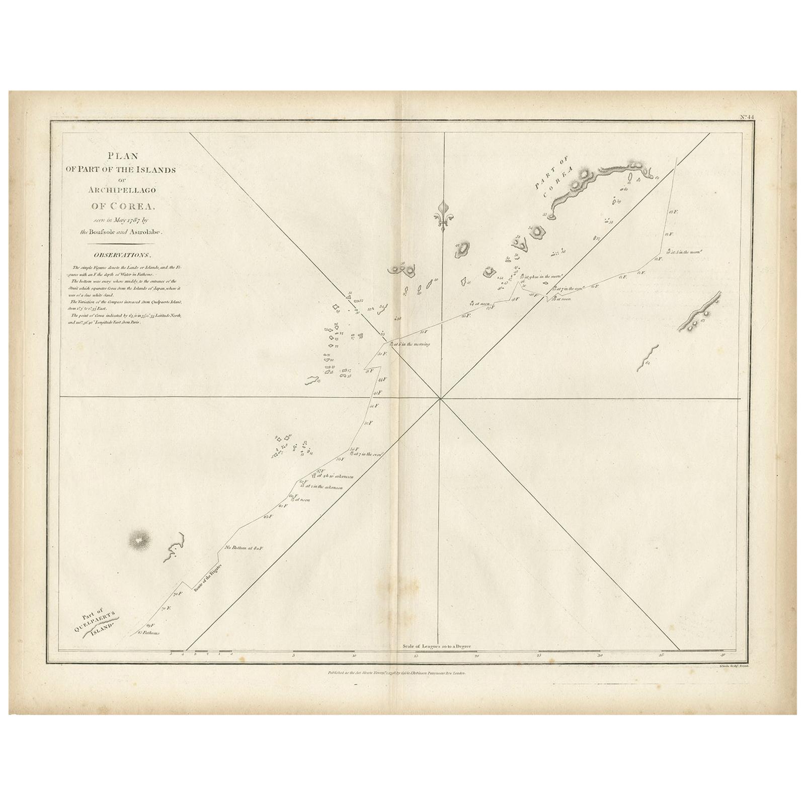
- Antique Map of Part of the Korean Archipelago, 1798Located in Langweer, NLAntique map titled 'Plan of Part of the Islands or Archipellago of Corea'. This map depicts part of the Korean Archipelago and originates from Charts and Plates to La Pérouse...Category
Antique Late 18th Century Maps
MaterialsPaper
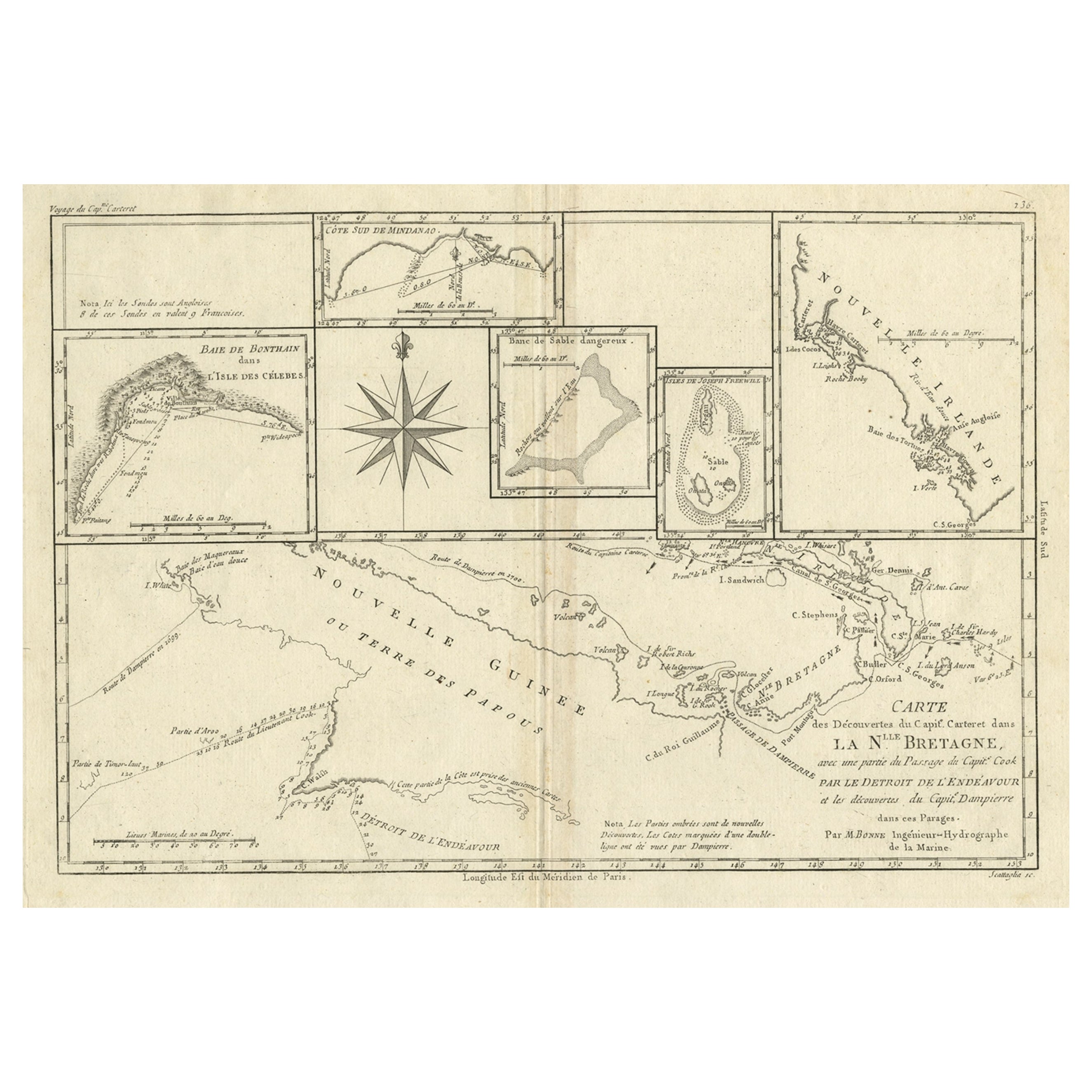
- Antique Detailed Map of Papua New Guinea and the Regions to the West, ca.1780Located in Langweer, NLAntique map titled 'Carte des Decouvertes du Capite. Carteret dans La Nlle. Bretagne avec une parte du passage du Capite. Cook Par Le Detroit De L'Endeavor ...Category
Antique 1780s Maps
MaterialsPaper
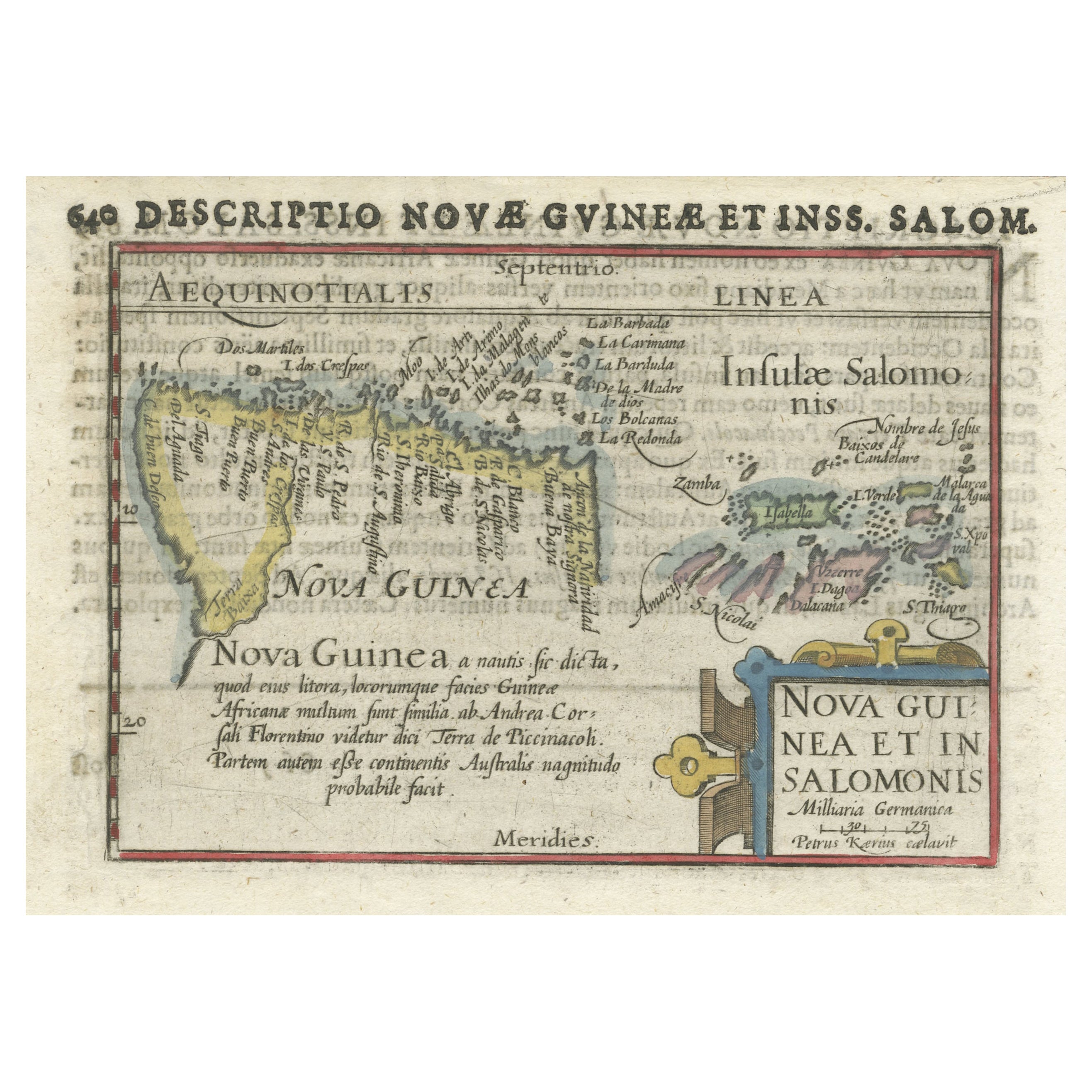
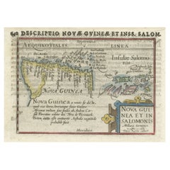
- Rare Original Miniature Map of Papua New Guinea and the Salomon Islands, 1600Located in Langweer, NLVery handsome original old coloured copper engraving of Papua and the Solomon Island. Title of the map 'Descriptio Novae Guneae et Inss. Salom. On the reverse text in Latin. Ve...Category
Antique Early 1600s Maps
MaterialsPaper
- Antique Map of New Ireland Island in the Bismarck Archipelago, New Guinea, 1772Located in Langweer, NLAntique map titled 'Nova Hibernia'. Antique map of New Ireland, an island in the Bismarck Archipelago, New Guinea. Lying just north of New Britain, from which it is separated by St. ...Category
Antique 18th Century Maps
MaterialsPaper
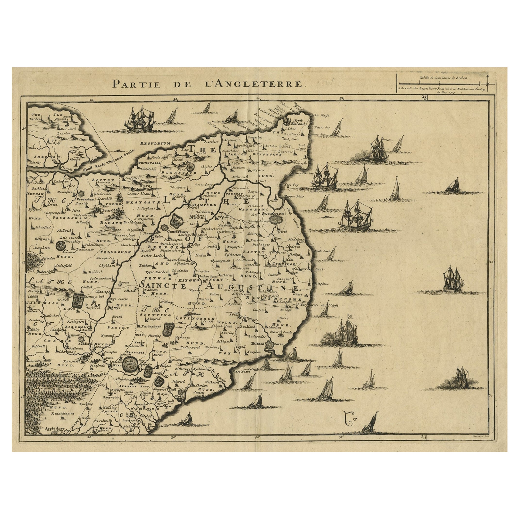
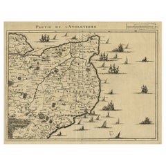
- Uncommon Antique Map of the English Channel Coastline, ca.1709Located in Langweer, NLAntique map titled 'Partie de L'Angleterre' Uncommon map of the English Channel coastline with many boats on the sea. Source unknown, to be determined. Artists and Engravers: Made...Category
Antique Early 1700s Maps
MaterialsPaper
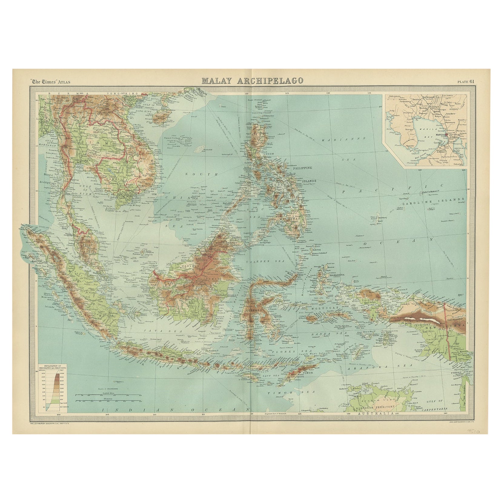
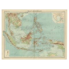
- Old Map of South East Asia Showing the Malay Archipelago, incl Borneo etc, 1922Located in Langweer, NLAntique map of South East Asia titled 'Malay Archipelago'. Old map of South East Asia depicting the Malay Archipelago including Sumatra, Java...Category
Vintage 1920s Maps
MaterialsPaper
You May Also Like
- New Map of North America from the Latest Discoveries, 1763Located in Philadelphia, PAA fine antique 18th century map of the North American seaboard. Entitled "A New Map of North America from the Latest Discoveries 1763". By the Cartographer/Engraver - John Spil...Category
Antique Mid-18th Century English Georgian Maps
MaterialsPaper
- West Africa Entitled "Guinea Propria": An 18th Century Hand Colored Homann MapBy Johann Baptist HomannLocated in Alamo, CAThis is a scarce richly hand colored copper plate engraved map of Africa entitled "Guinea Propria, nec non Nigritiae vel Terrae Nigrorum Maxima Pars" by Johann Baptist Homann (1664-1...Category
Antique Mid-18th Century German Maps
MaterialsPaper
- West Coast of Africa, Guinea & Sierra Leone: An 18th Century Map by BellinBy Jacques-Nicolas BellinLocated in Alamo, CAJacques Bellin's copper-plate map entitled "Partie de la Coste de Guinee Dupuis la Riviere de Sierra Leona Jusquau Cap das Palmas", depicting the coast of Guinea and Sierra Leone in ...Category
Antique Mid-18th Century French Maps
MaterialsPaper
- Map of the Republic of GenoaLocated in New York, NYFramed antique hand-coloured map of the Republic of Genoa including the duchies of Mantua, Modena, and Parma. Europe, late 18th century. Dimension: 25...Category
Antique Late 18th Century European Maps
- Map "Estuary- Mouth of the Thames"Located in Alessandria, PiemonteST/426 - Antique French Map of the estuary of the Thames, map dated 1769 - "Mape of the entrance of the Thames. Designed by filing of Navy cards fo...Category
Antique Mid-18th Century French Other Prints
MaterialsPaper
- Antique 1901 National Publishing Company's Road Map of New Jersey GeologicalLocated in Dayton, OHThe National Publishing Company's road map of New Jersey, showing all county and township divisions, cities villages and post-offices, railroads, ste...Category
Antique Early 1900s Victorian Prints
MaterialsPaper


