Antique Map Boston
2
to
6
77
24
68
31
23
23
14
11
11
9
7
6
6
5
5
4
4
3
3
3
3
2
2
2
2
1
1
1
1
1
4
4
3
3
1
Sort By
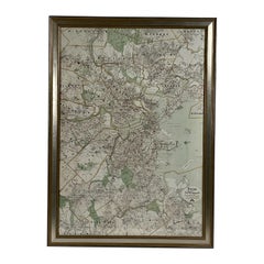
Map of Boston and Surrounding Towns
Located in Norwell, MA
Later copy of a nineteenth century map of Boston and surrounding towns. Showing parts of Quincy
Category
19th Century North American Antique Map Boston
Materials
Paper
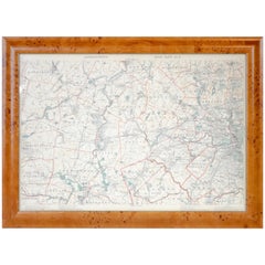
Original 1891 Walker Map
Located in Norwell, MA
Original 1891 map of Massachusetts by Walker. Towns include Cambridge, Boston, Dedham, Ashland
Category
19th Century Antique Map Boston
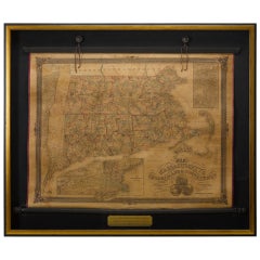
1854 Map of Massachusetts, Connecticut and Rhode Island, Antique Wall Map
Located in Colorado Springs, CO
and lakes. The impression features an inset map of Boston at upper right, and a Map of the Eastern
Category
19th Century American Antique Map Boston
Materials
Paper
H 38.13 in W 45 in D 3.5 in
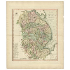
Antique Decorative County Map of Lincolnshire, England, 1804
Located in Langweer, NL
Antique county map of Lincolnshire first published circa 1800 Cities illustrated include Grantham
Category
Early 1800s Antique Map Boston
Materials
Paper
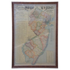
1903 Antique National Publishing Road Map of New Jersey Geological Survey
Located in Dayton, OH
1903 antique New Jersey road map by The National Publishing Company of Boston Massachusettes, No
Category
Early 1900s Victorian Antique Map Boston
Materials
Paper
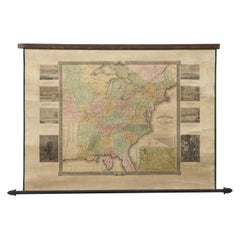
"The United States from the Latest Authorities" Antique Wall Map, 1835
Located in Colorado Springs, CO
noted.
The map is bordered with vignettes of Boston, New York, Philadelphia, Hartford, Cincinnati
Category
1830s American Antique Map Boston
Materials
Paper
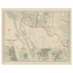
Antique Map of the United States of North America by Johnston '1909'
Located in Langweer, NL
America ( South West Sheet ). With inset maps of Chicago, San Francisco, Philadelphia and Boston. This map
Category
Early 20th Century Antique Map Boston
Materials
Paper
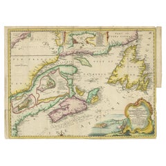
Antique Map Dedicated to British Merchants Trading to North America, ca.1746
Located in Langweer, NL
Description: Antique map titled 'A New Chart of the Coast of New England, Nova Scotia, New France
Category
1740s Antique Map Boston
Materials
Paper
H 13.98 in W 19.69 in D 0 in
Map Silk Embroidered Western Eastern Hemisphere New Old World Asia America Afri
Located in BUNGAY, SUFFOLK
Map Centre, Boston Public Library.
Category
18th Century British Georgian Antique Map Boston
Materials
Silk
H 0.4 in W 0.4 in D 0.4 in
1847 “World at One View” Antique Hand-Colored Wall Map of the World
Located in Colorado Springs, CO
This is a highly desirable hanging wall map of the "World at One View", published in 1847 by Ensign
Category
19th Century American Antique Map Boston
Materials
Paper
1842 Wall Map of the United States by J. H. Young, Published by S. A. Mitchell
Located in Colorado Springs, CO
city map insets of the vicinities around Boston, New York, Philadelphia, Baltimore and Washington
Category
1840s American Antique Map Boston
Materials
Paper
H 45 in W 38 in D 1 in
1912 "Panoramic View of New York City and Vicinity" by Jacob Ruppert
Located in Colorado Springs, CO
This is an attractive and very scarce map of New York, published by the Yorkville brewer Jacob
Category
1910s American Antique Map Boston
Materials
Paper
1918 George Eldridge Chart of Massachusetts Bay
Located in Norwell, MA
, Quincy, Boston, Medford, Lynn, Winthrop, Nahant, Marblehead, Salem, Beavery, and Galveston.
Weight: 24
Category
1910s North American Antique Map Boston
Materials
Paper
Old Print with a View of Saint Petersburg, Russia, 1887
Located in Langweer, NL
E.W. Walker & Co, Boston.
Condition: Good, minor wear and some age-related toning. Please study
Category
1880s Antique Map Boston
Materials
Paper
Pair of Floor Standing Globes by Gilman Joslin
By Gilman Joslin
Located in Lymington, Hampshire
terrestrial celestial globe inscribed ‘Manufactured by Gilman Joslin’ and ‘Improved Globe Boston’. American
Category
19th Century American Antique Map Boston
Materials
Iron
1891 Map of South Shore of Boston
Located in Norwell, MA
Original 1891 map showing Cohasset, Scituate, Marshfield, Duxbury, Kingston, Norwell, Hanover
Category
1890s North American Antique Map Boston
Materials
Paper
"The World" Published by Cummings & Hilliard, No. 1, Cornhill, Boston
Located in Soquel, CA
"The World" Published by Cummings & Hilliard, No. 1, Cornhill, Boston
Early 19th century engraved
Category
1820s American Realist Antique Map Boston
Materials
Paper, Printer's Ink, Etching
H 20 in W 24 in D 0.5 in
Early Folk Art American Two Sided Framed Military Drawing with Map
Located in Savannah, GA
Beacon Hill, Boston home. From what we have gathered, they are hand-colored drawings of some sort of
Category
Late 18th Century American Folk Art Antique Map Boston
Materials
Glass, Wood, Paper
HOMANN, Johann Baptist (1663-1724) Nova Anglia. Septentrionali Americæ implantat
Located in Bristol, CT
Map Sz: 18 3/4"H x 22 5/8"W
Frame Sz: 27 1/2"H x 31"W
Nuremberg: Homann Heirs, [circa 1740
Category
1740s Antique Map Boston
Materials
Paper
Portrait Painting Oil on Canvas by Joseph Badger
Located in Rome, IT
Joseph Badger (c. 1707–1765) was a portrait artist in Boston, Massachusetts, in the 18th century
Category
18th Century Academic Antique Map Boston
Materials
Oil
Il Gazzettiere Americano - Ancient Illustrated Book on the Americas - 1763
Located in Roma, IT
3 volumes. Engraved title vignettes, 78 engraved plates and maps by Giuseppe Pazzi (including
Category
1760s Antique Map Boston
Materials
Paper, Etching
H 11.82 in W 9.06 in D 1.38 in
Portrait Painting Oil on Canvas by Joseph Badger
Located in Rome, IT
Joseph Badger (c. 1707–1765) was a portrait artist in Boston, Massachusetts, in the 18th century
Category
18th Century Academic Antique Map Boston
Materials
Oil
"Nesting, " French 19th c Realist, Louvre Museum, Charming Small Oil of Chickens
By Charles-Emile Jacque
Located in Wiscasset, ME
Born in 1813 in Paris, Charles Emile Jacque began his training in etching as an apprentice to a map
Category
19th Century Realist Antique Map Boston
Materials
Oil, Wood Panel
Bibliomania or Book Madness by Thomas Frognall Dibdin, 1842
Located in Dallas, TX
).
Originally retailed by Little & Brown, Booksellers & Importers of Boston..
This Extremely Rare Book Is In
Category
Mid-19th Century English Early Victorian Antique Map Boston
Materials
Paper
"Under the Apple Tree", Figurative Chromolithograph after George Niles, 188/250
By Louis Prang
Located in Soquel, CA
- Chromolithographed and published by L. Prang & Co. ...Boston". Displayed in a rustic giltwood beveled frame. Image
Category
Late 19th Century American Impressionist Antique Map Boston
Materials
Lithograph, Cardboard
H 12.75 in W 10.75 in D 1.25 in
Epic of America by Jt Adams First Edition Re-Print
Located in Dallas, TX
by M.J. Gallagher, Published by Little, Brown and Company of Boston in 1932.
Considered a First
Category
Early 20th Century American American Classical Antique Map Boston
Materials
Paper
Portrait of William Pitt, Earl of Chatham: Rare Framed Mezzotint after Brompton
By Edward Fisher
Located in Alamo, CA
Magna Carta, a map of the colonies, including Long Island and Staten Island, and papers entitled "A Plan
Category
Late 18th Century Old Masters Antique Map Boston
Materials
Mezzotint
H 31.63 in W 26.63 in D 0.75 in
Japanese Children with Tortoise
By Harry Humphrey Moore
Located in New York, NY
topographical artist and explorer who mapped the Japanese coast in 1855; and the Boston landscapist
Category
Late 19th Century Antique Map Boston
Materials
Oil, Wood Panel
Interior of a Japanese House
By Harry Humphrey Moore
Located in New York, NY
topographical artist and explorer who mapped the Japanese coast in 1855; and the Boston landscapist
Category
Late 19th Century Antique Map Boston
Materials
Oil, Wood Panel
Japanese Girl Promenading
By Harry Humphrey Moore
Located in New York, NY
topographical artist and explorer who mapped the Japanese coast in 1855; and the Boston landscapist
Category
Late 19th Century Antique Map Boston
Materials
Oil, Wood Panel
Japanese Tea Garden
By Harry Humphrey Moore
Located in New York, NY
topographical artist and explorer who mapped the Japanese coast in 1855; and the Boston landscapist
Category
Late 19th Century Antique Map Boston
Materials
Oil, Wood Panel
Map of Palestine or Judea, Illustrating the History of the New Testament
By Rev. Nathan B. Rogers
Located in New York, NY
This extraordinary manuscript map is a rare survivor of the devotional and educational culture of New
Category
19th Century Antique Map Boston
Materials
Canvas, Paper, Ink, Pen
Pair of American Globes on Cast Iron Stands
Located in London, Middlesex
/ Boston/ Josiah Loring, 136 Washington st. 1841' made up of twelve hand-colored engraved gores and two
Category
1830s American American Classical Antique Map Boston
Materials
Iron
1818 Map of the Battle of Bunker Hill
Located in New York, NY
under the command of Major General Howe, and a Large Body of American Rebels."
Description
1818 map of
Category
1810s Realist Antique Map Boston
Materials
Engraving
Map of Washington City District of Columbia Seat of the Federal Government
By Albert Boschke
Located in La Jolla, CA
Albert Boschke’s suppressed wall map of Washington City, District of Columbia.
One of the most
Category
1850s American American Empire Antique Map Boston
Materials
Paper
L' Amerique Septentrionale (North America with California as an Island)
Located in New York, NY
Original and rare 1702 map of North America showing California as a island stretching as far north
Category
Early 1700s Realist Antique Map Boston
Materials
Engraving
Arizona Mountains
By Paul Lauritz
Located in Graton, CA
commercial artist doing maps, posters and decorations. In Portland, he married Mary Potterton in 1912, and
Category
Early 20th Century Impressionist Antique Map Boston
Materials
Oil
Pair of Classical Lyre-Back Mahogany Side Chairs with Paw Feet, Phyfe school
Located in Providence, RI
collection See Patricia E. Kane, 300 Years of American Seating Furniture (New York Graphic Society, Boston
Category
1810s American American Classical Antique Map Boston
Materials
Mahogany
A Rare And Important Tall Case Clock By Jacob Hoster, Hanover Pa
By Jacob Hostetter
Located in Sharon, MA
fourteen inch iron dial of Boston origins. Boston dials are known for their high quality and regional
Category
19th Century American Antique Map Boston
Painting of a Cotton Picker by William Aiken Walker
By William Aiken Walker
Located in Alexandria, VA
mainly of drawing maps and sketches of Charleston's defenses, until he was mustered out at the end of
Category
1870s American Antique Map Boston
Materials
Composition
Original Map of Boston
Located in Norwell, MA
Map of Boston and it's surrounding by Walker Lithographs and Publications, circa 1900. Showing
Category
Early 20th Century Antique Map Boston
Materials
Wood, Paint
1842 Map of Boston
Located in Essex, MA
An 1842 Map of Boston, Massachusetts and surrounding communities, published by the Society for the
Category
19th Century English Antique Map Boston
Original 1913 Chart of Boston Harbor
Located in Norwell, MA
Boston harbor chart by George Eldridge of Vineyard Haven and Boston. Detailed chart of Boston
Category
1910s Antique Map Boston
Materials
Paper
1847 Guide Map of the U.S., from Phelps's Travellers Guide, Antique Map
Located in Colorado Springs, CO
Philadelphia, Boston and Baltimore, with smaller maps of Pittsburgh, Cincinnati, Chicago and St. Louis.
A
Category
1840s American Antique Map Boston
Materials
Paper
Two Harvard Business School Maps
Located in Essex, MA
A pair of City of Boston ward plot plans showing Harvard Business School, c. 1910, along with the
Category
Early 20th Century American Antique Map Boston
1846 "Traveller's Guide and Map of the United States" Antique Wall Map by Ensign
Located in Colorado Springs, CO
Ensign's Traveller's Guide and map of the United States, containing the roads, distances, Steam
Category
1840s American Antique Map Boston
Materials
Paper
H 42.25 in W 53 in D 3.75 in
Giant Framed Map of Massachusetts, circa 1903
By Scarborough Company
Located in Essex, MA
A giant framed map of the Commonwealth of Massachusetts, measuring 62" wide x 44" high and
Category
Early 20th Century American Antique Map Boston
Materials
Paper, Plexiglass, Wood
19th Century Nantucket Map by Rev, Ewer, circa 1886
Located in Nantucket, MA
19th century Nantucket map by Rev, Ewer, circa 1886, a small version of Ewer's celebrated 1869
Category
1880s American Victorian Antique Map Boston
Materials
Paper
1844 "Plan of the City of Boston" by George W. Boynton
Located in Colorado Springs, CO
This striking plan of the Cradle of Liberty features excellent detail around the Boston Harbor. A
Category
1840s Antique Map Boston
1828 "Map of the United States" by T. Ensign
Located in Colorado Springs, CO
George Washington, with inset views and maps of the Capitol, Washington, DC, Boston and a small map of
Category
1820s American Antique Map Boston
Materials
Paper
19th Century Chart Map of Martha's Vineyard and Nantucket Shoals
Located in Rio Vista, CA
framed in a vintage wooden frame. Chart map produced by Thaxter and sons Boston Mass. in 1881 and
Category
19th Century American Antique Map Boston
Materials
Wood, Paper
1839 Antique Ornamental Map of the United States, by William Chapin
Located in Colorado Springs, CO
This is a wonderfully "ornamental" hand-colored wall map of the United States from 1839, the first
Category
19th Century American Antique Map Boston
Materials
Paper
1845 United States Hanging Wall Map by T & E. H. Ensign
Located in Colorado Springs, CO
"Ensign's Traveller's Guide and Map of the United States, Containing the Roads, Distances, Steam
Category
1840s American Antique Map Boston
Materials
Paper
George Eldridge Chart "C" Vineyard Sound Lightship to Chatham
Located in Norwell, MA
, published by Wilfrid O White Boston Mass. Copyright by Sydney Eldridge 1917. Sellers stamp by ship chandler
Category
1910s North American Antique Map Boston
Materials
Paper
1850 Map of Massachusetts, Connecticut, and Rhode Island, Antique, Hand-Colored
Located in Colorado Springs, CO
This attractive pocket map depicts the New England states of Massachusetts, Connecticut, and Rhode
Category
1850s American Antique Map Boston
Materials
Paper
H 29.75 in W 34 in D 2.25 in
Life of George Washington by John Marshall, 6-Vol with Maps, 1st Ed., 1804-1807
Located in Colorado Springs, CO
" (Jean Edward Smith).
The maps in this scarce atlas relate to military operations in the Revolutionary
Category
Early 1800s British Antique Map Boston
Materials
Leather
H 9.25 in W 10.75 in D 6.25 in
1792 "Plan of the City of Washington" by Ellicott, Antique Map or Plan of D.C.
Located in Colorado Springs, CO
Thackara & Vallance in Philadelphia and Samuel Hill in Boston to be engraved. The firms published the maps
Category
Late 18th Century American Antique Map Boston
Materials
Paper
H 32 in W 39.5 in D 1.75 in
American Terrestrial Globe
Located in Lincolnshire, GB
. Joslin was a map and globe maker from Boston USA
Category
19th Century American Antique Map Boston
Pelorus Made in 1920s of Brass, Made in New York with Original Mahogany Box
Located in Milan, IT
Pelorus made in 1920s of brass, signed Kelvin & Wilfrid O. White Co. Boston and New York complete
Category
1920s American Antique Map Boston
Materials
Brass
H 5.91 in W 7.88 in L 5.91 in
"The Life of George Washington" by John Marshall, First Edition, circa 1804-1807
Located in Colorado Springs, CO
.
The 12 engraved maps (most folding) depict Boston, New York Island, the engagement on White Plains
Category
Early 1800s British Antique Map Boston
Materials
Paper
H 1 in W 1 in D 1 in
- 1
Get Updated with New Arrivals
Save "Antique Map Boston", and we’ll notify you when there are new listings in this category.
Antique Map Boston For Sale on 1stDibs
Choose from an assortment of styles, material and more with respect to the antique map boston you’re looking for at 1stDibs. Each antique map boston for sale was constructed with extraordinary care, often using paper. Your living room may not be complete without an antique map boston — find older editions for sale from the 18th Century and newer versions made as recently as the 20th Century. Each antique map boston bearing Victorian hallmarks is very popular.
How Much is a Antique Map Boston?
An antique map boston can differ in price owing to various characteristics — the average selling price 1stDibs is $572, while the lowest priced sells for $75 and the highest can go for as much as $7,250.
More Ways To Browse
Chagall Circus Signed
Mexico Old Map
Framed Maps Italy
Map Of Eastern Europe
Antique Wooden Roller
Filipino Map
Nantucket Sound
Vintage Kitchen Stoves
Vintage Wood Table Radio
9 Foot Long Table
G T Johnson
Kentucky Antiques
Antique Mahogany Lyre Back Chairs
Antique Nova Scotia Furniture
Antique Furniture Nova Scotia
Antique Furniture Furniture Nova Scotia
Icon St George
Antique Furniture Nova Scotia Furniture
