Filipino Map

5
to
21
68
15
47
38
18
15
12
9
9
9
8
7
7
4
4
4
3
3
2
2
2
2
2
2
1
1
1
1
1
1
1
1
1
1
9
2
1
1
1
Sort By
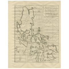
Antique Map of the Philippines by Anson '1749'
Located in Langweer, NL
Antique map titled 'Carte du Canal des Iles Philippines - Kaart van het Kanaal in de Filippynsche
Category

Antique Mid-18th Century Maps

Materials

Paper

Antique Map of the Philippines by Anson '1749'
H 24.41 in W 20.08 in D 0.02 in
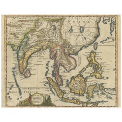
Antique Map of Southeast Asia, China, Philippines and India
Located in Langweer, NL
Antique map titled 'Indiae Orientalis et Insularum Adiacentium'. Decorative map of Southeast Asia
Category

Antique Early 18th Century Maps

Materials

Paper

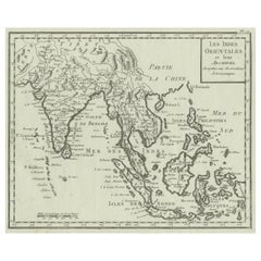
Antique Map of India, the East Indies and the Philippines
Located in Langweer, NL
Antique map titled 'Les Indes Orientales et leur Archipel'. Original antique map of India, the East
Category

Antique Mid-18th Century Maps

Materials

Paper

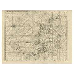
Antique Map of Luzon of Luconia in the Philippines, 1726
Located in Langweer, NL
Description: Antique map titled 'Lucon of Luconia'. Luzon is the largest and most populous island
Category

Antique 1720s Maps

Materials

Paper

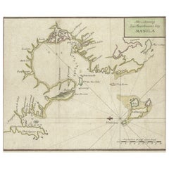
Antique Map of the Bay of Manila, Capital of the Philippines
Located in Langweer, NL
the Philippines. This map originates from a German edition of 'Voyage around the World' by Lord George
Category

Antique Mid-18th Century Maps

Materials

Paper

Antique Map of the Bay of Manila, Capital of the Philippines
No Reserve
H 8.47 in W 10.63 in D 0.02 in
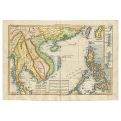
Antique Map of the Philippines, Taiwan and Surroundings by Bonne '1780'
Located in Langweer, NL
Antique map titled 'Les Isles Philippines, celle de Formose, le Sud de la Chine, les Royaumes de
Category

Antique Late 18th Century Maps

Materials

Paper

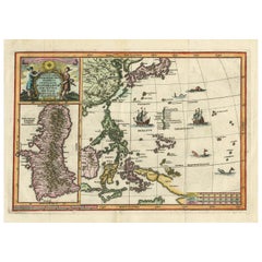
Antique Map of the Philippines and Guam by Scherer, circa 1702
Located in Langweer, NL
attractive map of the Mariana Islands, Philippines, Korea, Japan and Indonesia with an inset of the island
Category

Antique Early 18th Century Maps

Materials

Paper

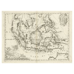
Original Antique Map of the Philippines, Malaysia, Indonesia, Singapore, c.1690
Located in Langweer, NL
Antique map titled 'Isole dell' Indie, diuise in Filippine, Molucche e della Sonda'. Old map of
Category

Antique 1690s Maps

Materials

Paper

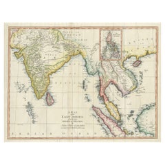
Large Antique Map of the East Indies, with Inset of the Philippines
Located in Langweer, NL
Antique map titled 'A Map of the East Indies (..)'. Large antique map of Southeast Asia, India, and
Category

Antique Late 18th Century Maps

Materials

Paper

Antique Map of China, Korea, Japan and the Northern Philippines, circa 1780
Located in Langweer, NL
'. Interesting and detailed map of China, Korea, Japan and the Northern Philippines. Published circa 1780.
Category

Antique Late 18th Century Maps

Materials

Paper

Old Map of the Philippines and Part of Indonesia 'Spice Islands', 1744
Located in Langweer, NL
mede Celebes etc'. Old map of the Philippines and part of Indonesia. Originates from 'Nieuwe Hand
Category

Antique 1740s Maps

Materials

Paper

Antique Map of Manilla Bay Philippines by P. van der Aa, 1719
Located in Langweer, NL
Rare antique map titled 'La Baie de Manille (..)'. Map of Manilla Bay, the map is oriented with
Category

Antique Early 18th Century Maps

Materials

Paper

Old Original Map of the Philippines and Part of Indonesia 'Spice Islands', 1744
Located in Langweer, NL
mede Celebes etc'. Old map of the Philippines and part of Indonesia. Originates from 'Nieuwe Hand
Category

Antique 1740s Maps

Materials

Paper

Rare Map of the Philippines; Joseph Freewills Island & Mindanao South End, 1773
Located in Langweer, NL
Three charts on one sheet titled '1) A Dangerous Shoal 2) Joseph Freewills Island 3) The South End of Mindanao'. It shows Captain Carteret's voyage: Saint George's Channel to Min...
Category

Antique 1770s Maps

Materials

Paper

Antique Map of the Northern Portion of the Philippines by J.N. Bellin, 1764
Located in Langweer, NL
Detailed map of the Northern portion of the Philippines, extending from Batanes and Babuyanes to
Category

Antique Mid-18th Century Maps

Materials

Paper

Large German Chart of the Islands of the Philippines with Hand-Colored Borders
Located in Langweer, NL
Original antique map titled 'Karte von dem Canal in den Philippinischen Inseln (..)'. Large
Category

Antique Mid-18th Century Maps

Materials

Paper

Antique Map of Southeast Asia by Ortelius '1587'
By Abraham Ortelius
Located in Langweer, NL
Antique map titled 'Indiae Orientalis Insularumque Adiacientium Typus'. Ortelius includes early
Category

Antique 16th Century Maps

Materials

Paper

Antique Map of Southeast Asia by Ortelius '1587'
Free Shipping
H 13.78 in W 19.3 in D 0.02 in
Antique Map of Southeast Asia by Garnier, 1860
Located in Langweer, NL
"Antique map titled 'Borneo, Iles de la Sonde, Celebes, Moluques et Phillippines'. Antique map of
Category

Antique 19th Century Maps

Materials

Paper

Striking Antique Map Centered on the Malay Peninsula
By Pieter Van Der Aa
Located in Langweer, NL
(...)'. Striking map of the region from the Philippines and Formosa to India and the Maldives, centered on the
Category

Antique Early 18th Century Maps

Materials

Paper

Antique Map of Southeast Asia with Decorative Allegorical Cartouche
Located in Langweer, NL
Antique map titled 'Les Indes Orientales et leur Archipel'. Old map of Southeast Asia, the Straits
Category

Antique Mid-18th Century Maps

Materials

Paper

Antique Map of the East Indies by Moll '1745'
Located in Langweer, NL
Philippines and part of Australia. This map originates from 'A Collection of Voyages and Travels' by T
Category

Antique Mid-18th Century Maps

Materials

Paper

Antique Map of the East Indies by Moll '1745'
H 13.98 in W 16.93 in D 0.02 in
Antique Map of the Moluccas by Porcacchi, 'circa 1620'
Located in Langweer, NL
Antique map titled 'Isole Molucche'. The map depicts the East Indies and Indochina, including
Category

Antique Early 17th Century Maps

Materials

Paper

Antique Map of Asia Showing Its Political Divisions, 1874
Located in Langweer, NL
eastward as far as Kamchatka, Japan, the Philippines and New Guinea. The map makes note of the steamship
Category

Antique 19th Century Maps

Materials

Paper

Antique Map of the Pacific Ocean by Anson, 1765
Located in Langweer, NL
Antique map titled 'Carte de la Mer du Sud ou Mer Pacifique - Kaart van de Zuyd-Zee of stille
Category

Antique 18th Century Maps

Materials

Paper

Antique Map of the Eastern Part of the World
Located in Langweer, NL
Antique map titled 'Nieuwe Kaart van het Oostelykste Deel der Weereld, diendende tot aanwyzing van
Category

Antique Mid-18th Century Maps

Materials

Paper

Antique Map of the Eastern Part of the World
Free Shipping
H 16.15 in W 17.96 in D 0.02 in
Antique Map of South America by G. Anson, 1749
Located in Langweer, NL
Antique map titled 'Kaart van het Zuidelykste Gedeelte van Zuider Amerika (..) - Carte de la Partie
Category

Antique Mid-18th Century Dutch Maps

Materials

Paper

Antique Map of South America by G. Anson, 1749
H 20.87 in W 20.48 in D 0.02 in
Antique Map of Juan Fernandez Island, Chile, c.1750
Located in Langweer, NL
Antique map titled 'Plan de la Côte du N.E. de l 'Ile de Juan Fernandes'. Map of the northeast
Category

Antique 18th Century Maps

Materials

Paper

Antique Map of Southern Mindanao, Sulawesi and Gilolo 'Halmahera', Indonesia
Located in Langweer, NL
Antique lithograph, with a text vignette on Borneo. This important map for the Philippines shows
Category

Antique Early 19th Century Maps

Materials

Paper

1797 Tardieu Map of Southeast Asia: The Malay Archipelago and Beyond
Located in Langweer, NL
- Collectible map - Decorative map - Educational piece - Geographic art - Borneo and Philippines - Exploration
Category

Antique 1790s Maps

Materials

Paper

Antique Map of the Asiatic Archipelago by E. Stanford, circa 1910
Located in Langweer, NL
Philippines and Borneo, the map shows a number of different seasonal passages through the region to Hong Kong
Category

20th Century Maps

Materials

Paper

Original Antique Map of Juan Fernandez by Van Schley, 1757
Located in Langweer, NL
Antique map titled 'Carte Particuliere de l'Isle de Juan Fernandez - Byzondere Kaart van 't Eiland
Category

Antique 18th Century Maps

Materials

Paper

Authentic Old Map of Southeast Asia with Original Border Coloring, 1745
Located in Langweer, NL
"Map of the East-Indies based on the work of Mr. Guillaume de L'Isle." Guillaume de L'Isle was a
Category

Antique 1740s Maps

Materials

Paper

Antique Map of Juan Fernandez Island by Anson, c.1740
Located in Langweer, NL
Antique map titled 'Plan de la Côte du N.E. de l 'Ile de Juan Fernandes'. Map of the northeast
Category

Antique 18th Century Maps

Materials

Paper

Antique Colourful Map of the Dutch East Indies 'Indonesia', ca.1806
Located in Langweer, NL
Antique map titled 'Les Isles de la Sonde Moluques Philippines, Carolines et Marianes'. Old map of
Category

Antique 19th Century Maps

Materials

Paper

Original Old Map with Many Details Around Manilla in the Philippine Islands
By F. Valentijn
Located in Langweer, NL
Original antique map titled 'Carte du Canal des Iles Philippines (..) - Kaart van het Kanaal in de
Category

Antique Early 18th Century Maps

Materials

Paper

Rare 16th Century Original Handcolored Miniature Map of China, Published in 1593
Located in Langweer, NL
, Canton, Suinam, Chiampa, Borneo and more. Also a few island of the Philippines, like Cebu and Mindanao
Category

Antique 16th Century Maps

Materials

Paper

Antique Map of Southeast Asia from Persia to the Timor Island, 1712
Located in Langweer, NL
Antique map titled 'A New Map of the East Indies'. Old map covering all of Southeast Asia from
Category

Antique 1710s Maps

Materials

Paper

Antique Map of Juan Fernandez Island and Cumberland Bay, Chile - c. '1749'
Located in Langweer, NL
Antique map titled 'Plan de la Côte du N.E. de l 'Ile de Juan Fernandes - Schets van den Noord-Oost
Category

Antique Mid-18th Century Maps

Materials

Paper

Large Italian Map of Islands of Oceania, incl Papua, Timor, Banda, Ceram, 1855
Located in Langweer, NL
Description: Antique map titled 'Carta di una parte dell'Oceania'. Beautiful large map of the
Category

Antique 1850s Maps

Materials

Paper

Antique Map of Tracks of Anson's Ships around South America & Cape Horn, 1749
Located in Langweer, NL
Description: Antique map titled 'Kaart van het Zuidelykste Gedeelte van Zuider Amerika (..) - Carte
Category

Antique 1740s Maps

Materials

Paper

Old Map Covering All of Southeast Asia from Persia to the Timor Island, 1712
Located in Langweer, NL
Description: Antique map titled 'A New Map of the East Indies'. Old map covering all of Southeast
Category

Antique 1710s Maps

Materials

Paper

Map of The East Indies with the Route of Capt. William Dampier's Voyage, 1698
Located in Langweer, NL
Antique map titled 'Kaart van Oost Indie'. Old map of the East Indies. It shows the routes of
Category

Antique 1690s Maps

Materials

Paper

Antique Chart of the Mid-Pacific Ocean by Anson, 'c.1784'
Located in Langweer, NL
Antique map titled 'Carte de la Mer du Sud ou Mer Pacifique'. Original chart of the mid-Pacific
Category

Antique Late 18th Century Maps

Materials

Paper

Original Vintage Advertising Poster Messageries Maritimes Far East Map H Baille
By Hervé Baille
Located in London, GB
/ Cambodia Laos Courriers d'Extreme Orient / Far East featuring a fantastic illustrated map design by Herve
Category

Vintage 1950s French Posters

Materials

Paper

Asia Declineatio: A 17th Century Hand-colored Map of Asia by Justus Danckerts
Located in Alamo, CA
This is a scarce 17th century beautifully hand-colored copperplate engraved map of Asia entitled
Category

Late 17th Century Old Masters Landscape Prints

Materials

Engraving

Original Vintage WWII Poster De Dollarpoliep The US Dollar Polyp Octopus War Map
Located in London, GB
like tentacles reaching into different countries on a map in and around North and South America marking
Category

Vintage 1940s Dutch Posters

Materials

Paper

Antique Print of a Fortress in Guangzhou in China, c.1850
Located in Langweer, NL
Brazil, Chile, the Marianas, and the Philippines. Although the projected voyage was to be of rather short
Category

Antique 19th Century Prints

Materials

Paper

Antique Print of a Garden in Guangzhou in China, circa 1850
Located in Langweer, NL
visited, including Brazil, Chile, the Marianas, and the Philippines. Although the projected voyage was to
Category

Antique 19th Century Prints

Materials

Paper

Antique Print of a Street Kitchen in Guangzhou in China, circa 1850
Located in Langweer, NL
visited, including Brazil, Chile, the Marianas, and the Philippines. Although the projected voyage was to
Category

Antique 19th Century Prints

Materials

Paper

Antique Print of European Factories in Guangzhou in China, circa 1850
Located in Langweer, NL
countries visited, including Brazil, Chile, the Marianas, and the Philippines. Although the projected voyage
Category

Antique 19th Century Prints

Materials

Paper

A truly delightful miniature terrestrial pocket globe
By Nathaniel Mills
Located in ZWIJNDRECHT, NL
turning overhead. In line with its counterpart, the terrestrial globe, celestial globes are mapped by a
Category

Antique Mid-18th Century British Dutch Colonial Globes

Materials

Other

Phantom - Red, Yellow, Black, Green, White, Blue, Magenta & Ochre - 10 Feet Tall
By Craig Kauffman
Located in Rancho Santa Fe, CA
helped put Los Angeles on the art map with audacious experiments in molding industrial plastic to create
Category

1980s Abstract Abstract Paintings

Materials

Silk, Oil Crayon, Acrylic

Original Vintage Advertising Poster Messageries Maritimes Far East Map H Baille
By Hervé Baille
Located in London, GB
/ Cambodia Laos Courriers d'Extreme Orient / Far East featuring a fantastic illustrated map design by Herve
Category

1950s More Prints

Materials

Paper

Original Vintage WWII Poster De Dollarpoliep The US Dollar Polyp Octopus War Map
Located in London, GB
like tentacles reaching into different countries on a map in and around North and South America marking
Category

1940s More Prints

Materials

Paper

"Corkscrew Hill" - Abstract Oil Painting
By Robert Reynolds
Located in New Haven, CT
impressions of the landscape in the Philippines. Inspired by his father's memoirs, Robert Reynolds captures
Category

2010s Abstract Abstract Paintings

Materials

Oil

"Limon" - Abstract Oil Painting
By Robert Reynolds
Located in New Haven, CT
of the landscape on the island of Leyte in the Philippines. Many figures within the painting suggest
Category

2010s Abstract Abstract Paintings

Materials

Oil

"Hill 1520" - Abstract Drypoint Etching
By Robert Reynolds
Located in New Haven, CT
inspired by tactical maps created during the WWII invasions of New Guinea and the Philippines. These prints
Category

2010s Abstract Abstract Paintings

Materials

Drypoint

"Maneuvers, Carigara" - Abstract Drypoint Etching
By Robert Reynolds
Located in New Haven, CT
drypoint etching inspired by tactical maps created during the WWII invasions of New Guinea and the
Category

2010s Abstract Abstract Prints

Materials

Drypoint

"Pinamopoan, Breakneck Ridge" - Abstract Drypoint Etching
By Robert Reynolds
Located in New Haven, CT
, Breakneck Ridge" is a drypoint etching inspired by tactical maps created during the WWII invasions of
Category

2010s Abstract Geometric Abstract Prints

Materials

Drypoint

"Tanahmerah Bay, New Guinea" - Abstract Drypoint Etching
By Robert Reynolds
Located in New Haven, CT
Guinea" is a drypoint etching inspired by military maps created during the WWII invasions of New
Category

2010s Abstract Abstract Prints

Materials

Drypoint

  • 1
Get Updated with New Arrivals
Save "Filipino Map", and we’ll notify you when there are new listings in this category.

Filipino Map For Sale on 1stDibs

With a vast inventory of beautiful furniture at 1stDibs, we’ve got just the filipino map you’re looking for. A filipino map — often made from paper — can elevate any home. Whether you’re looking for an older or newer filipino map, there are earlier versions available from the 18th Century and newer variations made as recently as the 19th Century. Each filipino map bearing Victorian hallmarks is very popular.

How Much is a Filipino Map?

A filipino map can differ in price owing to various characteristics — the average selling price 1stDibs is $379, while the lowest priced sells for $45 and the highest can go for as much as $2,726.

Read More

Pamela Shamshiri Shares the Secrets behind Her First-Ever Book and Its Effortlessly Cool Interiors

The sought-after designer worked with the team at Hoffman Creative to produce a monograph that beautifully showcases some of Studio Shamshiri's most inspiring projects.

Moroccan Artworks and Objects Take Center Stage in an Extraordinary Villa in Tangier

Italian writer and collector Umberto Pasti opens the doors to his remarkable cave of wonders in North Africa.

Montecito Has Drawn Royalty and Celebrities, and These Homes Are Proof of Its Allure

Hollywood A-listers, ex-pat aristocrats and art collectors and style setters of all stripes appreciate the allure of the coastal California hamlet — much on our minds after recent winter floods.

Whaam! Blam! Pow! — a New Book on Pop Art Packs a Punch

Publishing house Assouline and writer Julie Belcove have teamed up to trace the history of the genre, from Roy Lichtenstein, Andy Warhol and Yayoi Kusama to Mickalene Thomas and Jeff Koons.

The Sparkling Legacy of Tiffany & Co. Explained, One Jewel at a Time

A gorgeous new book celebrates — and memorializes — the iconic jeweler’s rich heritage.

What Makes a Gem-Encrusted Chess Set Worth $4 Million?

The world’s most opulent chess set, weighing in at 513 carats, is literally fit for a king and queen.

Tauba Auerbach’s Geometric Pop-Up Book Is Mighty Rare, Thanks to a Hurricane

This sculptural art book has an epic backstory of its own.

Step inside the Storied Mansions of Palm Beach’s Most Effervescent Architect

From Spanish-style courtyards to fanciful fountains, these acclaimed structures abound in surprising and elegant details.