Items Similar to Rare Map of the Philippines; Joseph Freewills Island & Mindanao South End, 1773

Want more images or videos?
Request additional images or videos from the seller
1 of 5
Rare Map of the Philippines; Joseph Freewills Island & Mindanao South End, 1773
About the Item
Three charts on one sheet titled '1) A Dangerous Shoal 2) Joseph Freewills Island 3) The South End of Mindanao'.
It shows Captain Carteret's voyage: Saint George's Channel to Mindanao. This print originates from 'An account of the voyages undertaken by the order of His present Majesty for making discoveries in the Southern Hemisphere, and successively performed by Commodore Byron, Captain Wallis, Captain Carteret, and Captain Cook, in the Dolphin, the Swallow, and the Endeavor (..)'.
Artists and Engravers: Published by John Hawkesworth.
Condition: Good, minor wear. Please study image carefully.
- Dimensions:Height: 11.03 in (28 cm)Width: 9.06 in (23 cm)Depth: 0 in (0.02 mm)
- Materials and Techniques:
- Period:1770-1779
- Date of Manufacture:1773
- Condition:Wear consistent with age and use.
- Seller Location:Langweer, NL
- Reference Number:
About the Seller
5.0
Platinum Seller
These expertly vetted sellers are 1stDibs' most experienced sellers and are rated highest by our customers.
Established in 2009
1stDibs seller since 2017
1,933 sales on 1stDibs
Typical response time: <1 hour
- ShippingRetrieving quote...Ships From: Langweer, Netherlands
- Return PolicyA return for this item may be initiated within 14 days of delivery.
More From This SellerView All
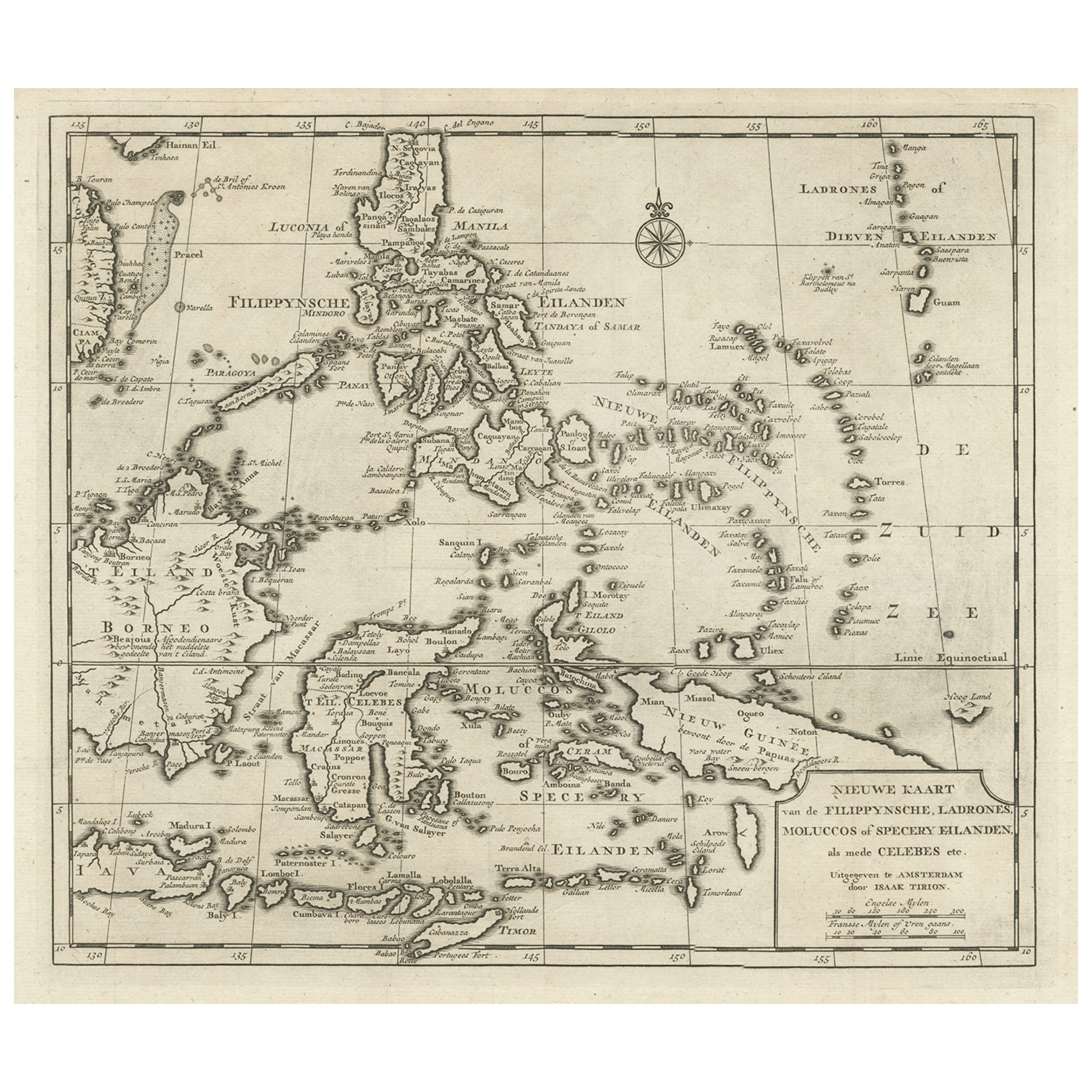
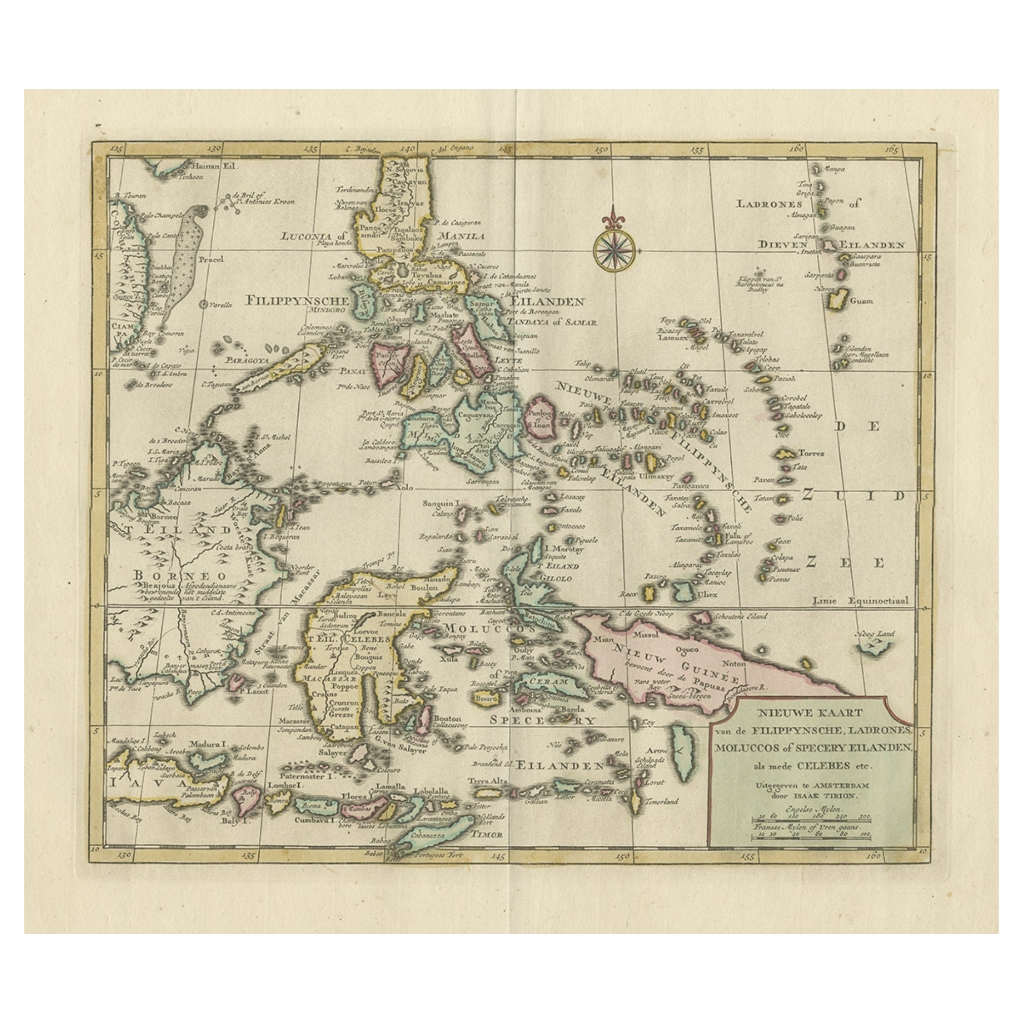
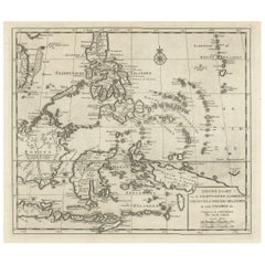
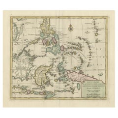
- Old Map of the Philippines and Part of Indonesia 'Spice Islands', 1744Located in Langweer, NLAntique map titled 'Nieuwe Kaart van de Filippynsche, Ladrones, Moluccos of Specery Eilanden, als mede Celebes etc'. Old map of the Philippines and part of Indonesia. Originates ...Category
Antique 1740s Maps
MaterialsPaper
- Old Original Map of the Philippines and Part of Indonesia 'Spice Islands', 1744Located in Langweer, NLAntique map titled 'Nieuwe Kaart van de Filippynsche, Ladrones, Moluccos of Specery Eilanden, als mede Celebes etc'. Old map of the Philippines and part of Indonesia. Originates ...Category
Antique 1740s Maps
MaterialsPaper
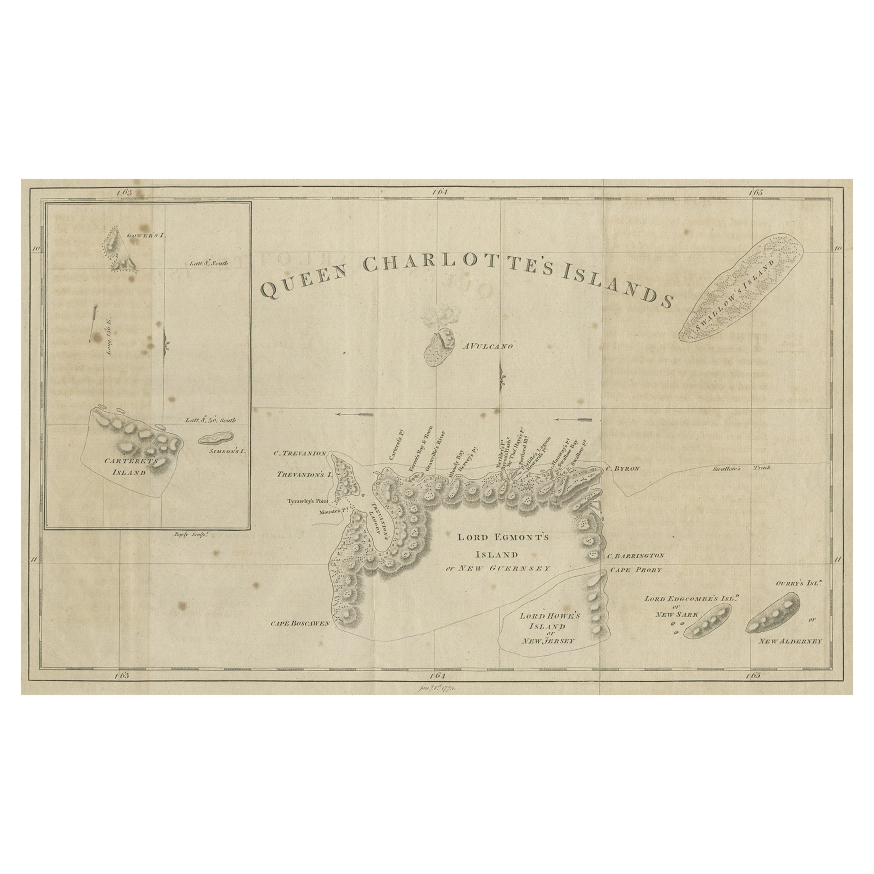
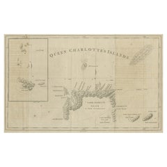
- Map of Queen Charlotte's, Carteret's, Simson's and Gower's Islands, Canada, 1773Located in Langweer, NLAntique map Canada titled 'Queen Charlotte's Islands'. Old map of Queen Charlotte's Islands, Canada. With an inset map of Carteret's, Simson's a...Category
Antique 1770s Maps
MaterialsPaper
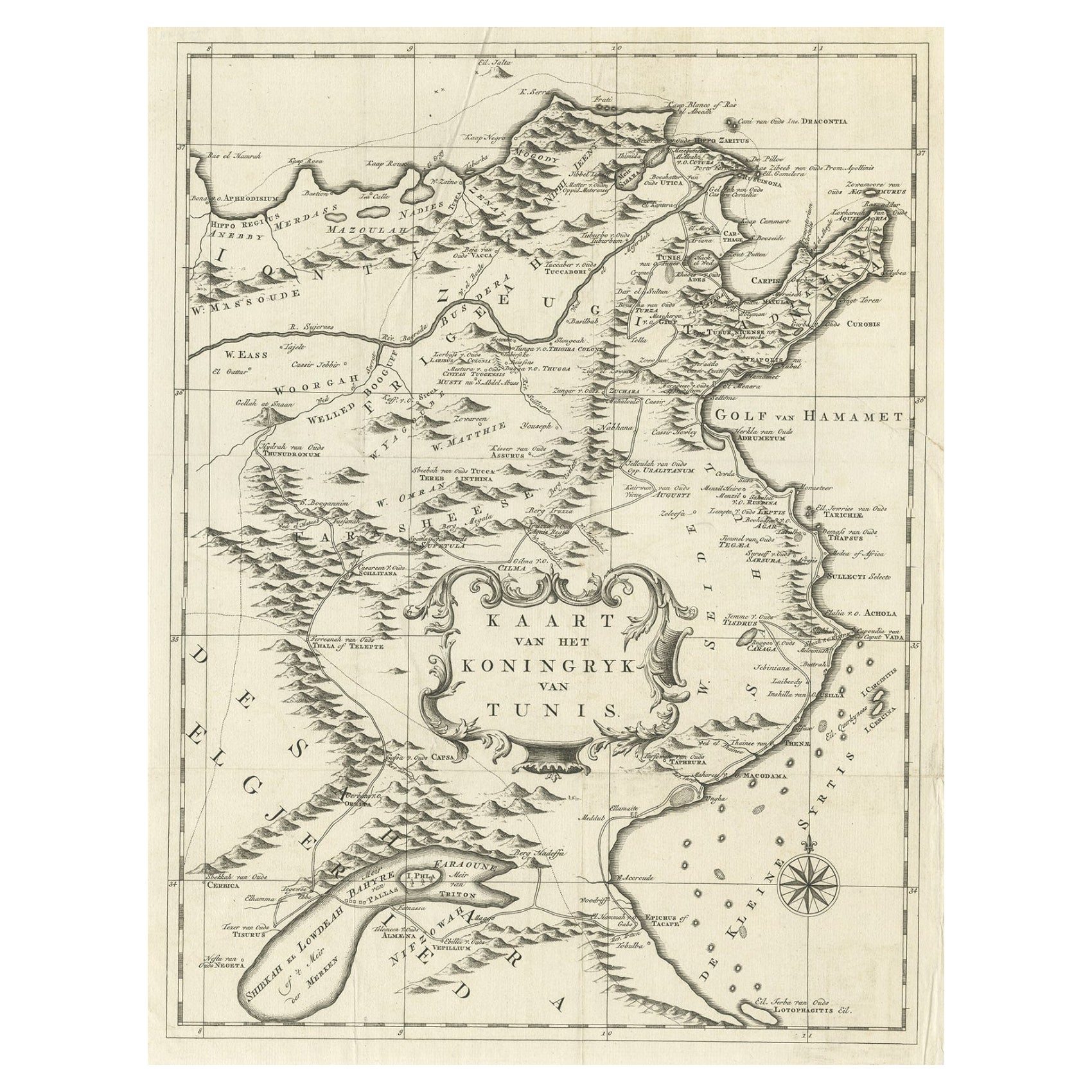
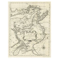
- Antique Map of the Kingdom of Tunisia, Africa, 1773Located in Langweer, NLAntique map titled 'Kaart van het Koningryk van Tunis'. Old map of the Kingdom of Tunisia. Originates from the first Dutch editon of an interesting travel account of Northern Africa ...Category
Antique 18th Century Maps
MaterialsPaper
- Antique Map of the Philippines by Anson '1749'Located in Langweer, NLAntique map titled 'Carte du Canal des Iles Philippines - Kaart van het Kanaal in de Filippynsche Eilanden'. Large detailed chart of the islands of the Philippines. One of the most detailed charts of the Philippines of the era. Shows Islands, bays, reefs, soundings tracks of the Manila Galleon route, etc. Includes a large compass...Category
Antique Mid-18th Century Maps
MaterialsPaper
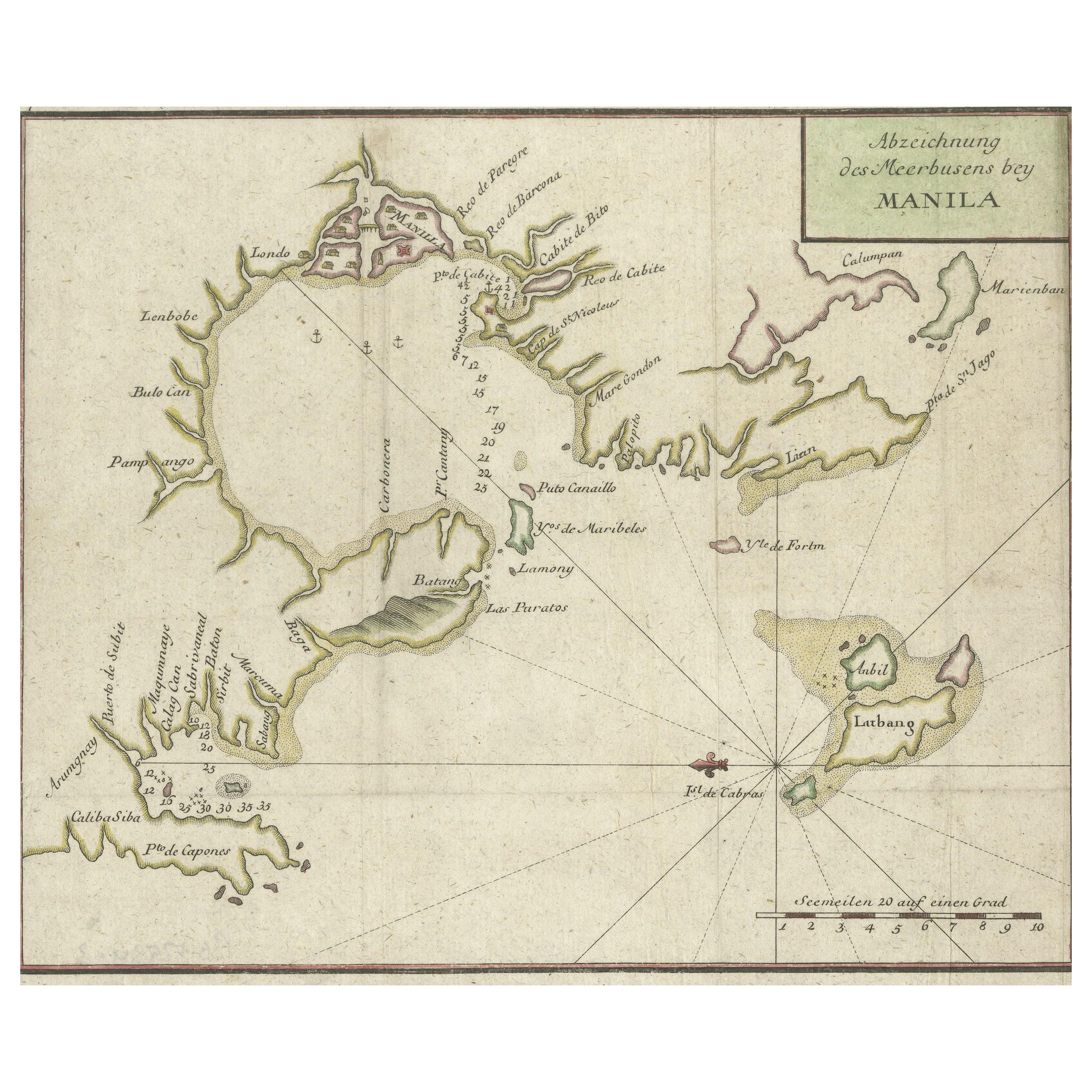
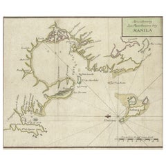
- Antique Map of the Bay of Manila, Capital of the PhilippinesLocated in Langweer, NLAntique map titled 'Abzeichnung des Meerbusens bey Manila'. Map of the Bay of Manila, capital of the Philippines. This map originates from a German edition of 'Voyage around the World...Category
Antique Mid-18th Century Maps
MaterialsPaper

You May Also Like
- Original Antique Map of South America. C.1780Located in St Annes, LancashireGreat map of South America Copper-plate engraving Published C.1780 Two small worm holes to left side of map Unframed.Category
Antique Early 1800s English Georgian Maps
MaterialsPaper
- Original Antique Map of South Africa, Arrowsmith, 1820Located in St Annes, LancashireGreat map of South Africa. Drawn under the direction of Arrowsmith. Copper-plate engraving. Published by Longman, Hurst, Rees, Orme and Br...Category
Antique 1820s English Maps
MaterialsPaper
- Original Antique Map of South America, circa 1830Located in St Annes, LancashireGreat map of South America Copper plate engraving Published by Butterworth, Livesey & Co., circa 1830 Unframed.Category
Antique Early 1800s English Other Maps
MaterialsPaper
- Map of the Republic of GenoaLocated in New York, NYFramed antique hand-coloured map of the Republic of Genoa including the duchies of Mantua, Modena, and Parma. Europe, late 18th century. Dimension: 25...Category
Antique Late 18th Century European Maps
- Hand-Colored 18th Century Homann Map of Denmark and Islands in the Baltic SeaBy Johann Baptist HomannLocated in Alamo, CAAn 18th century copper plate hand-colored map entitled "Insulae Danicae in Mari Balthico Sitae utpote Zeelandia, Fionia, Langelandia, Lalandia, Falstria, Fembria Mona" created by Joh...Category
Antique Early 18th Century German Maps
MaterialsPaper
- Original Antique Map of South East Asia, Arrowsmith, 1820Located in St Annes, LancashireGreat map of South East Asia Drawn under the direction of Arrowsmith Copper-plate engraving Published by Longman, Hurst, Rees, Orme and Brown, 1820 Unframed.Category
Antique 1820s English Maps
MaterialsPaper


Recently Viewed
View AllMore Ways To Browse
Filipino Furniture
George Map
Three Dolphins
Philippines Antique
Antique Philippines
Filipino Antique
Antique Filipino Furniture
Antique Swallow
Cook Islands
Antique Furniture Saint John
Antique In Philippines
Antique In The Philippines
Antique Furniture In Philippines
Antique Furniture In The Philippines
Captain Cook
Hemispheres Map
Antique Hemisphere Maps
George Cook