Map Of Eastern Europe
4
to
15
47
37
41
28
20
18
11
9
8
8
8
5
5
5
4
4
4
4
4
3
3
3
2
2
2
2
2
2
2
1
1
1
1
1
1
1
1
1
1
1
1
1
1
1
1
1
1
5
4
2
2
2
Sort By
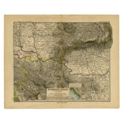
Antique Map of Eastern Europe by Stieler, 1890
Located in Langweer, NL
Antique map titled 'Osterreich-Ungarn in 4 Blattern, Blatt 4.' Map of Eastern Europe, with
Category
Antique 19th Century Maps
Materials
Paper
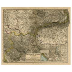
Antique Map of Eastern Europe, Incl Montenegro & Serbia & a Budapest Map, 1890
Located in Langweer, NL
Antique map titled 'Osterreich-Ungarn in 4 Blattern, Blatt 4.'
Map of Eastern Europe, with
Category
Antique 1890s Maps
Materials
Paper
H 15.63 in W 19.22 in D 0 in
1790 Thomas Stackhouse Map, Entitled "Russia in Europe, " , Ric.a004
Located in Norton, MA
: 14.5 x 15.25 inches. Mat size: 22.75 x 23.75 inches. A beautiful example of this map of Eastern Europe
Category
Antique 17th Century Unknown Maps
Materials
Paper
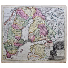
Scandinavia & Portions of Eastern Europe: 18th Century Hand-Colored Homann Map
By Johann Baptist Homann
Located in Alamo, CA
, becoming the leading map publisher in Germany and an important entity in the European map market. In 1715
Category
Antique Early 18th Century German Maps
Materials
Paper
H 20.75 in W 23.5 in D 0.07 in
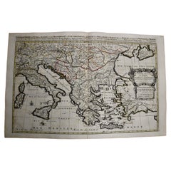
Southern & Eastern Europe: A Large 17th C. Hand-colored Map by Sanson & Jaillot
By Nicolas Sanson
Located in Alamo, CA
This large hand-colored map entitled "Estats de L'Empire des Turqs en Europe, ou sont les
Category
Antique 1690s French Maps
Materials
Paper
H 24.88 in W 38 in D 0.13 in
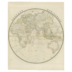
Antique Map of the Eastern Hemisphere by Wyld, 1842
Located in Langweer, NL
Antique map titled 'Eastern Hemisphere'. Large map depicting the continents Europe, Asia, Afrika
Category
Antique 19th Century Maps
Materials
Paper
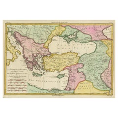
Antique Map of the Eastern Mediterranean and the Balkans
Located in Langweer, NL
Antique map titled 'La Turquie d'Europe et celle d'Asie'. Attractive double page map of the Eastern
Category
Antique Late 18th Century Maps
Materials
Paper
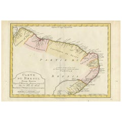
Antique Map of the Eastern Part of Brazil by A. Van Krevelt, 1772
Located in Langweer, NL
Rare edition of this accurate map of eastern part of Brazil. This map originates from 'Atlas
Category
Antique Late 18th Century Maps
Materials
Paper
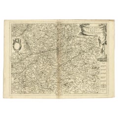
Detailed Antique Map of Western Belgium and Eastern France by Coronelli, 1690
By Vincenzo Coronelli
Located in Langweer, NL
Antique map titled 'Contado d'Hannonia (..)'. Map of western Belgium and eastern France, from south
Category
Antique 17th Century Maps
Materials
Paper
H 18.9 in W 26.58 in D 0 in
Antique European War Folding Map, ‘circa 1915’
Located in Langweer, NL
Antique folding map of the European War (1914-1915) titled 'The Eastern Campaign '. From Petrograd
Category
Early 20th Century Maps
Materials
Paper
Map Silk Embroidered Western Eastern Hemisphere New Old World Asia America Afri
Located in BUNGAY, SUFFOLK
A rare, late-18th century, silk, embroidered, double hemisphere, world map, blackwork, sampler
Category
Antique 18th Century British Georgian Maps
Materials
Silk
H 0.4 in W 0.4 in D 0.4 in
Antique Map of Central Europe "Centered on Germany" by F. de Wit, circa 1680
Located in Langweer, NL
A very detailed map of central Europe, centered on Germany. It extends from Belgium and The
Category
Antique Late 17th Century Maps
Materials
Paper
H 20.67 in W 24.41 in D 0.02 in
Original Antique Engraving of the Eastern Hemisphere, c.1700
Located in Langweer, NL
Antique map titled 'Proiectio Optica Aequinoctia lis Hemishaerii Orientalis' - Map of the Eastern
Category
Antique 17th Century Maps
Materials
Paper
Antique Map of Celebes 'Sulawesi, Indonesia' by Bellin, ciarca 1755
By Jacques-Nicolas Bellin
Located in Langweer, NL
Antique map titled 'Carte de l'Isle Celebes ou Macassar'. Map of Celebes (Sulawesi, Indonesia
Category
Antique Mid-18th Century European Maps
Materials
Paper
Antique Map of the Bay of Terney by La Pérouse, 1797
Located in Langweer, NL
Antique map titled 'Plan de la Baie de Ternai'. Old map of the north eastern coast of Russia. This
Category
Antique 18th Century Maps
Materials
Paper
Antique Map of Turkey in Asia by J. Tallis, circa 1851
Located in Langweer, NL
A highly decorative and finely engraved mid-19th century map of 'Turkey in Asia' (Middle Eastern
Category
Antique Mid-19th Century Maps
Materials
Paper
Antique Map of Germany During the Mid-18th Century, Published in 1747
Located in Langweer, NL
, Denmark and parts of Eastern Europe. Parts of northern Italy, Poland and Hungary are also included
Category
Antique 18th Century Maps
Materials
Paper
Captain Cook's Exploration of Tahiti 18th C. Hand-Colored Map by Bellin
By Jacques-Nicolas Bellin
Located in Alamo, CA
. Among his many achievements was the first European contact with the eastern coastline of Australia, the
Category
Antique Mid-18th Century French Maps
Materials
Paper
H 11.38 in W 17.5 in D 0.13 in
Balkan Convergence: A Map of Turkey and Greece with the Balkan States, 1882
Located in Langweer, NL
Southeastern Europe and the Eastern Mediterranean during the late 19th century.
The map spans the region from
Category
Antique 1880s Maps
Materials
Paper
H 22.45 in W 14.97 in D 0 in
Antique Map of Central Asia Wiht Nova Zembla as an Island, C.1700
Located in Langweer, NL
extending to include much of Eastern Europe and Northeastern Africa. The Caspian Sea is depicted with a
Category
Antique 18th Century Maps
Materials
Paper
Authentique Map by Pilon of The French Colonies in The West Indies, 1876
Located in Langweer, NL
The 1876 map titled "Carte des Colonies Françaises aux Antilles" represents a significant
Category
Antique Late 19th Century Maps
Materials
Paper
H 14.38 in W 16.54 in D 0 in
North & South America: A 17th Century Hand-colored Map by Jansson & Goos
By Johannes Janssonius
Located in Alamo, CA
route between Europe and Asia. The map includes portions of Japan, as well as multiple islands in the
Category
Antique 1620s Dutch Maps
Materials
Paper
1718 Ides & Witsen Map "Route D'amsterdam a Moscow Et De La Ispahan Et Gamron
Located in Norton, MA
,"
Ric.b005
Subject: Eastern Europe and Central Asia
Period: 1718 (published)
Publication: Voyages Par Le
Category
Antique Early 18th Century Dutch Maps
Materials
Paper
H 11.11 in W 14.81 in D 0.4 in
Original Antique Engrving of Chinese Tartary in the 18th Century, 1737
Located in Langweer, NL
(or Nerzinskoi) to Beijing. The map's eastern portion marks the road's beginning, and a decorative
Category
Antique 1730s Maps
Materials
Paper
No Reserve
H 11.42 in W 18.9 in D 0 in
The Roman Empire from the Time of Constantine the Great, Published in 1880
Located in Langweer, NL
Antique map titled: "IMPERIUM ROMANORUM inde a Constantini Magni tempore," which translates to "The
Category
Antique 1880s Maps
Materials
Paper
No Reserve
H 15.56 in W 18.51 in D 0 in
Teruel 1901: A Cartographic Depiction of Heritage and Natural Splendor in Spain
Located in Langweer, NL
Original antique map of Teruel in Spain, with highlighted gold. The province of Teruel, located in
Category
Antique Early 1900s Maps
Materials
Paper
Free Shipping
H 14.77 in W 20.08 in D 0 in
Jacques Liozu's 1951 illustrated map of Central and Eastern Europe
By Jacques Liozu
Located in PARIS, FR
Jacques Liozu's 1951 illustrated map of Central and Eastern Europe is a cartographic work of great
Category
1950s Prints and Multiples
Materials
Paper, Lithograph
Empire's Tapestry: Mapping Portugal's Global Legacy in 1903
Located in Langweer, NL
This map is an original antique map that showcases Portuguese possessions around the turn of the
Category
Antique Early 1900s Maps
Materials
Paper
Free Shipping
H 20.08 in W 14.77 in D 0 in
Roman Frontiers Engraved: Germania, Raetia, and Noricum, Published in 1880
Located in Langweer, NL
, which correspond to parts of modern-day Central and Eastern Europe, including areas of Germany, Austria
Category
Antique 1880s Maps
Materials
Paper
No Reserve
H 15.56 in W 18.51 in D 0 in
Roman Balkans: Pannonia, Illyricum, Dacia, Moesia, Thracia, Macedonia and Thyris
Located in Langweer, NL
and Eastern Europe. The title "PANNONIA, ILLYRICUM DACIA, MOESIA, THRACIA, MACEDONIA, EPIRYS
Category
Antique 1880s Maps
Materials
Paper
Free Shipping
H 15.56 in W 18.51 in D 0 in
Burgundy's Viticultural Landscape: A 1640 Cartographic Engraving by Willem Blaeu
Located in Langweer, NL
An hand-colored original antique map with the title "Utriusque Burgundiae tum Ducatus tum Comitatus
Category
Antique 1640s Maps
Materials
Paper
Free Shipping
H 18.51 in W 23.43 in D 0 in
Southern & Eastern Europe: A Large 17th C. Hand-colored Map by Sanson & Jaillot
By Nicholas Sanson d'Abbeville
Located in Alamo, CA
This large hand-colored map entitled "Estats de L'Empire des Turqs en Europe, ou sont les
Category
1690s Landscape Prints
Materials
Engraving
Hungary & Eastern Europe: A Large 17th C. Hand-colored Map by Sanson & Jaillot
By Nicholas Sanson d'Abbeville
Located in Alamo, CA
This large hand-colored map entitled "Le Royaume De Hongrie et les Estats qui en ont este sujets et
Category
1690s Landscape Prints
Materials
Engraving
Antique Print of a Fortress in Perm Krai in Eastern Europe, Russia, 1768
Located in Langweer, NL
carefully.
Date: 1768
Overall size: 18 x 25 cm.
Image size: 14 x 19 cm.
We sell original antique maps to
Category
Antique 18th Century Prints
Materials
Paper
Map of the World: An Original 18th Century Hand-colored Map by E. Bowen
Located in Alamo, CA
the British Isles, Europe, North America, Africa, and Asia. He also created maps for several important
Category
Mid-18th Century Old Masters Landscape Prints
Materials
Engraving
Map of the Russian Empire: An Original 18th Century Hand-colored Map by E. Bowen
Located in Alamo, CA
Isles, Europe, North America, Africa, and Asia. He also created maps for several important atlases
Category
Mid-18th Century Old Masters Landscape Prints
Materials
Engraving
Captain Cook's Exploration of Tahiti: 18th C. Hand-colored Map by Bellin
By Jacques-Nicolas Bellin
Located in Alamo, CA
. Among his many achievements was the first European contact with the eastern coastline of Australia, the
Category
Late 18th Century Landscape Prints
Materials
Engraving
North & South America: A 17th Century Hand-colored Map by Jansson & Goos
By Johannes Jansson
Located in Alamo, CA
route between Europe and Asia. The map includes portions of Japan, as well as multiple islands in the
Category
1620s Landscape Prints
Materials
Engraving
Original Engraving of Rotterdam Island, Nowadays Nomuka, Kingdom of Tonga, c1800
Located in Langweer, NL
which he achieved the first recorded European contact with the eastern coastline of Australia and the
Category
Antique Early 1800s Prints
Materials
Paper
H 11.62 in W 14.77 in D 0 in
Atlas Vallard, One-Time Only Limited Facsimile Edition of the Atlas of 1547
Located in BARCELONA, ES
model that inspired it. It is quite significant to note that the atlas depicts the Eastern Coast of
Category
2010s French Renaissance Books
Materials
Leather
Free Shipping
H 15.36 in W 11.82 in D 1.19 in
Original Imray & Son Chart of North Atlantic, 1876
Located in Norwell, MA
Nautical chart of the North Atlantic showing the Eastern United States coast, Caribbean Islands
Category
Antique 1870s Nautical Objects
Materials
Paper
Gregory's 1861 Expedition into the North West of Australia, 1862
Located in Langweer, NL
The map represents the route taken during F.T. Gregory's 1861 North West Australian Expedition
Category
Antique 1860s Prints
Materials
Paper
Free Shipping
H 8.39 in W 14.97 in D 0 in
Original Antique Print of a North American Chippewa Mother with Child, 1836
Located in Langweer, NL
, songs, maps, memories, stories, geometry, and mathematics.
European powers, Canada, and the United
Category
Antique 1830s Prints
Materials
Paper
H 7.49 in W 6.3 in D 0 in
Antoine Lafrery Set of 6 Engraving "Speculun Romanae Magnificen" 16th Century
Located in Beuzevillette, FR
confirmed 4 years later). He sold maps and prints, which allowed his reputation to spread to Europe. Between
Category
Antique 16th Century Italian Renaissance Picture Frames
Materials
Paper
H 19.3 in W 13.78 in D 0.4 in
Stalingrad to Berlin The German Defeat in the East by Earl Ziemke, Stated 1st Ed
Located in valatie, NY
completed of 3 projected books covering military operations on the Eastern Front of World War II in Europe
Category
Vintage 1960s American Books
Materials
Paper
H 10 in W 7.25 in D 1.5 in
Le Coste Nord Ovest Dell' America E Nord Est Dell' Asia Delineate Sulle Ultime O
Located in Bristol, CT
voyages of discovery, the highlights of which include the first European contact with eastern Australia
Category
1790s Prints and Multiples
Materials
Paper
Cemetery on Amsterdam Island, French Territory in the Indian Ocean, ca.1785
Located in Langweer, NL
first recorded European contact with the eastern coastline of Australia and the Hawaiian Islands, and
Category
Antique 1780s Prints
Materials
Paper
H 9.85 in W 15.36 in D 0 in
In the Bazaar II
By Charles Théodore Frère
Located in New York, NY
Frere was a French Orientalist painter. Though he originally painted European landscapes, Frere became
Category
19th Century Academic Figurative Paintings
Materials
Oil
Captain James Cook: 18th C. Portrait by William Hodges After Cook's 2nd Voyage
By William Hodges
Located in Alamo, CA
to explore the eastern coast of Australia, and he was the first to map the New Zealand coastline. He
Category
1770s Portrait Prints
Materials
Engraving
Scenery 2 (From Topography Series) - a painting in light, grey, beige and yellow
By Natalia Sitnikova
Located in Fort Lee, NJ
,
Ulyanovsk regional art museum,
Yaroslavl art museum,
Kolodzei Collection of Russian and Eastern European
Category
2010s Abstract Abstract Paintings
Materials
Alabaster, Sandstone
H 47.25 in W 39.38 in D 0.79 in
Rare Judaica Jewish Folk Art Sukkot Papercut Jerusalem Mizrach Archie Granot
By Archie Granot
Located in Surfside, FL
for festive occasions. Paper cutting was practiced by Jewish communities in both Eastern Europe and
Category
1980s Folk Art Mixed Media
Materials
Mixed Media
Composition XXI - square painting in light, grey, peach and red burgundy color
By Natalia Sitnikova
Located in Fort Lee, NJ
art museum,
Kolodzei Collection of Russian and Eastern European Art
Category
Early 2000s Abstract Abstract Paintings
Materials
Alabaster, Sandstone
H 19.69 in W 19.69 in D 0.79 in
Topography 10 - abstract painting in white, grey, pink and beige
By Natalia Sitnikova
Located in Fort Lee, NJ
art museum,
Kolodzei Collection of Russian and Eastern European Art.
Category
2010s Abstract Mixed Media
Materials
Alabaster, Sandstone
H 39.38 in W 39.38 in D 0.4 in
Topography 6 - abstract painting in light pink, white, yellow and grey
By Natalia Sitnikova
Located in Fort Lee, NJ
art museum,
Kolodzei Collection of Russian and Eastern European Art.
Category
2010s Abstract Abstract Paintings
Materials
Alabaster, Sandstone
H 39.38 in W 39.38 in D 0.4 in
Le Nid (The Nest)
By Jean Pierre Serrier
Located in San Francisco, CA
parents are from Eastern France, Lorraine.His mother, Solange, is a native of Blénod Toul, a village
Category
Mid-20th Century Surrealist Figurative Paintings
Materials
Oil
Antique Map of the Eastern and Western Hemisphere by Bodenehr, circa 1720
Located in Langweer, NL
America, Africa, Europe and Asia. The map of the Americas shows California as an Island from the Dutch
Category
Antique Early 18th Century Maps
Materials
Paper
H 11.23 in W 15.56 in D 0.6 in
Antique Map of Southern Italy, Hand-Colored, circa 1720
Located in Colorado Springs, CO
Presented is an original map of the Eastern Part of Italy, circa 1720. The map displays the
Category
Antique 1720s European Maps
Materials
Paper
1792 "Plan of the City of Washington" by Ellicott, Antique Map or Plan of D.C.
Located in Colorado Springs, CO
first official map of the City of Washington to be produced, showing the then future capital of the
Category
Antique Late 18th Century American Historical Memorabilia
Materials
Paper
H 32 in W 39.5 in D 1.75 in
Gulf of Mexico, Florida, C. America, Cuba: 18th C. Hand-colored Map by Bellin
By Jacques-Nicolas Bellin
Located in Alamo, CA
This beautiful 18th century hand-colored map entitled "Carte du Golphe du Mexique et des Isles de
Category
1750s Landscape Prints
Materials
Engraving
Antique Engraving of the Cemetery of Tongatapu, Friendly Islands, 1785
Located in Langweer, NL
Tongatapu, Friendly Islands. This map originates from volume 1 of 'Troisième voyage de Cook, ou, Voyage à
Category
Antique 1780s Prints
Materials
Paper
- 1
Get Updated with New Arrivals
Save "Map Of Eastern Europe", and we’ll notify you when there are new listings in this category.
Map Of Eastern Europe For Sale on 1stDibs
Find many varieties of an authentic map of eastern Europe available at 1stDibs. Frequently made of paper, animal skin and leather, every map of eastern Europe was constructed with great care. There are 30 variations of the antique or vintage map of eastern Europe you’re looking for, while we also have 1 modern editions of this piece to choose from as well. There are many kinds of the map of eastern Europe you’re looking for, from those produced as long ago as the 18th Century to those made as recently as the 21st Century. Each map of eastern Europe bearing Art Deco hallmarks is very popular. Many designers have produced at least one well-made map of eastern Europe over the years, but those crafted by Jacques-Nicolas Bellin, Johann Baptist Homann and Johannes Janssonius are often thought to be among the most beautiful.
How Much is a Map Of Eastern Europe?
A map of eastern Europe can differ in price owing to various characteristics — the average selling price 1stDibs is $853, while the lowest priced sells for $71 and the highest can go for as much as $7,950.
More Ways To Browse
Map Of Quebec
Antique Puerto Rico Map
Serbia Antique Map
Verde 1999 Retro
Albania Antique Map
Antique Maps Of Puerto Rico
Antique Land Surveyor
Jack Stuck
Antique Washboard
Dalmatian Table
Abstarct Art
Cree Native
Sellers In Atlanta Georgia
Elliott Smith
Sir Francis Bacon
Linen Map Italy
Rear Window Vintage Poster
Antique Maps Scandinavia
