Items Similar to London AA Map


Want more images or videos?
Request additional images or videos from the seller
1 of 5
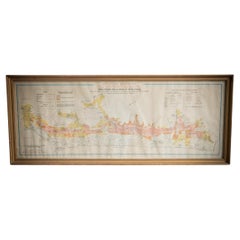
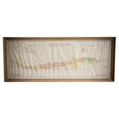
London AA Map
About the Item
London AA map.
- Dimensions:Height: 35.04 in (89 cm)Width: 27.17 in (69 cm)Depth: 0.79 in (2 cm)
- Materials and Techniques:
- Period:
- Date of Manufacture:Unknown
- Condition:Wear consistent with age and use. All Kingham Decorative items: the very bare minimum of restoration work may have been carried out. This is to ensure we retain the age and history of each piece, preserving the essence of originality and integrity.
- Seller Location:Alton, GB
- Reference Number:
About the Seller
No Reviews Yet
Vetted Seller
These experienced sellers undergo a comprehensive evaluation by our team of in-house experts.
Established in 2020
1stDibs seller since 2022
13 sales on 1stDibs
Typical response time: 16 hours
- ShippingRetrieving quote...Ships From: Alton, United Kingdom
- Return PolicyA return for this item may be initiated within 14 days of delivery.
More From This SellerView All
- Illustrated Map of London from ExhibtionLocated in Alton, GBDetailed illustrated map of London from the great exhibition of industry of all nations 1851.Category
Antique 19th Century Maps
MaterialsPaper
- Saxtons Map of Oxtons, Bucks, BerkLocated in Alton, GBFramed Saxton’s Map of Oxfordshire, Buckinghamshire, and Berkshire, 1574. Originally published as one of thirty-three maps in Christopher Saxton’s (c.1542- c.1610) Atlas of the Count...Category
Antique 16th Century British Maps
MaterialsPaper
- French School Map of Uk, Double-SidedLocated in Alton, GBMap of the UK in french made for schools from the 20th century.Category
20th Century Maps
MaterialsPaper
- Gilt Framed Vintage Wine Regions of France MapLocated in Alton, GBFramed French wine region map 1973. The print has been removed to clean the glass, the frame has minor damage in places but nothing that detracts from ...Category
Vintage 1970s French Posters
MaterialsPaper
- Gilt Framed Vintage French Cote De Beaune Wine Region Poster 1972Located in Alton, GBFramed Cote De Beaune region wine map from 1972. The print has been removed to clean the glass, the frame has minor damage in places but nothing that de...Category
Vintage 1970s French Posters
MaterialsPaper
- Gilt Framed Vintage French La Cote De Nuits Wine Region Poster 1972Located in Alton, GBFramed La Cote De Nuits region wine map from 1972. The print has been removed to clean the glass, the frame has minor damage in places but nothing that detracts from its beauty, if a...Category
Vintage 1970s French Posters
MaterialsPaper


You May Also Like
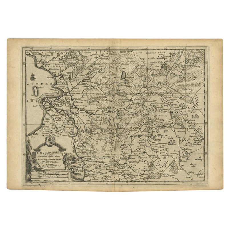
- Antique Map of Overijssel by Van der Aa, c.1715Located in Langweer, NLAntique map titled 'L'Over-Issel'. This map depicts the Dutch province Overijssel. This map originates from 'Nouvel Atlas, très exact et fort commode pour toutes sortes de personnes,...Category
Antique 18th Century Maps
MaterialsPaper
- Antique Map of Peru by van der Aa, 'circa 1720'Located in Langweer, NLAntique map titled 'Le Perou, Grand Pays de l Amerique Meridionale (..)'. Decorative map of Peru including portions of Ecuador and northern Chile and Boliv...Category
Antique Early 18th Century Maps
MaterialsPaper
- Antique Map of Scandinavia by Van der Aa 'circa 1710'Located in Langweer, NLAntique map titled 'Scandinavie Septentrionale' and 'Scandinavie Meridionale'. Copper engraving with two maps on one sheet. The upper map depicts Northern Scandinavia with Norway, Sw...Category
Antique Early 18th Century Maps
MaterialsPaper
- Antique Map of the East Indies by Van der Aa '1849'Located in Langweer, NLAntique map titled 'Kaart van Nederlands OostIndie door A.J. van der Aa'. Old map of the Dutch East Indies. This map originates from 'Nederlands Oost-Indië, of beschrijving der Neder...Category
Antique Mid-19th Century Maps
MaterialsPaper
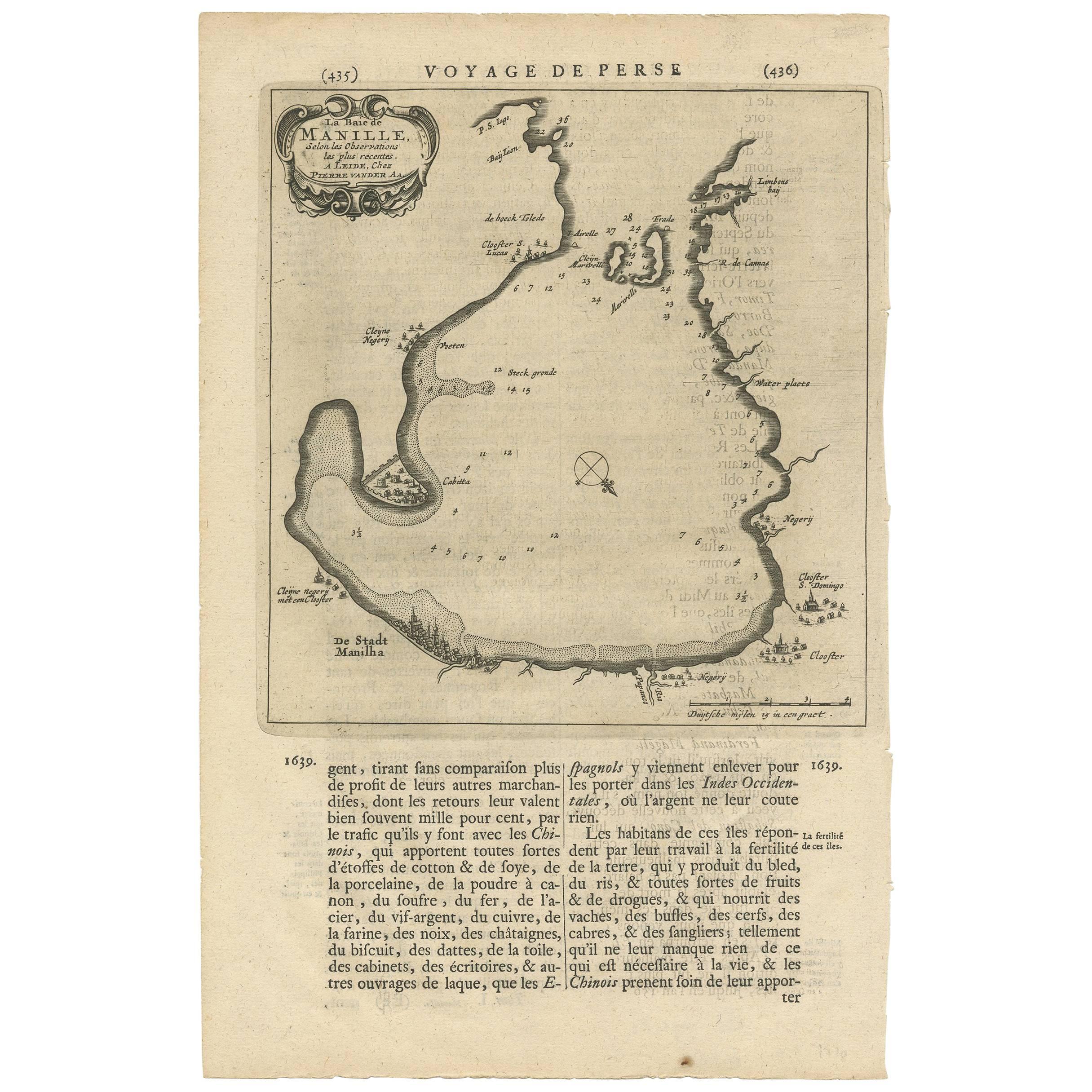
- Antique Map of Manilla Bay Philippines by P. van der Aa, 1719Located in Langweer, NLRare antique map titled 'La Baie de Manille (..)'. Map of Manilla Bay, the map is oriented with southwest at the top and includes a small town plan for Manilla and other places. This...Category
Antique Early 18th Century Maps
MaterialsPaper
- Antique Map of the Mughal Empire by Van der Aa, C.1725By Pieter Van Der AaLocated in Langweer, NLAntique map titled 'Royaume de Grand Mogol (..).' This map shows the extend of the Mughal Empire, which includes northern India, from Golconda to Afghanistan and eastwards to Bengal....Category
Antique 18th Century Maps
MaterialsPaper


Recently Viewed
View AllMore Ways To Browse
Unknown London
Antique Style Atlas
Nautical Map
Nautical Maps
Antique Ship Decor
Pacific Map
Coastal Maps
Antique Roman Map
Mexico Antique Map
Antique Sea Chart
Antique Maps Mexico
Antique Sea Charts
Amsterdam Coat Of Arms
Antique Texas Collectables
Large Map Of The Netherlands
Antique Furniture Alexandria
Victorian Fence
Alexandria Antique Furniture