Large Map Of The World
18
to
98
580
447
430
309
287
225
186
121
115
73
59
48
39
32
32
32
30
28
24
23
19
17
16
15
14
11
11
11
10
9
9
8
7
7
6
6
5
4
4
4
4
4
3
3
3
3
3
2
2
2
2
1
1
1
1
1
1
54
42
42
35
32
Sort By
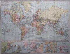
Large Original Vintage Map of The World, circa 1920
Located in St Annes, Lancashire
Great map of The World
Original color.
Good condition / minor foxing
Published by
Category
Vintage 1920s English Maps
Materials
Paper
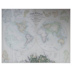
Large Original Antique Map of The World, Fullarton, C.1870
Located in St Annes, Lancashire
Great map of the World. Showing both hemispheres
From the celebrated Royal Illustrated Atlas
Category
Antique 1870s Scottish Maps
Materials
Paper
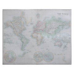
Large Original Antique Map of the World, Fullarton, circa 1870
Located in St Annes, Lancashire
Great map of the World.
From the celebrated Royal Illustrated Atlas
Lithograph. Original color
Category
Antique 1870s Scottish Maps
Materials
Paper
No Reserve
H 18.5 in W 22.5 in D 0.07 in
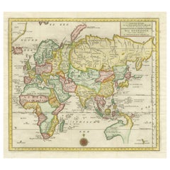
Antique Map of the Eastern Part of the World
Located in Langweer, NL
Antique map titled 'Nieuwe Kaart van het Oostelykste Deel der Weereld, diendende tot aanwyzing van
Category
Antique Mid-18th Century Maps
Materials
Paper
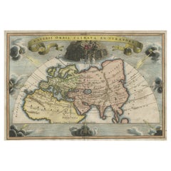
Decorative Ancient World Map with Large Parts of the World Still Unknown, c 1731
Located in Langweer, NL
Interesting ancient map of the world, based upon Strabo. The Southern tip of Africa is undiscovered
Category
Antique 1730s Maps
Materials
Paper
H 9.45 in W 14.57 in D 0 in
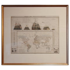
Antique Map of the Distribution of Vegetation throughout the World '1851'
Located in Langweer, NL
of vegetation throughout the world. Five drawings above the map show the vegetation in numerous areas
Category
Antique Mid-19th Century Maps
Materials
Paper
H 19.69 in W 21.86 in D 0.79 in
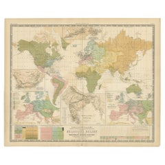
Antique Map Showing the Religions Around the World by Johnston '1854'
Located in Langweer, NL
According to Religious Belief'. Rare large-size thematic map on the distribution of religions around the
Category
Antique Mid-19th Century Maps
Materials
Paper
H 21.66 in W 26.38 in D 0.02 in
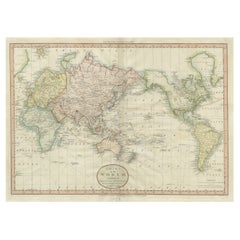
Very Attractive Antique Map of the World as Planisphere, Shows Cook's Voyages
Located in Langweer, NL
Antique map titled 'Chart of the World, according to Mercators Projection'. This world map shows
Category
Antique Late 18th Century Maps
Materials
Paper
No Reserve
H 16.15 in W 20.08 in D 0.02 in
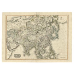
Large Antique Map of the Asian Continent, 1814
Located in Langweer, NL
Antique map titled 'Asia'. Large antique map of the Asian continent. Drawn under the direction of
Category
Antique 19th Century Maps
Materials
Paper
Antique Map of the World in Hemispheres by Keizer & de Lat, 1788
Located in Langweer, NL
double hemisphere world map on polar projections. In North America, there is a large Island of California
Category
Antique Late 18th Century Maps
Materials
Paper
Antique Hemisphere Map of the World 'Two on One Sheet' by Levasseur, '1875'
Located in Langweer, NL
la projection polaire'. Large map with two hemisphere world maps on one sheet. This map originates
Category
Antique Late 19th Century Maps
Materials
Paper
H 24.02 in W 18.71 in D 0.02 in
Antique Map of the World with Polar Projections by Keizer & de Lat, 1788
Located in Langweer, NL
Antique map titled 'Schuine Ronde Aard-Klooten (..)'. Interesting double hemisphere world map with
Category
Antique Late 18th Century Maps
Materials
Paper
H 8.08 in W 11.03 in D 0.02 in
Large Scale Map of Greece with Inset Map of Macedonia, c.1786
Located in Langweer, NL
Antique map titled 'Graeciae Antiquae'. Large scale map of Greece, extends south to the island of
Category
Antique 18th Century Maps
Materials
Paper
Antique Detailed World Map Drawn on Mercator's Projection, 1700
Located in Langweer, NL
Antique world map titled 'Carte generale du monde, ou description du monde terrestre & Aquatique
Category
Antique 17th Century Maps
Materials
Paper
Large Antique Map of Asia The Royal Atlas of Modern Geography by Johnston, 1882
Located in Langweer, NL
Antique map titled 'Asia'. Old map of the Asian continent. This map originates from 'The Royal
Category
Antique 19th Century Maps
Materials
Paper
H 19.53 in W 24.22 in D 0 in
Antique Map of the Region of Gaasterland, Friesland, The Netherlands, 1664
Located in Langweer, NL
original antique maps to collectors, historians, educators and interior decorators all over the world. Our
Category
Antique 17th Century Maps
Materials
Paper
H 11.82 in W 14.77 in D 0 in
Large Antique Map of Delfland by Cruquius, 1712
Located in Langweer, NL
Map no. 20 of a large wall map of Delfland, The Netherlands. The map covers the region of Pijnacker
Category
Antique 18th Century Maps
Materials
Paper
Large Antique Map of the Lower Nile Valley Including Egypt and Nubia, 1842
Located in Langweer, NL
maps to collectors, historians, educators and interior decorators all over the world. Our collection
Category
Antique 19th Century Maps
Materials
Paper
H 26.78 in W 19.89 in D 0 in
Large Antique County Map of Leicestershire, England, 1805
Located in Langweer, NL
Explore Leicestershire's Past: Antique Map by John Cary
Step into the history of Leicestershire
Category
Antique Early 19th Century Maps
Materials
Paper
Antique Map of the Holy Land, c.1710
Located in Langweer, NL
the world. Our collection includes a wide range of authentic antique maps from the 16th to the 20th
Category
Antique 18th Century Maps
Materials
Paper
Superb Antique Map of the Province of Gelderland, the Netherlands, ca.1575
Located in Langweer, NL
remarkable map was a 8 sheet world map in the year 1564, but only three copies have survived. In 1570 he
Category
Antique 16th Century Maps
Materials
Paper
H 16.86 in W 21.97 in D 0 in
Antique Map of the Northern Part of the Netherlands by Jaeger, 1784
Located in Langweer, NL
septentrionale, de differentes isles de la meer d'Allemagne, et du Zuider See.' Large and detailed map of the
Category
Antique 18th Century Maps
Materials
Paper
Large Detailed Map of Australia Wint Inset of Tasmania, 1937
Located in Langweer, NL
Antique map titled 'Australia'. Large folding map of Australia. With inset map of Tasmania. Printed
Category
20th Century Maps
Materials
Paper
Antique Map of Greece with an Inset Map of the Upper Danube Region, c.1720
Located in Langweer, NL
on map publishing in Germany. Apart from the atlases the firm published a very large number of
Category
Antique 18th Century Maps
Materials
Paper
H 21.07 in W 25.2 in D 0 in
Antique Map of the County of Hainaut by Jaillot, 1692
Located in Langweer, NL
Antique map titled 'Le Comté de Haynaut divisé en Chateliensis, Balliages, Prevoste's (..)'. Large
Category
Antique 17th Century Maps
Materials
Paper
Antique Map of the Region of Meissen by Schreiber, 1749
Located in Langweer, NL
Antique map titled 'Der Ertz-Gebürgische Creis in Meissen (..)'. Map of the region of Meissen
Category
Antique 18th Century Maps
Materials
Paper
Antique Map of the Region of Wonseradeel by Schotanus, 1664
By B. Schotanus
Located in Langweer, NL
all over the world. Our collection includes a wide range of authentic antique maps from the 16th to
Category
Antique 17th Century Maps
Materials
Paper
Antique Map of the Siege of Gent by Dumont, 1729
By Dumont
Located in Langweer, NL
Antique map titled 'Plan of the Siege and Attacks of the City and Citadel of Ghent'. Large map
Category
Antique 18th Century Maps
Materials
Paper
Large Antique Map of Denmark by Bowles, c.1780
By Thomas
Located in Langweer, NL
Antique map titled 'Bowles's new pocket map of the Kingdom of Denmark (..)' Large map of Denmark
Category
Antique 18th Century Maps
Materials
Paper
Antique Map of the Course of the Elbe River by Janssonius, c.1650
By Johannes Janssonius
Located in Langweer, NL
Antique map titled 'Nobilis Flubius Albis (..)'. Old map of the course of the Elbe river, large
Category
Antique 17th Century Maps
Materials
Paper
Two Impressive and Huge Midcentury World Map Wall Globes, Austria, 1950s
Located in Vienna, AT
We proudly offer this outstanding pair of very large wall-mounted modernist globes / world maps
Category
Mid-20th Century Austrian Mid-Century Modern Maps
Materials
Aluminum, Iron
Antique Map of the City of Bolsward, Friesland in The Netherlands, c.1598
Located in Langweer, NL
the world. Our collection includes a wide range of authentic antique maps from the 16th to the 20th
Category
Antique 16th Century Maps
Materials
Paper
H 9.45 in W 10.63 in D 0 in
Antique Map of Zeeland, The Netherlands, by Jaillot, 1693
Located in Langweer, NL
decorators all over the world. Our collection includes a wide range of authentic antique maps from the 16th
Category
Antique 17th Century Maps
Materials
Paper
Antique Map of the Eastern Hemisphere by Wyld, 1842
Located in Langweer, NL
Antique map titled 'Eastern Hemisphere'. Large map depicting the continents Europe, Asia, Afrika
Category
Antique 19th Century Maps
Materials
Paper
Antique Map of the German Empire by Johnston, 1882
By Alexander Keith Johnston
Located in Langweer, NL
Antique map titled 'Empire of Germany'. Old map of the German Empire with an inset map of Berlin
Category
Antique 19th Century Maps
Materials
Paper
Antique Map of the Pacific Ocean by Renneville, 1725
Located in Langweer, NL
Rare map of the Southern Pacific, illustrating Le Maire's tracks, extending from the La Maire
Category
Antique 18th Century Maps
Materials
Paper
Antique Map of the Low Countries by Cary, 1813
Located in Langweer, NL
all over the world. Our collection includes a wide range of authentic antique maps from the 16th to
Category
Antique 19th Century Maps
Materials
Paper
Antique Map of the Low Countries by Brué, 1822
Located in Langweer, NL
Antique map titled 'Carte du Royaume des Pays-Bas'. Large format map of the Low Countries. This map
Category
Antique 19th Century Maps
Materials
Paper
Antique Map of the Middle East by Mortier, 1700
Located in Langweer, NL
Antique map titled 'Carte de la Situation du Paradis Terrestre (..)'. Detailed map of the Holy Land
Category
Antique 18th Century Maps
Materials
Paper
Map of East Friesland, The Netherlands & the Area Emden & Norden, Germany, 1635
Located in Langweer, NL
and Norden. Large inset map of the mouth of the Amasis River. The map is decorated with a large title
Category
Antique 1630s Maps
Materials
Paper
H 20.48 in W 24.34 in D 0 in
Antique Map of the Region of Fulda by Homann, c.1730
Located in Langweer, NL
Antique map titled 'S.R.I. Principatus Fuldensis in Buchonia'. Rare edition of the large JB Homann
Category
Antique 18th Century Maps
Materials
Paper
Interesting Map of the Thousand Islands in the Bay of Batavia 'Jakarta', ca.1740
Located in Langweer, NL
A single unfolded page border colored engraved map, printed no. 107 in top corner. This same map is
Category
Antique 1740s Maps
Materials
Paper
H 11.42 in W 8.27 in D 0 in
Antique Map of the Siege of Groningen by Le Clerc, 1730
Located in Langweer, NL
original antique maps to collectors, historians, educators and interior decorators all over the world. Our
Category
Antique 18th Century Maps
Materials
Paper
Map of the Duchy Clivia & Ravestein, Brabant in The Netherlands & Germany, 1635
Located in Langweer, NL
world map in 1605. His most famous work was the "Atlas Novus" or "Theatrum Orbis Terrarum sive Atlas
Category
Antique 1630s Maps
Materials
Paper
H 16.86 in W 22.05 in D 0 in
Antique Map of the Seventeen Provinces of Netherlands, Belgium, Luxembourg, 1748
By Homann Heirs
Located in Langweer, NL
very large number of individual maps. The Homanns produced a Neuer Atlas in 1714, a Grosser Atlas in
Category
Antique 18th Century Maps
Materials
Paper
H 21.07 in W 25.01 in D 0 in
Antique Map of the Islands of Denmark by Homann Heirs, 1720
Located in Langweer, NL
atlases the firm published a very large number of individual maps. The Homanns produced a Neuer Atlas in
Category
Antique 18th Century Maps
Materials
Paper
Detailed Old Map of the Seven Provinces of the Belgian/Dutch Federation, ca.1748
Located in Langweer, NL
atlases the firm published a very large number of individual maps. The Homanns produced a Neuer Atlas in
Category
Antique 18th Century Maps
Materials
Paper
H 25.2 in W 21.07 in D 0 in
Large Antique Map of France by De Wit, c.1680
By Frederick de Wit
Located in Langweer, NL
Antique map titled 'Accuratissima Galliae Tabula vulgo Royaume de France'. Detailed map of France
Category
Antique 17th Century Maps
Materials
Paper
Large Antique Map of Asia including All of Southeast Asia, c.1792
Located in Langweer, NL
Antique map titled 'L' Asie Divisee en ses Empires, Royaumes, et Etats'. Attractive, large map of
Category
Antique 18th Century Maps
Materials
Paper
Free Shipping
H 20.67 in W 25.4 in D 0 in
Antique Map of the Netherlands and Belgium by Bowen, 1747
By Emanuel Bowen
Located in Langweer, NL
map of South of the Netherlands and Belgium. With large inset of the city of Mons, Bergen. Originates
Category
Antique 18th Century Maps
Materials
Paper
Rare Authentic Engraved Map of Large Part of Indonesia by Stavorinus, 1779
Located in Langweer, NL
Antique map titled 'Carte de la Navigation de Batavia a Amboina'. Rare chart of Indonesia including
Category
Antique 18th Century Maps
Materials
Paper
H 29.34 in W 9.06 in D 0 in
Antique Map of the Hennaarderadeel Township 'Friesland' by Halma, 1718
Located in Langweer, NL
decorators all over the world. Our collection includes a wide range of authentic antique maps from the 16th
Category
Antique 18th Century Maps
Materials
Paper
Antique Map of the Hainaut Region by Visscher, c.1690
By Nicolaes Visscher II
Located in Langweer, NL
Antique map titled 'Comitatus Hannoniae et Archiepiscopatus Cameracensis Tabula'. Large map of the
Category
Antique 17th Century Maps
Materials
Paper
Antique Map of Drenthe, a Province in The Netherlands, 1658
Located in Langweer, NL
, a province in the Netherlands. Large cartouche with coats of arms. This map is made by J. Janssonius
Category
Antique 17th Century Maps
Materials
Paper
Antique Map of Guadeloupe, Island in the Caribbean, c.1757
Located in Langweer, NL
the world. Our collection includes a wide range of authentic antique maps from the 16th to the 20th
Category
Antique 18th Century Maps
Materials
Paper
Antique Map of Belgium and the Netherlands by Johnston, 1882
By Alexander Keith Johnston
Located in Langweer, NL
Antique map titled 'Belgium and the Netherlands'. Old map of Belgium and the Netherlands. This map
Category
Antique 19th Century Maps
Materials
Paper
Antique Map of the Seventeen Provinces by Homann Heirs, 1748
By Homann Heirs
Located in Langweer, NL
on map publishing in Germany. Apart from the atlases the firm published a very large number of
Category
Antique 18th Century Maps
Materials
Paper
Antique Map of Central America Showing the Communication Lines, 1850
Located in Langweer, NL
Antique map titled 'Map of Central America Shewing the Different Lines of Atlantic & Pacific
Category
Antique 19th Century Maps
Materials
Paper
Antique Map of Denmark with an Inset Map of Iceland, 1832
Located in Langweer, NL
Antique map titled 'Denmark'. Large map of Denmark with an inset map of Iceland.
Artists and
Category
Antique 19th Century Maps
Materials
Paper
Antique Map of the Passage Between the Atlantic and Pacific Oceans, circa 1753
Located in Langweer, NL
trade route for the Dutch. The map is adorned with a fine compass rose.Source unknown, to be determined
Category
Antique 18th Century Maps
Materials
Paper
H 9.61 in W 12.8 in D 0 in
- 1
- ...
Get Updated with New Arrivals
Save "Large Map Of The World", and we’ll notify you when there are new listings in this category.
Large Map Of The World For Sale on 1stDibs
With a vast inventory of beautiful furniture at 1stDibs, we’ve got just the large map of the world you’re looking for. Each large map of the world for sale was constructed with extraordinary care, often using paper, metal and wood. Find 207 options for an antique or vintage large map of the world now, or shop our selection of 30 modern versions for a more contemporary example of this long-cherished piece. Your living room may not be complete without a large map of the world — find older editions for sale from the 18th Century and newer versions made as recently as the 21st Century. A large map of the world is a generally popular piece of furniture, but those created in modern, mid-century modern and Baroque styles are sought with frequency. Many designers have produced at least one well-made large map of the world over the years, but those crafted by Nic Parnell, Maarten Vrolijk and Morrison Thomas are often thought to be among the most beautiful.
How Much is a Large Map Of The World?
The average selling price for a large map of the world at 1stDibs is $1,520, while they’re typically $49 on the low end and $1,150,000 for the highest priced.
More Ways To Browse
World Map Relief
Map Of St Louis
Voyage En H
Embalming Antique
Malabar Map
Original Antique Map Of Persia
Antique Map Israel
Antique Navigation Charts
Map Holder
Map Antarctica
Eastern Orthodox
New Guinea African
Speed Antique Map
Antique Map Palestine
Antique Iranian Map
Map Of Jerusalem Antique
Afghanistan Antique Map
Map Panama
